
Interstates | U.S. Highways | State Roads | Former Highways | Highway Scenes
Fort Wayne, the Summit City, is the second largest city in Indiana and the largest in Northeast Indiana. The city also serves as the county seat for Allen County and hub for a multi-county metropolitan area that includes Noble, DeKalb, Whitley, Huntington, Wells and Adams Counties. The city is served by one major interstate route, one interstate beltway, and several U.S. and state highways that crisscross the city (or did at least).
As the name would imply, the community was founded in 1794 as a fort on the frontier to serve the expanding United States into the Miami Indian nation. The fort was named for General “Mad” Anthony Wayne, who was instrumental in helping with that westward expansion by winning victories against the local Indian tribes. The fort was founded at the confluence of the Maumee, St. Mary’s and St. Joseph Rivers (the Three Rivers) and ever since the community has been at the confluence of transportation. The city was eventually a part of the Wabash and Erie Canal, built to connect the Ohio River with Lake Erie. Fort Wayne itself was at the high point on the canal, at the divide separating the Ohio River and Maumee River basins, giving Fort Wayne the nickname of the Summit City.
Fort Wayne was incorporated as a city in 1840 and has seen steady growth ever since. As with many cities, the railroads converged in Fort Wayne, bringing a growing stream of immigrants into the city. In the 20th Century, highways began to converge on the city as well and the growth of the manufacturing sector added more people in jobs to the city. Eventually, many of those jobs would decline, but the fact that Fort Wayne was the hub city for business, finance, healthcare and services for the region kept it from declining too much and today the Downtown has seen redevelopment while the suburbs of the city have continued to expand. With a series of annexations in the 2000s, the city grew from around 220,000 to a 2010 population of 253,691. By 2020, the population swelled by over 10,000 to 263,886.
Interstates

Guides:
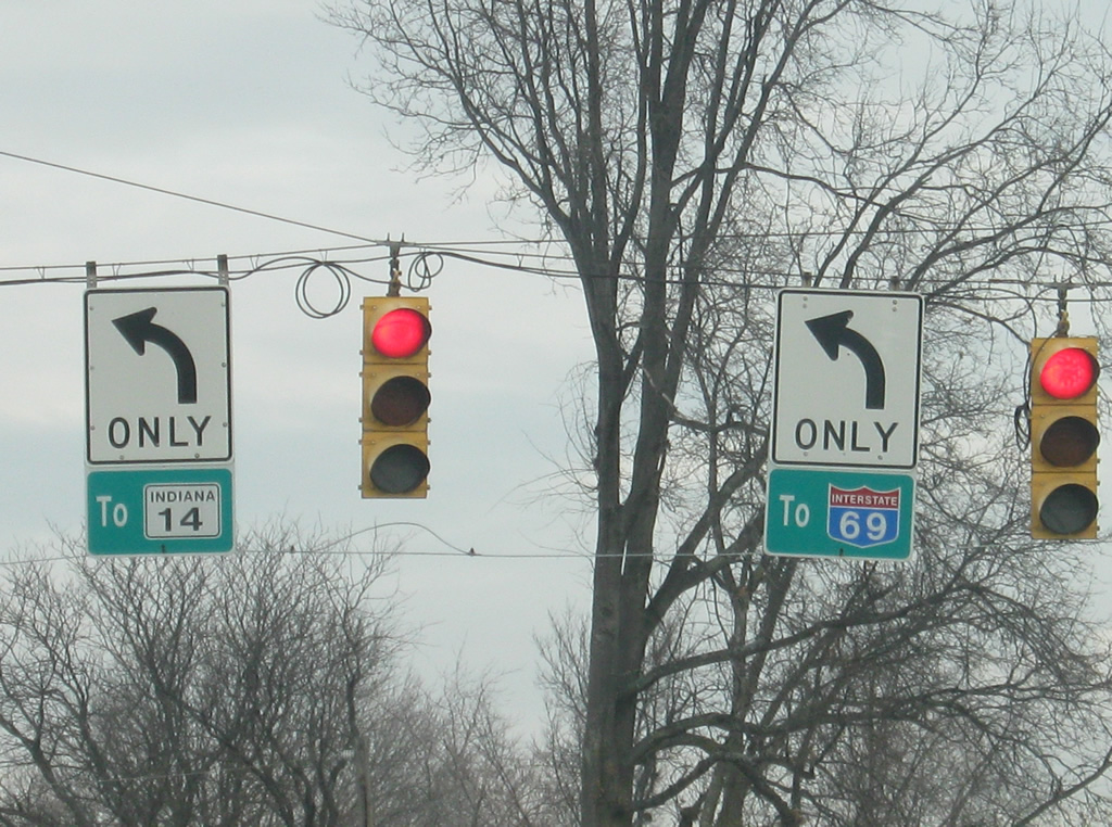
Interstate 69
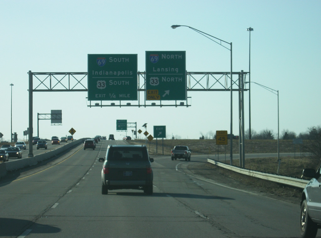
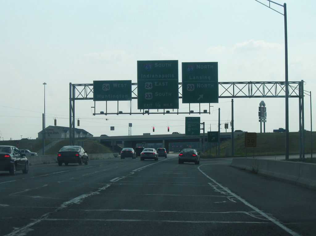
Interstate 69 has had the most diverse history among Indiana freeways and is the only one that isn’t complete as of 2023. Split into two sections through the Hoosier State, the northern segment of I-69 begins on the northeast side of Indianapolis at Interstate 465, traveling 157 miles north to the Michigan state line near Angola. The southern section of I-69 was completed in stages between Evansville and Bloomington by the mid 2010s. Between Bloomington and south Indianapolis, I-69 overlays SR 37. One final construction project, opening late 2024, will join the remaining piece of I-69 with I-74/465 near the Sunshine Gardens neighborhood of Indianapolis.
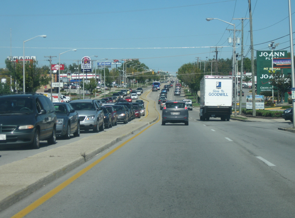
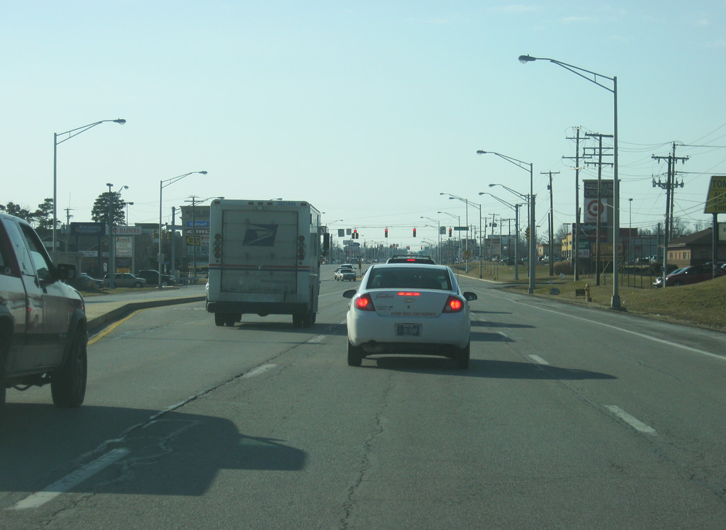
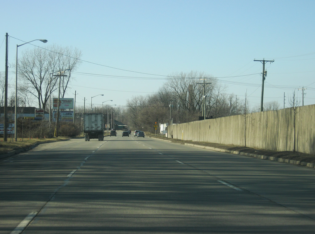
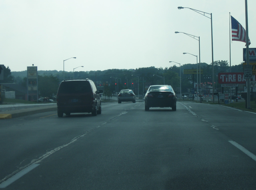
Constructed in the 1960s, I-69 was first completed from U.S. 24 northward across the northwest side of Fort Wayne. Unlike most cities during the planning of the Interstate System, I-69 was never planned to go through downtown Fort Wayne. Prior to the 2000s, Interstate 69 through Fort Wayne consisted of a rural four lane interstate with cloverleaf interchanges. In the 2000s, INDOT completely rebuilt I-69 between Exits 302 and 316, adding a third travel lane and improving interchanges.

Guides:
Interstate 469
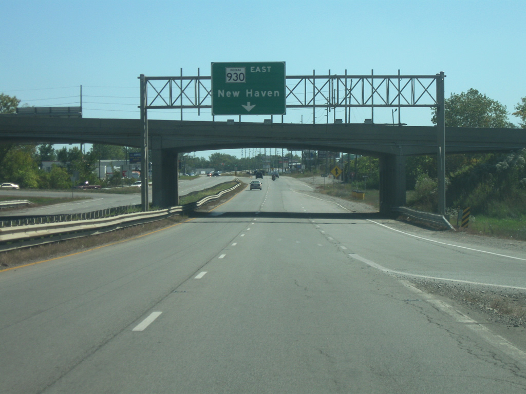
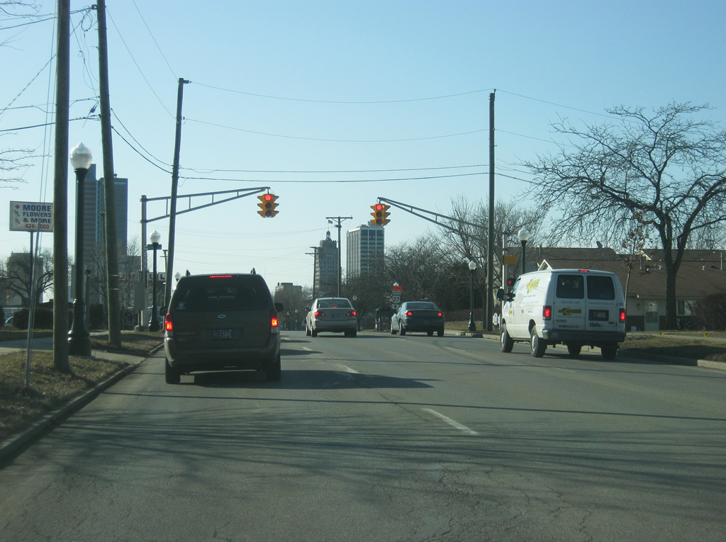
Designated as the Ronald Reagan Highway, Interstate 469 is the 31-mile beltway around Fort Wayne’s east side and completes the loop created by itself and its parent, Interstate 69. The entire beltway is a four-lane concrete highway with a jersey barrier that was built so to reduce its impact on the environment. The beltway serves as a bypass for three of the U.S. highways that used to go through Fort Wayne. U.S. 30 follows the beltway to the north using Interstate 69 to Exit 19. U.S. 24 uses the southern part of the beltway, using Interstate 69 to the beltway and then going to Exit 21. U.S. 33 follows the same routing as U.S. 24, but leaves the beltway at Exit 11. The beltway also spelled the end of Indiana 1’s route inside Fort Wayne and the decommissioning of that highway in between Interstate 469 and Interstate 69 divided the state highway into two segments. As with Indianapolis, only two highways (U.S. 27 and Indiana 930) are still routed through Fort Wayne inside the loop created by the beltway and its parent route.
The beltway was conceived originally as a bypass for U.S. 24 (which was still routed through the city) and after seeing the congestion on the U.S. 30 bypass on the north side (present day Indiana 930) it was agreed that this would be a freeway. Construction began in 1986 on the southwest side near the Fort Wayne International Airport at the interchange with Interstate 69 and Lafayette Center Road and continued east across the southern rural fringes of Fort Wayne all the way to current Exit 19. In 1989, the highway was given the designation of Indiana 469, until the beltway was completed in which it would receive its full interstate designation. Construction would resume in 1992 to finish the beltway from Exit 19 north around the northeast side of Fort Wayne to its current northern endpoint at Interstate 69, which was finished in 1995, at which point it became Interstate 469.
U.S. Highways

Guides:
U.S. 24
U.S. 24 blazes a 1,540-mile path across the United States from Minturn, Colorado at Interstate 70 to Interstate 75 north of Pontiac, Michigan. In Indiana, it goes for 164 miles from west of Kentland east through Monticello, Logansport, Peru, Wabash and Huntington before going through the Fort Wayne area. From Logansport northeast toward Fort Wayne U.S. 24 is a four-lane highway that is part of the Hoosier Heartland Corridor. In conjunction with the twin-laning of Indiana 25 from Logansport to Lafayette, the Hoosier Heartland Corridor will be a four-lane expressway from Lafayette to Fort Wayne. East of Interstate 469, the highway is currently being improved to freeway standards to the Ohio state line as a part of the Fort-to-Port Project. From the state line, U.S. 24 is a four-lane highway northeast toward Toledo and Lake Erie (once Ohio’s part of Fort-to-Port is completed in 2012).
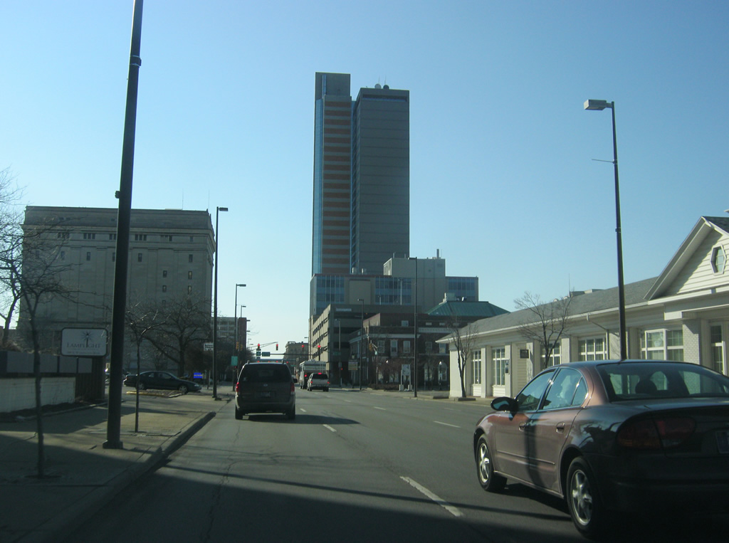
U.S. 24 is a four-lane expressway coming out of the southwest out from Huntington as it enters Allen County and passes by the Aboite Township suburbs of southwest Fort Wayne. Once it reaches Interstate 69, it follows the freeway to the southwest to Interstate 469. From there, it follows the beltway for 21 miles to the east side of New Haven where it resumes its trek toward Defiance and Toledo. Originally, the highway continued from where it turned off onto Interstate 69 and followed Jefferson Boulevard northeast into Fort Wayne. In town, it followed Jefferson Boulevard east across the city (while the westbound lanes followed Washington Boulevard to the north). On the east side, the two roads merged and became Washington Boulevard where it would follow New Haven Avenue and Lincoln Highway east into New Haven. In New Haven, U.S. 24 followed Broadway Street through Downtown Fort Wayne before heading east on Rose Avenue out of the city. Once Coliseum Boulevard (the old U.S. 30 and current Indiana 930) was built, U.S. 24 was routed along the bypass to the north.

Guides:
U.S. 27
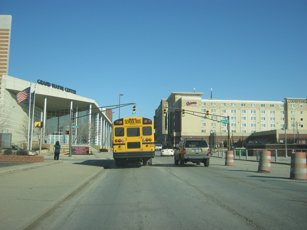
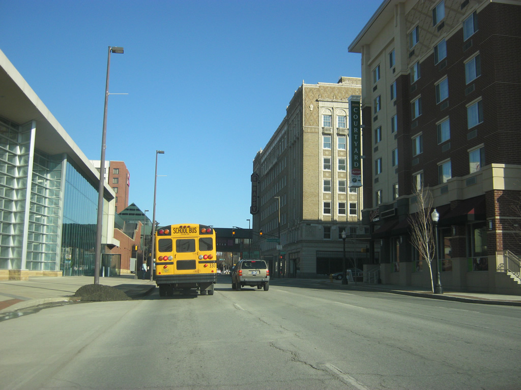
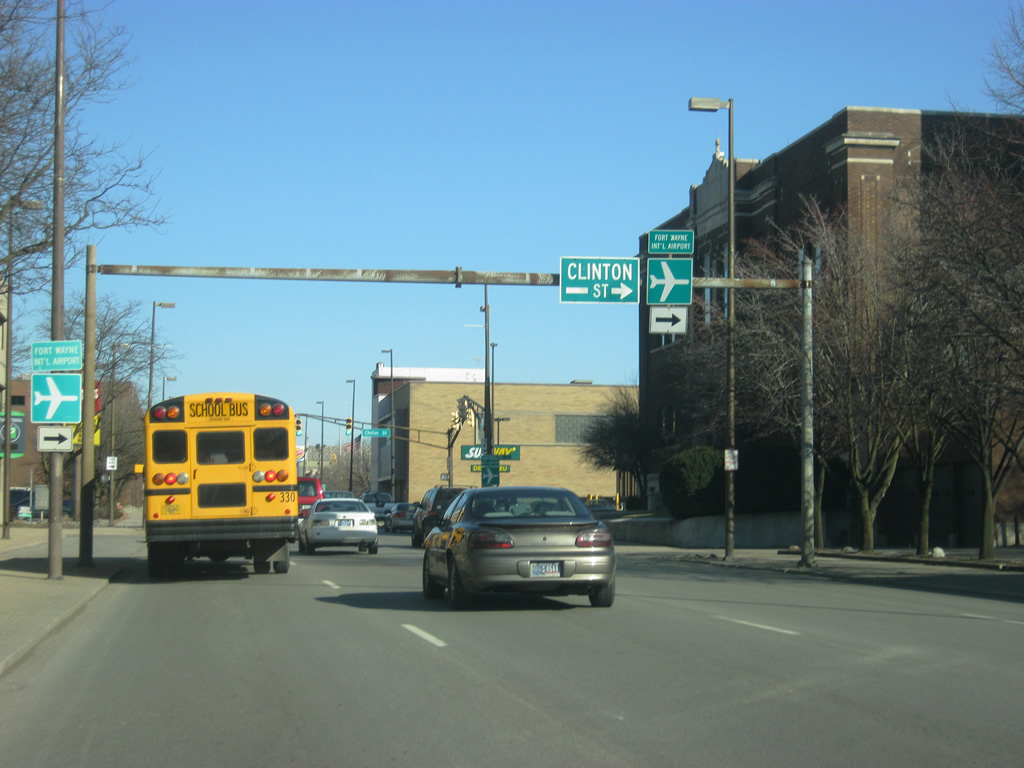
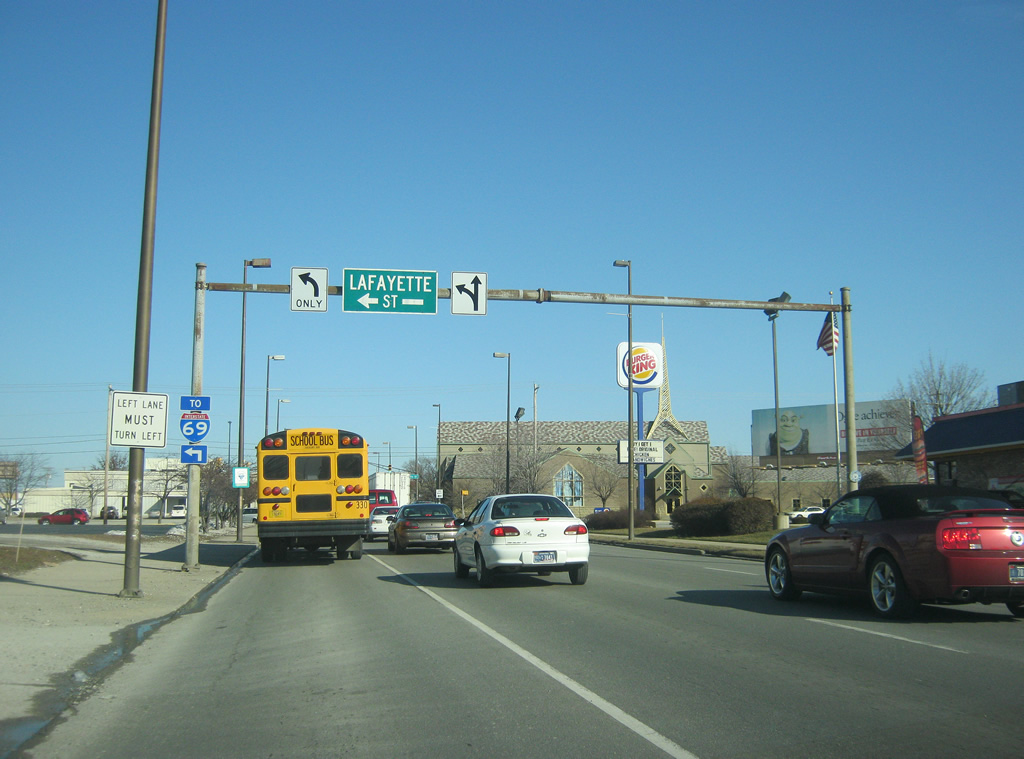
U.S. 27 goes for 1,373 miles north from Miami, Florida to Fort Wayne. In Indiana, the highway travels for 117.78 miles from Union County northward through Richmond, Winchester, Portland and Decatur before going into Fort Wayne. The highway is one of two that goes through the city of Fort Wayne in between the loop created by Interstates 69 and 469. In Fort Wayne, U.S. 27 is a four-lane highway along Decatur Road as it enters from the south in Adams County multiplexed with U.S. 33. At the interchange with Interstate 469/U.S. 24, U.S. 33 turns off to the west while U.S. 27 continues up onto the south side to the point where the highway splits up on the one-way couplet of Lafayette Street to the north and Clinton Street to the south. The two roads go through Downtown Fort Wayne and meet back up again on the north side where they head northwest along Clinton Street before following Lima Road north to Interstate 69, where the highway officially ends.
U.S. 27’s history through the area is rather straightforward through Fort Wayne, following the paths of Lafayette and Clinton Streets through the city from the beginning. The U.S. highway had followed Clinton Street and Coldwater Road to the north of Fort Wayne along the highway that would be eventually designated as Indiana 327 (and truncated to Garrett). Upon completion of the Interstate 69 corridor, the highway was rerouted onto Lima Road and then onto the interstate north toward Lansing, Michigan where it turned north toward Grayling, Michigan. In 2002, the segment from Fort Wayne north to Grayling was truncated as Interstate 69 and U.S. 127 took over. This left the northern end of the U.S. highway at the cloverleaf interchange with Interstate 69 and the southern end of Indiana 3’s northern segment on the north side of Fort Wayne.

Guides:
U.S. 30
U.S. 30 goes for 3,073 miles across the country from Astoria, Oregon to Atlantic City, New Jersey and in Indiana goes for 151.8 miles. Across Indiana, the highway is at least four lanes, staring out in Dyer in Northwest Indiana and continuing east through Merrillville, Valparaiso, Plymouth, Warsaw, Columbia City and Fort Wayne before heading east into Ohio. U.S. 30 comes into the Fort Wayne area from Whitley County and Columbia City and is a four-lane expressway to its interchange with U.S. 33 north and onto Interstate 69. From there, U.S. 30 follows Interstate 69 north to Interstate 469 and then follows the Fort Wayne beltway around the north and east sides of Fort Wayne and New Haven to Exit 19 where it continues going east as a four-lane expressway in the rural eastern half of Allen County before crossing over into Ohio.
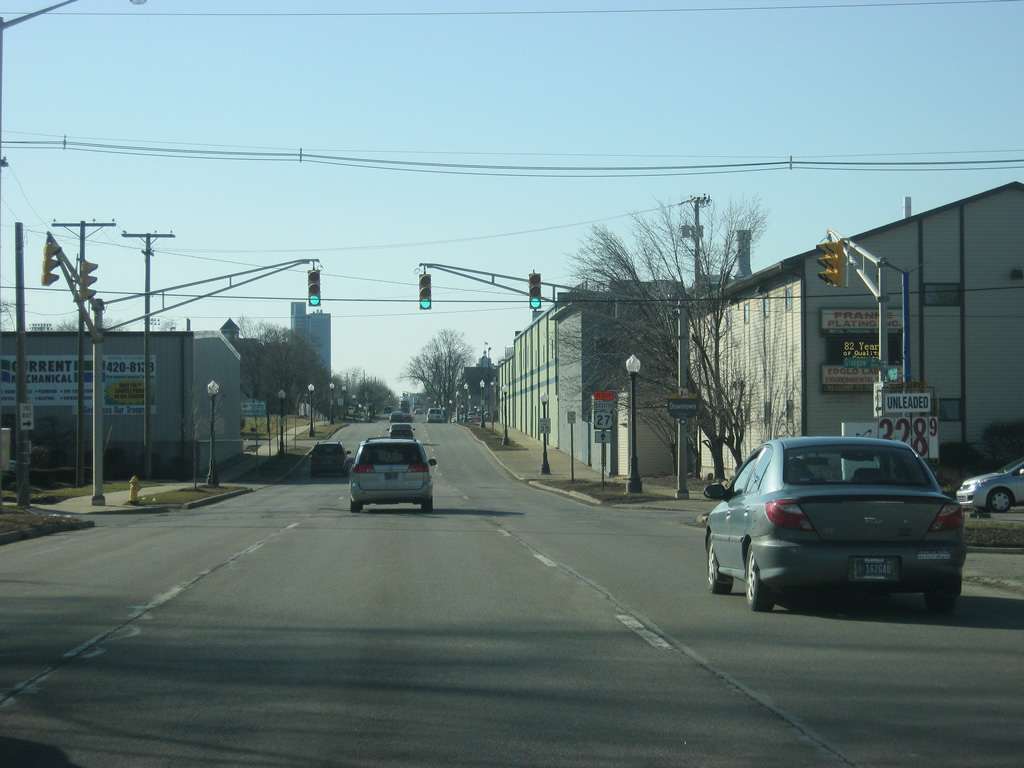
U.S. 30 follows the path of the original Lincoln Highway across the cities of Fort Wayne and New Haven and further to the west toward Columbia City and Warsaw. Originally, the highway came in from the northwest along Goshen Road south to Sherman Street and south to Jefferson Boulevard in Downtown Fort Wayne. The highway would then follow Washington Boulevard to Maumee Street, Fletcher Avenue and then New Haven Avenue, going east into New Haven before heading east out of the town. The routing wasn’t changed much until the construction of the new bypass (Circumurban Highway) around the north side of Fort Wayne in 1960. U.S. 30 was routed along this bypass (which later became Coliseum Boulevard to a cloverleaf interchange with Washington Boulevard on the east side). U.S. 30 then followed a new highway east along the south side of New Haven to a new four-lane segment east of town. The final route change for U.S. 30 occurred when the Interstate 469 beltway was completed and the highway was moved to its current routing. Indiana 930 was designated along the original bypass route for U.S. 30 (today’s Coliseum Boulevard).

Guides:
U.S. 33
U.S. 33 goes for 709 miles from Elkhart at the St. Joseph Valley Parkway (U.S. 20) to the southeast to its endpoint at Richmond, Virginia. In Indiana, the highway travels for 94.72 miles from Elkhart to the southeast through Goshen, Ligonier, Churubusco, Fort Wayne and Decatur before crossing into Ohio. The highway today comes in from the northwest onto the U.S. 30 expressway, multiplexing with the highway for a half mile. At that point, it goes south onto Interstate 69 and follows the routing with U.S. 24 to the southern end of Interstate 469, going east to Exit 11. At that point, it follows U.S. 27 south to the Adams County seat of Decatur and then breaks off toward the southeast into Ohio.
U.S. 33 is the newest of the U.S. highways in the Fort Wayne area, filling in for the former route Indiana 2 (which had crossed the state along its current route from Illinois to South Bend, and then follows U.S. 33’s route from South Bend to Fort Wayne). That said, U.S. 33 wasn’t commissioned until 1935, at which point the highway was already multiplexed along U.S. 30’s route into Fort Wayne. At Downtown Fort Wayne, the highway was then multiplexed along U.S. 27 down Clinton Street (and later on the one-way couplet of Clinton and Lafayette Streets). Since its inception, U.S. 33 has been multiplexed with U.S. 27 in some way heading south of Fort Wayne. After U.S. 30’s rerouting to its bypass (present day Indiana 930) U.S. 33 was by itself for the routing down Goshen Road and Sherman Boulevard toward Downtown Fort Wayne. Into the 1970s and 1980s, U.S. 33 was moved onto the U.S. 30 bypass to U.S. 27 at Lima Road. Then the highway followed U.S. 27 to the south. Finally, when the southern part of the then-U.S. 24 bypass (current Interstate 469) was finished, U.S. 33 was rerouted onto its current alignment.
State Roads

Guides:
Indiana 1
Indiana 1 runs for nearly 200 miles in two separate segments. Prior to the early 1990s, the highway was continuous, but as highways were being decommissioned within the loop being formed by Interstates 69 and 469 in Fort Wayne, Indiana 1’s routing within the city was axed, leaving two segments, a northern one that goes for 40 miles and a southern one that goes for 137 miles. Today, the northern segment begins at the busy Exit 116 in Fort Wayne’s northern suburbs and heads northeast toward the town of Leo-Cedarville and St. Joe. The highway is mostly rural, crossing eastern DeKalb and Steuben Counties before ending at U.S. 20. The southern segment begins at Interstate 469/U.S. 24/U.S. 33 near the Fort Wayne International Airport and connects the city to the Wells County communities of Ossian and Bluffton before heading south through rural parts of eastern Indiana.
For most of its history, Indiana 1 has come into Fort Wayne from the southwest, along Bluffton Road and across the St. Mary’s River onto Broadway Street. In Downtown Fort Wayne, it would head east toward Clinton Street where it would follow the routing of U.S. 27 to the north out of Fort Wayne. Later on, Indiana 1’s routing on the southwest side of Fort Wayne was moved to Rudisill Boulevard to meet up with U.S. 27 at Lafayette and Clinton Streets to head north into the city. Into the 1980s, the highway’s southwestern routing was changed again to follow Bluffton Road north to Baer Field Thruway (present day Airport Expressway) and Paulding Road before heading north along U.S. 27. Eventually, the highway followed U.S. 27 north to Interstate 69 and then north to Exit 116 where it resumed its path toward Leo-Cedarville. Finally during the early 1990s, the highway’s routing through Fort Wayne was decommissioned, with the state road ending at Interstate 69 on the north side and Interstate 469 on the south side.

Guides:
Indiana 3
Indiana 3 goes for 223.5 miles from Clark County in Southern Indiana to LaGrange County in the far northern tier of the state. The highway was continuous until 1972 where the section from Markle to Fort Wayne was decommissioned. Indiana 3 was once routed through Fort Wayne, but as with Indiana 1, that routing got decommissioned in 1972 when Interstate 69 was finished. Today, Indiana 3’s portion in the Fort Wayne area begins at Interstate 69 on the north side of town where Indiana 3 follows Lima Road north as a six-lane expressway up to Dupont Road and then as a four-lane expressway into DeKalb and Noble Counties, connecting Fort Wayne with the city of Kendallville.
Historically, Indiana 3’s route through Fort Wayne was similar to Indiana 1’s. Indiana 3 came in from the southwest along Indianapolis Road from the direction of Zanesville and Markle. Indianapolis Road met up with Bluffton Road and Indiana 3 followed Indiana 1 through Downtown Fort Wayne. Indiana 3 had always made it to Lima Road, but how it did so in the past differed. Originally, the highway was routed up Wells Street from Downtown north onto Lima Road, later on it was routed along U.S. 27 up Lafayette Street and Spy Run Avenue which lead into Lima Road. As Indiana 1’s route on the southwest side of Fort Wayne was rerouted, so was Indiana 3’s. And once Interstate 69’s route was completed, Indiana 3 was simply cut off at Markle to the south and the north side of Fort Wayne to the north leaving its current gap.

Guides:
Indiana 14
Indiana 14 runs for 123 miles from U.S. 41 at the town of Enos in Newton County, and stretches east across Indiana through Winamac, Rochester and South Whitley before ending at Interstate 69 on the west side of Fort Wayne. The highway was rebuilt in the late 2000s from Interstate 69 west to Scott Road, where it is now a four-lane highway serving the growing western suburbs of Fort Wayne. From Scott Road, the highway is a two-lane road that continues west toward Whitley County.
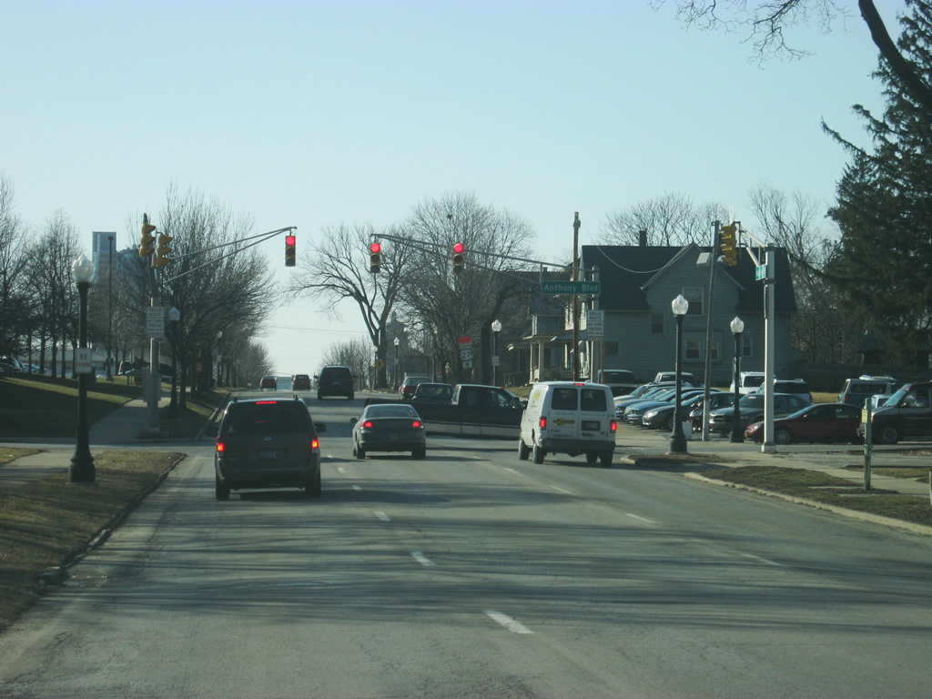
Until 1995, the highway stretched across Fort Wayne and New Haven all the way to the Ohio border. That routing involved Illinois Road to the east of Interstate 69 to Jefferson Boulevard and then onto Washington Boulevard where it went east across Fort Wayne multiplexed with U.S. 24 and U.S. 30 at various times. On the east side of Fort Wayne, Indiana 14 was routed onto present-day Indiana 930 into the city of New Haven and then onto Lincoln Highway and Dawkins Road where it continued in straight line to the east toward the town of Edgerton. Prior to the 1940s, the highway actually went to the northeast out of Fort Wayne along Anthony Boulevard, Crescent Avenue and Stellhorn Road before heading toward the northeast toward Harlan. Once Indiana 37 was routed into Fort Wayne, Indiana 14’s routing was moved to its more well-known alignment.

Guides:
Indiana 37
Indiana 37 goes for 235 miles in two separate segments. The longer southern segment goes from Marion south past Elwood, Noblesville, Indianapolis, Martinsville, Bloomington, Bedford and Paoli before ending in Tell City. The northern segment goes from Interstate 469 on the northeast side of Fort Wayne and heads northeast toward Cuba, Harlan and Hicksville, Ohio. As with other state highways in the Fort Wayne area, Indiana 37’s history is more complex. Indiana 37 was the last state highway to be routed into Fort Wayne among the traditional one or two-digit highways (not including spurs or bypasses).
Since Indiana 37 was originally an Indianapolis to Tell City route, it wasn’t until the 1930s and 1940s that the highway was extended northeast toward Marion, Huntington and Fort Wayne. Up until the 1980s, the highway was routed along Indiana 9 from Marion to Huntington and U.S. 24 from Huntington into Fort Wayne. Indiana 37 followed U.S. 24’s routing into Downtown Fort Wayne and east to Anthony Boulevard, where it followed Indiana 14’s original route along Anthony, Crescent Avenue and Stellhorn Road toward the northeast. As the highway was being decommissioned from Marion to Fort Wayne, the northeastern part of Indiana 37 in Fort Wayne was being truncated to the U.S. 30 bypass (today’s Coliseum Boulevard) before its final truncation to the newly built Interstate 469 / U.S. 30 bypass in the 1990s, giving it its current routing.

Guides:
Indiana 930
Indiana 930 goes for 13 miles from Interstate 69 to Interstate 469 as a bypass of the north side of Fort Wayne before heading east toward New Haven. The highway serves as a “business route” for the former U.S. 30 as it went across Fort Wayne before the Interstate 469 beltway was finished in the early 1990s. Originally, U.S. 30 went through the heart of Downtown Fort Wayne and headed east through New Haven toward the southeast. Then, Coliseum Boulevard (originally Circumurban Highway) was built in 1950. Until the late 1980s, the highway served as the U.S. 30 bypass of Fort Wayne, but as with many bypasses, soon became congested as Fort Wayne’s retail center. When U.S. 30 was rerouted around Interstate 69 and Interstate 469 the route was to be given back to local authorities. When they turned down the offer, INDOT created a new designation (the 900 series) to keep the highway in INDOT hands, hence Indiana 930.
Former Highways
Indiana State Road 230
Indiana 230 existed primarily in the 1930s as a highway from U.S. 24 and U.S. 30 in New Haven eastward to the Ohio border at the town of Edgerton. The highway was decommissioned when Indiana 14 was moved onto its alignment in the 1940s.
Indiana State Road 324
Indiana 324 existed briefly in the 1950s as part of Circumurban Boulevard, which later on became Coliseum Boulevard and Indiana 930. The route of Indiana 324 went from Goshen Road (U.S. 30/U.S. 33) east to Crescent Avenue (Indiana 37). By the time that Circumurban Boulevard was extended to the south toward New Haven, U.S. 30 was routed onto the new bypass and Indiana 324 was decommissioned.
Indiana State Road 327
Indiana 327 still runs today from the town of Garrett in DeKalb County north to the Michigan state line for a distance of 32 miles. As the number suggests, it was a spur off of U.S. 27 which used to follow Coldwater Road north out of Fort Wayne to Garrett before heading east toward Auburn. In the 1970s, when U.S. 27 was routed onto Interstate 69, Indiana 327 was extended along Coldwater Road from Garrett south to U.S. 27 at Lima Road on the north side of Fort Wayne. Since then, the highway was truncated back to Garrett at the junction with Indiana 205.
Indiana State Road 427
Indiana 427 also still exists today, but it goes for only 15.6 miles from U.S. 6 in Waterloo to Ohio state line east of Hamilton. From at least the 1930s, Indiana 427 had existed from Downtown Fort Wayne toward the north. For a while, it followed U.S. 27 and Indiana 1 out of Fort Wayne toward the northeast. It followed Clinton Street and Leo Road northeast to Tonkel Road in northern Allen County. Indiana 427 continued north toward Auburn from there. In DeKalb County, parts of the highway are still named Old State Road 427. Once Interstate 69 was finished, the highway was truncated toward Waterloo.
Indiana State Road 469
Indiana 469 existed as the temporary designation for the Interstate 469 beltway as it was being built around Fort Wayne. The highway wasn’t designated for more than a decade in the late 1980s and early 1990s. Once the beltway was completed on the north side of Fort Wayne, the Interstate 469 designation officially took over.
Fort Wayne Area Highway and Road Scenes
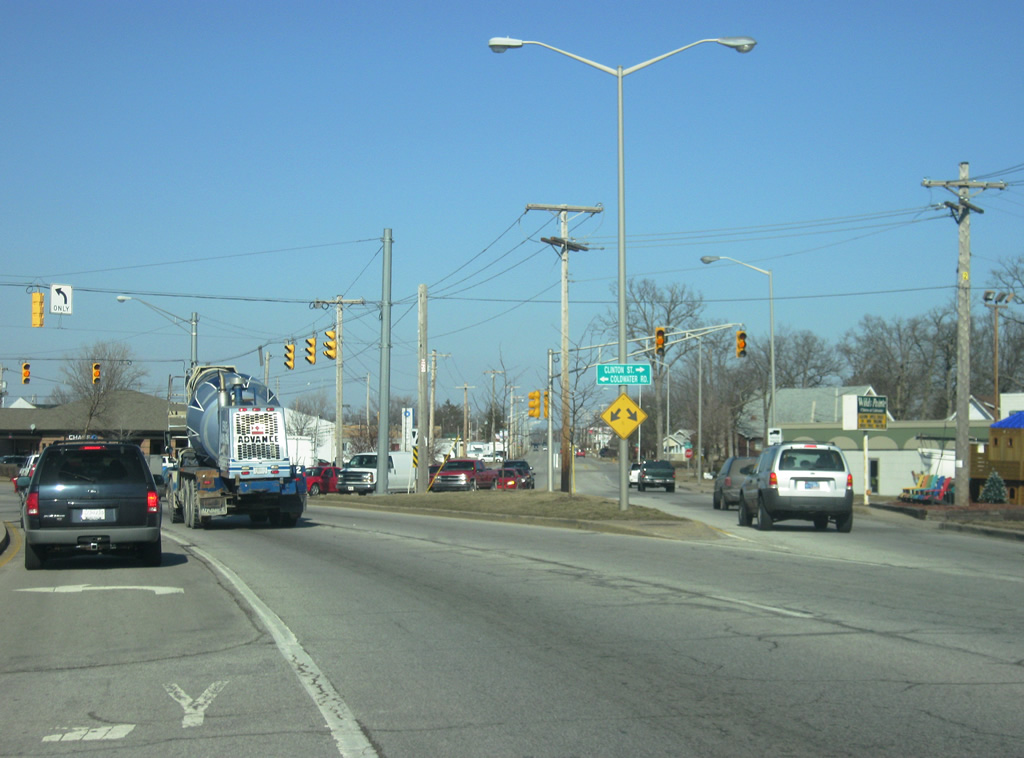
Coldwater Road: Old U.S. 27 and Indiana 327 – From Clinton Street to Interstate 69
| Coldwater Road - North |
 | Coldwater Road officially begins at Clinton Street to the south of the Glenbrook Square Mall. Clinton Street continues north along the original routing of U.S. 27 to the northeast toward SR 1 (Dupont Road). The left turn lane serves a shopping center that is located to the south of the mall. 02/06/12 |
 | Coldwater Road is a four lane arterial that serves the eastern boundary of the Glenbrook Square Mall, the largest shopping center in Northeast Indiana. Coldwater Road carried U.S. 27 north to Interstate 69 when the interstate was finished and later on carried SR 327. The section from Clinton Street north to the town of Garrett was truncated later on. 02/06/12 |
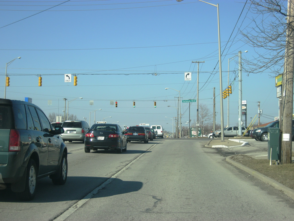 | At the intersection with Coldwater Road and SR 930 (Coliseum Boulevard). SR 930 constitutes a 13 mile highway that used to carry U.S. 30 for a bypass around the north side of Fort Wayne. SR 930 (Coliseum Boulevard) is primarily a four to six lane highway that has since seen commercial development, especially at its intersection with Coldwater Road, which is among the busiest in Fort Wayne. 02/06/12 |
    | North of SR 930 (Coliseum Boulevard), Coldwater Road becomes a busy four lane arterial connecting SR 930 (Coliseum Boulevard) with Interstate 69. Shopping centers primarily line the road as it provides the main connector between the interstate and Downtown Fort Wayne via Clinton Street. 09/19/09 |
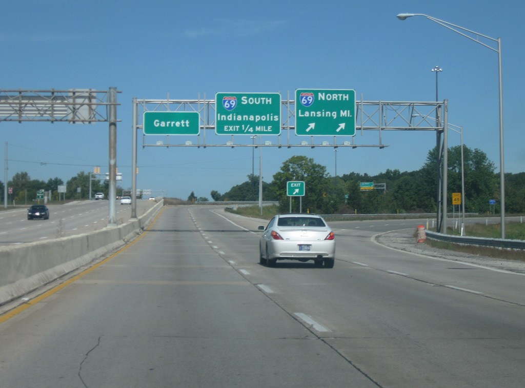 | Coldwater Road passes the intersection with Washington Center Road before it approaches its intersection with Interstate 69. Lansing, Michigan is the northbound control city of the interstate via Auburn, Angola and Coldwater, Michigan. Interstate 69 heads south toward Marion, Muncie, Anderson and Indianapolis and will eventually head further southwest toward Evansville. Northbound Coldwater Road is given a control city of Garrett, referring to the time when SR 327 followed Coldwater Road to the north toward the DeKalb County town. 09/19/09 |
| Coldwater Road - South |
 | Looking south at the interchange with Interstate 69. Lansing, Michigan is the northbound control city of the interstate via Auburn, Angola and Coldwater, Michigan. Interstate 69 heads south toward Marion, Muncie, Anderson and Indianapolis and will eventually head further southwest toward Evansville. Coldwater Road follows the former routing of U.S. 27 and SR 327 from Interstate 69 south toward Clinton Street, which leads to present-day U.S. 27 en route to Downtown Fort Wayne. 09/19/09 |
 | South of the Interstate 69 interchange, Coldwater Road nears the intersection with Washington Center Road, a busy arterial that stretches across the north side of Fort Wayne connecting Coldwater Road with SR 3 (Lima Road) and U.S. 33 (Goshen Road) to the west and Clinton Street (old U.S. 27) to the east. Coldwater Road carries a decent amount of commuters from Interstate 69 south toward Downtown Fort Wayne each day, hence the double turn lanes approaching Washington Center Road. 09/19/09 |
Illinois Road: Old Indiana 14 – From Jefferson Boulevard (Old U.S. 24) to Interstate 69
| Illinois Road - West |
 | Illinois Street westbound begins at Jefferson Boulevard and heads due west toward its first intersection with Hillegas Road. The eastbound lanes serve a gas station to the east at the intersection with Jefferson Boulevard and Illinois Road. Hillegas Road, and its southern counterpart Ardmore Avenue, is a major north-south arterial that begins at California Road and heads south to Airport Expressway. 01/14/12 |
 | Illinois Road westbound continues west of Hillegas Road as the road splits again to serve the Jefferson Pointe shopping center. Two eastbound lanes from the Jefferson Pointe shopping center continue east on Illinois Road toward Hillegas Road. 01/14/12 |
 | A view of Illinois Road on the north side of the Jefferson Pointe shopping center. A southern branch of Illinois Road comes in from the southeast to meet up with the highway in earnest. 01/14/12 |
 | Illinois Road at the intersection with Thomas Road and Apple Glen Boulevard. Thomas Road heads north from Illinois Road to Bass Road while Apple Glen Boulevard arcs around the western boundary to the Jefferson Pointe shopping center back to Jefferson Boulevard. 01/14/12 |
 | West of Thomas Road/Apple Glen Boulevard, Illinois Road consists of a four lane highway that continues west toward Interstate 69. Numerous car dealerships and shopping centers line the highway along its way toward the interstate. Illinois Road follows the original routing of SR 14 into the city of Fort Wayne. 01/14/12 |
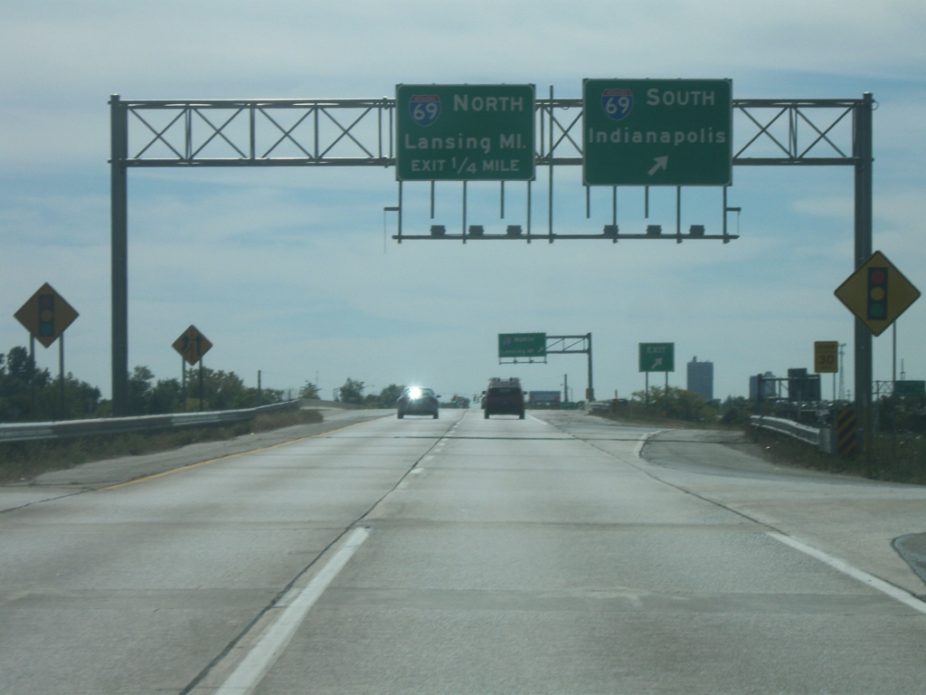
 | Illinois Road meets up with a cloverleaf interchange with Interstate 69/U.S. 33 to the west of its intersection with Magnavox Way. Lansing, Michigan is the northbound control city of the interstate via Auburn, Angola and Coldwater, Michigan. Interstate 69 heads south toward Marion, Muncie, Anderson and Indianapolis and will eventually head further southwest toward Evansville. On the other side of the interchange, Illinois Road becomes SR 14, which goes for 123 miles from Interstate 69/U.S. 33 to the towns of South Whitley, Akron and Rochester before ending at U.S. 41 in Newton County. 01/14/12 |
| Illinois Road scenes |
 | Signs guide traffic at the northbound intersection of Getz Road with Illinois Road onto SR 14 west and Interstate 69. The shields are obviously not INDOT created. 01/14/12 |
Jefferson Boulevard / Maumee Avenue / Washington Boulevard (Old U.S. 24/ 30 /SR 14)
| Jefferson Boulevard - East |
 | Jefferson Boulevard (Old U.S. 24, U.S. 30 and SR 14) east at the intersection with Broadway Street, the original route for SR 1 and SR 3 from the south into Fort Wayne. 01/14/12 |
 | East of Broadway Street, Jefferson Boulevard nears Downtown Fort Wayne as the road is generally three lanes in width heading east. The twin spires of the Cathedral of the Immaculate Conception looms in the distance. The stoplight up ahead is with Fairfield Avenue. 01/14/12 |
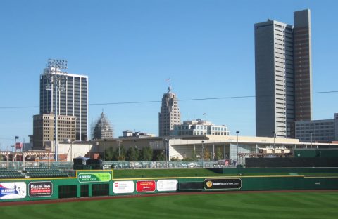
 | East of Fairfield Avenue, Jefferson Boulevard passes by construction at the new Harrison Square development. Parkview Field, the home of the minor-league Fort Wayne Tin Caps, is just south of Harrison Square. 01/14/12 |
 | Now approaching the intersection with Jefferson Boulevard and Webster Street. The Grand Wayne Convention Center begins on the north side of Jefferson Boulevard to the east of Webster Street. 01/14/12 |
 | Passing by a new downtown hotel, which is across the street from the Grand Wayne Convention Center, along Jefferson Boulevard. The stoplight ahead is with Harrison Street. 01/14/12 |
 | Past the Grand Wayne Convention Center, Jefferson Boulevard is four lanes as it nears the intersection with Clinton Street (U.S. 27 south). The sign bridge used to hold the route markers of the various U.S. and state highways that were routed through Fort Wayne. Interestingly, U.S. 27 isn't signed here, although it still follows Clinton Street to the south toward the Fort Wayne International Airport and Decatur. 01/14/12 |
 | East of Barr Street, Jefferson Boulevard nears the intersection with Lafayette Street (U.S. 27 north). The one way couplet of Clinton and Lafayette Streets (with Barr Street in the middle) used to carry U.S. 33 along with SR 1 and SR 3. Today, it just carries U.S. 27. An Interstate 69 shield directs traffic to the north along U.S. 27 toward the interstate. 01/14/12 |
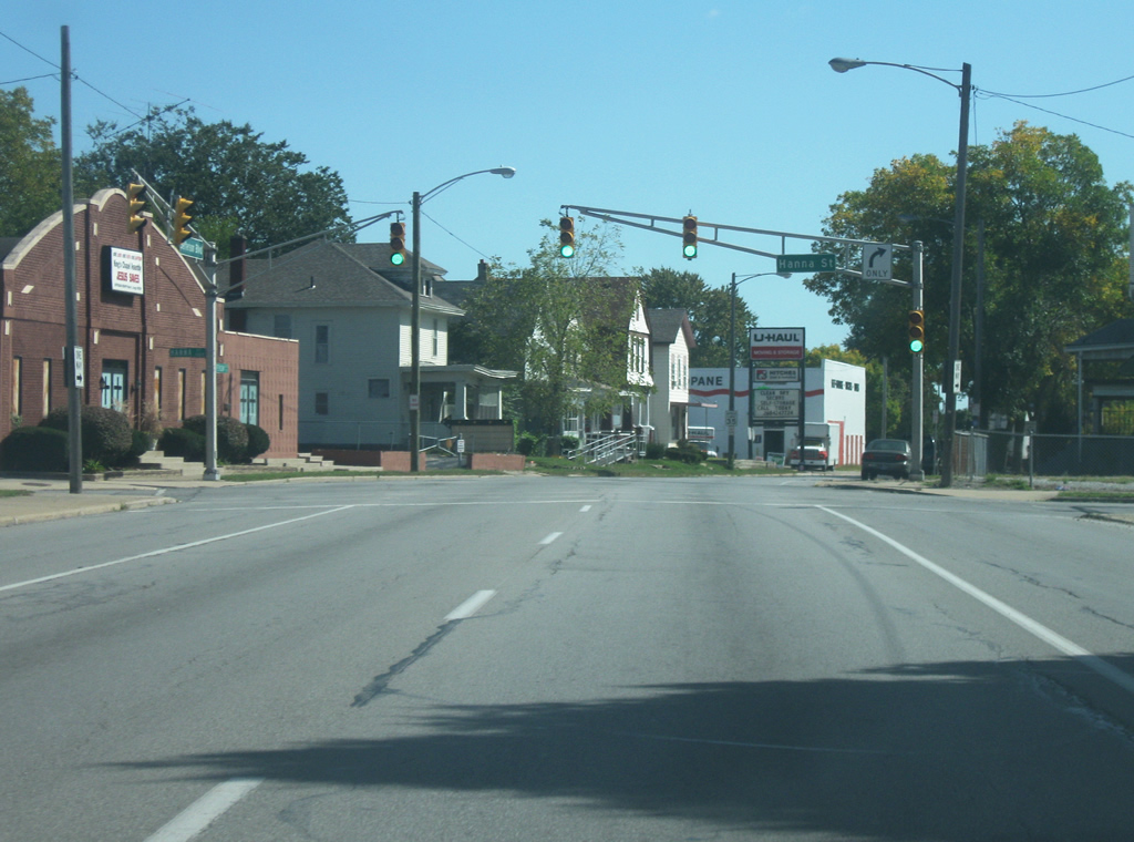 | Three blocks to the east of Lafayette Street (U.S. 27 north), Jefferson Boulevard nears the intersection with Hanna Street. 09/19/09 |
 | Jefferson Boulevard passes by Hanna Park as it enters the east side of Fort Wayne. The street Jefferson Boulevard branches off toward the right where it ends at Division Street straight ahead. The three travel lanes that used to carry U.S. 24, U.S. 30 and SR 14 continue as Maumee Avenue as the highway bypasses the end of Jefferson Boulevard before resuming its trajectory toward the southeast. 09/19/09 |
| Maumee Avenue - East |
   | Maumee Avenue continues to the east across Fort Wayne's east side as it passes by the campus of Indiana Tech in the first picture, the intersection with Anthony Boulevard in the second picture and Dubois Street in the third picture. Anthony Boulevard carried the route of SR 37 from the northeast where it would follow Washington Boulevard to the west across Downtown Fort Wayne and Jefferson Boulevard/Maumee Avenue to the east. 09/19/09 |
 | Maumee Avenue ends as the three travel lanes of the old routing of U.S. 24, U.S. 30 and SR 14 come together with the westbound lanes, at which point the road carries the name of Washington Boulevard (which carries the westbound lanes as part of the one way couplet with Jefferson Boulevard/Maumee Avenue). 09/19/09 |
| Washington Boulevard - East |
 | A view of Washington Boulevard east of their junction as they now head east toward the interchange with SR 930 north (Coliseum Boulevard). 09/19/09 |
 | Now as an undivided mulit-lane highway, Washington Boulevard nears the parclo interchange with SR 930 north and Coliseum Boulevard. To the south, Coliseum Boulevard continues to Pontiac Street. To the north, SR 930 goes for 13 miles along the route of the U.S. 30 bypass around Fort Wayne's north side. 09/19/09 |
 | Washington Boulevard ends at the parclo interchange with SR 930 north/Coliseum Boulevard, but the highway continues east as the final few miles of former U.S. 30 which leads toward the community of New Haven and Interstate 469/U.S. 24. U.S. 24, U.S. 30 and SR 14 all used to follow this route toward New Haven where they would split up. 09/19/09 |
| Washington Boulevard - West |
  | Washington Boulevard begins west of the interchange with SR 930 north/Coliseum Boulevard. The first part of the highway carries both directions of the former route of U.S. 24, U.S. 30 and SR 14. In the second picture, the roadways split as the westbound lanes continue along Washington Boulevard while the eastbound lanes follow Maumee Avenue. A Fort Wayne gateway greets motorists along westbound Washington Boulevard in the second picture. 01/14/12 |
  | A Lincoln Highway shield honors the original routing of the Lincoln Highway along Washington Boulevard through the city of Fort Wayne. The Lincoln Highway in Indiana generally follows the routing of U.S. 30 and U.S. 33. 01/14/12 |
  | Washington Boulevard nears the intersection with Glasgow Avenue in the first picture and Anthony Boulevard in the second. Anthony Boulevard carried the route of SR 37 from the northeast where it would follow Washington Boulevard to the west across Downtown Fort Wayne and Jefferson Boulevard/Maumee Avenue to the east. Anthony Boulevard continues to the south across the east side of Fort Wayne to U.S. 27 (Lafayette Street). 01/14/12 |
    | West of Anthony Boulevard, Washington Boulevard follows the old routing of U.S. 24, U.S. 30 and SR 14 west toward Downtown Fort Wayne. The road typically consists of three westbound lanes at it passes by the campus of Indiana Tech in the first picture, the intersection with Harmar Street in the second picture and Hanna Street in the fourth picture. 01/14/12 |
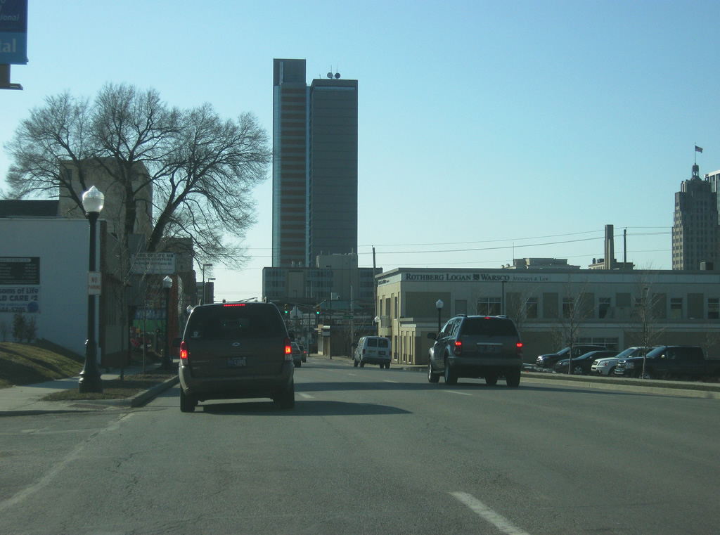 | One Summit Square, the tallest building in Fort Wayne, rises as Washington Boulevard approaches the heart of Fort Wayne. The tower is also the tallest building in Indiana outside of Indianapolis. 01/14/12 |
 | Washington Boulevard nears the intersection with Lafayette Street (U.S. 27 north). The sign bridge used to hold the route markers of the various U.S. and state highways that were routed through Fort Wayne. Interestingly, U.S. 27 isn't signed here, although it still follows Lafayette Street north toward its northern terminus at Interstate 69. 01/14/12 |
 | West of Lafayette Street (U.S. 27 north), Washington Boulevard consists of four lanes as it nears the intersection with Barr Street. 01/14/12 |
 | Now coming up on the intersection with Clinton Street (U.S. 27 south). Clinton Street carries the routing of U.S. 27 to the south toward the Fort Wayne International Airport and Decatur. 01/14/12 |
 | Washington Boulevard passes underneath a skybridge as it approaches the next intersection with Calhoun Street. The skybridge connects One Summit Square with a parking garage. 01/14/12 |
 | West of Calhoun Street, Washington Boulevard passes by the Grand Wayne Convention Center as it approaches the intersection with Harrison Street. Harrison Street used to run to the south of Washington Boulevard before it was cut off by the convention center. 01/14/12 |
 | Washington Boulevard now approaches the intersection with Ewing Street as it passes by the Allen County Public Library. Ewing Street at one time carried the routes for U.S. 30 and U.S. 33 to the north toward Goshen Road, where the highways continued to the northwest to their split northwest of Fort Wayne. 01/14/12 |
 | Washington Boulevard nears the intersection with Broadway Street, which at one time carried the routes of SR 1 and SR 3 to the southwest. 01/14/12 |
   | West of Broadway Street, Washington Boulevard becomes a residential two-way street even as it remains heavy with traffic. Since Interstate 69 was routed to the west of Fort Wayne, streets such as Washington and Jefferson Boulevards still carry heavy commuter traffic out of Downtown each weekday. In the second picture, Washington Boulevard crosses the intersection with College Street. 01/14/12 |
 | Washington Boulevard runs past the south bank of St. Mary's River as it nears the western end of the one way pair with Jefferson Boulevard. 08/16/09 |
| Jefferson Boulevard - West |
 | Now crossing over the St. Mary's River back with the eastbound lanes of old U.S. 24 and SR 14, the road takes on the name of Jefferson Boulevard. 08/16/09 |
 | A view of Jefferson Boulevard as it heads to the northwest toward the junction with Main Street, which goes back to the east into Downtown Fort Wayne. Originally, Main Street carried U.S. 24 and SR 14 before Jefferson Boulevard was extended this way. 08/16/09 |
 | Jefferson Boulevard passes underneath a railroad overpass as left turns are prohibited along this tight and congested stretch of highway. 08/16/09 |
 | Westbound Jefferson Boulevard again expands to three lanes at it approaches the intersection with Freeman Street and Washington Road. 08/16/09 |
 | Jefferson Boulevard nears the split with Illinois Road, which continues in a due west direction toward Interstate 69 along the former routing of SR 14. Jefferson Boulevard continues toward the southwest along the former routing of U.S. 24. 08/16/09 |
 | Jefferson Boulevard at the intersection with Hillegas Road/Ardmore Avenue. Hillegas Road and its southern counterpart Ardmore Avenue are a major north-south arterial that begins at California Road and heads south to Airport Expressway. 08/16/09 |
 | West of the intersection with Hillegas Road/Ardmore Avenue, Jefferson Boulevard passes near the Jefferson Pointe shopping center, an open air lifestyle center. Up ahead is the intersection with Apple Glen Boulevard, which forms the western boundary of Jefferson Pointe. 08/16/09 |
  | Views of Jefferson Boulevard to the west of Apple Glen Boulevard as they near the intersection with Covington Road in the second picture. The highway remains four lanes to the southwest as it follows the original routing of U.S. 24. 08/16/09 |
  | Southwest of Covington Road, Jefferson Boulevard begins to transition into a suburban highway as it gains a grassy median and passes by more shopping centers en route toward the interchange with Interstate 69/U.S. 33. 08/16/09 |
 | Jefferson Boulevard finally approaches the interchange with Interstate 69 and U.S. 33. Interstate 69 heads north toward the north side of Fort Wayne, Auburn and Angola en route to Lansing, Michigan while the interstate to the south picks up U.S. 24 east toward Interstate 469, Marion, Muncie, Anderson and Indianapolis. U.S. 24 picks up on the other side of the interchange as a four lane expressway toward the city of Huntington some 20 miles away. 08/16/09 |
Page Updated February 26, 2012