
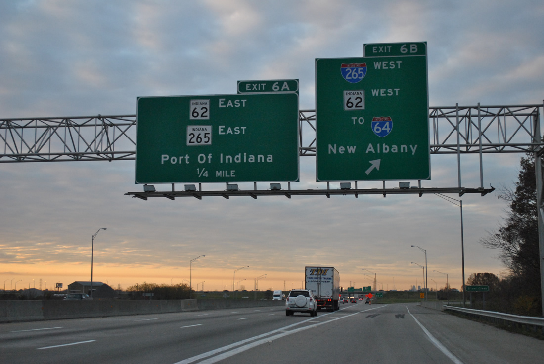
Interstate 65 south at I-265, SR 62 and SR 162.
Commenced the final day of this trip from Jeffersonville, Indiana, just outside of the Interstate 65, I-265, and Indiana 265 interchange. Avoiding the bulk of traffic along Interstate 65 into Louisville, we opted for I-265 west to I-64 and out of the Falls City area.
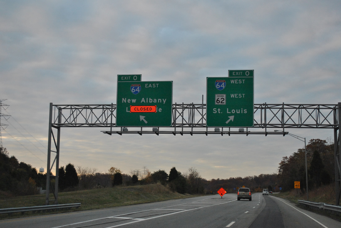
The west end of Interstate 265 in Indiana.
Currently I-265 does double duty, as the Sherman Minton Bridge over the Ohio River of Interstate 64 was closed for emergency repairs on September 9. http://transportation.ky.gov/sherman-minton-bridge/Pages/default.aspx Alternate Interstate 64 shields are posted to guide motorists along Interstate 265 between I-64 and I-65. Exit 0 of Interstate 265 west remains open as the I-64 ramps to Spring and Main Streets at New Albany remain in service.
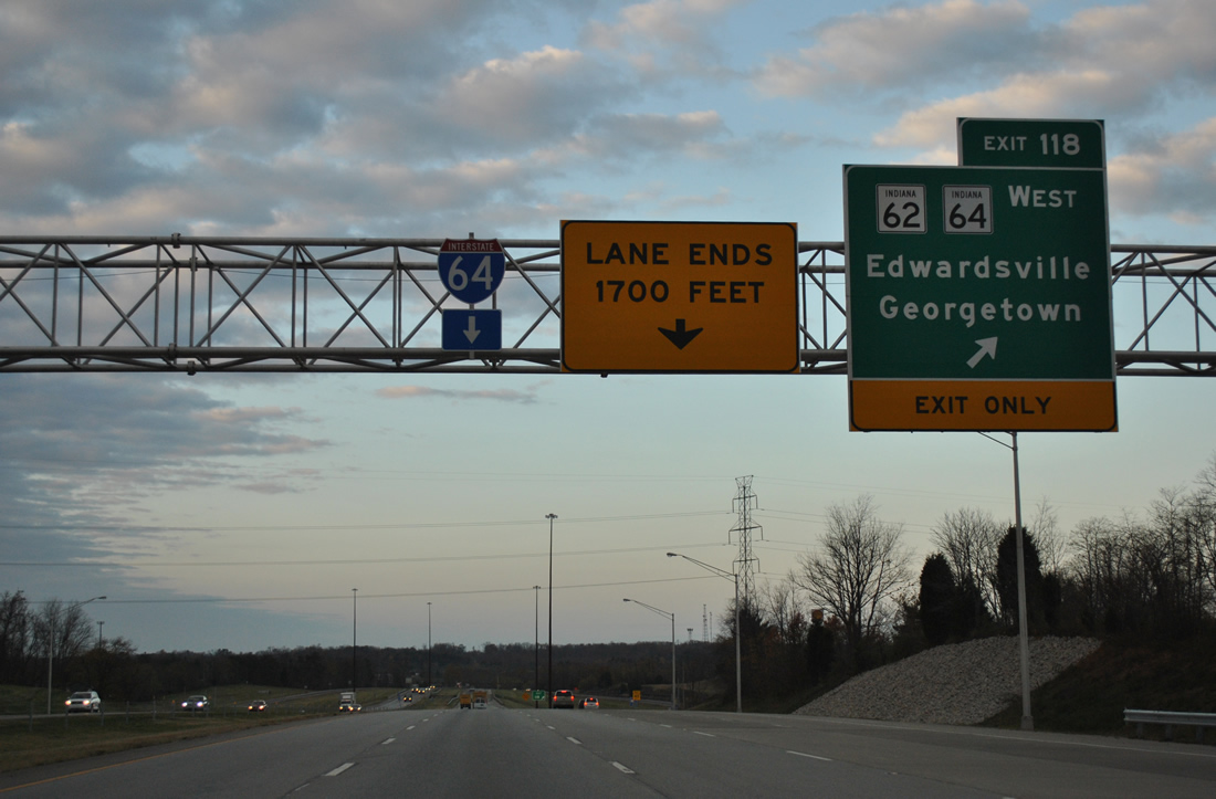
Interstate 64 reduces to four overall lanes beyond the diamond interchange (Exit 118) with Indiana 62 and 64 west. The road remains rural from this point west to Mt. Vernon, Illinois.
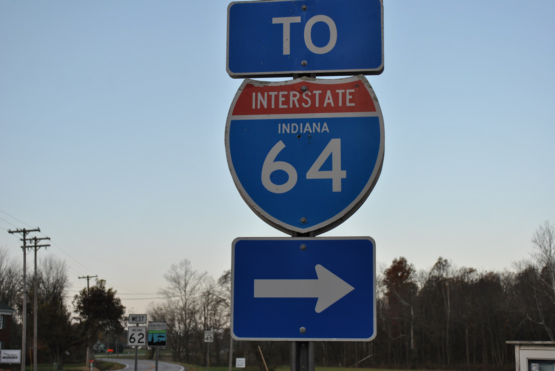
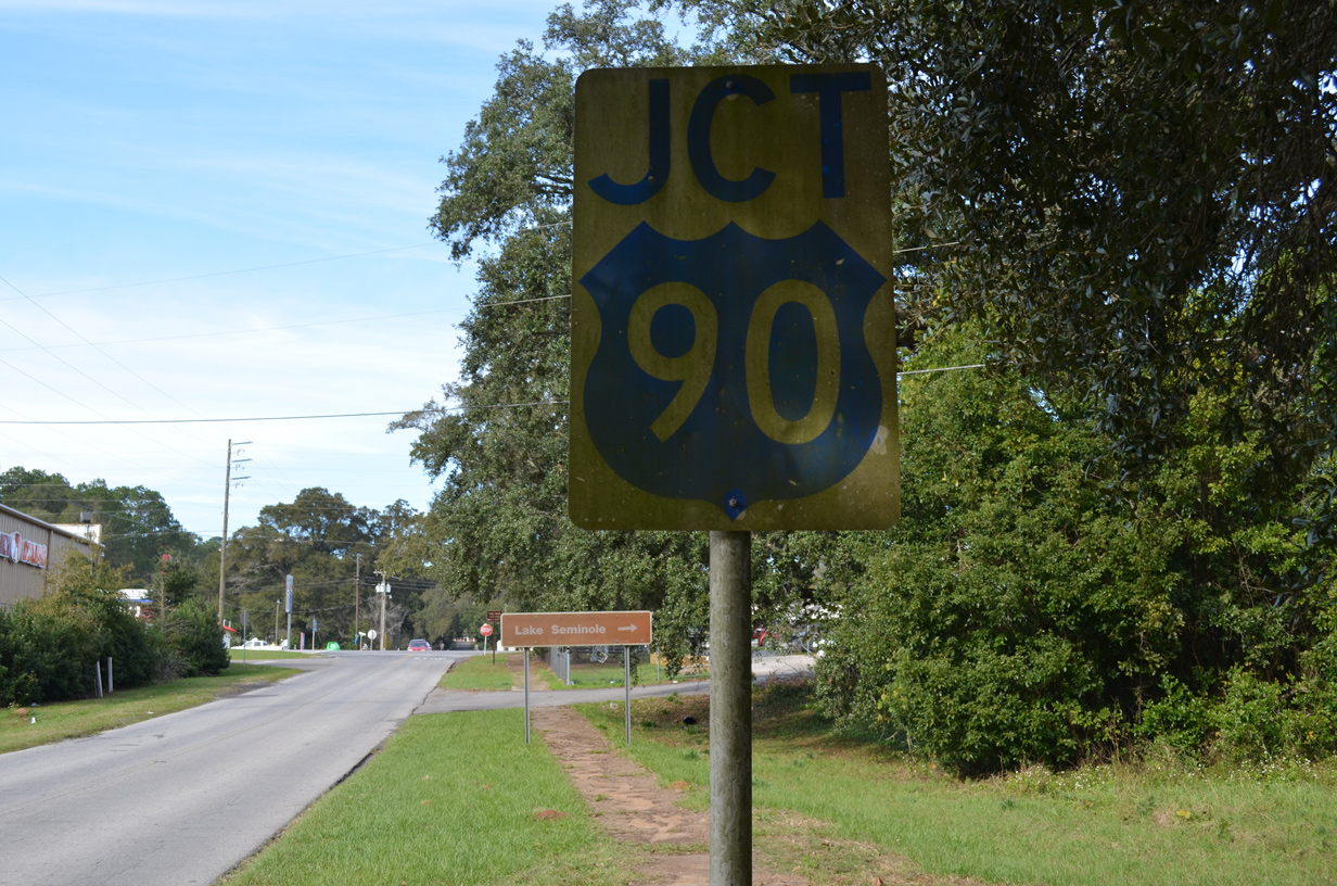
The only state-named shield for Interstate 64 posted in Indiana that we are aware.
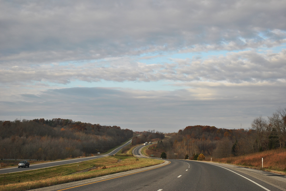
Traffic counts are somewhat low along Interstate 64 across southern Indiana, ranging between 10,200 vehicles per day (vpd) and 23,950 vpd from I-164 at Evansville to Exit 113 near Lanesville. This scene looks at the hills along the westbound freeway ahead of Exit 63.
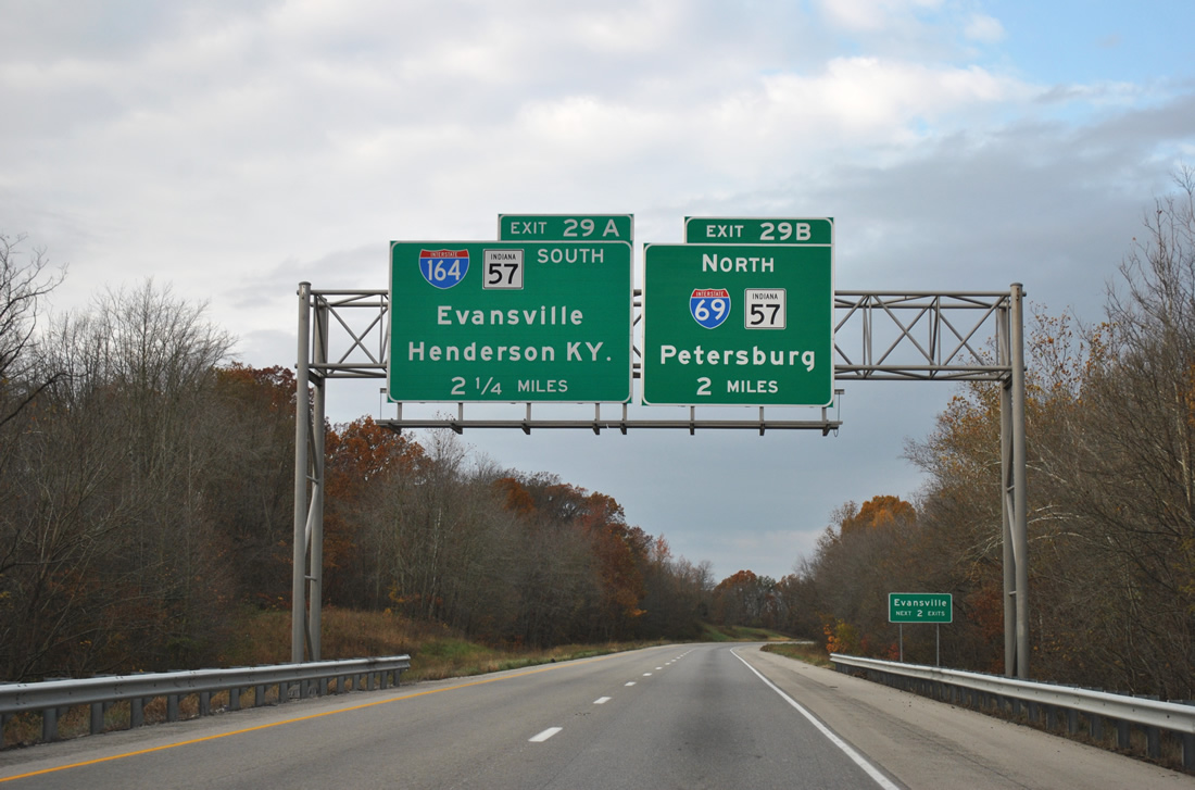
A ten mile exit less stretch lies ahead of the full-cloverleaf interchange of Interstate 64 west with Interstate 164 & Indiana 57 south and Interstate 69 & Indiana 57 north (Exits 29B/A).
Interstate 69 north at Indiana 68.
A 1.77-mile stretch of Interstate 69 between Interstate 64 and SR 68 opened to traffic on October 1, 2009.1 This segment is the first to be completed between Evansville to Bloomington. The greened out exit number displayed “22” in 2009, continuing the mileage of Interstate 164 northward. Since I-69 will be shorter than that to Kentucky, the number was premature. See a photo of the sign before the greenout on the AARoads Forum.
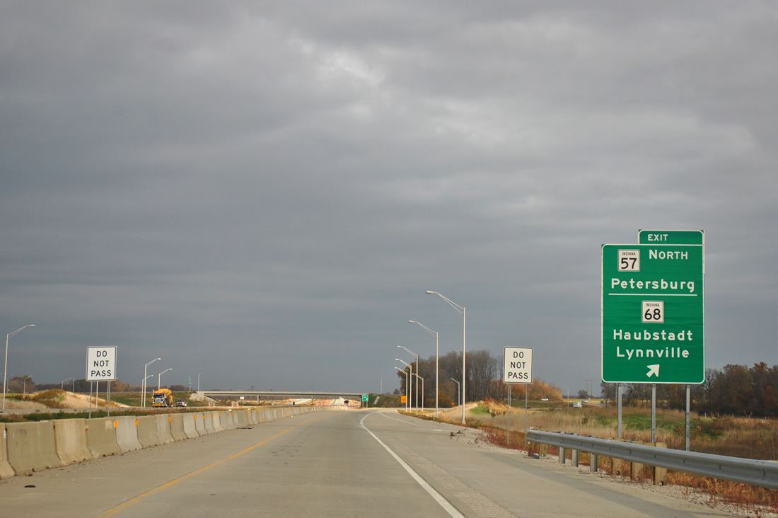
Construction is well underway as part of Governor Mitch Daniels’ Major Moves initiative to extend Interstate 69 southwest from Indianapolis. Currently traffic must depart for the Indiana 57 northbound ramp to SR-68. Work continues on the next segments of new Interstate 69 from Indiana 68 to Indiana 64 near Oakland City (Section 2) and SR 64 to Crane Naval Surface Warfare Center (Section 3) with a completion dated set for December 2012. Section 4, Crane to Bloomington, has yet to break ground but is slated for a 2014 opening.2
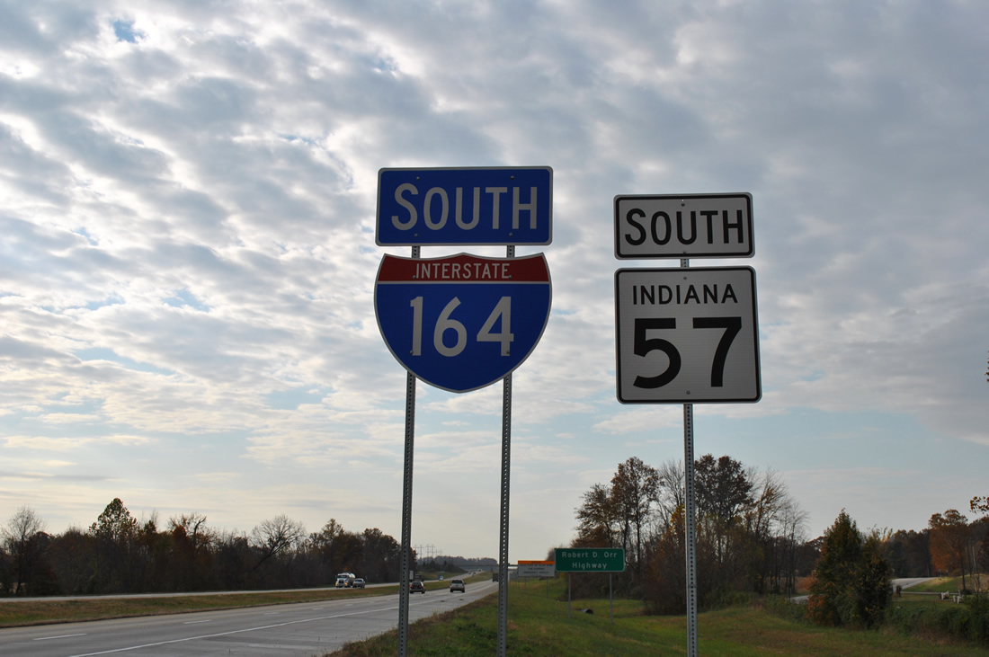
The first southbound shield of Interstate 164 coincides with an Indiana 57 marker south of the interchange with Interstates 64 and 69.
Interstate 69 will run in tandem with I-164 to a point where the Evansville spur turns west. A new bridge is planned across the Ohio River for Interstate 69. Estimates put the new span and a 13-mile stretch of roadway from the river to the Pennyrile Parkway at $1.4 billion.3
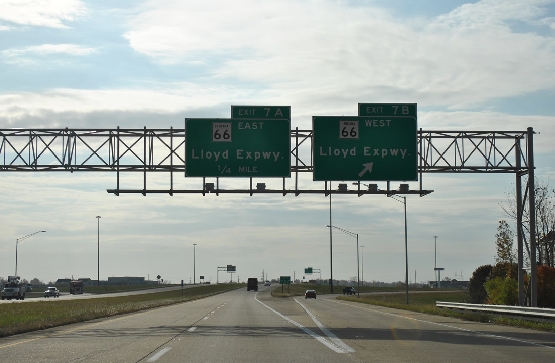
I-164 south at the Lloyd Expressway (SR 66) in Evansville.
The Lloyd Expressway opened officially in 1988 as a controlled access route from downtown Evansville east to Interstate 164 and west to the University of Southern Indiana and Posey county line. The divided highway doubles as SR 66 east of U.S. 41 and SR 62 west of U.S. 41. See Thomas Decker’s Lloyd Expressway guide at AARoads for photos.
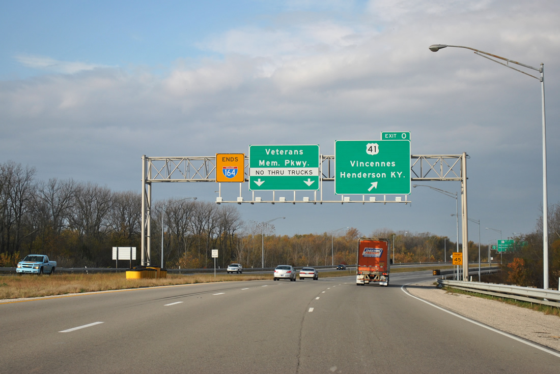
Interstate 164, completed August 2, 1990, concludes at the full-cloverleaf interchange with U.S. 41 (Exit 0).
The freeway transitions into Veterans Memorial Parkway, a controlled-access roadway west to Riverside Drive at Sunset Park. U.S. 41 continues south from the end to Henderson, Kentucky.
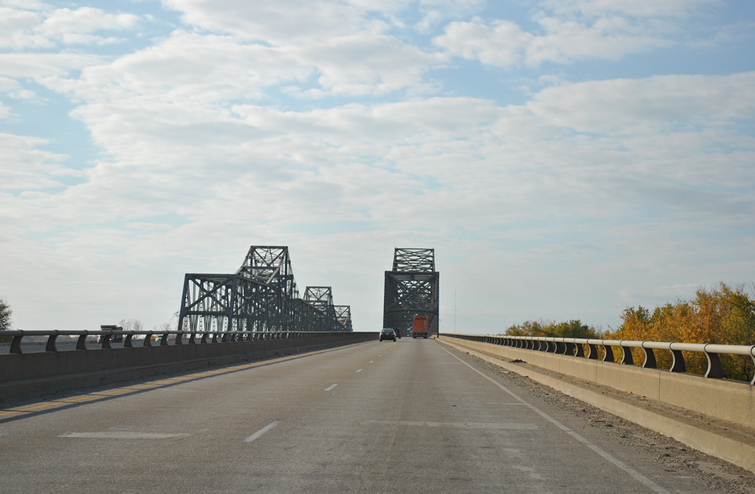
U.S. 41 passes by Ellis Park from Interstate 164 to enter the state of Kentucky at the Ohio River. A pair of cantilever bridges span the river: the northbound bridge opened in 1932, the southbound in 1965.
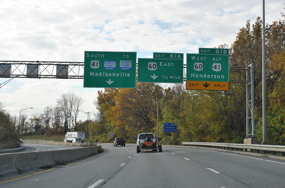
A congested stretch awaits southbound motorists along U.S. 41 between the Ohio River and the Pennyrile Parkway beginning. Numerous traveler services and other businesses line the arterial through to the freeway beginning at Exit 81 (U.S. 60).
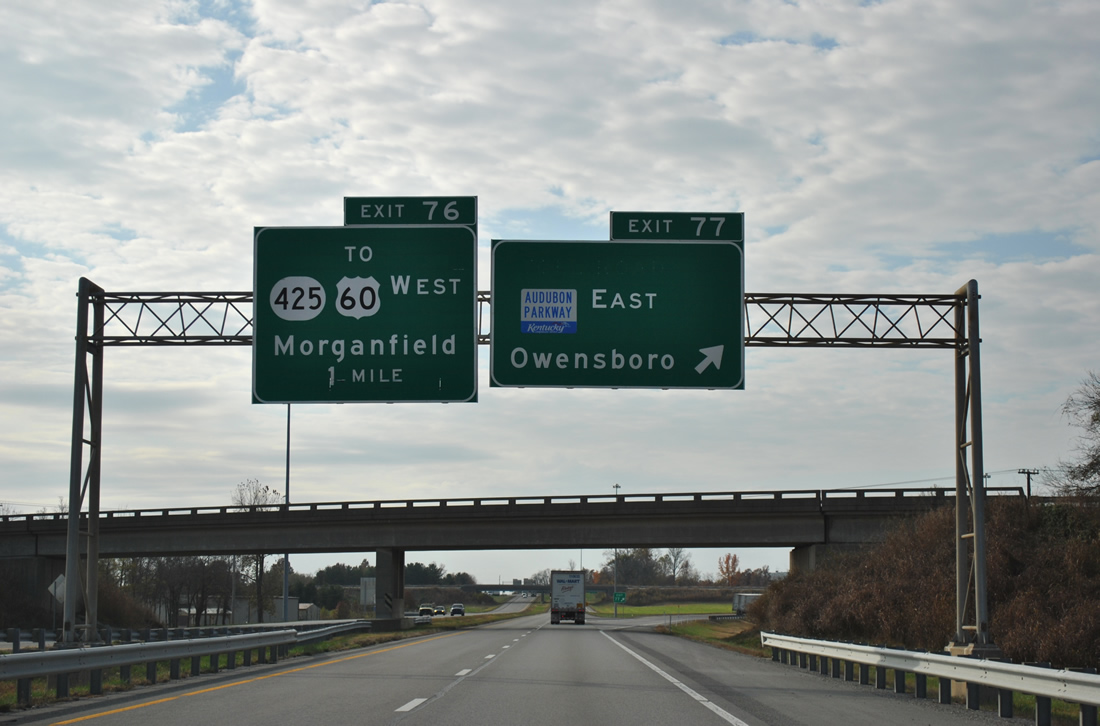
The Audubon Parkway joins Henderson with Owensboro via Exit 77 of the Pennyrile Parkway.
Some Chamber of Commerce suggestions for the Audubon upgrade the route as a spur of Interstate 69 to bring Owensboro onto the Interstate system.
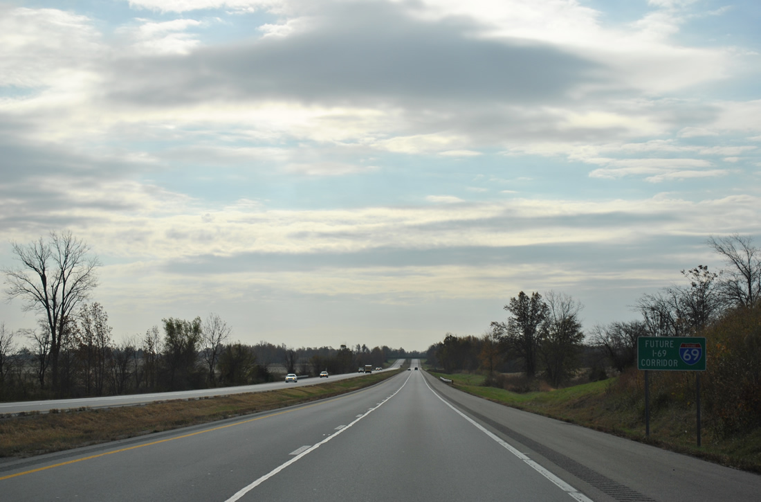
Pennyrile Parkway doubles as the Future Interstate 69 corridor from Henderson south to the Western Kentucky Parkway. Signs such as this are posted periodically along the route.
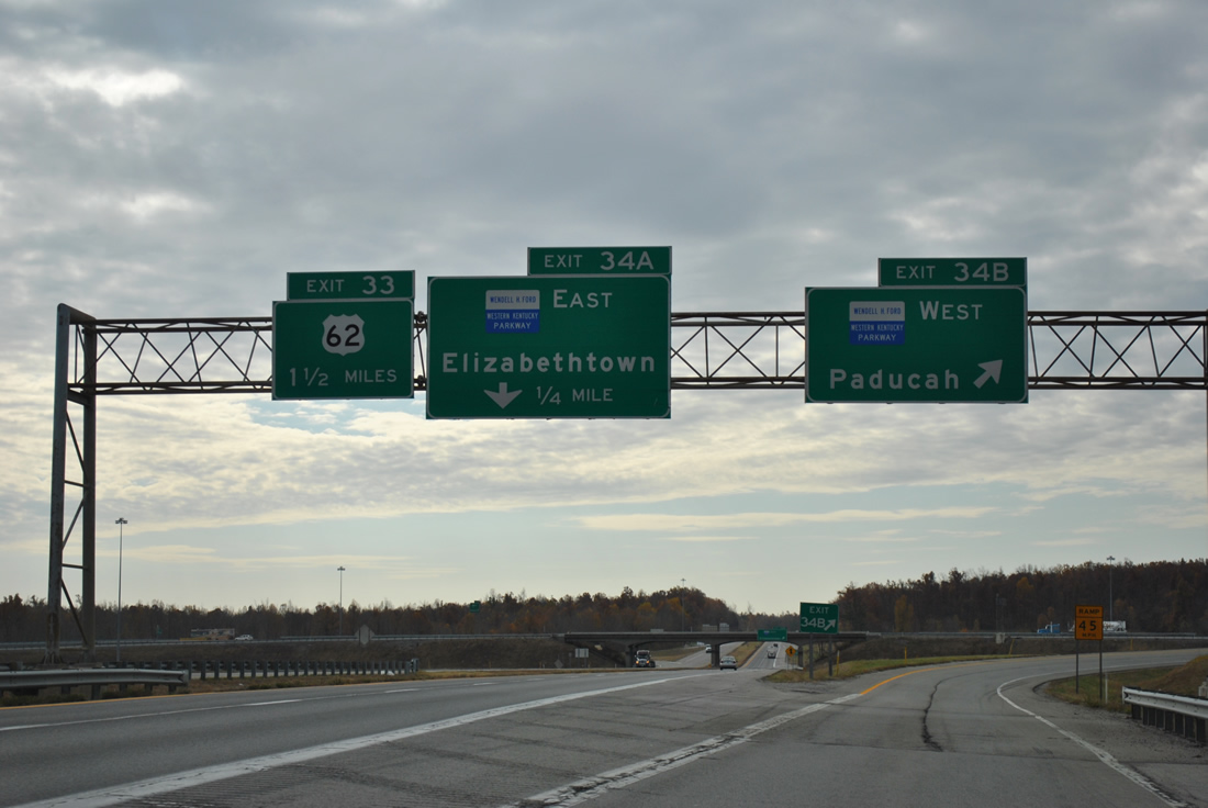
Future Interstate 69 turns west along the Western Kentucky Parkway at Exit 34B of the Pennyrile Parkway. A full-cloverleaf interchange currently joins the two roadways, with Interstate 69 southbound utilizing a single lane ramp to make the transition.
Interstate 69 was officially designated in Kentucky on October 18, 2011. Signs went up along the Western Kentucky Parkway between the Pennyrile and junction Interstate 24 after a ceremony at Nortonville. Some shield assemblies include “Formerly Western Kentucky Parkway” markers as well.
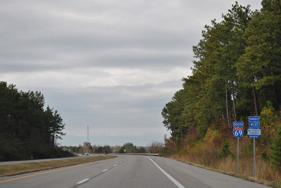
Our drive along the I-69 stretch west to I-24 revealed only stand-alone shields and guide signs were not updated to reflect the Interstate status yet.
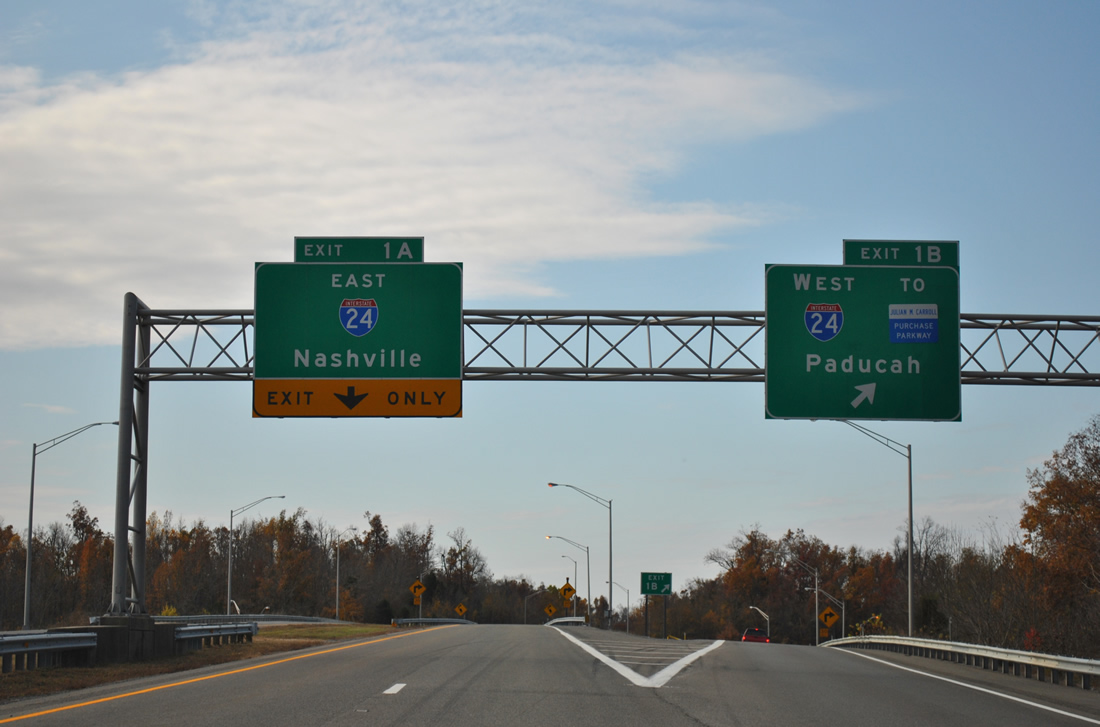
Interstate 69 south joins Interstate 24 west for 17-mile overlap to the Purchase Parkway. Signs for Interstate 69 were not posted along I-24 yet and the Purchase Parkway is only signed as a Future Interstate 69 corridor at this time.
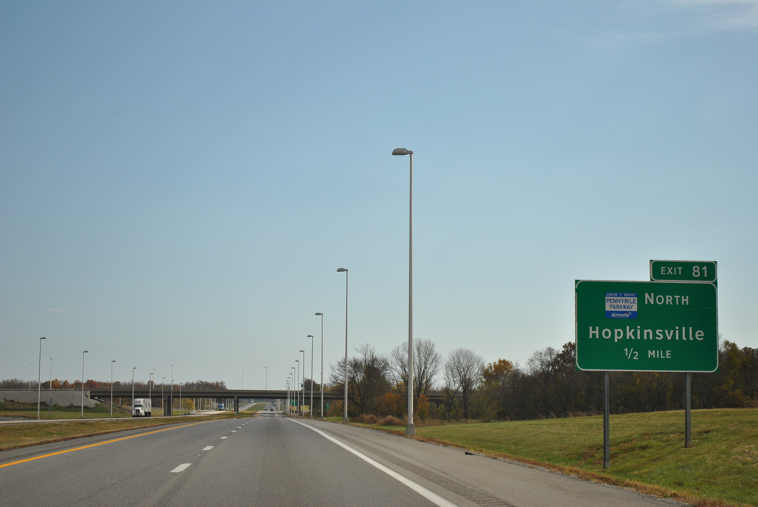
One half mile ahead of the trumpet interchange (Exit 81) with the Pennyrile Parkway northbound beginning on I-24 east. The Parkway was extended southward six miles from U.S. 68 at Hopkinsville on March 1, 2011.
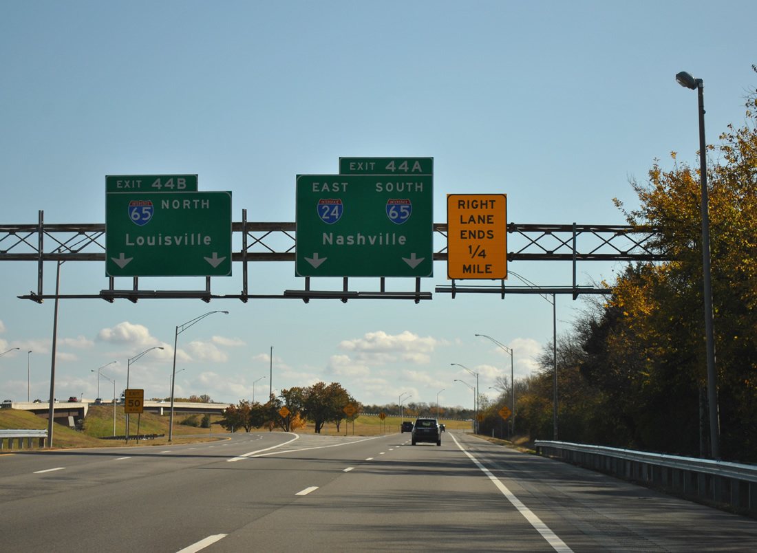
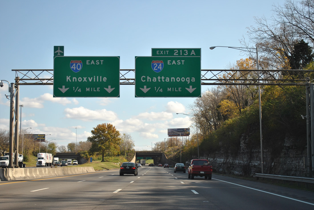
Heading south to the merge of Interstate 24 east and 65 south at Nashville. The two share 1.8 miles.
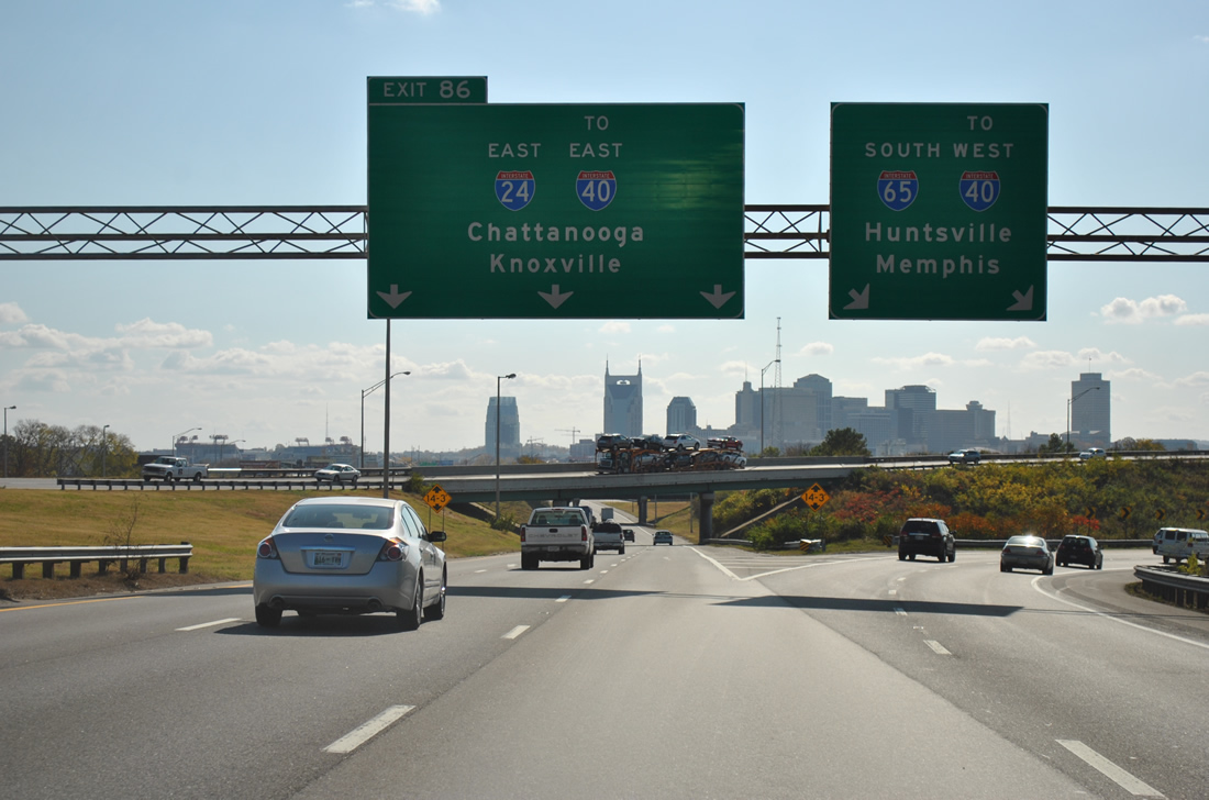
With the downtown Nashville skyline in view, Interstate 65 south parts ways with Interstate 24 east at a directional interchange.
I-24 & 65 originally continued together to junction Interstate 40 at the Cumberland River. The northern arc of the Nashville inner belt was originally signed as Interstate 265, but replaced in 1999 when Interstate 65 was realigned to the west in an effort to split through traffic.

A look at downtown Nashville and the Korean Veterans Boulevard and Shelby Avenue Bridges over the Cumberland River from Interstate 24 east (south).
Interstate 24 and 40 share a brief stretch of pavement leading away from central Nashville.
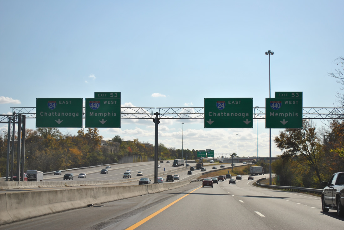
Continuing south, Interstate 24 leaves Interstate 40 and quickly meets the east end of Interstate 440. Ramps from Interstate 40 form separate carriageways through to the I-440 (Exit 53) directional interchange.
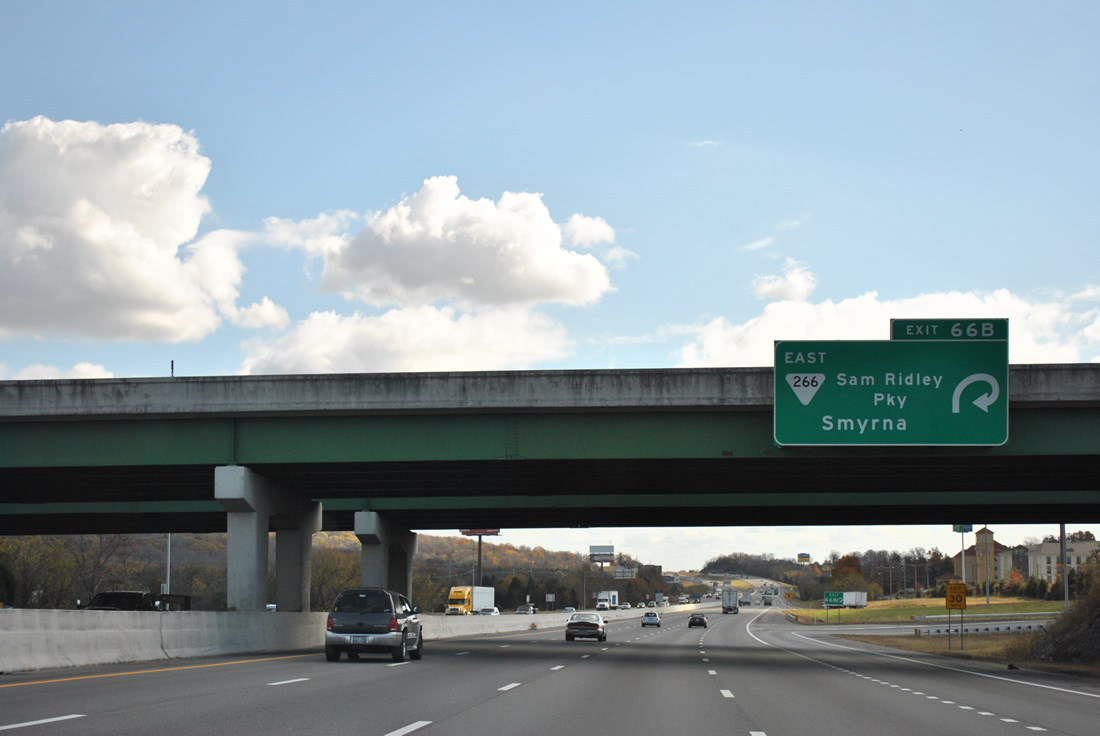
Interstate 24 constitutes an eight-lane suburbanized freeway from Nashville southeast toward Murphreesboro.
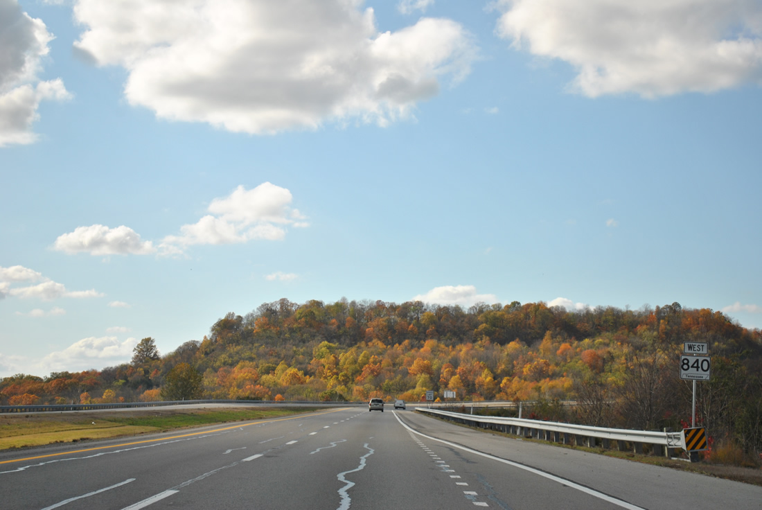
Tennessee 840 reassurance marker posted after Exit 34 (Peytonsville-Trinity Road).
Tennessee 840 currently exists in two segments, from I-40 to SR 46 in Williamson County and from U.S. 31 to I-40 in Wilson County. Construction is underway to join the two portions into a seamless beltway on the south side of Nashville by December 2012.
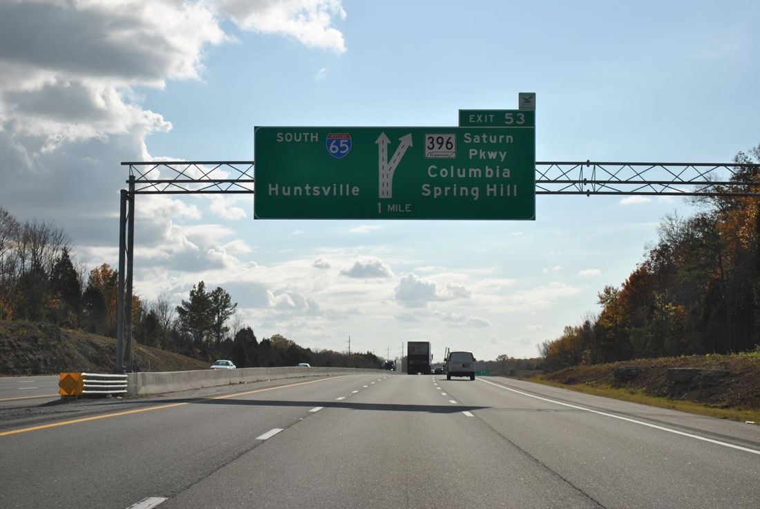
South of TN-840, Interstate 65 meets the east end of Tennessee 396 (Saturn Parkway).
Named for the original General Motorists Saturn Plant at Spring Hill, the TN-396 expressway connects I-65 with U.S. 31 (Main Street). Interstate 65 transitions into a rural freeway beyond Spring Hill.
See photos from the rest of this day’s drive on our updated Interstate 65 southbound guides for Alabama.
Sources:
- “Southbound Indiana 57 traffic diverting onto new stretch of I-69.” Evansville Courier & Press, September 29, 2009.
- “Portions of Interstate 69 ready for traffic by end of 2012.” Evansville Courier & Press, August 29, 2011.
- “Lobbyists being hired to push for I-69 bridge.” Evansville Courier & Press, February 12, 2011.


Hey Alex!
This is an awesome photo blog. Your passion for America’s great and pioneering experiment in mobility is inspiring. To extend your work here, I invite you to our platform, InfraInput.org which welcomes any issues and ideas you find in your travels, visits, or everyday commutes on state highways and local roads. It is quite unfortunate most of these systems show marks of aging and congestion. Please be one of our first beta users to turn this situation around.
Thanks!
Good news…the Sherman Minton (I-64) bridge crisis was resolved quickly, thanks to KyDot, InDot, USDOT and Hall Construction! Also the IN 265 Eastern Crossing Bridge to I-265 in Kentucky is well under construction. When finished in Summer 2016, the Interstate 265 outer belt (I-264 is the inner loop) will be complete around urbanized Louisville.