|
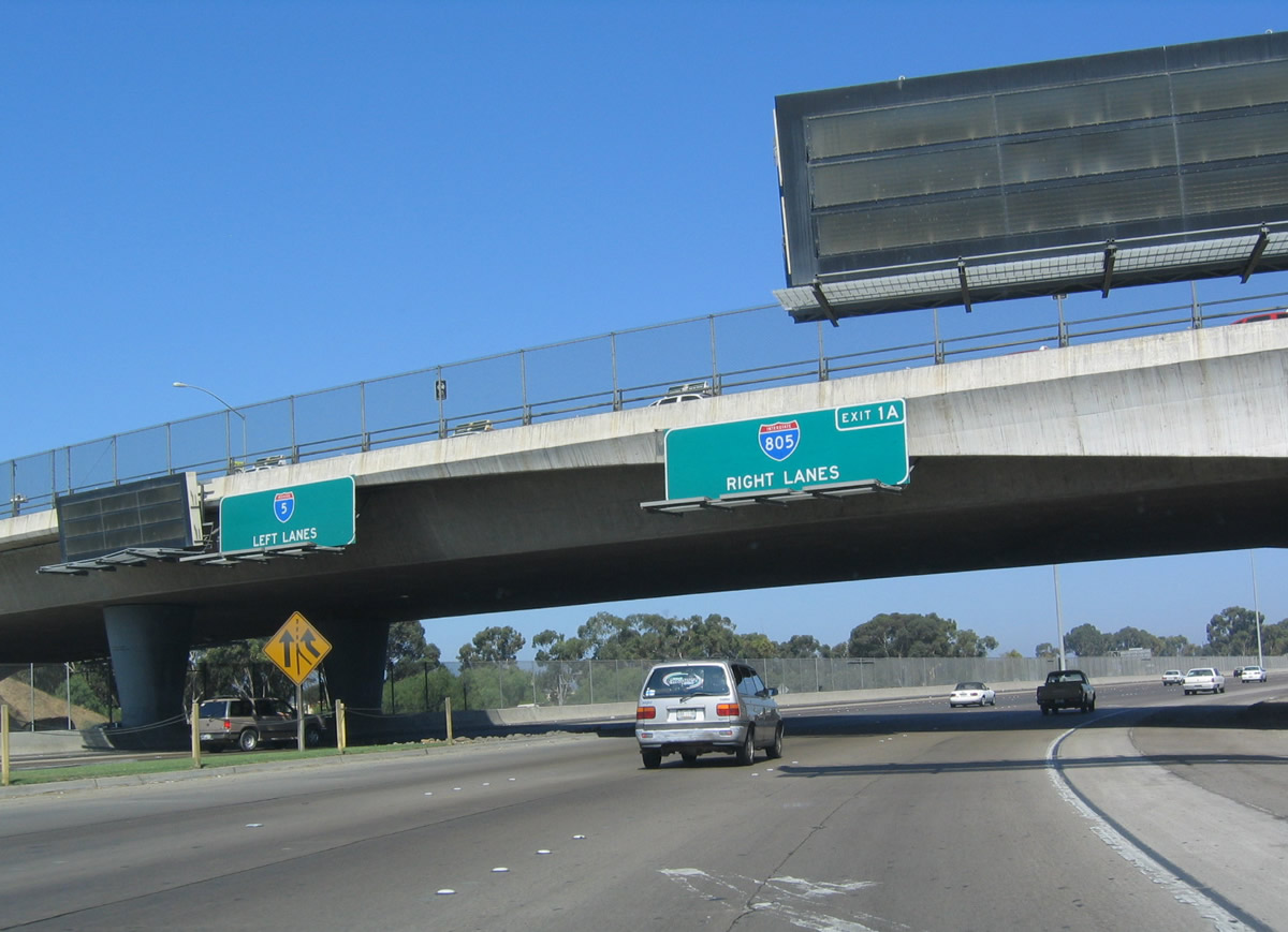
| Interstate 5 originates in San Ysidro, the southernmost community within the city of San Diego. Upon passing through the U.S. Customs Station, the freeway quickly partitions with I-805 (Jacob Dekema Freeway north). The original button copy signs were replaced with exit number signs in 2004. 07/18/04 |
|
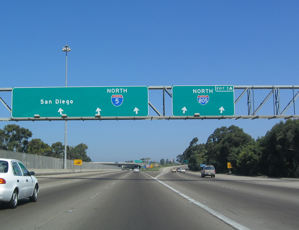
| Interstates 5 and 805 split at Exit 1A, just beyond the customs station at the International Port of Entry. I-5 remains closer to the bay and coast, while I-805 loops through the inland communities of the San Diego metropolitan area. They rejoin in the northern San Diego neighborhood of Sorrento Valley. A former business loop for I-5 used to follow the Historic U.S. 101 route through San Ysidro, Chula Vista and National City. This route today can be traced along Beyer Boulevard, Broadway, and National City Boulevard north from I-805 and San Ysidro Boulevard. 07/18/04 |
|
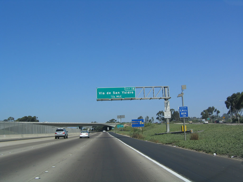
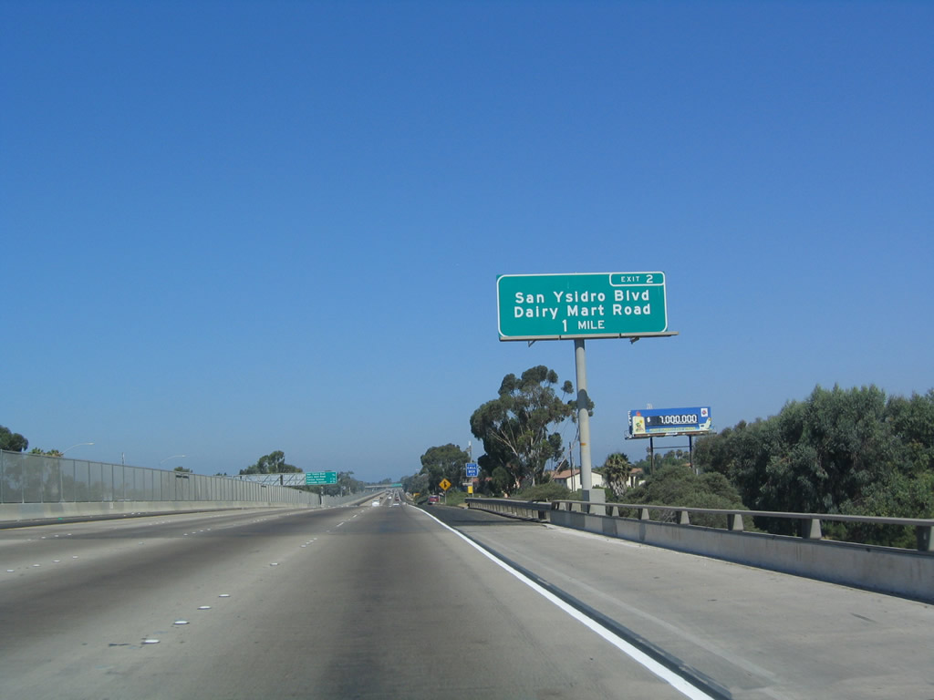
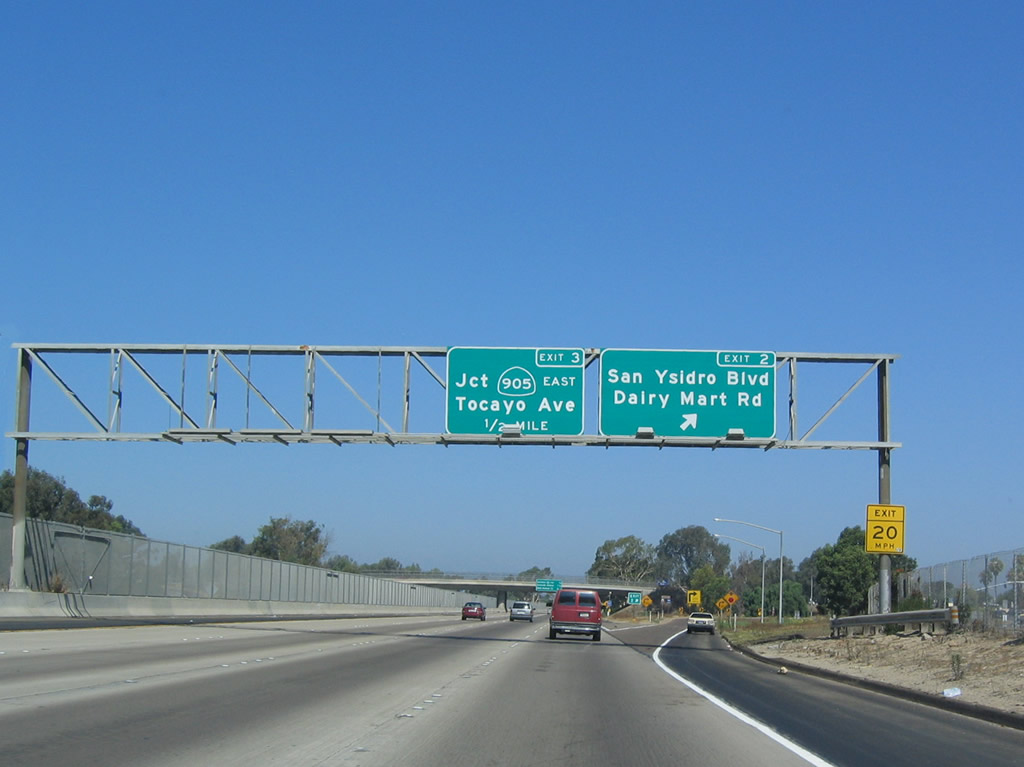
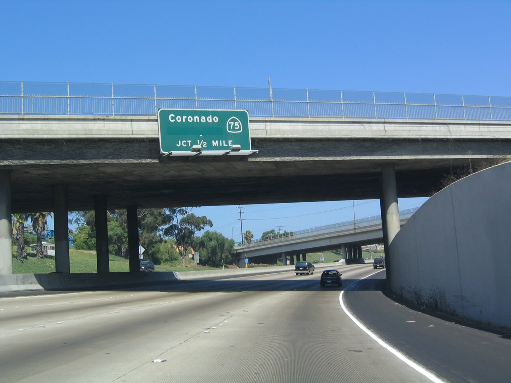
| The succeeding exit along northbound Interstate 5 leads to both Via de San Ysidro and San Ysidro Boulevard. San Ysidro Boulevard closely parallels I-5 between SR 905 and the International Border, always remaining to the east of the freeway. 07/18/04 |
|
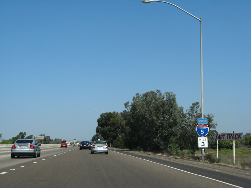
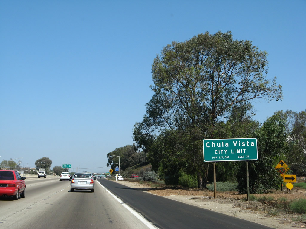
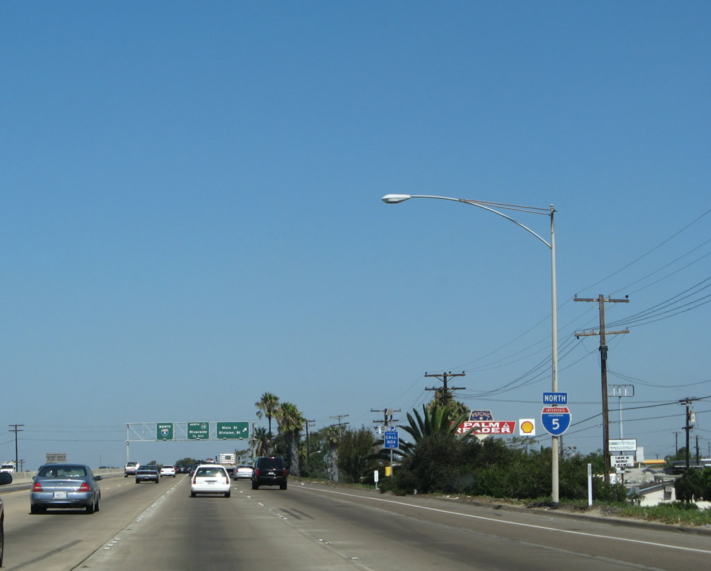
| This advance sign for Via de San Ysidro has the distinction of being the first numbered exit in San Diego County / Caltrans District 11; it was placed in February 2002. The transition ramp from southbound Interstate 805 to I-5 south and a welcome to California monument appears behind the sign. 07/18/04 |
|
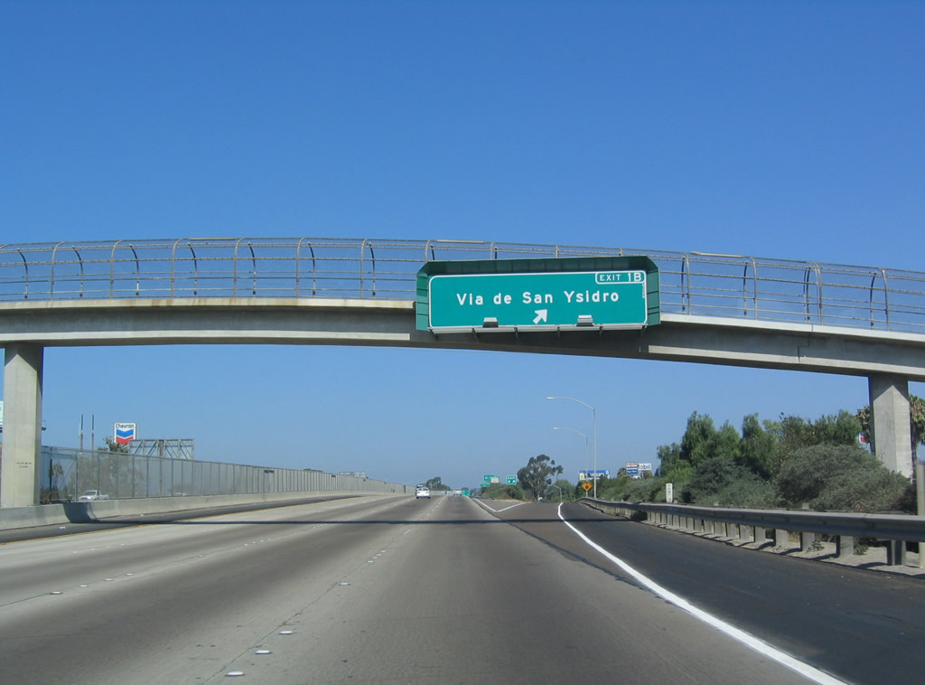
| Exit 1B departs Interstate 5 north for Via de San Ysidro to the San Diego community of San Ysidro. 07/18/04 |
|
| Interstate 5 (Montgomery Freeway) continues one mile north to Exit 2 with Dairy Mart Road. 07/18/04 |
|
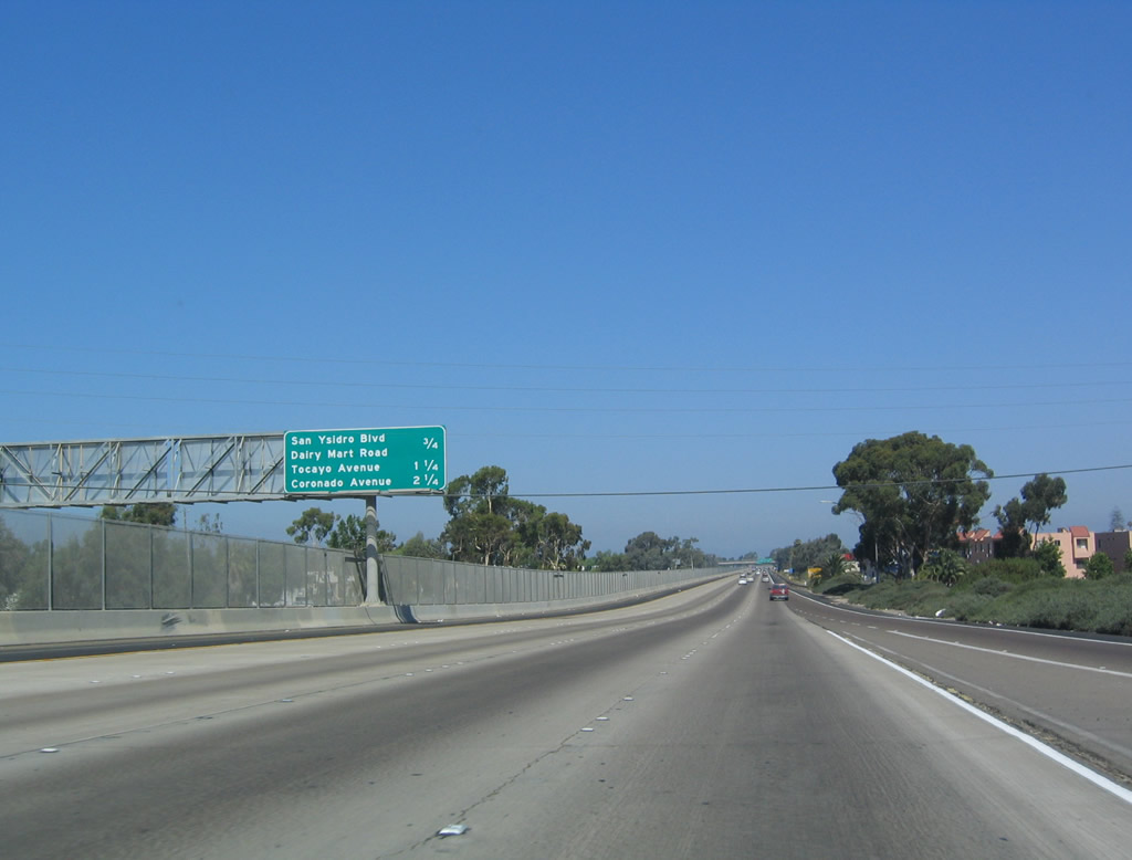
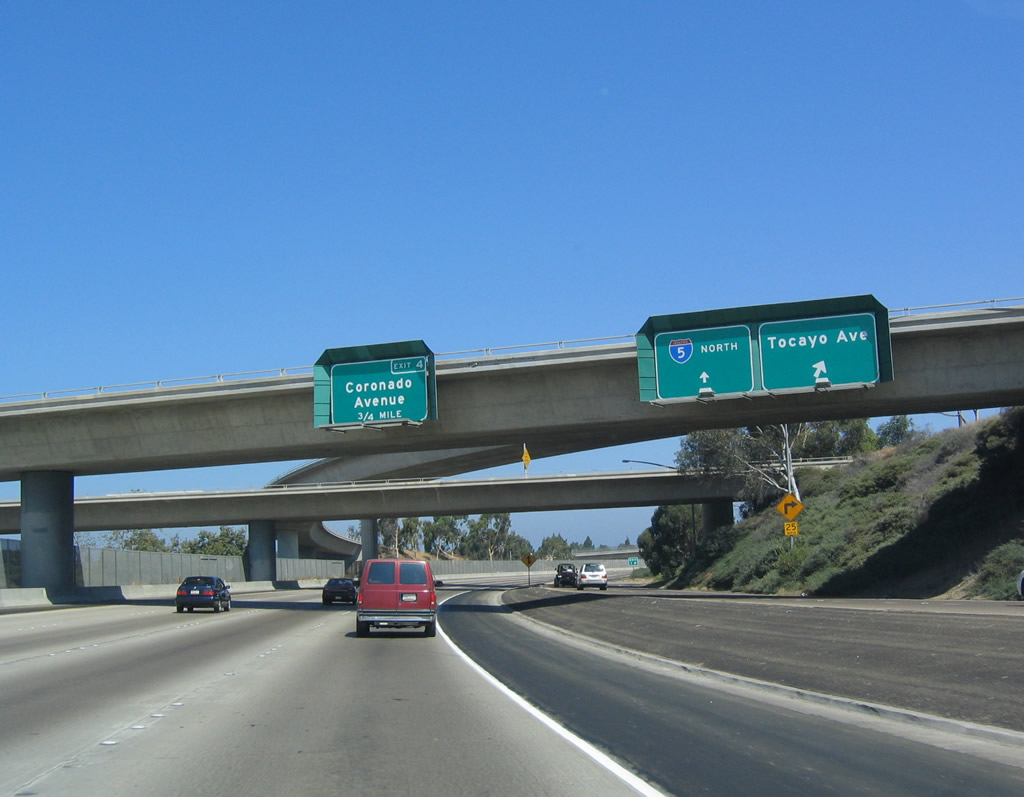
| A chain-link fence lines the median of Interstate 5 north from the International Border to the Coronado Avenue interchange (Exit 4). The fence prevents people from attempting to cross the freeway. Although safety is the primary reason for this fence, it is also in place to assist Border Patrol agents. The subsequent exit after Dairy Mart Road connects I-5 with Tocayo Avenue and SR 905. 07/18/04 |
|
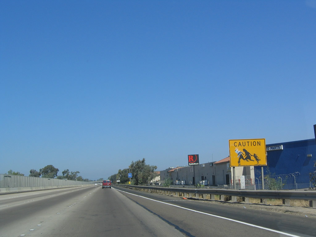
| Large yellow signs depicting a family of three running with the word "Prohibido" (meaning Caution) were formerly used along Interstate 5 in Southern California. The intent of this sign, first placed in the early 1980s, was to warn motorists of people potentially fleeing the border crossing or the Border Patrol. 07/18/04 |
|
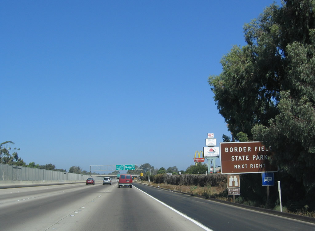
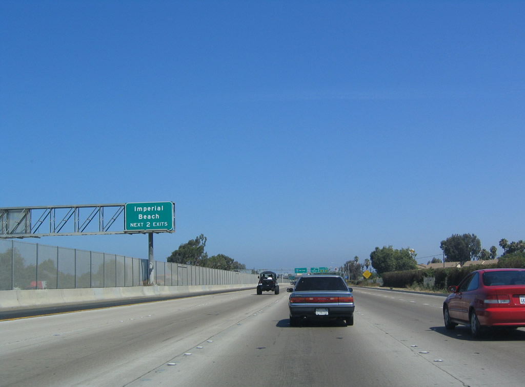
| Dairy Mart Road leads to Border Field State Park, a large area of green open space designated at a former Navy reservation wedged between the border fence and the cities of Imperial Beach and San Diego. The Tijuana River passes through the estuary at Border Field, and the much of the wetland area is protected as parts of the state park or the federal Tijuana River National Estuarine Sanctuary and the Tijuana Slough National Wildlife Refuge. 07/18/04 |
|
| Northbound I-5 at Exit 2 for Dairy Mart Road, with connections to San Ysidro Boulevard. In a strange twist, the newly placed exit number signs approaching SR 905 originally featured Interstate 905 shields. Despite the completion of the Otay Mesa Freeway in 2012, SR 905 remains the designation. 07/18/04 |
|
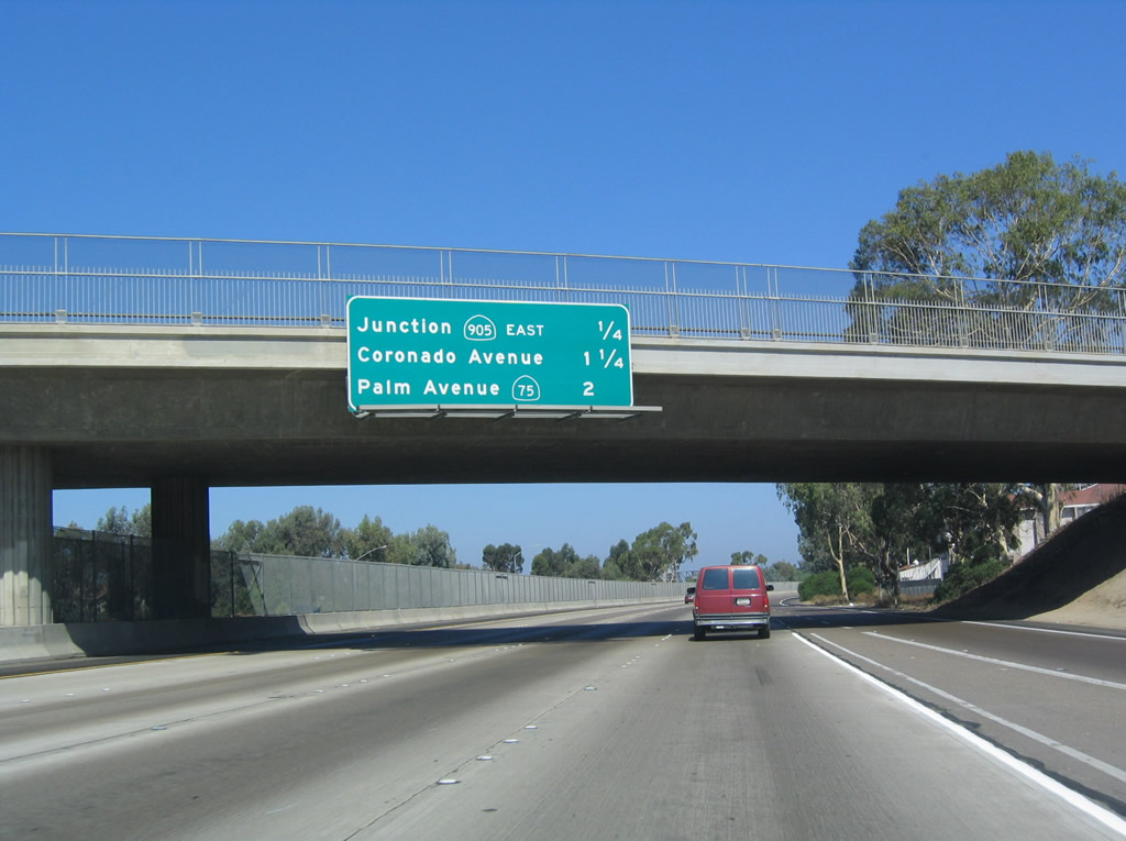
| Northbound Interstate 5 distance sign approaching Exit 3, SR 905 one-quarter mile. SR 905 was at one time an easterly extension of SR 75, and it later was SR 117 during the late 1970s and early 1980s. 07/18/04 |
|
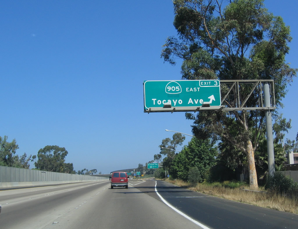
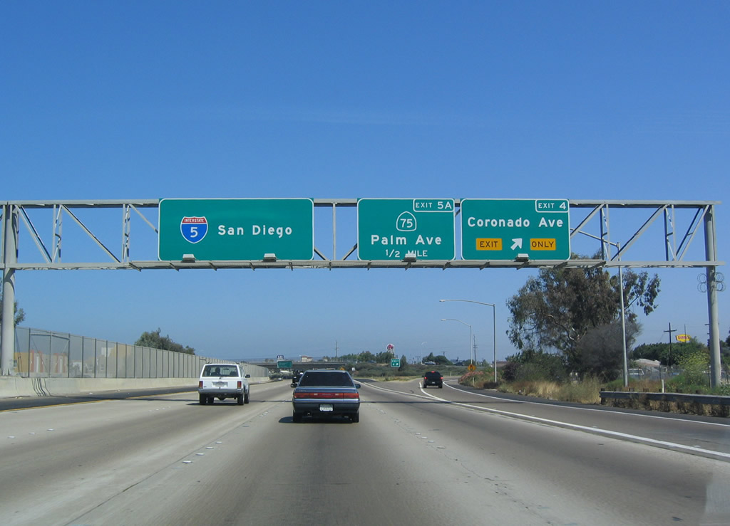
| Exit 3 leaves I-5 north to SR 905 east. The Otay Mesa Freeway connects I-5, I-805, Brown Field Airport, SR 125 and the Otay Mesa Port of Entry. Approved by AASHTO as I-905 in 1984, the freeway was completed in 2012 but remains designated as SR 905. 07/18/04 |
|
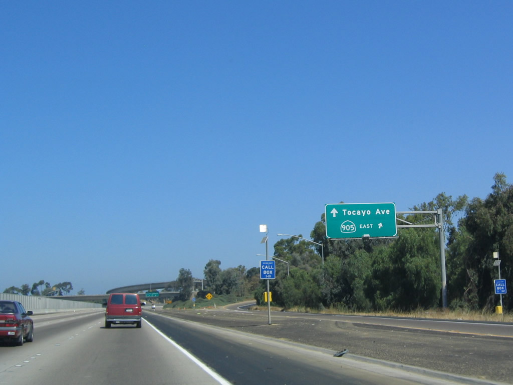
| A collector distributor roadway connects I-5 north with SR 905 east and Tocayo Avenue west at a cloverstack interchange (Exit 3). 07/18/04 |
|
| A one-time proposal for Tocayo Avenue outlined the route as a western extension of SR 905. The intent was for SR 905 to connect directly with the Mexico 1-D toll road near Playas de Tijuana. This project never advanced due to environmental restrictions for constructing a route through the sensitive Tijuana River Valley, and the building of a new border crossing station. 07/18/04 |
|
| Interstate 5 continues a quarter mile north from the Iris Avenue over crossing to Exit 4 with Coronado Avenue. Generally, the section of I-5 from the Mexican border north to SR 54 was built in 1973. 07/18/04 |
|
| The succeeding two interchanges of I-5 north serve the city of Imperial Beach via Coronado Avenue and SR 75 (Palm Avenue). 07/18/04 |
|
| Coronado Avenue leads west from Exit 4 through the Otay Mesa-Nestor neighborhood of San Diego to connect with Imperial Beach Boulevard in the city of Imperial Beach. Even though this interchange is located in San Diego, the control city is listed as San Diego, perhaps because Downtown is still another 12 miles north of here, and the freeway will briefly leave the city to pass through the cities of Chula Vista and National City. 07/18/04 |
|
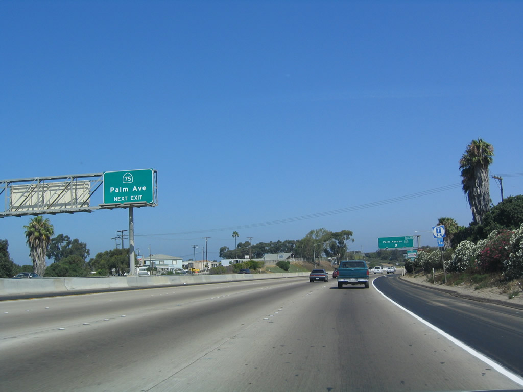
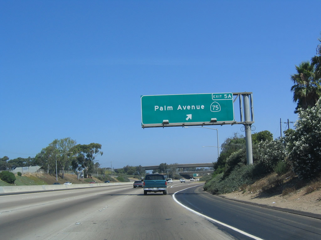
| The ensuing northbound interchange marks the southern terminus of SR 75 (Palm Avenue). The state route leads west from Exit 5A and then north along the Silver Strand. Palm Avenue continues east of this interchange as a San Diego city street. 07/18/04 |
|
| SR 75 connects Interstate 5 with Imperial Beach, the Silver Strand, and Coronado. Imperial Beach, known as "Classic Southern California," had a population of 26,324 as of the 2010 Census. The city was founded in 1887 and incorporated on September 17, 1956. 07/18/04 |
|
| Exit 5A leaves Interstate 5 north for SR 75 (Palm Avenue) west to Imperial Beach. The guide sign that preceded this one referenced the state route as heading north. It was likely amended because SR 75 initially travels east-west. 07/18/04 |
|
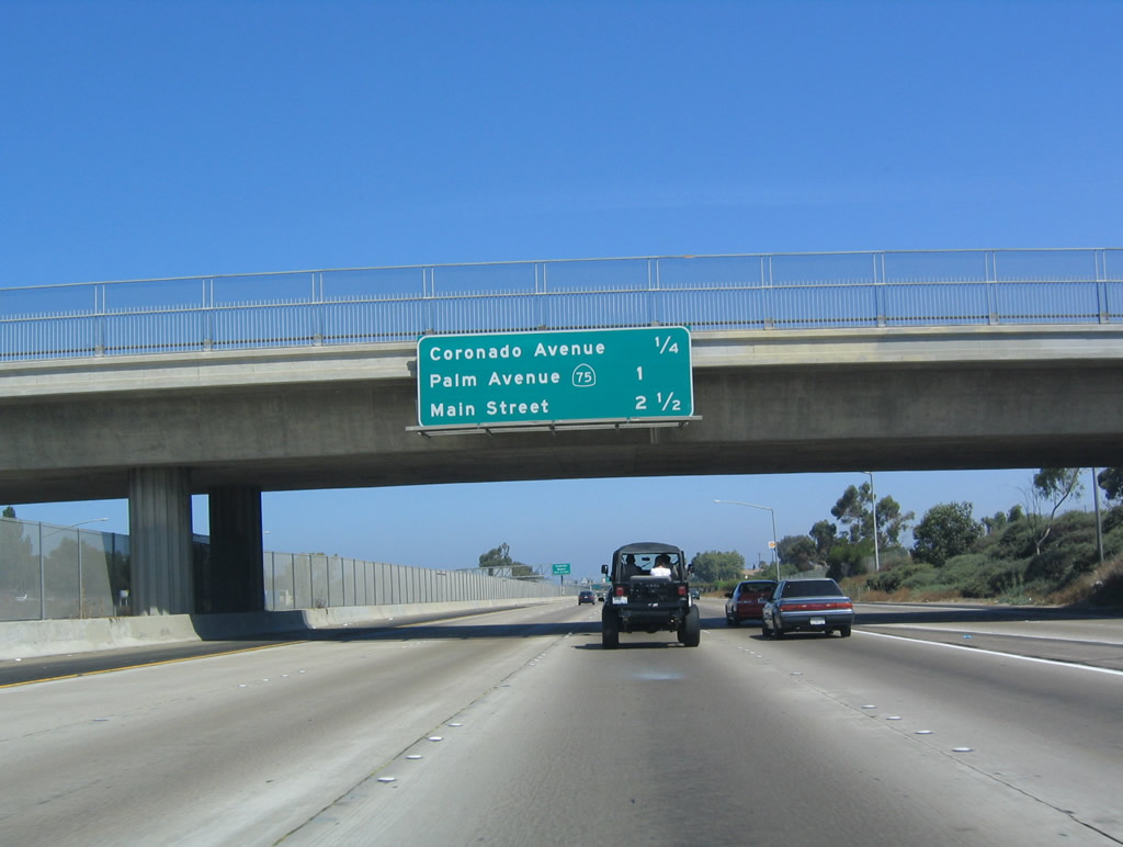
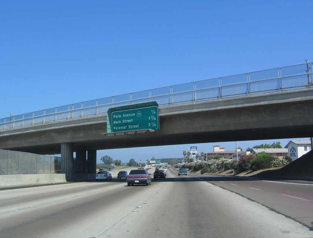
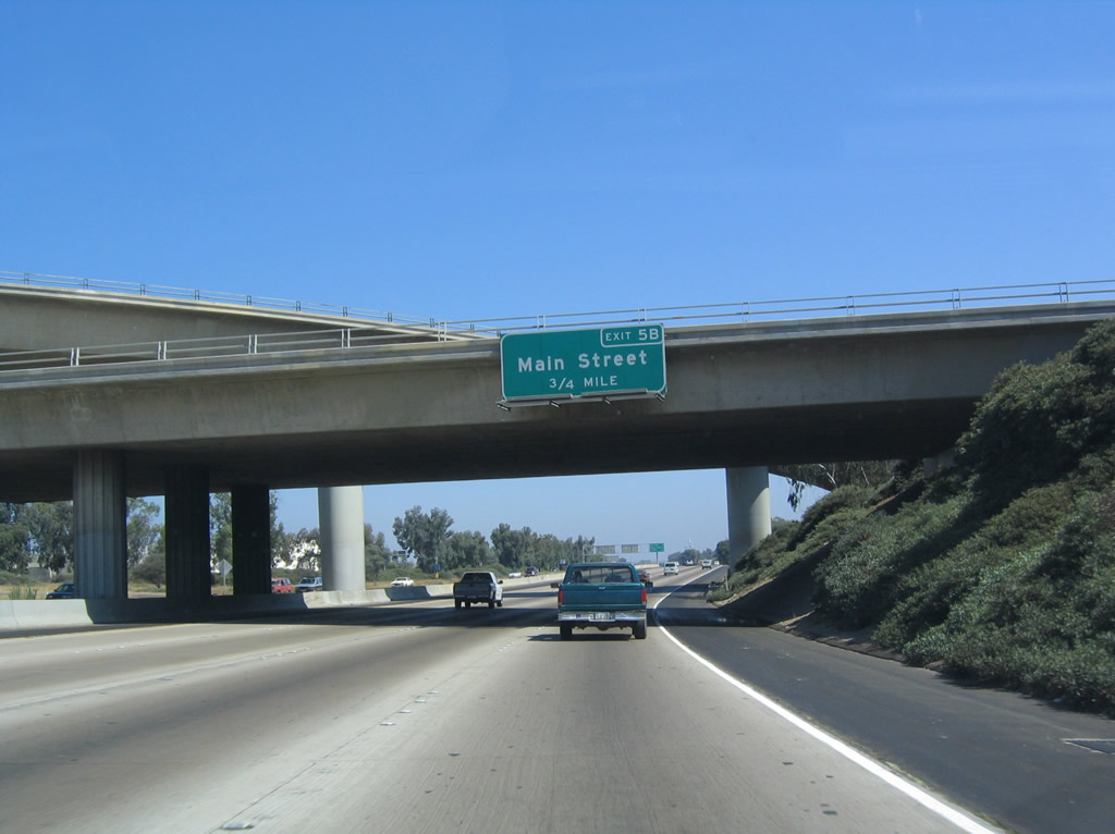
| Next along Interstate 5 (Montgomery Freeway) north is Exit 5B to Main Street. Palm Avenue and a flyover ramp connecting the street east with northbound I-5 passes overhead. 07/18/04 |
|
| This reassurance shield for Interstate 5 north appears after the onramp from SR 75 (Palm Avenue). 07/18/04 |
|
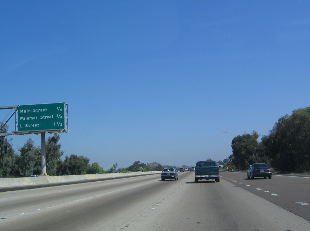
| This distance sign is located along northbound Interstate 5 as it approaches Exit 5B, Main Street. This is the first of several exits from Interstate 5 in Chula Vista, one of the largest suburbs of San Diego. With the early 2000s development of Eastlake and Otay Ranch, Chula Vista saw a massive influx of people in search of newer homes and more affordable housing when compared to Northern San Diego County. The succeeding exits are for Palomar Street (Exit 6) and L Street (Exit 7). 07/18/04 |
|
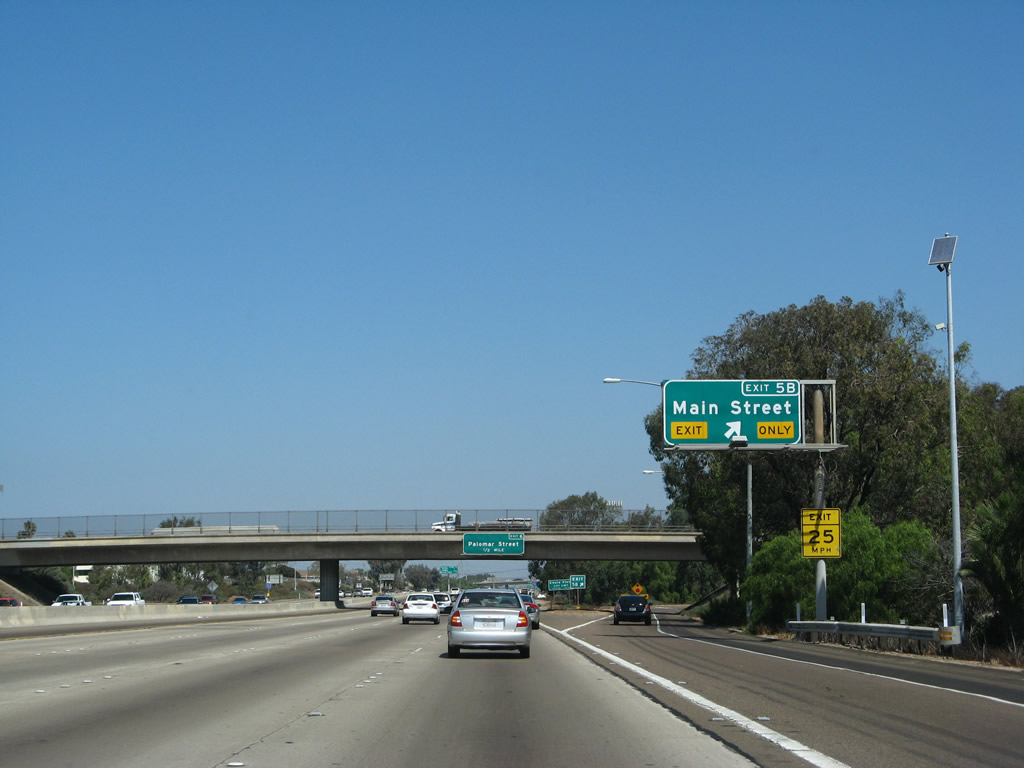
| Exit 5B departs from Interstate 5 north to Main Street near downtown Chula Vista. 09/01/07 |
|
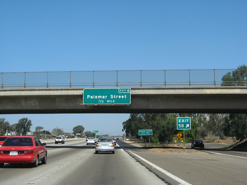
| Interstate 5 advances a half mile north from the Main Street over crossing to Exit 6 with Palomar Street. 09/01/07 |
|
| Interstate 5 briefly leaves the city of San Diego to pass through the western sections of Chula Vista and National City. The city of Chula Vista incorporated on October 17, 1911, and it has grown substantially since then as newer communities such as Eastlake and Otay Ranch east of Interstate 805 have developed. The largest suburb of San Diego, Chula Vista had a population of 173,556 as of the 2000 Census. 09/01/07 |
|
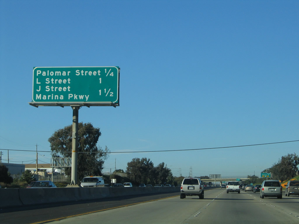
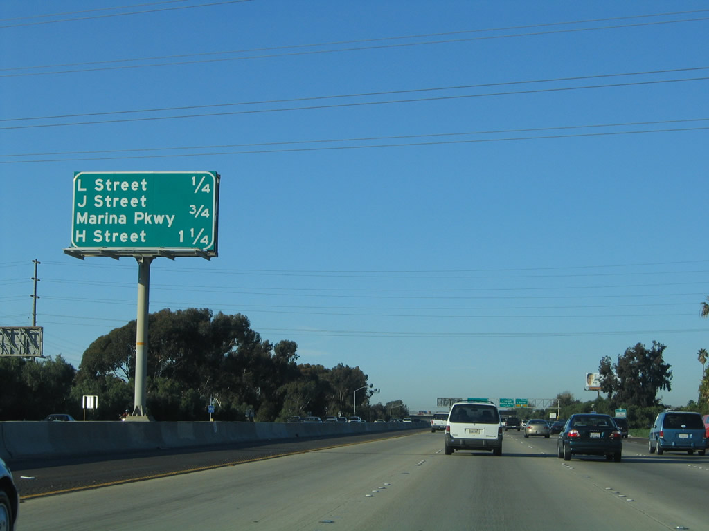
| Interchange sequence sign preceding the Palomar Street off-ramp. Exit 7A to L Street and 7B to J Street / Marina Parkway follow over the succeeding 1.25 miles. 01/31/05 |
|
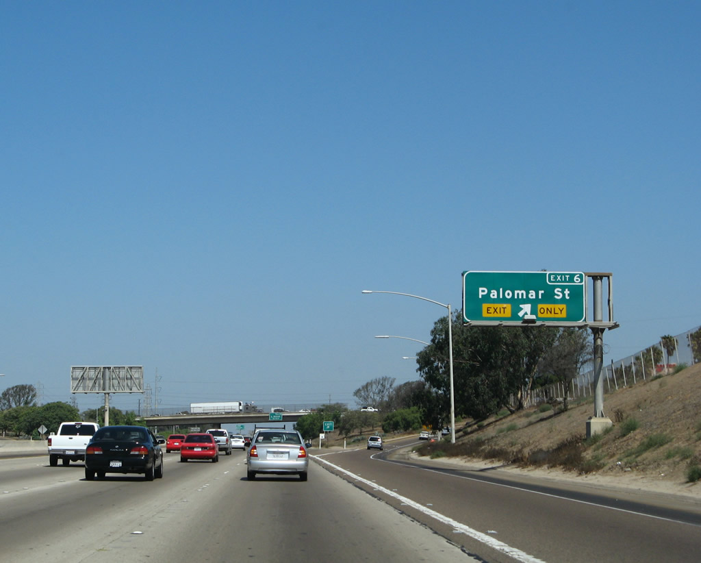
| Exit 6 leaves Interstate 5 northbound for Palomar Street. 09/01/07 |
|
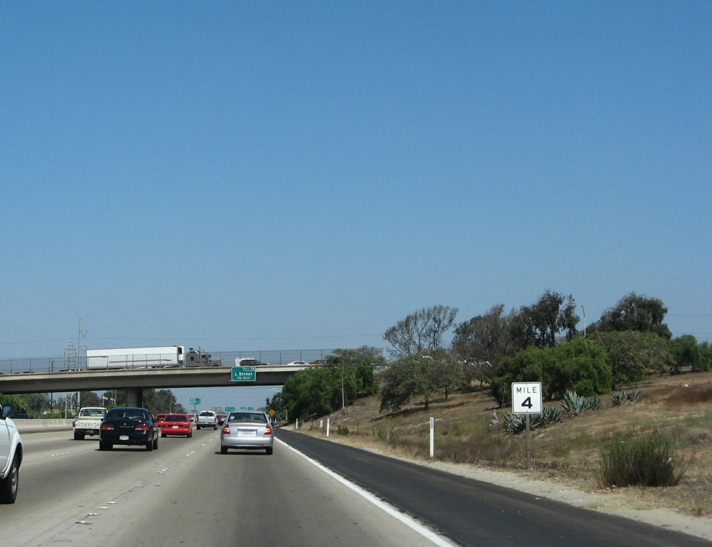
| This white mile sign is posted for motorists to check their speedometers; it is the fourth such sign in a series of five. 09/01/07 |
|
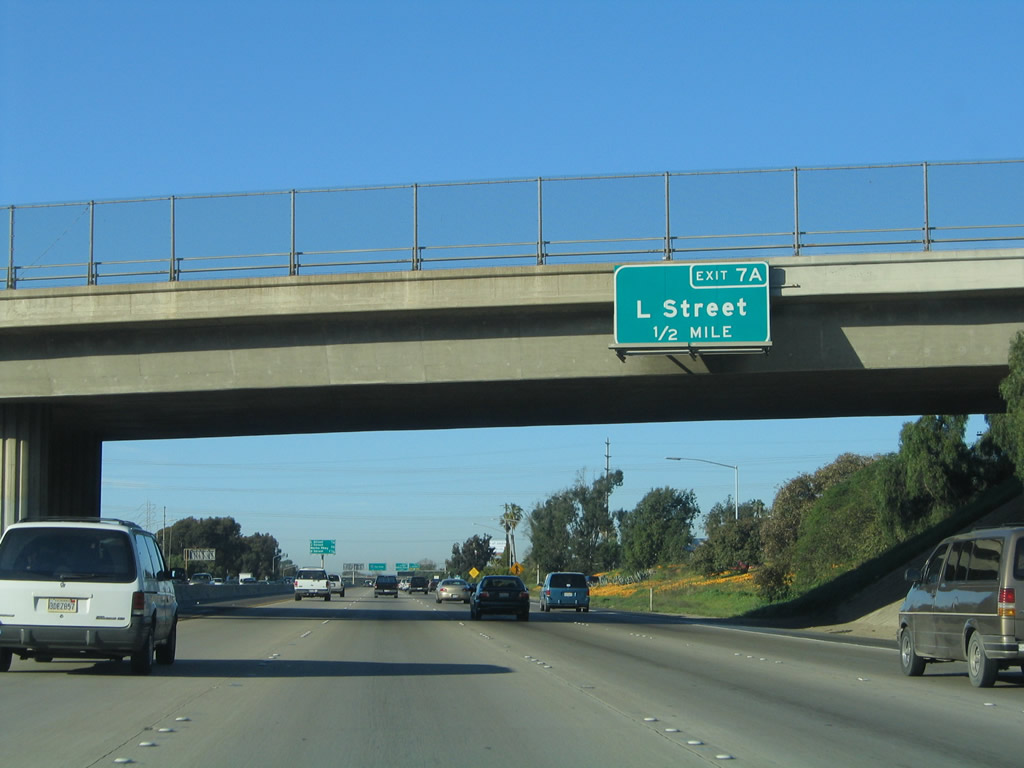
| The ensuing exit along northbound Interstate 5 (Montgomery Freeway) connects with L Street in one half mile. 01/31/05 |
|
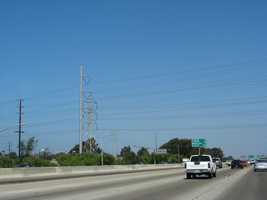
| High-voltage power lines (San Diego Gas & Electric) cross over Interstate 5 between Exits 6 and 7A. These lines connect the South Bay power plant with a substation near the foot of Mt. San Miguel near SR 125. 09/01/07 |
|
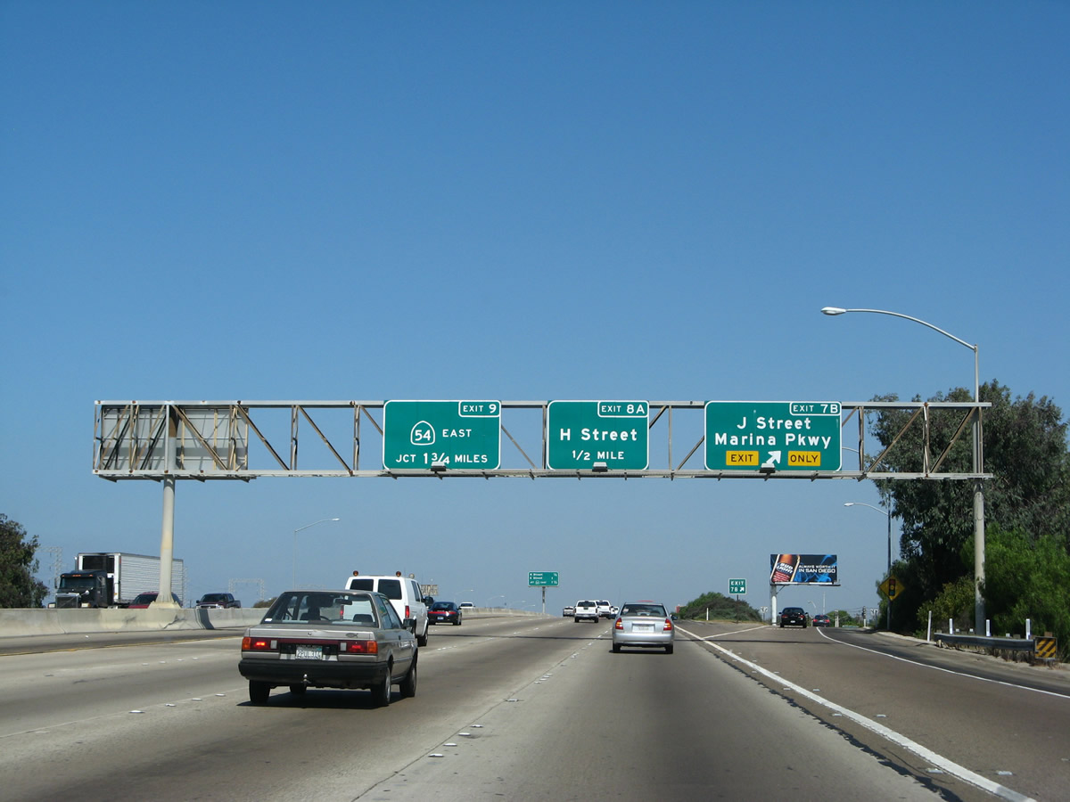
| This interchange sequence sign along Interstate 5 (Montgomery Freeway) north provides the distance to Exits 7A, 7B and Exit 8A. 01/31/05 |
|
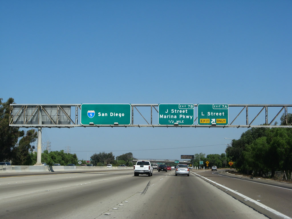
| Northbound Interstate 5 meets L Street in Chula Vista at Exit 7A. A power plant owned by the San Diego Port District is located just west of the freeway along the San Diego Bayshore. Although seldom visible, I-5 parallels San Diego Bay northward to Exit 19 with Old Town Avenue. 09/01/07 |
|
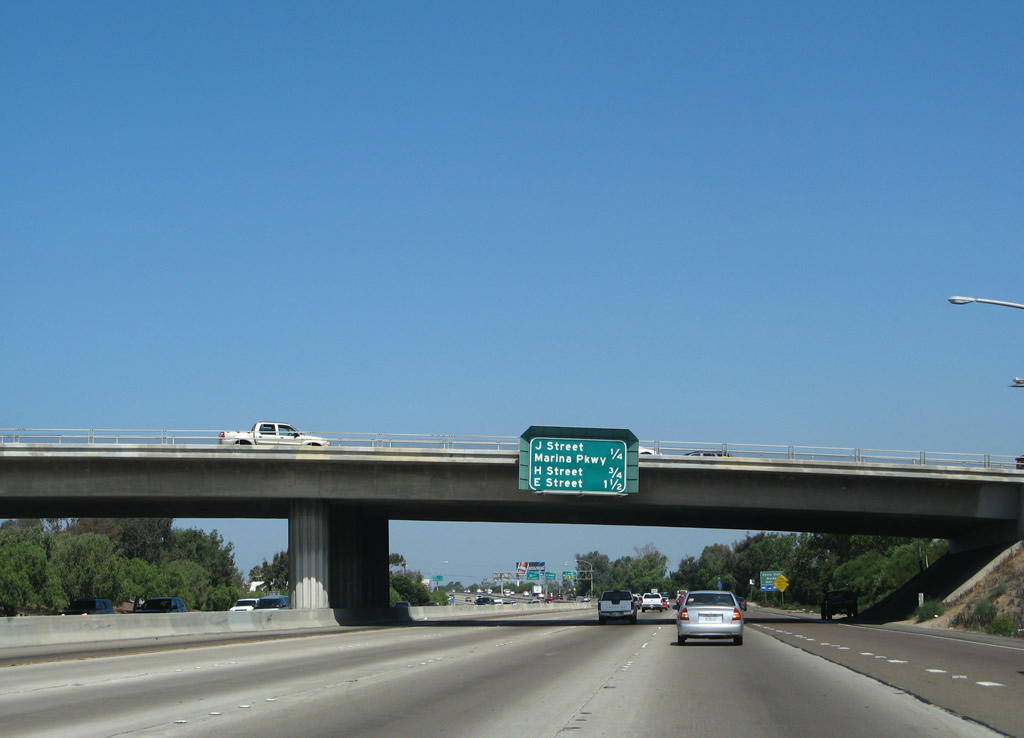
| The diamond interchange (Exit 7B) with J Street lies just a quarter mile north of the L Street overpass 09/01/07 |
|
| Northbound Interstate 5 reaches Exit 7B to J Street and Chula Vista's harbor. 09/01/07 |
|
| One quarter mile ahead of Exit 8A to H Street on I-5 northbound. 01/31/05 |
|
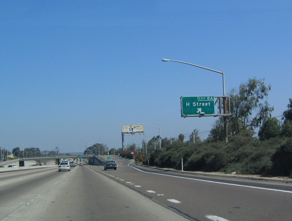
| Exit 8A departs from Interstate 5 north for H Street. H Street is a major east-west thoroughfare in Chula Vista, as it leads through the older parts of town on its way west into Eastlake. 07/18/04 |
|
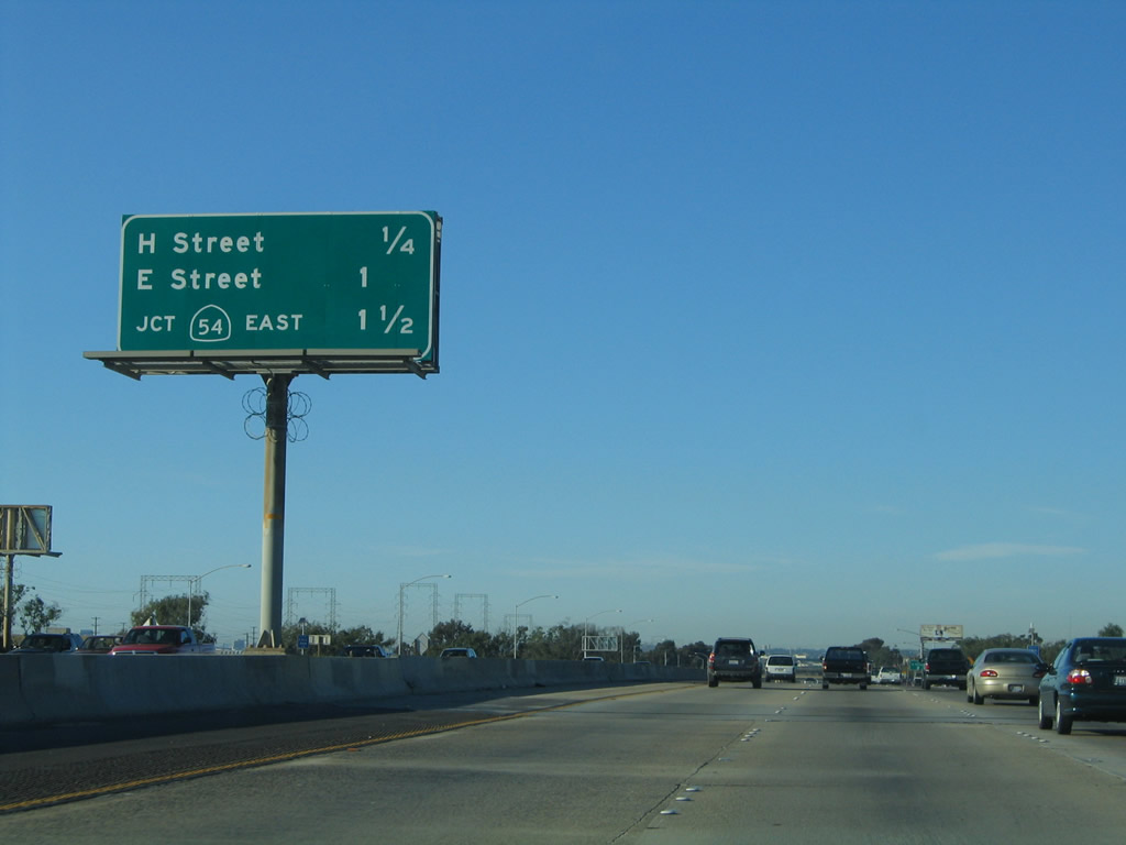
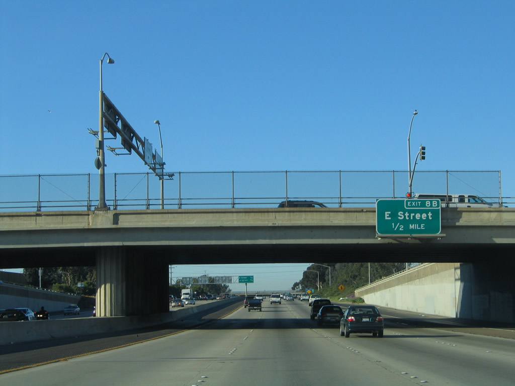
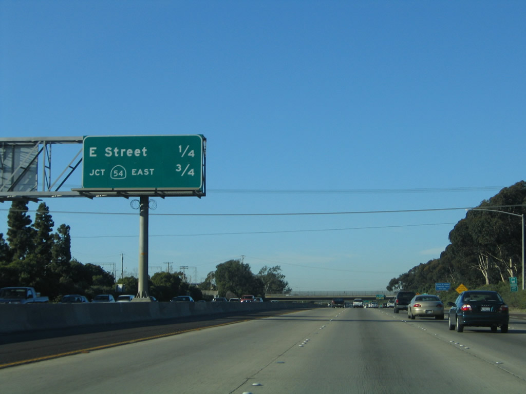
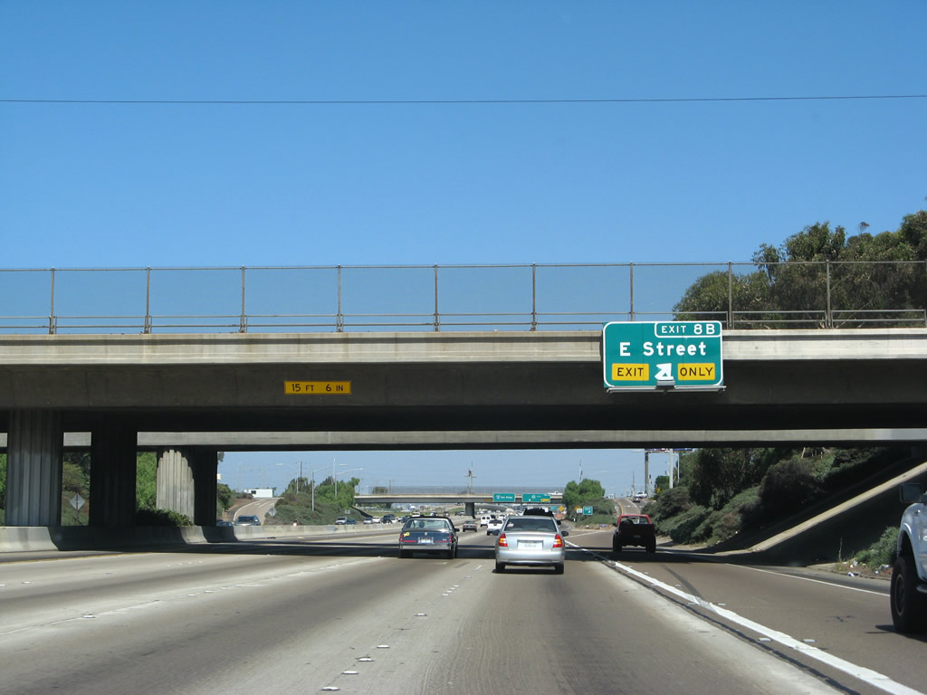
| Interstate 5 north meets San Diego County Route S-17 (E Street) east to Chula Vista and Bonita in a half mile. 01/31/05 |
|
| Forthcoming Exit 8B (E Street east) links with the Chula Vista Civic Center and downtown tourist information center/chamber of commerce. This exit also leads to Sweetwater Marsh. 01/31/05 |
|
| Entering the parclo interchange (Exit 8B) with CR S-17 (E Street) on Interstate 5 (Montgomery Freeway) north. CR S-17 is not signed from I-5, but an end shield is present along westbound E Street ahead of the freeway. E Street becomes Bonita Road east of I-805 near Plaza Bonita. 09/01/07 |
|
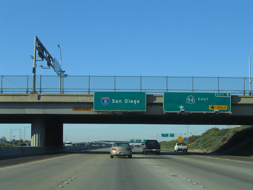
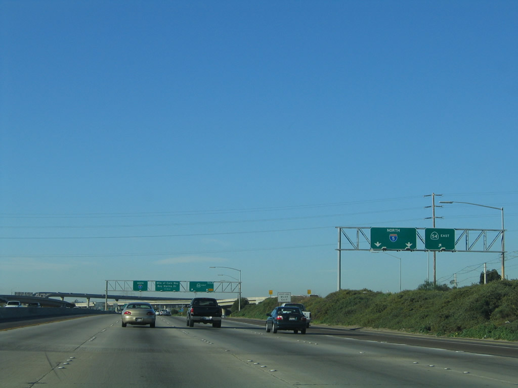
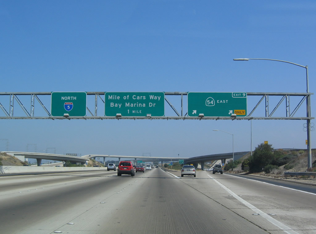
| Exit 9 separates from I-5 north with two lanes for SR 54 (Filipino-American Highway) east to Spring Valley, Rancho San Diego and El Cajon. This freeway arcs northeast, connecting I-5 with I-805 within the vicinity of National City/Chula Vista and SR 125 near Bonita. 01/31/05 |
|
| The E Street on-ramp provides access to SR 54 east in addition to I-5 north. The directional T interchange with SR 54 was built from 1988 to 1991. Interstate 5 between SR 54 and Harbor Drive opened in 1965. 01/31/05 |
|
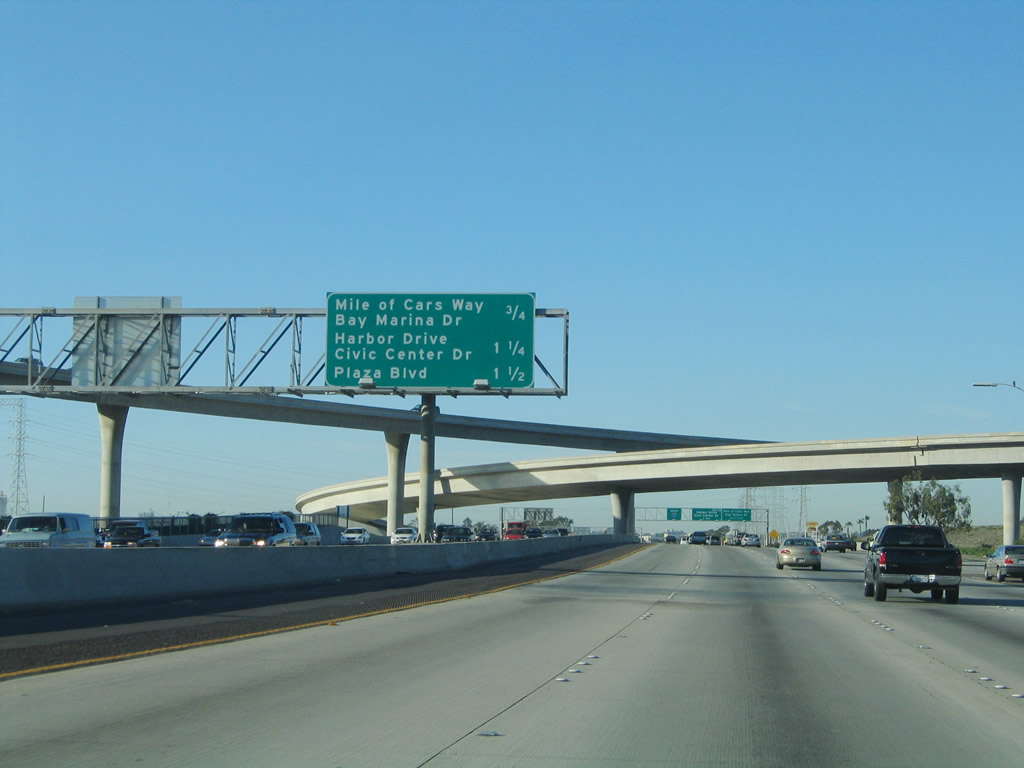
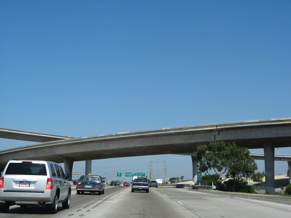
| SR 54 (South Bay Freeway) initially separates with roadways paralleling the Sweetwater River to the systems interchange with Interstate 805. Sign changes made here in 2001 followed the renaming of 24th Street to Mile of Cars Way. 07/18/04 |
|
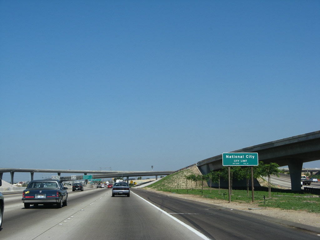
| The freeway departs Chula Vista and enters the city of National City, "in the Center of It All." The city limits are located just south of the Sweetwater River bridge crossing. National City was founded in 1868 and incorporated on September 17, 1887. 09/01/07 |
|
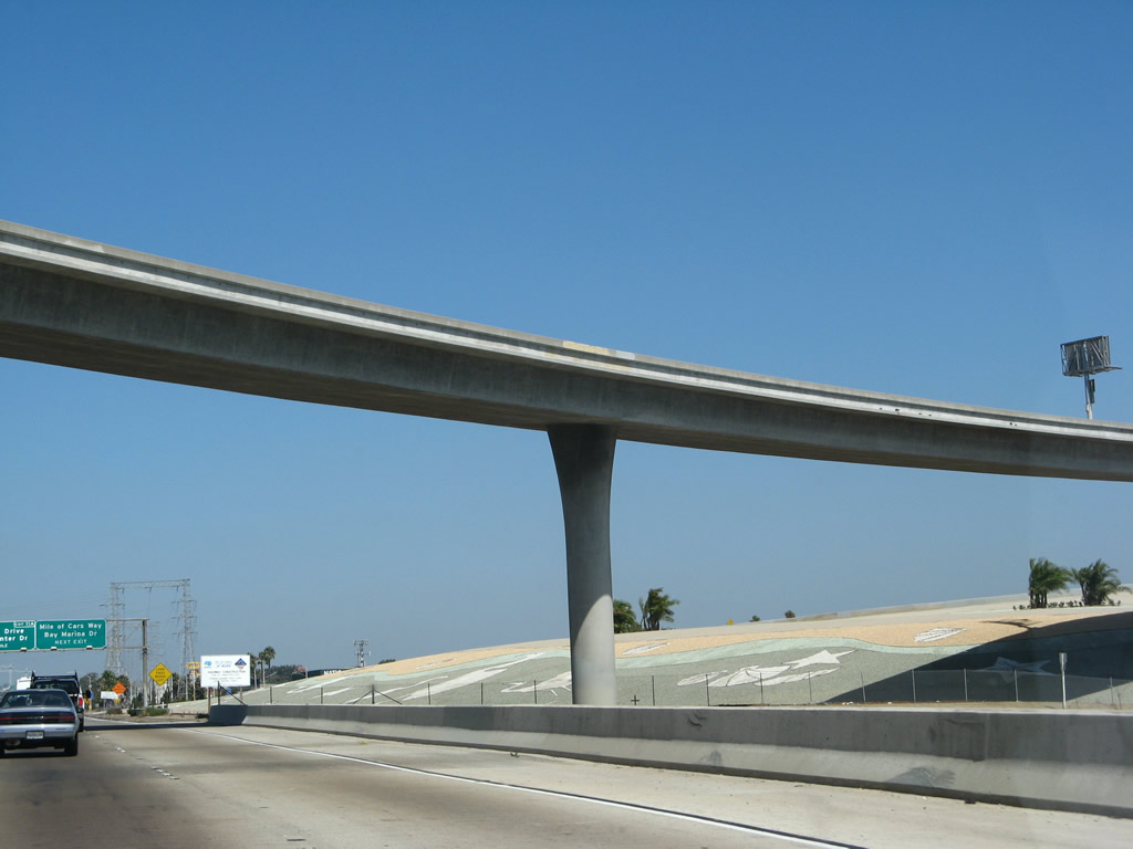
| A streetscape project added decorative rock arrangements at the exchange between Interstate 5 and SR 54. Plants had a hard time growing here due to high soil salinity. 09/01/07 |
|
| Three off-ramps depart over the course of one mile starting with Exit 10 to Mile of Cars Way (24th Street) and Bay Marina Drive. 01/31/05 |
|
| Interstate 5 crosses over the Sweetwater River through the exchange with SR 54. A pair of connecting flyovers pass overhead. 09/01/07 |
|
| As Interstate 5 proceeds north under the transition ramp from SR 54 west to Interstate 5 south, more decorative rock arrangements can be seen on the right side of the freeway. 09/01/07 |
|
| Exit 10 departs next for Mile of Cars Way (formerly 24th Street). Twenty-fourth Street was renamed in 2000 in order to advertise the Mile of Cars, a stretch of old U.S. 101 in National City that is locally famous for all the car dealerships in close proximity to one another. 07/01/04 |
|
| An auxiliary lane opens northbound from the SR 54 on-ramp to Exit 10 for Mile of Cars Way. The large power lines to the east of the freeway provides electricity transmission service between the South Bay Natural Gas plant and Downtown, as well as the naval and industrial facilities located along Harbor Drive (old U.S. 101) south of the Coronado Bridge (SR 75). 08/23/10 |
|
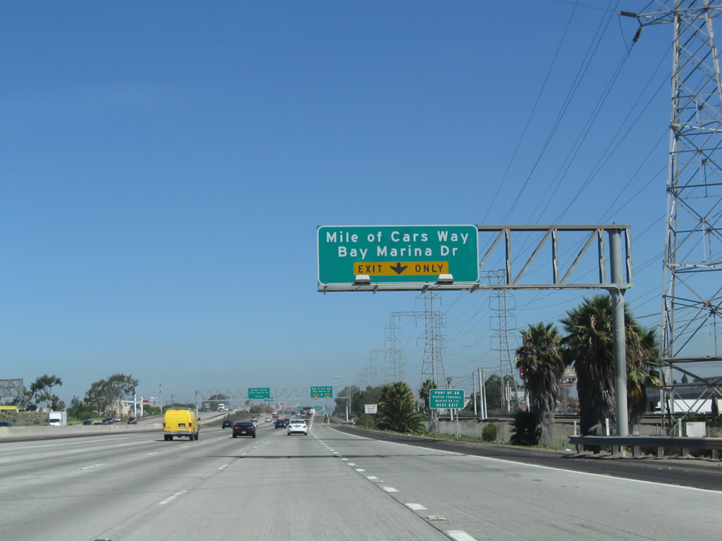
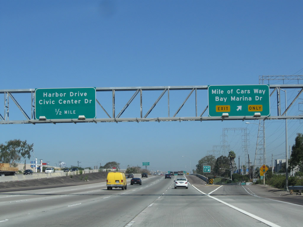
| Northbound Interstate 5 reaches Mile of Cars Way and Bay Marina Drive (former 24th Street) to the Port of San Diego, Berths 24 1-11. Exit 11A follows for Harbor Drive, which is the original alignment for U.S. 101 between National City and Downtown San Diego. 08/23/10 |
|
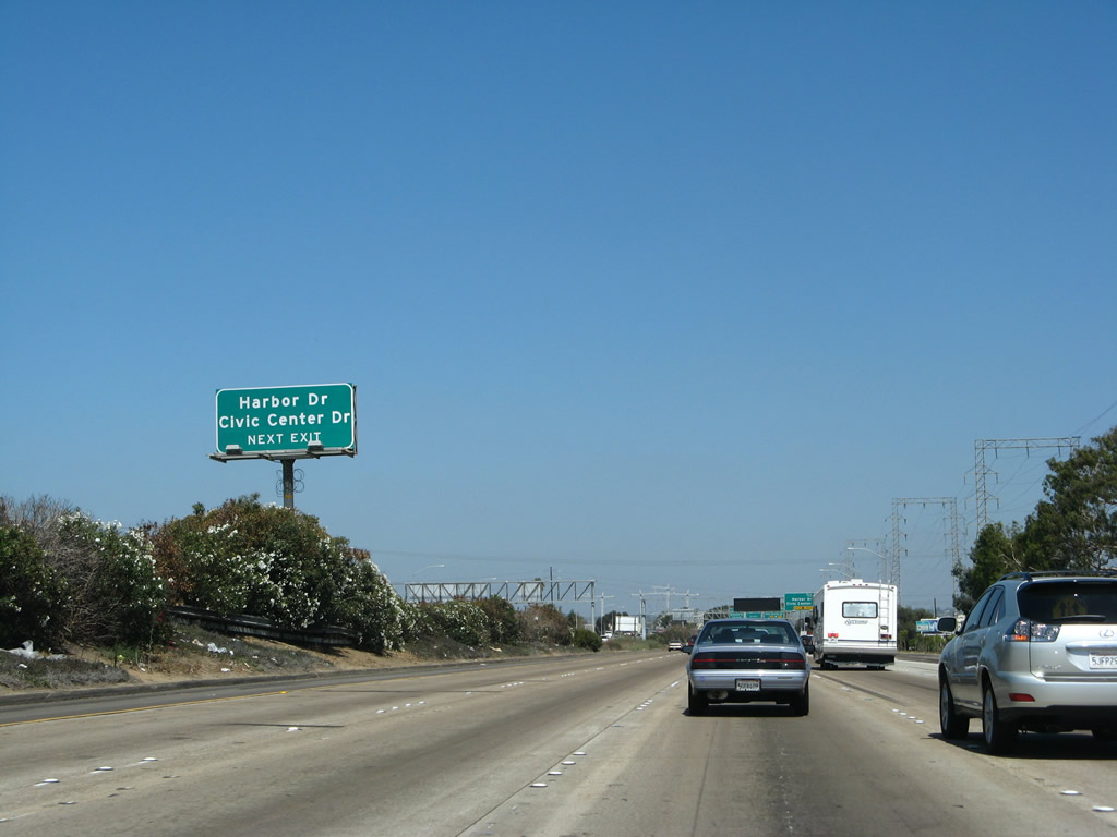
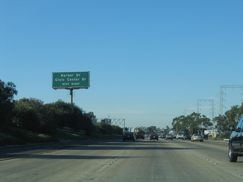
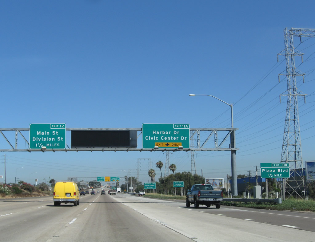
| The next exit along northbound Interstate 5 is Exit 11A, Harbor Drive and Civic Center Drive. Harbor Drive is the original alignment of U.S. 101 from National City to San Diego. At one time, U.S. 101 used to pass over the freeway here at an angle, but Harbor Drive was turned 90 degrees to connect into Civic Center Drive. Historic U.S. 101 follows an S-curve to get into Downtown National City. 09/01/07, 01/31/05 |
|
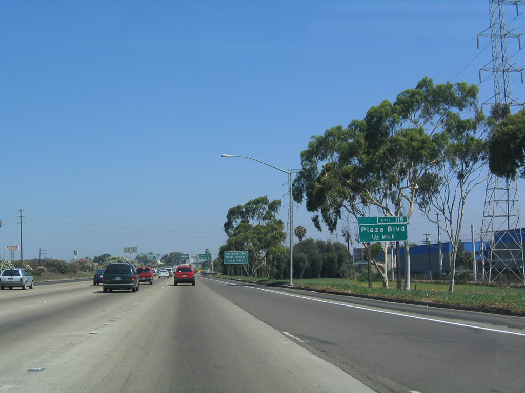
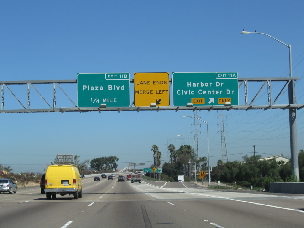
| The succeeding exit connects with Plaza Boulevard. The original bridge over Civic Center Drive extends out about two or three lanes further to the right than needed. A new overhead was added here in 2007, following the addition of a auxiliary lane. 08/23/10, 07/18/04 |
|
| Use Exit 11A, Civic Center Drive eastbound, to reach the National City civic center. 09/01/07, 07/18/04 |
|
| Northbound Interstate 5 reaches Exit 11A, Harbor Drive and Civic Center Drive. The section of Interstate 5 from Harbor Drive (Old U.S. 101) north to SR 15 was built in 1964. For a time starting in the late 1960s, Harbor Drive was known as Business Loop I-5, but that designation was eliminated by the 1980s. No shields for the former business route remain on Harbor Drive or Pacific Highway. 08/23/10, 09/01/07, 07/18/04 |
|
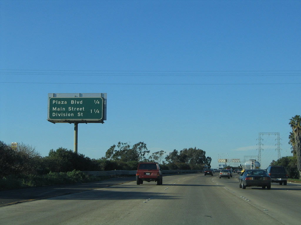
| This distance sign, located after Exit 11A along northbound, provides the distance to Exit 11B, Plaza Boulevard and Exit 12, Main Street and Division Street. It was removed in 2007 when the signs in the previous photograph were added at the Exit 11A gore point. 01/31/05 |
|
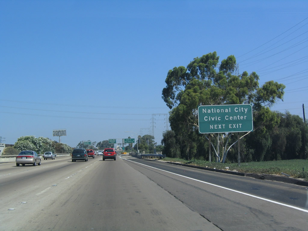
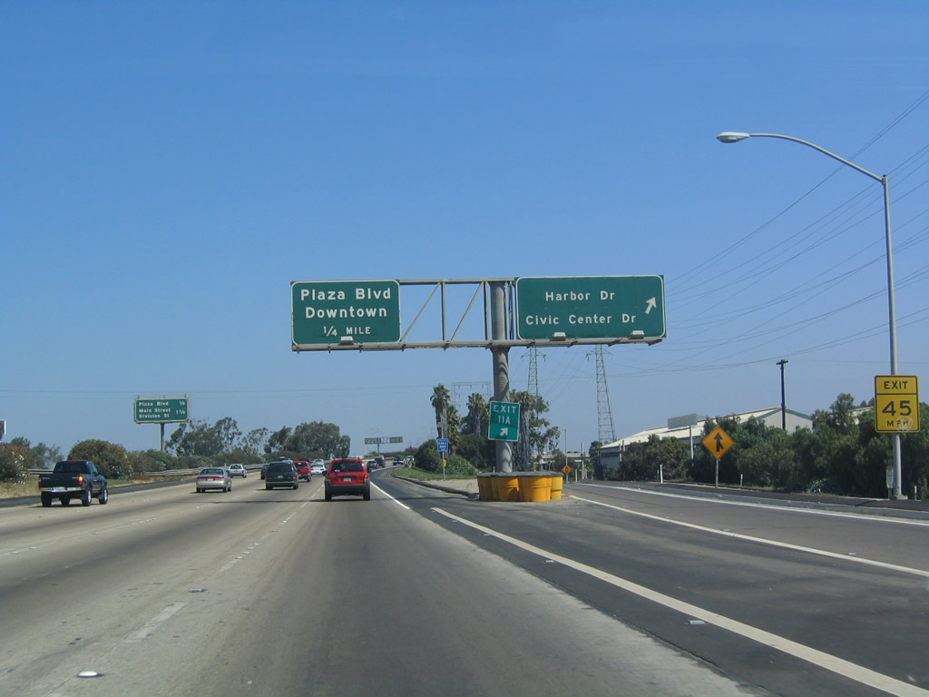
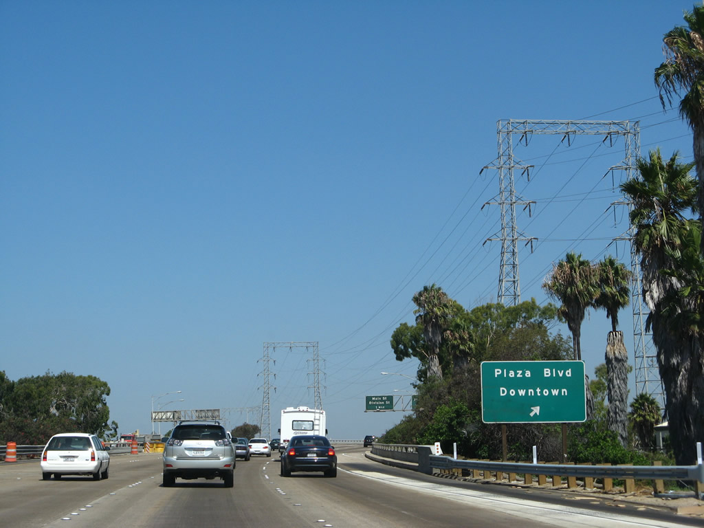
| Northbound Interstate 5 reaches Exit 11B, Plaza Boulevard. A set of high voltage power lines carry power from the South Bay power plant north toward the shipyards and downtown San Diego. 09/01/07 |
|
| A second sign (old-style "butterfly gantry") shows the gore point for Exit 11B, Plaza Boulevard to downtown National City. 09/01/07 |
|
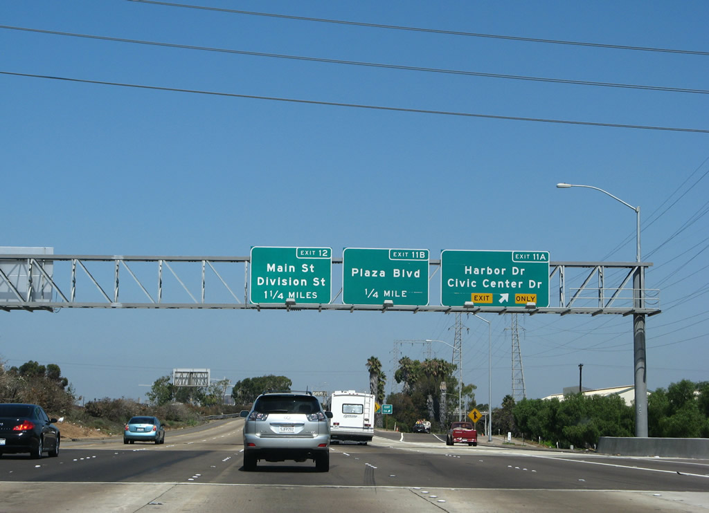
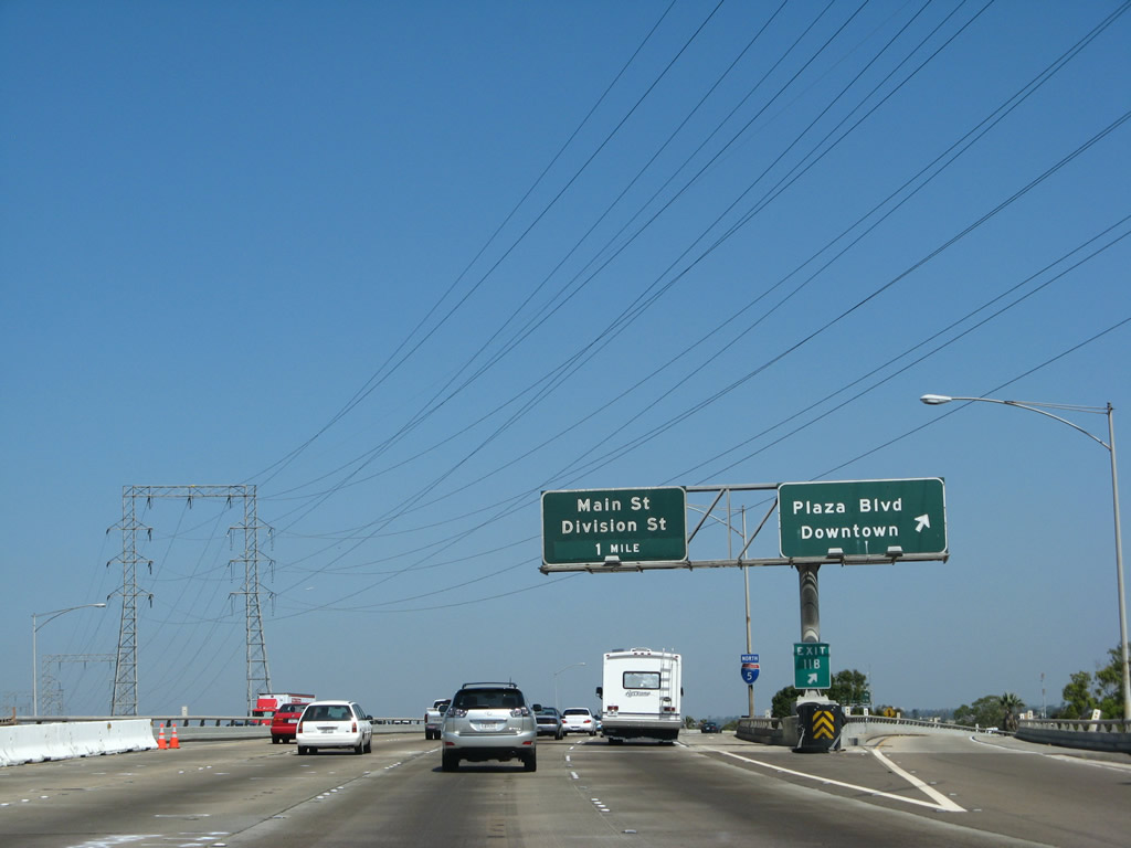
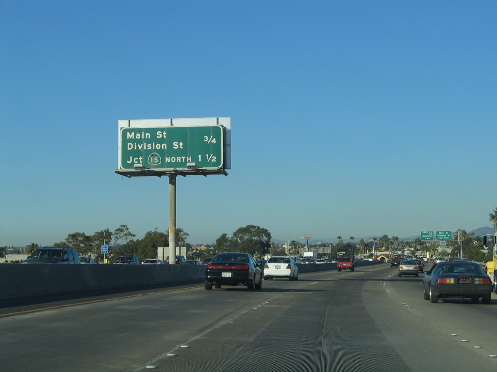
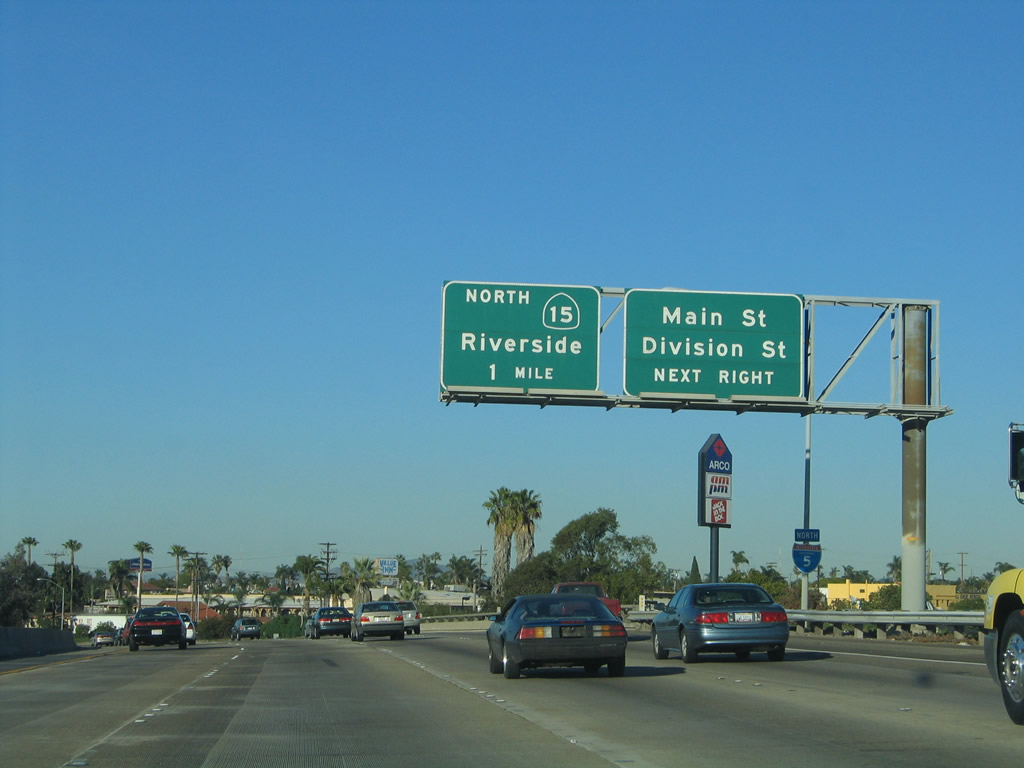
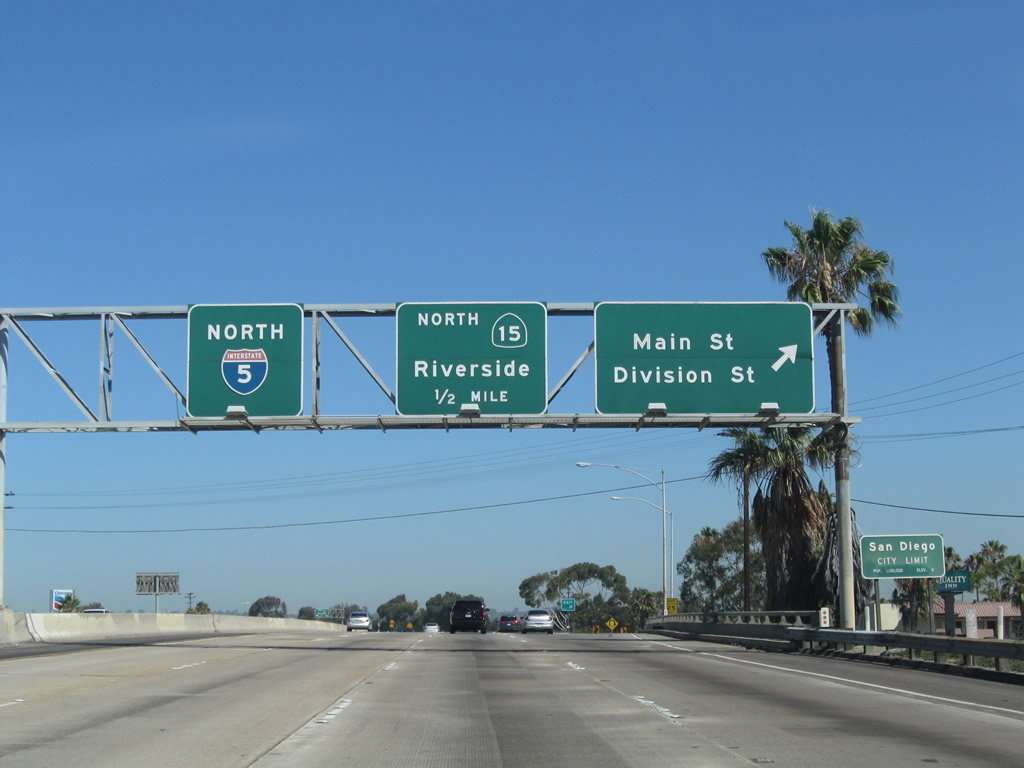
| The next exit along northbound Interstate 5 is Exit 12, Main Street and Division Street, three-quarters of a mile. Not to be confused with Exit 5B (Main Street in Chula Vista), this exit connects to San Diego's Main Street, which passes through the Barrio Logan community. Division Street marks the boundary between National City and San Diego. The next exit is the SR 15 freeway (Exit 13A). 01/31/05 |
|
| Main Street parallels Interstate 5 to the southwest between Sigsbee Street and Interstate 5 along the northeastern boundary of the 32nd Street Naval Station, while Division Street acts as the east-west boundary between the city of San Diego (Shelltown neighborhood) and National City between Interstate 5 and Highland Avenue/43rd Street. 01/31/05 |
|
| In addition to Main Street and Division Street, Exit 12 also connects to National City Boulevard, which heads south from this interchange into downtown National City. As noted earlier, National City Boulevard carries old U.S. 101 through downtown National City and reconnects with the freeway at this interchange. Exit 12 is also the northern terminus of the business loop for Interstate 5 that used to run from the border north to National City. 09/01/07 |
|
| An Interstate 5 north reassurance shield is posted after the onramp from former Business Loop I-5/Historic U.S. 101 National City Boulevard. 09/01/07 |
|
| Northbound Interstate 5 reaches Exit 12, Main Street and Division Street. The next exit is SR 15, Exit 13. Division Street, per its name, is the city limits between National City and San Diego. Passing by Exit 12, motorists enter the city of San Diego for a second time since leaving the Otay-Nestor community. Note the lack of control city now that Interstate 5 reenters San Diego. That changes once motorists reach the Coronado Bridge (SR 75/Exit 14A). 08/23/10 |
|
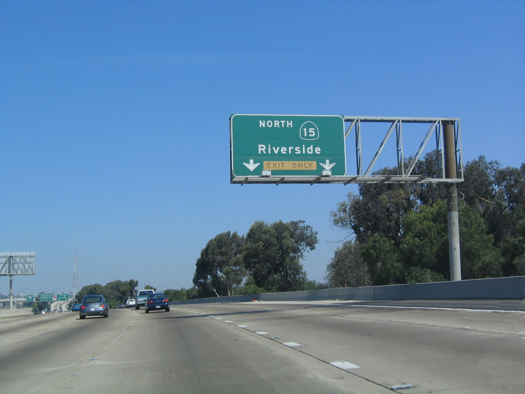
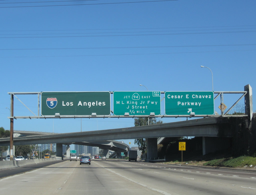
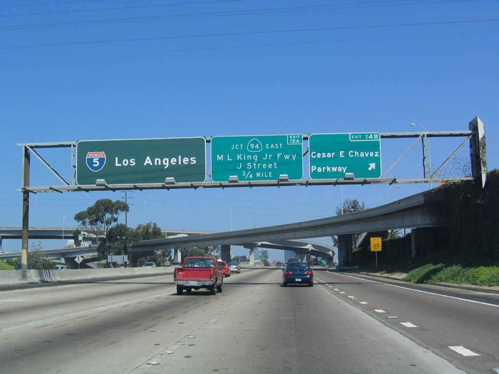
| The next exit along northbound Interstate 5 is Exit 13A, SR 15 north to Interstate 15 north to Riverside. With the completion of the 40th Street Freeway through the Mid-City community of San Diego, SR 15 is very close to becoming Interstate 15. One area of improvement that remains is the reconfiguration of the SR 15/SR 94 interchange, with its left exits, tight turns, and narrow underpass for SR 15. This improvement is scheduled as funds become available. In the meantime, Interstate 15 terminates at Interstate 8 in Mission Valley, and the freeway continues as SR 15 south to this point. 07/18/04 |
|
| Northbound Interstate 5/Montgomery Freeway reaches Exit 13A for SR 15. This marks the southern terminus of SR 15, which is so designated between Interstate 5 and Interstate 8. It is a continuous freeway from here all the way to Interstate 8; the freeway was completed in 1999. After this interchange, Interstate 5 heads due west (between Exits 13A and 13B) before turning northwest again toward the Coronado Bridge and downtown. 07/18/04 |
|
| This bridge carries traffic from southbound SR 15 onto southbound Interstate 5. Note the grassy/ice plant area to the right (east) of the interchange. This area was to be the location of unconstructed SR 252 to join Interstate 5. Since SR 252 was canceled in 1980, the extra land is left for additional freeway landscaping. The section of Interstate 5 from SR 15 to SR 75 was built and opened to traffic in 1963. 07/18/04 |
|
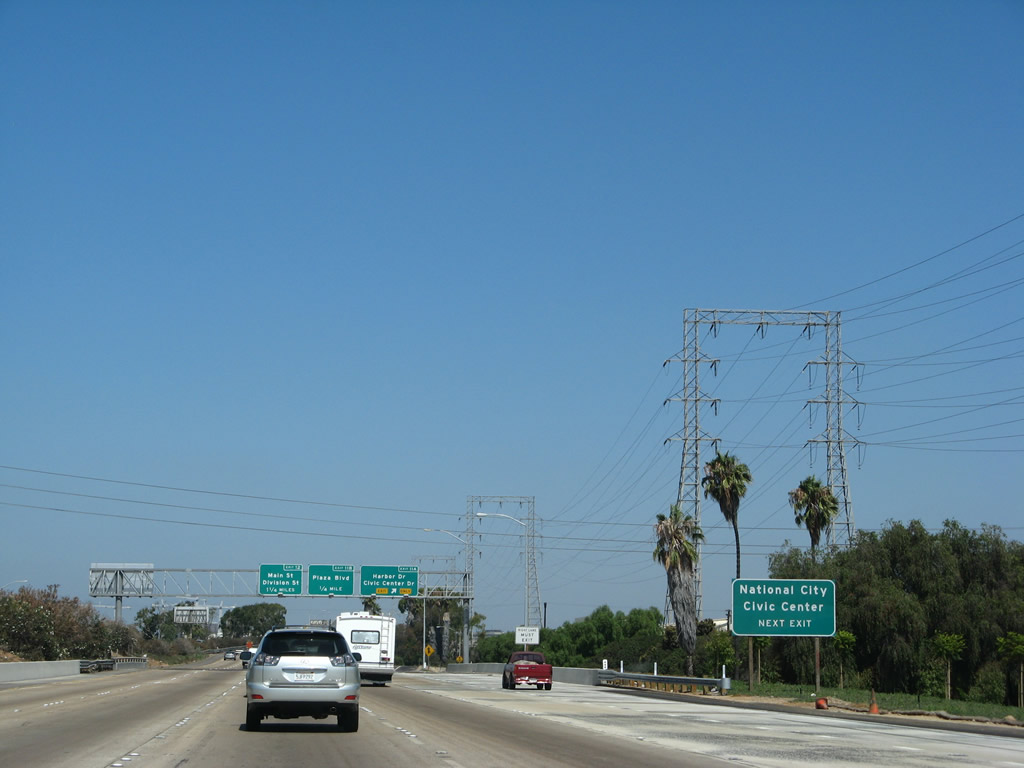
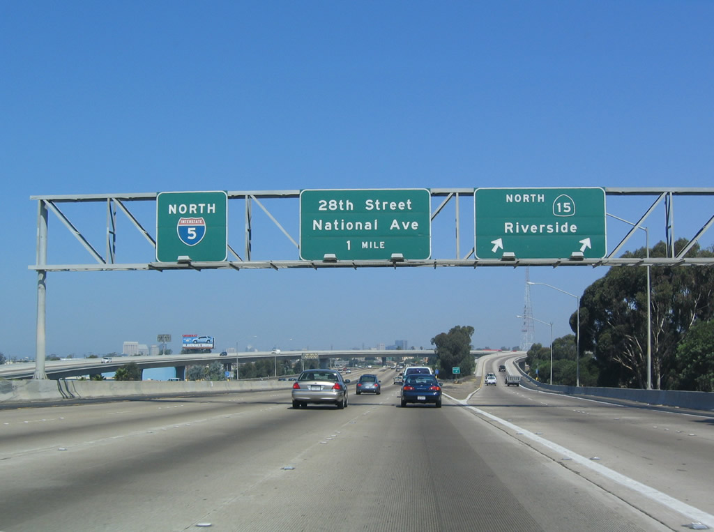
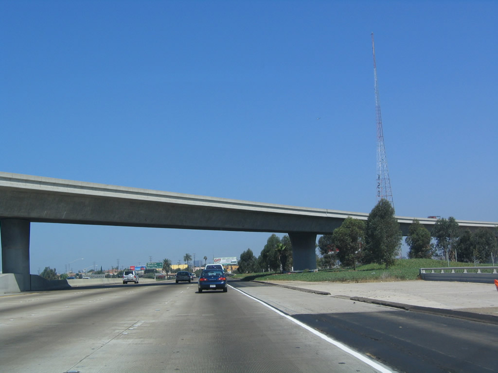
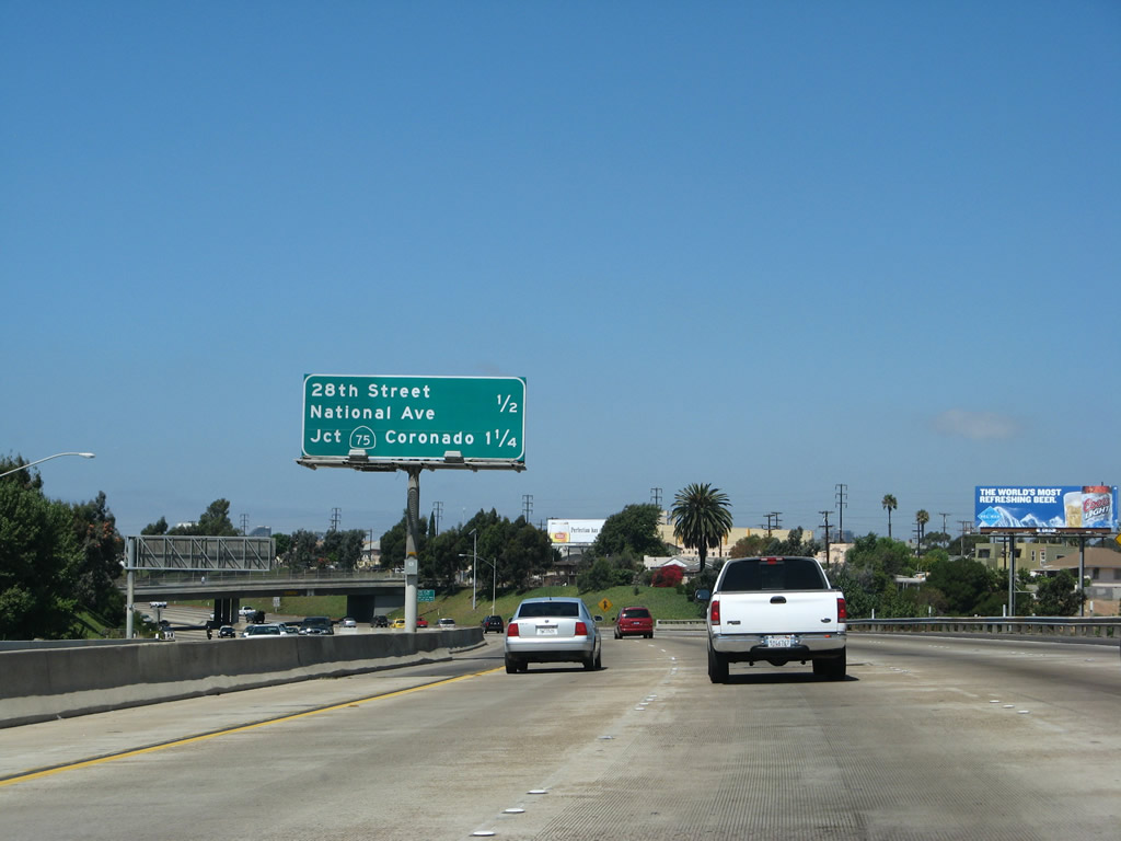
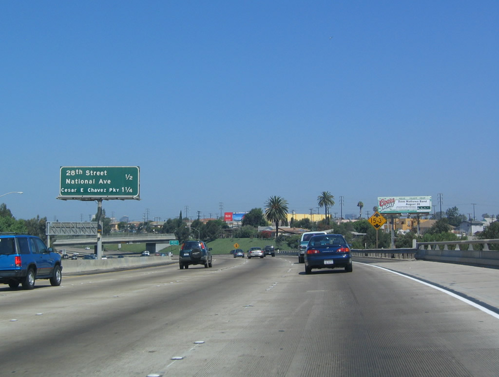
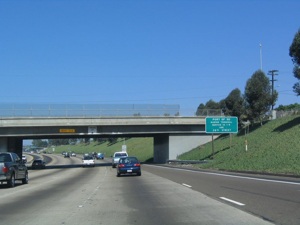
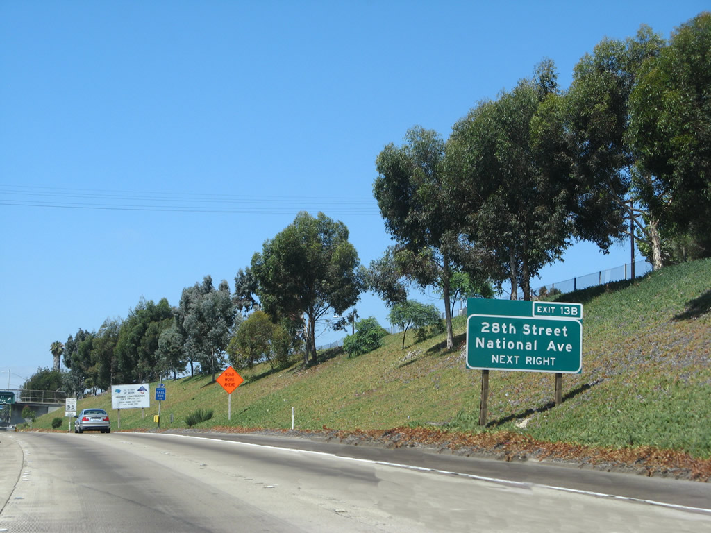
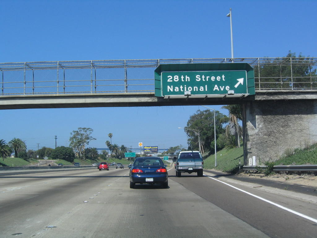
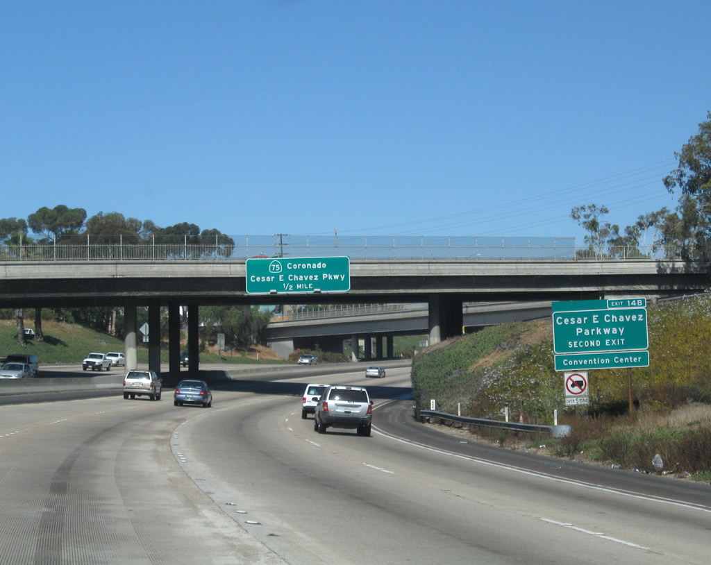
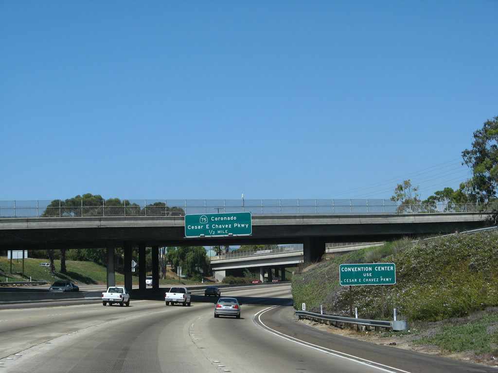
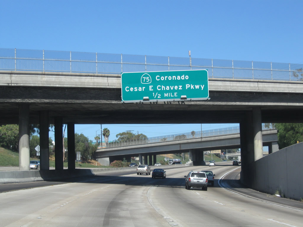
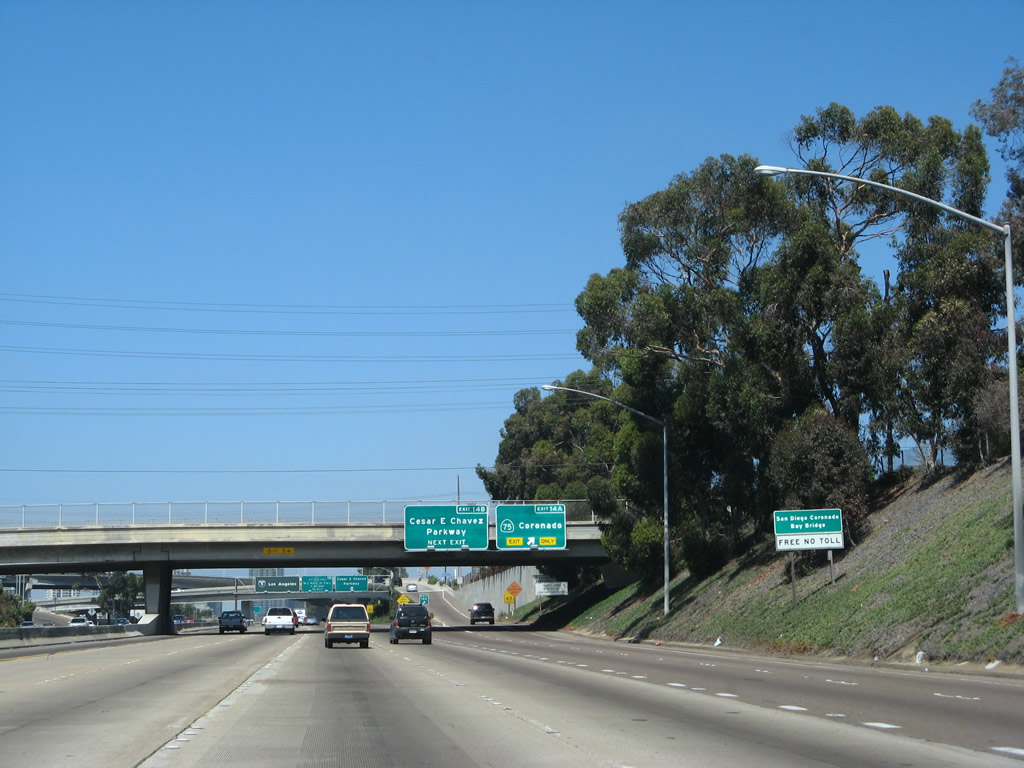
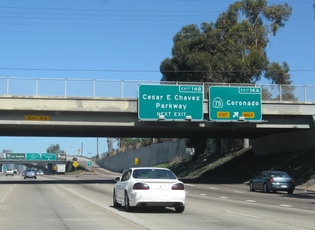
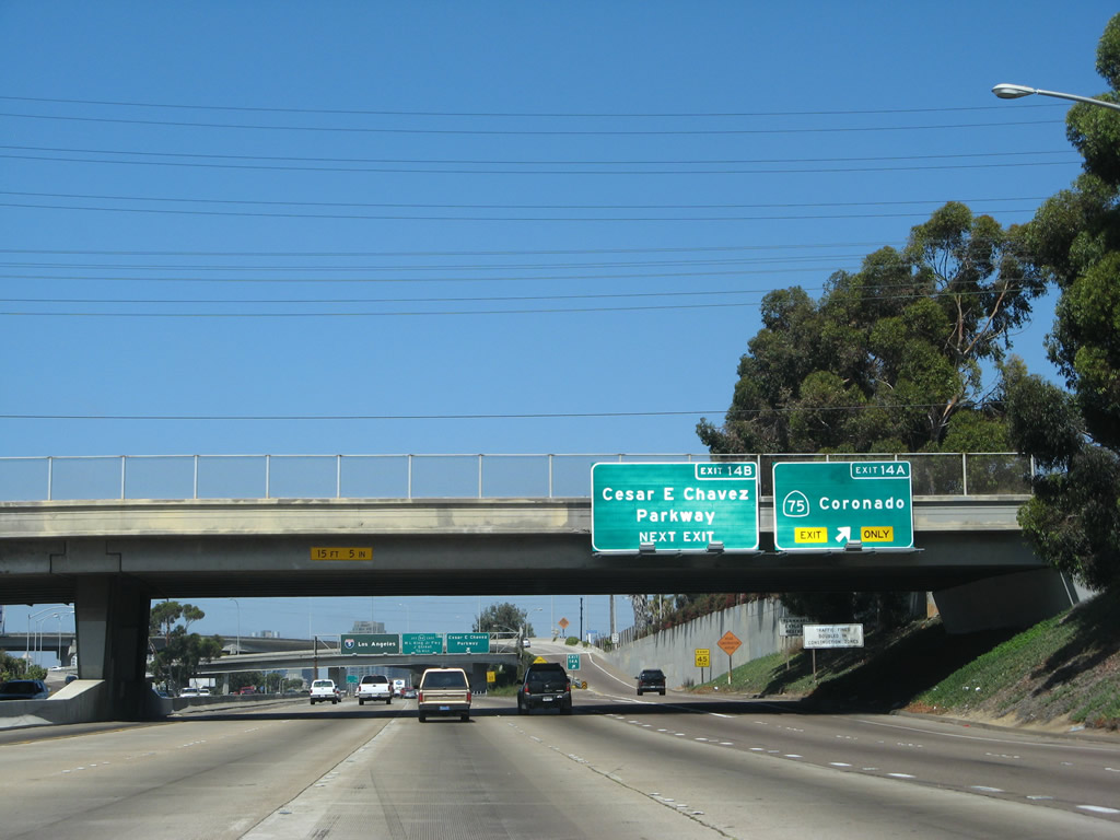
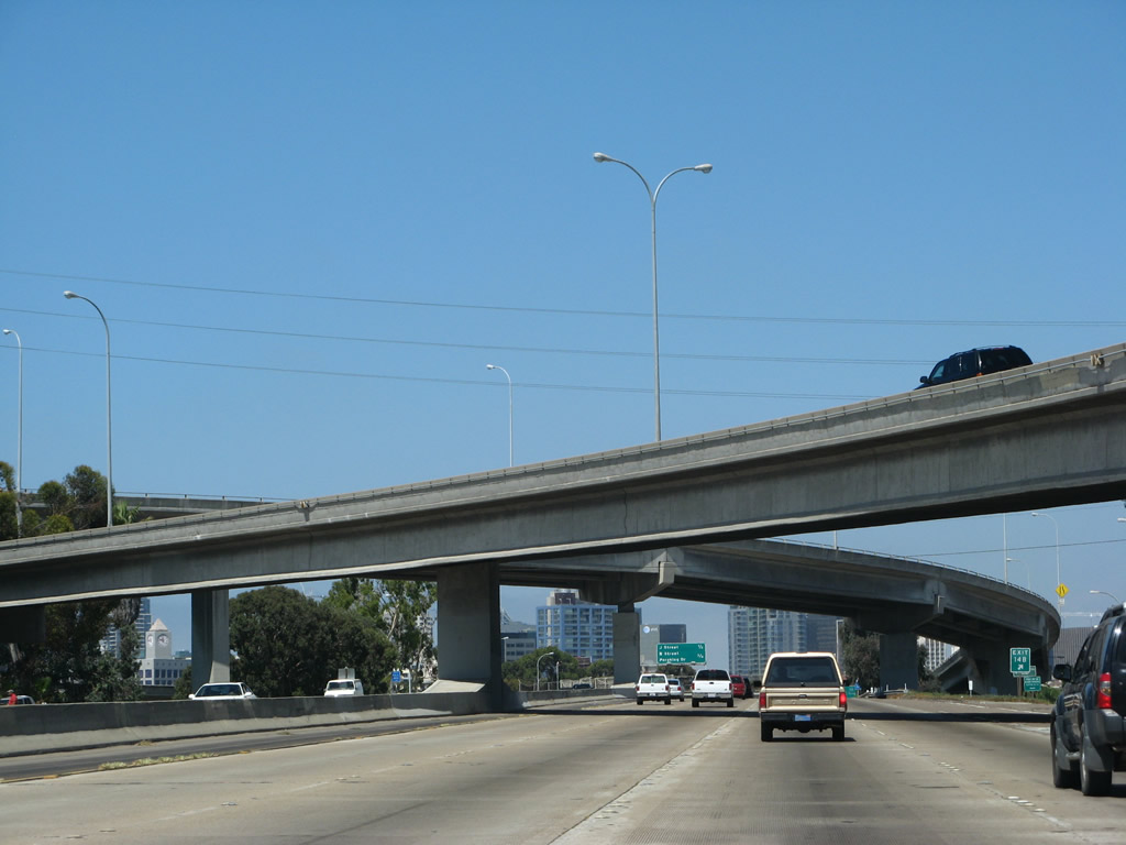
| This distance sign along northbound Interstate 5/Montgomery Freeway provides the distance to the next two exits, Exit 13B, 28th Street and National Avenue and Exit 14A, SR 75/San Diego-Coronado Bay Bridge west to Coronado. The 2004 sign picture does not include SR 75 but instead shows Cesar Chavez Parkway (Exit 14B). A green overlay covers the original name of Crosby Street, which was renamed as Cesar Chavez Parkway in 2002. SR 75 (Coronado Bridge) was not on the 2004 sign photo, as the older sign likely predated the bridge (which opened in 1969). 09/01/07 |
|
| Use Exit 13B, 28th Street south to the Port of San Diego at the 28th Street Pier. This port is located just north of the 32nd Street Naval Station. 09/01/07, 07/18/04 |
|
| An exit number sign was added here in 2007 for Exit 13B. 09/01/07 |
|
| Northbound Interstate 5 reaches the 28th Street and National Avenue exit, Exit 13B. 28th Street is a north-south city street leading toward North Park and Mid-City. This is also a primary exit to reach several U.S. Navy facilities, including a recruit depot and a variety of bases. Motorists should use Cesar Chavez Parkway (Crosby Street) to reach the 10th Avenue Port Terminal and other port facilities. 07/18/04 |
|
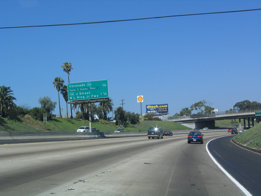
| The next exit along northbound Interstate 5 is Exit 14A, SR 75/Coronado Bridge. This distance sign in the median was first replaced in late 1999/early 2000 when most SR 94 overhead freeway signs were replaced to include the official name, "Martin Luther King Jr. Freeway." This sign was among the first to be replaced with a reflective sign (see 2004 photo). Since then, Crosby Street (Exit 14B, just after the SR 75 exit), has been renamed as Cesar Chavez Parkway (in April 2002). So this new sign was rendered obsolete within three years of placement. A replacement distance sign was in place by 2007. 09/01/07, 07/18/04 |
|
| The best way to access the San Diego Convention Center from northbound is to exit at Cesar Chavez Parkway/Crosby Street (Exit 14B) and take it west to Harbor Drive, then turn north along Harbor Drive to the center. This sign is obsolete due to the renaming of Crosby Street to Cesar Chavez Parkway. The Convention Center itself is routinely booked, but most traffic for it comes from the north (since many come into San Diego from Lindbergh Field, the airport). 08/23/10, 09/01/07, 07/18/04 |
|
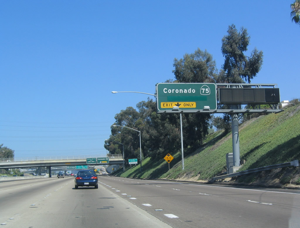
| The next two exits along Interstate 5 north are Exit 14A for SR 75 west to Coronado and Exit 14B for Cesar Chavez Parkway to Barrio Logan and Logan Heights. No exit number was added to this sign when it was replaced in 2007. This old overhead sign (see 2004 photo) features "Crosby Street" covered up below "Coronado" (the "y" is still visible in the older porcelain enamel sign). Thanks to our correspondent Dain for unraveling that mystery! The interchange with SR 75 was built in 1969, the same year the bridge was opened. 08/23/10, 07/18/04 |
|
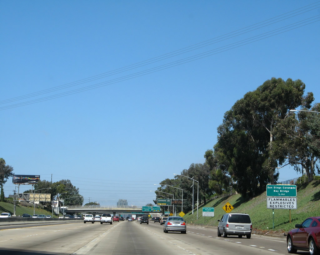
| SR 75 is the San Diego-Coronado Bay Bridge, a sweeping bridge that forms an arc over the blue waters of the San Diego Bay. It was a toll facility until July 2002, when the tolls were lifted and rides between San Diego and Coronado were made free. By August 2002, most of the old toll fixtures were removed, much to the chagrin of the residents of Coronado, who were more than happy to keep the toll to reduce the amount of traffic invading the community at the tip of the Silver Strand. SR 75 itself is the primary arterial for Coronado, but it often sees early morning traffic as it, together with SR 282, is the primary route to the North Island Naval Air Station. 09/01/07 |
|
| The direction banner for SR 75 is omitted (to would say south or west) primarily because SR 75 crosses the Coronado Bay Bridge in a westbound direction before entering the city of Coronado. From the bridge, stellar views of the downtown San Diego skyline, Hotel del Coronado, San Diego Bay, Pacific Ocean, Point Loma, and shipyards are visible. This overhead sign is still in place as of June 2009. 07/18/04 |
|
| At the time this picture was taken, the San Diego-Coronado Bay Bridge was free of tolls. 09/01/07 |
|
| Northbound Interstate 5 reaches Exit 14A, SR 75. As noted earlier, this sign has been amended to reflect the fact that their is no toll over the bridge. In the late 1990s-early 2000s, this interchange, as well as the entire Coronado Bridge, was retrofitted for earthquake protection. However, retrofitting the bridge was not as easy as it normally would be, because many of the support pillars for the interchange and bridge land in Chicano Park. Through the years, locals have painted large murals on many of the pillars, and engineers were required to find a way to avoid damaging these colorful murals while improving the integrity of the bridge. These murals may be seen by exiting on Cesar Chavez Parkway, Exit 14B. The retrofit was a success, and most murals remained intact. 08/23/10, 09/01/07, 07/18/04 |
|
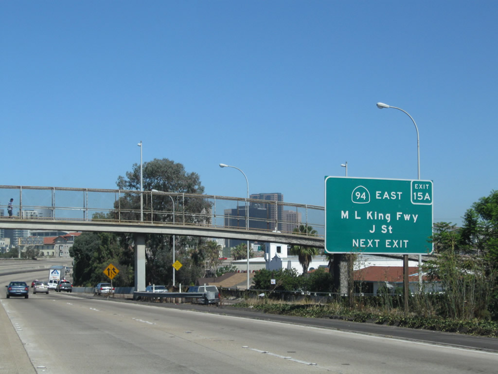
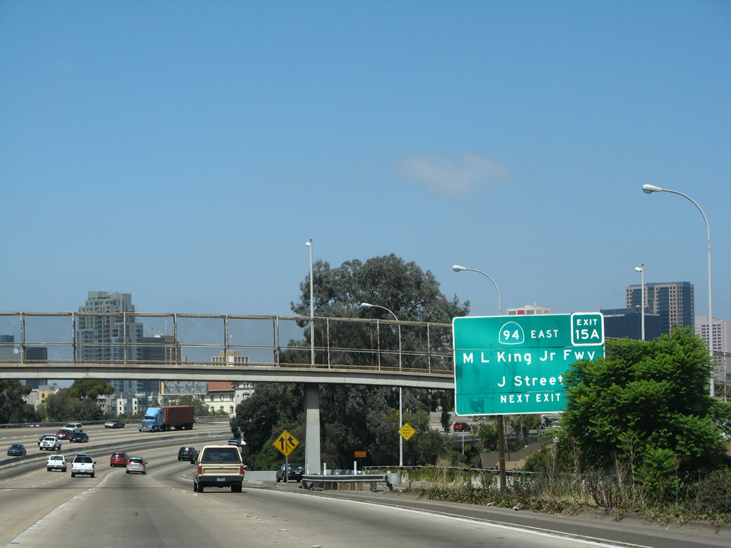
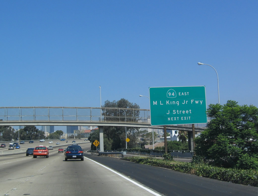
| Immediately thereafter, northbound Interstate 5 meets Exit 14B, Cesar Chavez Parkway, which was known as Crosby Street until 2002. Cesar Chavez was an activist who championed the rights of Latino farmers in the Central Valley; his influence is still felt throughout the Latino community as well as the state of California. The next exit along northbound is Exit 15A, J Street (with a connection to SR 94 east). In 2004, the exit number was affixed to this sign (which was originally installed in 1999 when the Martin Luther King, Jr. Freeway designation was made prominent on most SR 94 overhead and roadside signs). By 2007, the exit number sign was gone and oddly was replaced with another sign that had no exit number. 08/23/10, 07/18/04 |
|
| This view shows Interstate 5 north as it passes through the Coronado Bridge interchange complex. 09/01/07, 08/23/10 |
|
| Upon exiting, the first traffic signal is the connection to Cesar Chavez Parkway. 01/31/05 |
|
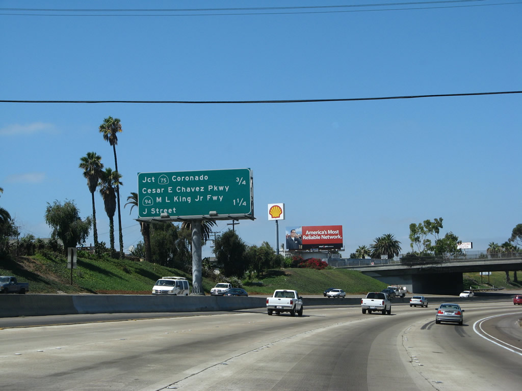
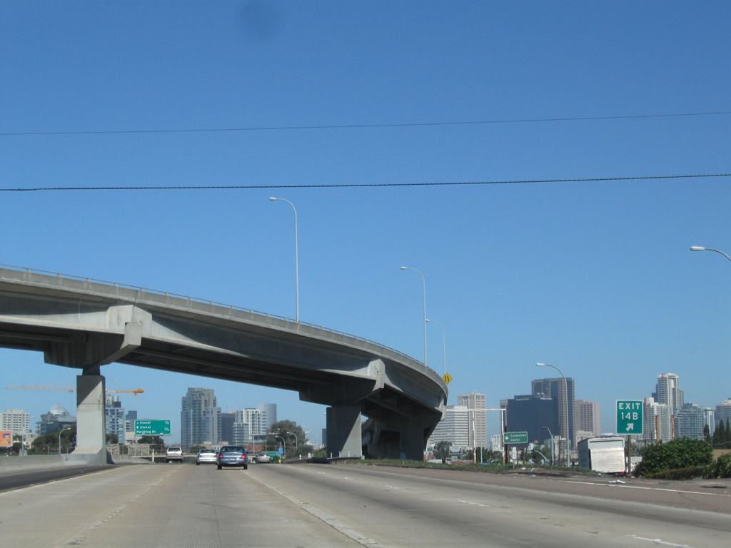
| San Diego's skyline comes into view as Interstate 5 approaches Exit 15A, SR 94/Martin Luther King Freeway and J Street. There is no direct transition from northbound Interstate 5 to eastbound SR 94, so traffic must take 19th Street (frontage road) north for a half block to reach J Street and about four blocks to reach the onramp to SR 94. The section of Interstate 5 (U.S. 101) from SR 75 north to SR 94 was built in 1963. 09/01/07, 07/18/04 |
|
| Much of the original SR 94 signage was replaced in 1999 when the signs were made to emphasize the fact that SR 94 is the Martin Luther King Jr. Freeway. In a period of time when such named freeways were falling out of favor, one oddity was the addition of Martin Luther King Jr. Freeway signs along SR 94 between Interstate 5 and SR 125. However, more recent initiatives (such as the restoration of the Arroyo Seco Parkway designation to SR 110) may indicate another change in this practice. This sign was replaced between 2007 and 2010. 08/23/10, 09/01/07, 07/18/04 |
|
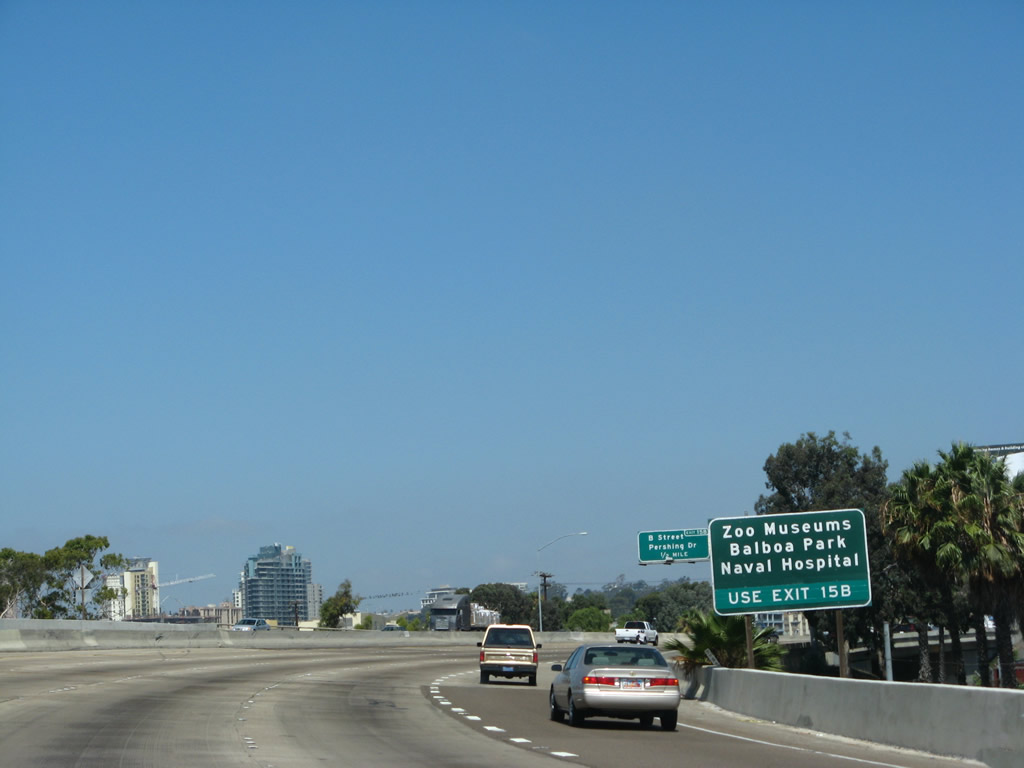
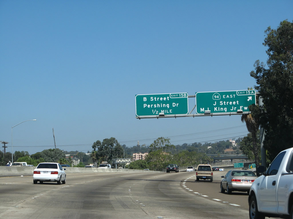
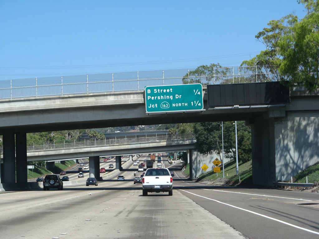
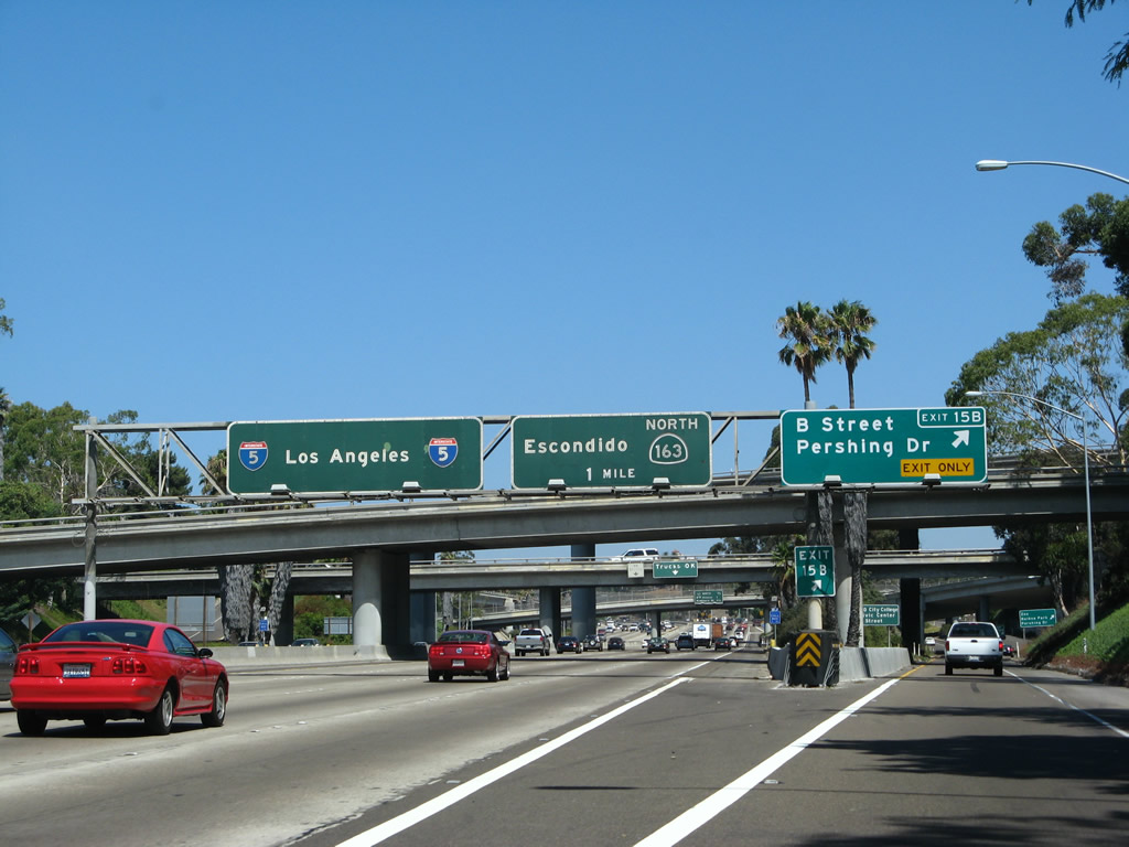
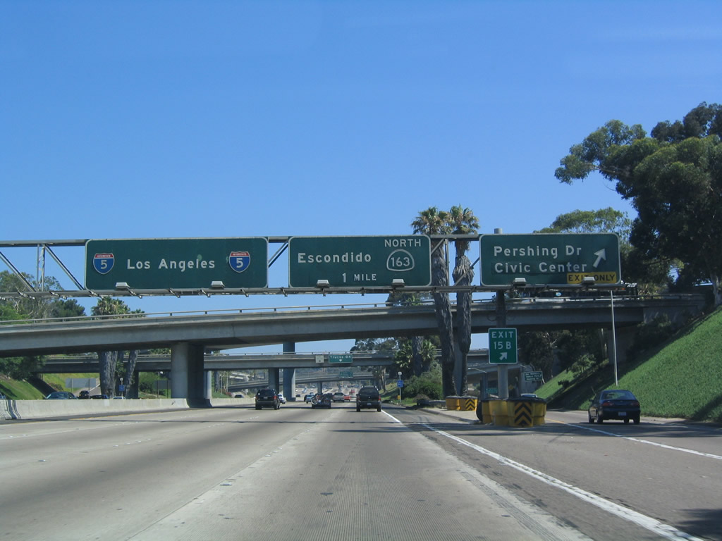
| Traffic from northbound SR 75 merges onto Interstate 5 north as the freeway approaches Exit 15B, SR 94 east. In the first exit numbering sign of its kind, this roadside sign indicates that traffic en route to the San Diego Zoo, Balboa Park, museums, and Naval Hospital should use Exit 15B, Pershing Drive north to Florida Street north. This is the most direct route from northbound Interstate 5. 09/01/07 |
|
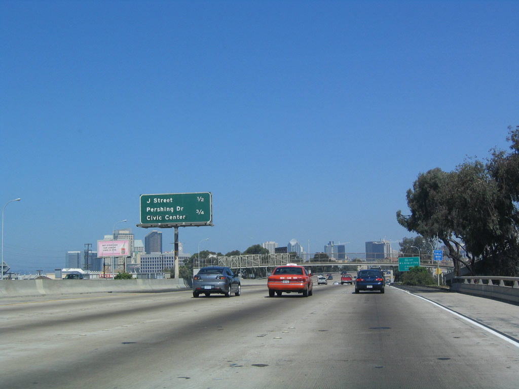
| Northbound Interstate 5 reaches Exit 15A, J Street and SR 94. Note that the directional arrow for this sign is missing. This reflective sign was placed in 1999, but it did not have an exit number added to the sign. J Street is an east-west city street that leads west into downtown and east into the neighborhood of Sherman Heights. This sign was replaced in early 2005. 09/01/07, 07/18/04 |
|
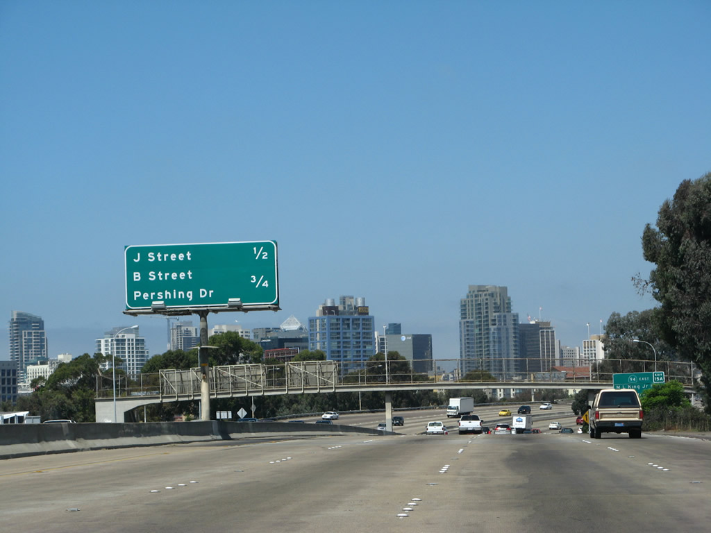
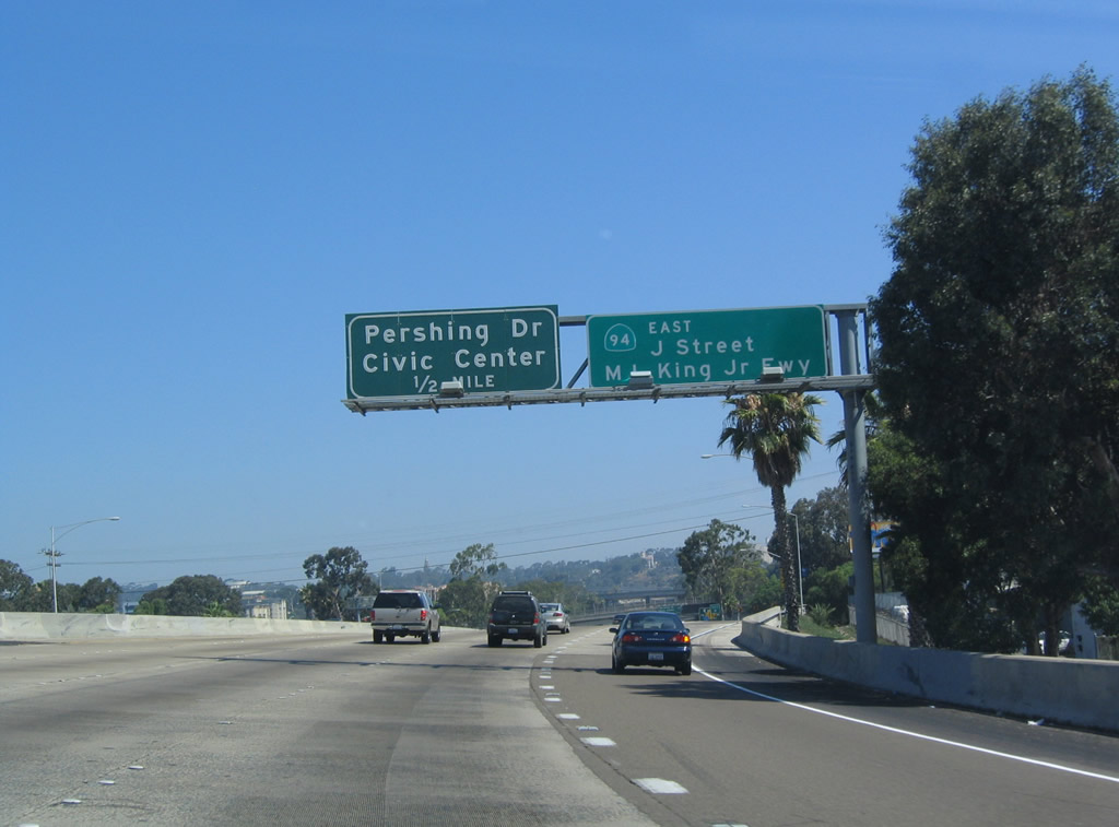
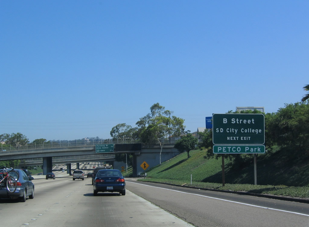
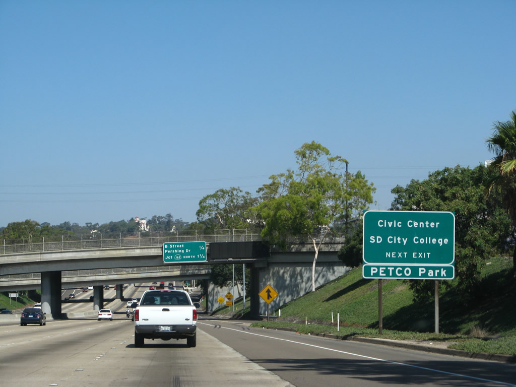
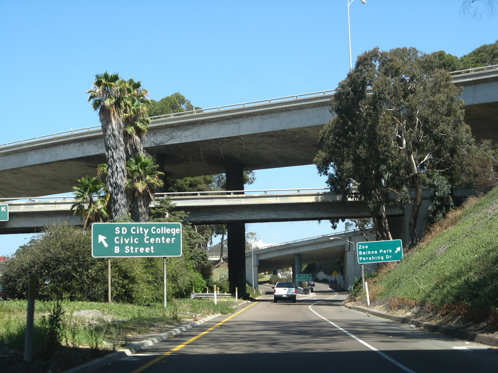
| In addition to Pershing Drive, Exit 15B also serves east-west B Street. Use B Street west to enter downtown, with connections to San Diego City College, the downtown financial district, Gaslamp Quarter, and the Padres' PETCO Ballpark. 09/01/07, 07/18/04 |
|
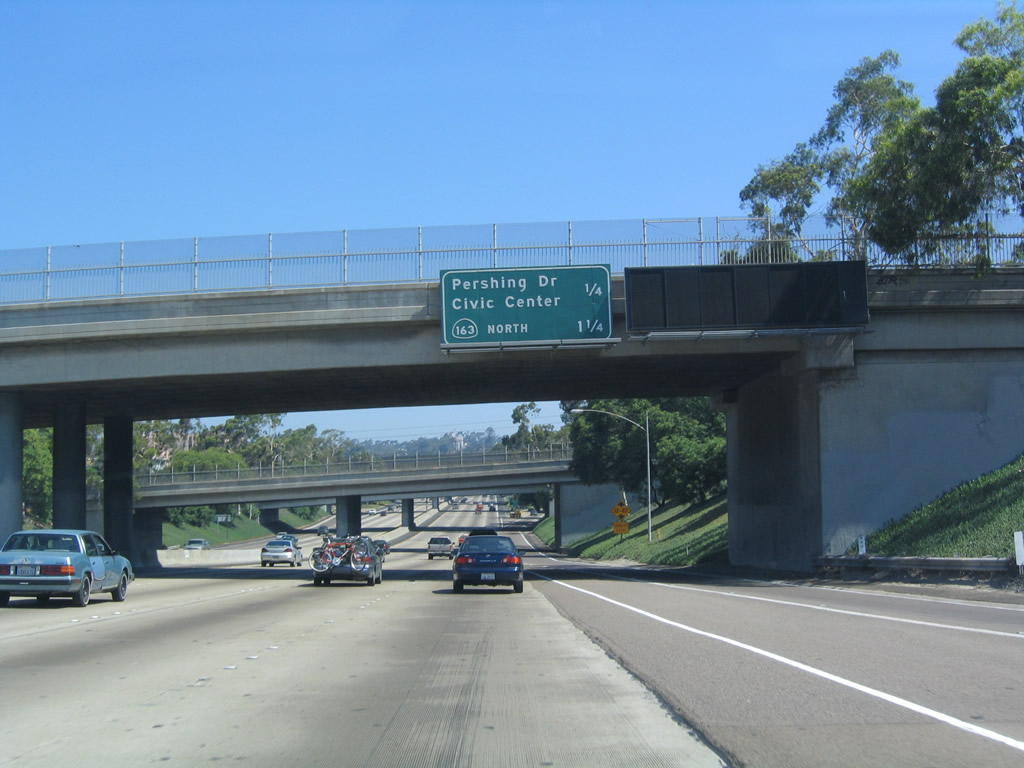
| This distance sign for the next two exits (Exit 15B, Pershing Drive/B Street and Exit 16A, SR 163) is mounted on the J Street overpass at the onramp from Imperial Avenue/19th Street. 09/01/07, 07/18/04 |
|
| Northbound Interstate 5 reaches Exit 15B, Pershing Street and B Street. Pershing Street leads northwest along the once-proposed and now-canceled SR 171/Switzer Canyon Freeway, and it serves most locations in Balboa Park, including the Zoo and Museums via Florida Street and Balboa Park Golf Course. B Street is an east-west city street that leads one way into the financial district of downtown San Diego. It is regularly busy, and it carries commuter traffic from the freeway toward the Civic Center and other downtown locations. 09/01/07, 07/18/04 |
|
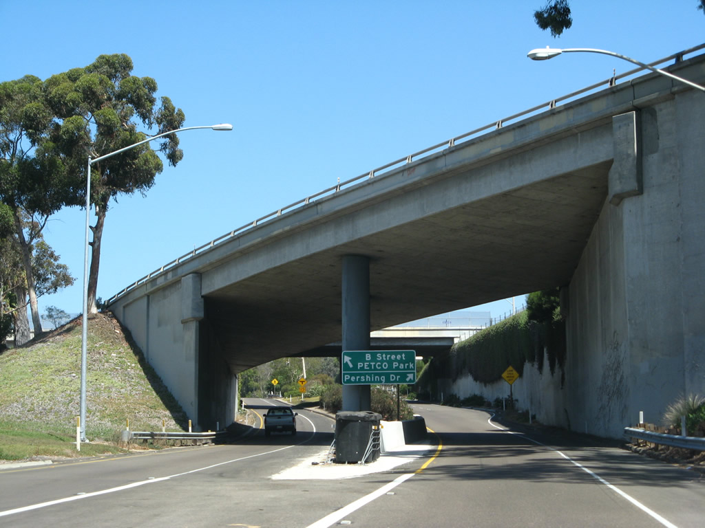
| Now on the ramp to B Street and Pershing Drive, this high-speed connector was planned to be the direct access to proposed SR 171, the Switzer Canyon Freeway. Since that freeway was removed from planning documents in 1994, the connecting ramps now provide fast access to Pershing Drive and Balboa Park. 09/01/07 |
|
| Still on the Pershing Drive offramp, the ramp splits, with the left lane connecting to B Street west to City College and the financial district of downtown San Diego. The right lane connects to Pershing Drive and Balboa Park; the right lane would have been part of the connector to unconstructed SR 171. 09/01/07 |
|
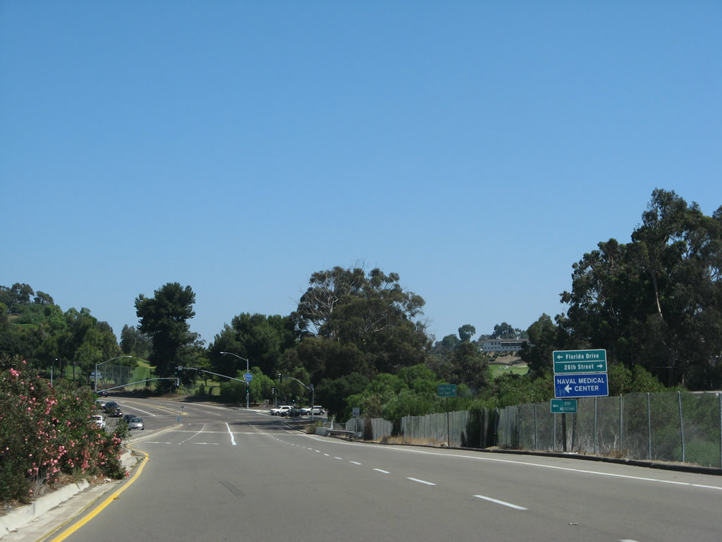
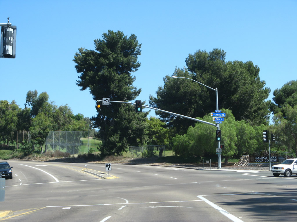
| Northbound Pershing Drive approaches Florida Drive north and 26th Street southeast. Florida Drive leads north to the zoo and museums on the central mesa of Balboa Park. 26th Street connects to the Balboa Park Golf Course and the community of Golden Hill. 09/01/07 |
|
| Had the Switzer Freeway (SR 171) been built, it would have turned northeast here to cross the golf course and then follow Switzer Canyon through the community of North Park to join Interstate 805 just south of the Interstate 8 interchange. This freeway was removed from the city's planned network of freeways due to the damage it would have caused to Balboa Park and the community of North Park. Now cancelled, the freeway through Switzer Canyon will not be built. 09/01/07 |
|
| Returning to mainline Interstate 5 north, we see this truck allocation signage. As a result of the merging ramps, trucks are recommended to use the number three ramp as shown by this sign mounted on the F Street overpass. This keeps the trucks away from the multiple merges and ramps on the right lanes. 01/31/05 |
|
| Distance sign along northbound as it enters the Downtown S-Curve, where the freeways turns sharply west and then north again. This section of Interstate 5 (from SR 94/Martin Luther King Jr. Freeway to Sassafras Street) was built in 1962; overhead porcelain enamel guide signs are very common along this stretch. 01/31/05 |
|
| As noted above, the exit only lanes for SR 163 are the same lanes used by the SR 94 entrance ramp along southbound. It is best to use the far right lane, since it will exit north onto the Cabrillo Freeway. The only movements that keep the Interstate 5/SR 163 interchange from being a symmetrical stack are the lack of northbound Interstate 5 to southbound 10th Avenue connection and northbound 11th Avenue connection to southbound Interstate 5. This interchange fits the mold of an original symmetrical stack interchange. 01/31/05 |
|
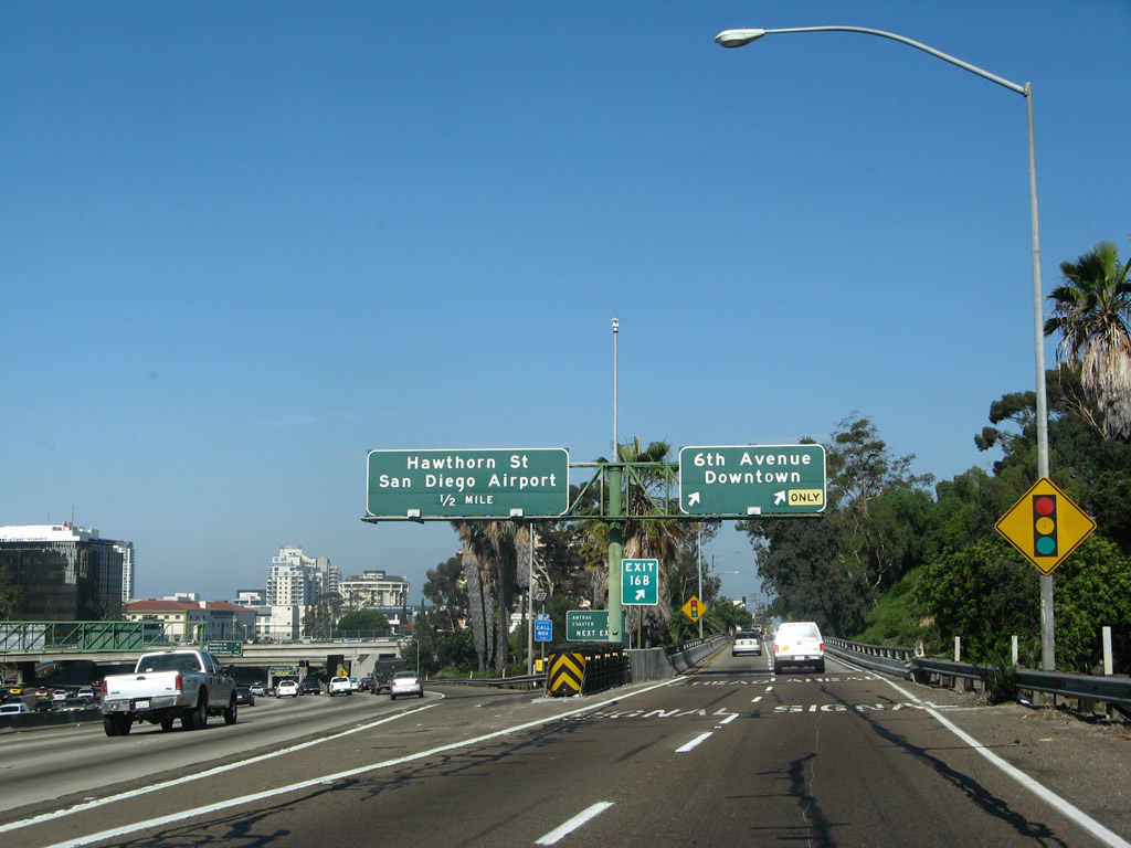
| Use Exit 17, Hawthorne Street, to reach the Embarcadero, Cruise Ship Terminal, Maritime Museum, and Cabrillo National Monument (via Harbor Drive northbound). 07/24/07 |
|
| The right two lanes of Interstate 5 north connect to SR 163/Cabrillo Freeway north. The pedestrian overpass connects San Diego City College (a community college located to the east of 11th Avenue) and San Diego High School with Balboa Park to the north of Interstate 5. 11th Avenue northbound transitions into northbound SR 163 after Ash Street, which is just a short distance south of the Interstate 5/SR 163 stack interchange. Ash Street is an east-west city street that leads from 10th/11th Avenue west to the bayfront at Harbor Drive, thus providing a through route. 07/24/07 |
|
| Use Exit 17, Hawthorn Street, to reach San Diego International Airport (third exit, after Exit 16A and Exit 16B). 07/18/04 |
|
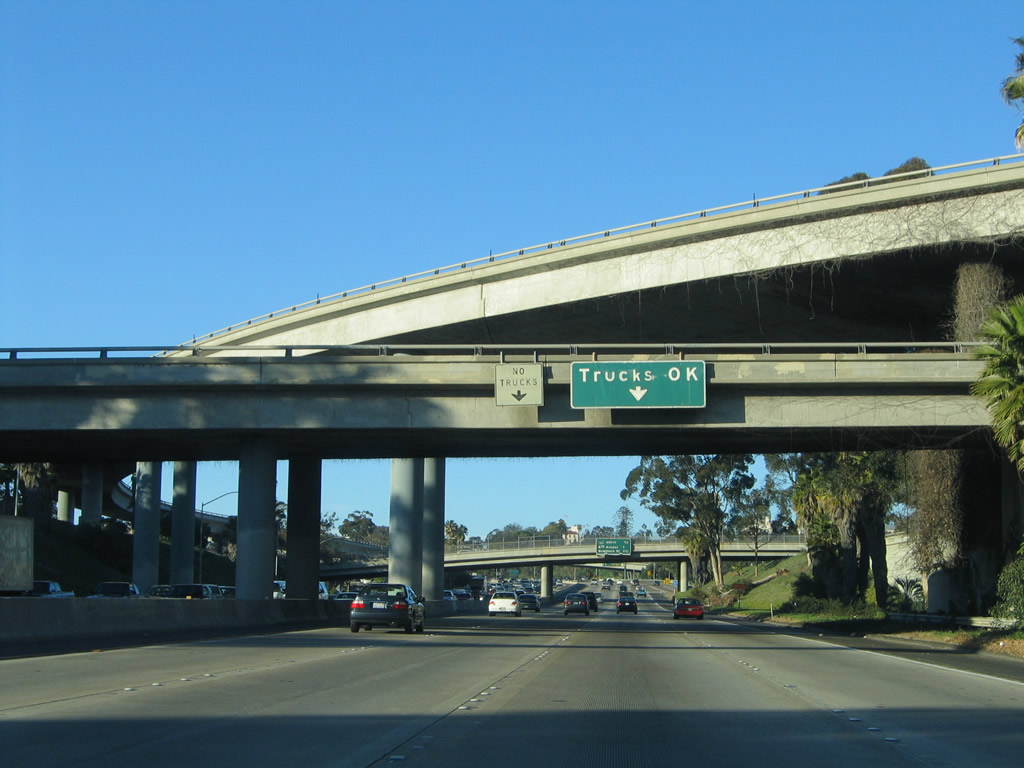
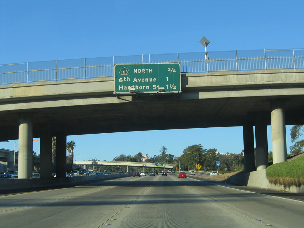
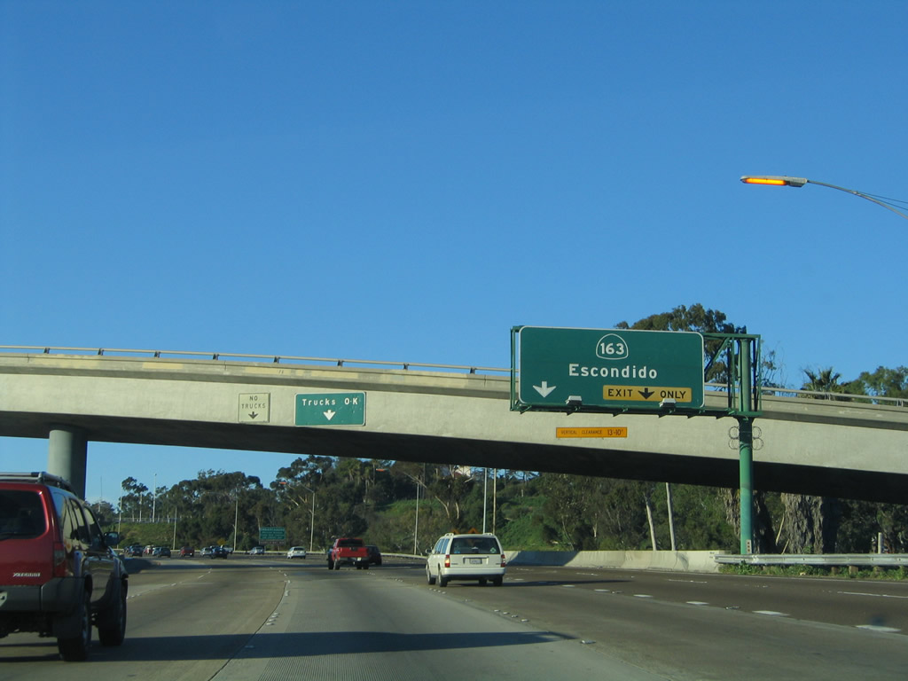
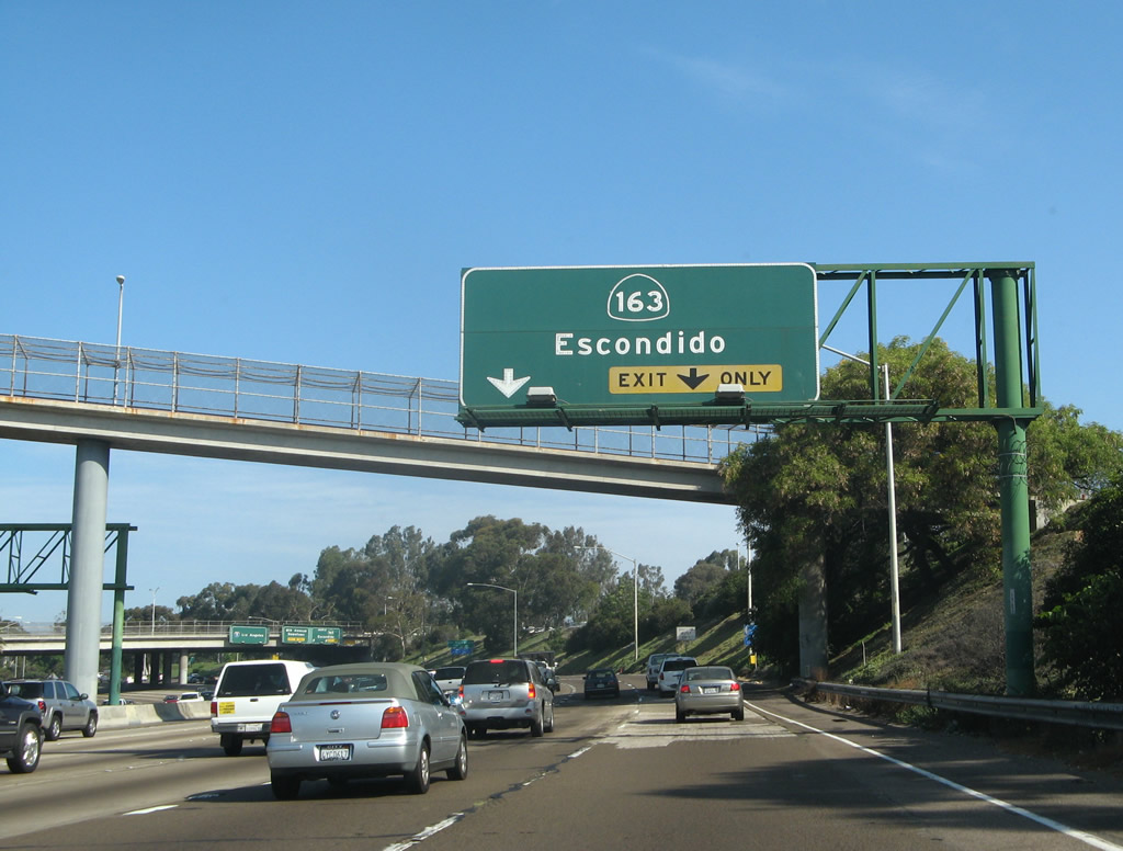
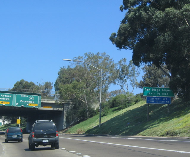
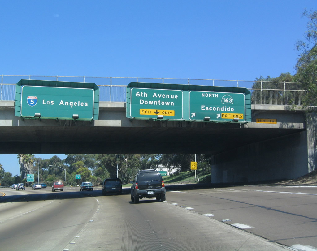
| Northbound Interstate 5 reaches Exit 16A for SR 163 (Cabrillo Freeway) north. This exit marks the southern terminus of SR 163, which was at one time known as U.S. 395. With the decommissioning of many U.S. routes in California beginning in 1964, U.S. 395 was removed around 1972. As such, SR 163 is a fairly short route, leading from downtown San Diego north to Interstate 15 near Miramar Marine Corps Air Station. 07/18/04 |
|
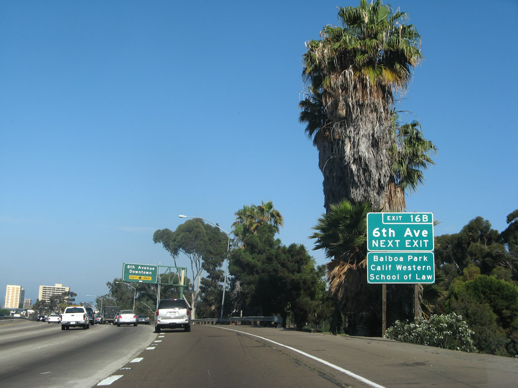
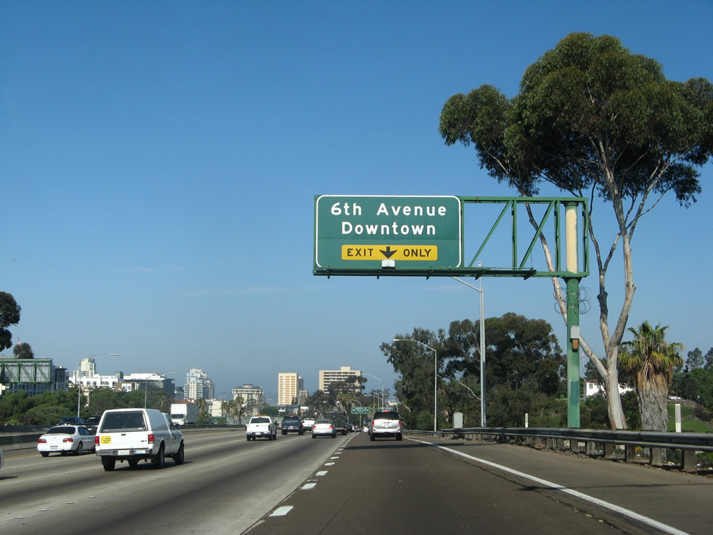
| The next exit along northbound is for Sixth Avenue. This major city street leads south into the Gaslamp Quarter, made famous in the 1990s and 2000s as downtown's premier entertainment district. What was once a derelict district full of illegal activities (such as prostitution and gambling) became the region's entertainment mecca. Northbound along Sixth Avenue leads to the western fringes of Balboa Park, and it also provides access to several older neighborhoods in San Diego, including Bankers Hill and Hillcrest. 07/24/07 |
|
| Interstate 5 skirts the north edge of downtown as it briefly heads due west between Exits 15B and 17. It resumes traveling northwest after the Hawthorn Street exit (Exit 17). At this point, Interstate 5 is on top of the four-level stack interchange; SR 163 forms the lowest level. 07/24/07 |
|
| Northbound Interstate 5 reaches Exit 16B, Sixth Avenue. Interstate 5 intersects Sixth Avenue, a north-south city street, because it follows an S-Curve through the downtown area. From the SR 94 onramp, northbound Interstate 5 turns due west, intersecting with SR 163 (Cabrillo Freeway) and Sixth Avenue. It then turns north again right around the Hawthorne Street (Exit 17A) exit ramp, thus forming the "S." The two turns are rather sharp for an Interstate-standard freeway, and the "S-curve" is routinely mentioned in traffic reports as a source of traffic congestion during rush hours because of the convergence of so many freeways at this location. 07/24/07 |
|
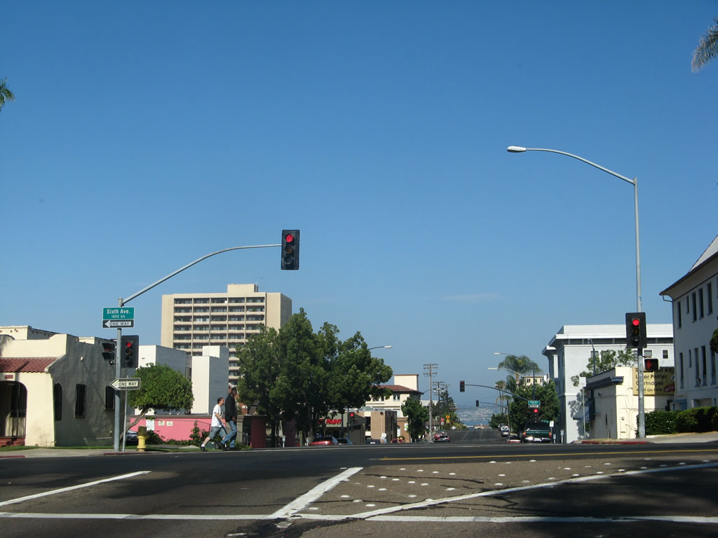
| A narrow two lane bridge connects Exit 16B with Sixth Avenue. A traffic signal ahead allows for a left turn onto Sixth Avenue south into downtown, or motorists may continue straight on Elm Street west to Fifth Avenue north to Uptown and Hillcrest. 07/24/07 |
Page Updated 07-28-2014.

 North
North