|
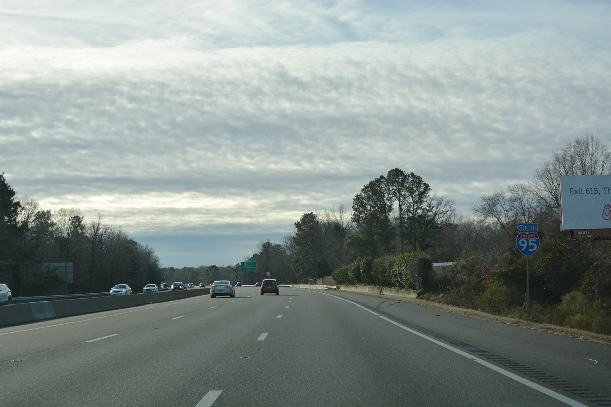
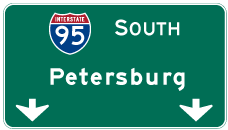
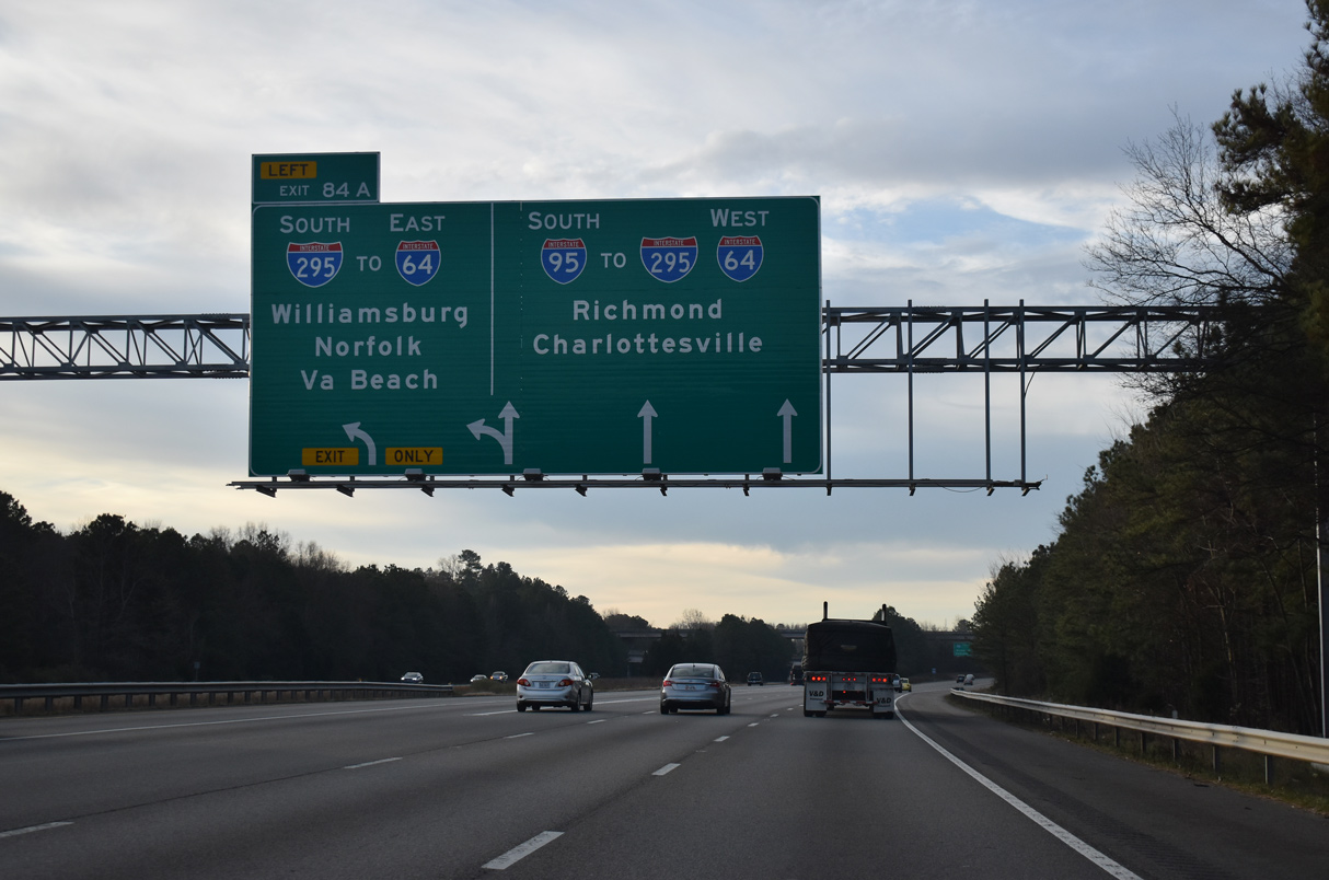
| Traffic partitions for I-295 south to Petersburg at a wye interchange (Exit 84A) in 0.75 miles. Prior to 2001, guide signs for Exit 84A used Miami, Florida as a control point. 12/30/20 |
|
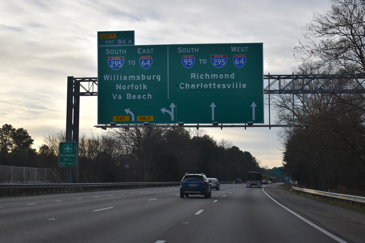
| Interstate 295 provides a high speed bypass of Richmond to Richmond International Airport (RIC) and Hopewell east of Petersburg. Speed limits were increased along the freeway to 70 miles per hour in 2010. 12/30/20 |
|
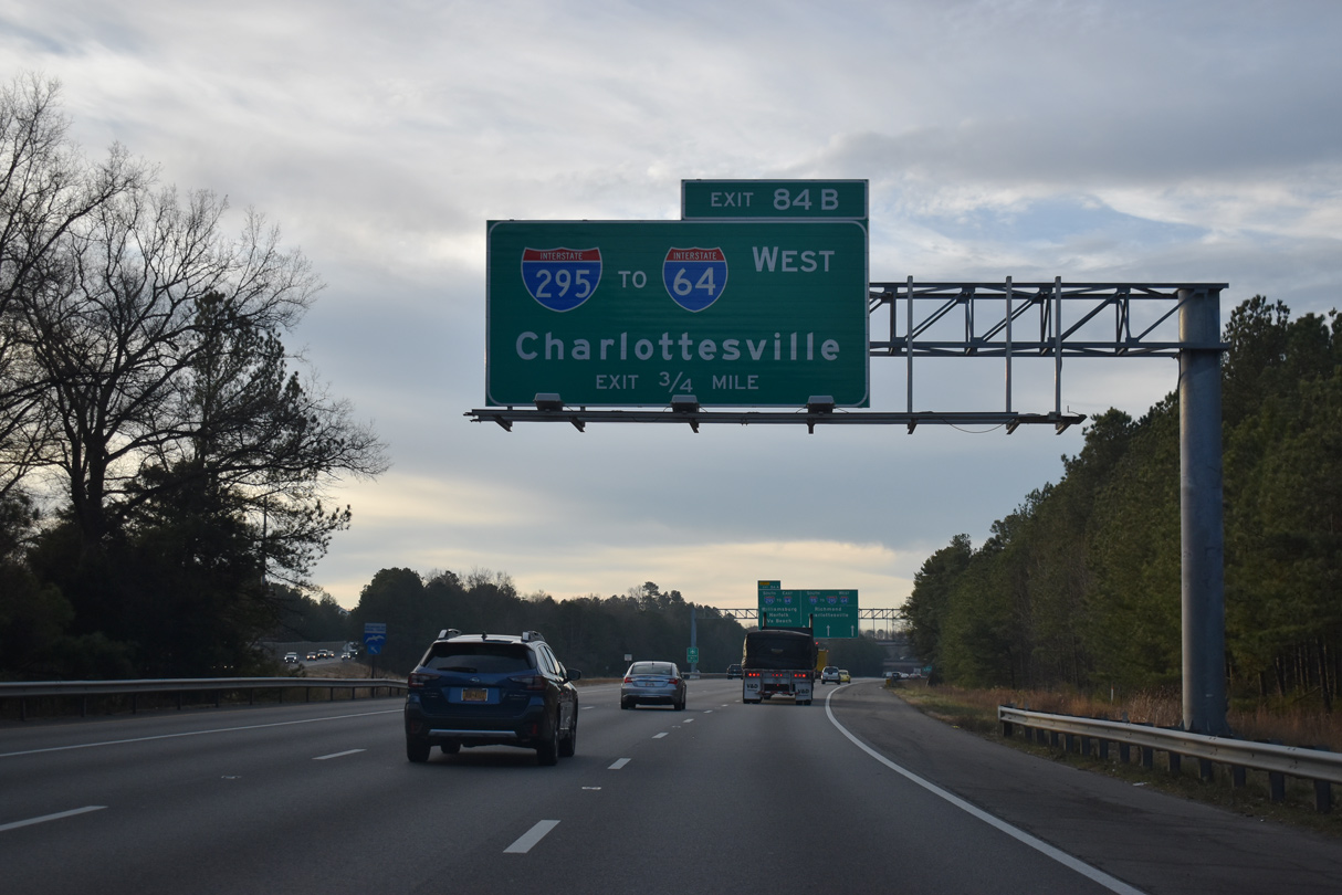
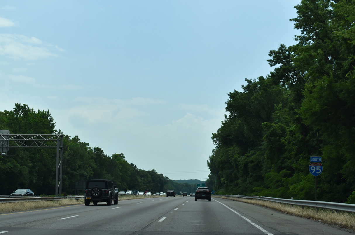
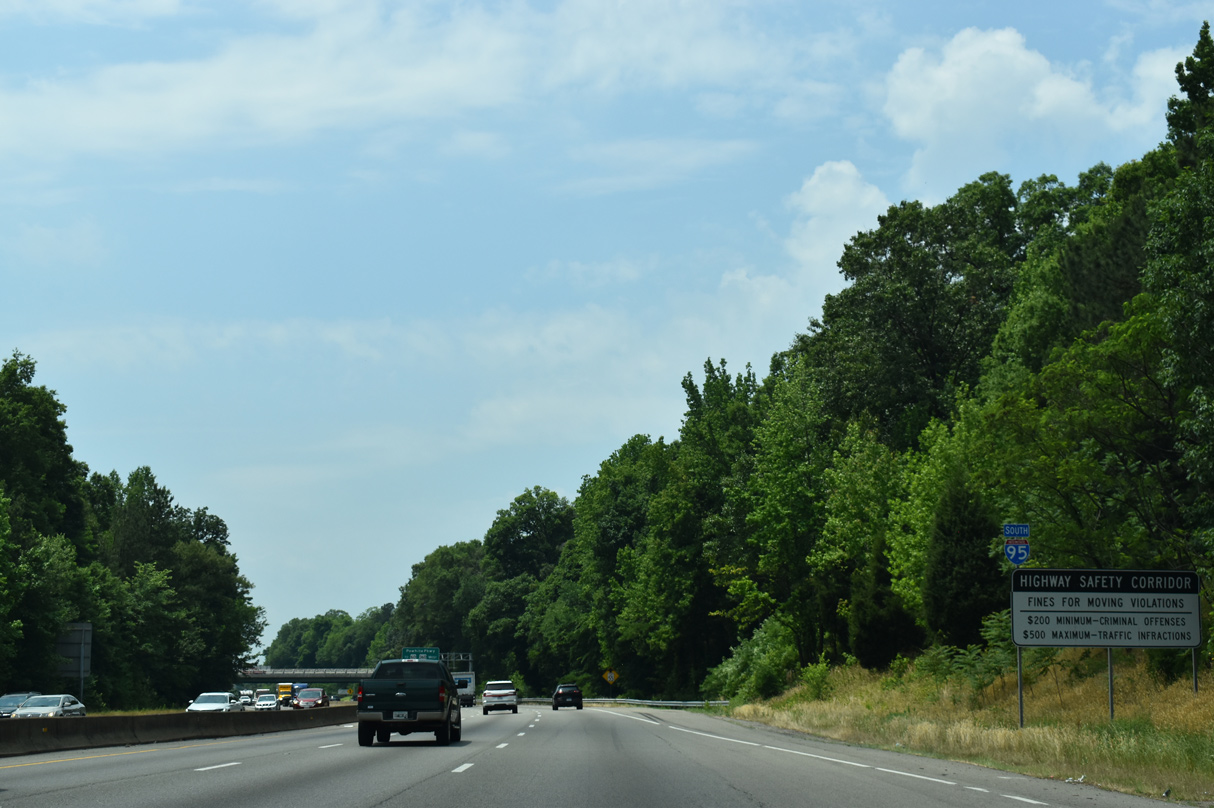
| Interstate 295 bypasses Richmond to the northwest from I-95 to I-64 ahead of Charlottesville. 12/30/20 |
|
| Interstate 295 was originally considered for a full beltway encircling Richmond. The southwestern segment was eventually built as State Route 288. Pochahontas Parkway (SR 895) connects I-295 near RIC Airport with I-95 south of Bensley. 12/30/20 |
|
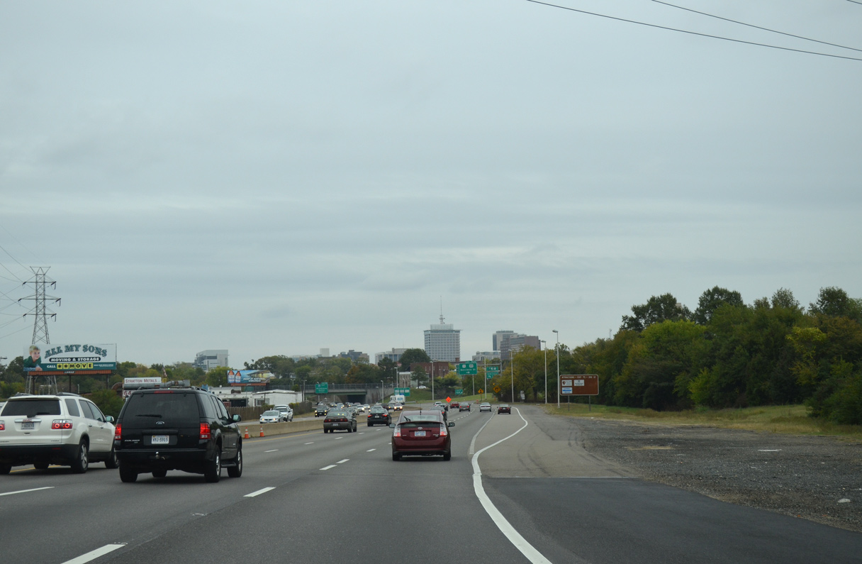
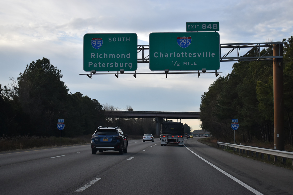
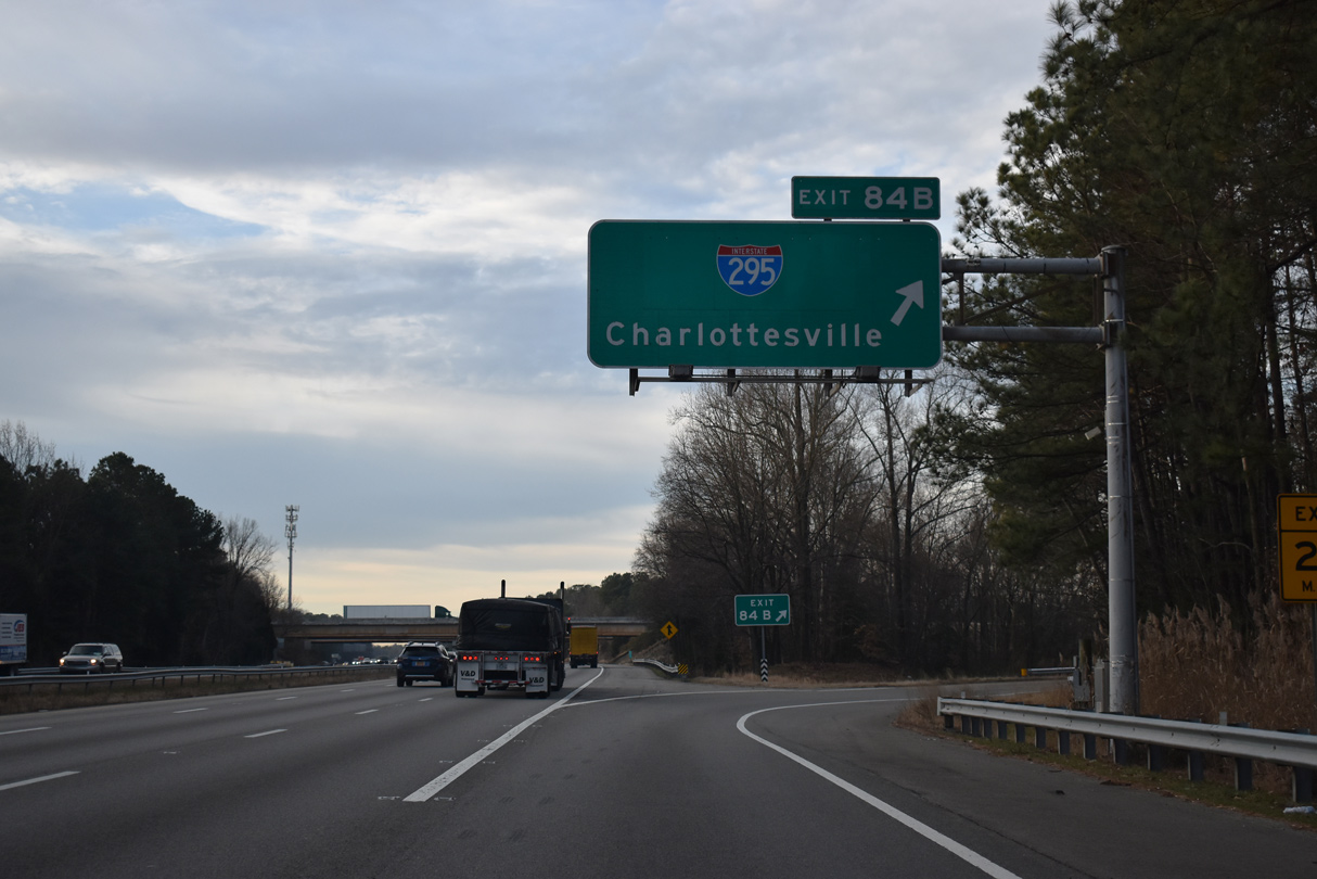
| I-95 proceeds south to a cloverleaf interchange (Exit 84B) with the Interstate 295 mainline. 12/30/20 |
|
| The northwestern quadrant of Interstate 295 arcs west by Glen Allen, Innsbrook and Wyndham to I-64 at Short Pump. 12/30/20 |
|
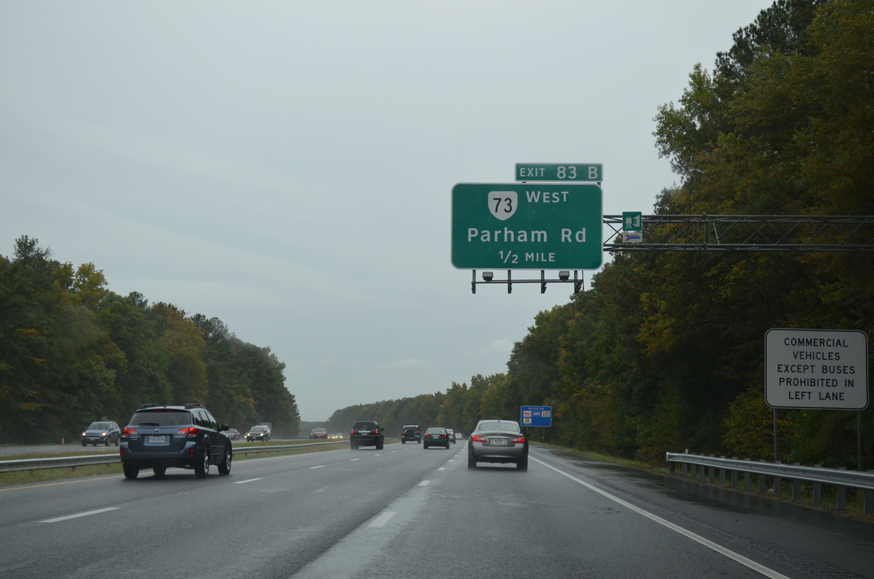
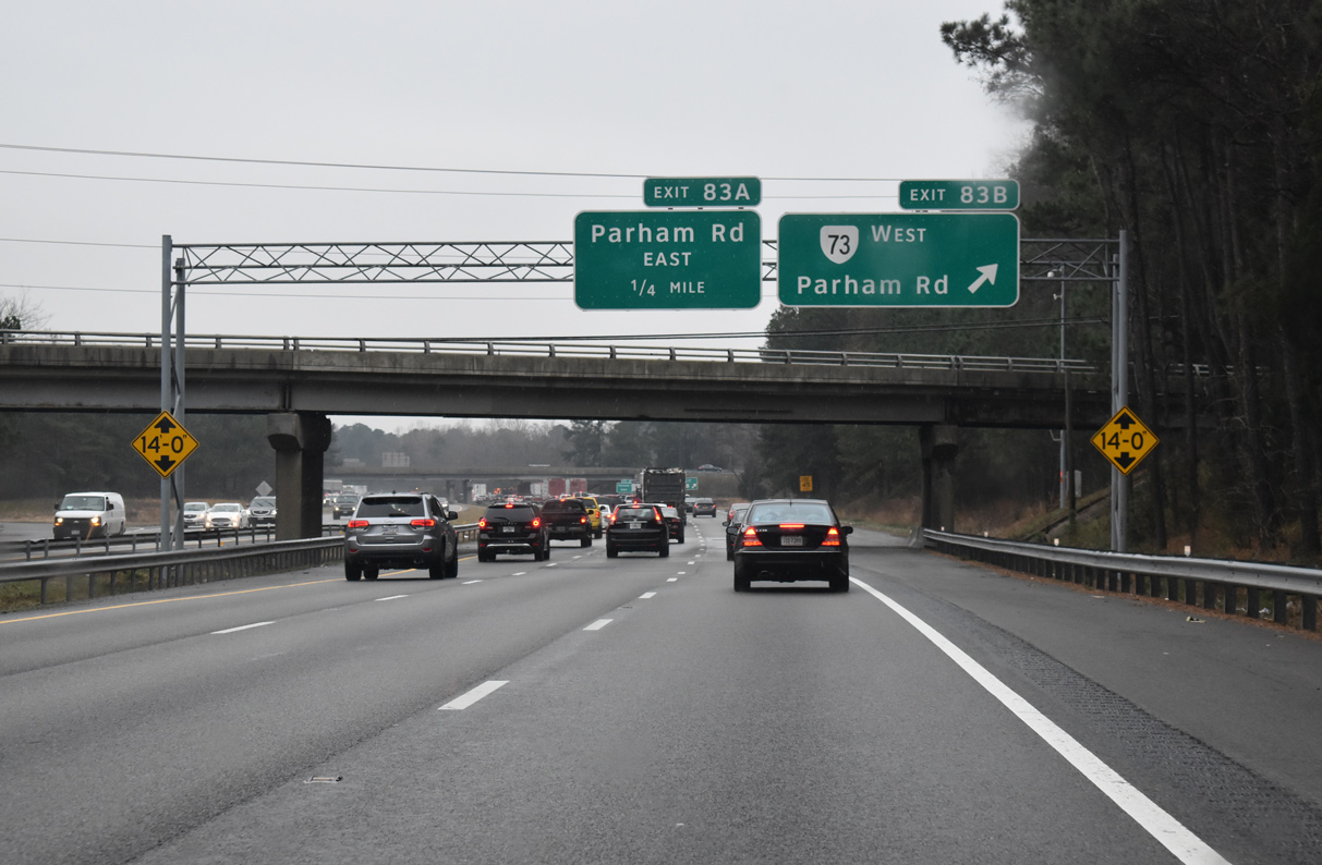
| Advancing south from I-295, Interstate 95 travels one mile to a cloverleaf interchange (Exit 83) with SR 73 (Parham Road). 10/12/14 |
|
| I-95 passes through a wooded area ahead of Scott Street and the exchange with Parham Road. 01/04/19 |
|
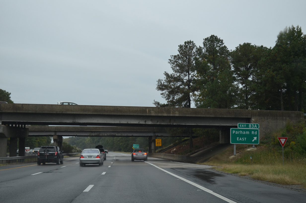
| Parham Road heads west from Exit 83B to Laurel and I-64 at Exit 181. Parham Road connects Interstate 95 with U.S. 301/SR 2 (Chamberlayne Avenue) 1.48 miles east of SR 73 via Exit 83A. 10/12/14 |
|
| SR 73 constitutes a 0.78 mile long route along Parham Road from just east of I-95 at Exit 83 to parallel U.S. 1 (Brook Road). Parham Road (SR 6710) arcs 9.82 miles southwest from U.S. 1 to SR 150 (Chippenham Parkway) at Tuckahoe. 01/04/19 |
|
| Exit 83A loops onto Parham Road (SR 73) east toward U.S. 301/SR 2 at the Chamberlayne community. 10/12/14 |
|
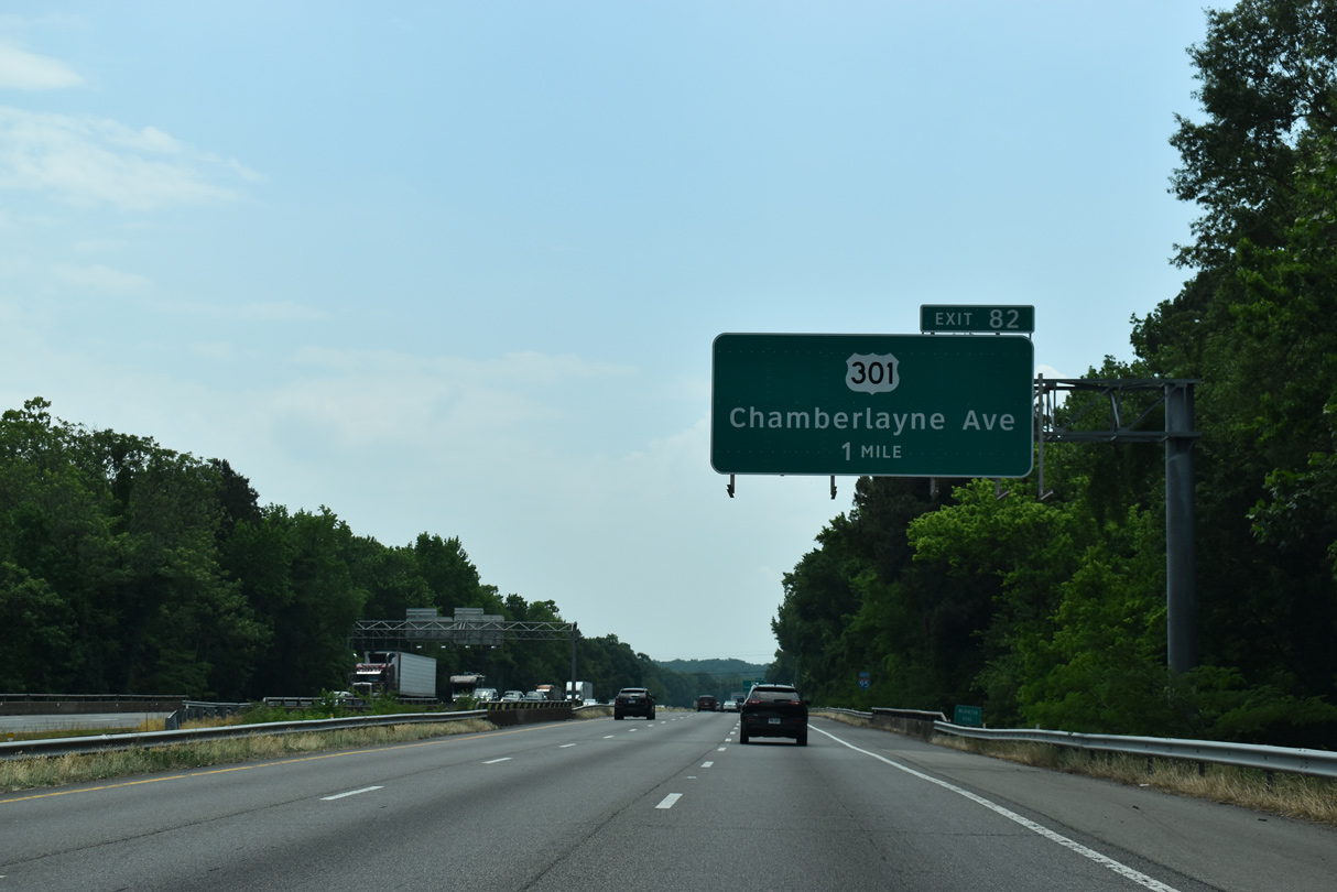
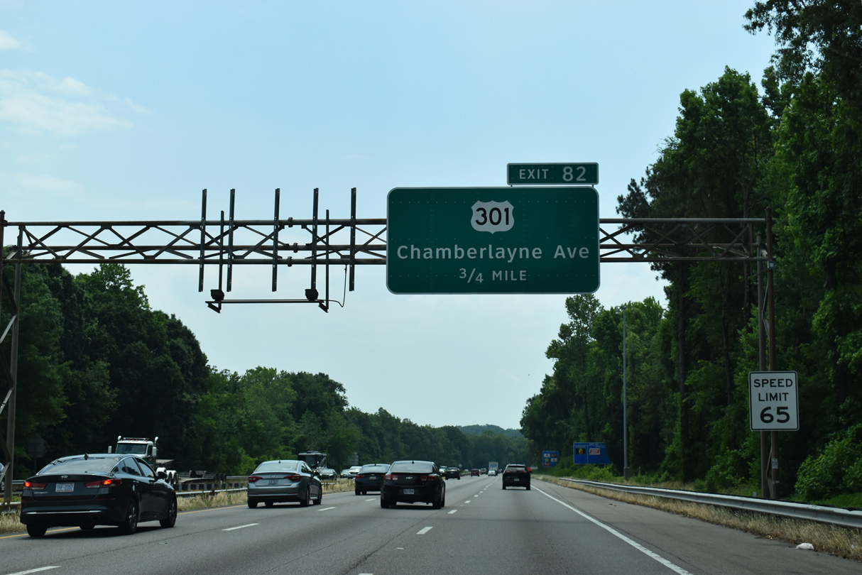
| U.S. 301 converges with I-95 at the first of many interchanges between the two south to Santee, South Carolina at Exit 82. U.S. 301 is Chamberlayne Road in Henrico County and Chamberlayne Avenue within the city of Richmond. 05/28/21 |
|
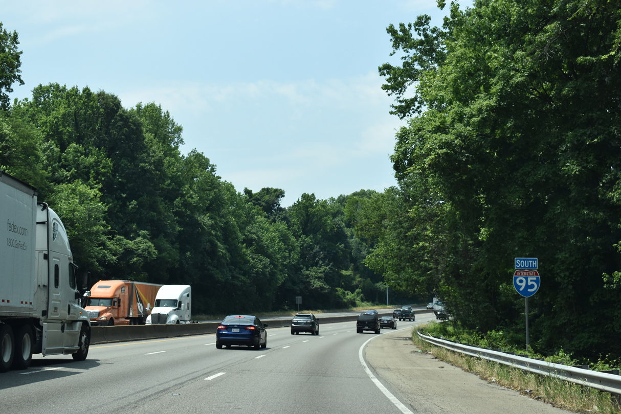
| Leading south to Exit 82, speed limits along I-95 were raised from 55 to 60 MPH between July and October 2005. They were subsequently increased again to 65 MPH by Fall 2019. 05/28/21 |
|
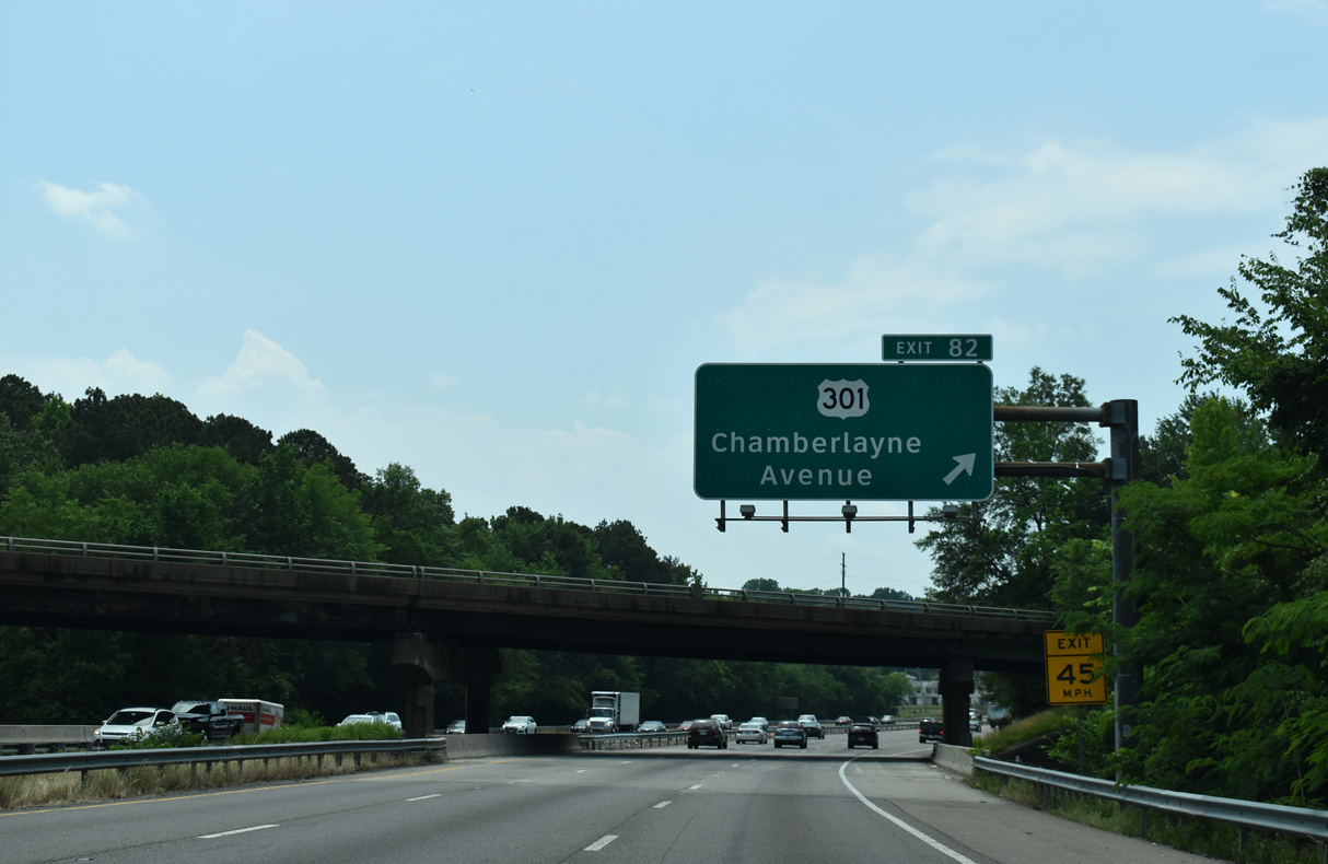
| U.S. 301 (Chamberlayne Road) separates into split roadways through a modified trumpet interchange (Exit 82) with Interstate 95. 05/28/21 |
|
| Exit 82 joins U.S. 301 south from the left as Chamberlayne Road continues to Ginter Park and an overlap with U.S. 1 at Azalea Avenue in Richmond. 05/28/21 |
|
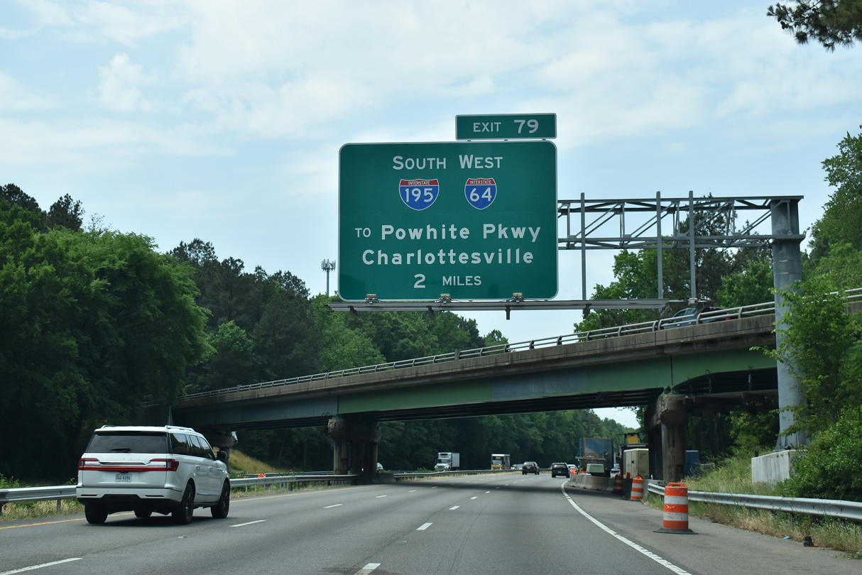
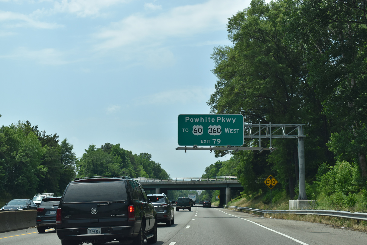
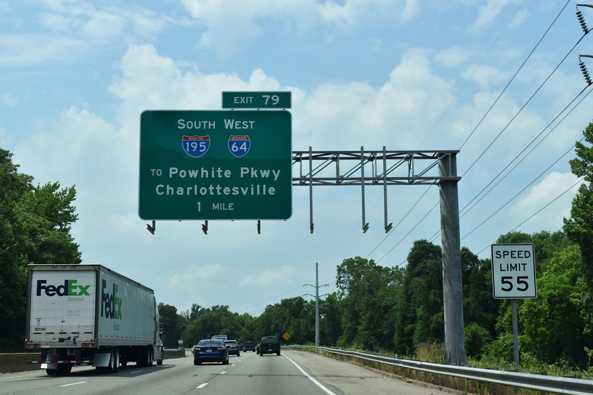
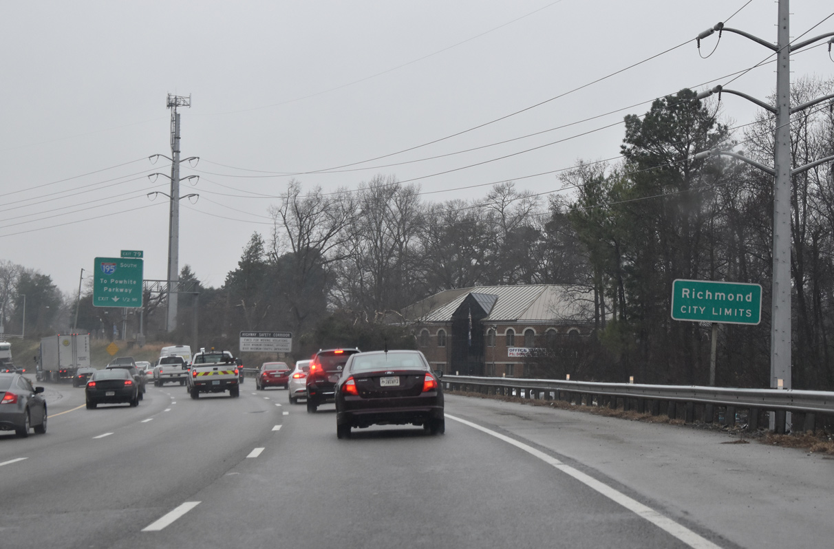
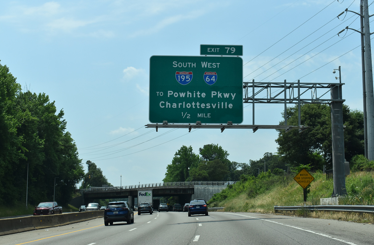
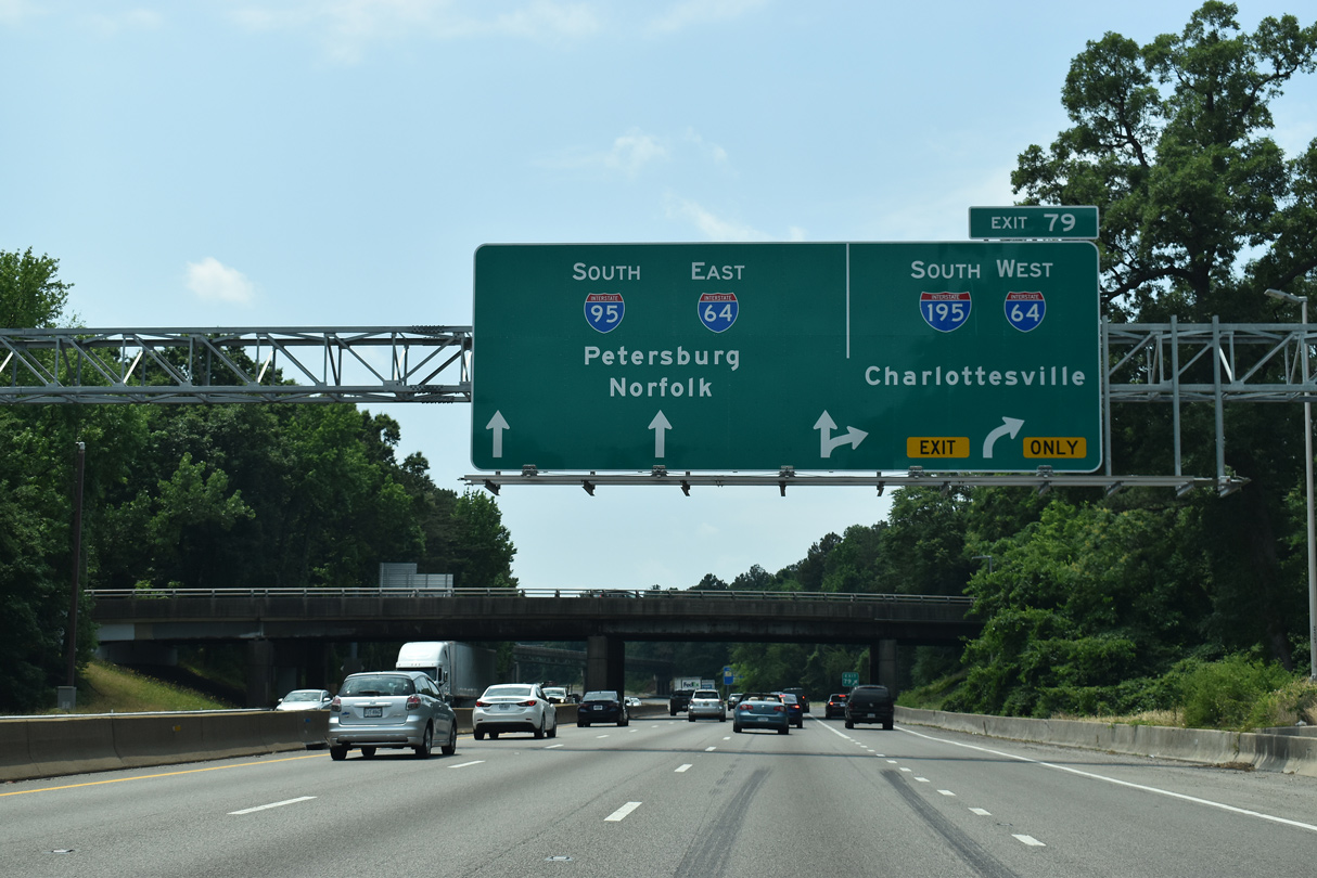
| I-95 bends southwest from U.S. 301, two miles to the exchange (Exit 79) with I-64 west and I-195, a 3.50 mile spur south to SR 76 (Powhite Parkway). 05/28/21 |
|
| A partial interchange joins U.S. 1 (Brook Road) south with I-95 beyond this confirming marker. 05/28/21 |
|
| Forthcoming Interstate 195 directly ties into SR 76 (Powhite Parkway), with connections to U.S. 60 and U.S. 360 at Midlothian and other Chesterfield County suburbs. 05/28/21 |
|
| I-95 navigates through an S-curve alongside Upham Brook and Joseph Bryan Park southwest from U.S. 1 (Brook Road). 05/28/21 |
|
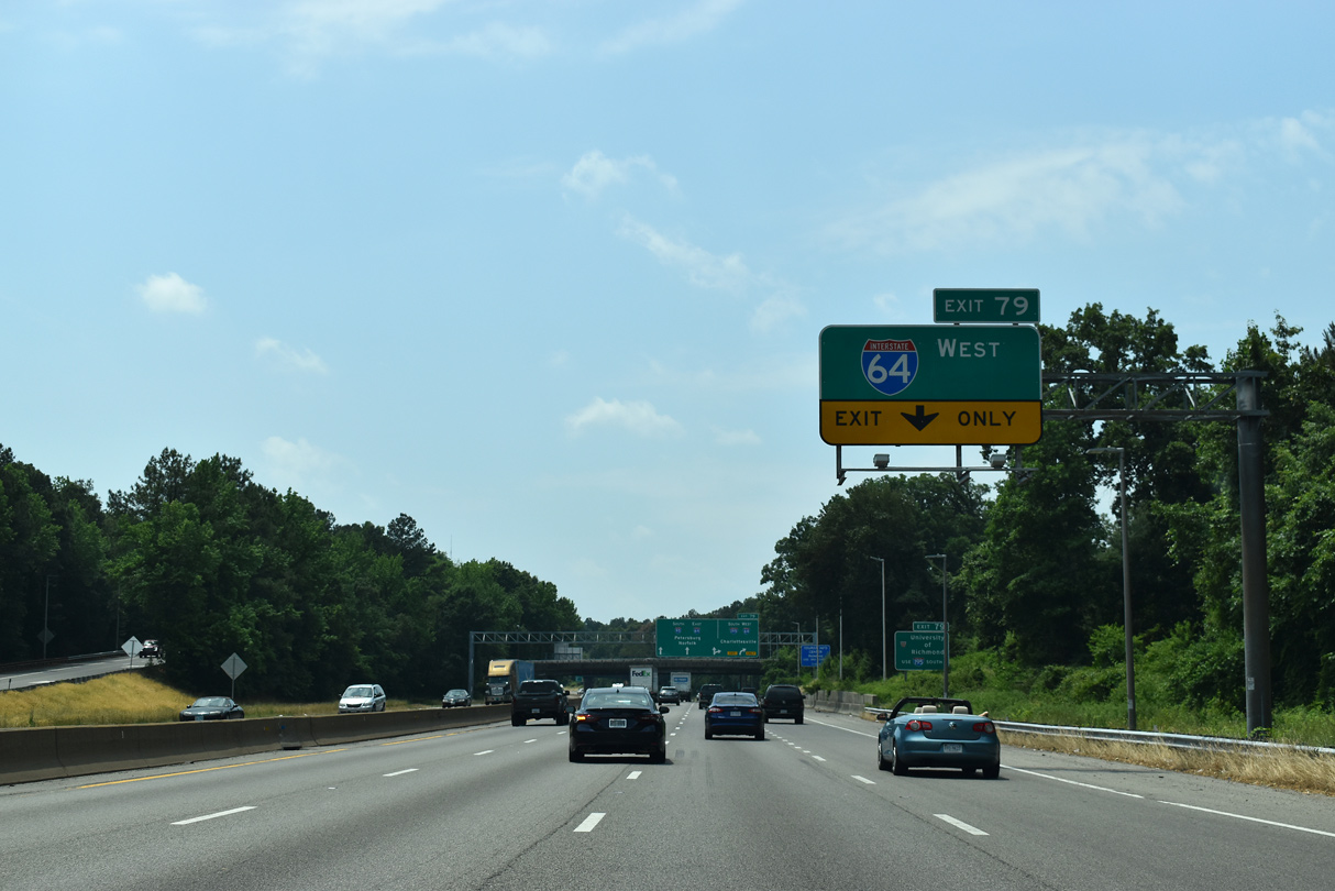
| Overlapping directional T interchanges connect I-95 with I-64/195. Exit 79 initially joins I-195 south ahead of a second ramp for Interstate 64 west to Charlottesville. 05/28/21 |
|
| I-95 formally enters the city of Richmond at the partial interchange with SR 161 (Lakeside Avenue / Hermitage Road). 01/04/19 |
|
| In addition to connecting I-64/95 with the tolled Powhite Parkway (SR 76), I-195 with SR 195 (Downtown Expressway) forms an urban loop to the Richmond central business district. 05/28/21 |
|
| An auxiliary lane opens south from the SR 161 (Lakeside Avenue / Hermitage Road) entrance ramp by Joseph Bryan Park to Exit 79. Interstate 64 is a major freeway stretching across the width of Virginia from Chesapeake in Hampton Roads to the Mountain State west of Clifton Forge. 05/28/21 |
|
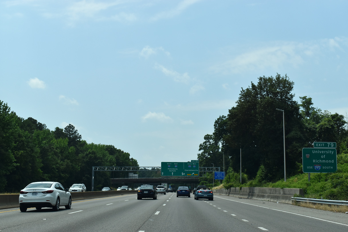
| I-195 (Beltline Expressway) south to SR 147 (Cary Street) west leads to the University of Richmond. 05/28/21 |
|
| Exit 79 separates with two lanes for I-64 west and I-195 south. The tolled Downtown Expressway (SR 195) extends southeast from I-195 at Carytown to I-95 at the James River (Exit 74A). 05/28/21 |
|
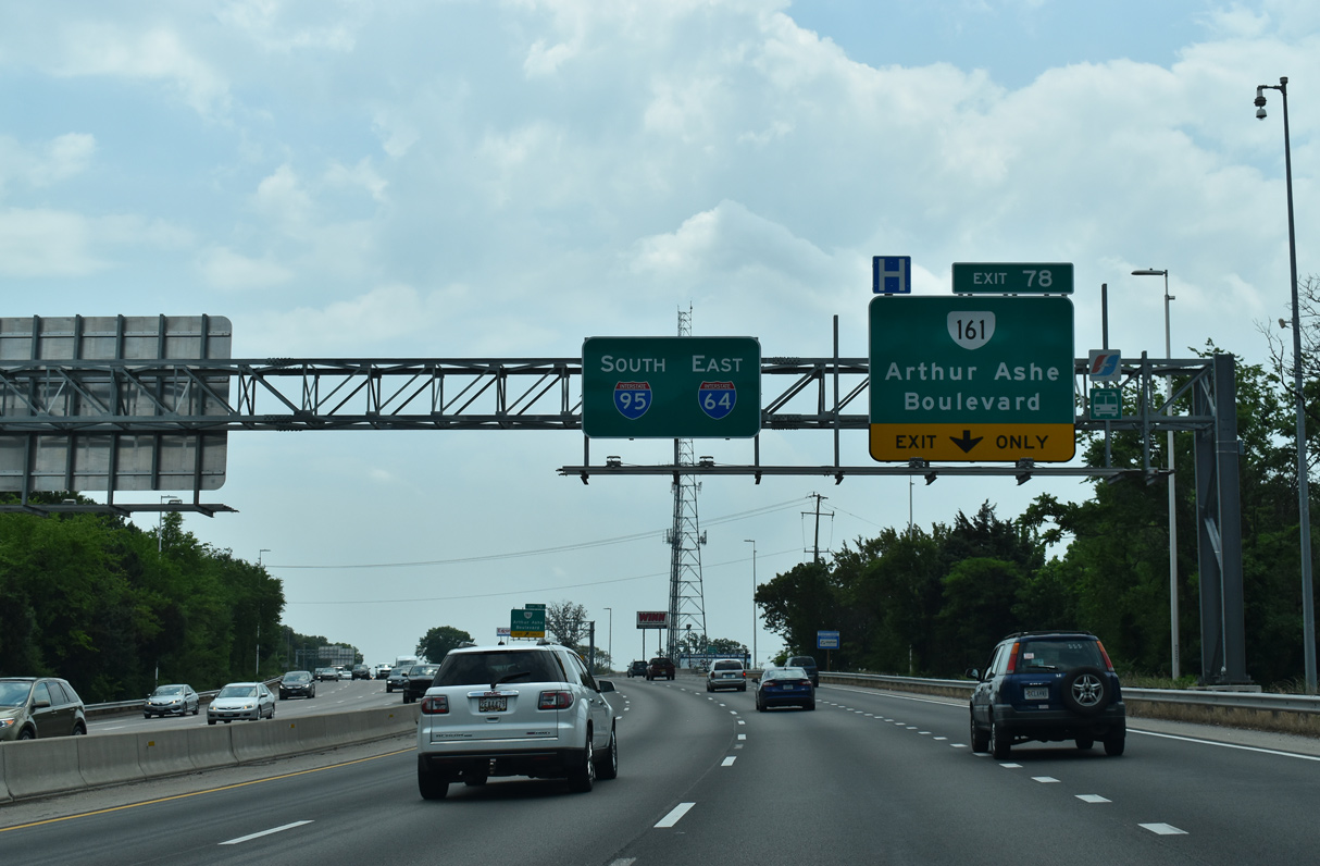
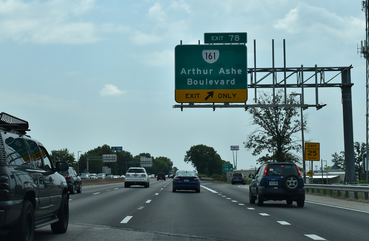
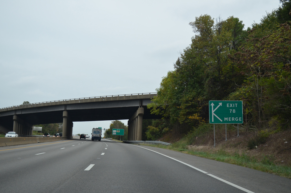
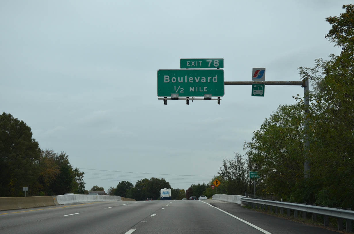
| Interstate 64 combines with I-95 south beyond the SR 197 (Laburnum Avenue) underpass. A weaving traffic pattern ensues with the subsequent ramp (Exit 78) to SR 161 (Arthur Ashe Boulevard). 10/12/14 |
|
| The city of Richmond formally renamed Boulevard after Arthur Ashe, Jr. during a ceremony held June 22, 2019. A native of Richmond, Ashe was a world renown tennis player.1 Sign replacements showing the new name also included SR 161, which follows the boulevard south from Hermitage Road. 10/12/14 |
|
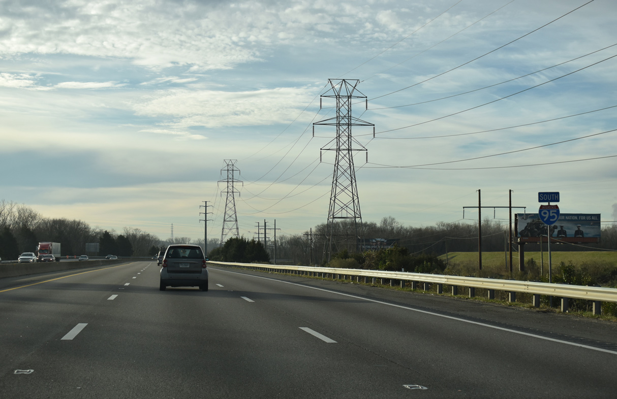
| SR 161 (Arthur Ashe Boulevard) heads south to the Museum District and Carytown before crossing the James River on the tolled Boulevard Bridge. SR 161 meets I-95 again at Exit 69 in south Richmond. 05/28/21 |
|
| North from Exit 78, SR 161 (Arthur Ashe Boulevard) shifts onto Hermitage Road at the Laburnum Park neighborhood. The 14.04 mile long state route concludes at U.S. 1 (Brook Road) near Belmont Park Golf Course. 05/28/21 |
|
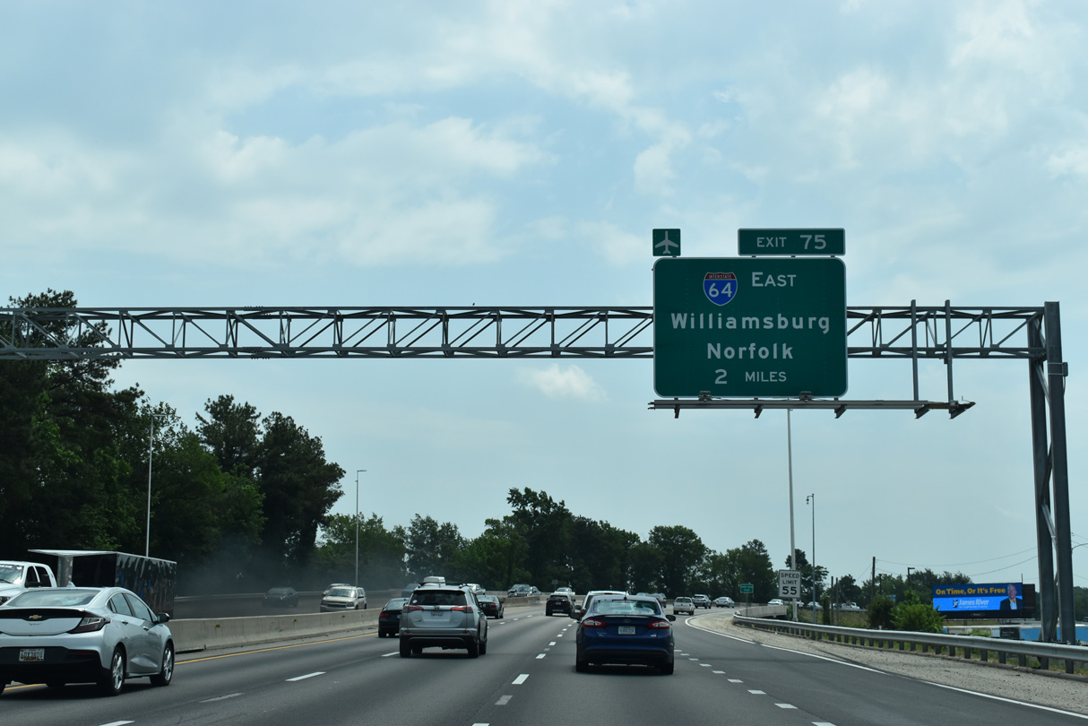
| Interstate 64 east separates from I-95 (Richmond-Petersburg Turnpike) south in two miles. 05/28/21 |
|
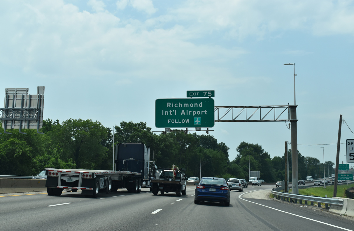
| Interstate 64 provides the most direct route from I-95 and Downtown Richmond to Richmond International Airport (RIC), located south U.S. 60 between Montrose and Sandston. 05/28/21 |
|
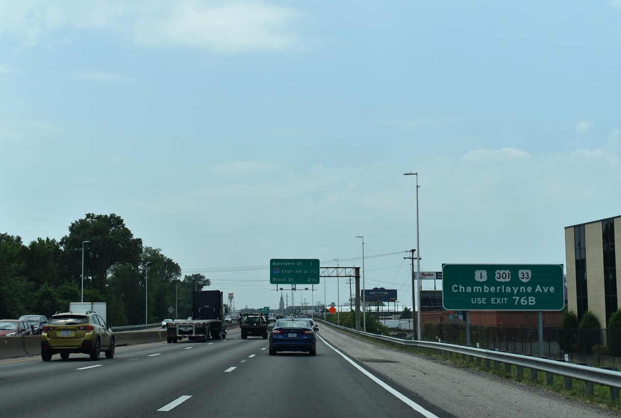
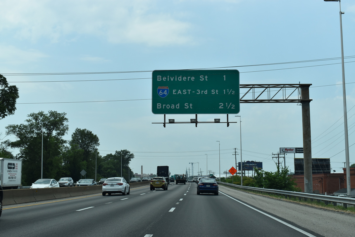
| The ensuing exit joins I-64/95 (Richmond-Peterbsurg Turnpike) south with U.S. 1/301 (Belvidere Street). The two overlap along Chamberlayne Avenue to Ginter Park in north Richmond and south from adjacent SR 33 (Leight Street) to Virginia Commonwealth University (VCU) and Gambles Hill. 05/28/21 |
|
| Interchange sequence sign outlining the succeeding three exits from Interstate 95 southbound. 05/28/21 |
|
| I-64/95 parallel a CSX Railroad line just ahead of Exit 76B for SR 33 (Leigh Street) to U.S. 1/301 (Belvidere Street). 05/28/21 |
|
| SR 33 (Leigh Street) parallels I-95 southeast from U.S. 1/301 (Belvidere Street) to the East End district and meets I-64 at Exit 193. 05/28/21 |
|
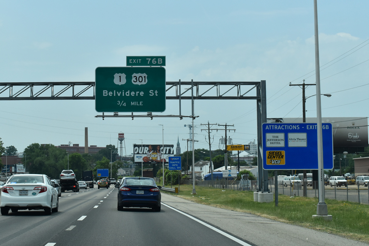
| The original toll plaza for the Richmond-Petersburg Turnpike was located just ahead of the parclo interchange (Exit 76B) with SR 33 (Leigh Street) and U.S. 1/301 (Belvidere Street). 10/12/14 |
|
| Exit 76B parts ways for Gilmer Street south at SR 33 (Leigh Street) in the Carver neighborhood. U.S. 1/301 remain paired south to Petersburg. 05/28/21 |
|
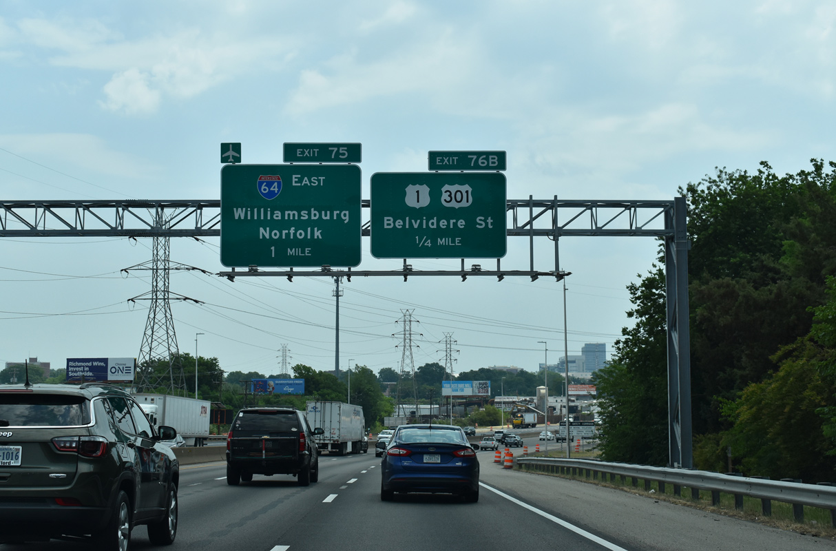
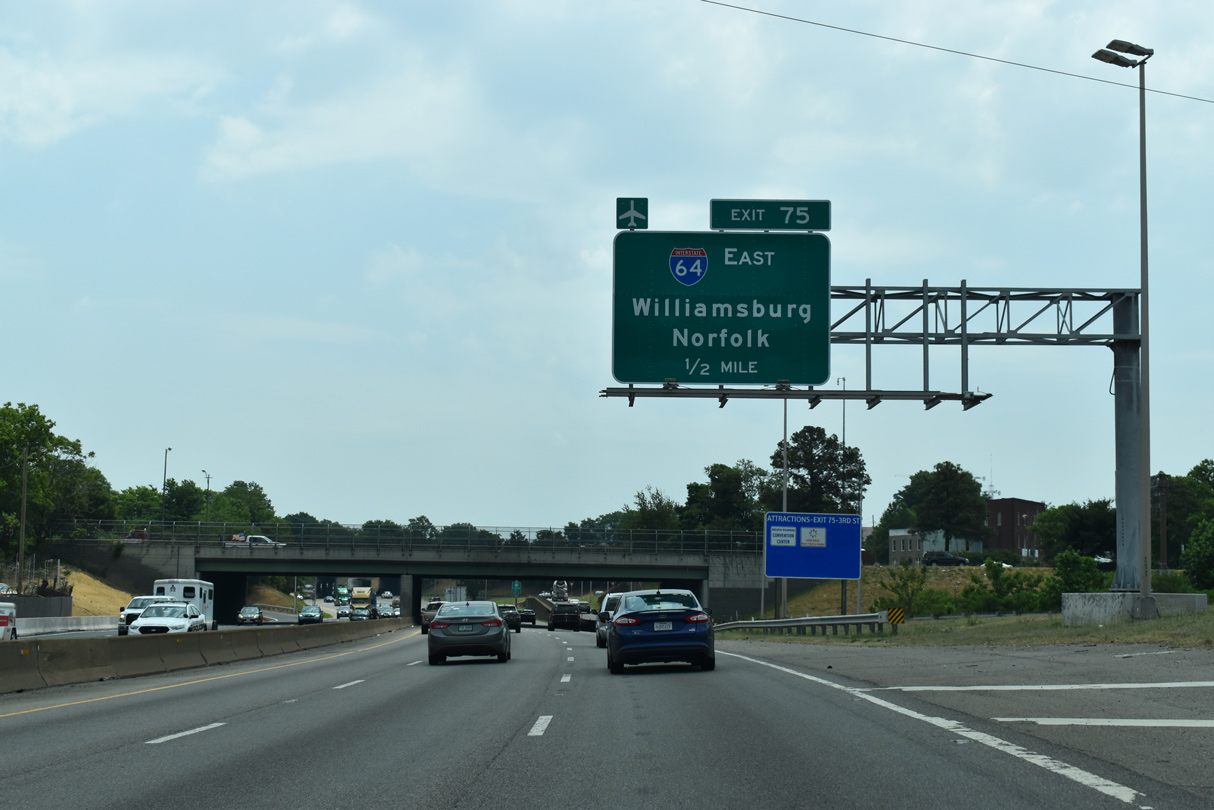
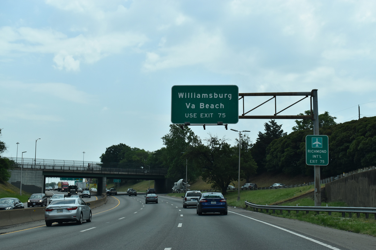
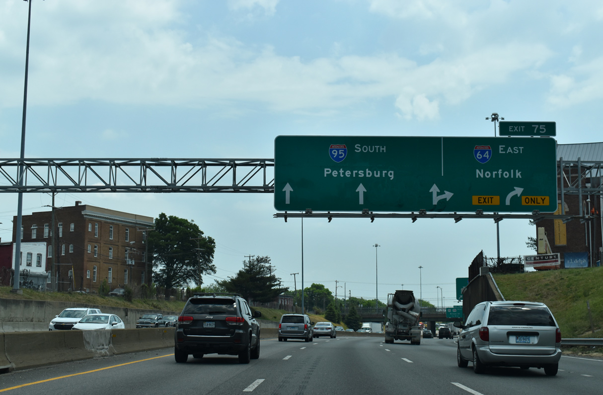
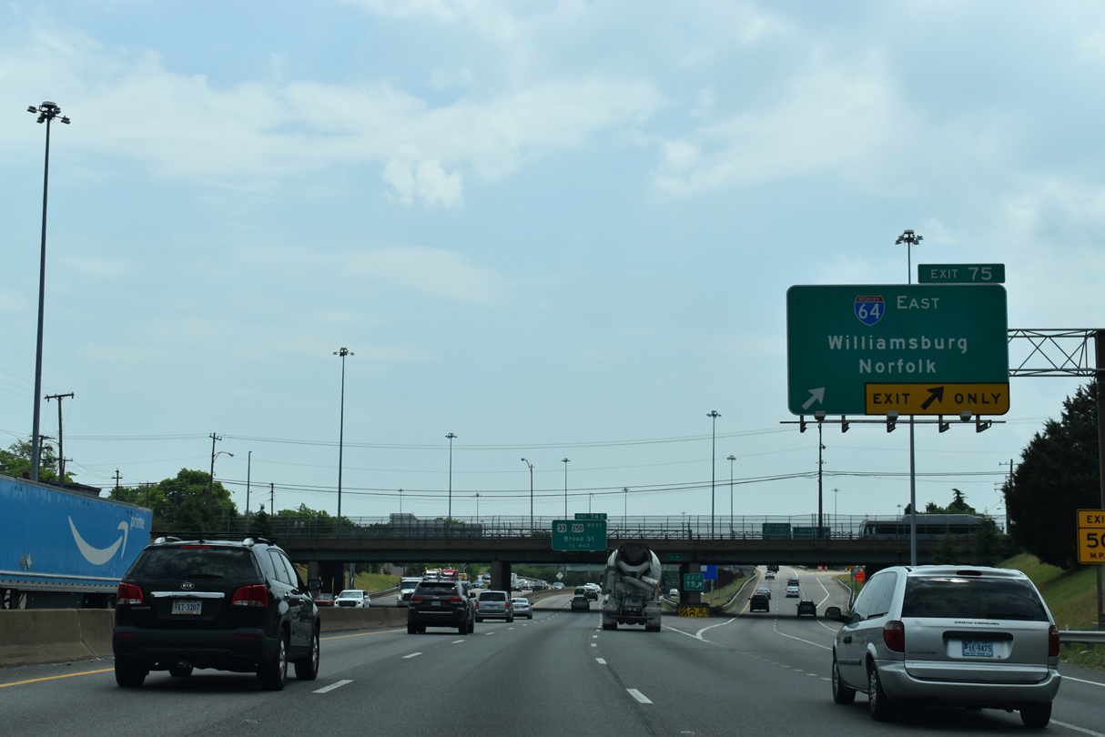
| I-64 parts ways with I-95 south at a directional T interchange (Exit 75) a half mile east of U.S. 1/301. Beyond Richmond, Interstate 64 angles southeasterly toward Williamsburg, Jamestown, Norfolk and Virginia Beach. 05/28/21 |
|
| The easternmost extent of Interstate 64 runs through the city of Virginia Beach. I-64 travels 94 miles from I-95 to I-264, which extends east toward the Atlantic beaches. 05/28/21 |
|
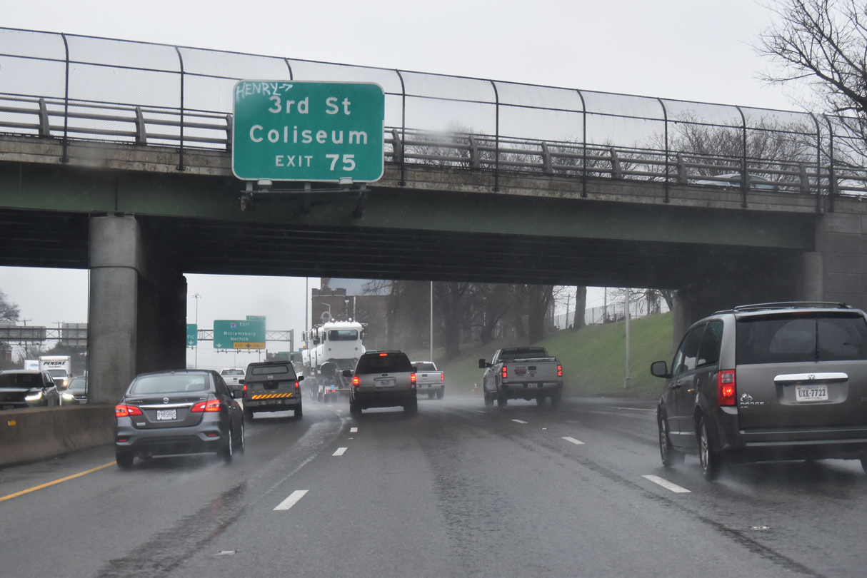
| A ramp from Exit 75 connects I-64/95 with Third Street one block north of SR 33 (Leigh Street) by the Greater Richmond Convention Center and the Richmond Coliseum. 01/04/19 |
|
| Interstate 64 arcs northeast from I-95 to Highland Park in Richmond before resuming an eastward course to Richmond international Airport (RIC) and I-295 beyond Sandston. 05/28/21 |
|
| Interstate 64 arcs northeast from Interstate 95 via Exit 75 to Central Gardens and Oak Hill before resuming an eastward course to Highland Springs and Interstate 295 east of Seven Pines. 05/28/21 |
|
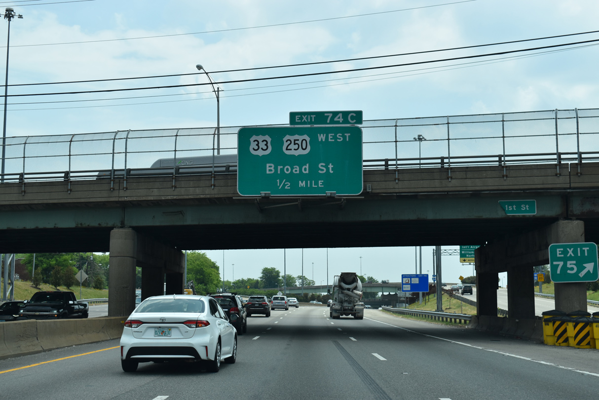
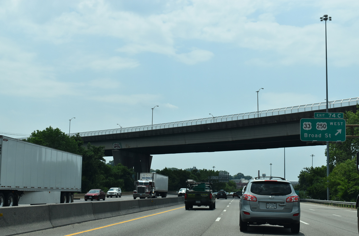
| Curving south along the Biotech and MCV District, I-95 meets U.S. 250 (Broad Street) westbound in 1.25 miles. Overheads for Exit 74C incorrectly reference U.S. 33, which ends 1.5 miles to the northwest along Broad Street at Hancock/Harrison Streets. 01/04/19 |
|
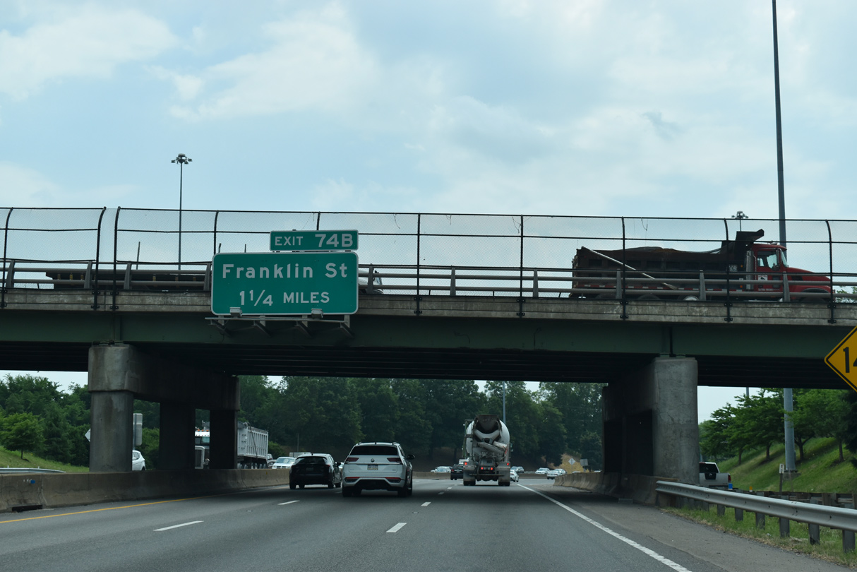
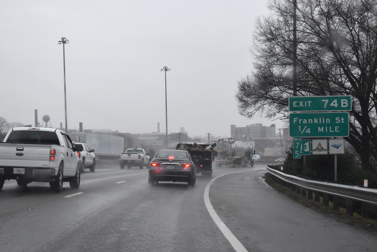
| Exit 74B follows U.S. 250 (Broad Street) from I-95 south to Franklin Street at 15th Street in Downtown Richmond. 01/04/19 |
|
| Exit 74C leaves I-95 south for U.S. 250 (Broad Street) west to the Virginia State Capitol, Richmond City Hall and the MCV Campus of Virginia Commonwealth University. U.S. 250 originates at Broad and 23rd Streets in the Church Hill neighborhood. 01/04/19 |
|
| Exit 74B to Franklin Street departs a quarter mile south of the trumpet interchange with U.S. 250 (Broad Street). 01/04/19 |
|
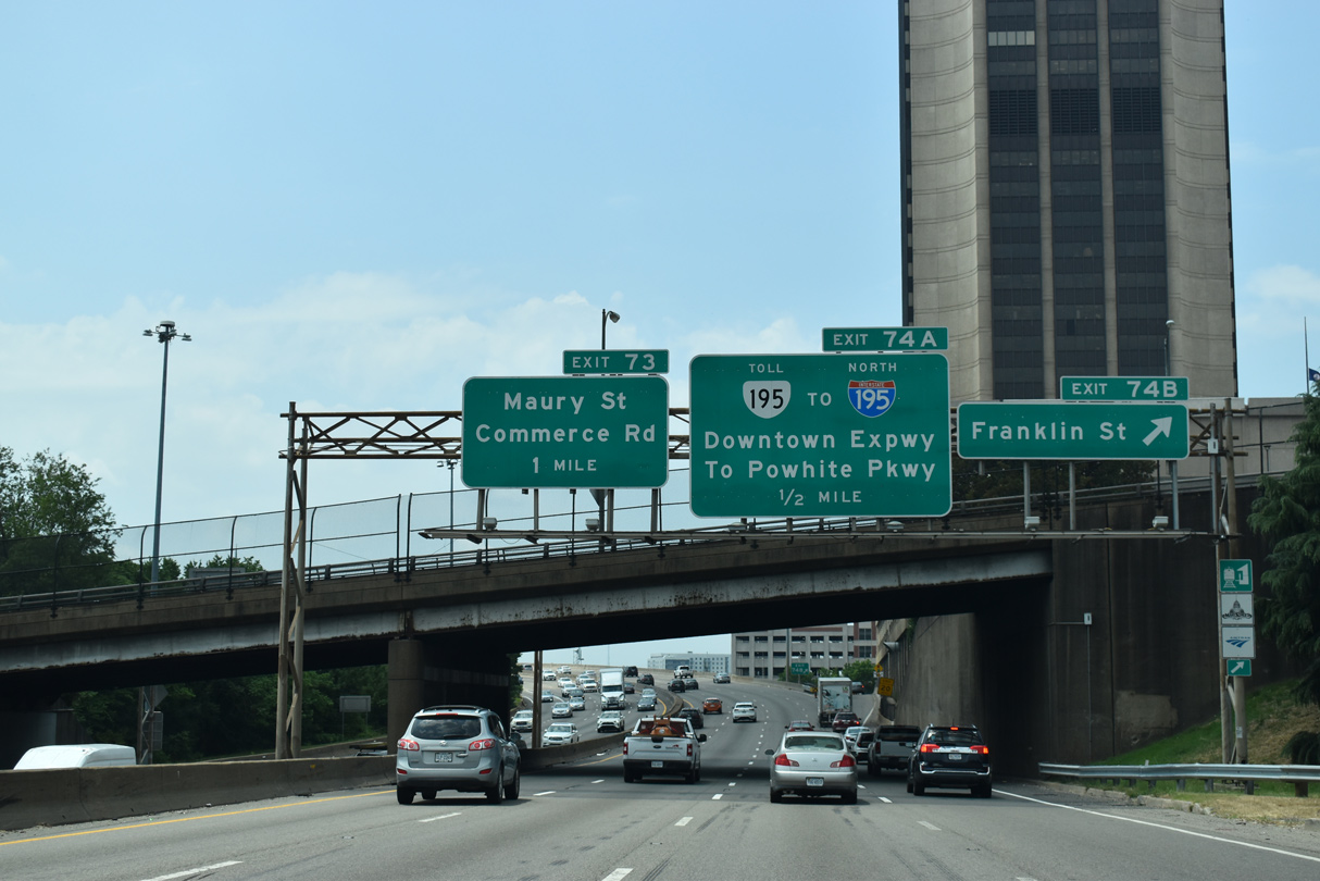
| The Virginia State Capitol lies two blocks west of Exit 74B along Bank Street. SR 195 (Downtown Expressway) runs four blocks south of the capitol through a tunnel at Kanawha Plaza. 01/04/19 |
|
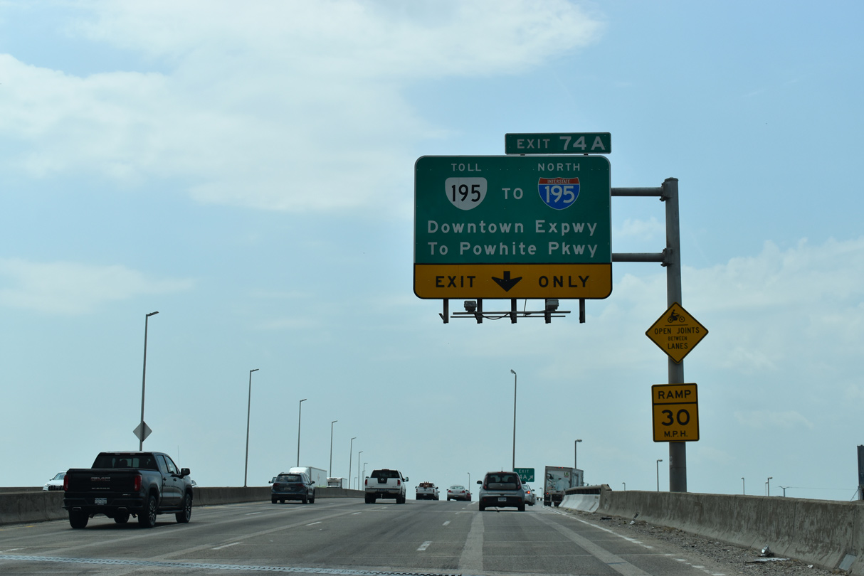
| Interstate 95 (Richmond-Petersburg Turnpike) ascends onto a high level bridge across the James River through the directional T interchange (Exit 74A) with the Downtown Expressway. SR 195 travels 3.12 miles west to the Powhite Parkway (SR 146) south and I-195 north at the Stadium District. 01/04/19 |
|
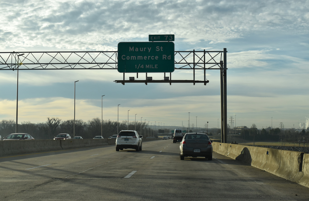
| Interstate 95 lowers from the James River bridge into a trumpet interchange (Exit 73) for Maury Street. The access road at Exit 73 links with 4th and Maury Streets, four blocks east of U.S. 360 (Hull Street). 12/30/20 |
|
| Exit 73 parts ways for Maury Street and the at Old Town Manchester neighborhood. Maury Street connects with Commerce Road (SR 926), an arterial leading south through industrial areas alongside Interstate 95. 12/30/20 |
|
| I-95 confirming marker posted south after the entrance ramp from 4th and Maury Streets. 12/30/20 |
|
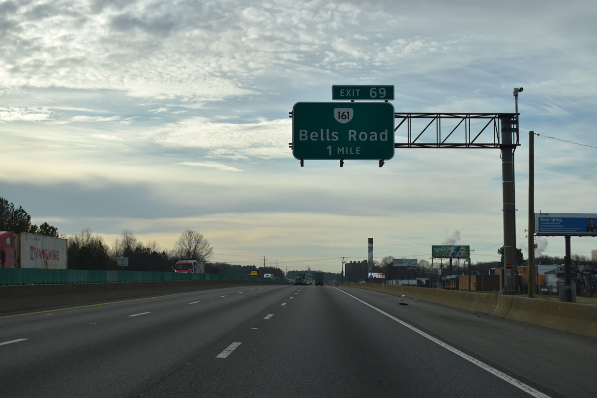
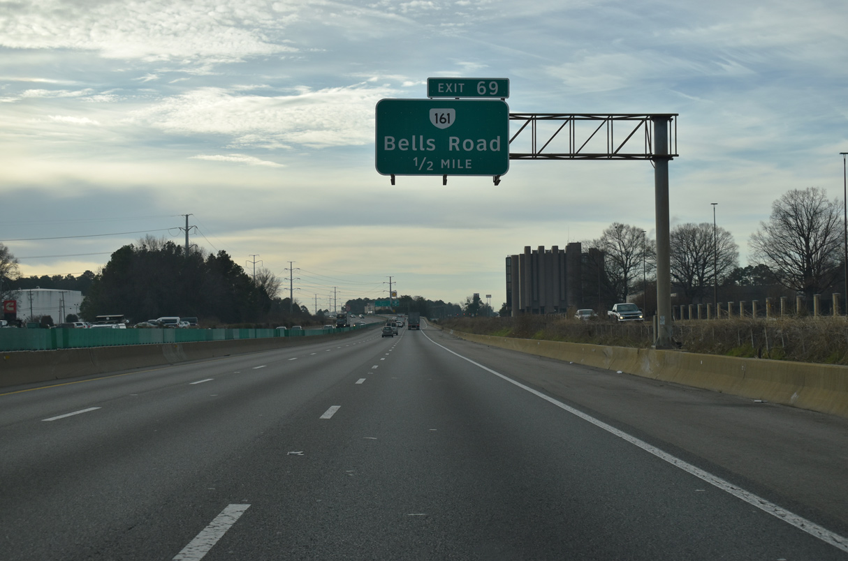
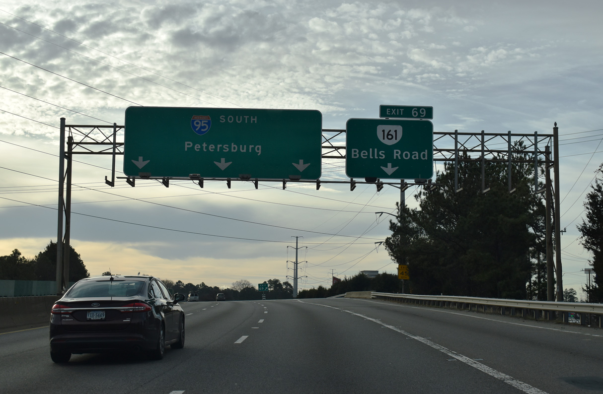
| The last interchange within the city of Richmond on I-95 south joins the Richmond-Peterburg Turnpike with the south end of SR 161 at Commerce Road and Walmsley Boulevard. 12/30/20 |
|
| SR 161 dog legs north along Commerce Road to Bells Road west by the Philip Morris USA plant to Clopton. The state route met I-95 previously at Exit 78 and 80 (northbound). 12/30/20 |
|
| Entering the trumpet interchange (Exit 69) for SR 161 (Commerce Road) north to McGuire Veterans Medical Center and the Port of Richmond. 12/30/20 |
|
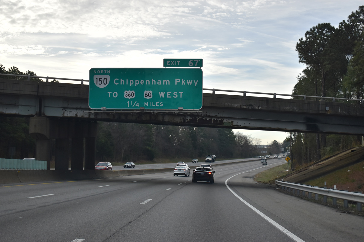
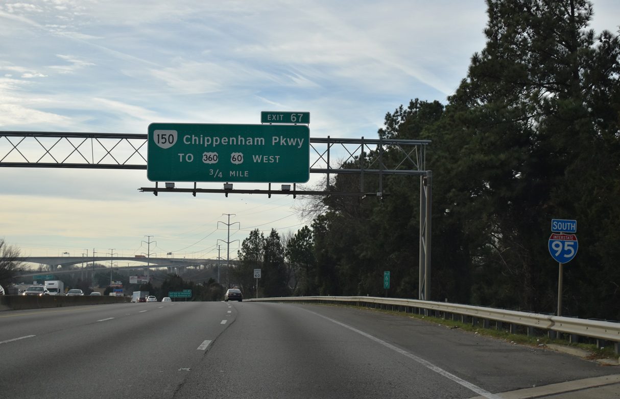
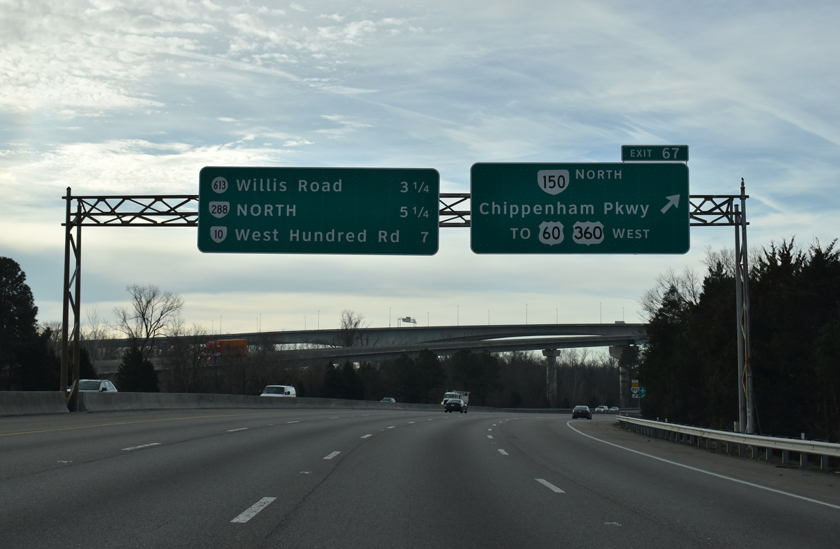
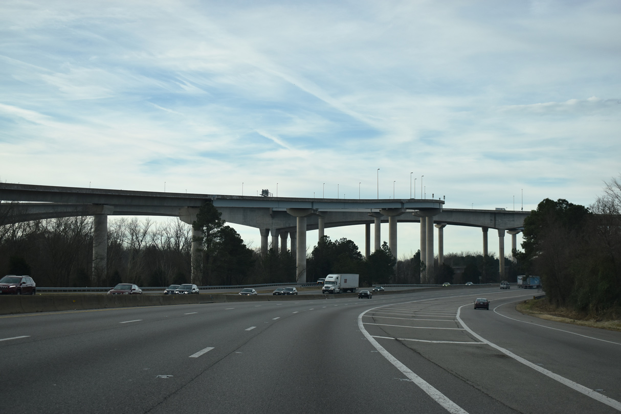
| Continuing south, Interstate 95 next meets SR 150 (Chippenham Parkway) north (Exit 150). 12/30/20 |
|
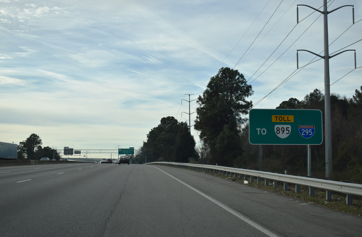
| The ramp from I-95 south to SR 895 (Pochahontas Parkway) east was cut from original construction of the systems interchange between the two and Chippenham Parkway to reduce costs. 12/30/20 |
|
| SR 150 constitutes a 14.17 mile long route north from I-95/SR 895 (Pochahontas Parkway) to Parham Road at River Road in Tuckahoe. Chippenham Parkway is a freeway encircling south Richmond to Forest Hill Avenue (SR 683) near Gravel Hill and Oxford. 12/30/20 |
|
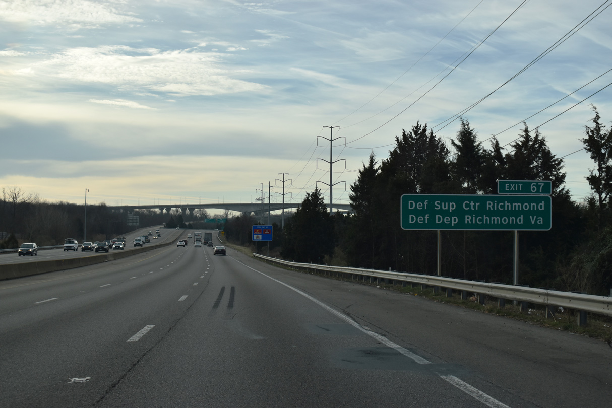
| SR 150 (Chippenham Parkway) west to U.S. 1/301 south leads to Bellwood and the US Defense Supply Center Richmond (DSCR). 12/30/20 |
|
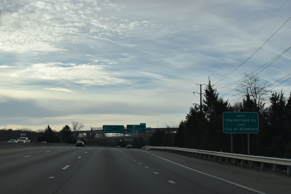
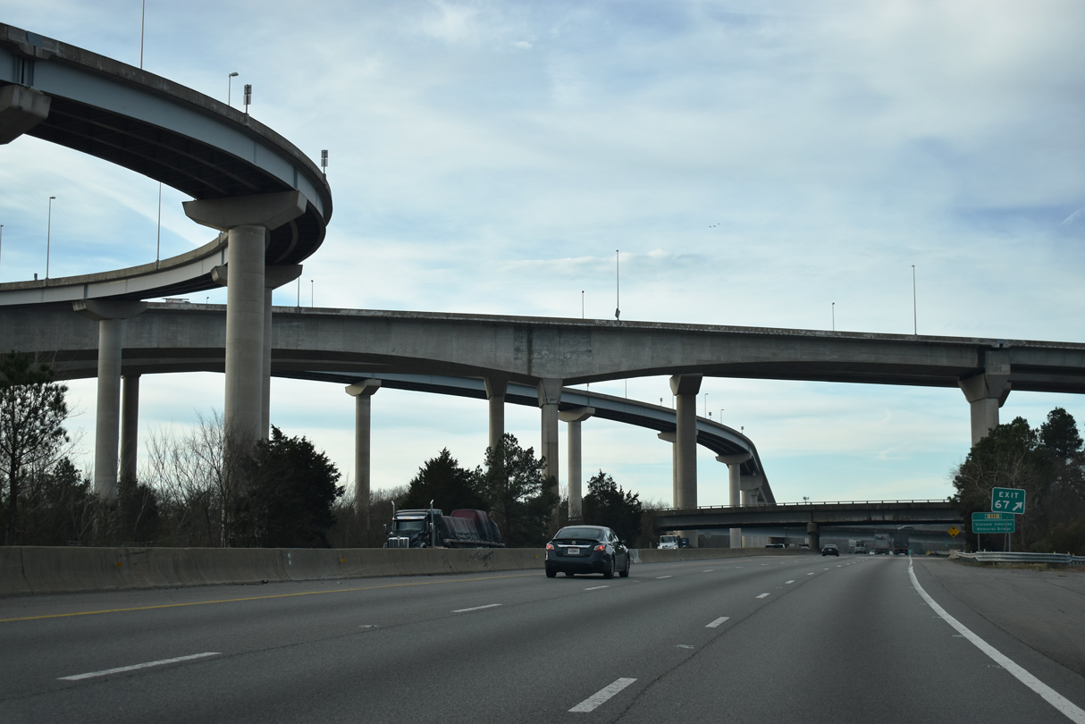
| Paralleling the James River, Interstate 95 crosses into Chesterfield County just ahead of the gore point for Exit 67. 12/30/20 |
|
| SR 150 (Chippenham Parkway) serves commuters to Midlothian and other Chesterfield County suburbs with connections at U.S. 360 (Hull Street Road), U.S. 60 (Midlothian Turnpike) and SR 76 (Powhite Parkway). 12/30/20 |
|
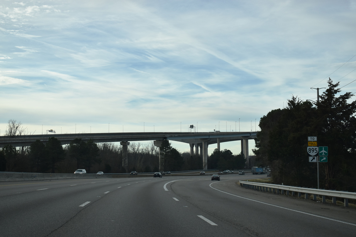
| SR 150 (Chippenham Parkway) transitions into SR 895 (Pochontas Parkway), a toll road extending 7.62 miles east to Interstate 295, within the four level interchange at I-95. 12/30/20 |
|
| Pochontas Parkway was completed east to I-295 in September 2002. 12/30/20 |
|
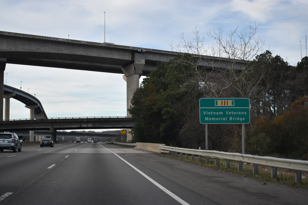
| The high level bridge taking SR 895 (Pochontas Parkway) across the James River is the Vietnam Veterans Memorial Bridge. 12/30/20 |
|
| Interstate 95 crosses Falling Creek south from the exchange with SR 150/895. 12/30/20 |
|
| I-95 runs between the CSX Railroad and the James River over the ensuing stretch. 12/30/20 |
|
| The Drewry's Bluff / Fort Darling Unit of Richmond National Battlefield Park lies north of Bellwood Road (SR 656) and east of I-95 along the James River. 12/30/20 |
|
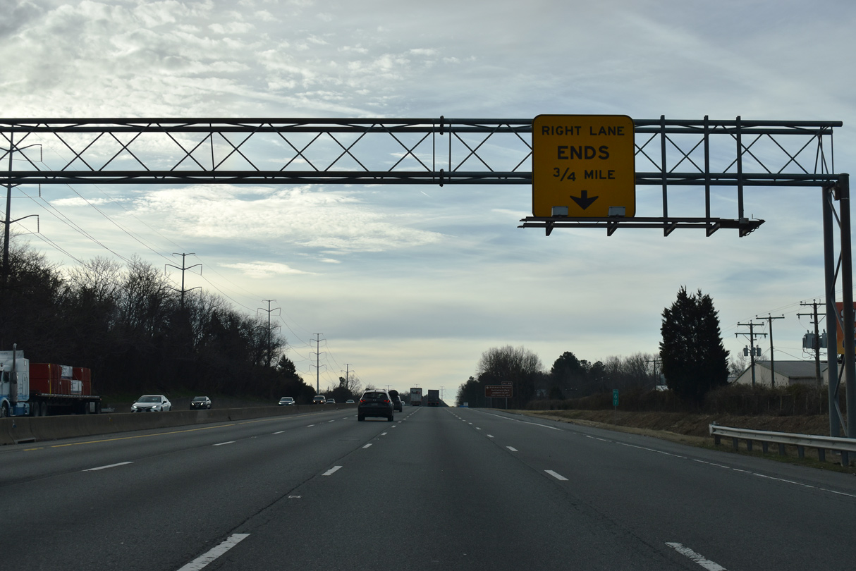
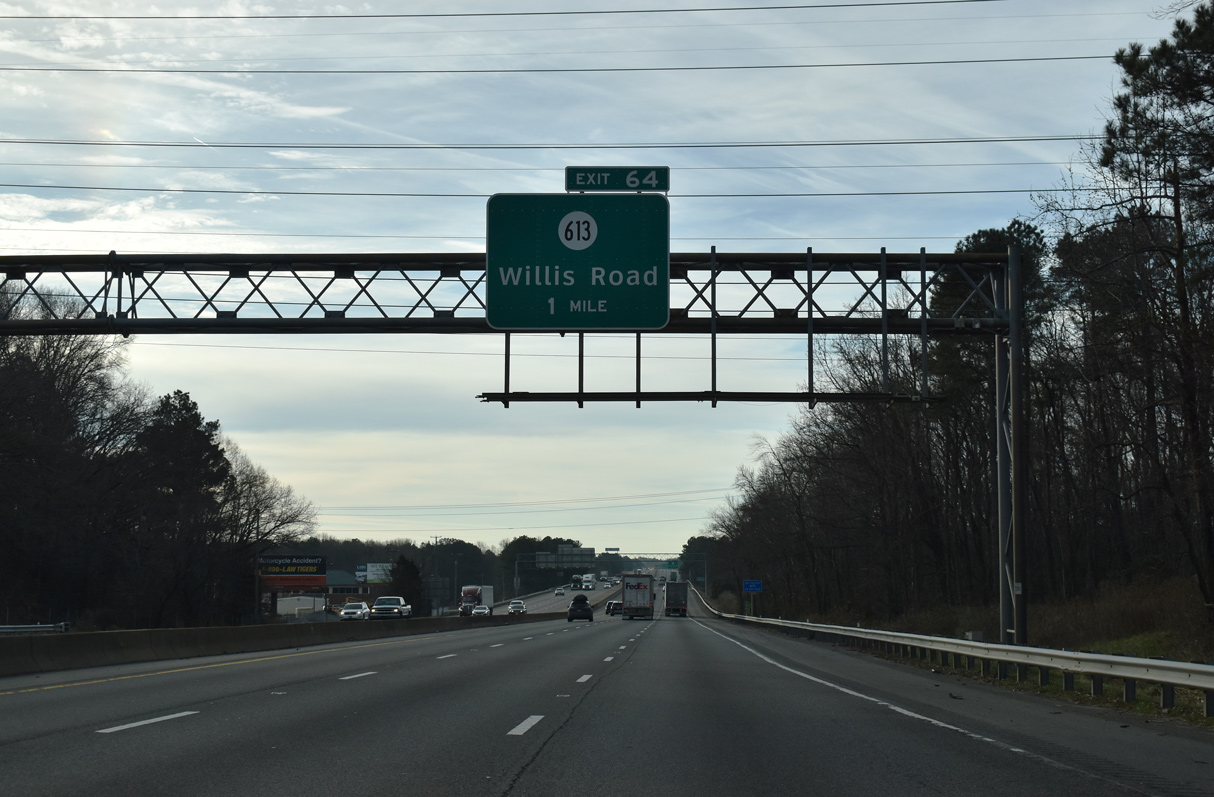
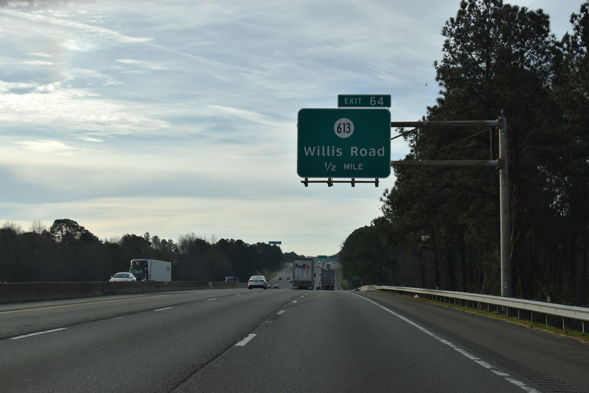
| A lane drop precedes the diamond interchange (Exit 64) with SR 613 (Willis Road). 12/30/20 |
|
| Willis Road spurs east from U.S. 1/301 (Jefferson Davis Highway) to the Bellwood Manor community and industrial businesses along Kingsland Creek and the James River. 12/30/20 |
|
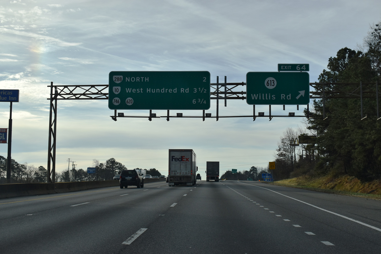
| Exit 64 leaves I-95 south for SR 613 (Willis Road). 12/30/20 |
|
| Reassurance marker posted ahead of the SR 608 (Reymet Road) underpass. 01/01/17 |
|
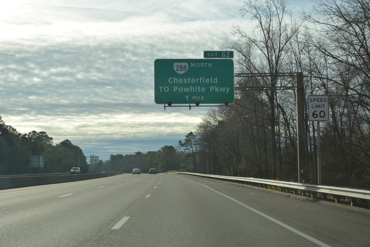
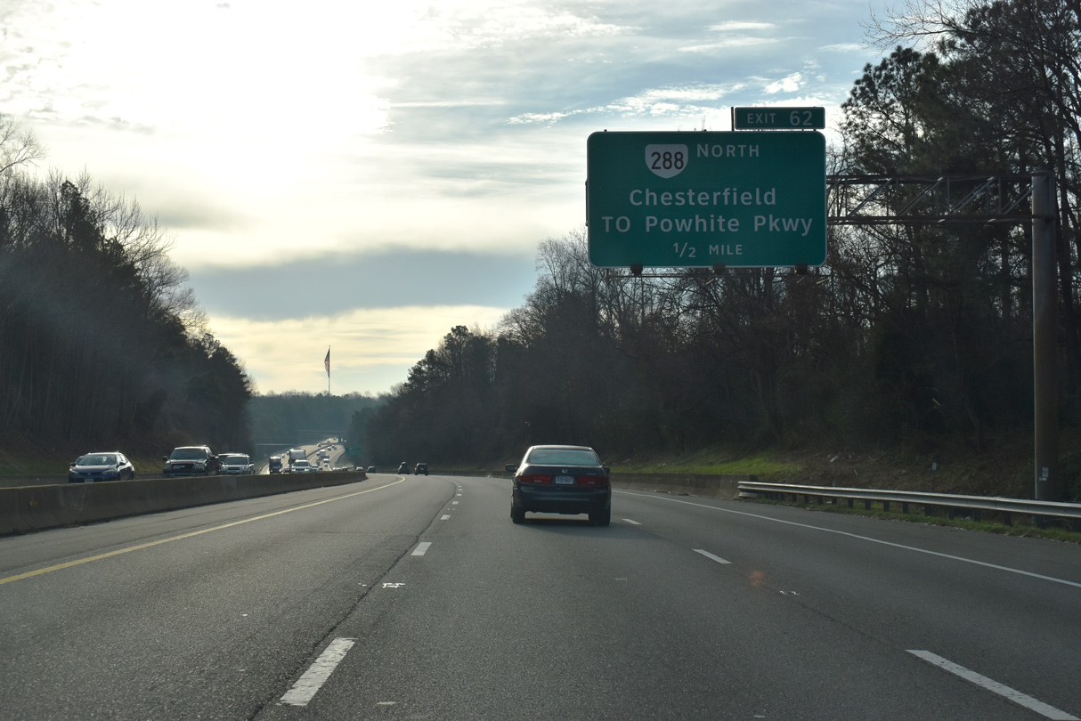
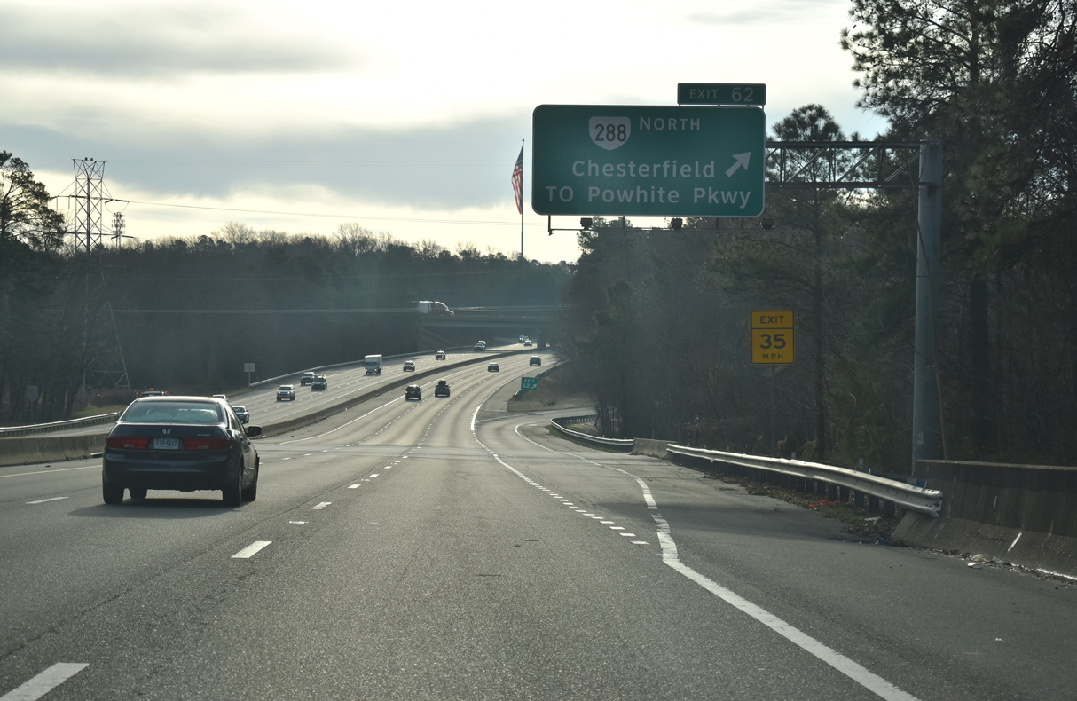
| SR 288 is a commuter freeway and western bypass of Richmond northwest from Exit 62 to Interstate 64 in Goochland County. 01/01/17 |
|
| Virginia Route 288 was constructed in stages from 1998 to 2004. The last segment opened to traffic on November 19, 2004. 12/30/20 |
|
| The 32.56 mile route of SR 288 concludes at a trumpet interchange (Exit 62) with Interstate 95 east of Chesterfield. 12/30/20 |
Page Updated 08-12-2021.

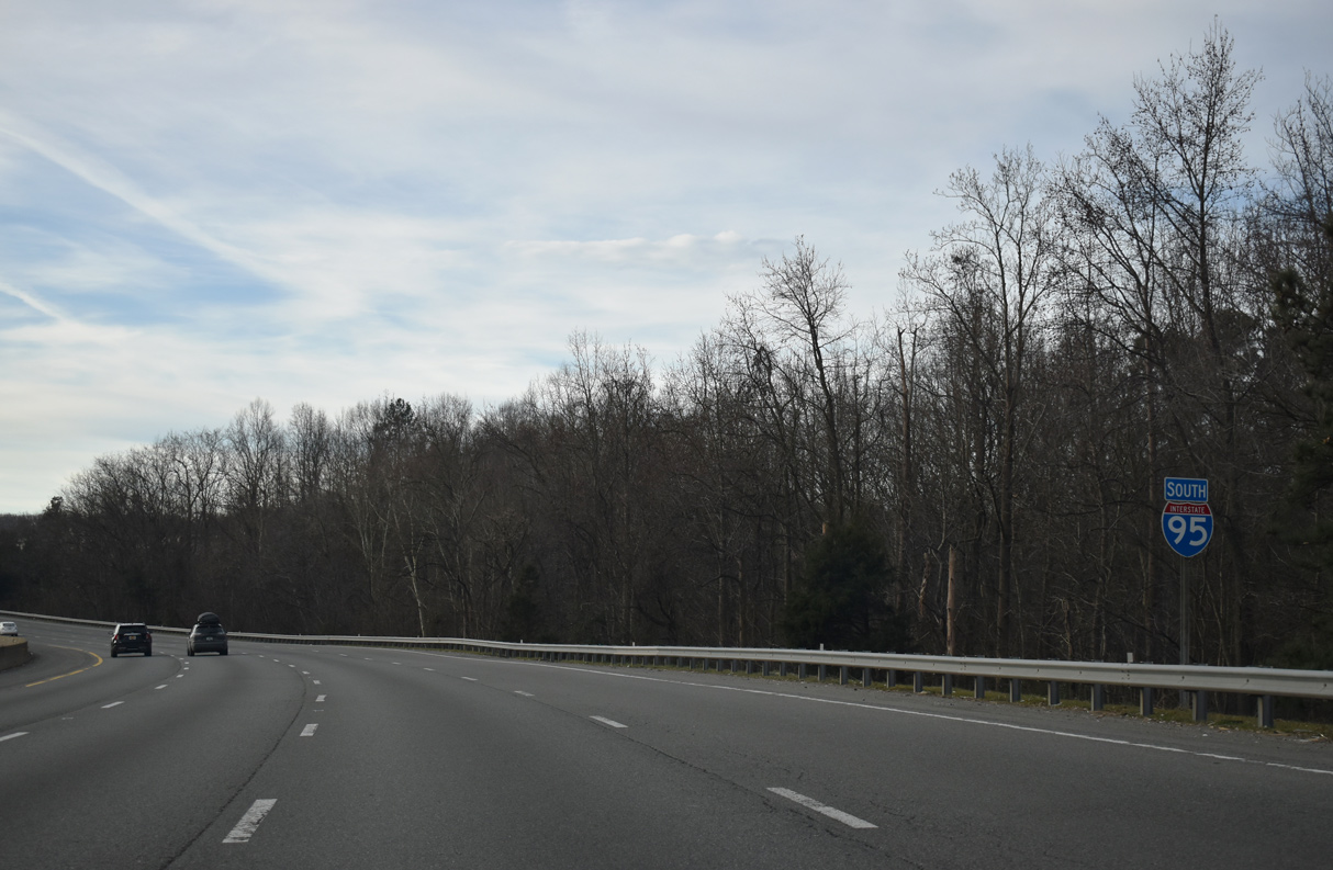
 South
South


 East
East