|
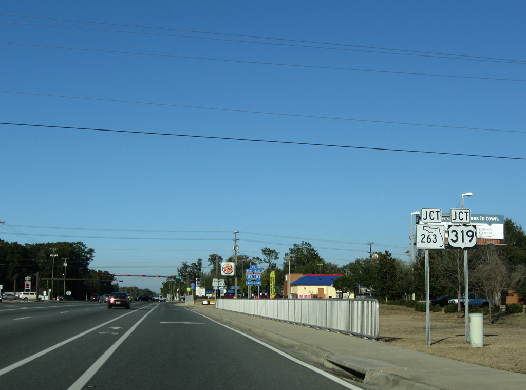
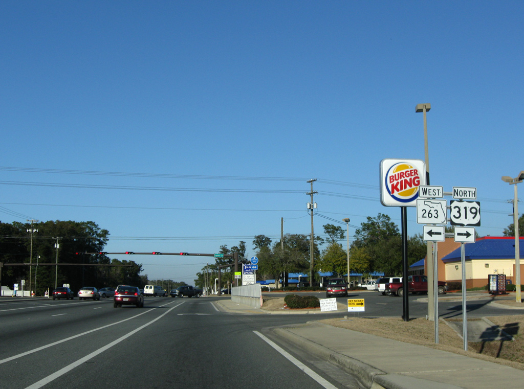
| Converging within Apalachicola National Forest, U.S. 319/SR 61 north expand into a four lane divided highway to SR 263 (Capital Circle SW). U.S. 319 turns east onto Capital Circle along the south side of Tallahassee while SR 61 remains northeast along Crawfordville Road toward the city center. 01/15/11 |
|
| SR 263 encircles the west side of Tallahassee northward to U.S. 27 near Lake Jackson. Capital Circle varies with two rural lanes by Tallahassee International Airport (TLH) to a six lane commercial arterial between U.S. 90 and I-10 at Exit 196. 01/15/11 |
|
| Crawfordville Road extends northward from the split with U.S. 319 (Capital Circle SW) as a four lane arterial by a number of low density subdivisions and a few strip malls. 11/20/14 |
|
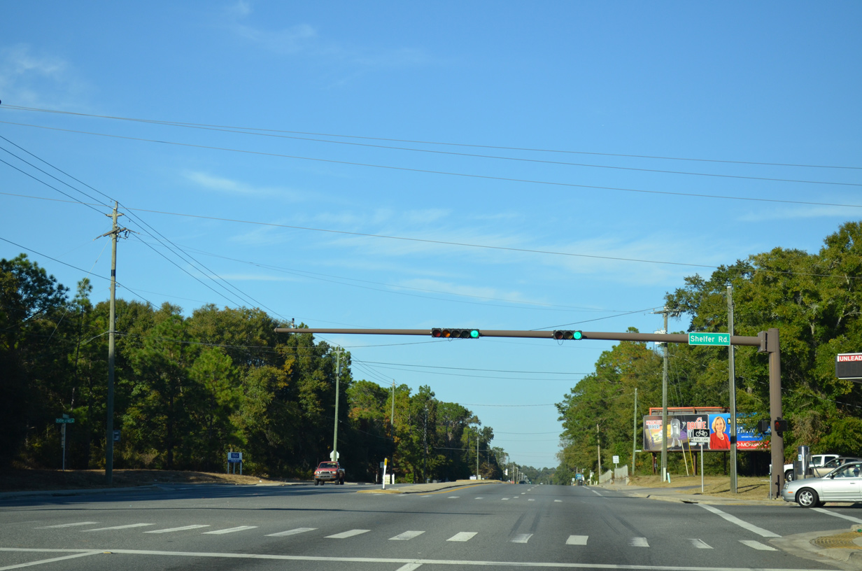
| Shelfer Road forms an arc east and south from SR 61 (Crawfordville Road) to U.S. 319 (Capital Circle SW) by several apartment buildings and Oak Ridge Elementary School. 11/20/14 |
|
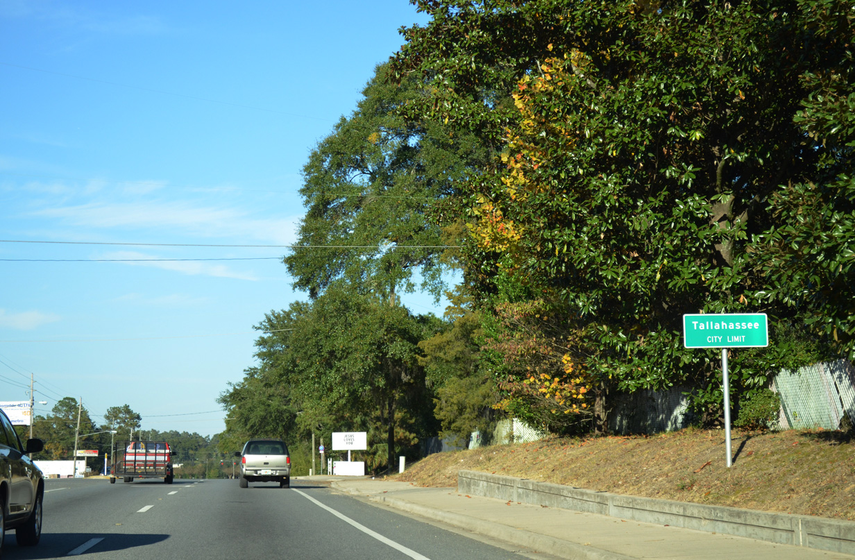
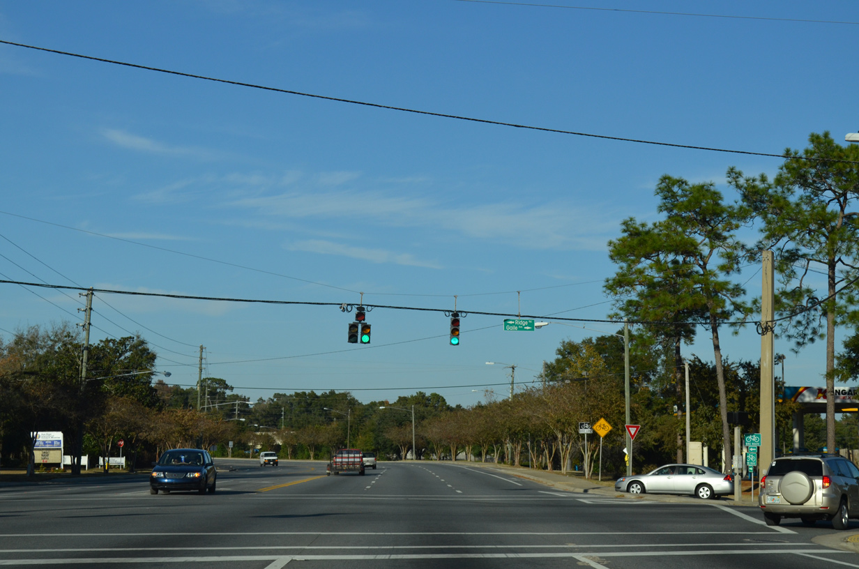
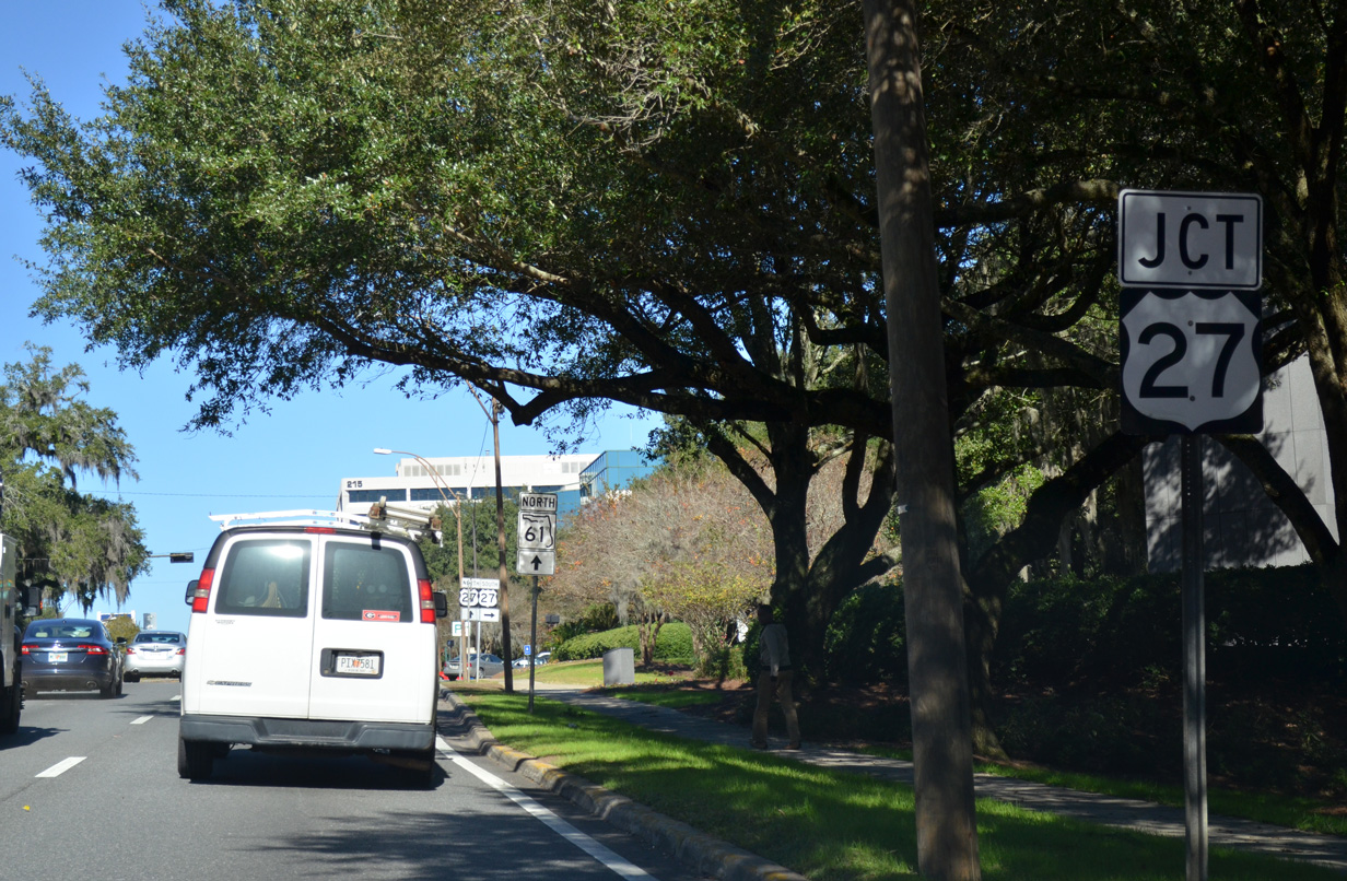
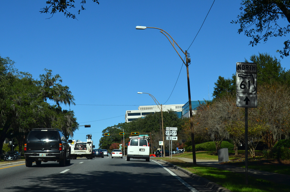
| State Road 61 travels across outlying sections of the capital city limits before fully entering Tallahassee north of Patty Lynn Drive. 11/20/14 |
|
| Ridge Road arcs south and east from Springsax Road near CR 2203 (Springhill Road) to become Gaile Avenue east at SR 61 (Crawfordville Road). Gaile Avenue between SR 61 and adjacent SR 363 (Woodville Highway) constitutes the 0.103 mile long unsigned State Road 61A. 11/20/14 |
|
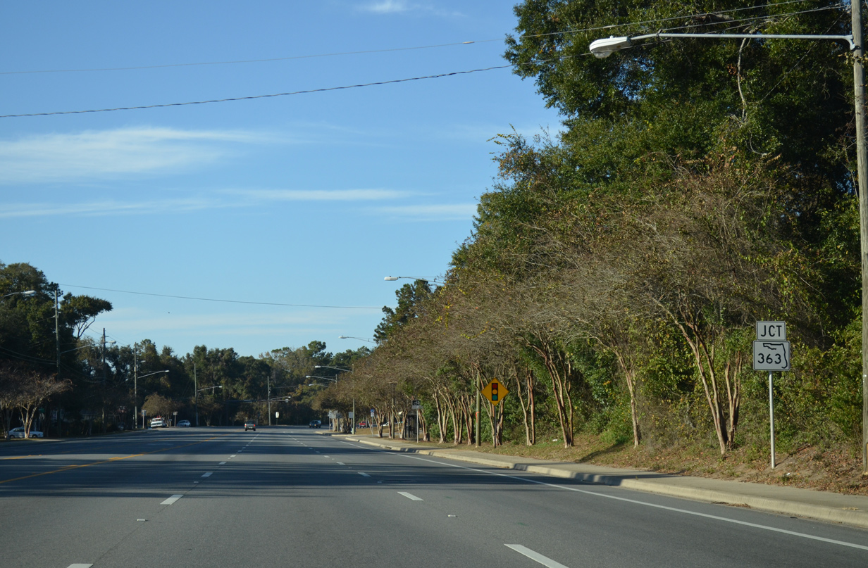
| Bending westward, Crawfordville Road becomes Adams Street ahead of the SR 61 turn onto Paul Russell Road at SR 363. 11/20/14 |
|
| SR 363 over takes Adams Street north from SR 61 for Florida A & M University and the west side of the State Capitol complex. SR 363 south combines with SR 61 north to make the connection to parallel Woodville Highway south. 11/20/14 |
|
| Northbound reassurance marker posted for SR 61 along South Monroe Street after Orange Avenue (SR 373 west / CR 373 east). 07/19/07 |
|
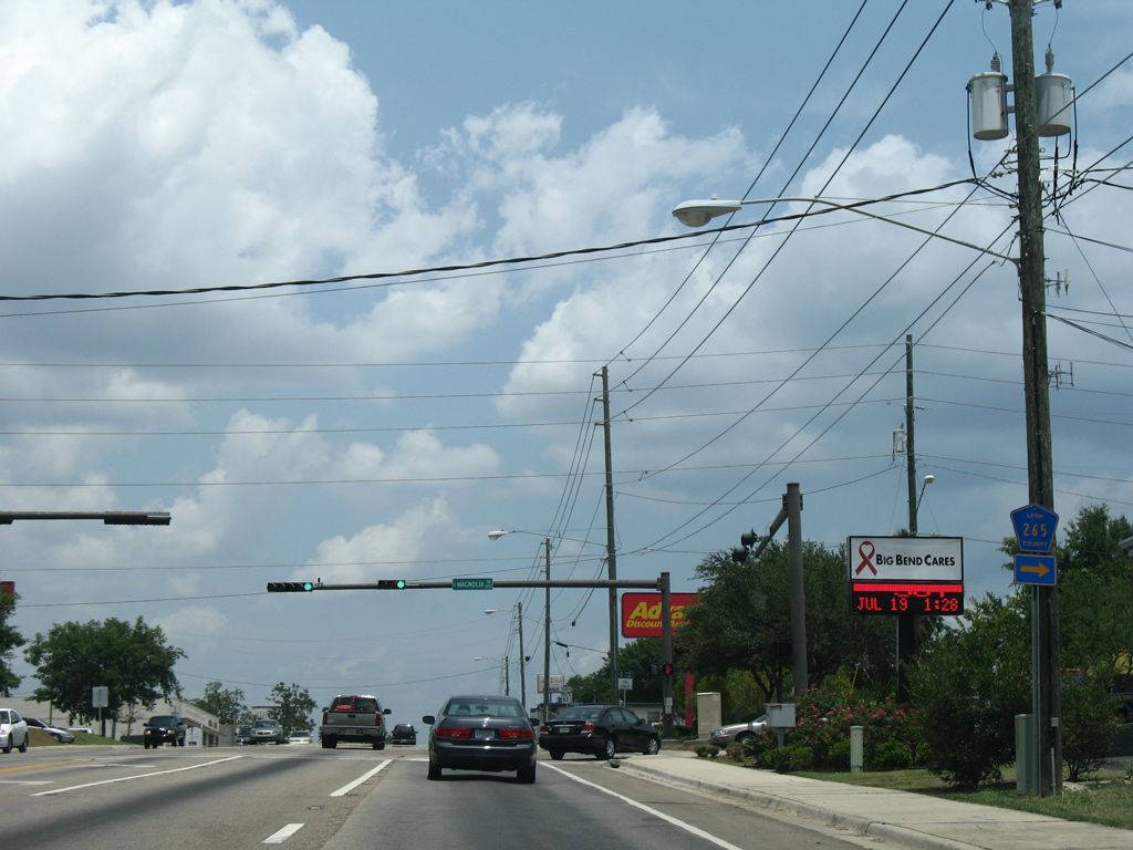
| S Monroe Street crests to an elevation of 150 feet above sea level as SR 61 enters the intersection with Magnolia Drive east and Palmetto Street west. 07/19/07 |
|
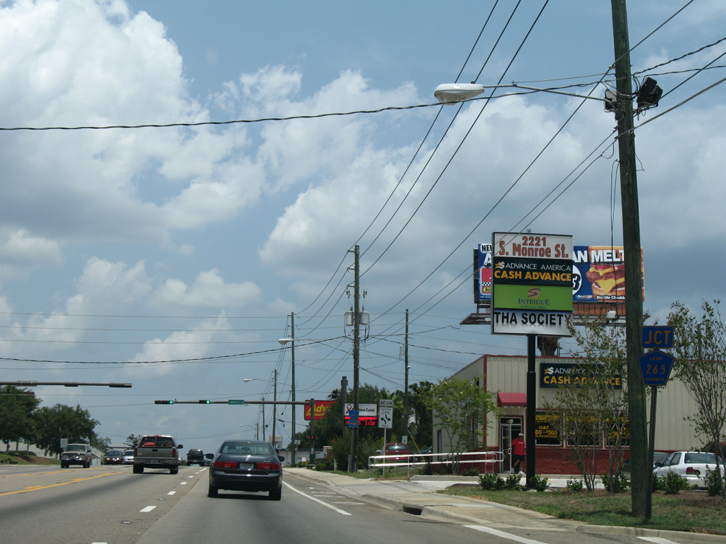
| Magnolia Drive east to Country Club Park and Indianhead Acres and north to U.S. 27 (Apalachee Parkway) near Governor's Square Mall is CR 265. The two lane roadway widens into a commercial arterial beyond U.S. 27 as part of SR 265 north to Tallahassee Memorial Hospital. 07/19/07 |
|
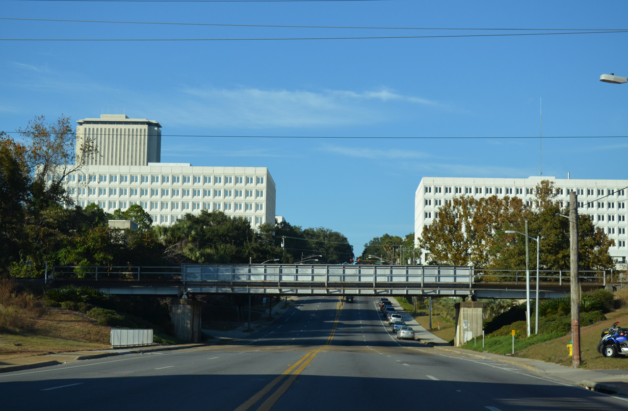
| SR 61 (S Monroe Street) climbs again beyond this CSX Railroad bridge to enter the Tallahassee central business district. 11/20/14 |
|
| Gaines Street east three blocks to Meridian Street north at Cascade Park doubles as the 0.40 mile long County Road 1555. CR 1555 transitions there to CR 2196 (Lafayette Street) east parallel to U.S. 27 (Apalachee Parkway). 11/20/14 |
|
| West from SR 61 (S Monroe Street), Gaines Street heads toward Doak Campbell Stadium on the FSU Campus along the former east leg of SR 371. This section of SR 371 was turned over to the city and redesigned with pedestrian enhancements. Ensuing development along Gaines Street included the construction of several upscale apartment buildings and the addition of artwork within the roundabout built at Woodward Street. 11/20/14 |
|
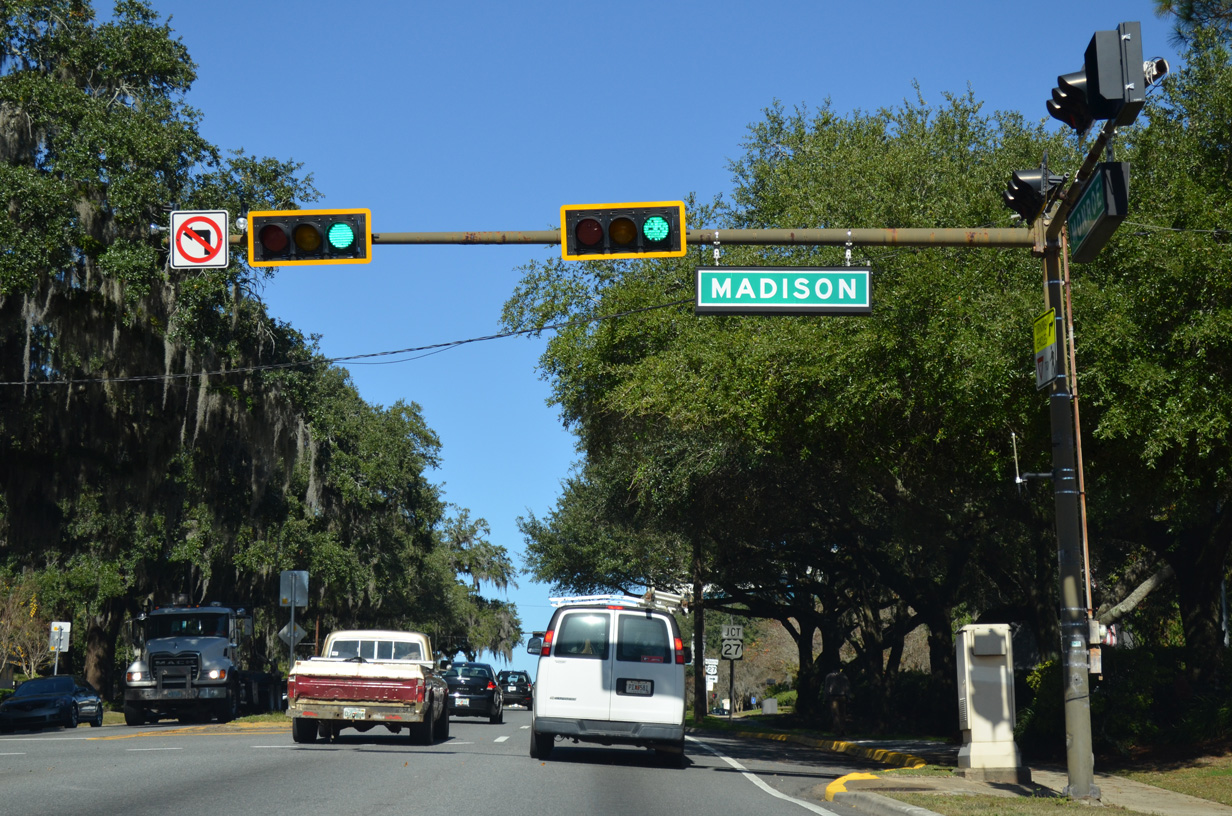
| Madison Street flows east into SR 61 (Monroe Street) at the next block north. Madison Street represents the former eastern extent of SR 366, which utilized a couplet between FSU and SR 61 on St. Augustine / Madison Street east and Jefferson / Pensacola Street west. 11/26/14 |
|
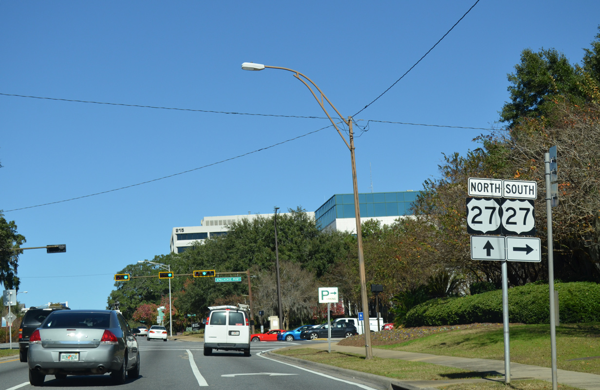
| The Florida State Capitol lines the west side of SR 61 from Madison Street north to Jefferson Street. U.S. 27 ties into Monroe Street on this stretch from Apalachee Parkway 11/26/14 |
|
| U.S. 27/SR 61 overlap 0.39 miles northward along Monroe Street. 11/26/14 |
|
| Apalachee Parkway stems east from Monroe Street as a four lane boulevard and arterial to Governor's Square Mall and Lafayette to exit the Tallahassee area at Chaires Crossing. The US route doubles as unsigned State Road 20 to Gainesville. 11/26/14 |
|
| Jefferson Street and Pensacola Street west from U.S. 27/SR 61 (Monroe Street) were formerly of SR 366. SR 366 was truncated to Stadium Drive when Pensacola Street was demolished at Doak S. Campbell Stadium on the FSU campus. 11/26/14 |
|
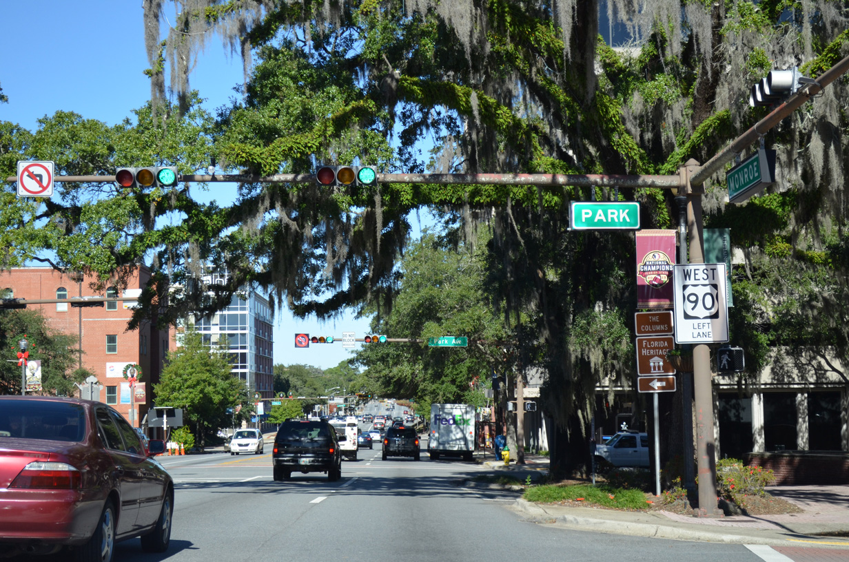
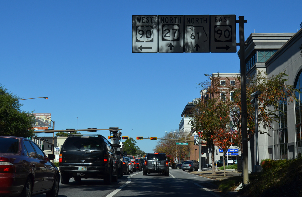
| Park Avenue forms a linear park west four blocks and east three blocks from Monroe Street. U.S. 27/SR 61 precede two blocks north to intersect U.S. 90 (Tennessee Street). 11/26/14 |
|
| U.S. 27/SR 61 (Monroe Street) north at U.S. 90 (Tennessee Street). U.S. 90 west leads to the campus of Florida State University (FSU) and Midway. Beyond the eastern Tallahassee suburbs, U.S. 90 continues to Monticello. 11/26/14 |
|
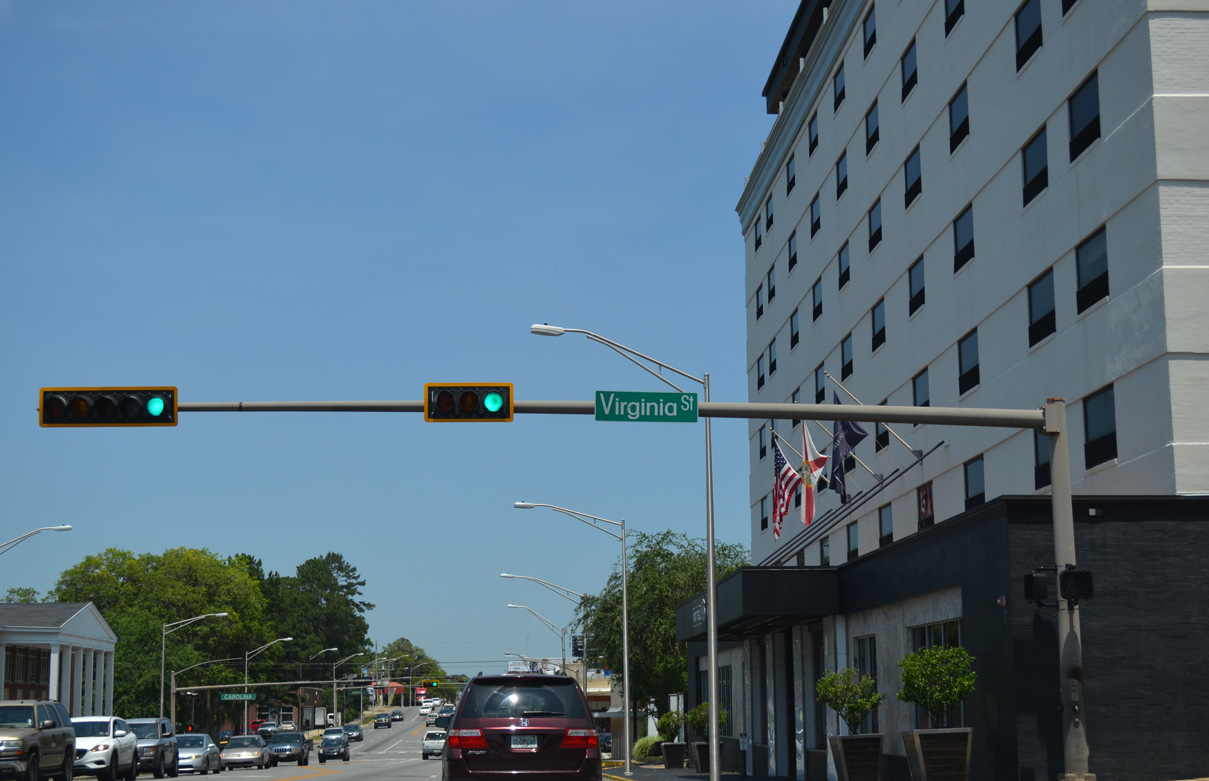
| U.S. 27/SR 61 (Monroe Street) north at Virginia Street. 05/07/15 |
|
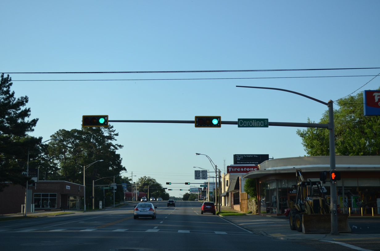
| Carolina Street leads west to Carter - Howell - Strong Park and east to N Meridian Street. 05/07/15 |
|
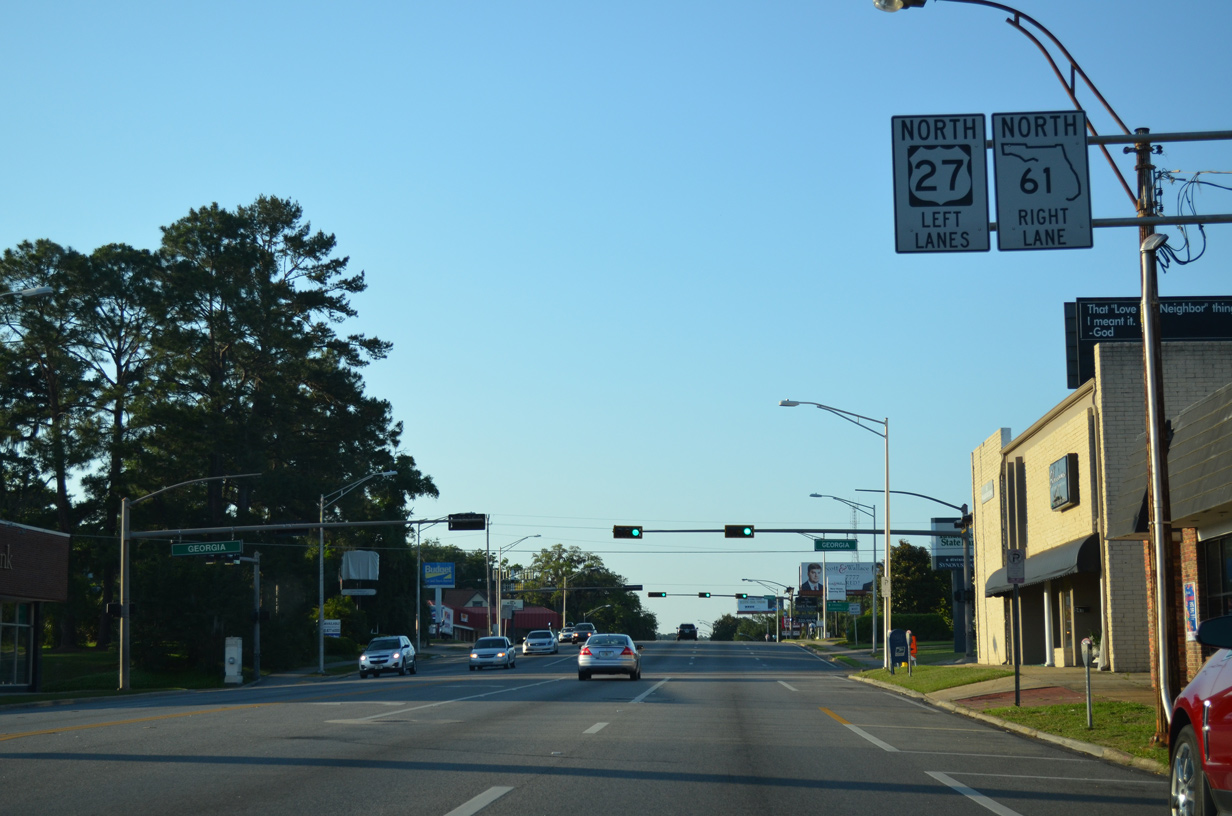
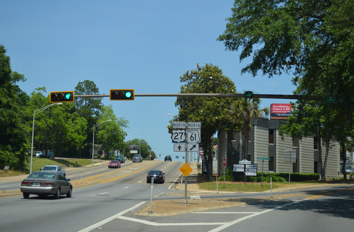
| Monroe Street northbound expands to three lanes from Georgia Street to the separation of U.S. 27 and SR 61 at Thomasville Road. 05/07/15 |
|
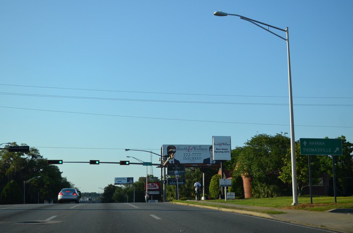
| U.S. 27 remains along Monroe Street northwest through Tallahassee to Lake Jackson. Continuing into Gadsden County, U.S. 27 heads to the town of Havana and into the Peach State ahead of Attapulgus. 05/07/15 |
|
| Betton Road extends Bradford Road east across SR 61 (Thomasville Road) to Winthrop Park, the Betton Hill community and Leon County Road 151 (Centerville Road). Bradford Road west links SR 61 with U.S. 27 at Martin Luther King, Jr. Boulevard. 12/03/10 |
|
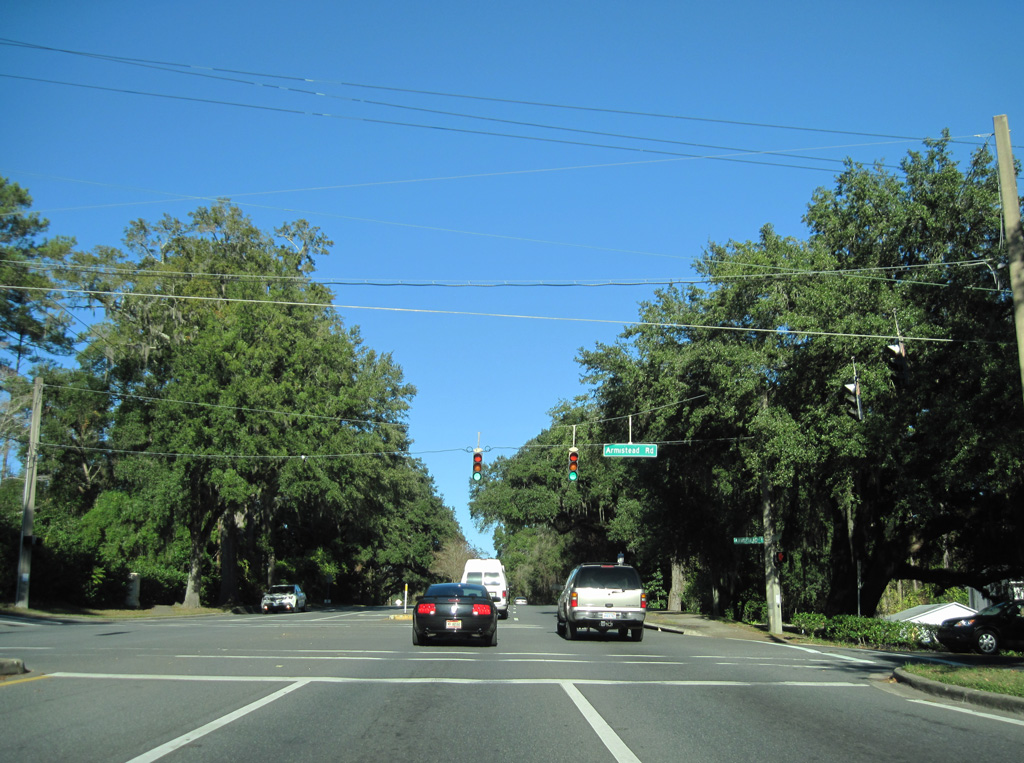
| Armistead Road arcs east from SR 61 through the Betton Hills community by Guyte P. McCord Park to Woodgate Way. 12/03/10 |
|
| Woodgate Way winds northward through the Woodgate subdivision to intersect SR 61 (Thomasville Road) at the suceeding northbound signal. 12/03/10 |
|
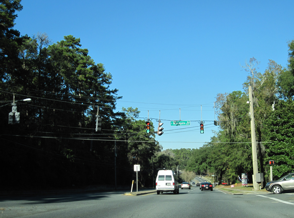
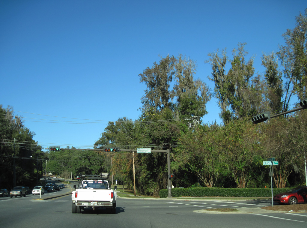
| Hermitage Boulevard constitutes a four lane parkway east to U.S. 319 (Capital Circle NE) opposite Eastgate Way. 12/03/10 |
|
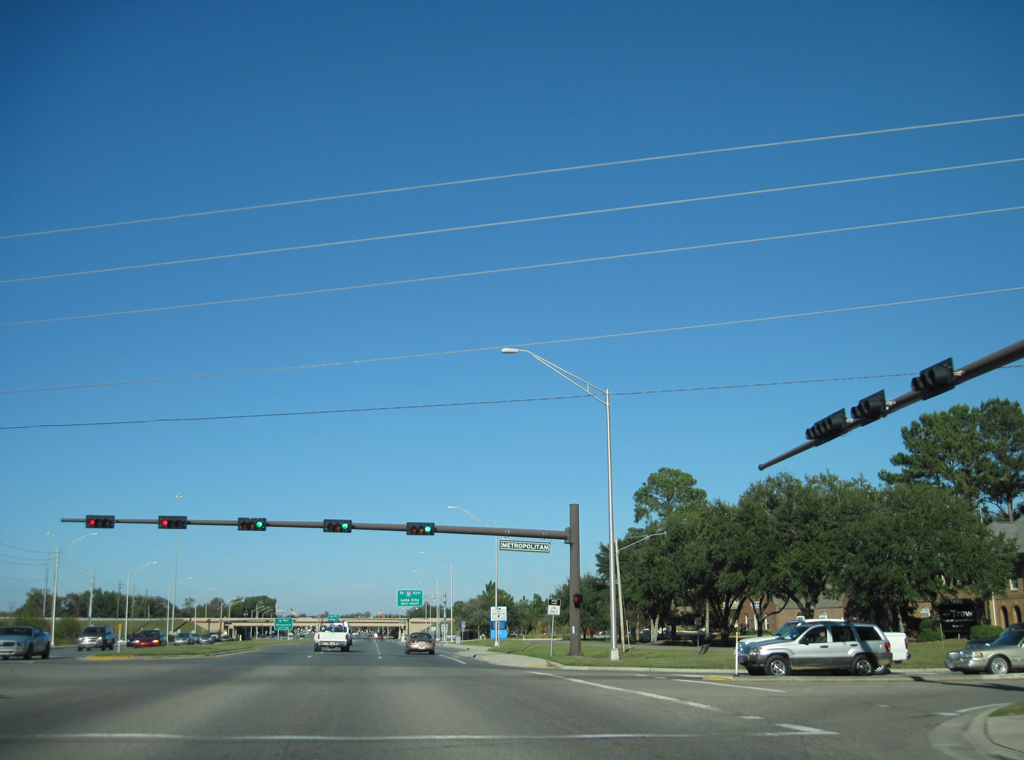
| SR 61 (Thomasville Road) north at Metropolitan Boulevard, a local road west to Metropolitan Corporate Center and east to Lonnbladh Road. 12/03/10 |
|
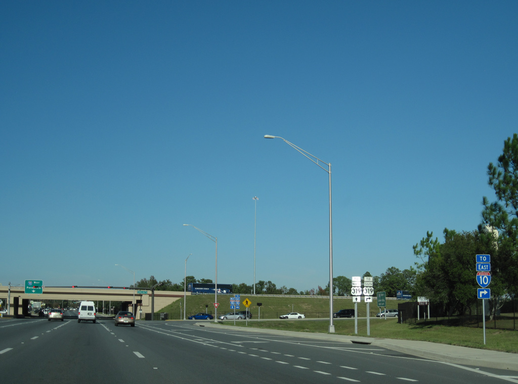
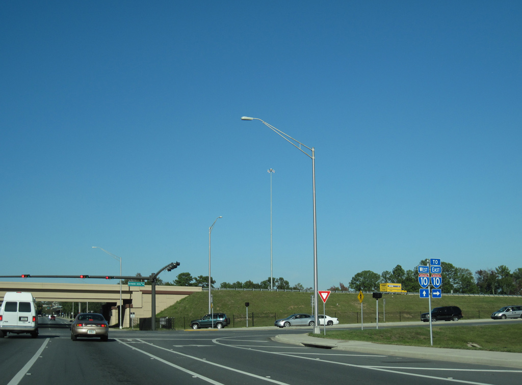
| SR 61 expands to seven lanes ahead of SR 162 (Raymond Diehl Road) east and the westbound entrance ramp to Interstate 10. 12/03/10 |
|
| SR 162 was designated during the 2006-08 construction to expand the exchange with I-10 to include new ramps with U.S. 319. The eastbound entrance ramp directly from SR 61 was relocated to tie into Raymond Diehl Road midway between Thomasville Road and U.S. 319 (Capital Circle NE). 12/03/10 |
|
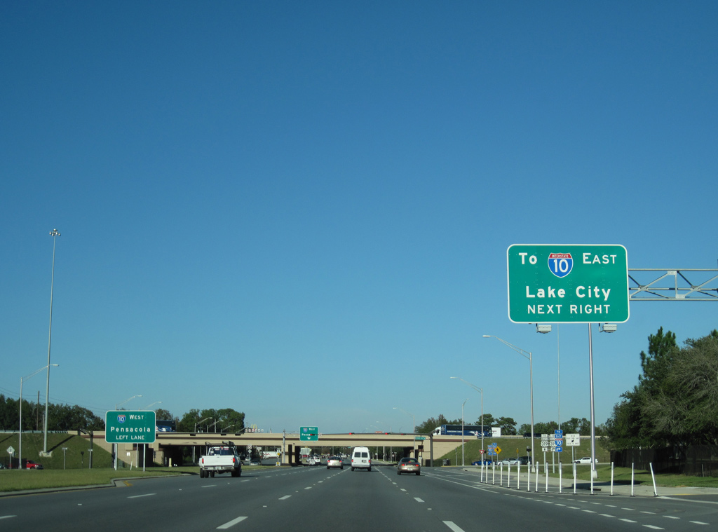
| Northbound at Raymond Diehl Road (SR 162) east to I-10 east to Lake City and Jacksonville. SR 162 measures just 0.292 miles along Raymond Diehl Road. 12/03/10 |
Page Updated 07-28-2023.


 North
North