|
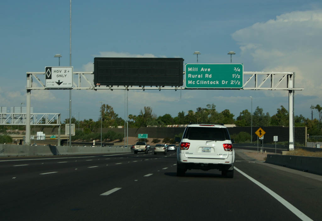
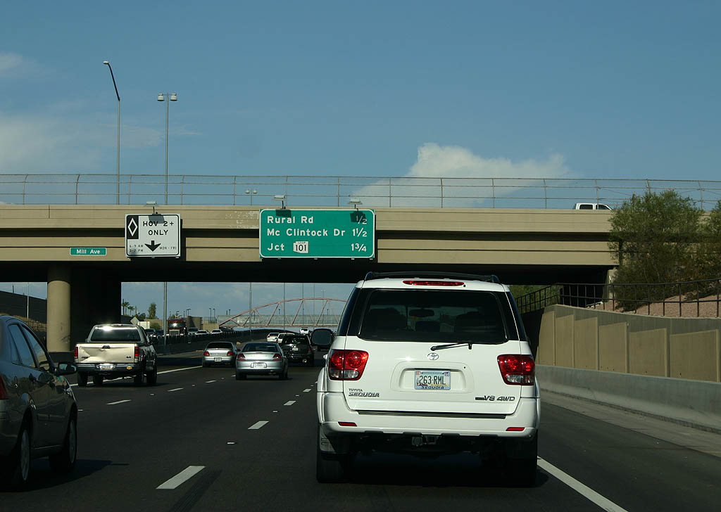
| Distance sign to Mill Avenue, Rural Road and McClintock Drive. 07/22/07 |
|
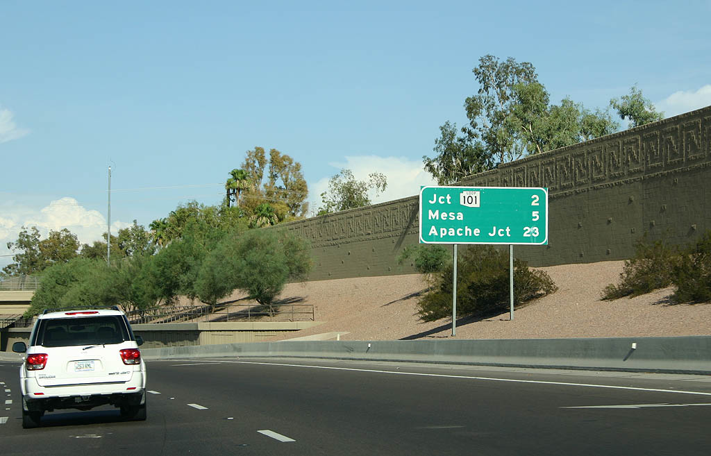
| The major mileposts along U.S. 60 are Loop 101 (5 miles), Mesa (8 miles) and Apache Junction (22 miles). 07/22/07 |
|
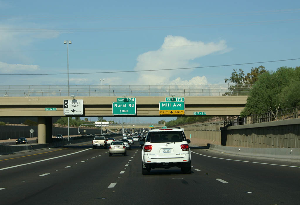
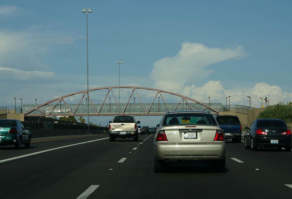
| The next exit is Mill Avenue north into Downtown Tempe and ASU. 07/22/07 |
|
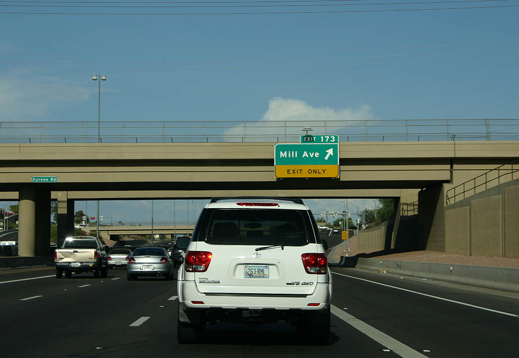
| Exit 173 departs U.S. 60 east for Mill Avenue. 07/22/07 |
|
| This pedestrian footbridge is uniquely designed, replicating the original arched pedestrian footbridge built when the freeway was completed in 1975. The arched bridge was unique for the lack of stairs, but did not meet ADA codes and was replaced in 2000 when the freeway was rebuilt. 02/10/08 |
|
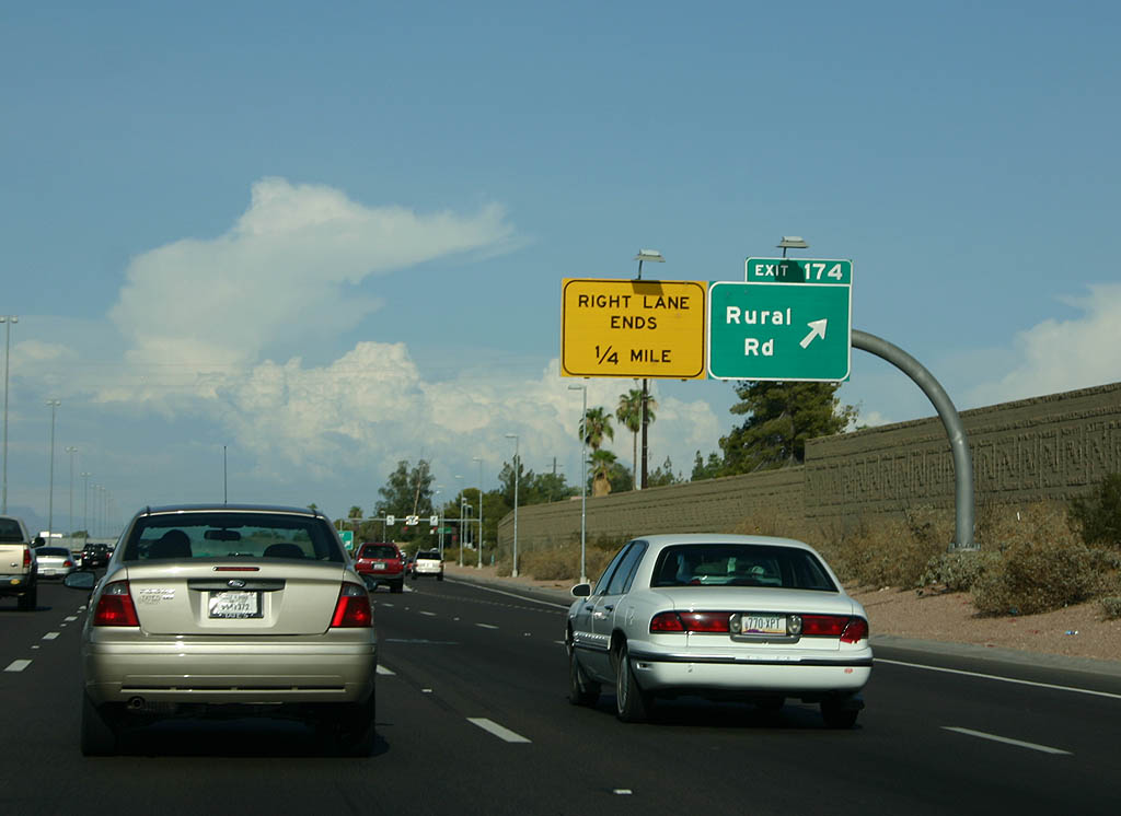
| Exit 174 leaves U.S. 60 east in a half mile for Rural Road. 07/22/07 |
|
| A lane drop follows on U.S. 60 east beyond Exit 174 to Rural Road. 02/10/08 |
|
| The succeeding exit is for McClintock Drive. 07/22/07 |
|
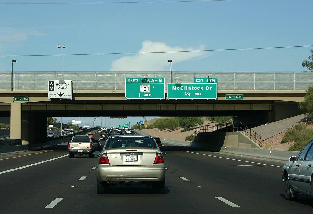
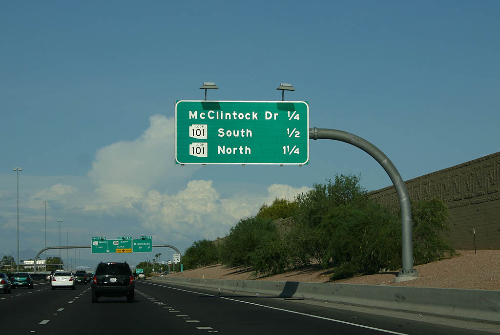
| Distance sign for exits to McClintock Drive and the systems interchange with Loop 101. 07/22/07 |
|
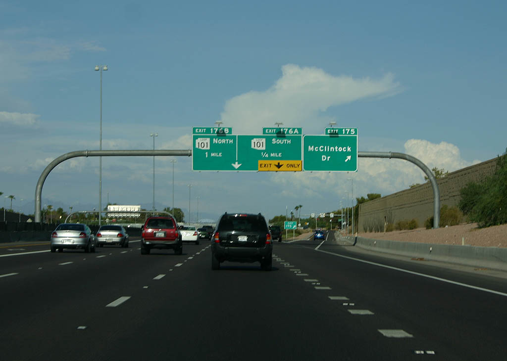
| Exit 175 parts ways for McClintock Drive. A lane drop occurs at Exit 176 A. 07/22/07 |
|
| The exit ramp for Loop 101 south passes under the entrance ramp from McClintock Drive. 07/22/07 |
|
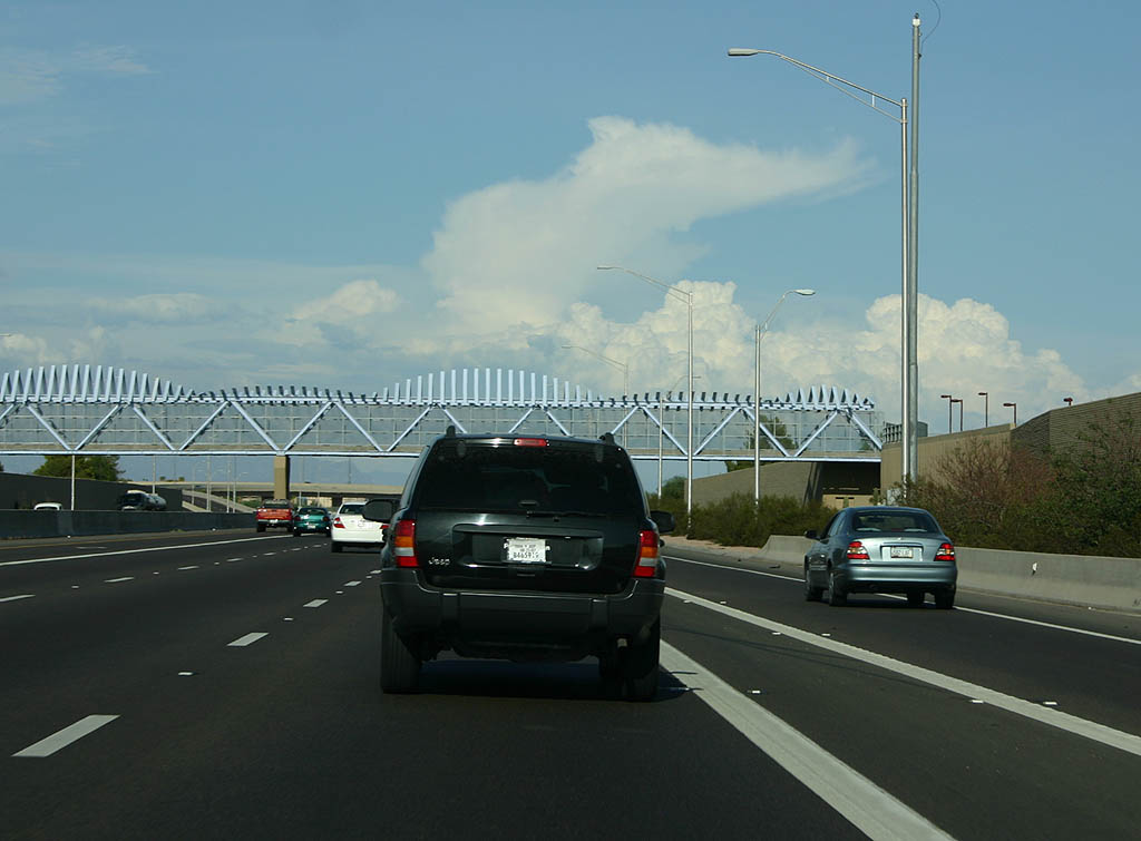
| This pedestrian footbridge was planned as part of the 2000 reconstruction, but not completed until 2005. 05/26/07 |
|
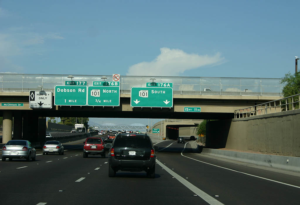
| Exit 176 B departs for Loop 101 northbound at a three-level interchange. 05/26/07 |
|
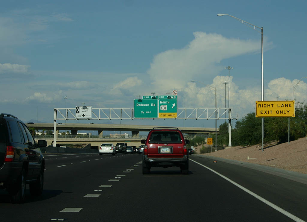
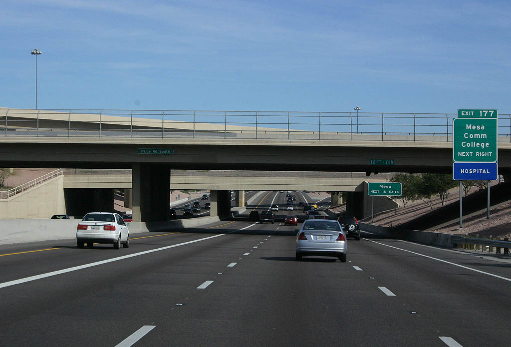
| Forthcoming Exit 177 points of interest include Mesa Community College and Banner Desert Medical Center. 02/10/08 |
|
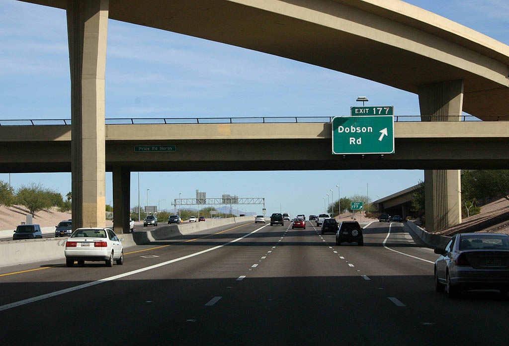
| Exit 177 departs for Dobson Road from within the exchange at Loop 101. 02/10/08 |
|
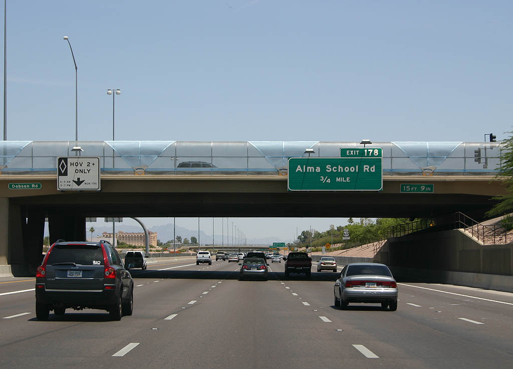
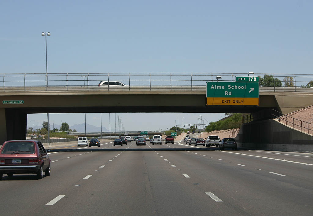
| Entering the city of Mesa, U.S. 60 advances to Exit 178 for Alma School Road. 05/26/07 |
|
| Exit 178 separates from the Superstition Freeway east for Alma School Road and Fiesta Mall. 05/26/07 |
|
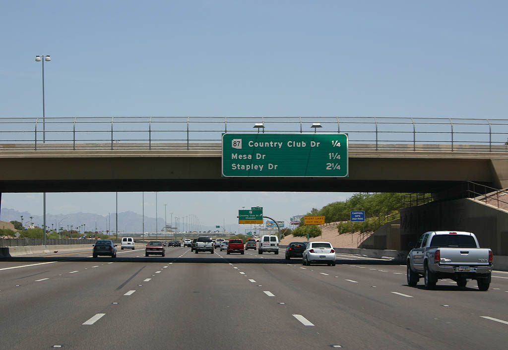
| Distance sign to Country Club Drive, Mesa Drive, and Stapley Drive. 05/26/07 |
|
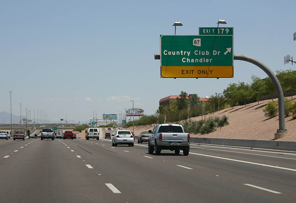
| Exit 179 leaves U.S. 60 east for Country Club Drive. Country Club Drive leads to Golfland, an amusement park, as well as Downtown Mesa. The arteral was noted as SR 87, but the section through Mesa was decommissioned. 05/26/07 |
|
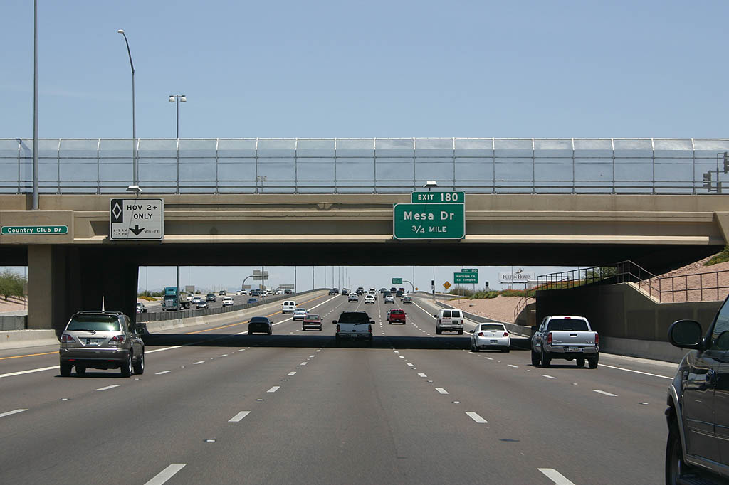
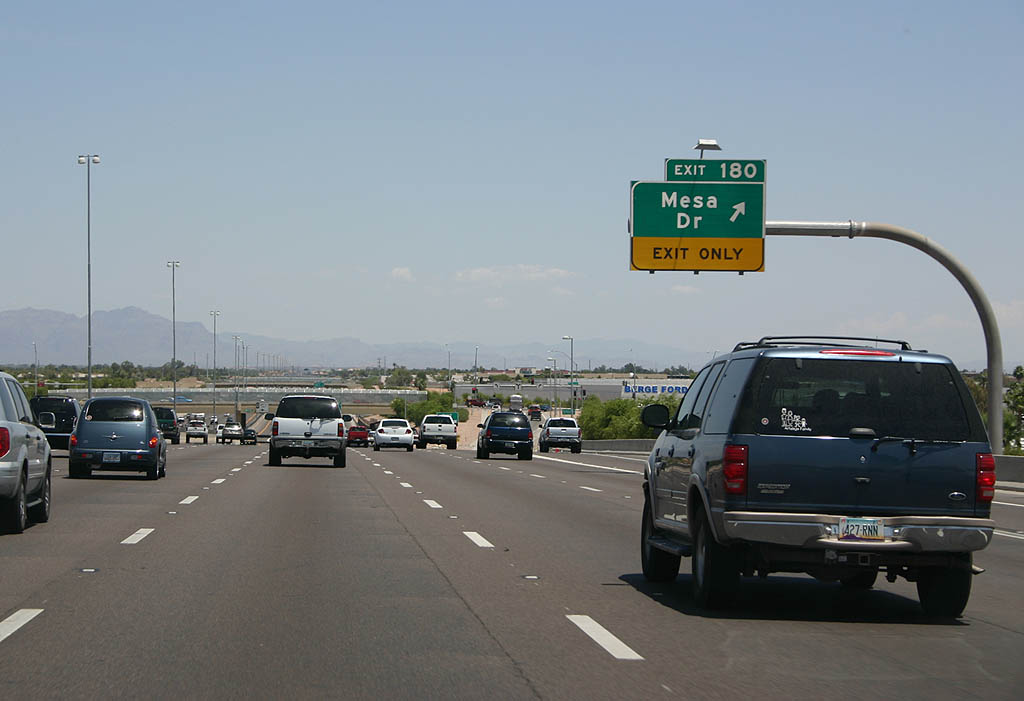
| 0.75 miles from Exit 180 to Mesa Drive. 05/26/07 |
|
| Mesa Drive also connects U.S. 60 with Downtown Mesa. 05/26/07 |
|
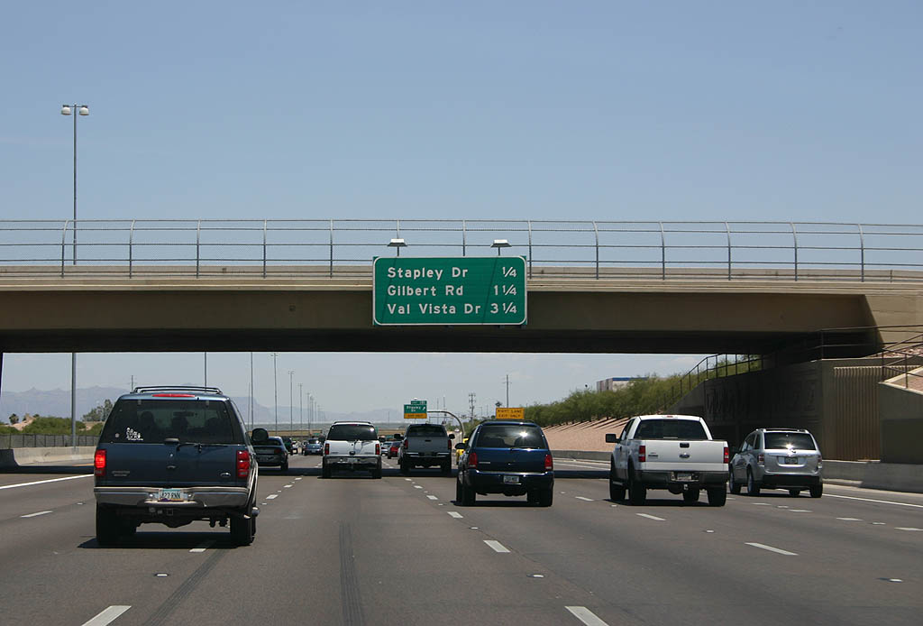
| Distance sign to Stapley Drive, Gilbert Road and Val Vista Drive. 05/26/07 |
|
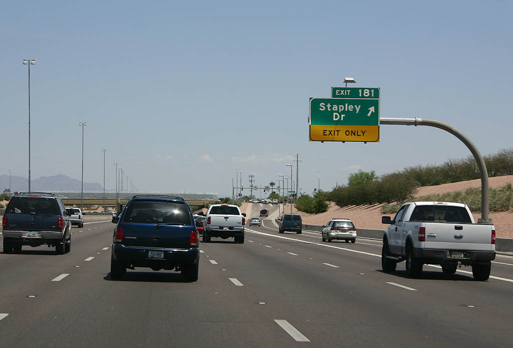
| Exit 181 serves Stapley Drive. 05/26/07 |
|
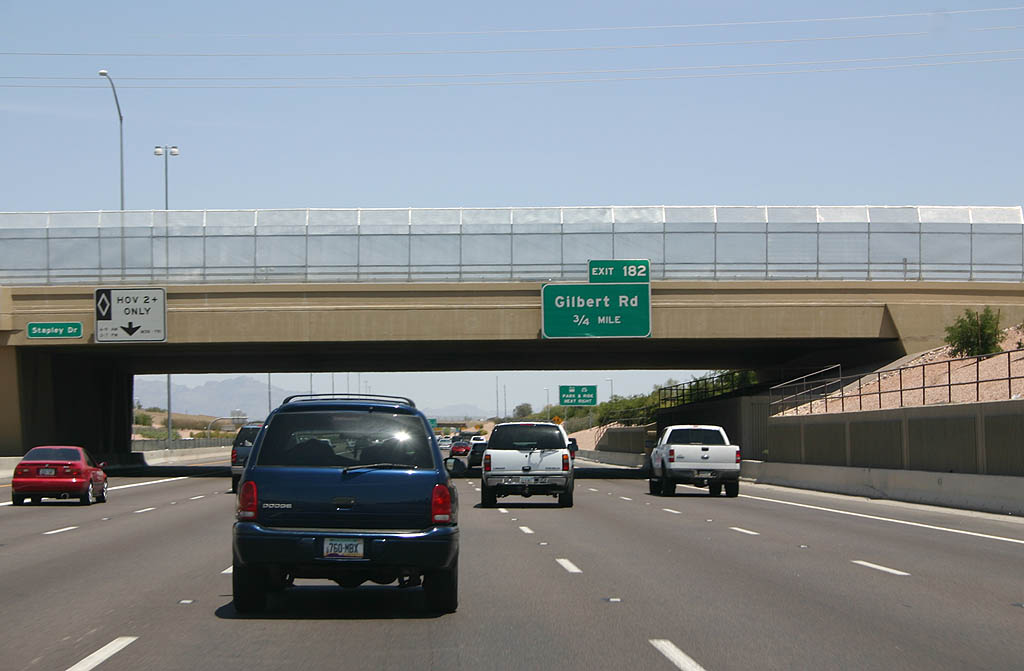
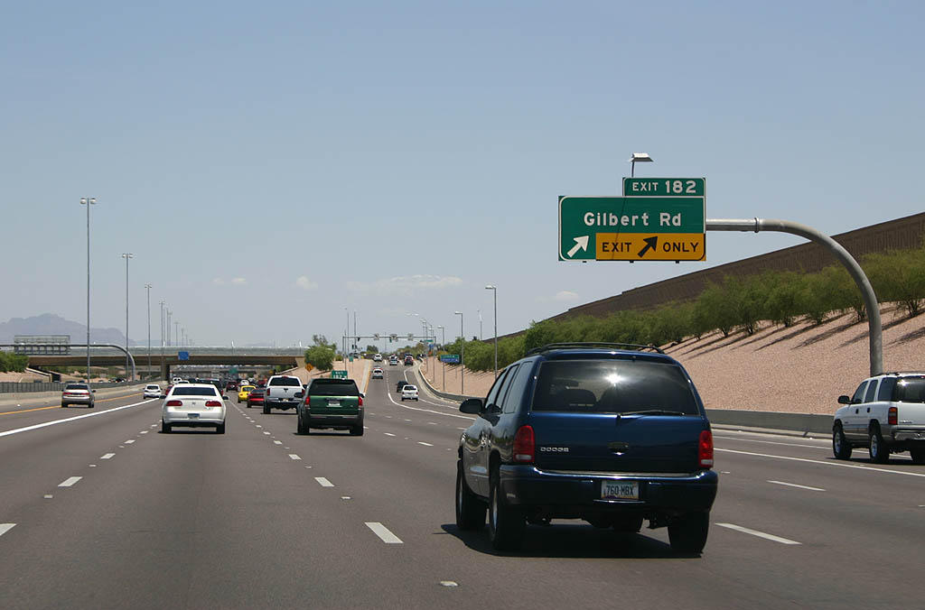
| Exit 182 leaves U.S. 60 east in 0.75 miles for Gilbert Road. 05/26/07 |
|
| Gilbert Road travels south to the town of Gilbert. 05/26/07 |
|
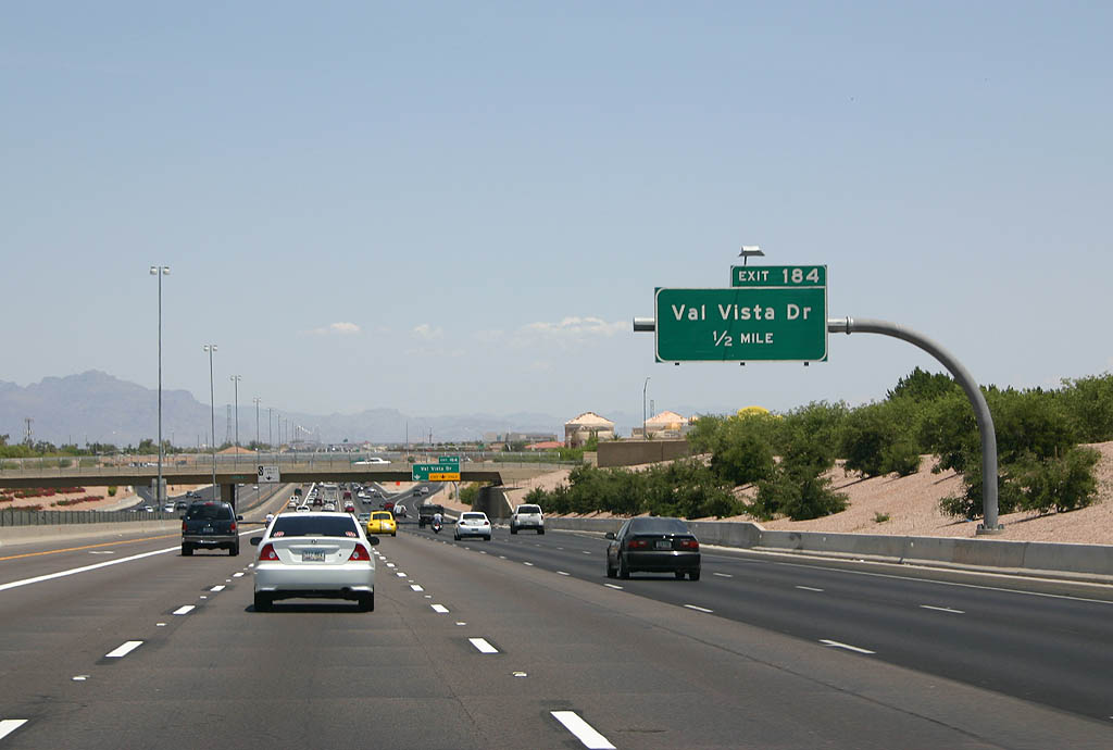
| A lane drop occurs in a half mile at Exit 184 for Val Vista Drive. 05/26/07 |
|
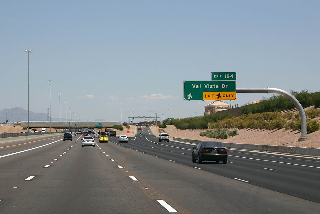
| Exit 184 marks the east end of the 2000 reconstruction along U.S. 60. 05/26/07 |
|
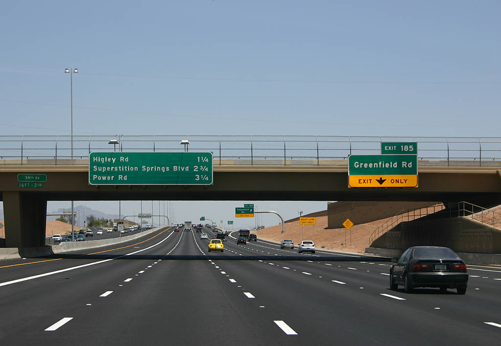
| Construction completed in 2007 widened U.S. 60 from Val Vista Drive to Ellsworth Road. The succeeding exit is Greenfield Road, followed by Higley Road, Superstition Springs Boulevard and Power Road. 05/26/07 |
|
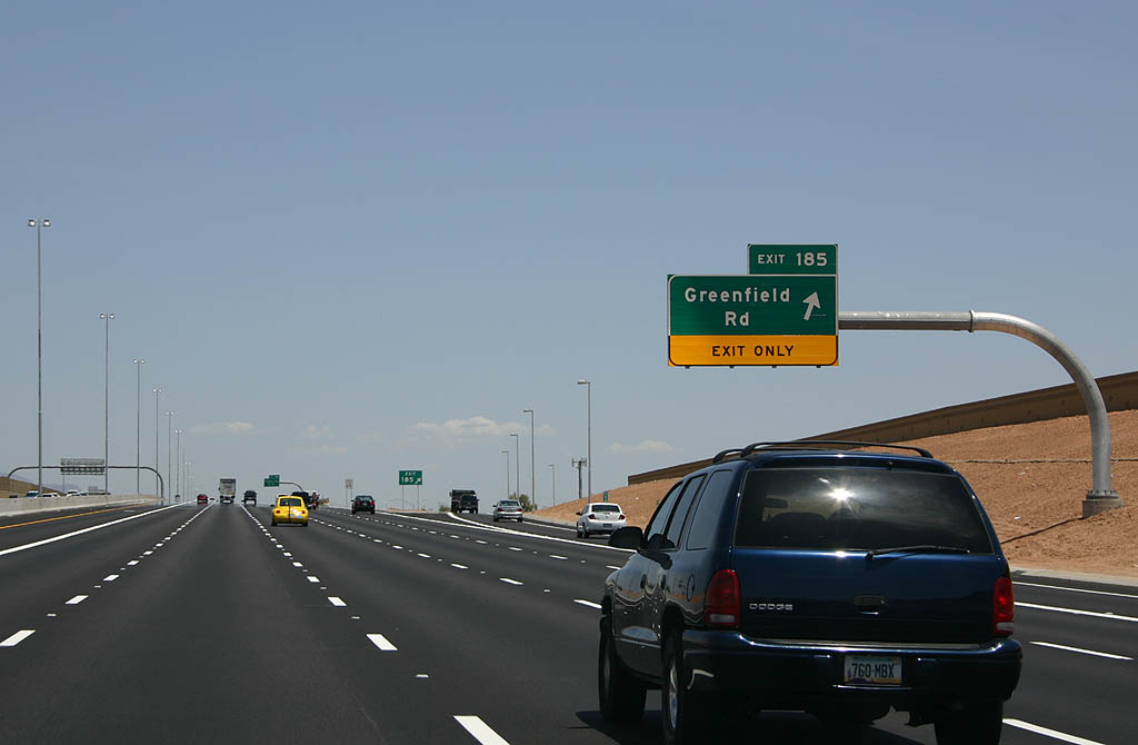
| U.S. 60 east at Exit 185 to Greenfield Road. 05/26/07 |
|
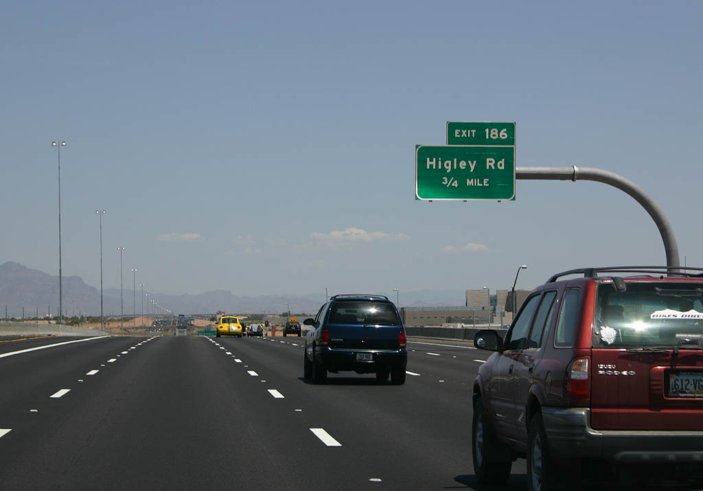
| Advancing east, U.S. 60 meets Higley Road in 0.75 miles. 05/26/07 |
|
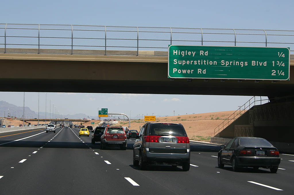
| Distance sign to Higley Road, Superstition Springs Blvd and Power Road. 05/26/07 |
|
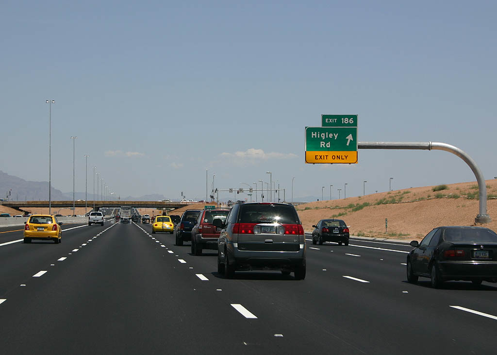
| Exit 186 leaves the Superstition Freeway east for Higley Road. 05/26/07 |
|
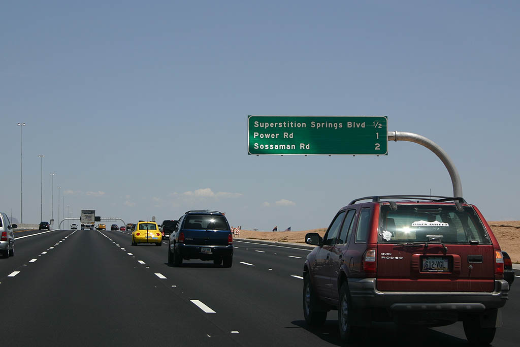
| The next three exits are Superstition Springs Blvd, Power Road and Sossaman Road. 05/26/07 |
|
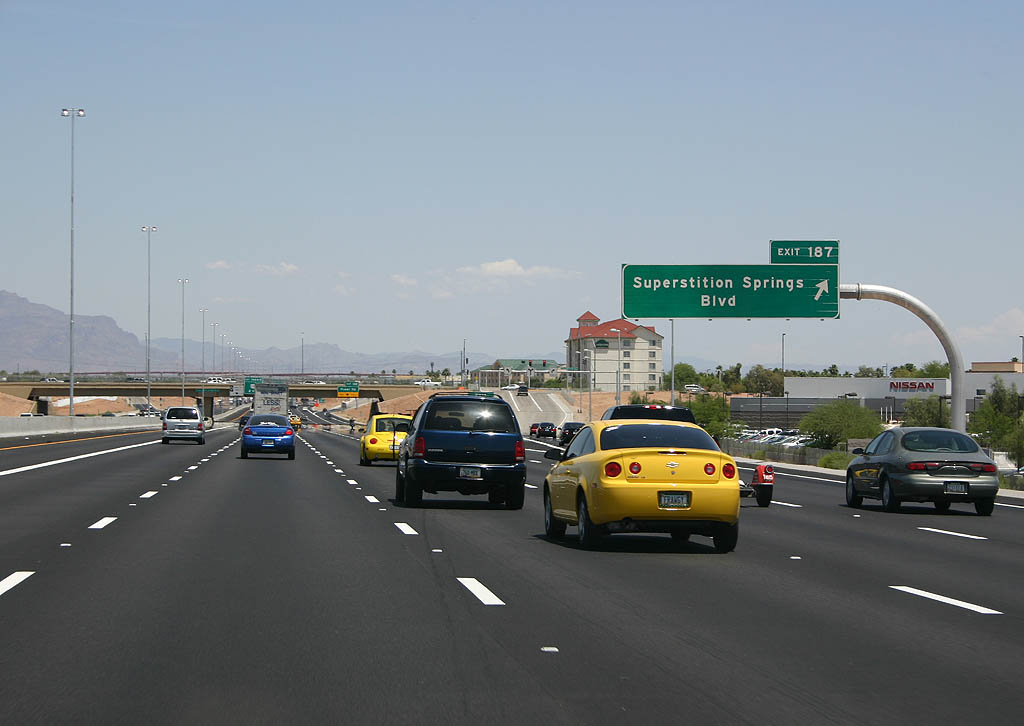
| Exit 187 serves Superstition Springs Boulevard and Superstition Springs Mall. 05/26/07 |
|
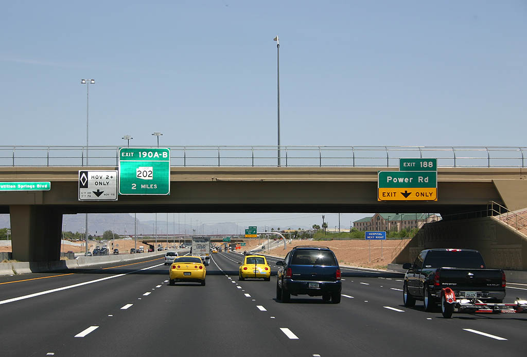
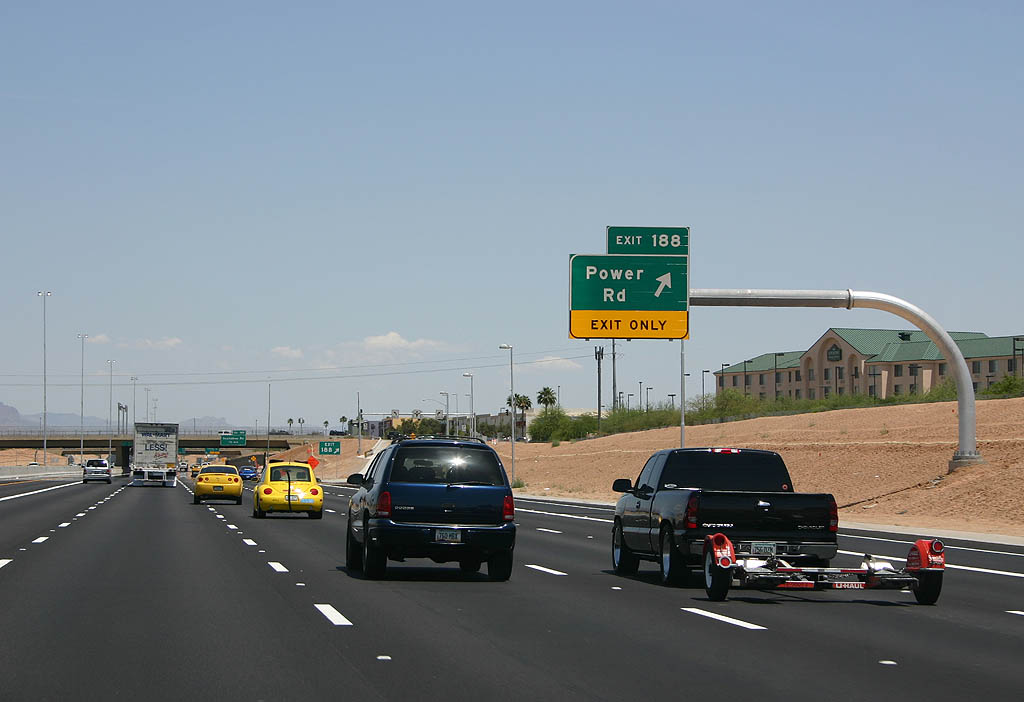
| Advance signage for exit 188, Power Road. 05/26/07 |
|
| Power Road departs here, as exit 188. Use Power Road to reach Williams Gateway Airport and the ASU East (Polytechnic) campus. 05/26/07 |
|
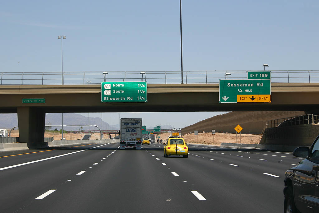
| Advance signage for exit 189, Sossaman Road. 05/26/07 |
|
| Sossaman Road departs here. The next exits serve Loop 202. 05/26/07 |
|
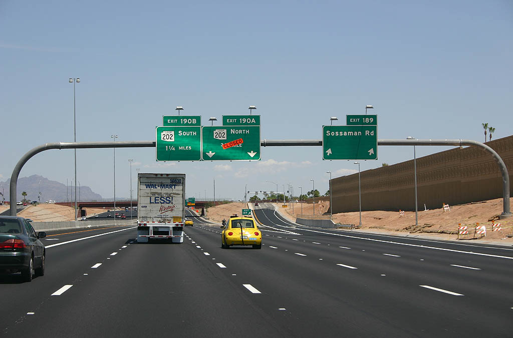
| At the time of this photo, Loop 202 northbound was not yet open. Exit 190A is now open and serves Loop 202 northbound. 05/26/07 |
|
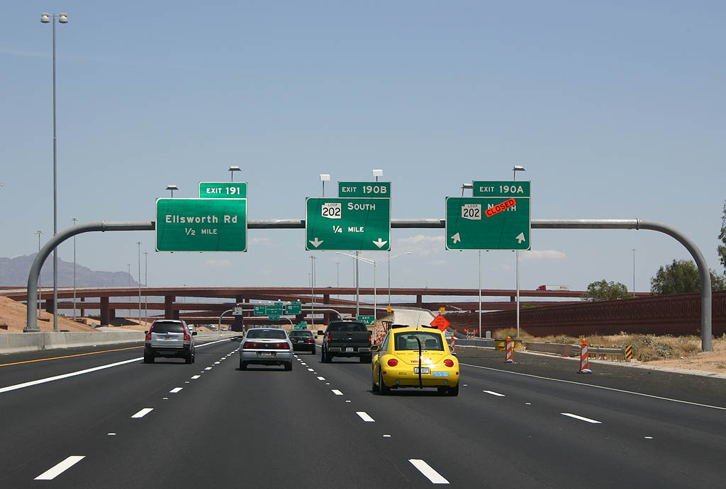
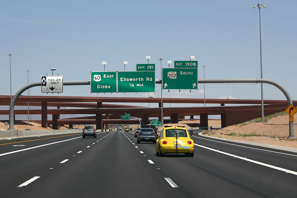
| Exit 190B serves Loop 202 southbound. This interchange is called the SuperRedTan interchange, after the names of the three freeways (Superstition, Red Mountain, and Santan) that meet here. 05/26/07 |
|
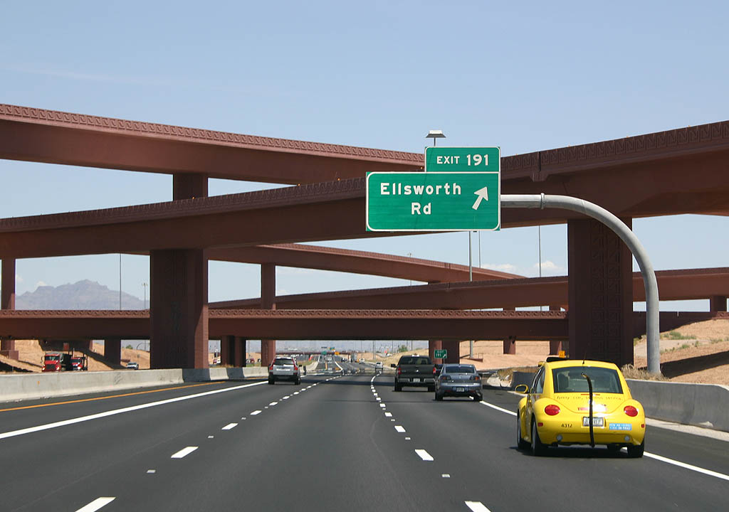
| Under the shadows of the SuperRedTan interchange, we find exit 191, Ellsworth Road. 05/26/07 |
|
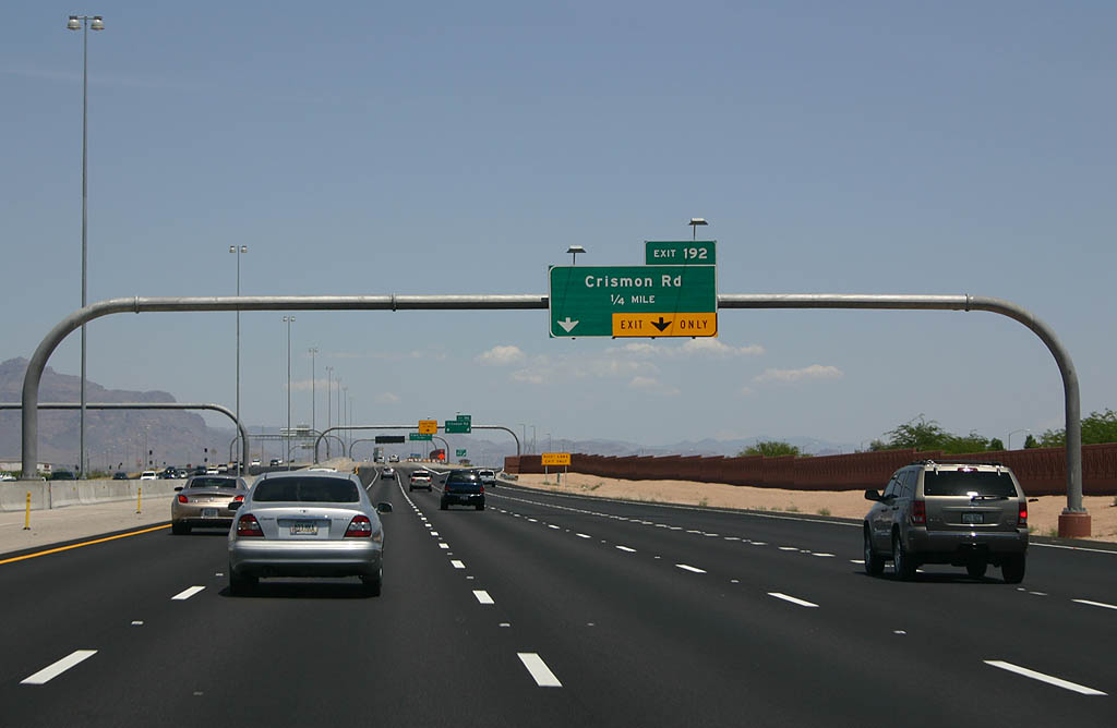
| Advance signage for exit 192, Crismon Road. We are now in East Mesa, in an area urbanized during the 1990s. 05/26/07 |
|
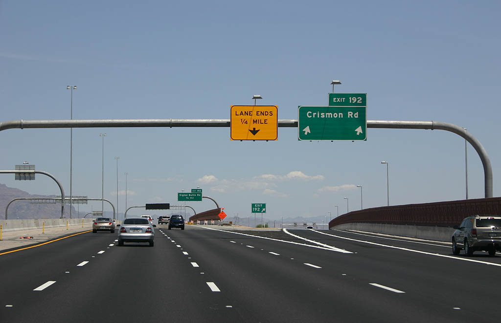
| Crismon Road departs here. This section of freeway was built in 1989, and is being widened in these photos. 05/26/07 |
|
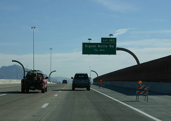
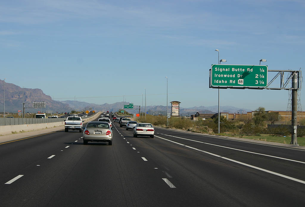
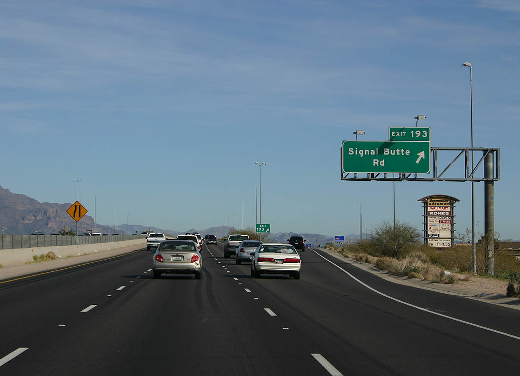
| Advance signage for exit 193, Signal Butte Road. 05/26/07 |
|
| Signal Butte Road is named after Signal Butte, which was so named because it was reportedly used by Pima Indians to watch for Apache invaders. 02/10/08 |
|
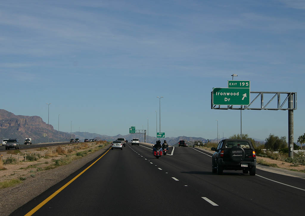
| Advance signage for Exit 195, Ironwood Drive in Apache Junction. The bridge ahead serves Meridian Drive. 02/10/08 |
|
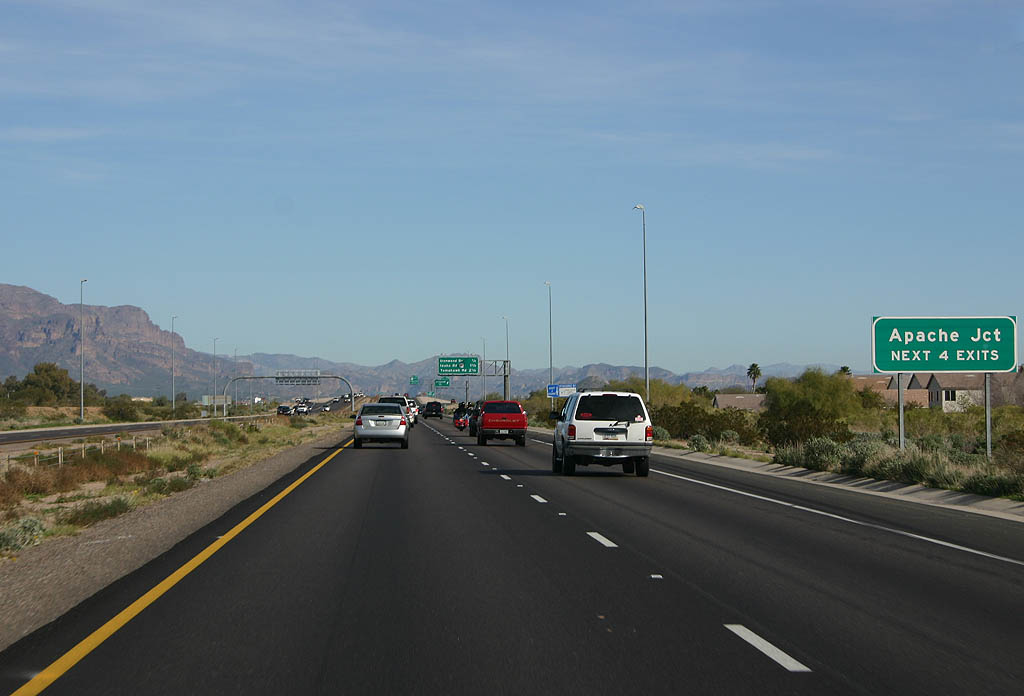
| Meridian Drive marks the eastern limit of Maricopa County and Mesa, and the beginning of Pinal County and Apache Junction. Use the next four exits to reach Apache Junction, a rapidly growing city at the base of the Superstition Mountains. 02/10/08 |
|
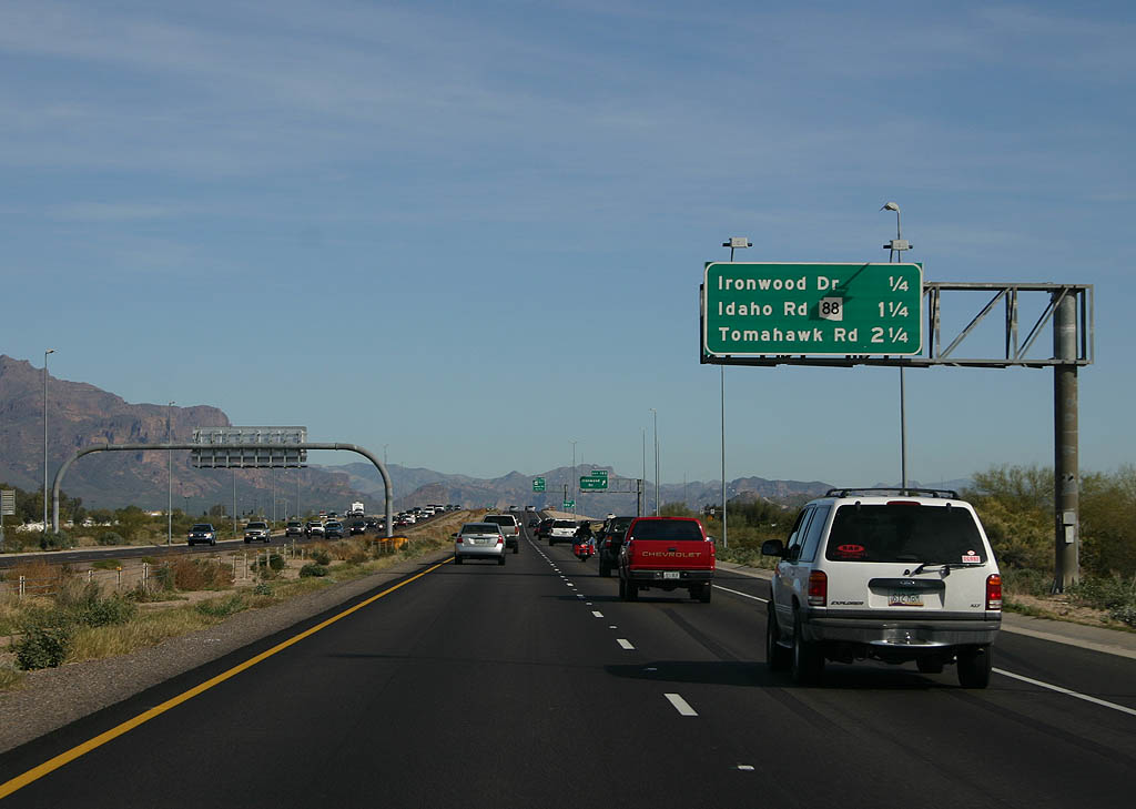
| Distance sign to Ironwood Drive, Idaho Road (SR 88) and Tomahawk Road. 02/10/08 |
|
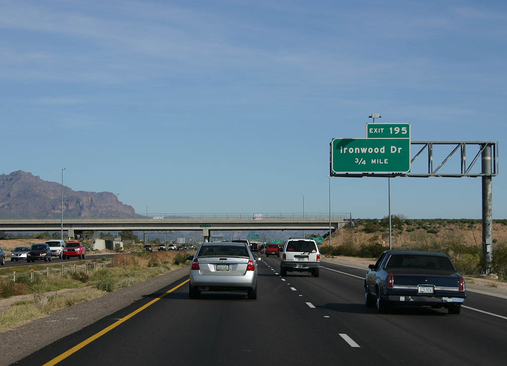
| Ironwood Drive departs here, at exit 195. 02/10/08 |
|
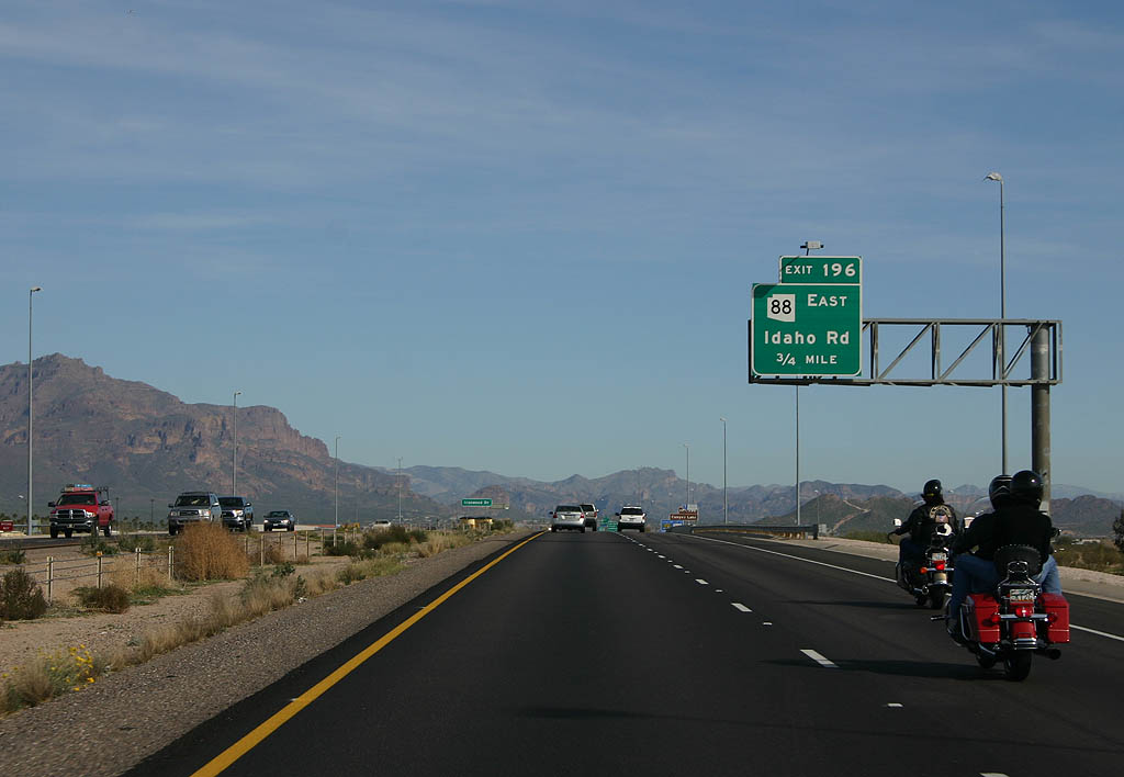
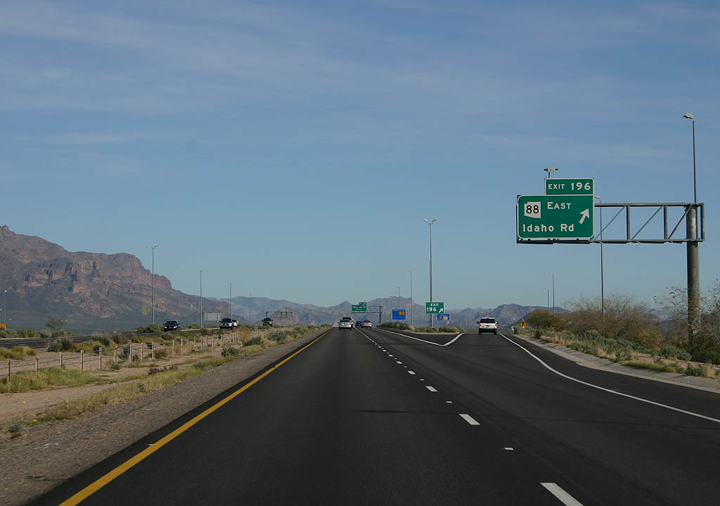
| The succeeding exit along U.S. 60 east is for SR 88 (Idaho Road). 02/10/08 |
|
| Forthcoming Exit 196 marks the west end of SR 88. 02/10/08 |
|
| SR 88 is famous as the Apache Trail, which leads northeast into the Tortilla Flats area. One of the few unpaved state routes in Arizona, SR 88 is unpaved for approximately 20 miles from near Castle Dome to Tonto National Monument and a point just ahead of SR 188 at Roosevelt. 02/10/08 |
|
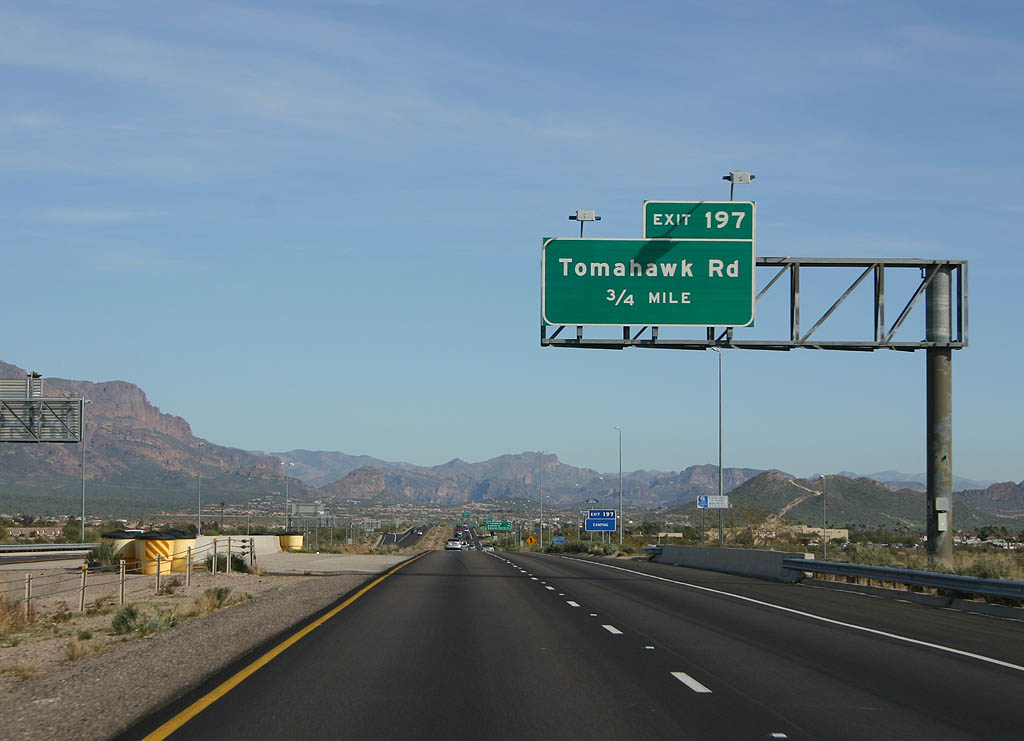
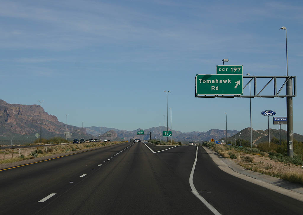
| Advance signage for exit 197, Tomahawk Road. 02/10/08 |
|
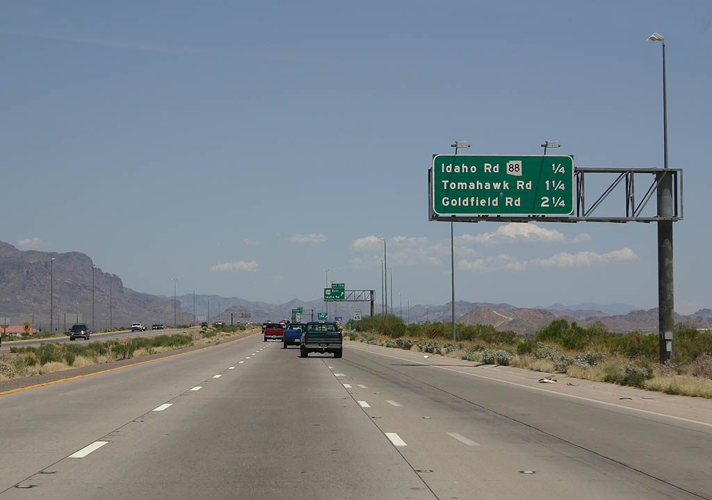
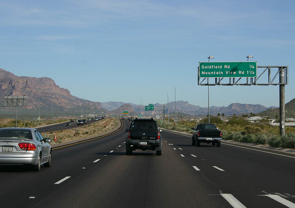
| Distance sign to Tomahawk Road, Goldfield Road and Mountain View Road. 02/10/08 |
|
| Tomahawk Road exits here, as exit 197. 02/10/08 |
|
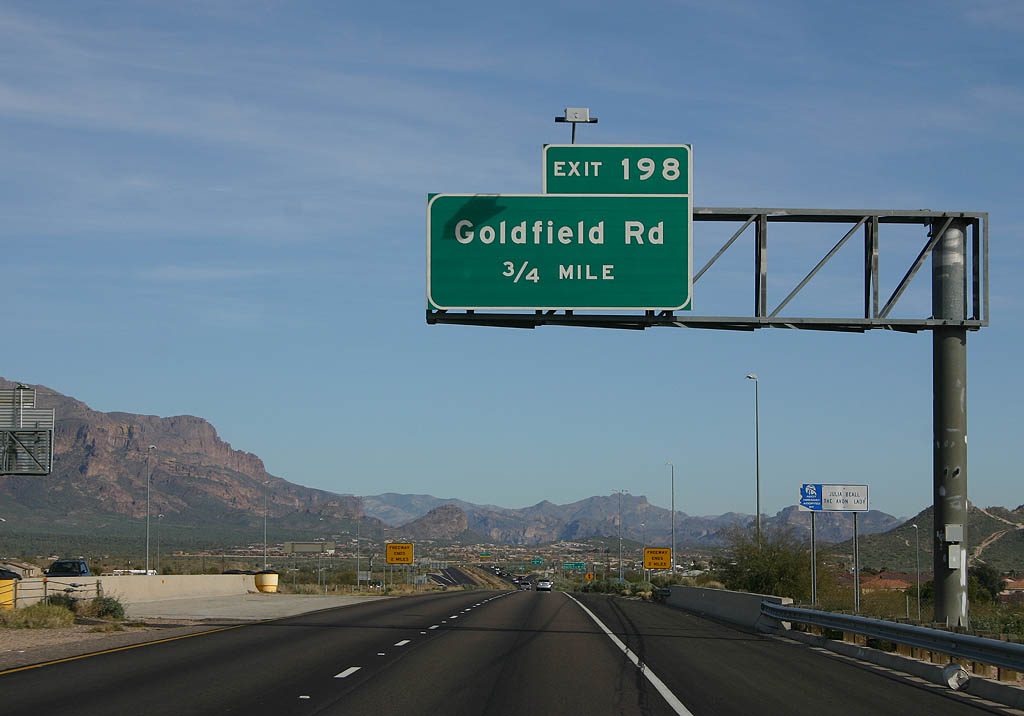
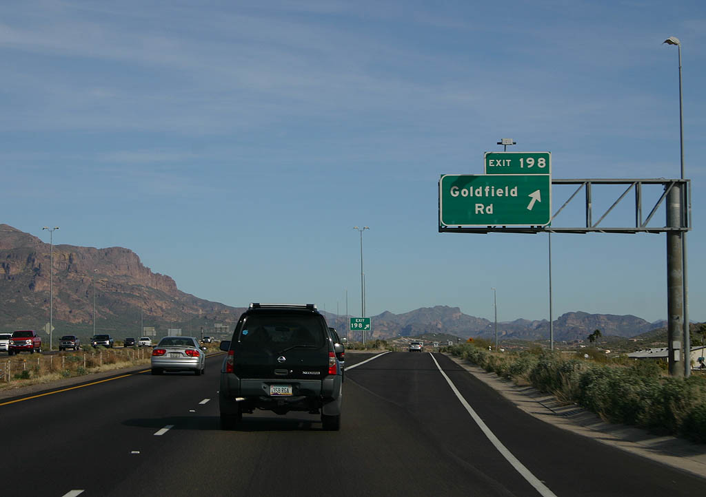
| Advance signage for Goldfield Road, exit 198. 02/10/08 |
|
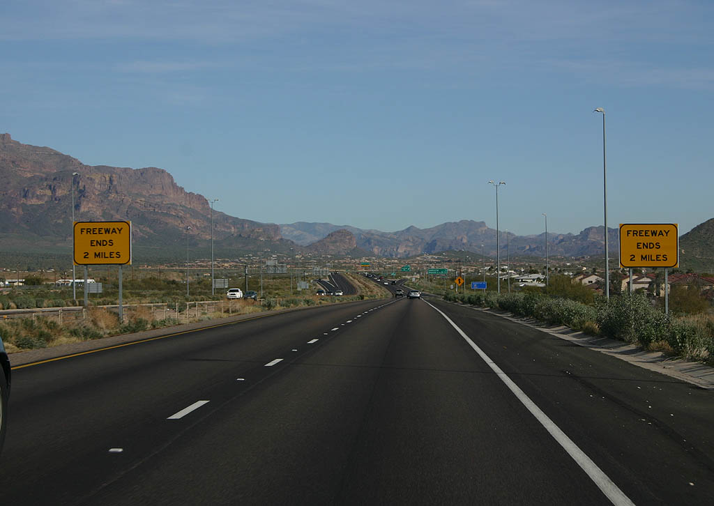
| Just past Goldfield Road, the US 60 freeway ends and becomes an expressway. This set of signs warns of the upcoming freeway end. This last section of freeway was built in 1991. 02/10/08 |
|
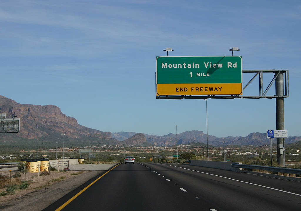
| Distance sign to Goldfield Road and Mountain View Road. 02/10/08 |
|
| Goldfield Road exits here, as exit 198. This is the last exit on US 60 eastbound. 02/10/08 |
|
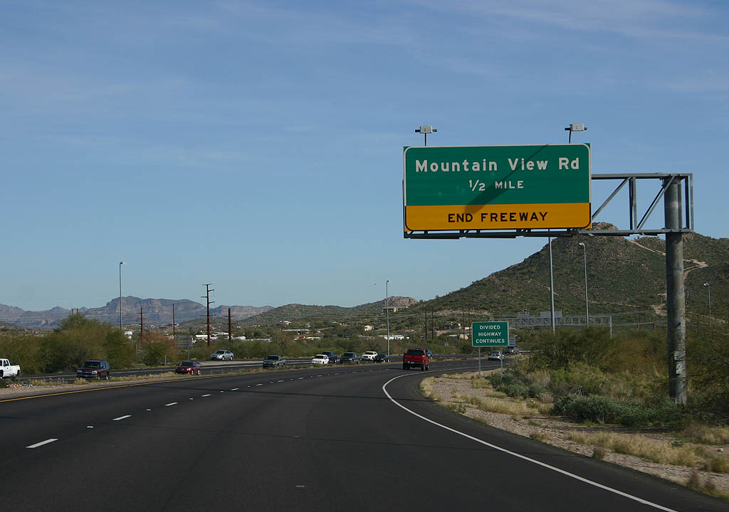
| Eastbound U.S. 60 approaching Mountain View Road in Apache Junction. US 60 is now a four lane divided highway with at-grade intersections from this point east toward Florence Junction. 02/10/08 |
|
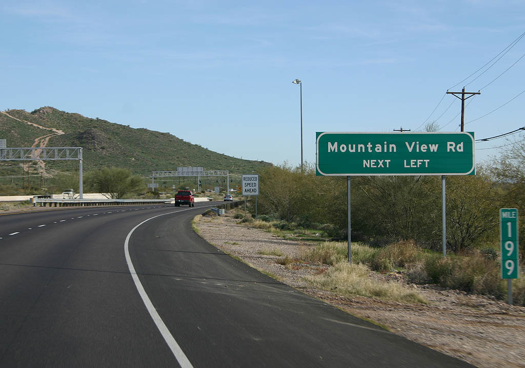
| Advance signage for Mountain View Road. 02/10/08 |
|
| Mountain View Road is a left turn from the expressway, just east of this sign. 02/10/08 |
|
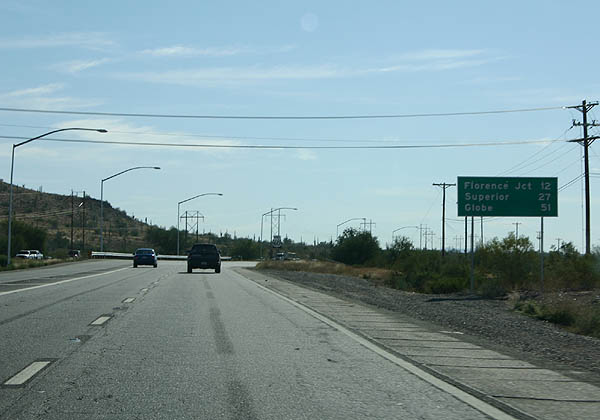
| Distance sign to Florence Junction, Superior and Globe. 11/11/06 |
|
| This road leads north to the Peralta Trailhead. The Peralta Trailhead is one of the most popular entries to the Superstition Wilderness, located in the Superstition Mountains just north of here. 11/11/06 |
|
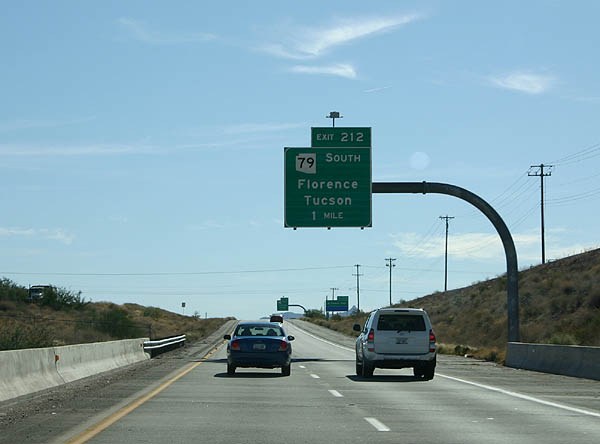
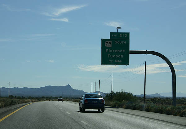
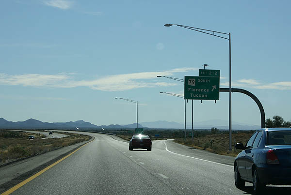
| Advance signage for exit 212, SR 79 to Florence and Tucson. 11/11/06 |
|
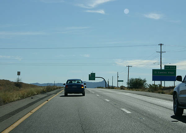
| Exit 212 is also known as El Camino Viejo. 11/11/06 |
|
| The old T-junction between SR 79 (former US 80-89) and US 60 was replaced with a grade separated interchange in 2004, as part of upgrades to US 60 to reduce accidents. 11/11/06 |
|
| SR 79 departs here, as exit 212. 11/11/06 |
Page Updated 03-26-2008.

 East
East