
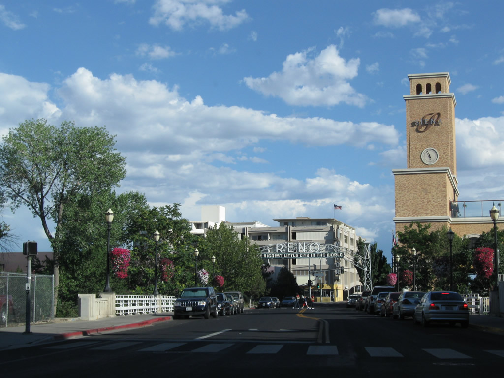
The city of Reno is the “Biggest Little City in the World.” The Downtown city scape includes towering hotels and casinos. With gambling a huge part of the local economy, many travelers from Northern California visit Reno for the nightlife, entertainment, gambling and fine dining.
Seat of Washoe County, Reno had a population of 264,165 as of the 2020 Census. A steady population growth increased from 225,221 as of the 2010 Census and 180,480 as of the 2000 Census. According to the city web site, Reno was officially established on May 13, 1868. It was named after named after Civil War General Jesse Reno.
Reno sits at an elevation of 4,505 feet above sea level. The city is located within Truckee Meadows, a valley it shares with Sparks, along the banks of the Truckee River. Due to its position east of the Sierra Nevada and within the rain shadow, Reno only sees an average annual precipitation (rain and snow) of 7.48 inches, which is quite a bit less than seen in California’s Central Valley on the west side of the same mountain chain.

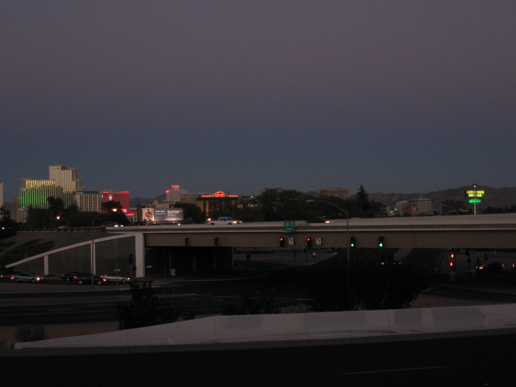
The Downtown Reno skyline, looking west from U.S. 395, includes the distinctive Silver Legacy dome and several high rise towers, many of which are hotels and resorts. 07/19/09
Companion city of Sparks lies adjacent to Reno east of U.S. 395 and north of the Truckee River. Like Reno, Sparks saw growth due to the explosion in the gambling industry through the 20th century as well as its position along the Union Pacific Railroad. As of the 2010 Census, Sparks had a population of 90,264, an increase from 66,346 recording in the the 2000 Census. The city grew further with 108,445 residents in 2020.
Known as the “City of Promise,” Sparks sits at an elevation of 4,410 feet above sea level. The city was named in 1904 for former Governor John Sparks. It incorporated on March 15, 1905.
Sparks’s tallest casino is the Nugget, built in 1984 and located in Downtown. The Union Pacific Railroad switch yard sits on the south side of Interstate 80 near the interchange with Pyramid Way (SR 445).
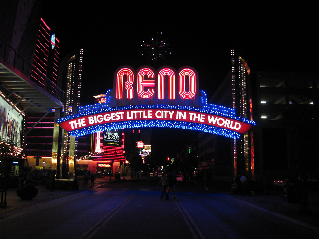
The famous Reno arch is located downtown on Virginia Street (U.S. 395 Business) south of Interstate 80 near Old U.S. 40 and Business Loop I-80 (Fourth Street). Photo by Steve Hanudel and Erik Slotboom (05/16/12).

Interstates

Guides:
Purple Heart Trail / Victory Highway
Interstate 80 replaced U.S. 40 as the main route across Truckee Meadows. The freeway travels east from Verdi and the master planned Somersett community with four lanes through the Mogal area of west Reno. With increasing traffic, I-80 expands to five lanes plus an auxiliary lane from Robb Drive (Exit 9) east to McCarran Boulevard (SR 659). Eastbound traffic remains with just two through lanes until the SPUI (Exit 12) with Keystone Avenue (Business Loop I-80).
A lid hosts a Walgreens pharmacy on the block between Virginia Street (U.S. 395 Business) and Center Street above a seven lane section of Interstate 80. Staying below grade, I-80 advances east to meet I-580/U.S. 395 south to Carson City and the U.S. 395 freeway north to Silver Lake in north Reno and Bordertown along the California state line.
Through Sparks, Interstate 80 parallels the Union Pacific Railroad line with six overall lanes east to the SPUI (Exit 18) with SR 445 (Pyramid Way). Separating industrial areas to the south with the adjacent commercial strip along Business Loop I-80 (Victorian Avenue), I-80 reduces to four lanes plus auxiliary lanes to the McCarran Boulevard at Exit 19, and by Sparks Marina Park. The northeast Truckee Meadows is home to the Outlets at Sparks retail complex, Wild Island Family Adventure Park and an array of warehouses, distribution centers and trucking companies. Interstate 80 leaves the built up areas of east Sparks for a rural course along the Truckee River east to Mustang, Patrick and the Tahoe Reno Industrial Center off USA Parkway (SR 439) south.


Guides:
Martin Luther King, Jr. Memorial Highway
The primary freeway route through Reno-Sparks is Interstate 580 and U.S. 395, which bypasses old U.S. 395 along Virginia Street and stays to the east of Downtown Reno. The Interstate 580 Freeway Extension Project, which connected disparate segments of U.S. 395 freeway near Washoe Lake and Mt. Rose Junction (bypassing Pleasant Valley), was completed in August 2012. As of August 2, 2017, Interstate 580 was fully opened from Interstate 80 at Reno southward to the separation of U.S. 50 west and 395 south in Carson City. The section of Interstate 580 and U.S. 395 through the city of Reno is named the Martin Luther King, Jr. Memorial Highway, with the older portions originally called the North-South Freeway.
South from Carson City through Minden, U.S. 395 is the primary route through the Eastern Sierra. Part of a 1,305 mile long route that spans four states, U.S. 395 is the Three Flags Highway. Entering Nevada at Topaz Lake, U.S. 395 turns northwest by the Pine Nut Mountains to enter Carson Valley ahead of Gardnerville. Overtaking MSR 88 north from Alpine County, California, U.S. 395 proceeds due north to cross the Carson River ahead of Eagle Valley and the state capital of Carson City. U.S. 395 accompanies U.S. 50 along the Carson City Freeway (I-580) to bypass Downtown, with U.S. 395 Business following the former route along Carson Street.
U.S. 50 splits with I-580/U.S. 395 at William Street to the continuation east to Fallon. North from there, the freeway proceeds past Washoe Lake and Mt. Rose Junction before entering Truckee Meadows and the Reno-Sparks metropolitan area. Traveling north into Reno, Interstate 580 and U.S. 395 have direct connections with Reno-Tahoe International Airport (RNO).
I-580 ends at Interstate 80 (Exit 68). U.S. 395 continues northwest, aiming back into California at Bordertown as a full freeway. U.S. 395 will travel as a freeway or expressway northward to Susanville.
U.S. Highways


Guides:
Keystone Avenue / Fourth Street / Victorian Avenue
Business Loop I-80 follows Historic U.S. 40 along Fourth Street in Reno and Victorian Avenue in Sparks. The entire 5.2 mile route, with the exception of a 0.176 mile segment through the diamond interchange (Exit 16) with I-80, is locally maintained, with former NDOT sections previously designated as SR 647. SR 647 remains in the state system along 3.22 miles of 4th Street, west of McCarran Boulevard (SR 659) to I-80 at Exit 8.
Beginning at the SPUI (Exit 12) with Keystone Avenue in the West University area of Reno, Business Loop I-80 branches south from I-80 to connect with 4th Street east to the Reno central business district. 4th Street and Virginia Street meet in the heart of Downtown, representing the former crossroads of U.S. 40 and U.S. 395. Paralleling the Union Pacific Railroad eastward, Business Loop I-80 passes below I-580/U.S. 395 and enters the city of Sparks, where 4th Street becomes Prater Way.
Victorian Avenue leads the business route east along the north side of Interstate 80 from Kietzke Lane (old SR 667) along a commercial strip through to SR 659 (McCarran Boulevard). Business Loop I-80 rejoins I-80 at the parclo interchange (Exit 19) with McCarran Boulevard. As of July 2017, only four reassurance markers remained posted for Business Loop I-80 in Reno and Sparks.


Guides:

Guides:
Virginia Street
U.S. 395 Business follows the pre-freeway alignment of U.S. 395 along Virginia Street from Exit 61 in south Reno north through Downtown to Exit 72 at Panther Valley. Only the northern 3.161 miles of U.S. 395 Business are state maintained as SR 430. The rest is under local control.
Until 2012, U.S. 395 Business ended at Mt. Rose Junction, where it met SR 431 (Geiger Grade Road) east and SR 341 (Mt. Rose Highway) west. The portion of Virginia Street north from Mt. Rose Junction to Patriot Boulevard, where I-580/U.S. 395 cross from the west to the east en route to Reno Tahoe International Airport (RNO), is now a part of NDOT-maintained U.S. 395 Alternate. This maintenance change took place with the completion of I-580 south through the Washoe Valley in August 2012.
U.S. 395 Alternate replaced the surface route of U.S. 395 south from Reno through Steamboat, Pleasant Valley and Washoe City. The route loops west of I-580 through the western Washoe Valley to Franktown along what was SR 429. The 20.08 mile long highway ends at the Eastlake Boulevard interchange (Exit 44) with I-580/U.S. 395.
The first section of the North-South Freeway was completed in 1970. U.S. 395 officially relocated from Virginia Street to the adjacent freeway as approved by AASHTO on June 20, 1972.
State Routes

Guides:
Geiger Grade Road
Nevada State Route 341 loops southeast from U.S. 395 Alternate and SR 431 at Mt. Rose Junction to Virginia City in Storey County and U.S. 50 near Mound House. The state route connects south Reno with the suburb of Virginia Foothills before winding across the Virginia Range to Geiger Summit (el. 6,820) feet and the Virginia Highlands community.

Guides:
3rd Street / US 40
Business Loop I-80 through Verdi is state maintained and designated SR 425. The 3.437 mile loop follows 3rd Street from Exit 2 through the community of Verdi, and old U.S. 40 from there back to I-80 at Exit 5 by Mogul in west Reno.

Guides:
South Meadows Parkway
The 0.370 mile segment of South Meadows Parkway linking U.S. 395 Alternate (Virginia Street) and Foothill Road with I-580/U.S. 395 at Exit 60 is state maintained. The four lane arterial in south Reno is unsigned SR 426.

Guides:
Mt. Rose Highway
A 24.41 mile long highway, SR 431 stems southwest from U.S. 395 Alternate (Virginia Street) and SR 341 (Geiger Grade Road) into the Carson Range and Toiyabe National Forest. The state route makes a number of switchbacks and horse show curves onto Slide Mountain (el, 9,698 feet) and across Mount Rose Summit (el. 8,900 feet) as it connects Mt. Rose Junction in south Reno with Lake Tahoe and SR 28 at Incline Village.

Guides:
Clear Acre Lane / Sun Valley Boulevard
SR 443 spurs 3.197 miles north from SR 659 (McCarran Boulevard) into the community of Sun Valley. The southern leg of the route arcs northeast from an interchange with the U.S. 395 freeway around the Meadow View Terrace and Scenic Terrace subdivisions to Dandini Boulevard. The undivided four lane arterial becomes Sun Valley Boulevard north from there to Sun Valley Community Park and 7th Avenue, where SR 443 ends.

Guides:
Pyramid Way
Pyramid Way constitutes a busy arterial route north from Interstate 80 at Exit 18 in Sparks to the suburbs of Spanish Springs Valley and Spanish Springs. SR 445 follows the road north to rural Warm Springs Valley and SR 446 at Pyramid Lake.
Proposed in 2006, the Pyramid-McCarran Intersection Improvement Project addresses congestion at the intersection of SR 445 (Pyramid Way) and SR 659 (McCarran Boulevard). Costing $72 million overall, the expansion work got underway with the demolition of houses in December 2014. In all 71 buildings, 69 of which were homes, were razed to make way for an added lane in each direction of Pyramid Way, dedicated turn lanes for both state routes, a new multi-use path along the east side of SR 445 and sidewalk construction.1 Work ran through Spring 2018.

Guides:
Former Nevada 646 – Prater Way
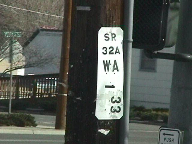
A remnant Nevada State Route 32A milepost previously posted along Prater Way in Sparks. Photo by Mike Ballard (08/99).
Prater Way through Sparks was formerly a state route. The boulevard was initially designated as SR 32A, then changed to SR 646 in 1976 during the statewide renumbering. The state maintained designation was gradually reduced until it only included a very small segment of Prater Way adjacent to the intersection with East McCarran Boulevard (SR 559). By 2011, the remainder of SR 646 was decommissioned.

Guides:
2nd Street / Glendale Avenue
SR 648 overlays 2.66 miles of 2nd Street in Reno and Glendale Avenue in Sparks. The state route originates at SR 667 (Kietzke Lane) just ahead of a parclo interchange (Exit 67) with I-580/U.S. 395. East across the Truckee River at Fishermans Park, SR 648 enters Sparks and continues into an industrial area through to its end at SR 659 (McCarran Boulevard).

Guides:
Plumb Lane
Plumb Lane constitutes a commercial arterial from Arlington Avenue to the passenger terminal of Reno-Tahoe International Airport (RNO). The eastern 0.589 miles, from SR 667 (Kietzke Lane) to the SPUI with I-580/U.S. 395 and Terminal Way is signed as SR 653.

Guides:
Waltham Way
SR 655 spurs south from Interstate 80 near Patrick along Waltham Way. The 1.142 mile long route connects the freeway at Exit 28 with an industrial park across the Truckee River in north Storey County.

Guides:
McCarran Boulevard
SR 659 is the designation for the at-grade beltway encircling the Reno-Sparks metropolitan area. Known primarily as McCarran Boulevard; its state route number is rarely used by the traveling public. This busy route is currently maintained entirely by NDOT; prior to 2009, portions of the loop route were locally maintained. SR 659 measures 22.97 miles in length.
Until 2009, the northwestern quadrant of McCarran Boulevard was designated as SR 651 and the northeastern quadrant was designated as SR 650. SR 650 and SR 651 changed designations at the point where McCarran Boulevard passed over the freeway along U.S. 395. Most of the southern half of McCarran Boulevard was maintained by local jurisdictions. With NDOT assuming maintenance of the entire McCarran Boulevard loop, SR 650 and SR 651 were consolidated as newly designated SR 659.

Guides:
Kietzke Lane
SR 667 overlays a 3.84 mile section of Kietzke Lane north from U.S. 395 Business (Virginia Street) in Reno. The five lane commercial boulevard parallels I-580/U.S. 395 to the west to SR 648 (2nd Street). A median separates traffic along the northernmost extent curving Kietzke Lane across the Truckee River. SR 667 ends at Galletti Way and the Sparks city line, but formerly extended east to Business Loop I-80 (Victorian Avenue).

Guides:
Rock Boulevard
Rock Boulevard leads north from industrial areas of Sparks south of the Union Pacific Railroad to the residential street grid north of Interstate 80. A 0.395 mile section of the four lane arterial, from Hymer Avenue north to the ramps with I-80 at Exit 17 and Victorian Avenue (Business Loop I-80) is unsigned SR 668.

Guides:
Holcomb Ranch Lane / Huffaker Lane / Lakeside Drive
SR 671 loops 3.43 miles from U.S. 395 Alternate along a combination of Holcomb Ranch Lane west, Lakeside Drive north and Huffaker Lane east. Serving Holcomb Ranch Lake and subdivisions including Casazza Ranch Estates, Diamond, Legacy Farms, Frost Ranches and Cottonwood Estates, the unsigned state route ends at the intersection of Huffaker Lane and Del Monte Lane north.

Guides:
Stead Boulevard
Stead Boulevard stems north from North Virginia Street (old U.S. 395) to Stead, Dorothy Macalinden Park / Mayors Park and Echo Avenue near Reno-Stead Airport (RTS). The 0.395 mile section of Stead Boulevard linking old U.S. 395 with U.S. 395 at Exit 76 is unsigned SR 673.

Guides:
Franktown Road
Franktown Road comprises a rural loop west of U.S. 395 Alternate through western reaches of Washoe Valley. Designated as SR 877, the 4.30 mile route commences by the Lighting ‘W’ Ranch golf course community, leading west to Lewers Creek and north to Franktown. SR 887 represents the original alignment of U.S. 395.

Guides:
Slide Mountain Road
Slide Mountain Road spurs 1.02 miles south from SR 431 (Mt. Rose Highway) to Mt. Rose and Winters Creek ski areas on Slide Mountain. The route is unmarked.

Guides:
Farr Lane / Queens Way / Wedekind Road
SR 880 arcs west 0.621 miles from SR 445 (Pyramid Way) along a combination of residential streets in Sparks. The unsigned state route circles north of Sparks Village Green subdivision along Queen Way west, Farr Lane north and Wedekind Road west to Malapi Way.
SR 880 represents the remaining segment of old SR 33 still within the state system. SR 33 turned west from Pyramid Way (then-SR 32) and followed all of Wedekind Road through to Sutro Street. Sutro Street linked SR 33 with Wells Avenue west and south around the Washoe County Fair Grounds to end at Interstate 80.
Guides:
Veterans Parkway / SouthEast Connector
The Regional Transportation Commission (RTC) of Washoe County SouthEast Connector project finished on July 6, 2018 constructed a new 5.5 mile long arterial southward from Sparks Boulevard and Greg Street in the east Truckee Meadows area of Sparks. Named Veterans Parkway, the controlled access road extends south from the Veterans Memorial Bridge over the Truckee River to the previously built section of Veterans Parkway at South Meadows Parkway. A multi use path accompanies the six lane roadway and speed limits are posted at 45 miles per hour.
Other Reno-Sparks highway scenes
| Commercial Row |
   | A major redevelopment project next to Commercial Row in 2005 shifted the Union Pacific Railroad tracks underground. Called the Reno Transportation Rail Access Corridor (ReTRAC) Project, the area formerly occupied by the railroad was converted into an open space for public use. This block is located between Sierra and Virginia Streets across from the former Fitzgeralds Casino and Hotel. Now known as the Whitney Peak Hotel, Fitzgeralds opened in 1976 and closed in 2008. 07/21/09 |
| Keystone Avenue |
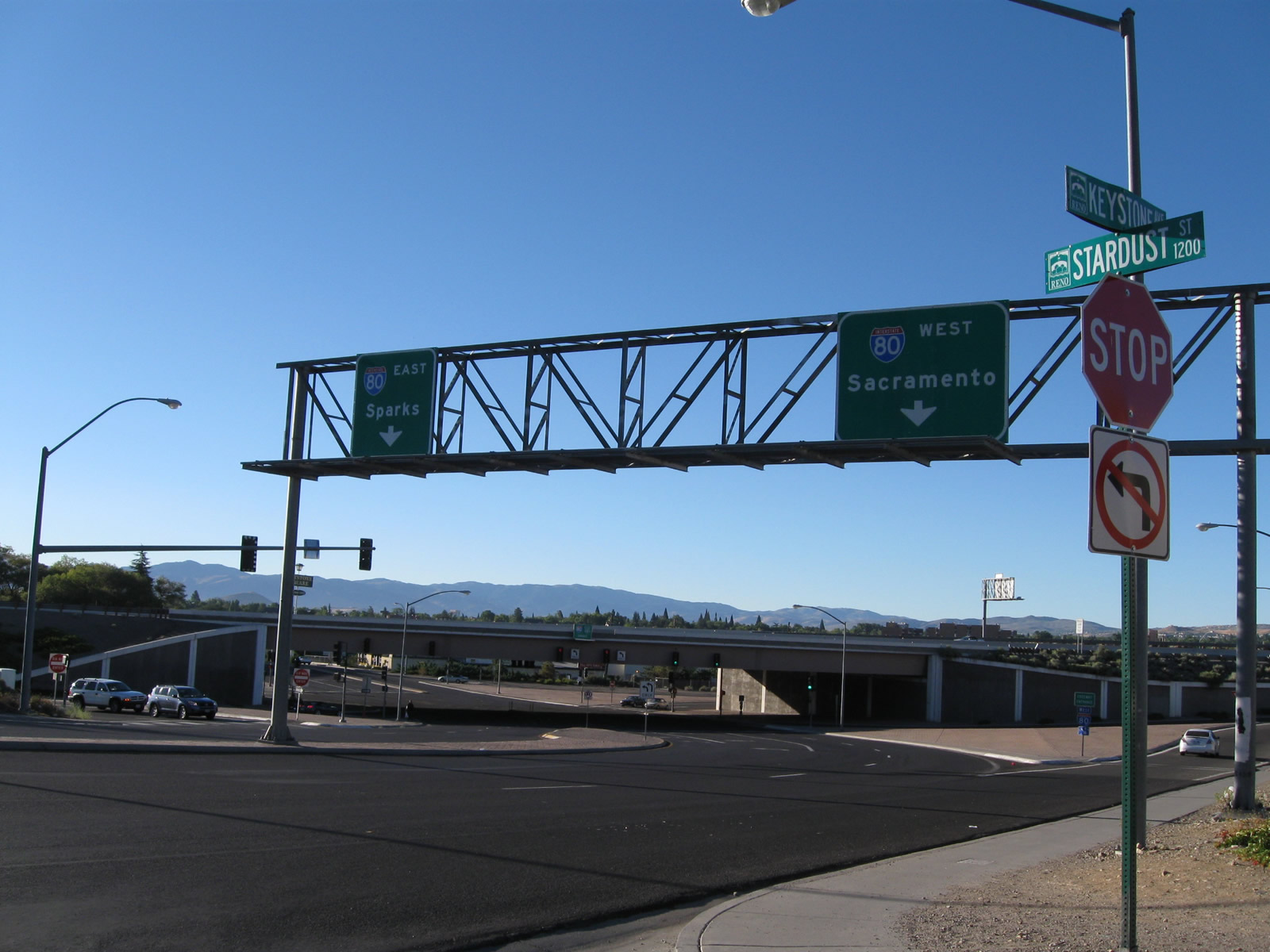   | Southbound Keystone Avenue at the single-point urban interchange with I-80. Interstate 80 east leads to Reno and Sparks and west to Verdi, Truckee and Sacramento. 09/05/10 |
   | This series of pictures shows twilight over the Reno skyline as seen from the Interstate 80-Keystone Avenue interchange. 09/04/10 |
| Lake Street |
 | Passing through an intersection with First Street, southbound Lake Street crosses the Truckee River. At the south bank of the river is an older Reno arch that spans over the street. 07/23/09 |
 | This arch, which states "Reno - The Biggest Little City in the World" just like the modern one on Virginia Street, was first erected in 1926 in honor of the Nevada Transcontinental Highways Exposition of Summer 1927. This exposition celebrated the completion of U.S. 40, the Victory Highway, and U.S. 50, the Lincoln Highway. The arch was reconfigured after the event was over, and in 1935 this arch took its current form. It was moved off Virginia Street in 1963 and found its way to the current location on Lake Street in 1995 near the National Automobile Museum and the Siena Hotel Casino. For much more on the history of the Reno arches, visit New to Reno: The Reno Arch. 07/23/09 |
 | Southbound Lake Street meets Mill Street. 07/23/09 |
| Nugget Avenue |
 | Sparks's lone high-rise casino is the Nugget (built 1984), located on the south side of the elevated Interstate 80 freeway in downtown Sparks. The Union Pacific Railroad switch yard sits on the south side of the freeway. This view looks east on Nugget Avenue between the hotel and the railroad tracks. 07/23/09 |
 | Eastbound Nugget Avenue meets SR 445 (Pyramid Way), which travels north to Pyramid Lake, Gerlach, and the Black Rock Desert 07/23/09 |
| Truckee River Bridges in Downtown Reno |
 | The Reno River Walk is named in honor of Raymond I. Smith; this trellis is found on the south bank. 07/21/09 |
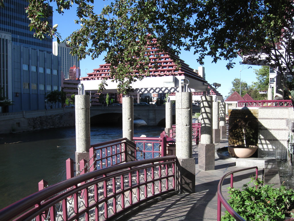 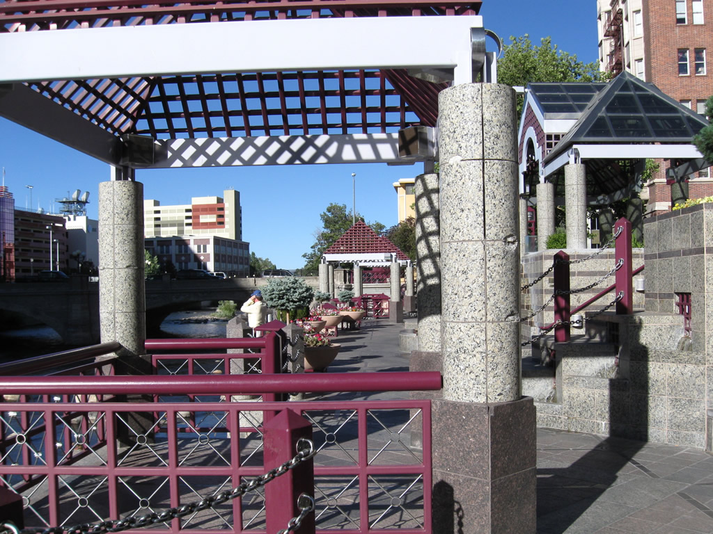     | An elaborate network of decorative ramps, railings, and kiosks line the south side of the Truckee River through downtown Reno. The Virginia Street bridge is visible in the background. Along the south side of the river are several water features. 07/21/09 |
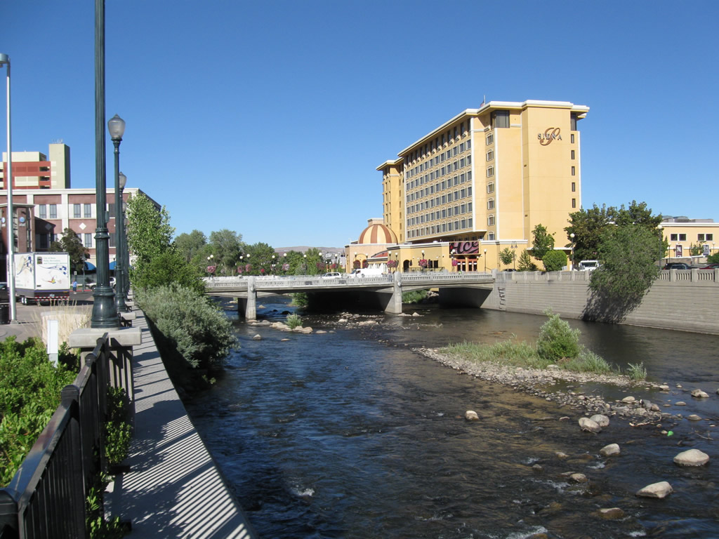 | This view looks east from the U.S. 395 Business (SR 430) / Virginia Street bridge to the Center Street bridge over the Truckee River in downtown Reno. 07/21/09 |
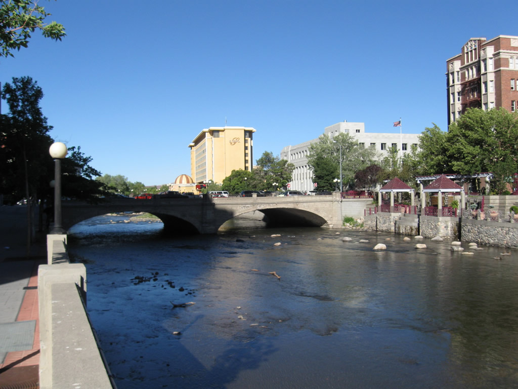 | The 1905 Virginia Street bridge over the Truckee River is a double-concrete arch bridge; this view looks east from the Sierra Street bridge. This bridge carries U.S. 395 Business and SR 430 over the river. Plans call for replacement of the Virginia Street bridge (along with the Sierra Street and Lake Street bridges over the Truckee River) in the 2010s as part of the Truckee River Flood Project due to flooding issues in downtown Reno (a devastating flood struck the area in 1997). For more on the Virginia Street Bridge including history and bridge replacement proposals, see On-Line Nevada. 07/21/09 |
 | Looking south from the north bank of the Truckee River at the Sierra Street crossing, old bridge railing lines the River Walk. 07/21/09 |
 | The Reno River Walk offers dining and shopping along the north and south sides of the Truckee River in downtown Reno. Looking west from the Sierra Street crossing of the Truckee River, an antique street light illuminates the intersection of the River Walk with Sierra Street (former U.S. 395 Alternate). 07/21/09 |
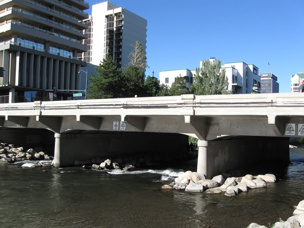
  | Southbound Sierra Street (former U.S. 395 Alternate) crosses the Truckee River. Sierra Street is one way southbound over the river. Like the nearby Virginia Street and Lake Street bridges, this bridge is programmed for removal and replacement as part of the Truckee River Flood Project. 07/21/09 |
 | Looking east on the Reno River Walk toward the Sierra Street bridge, the Truckee River has a walled flood control channel as it passes through downtown Reno. 07/21/09 |
   | From Sierra Street west to Arlington Avenue, the river passes through Wingfield Park and sees plenty of floaters and rafters in the water. 07/21/09 |
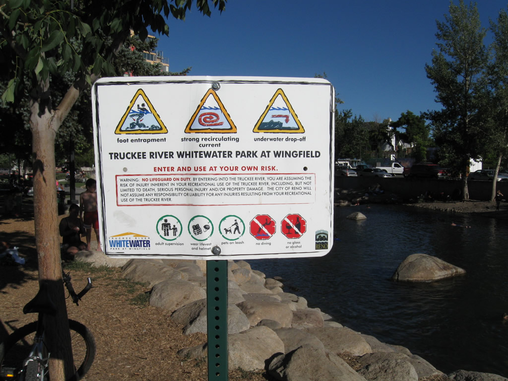 | Swimmers and floaters about to use the Truckee River are warned of possible risks and perils within the swift moving waterway. This sign is found in Wingfield Park. 07/21/09 |
 | A rose-colored pedestrian bridge crosses the main channel of the Truckee River west of Sierra Street between the north bank and Wingfield Park, a large turfed park located on an island in the river. 07/21/09 |
 | From the pedestrian bridge is this view looking east along the Truckee River channel. 07/21/09 |
  | Arlington Avenue crosses the Truckee River in Wingfield Park; this view looks northeast at the bridge from pedestrian walkway in the park. 07/21/09 |
 | West of Arlington Avenue, the Truckee River widens out to a more natural channel as compared to that seen in downtown Reno. 07/21/09 |
Sources:
- “Demolition Nears for Pyramid McCarran Project.” KOLO-TV 8 (Reno, NV), December 8, 2014.
Page updated July 23, 2018.