|
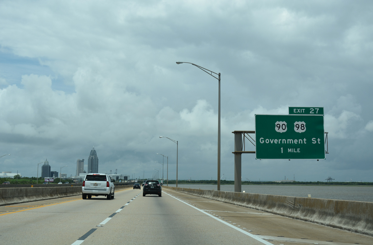
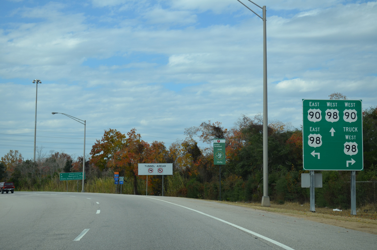
| I-10 and U.S. 90/98 (Battleship Parkway) meet for a third time at two overlapping wye interchanges (Exit 27) adjacent to the Bankhead Tunnel. 06/05/17 |
|
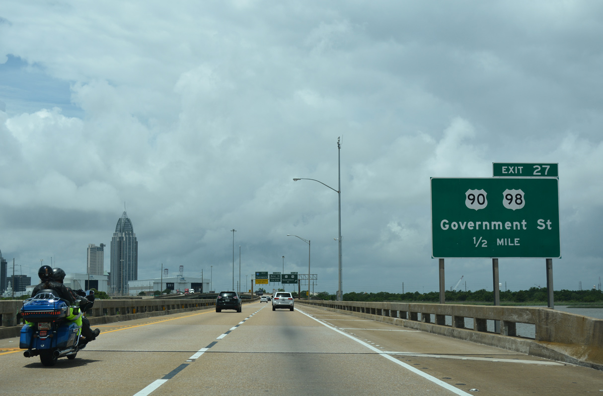
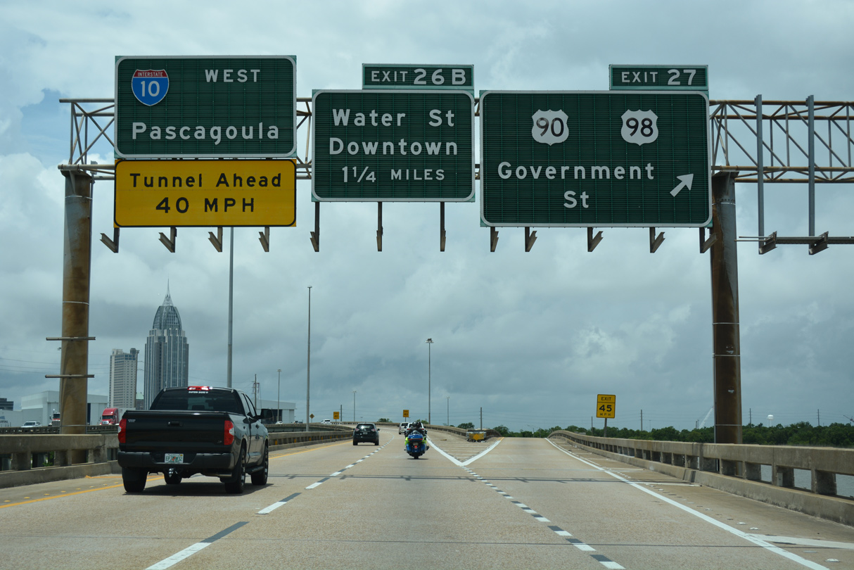
| Exit 27 departs I-10 west in two tenths of a mile for U.S. 98 west to Downtown Mobile and U.S. 90 (Cochrane Causeway) north to Prichard. 06/05/17 |
|
| Interstate 10 (Mobile Bayway) crosses onto Blakeley Island from Polecat Bay at Exit 27. U.S. 90/98 meet I-10 between the USS Alabama and the east entrance to the Bankhead Tunnel. 06/05/17 |
|
| All vehicles transporting hazardous materials (HAZMAT) west along I-10 are required to cross the Mobile River on the Cochrange-Africatown Bridge (U.S. 90/98 Truck) to lieu of the George Wallace or Bankhead Tunnels. 11/25/14 |
|
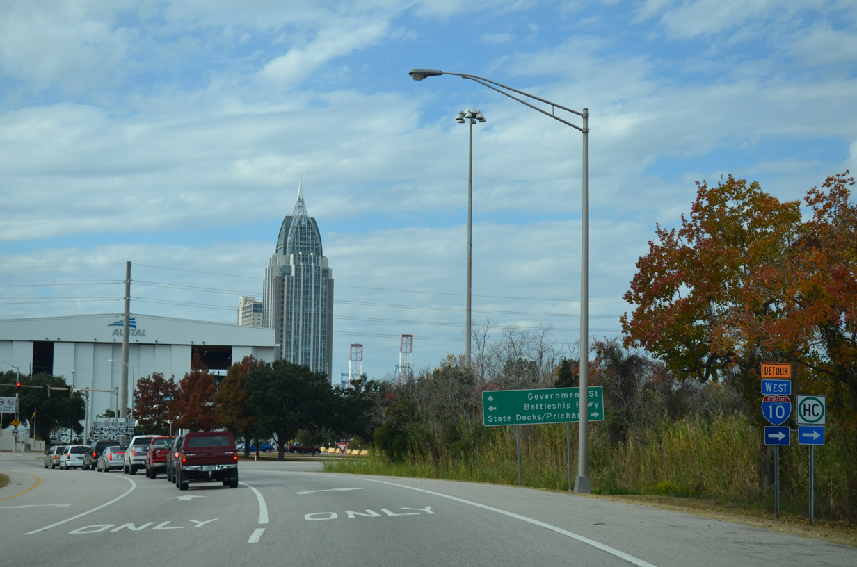
| U.S. 90/98 split at Exit 27 and reconvene along the Henry Aaron Loop encircling Downtown Mobile. Beyond Mobile, U.S. 98 travels northwest away from the Gulf Coast to Hattiesburg, Mississippi. 11/25/14 |
|
| U.S. 90/98 Truck (Cochrane Causeway) loop north by the Alabama State Docks to Magazine in Mobile and back south along I-165 from Prichard. 11/25/14 |
|
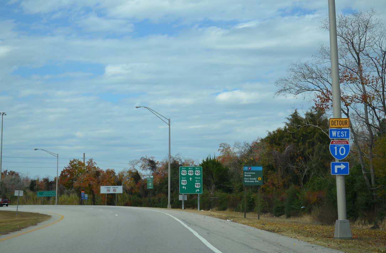
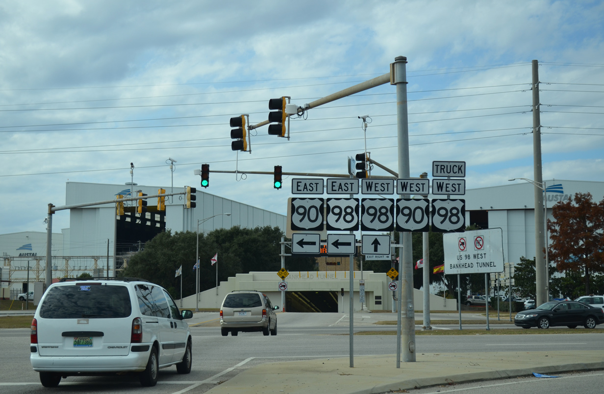
| Prior to 1999, U.S. 90/98 overlapped west through the Bankhead Tunnel to Downtown Mobile. Opened in 1941, the Bankhead Tunnel crosses the Mobile River with two lanes west to Government Street at Conception Street. 11/25/14 |
|
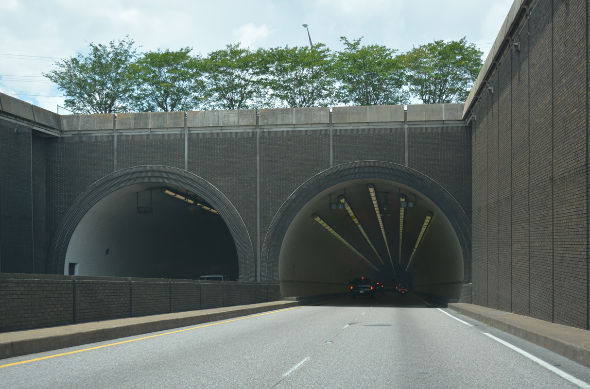
| Interstate 10 lowers into the George C. Wallace Tunnel across the Mobile River ahead of Dunlap Drive, the Alabama Department of Transportation Traffic Management Center and adjacent ship building facilities. 06/05/17 |
|
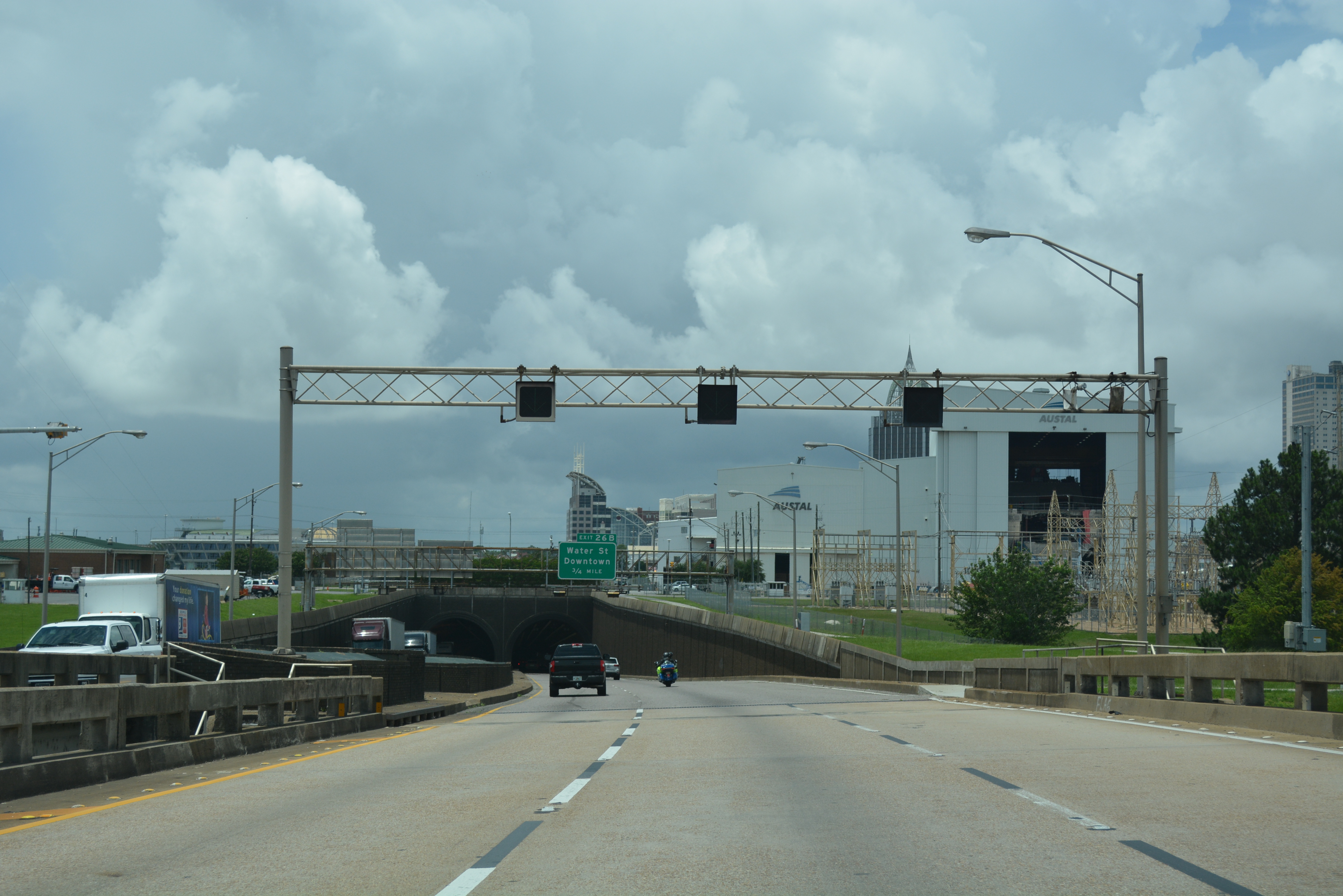
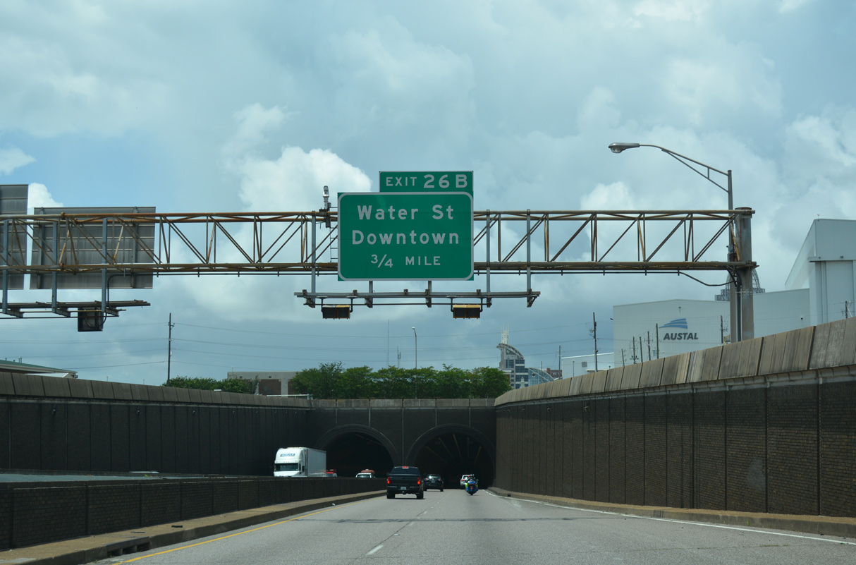
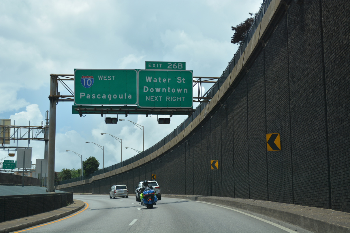
| I-10 emerges from the Wallace Tunnel at a two-wye interchange (Exit 26B) with Water Street. The exchange was built for the south end of I-210, the canceled urban loop through Downtown Mobile. 06/05/17 |
|
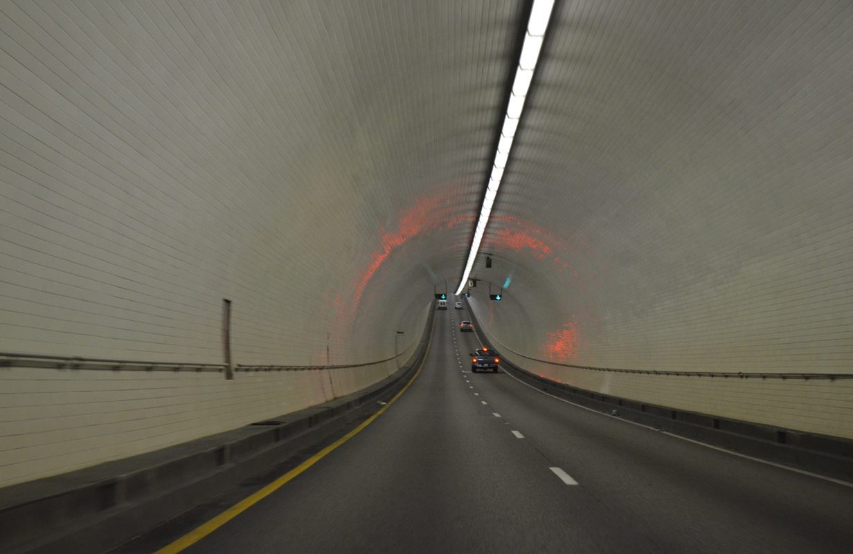
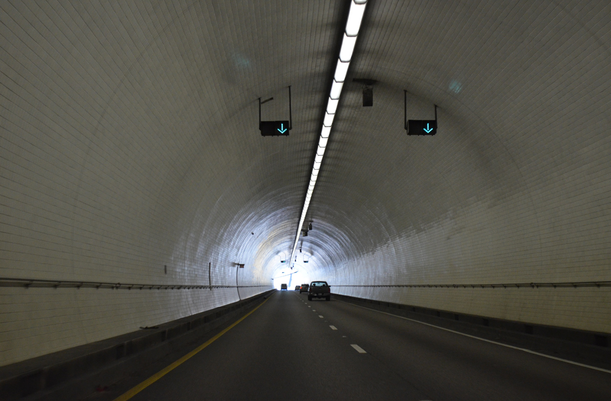
| The George C. Wallace Tunnel opened on February 9, 1973 as the third Mobile River crossing between Mobile and Blakeley Island. Shelved in 2019, a six lane cable-stayed bridge was proposed to replace the four lane tunnel. 06/05/17 |
|
| Costing approximately $50 million, construction on the George C. Wallace Tunnel commenced on October 9, 1969.1 05/09/15 |
|
| Passing is permitted through the Wallace Tunnel and the speed limit is posted at 50 miles per hour. 05/19/14 |
|
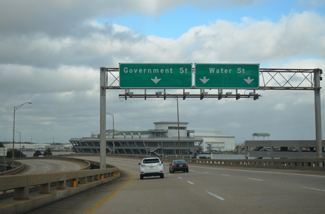
| Water Street constitutes a six lane boulevard running north from Canal Street at I-10 alongside a CSX Railroad line to the Arthur R. Outlaw Convention Center, RSA Tower and the GM&O Transit Center at Beauregard Street (U.S. 90). 06/05/17 |
|
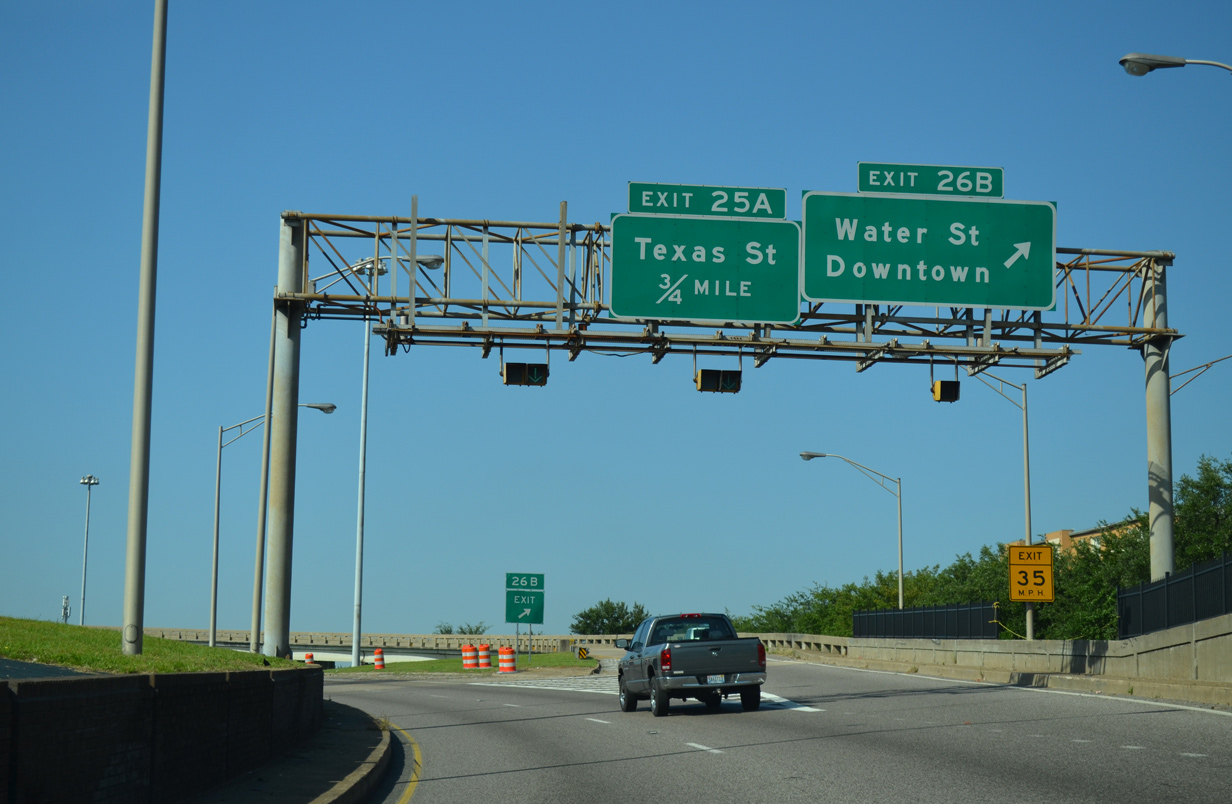
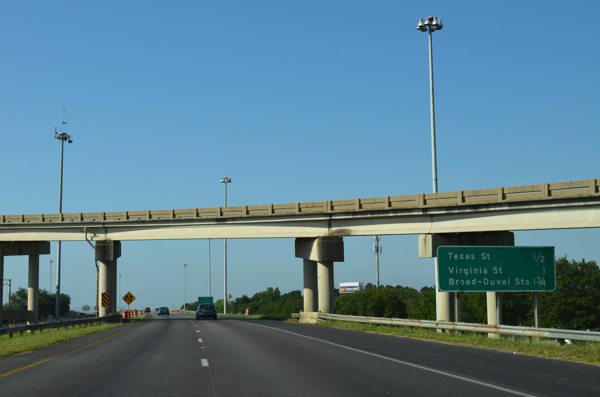
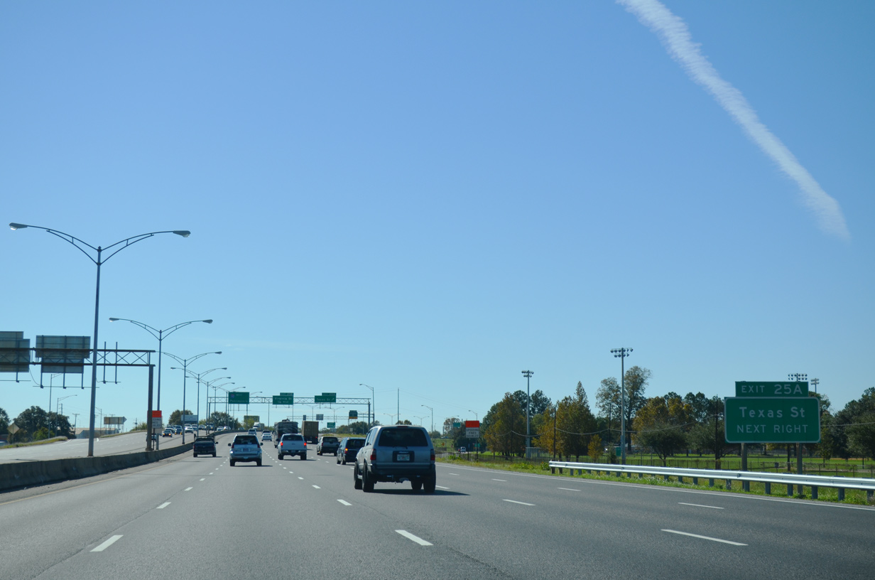
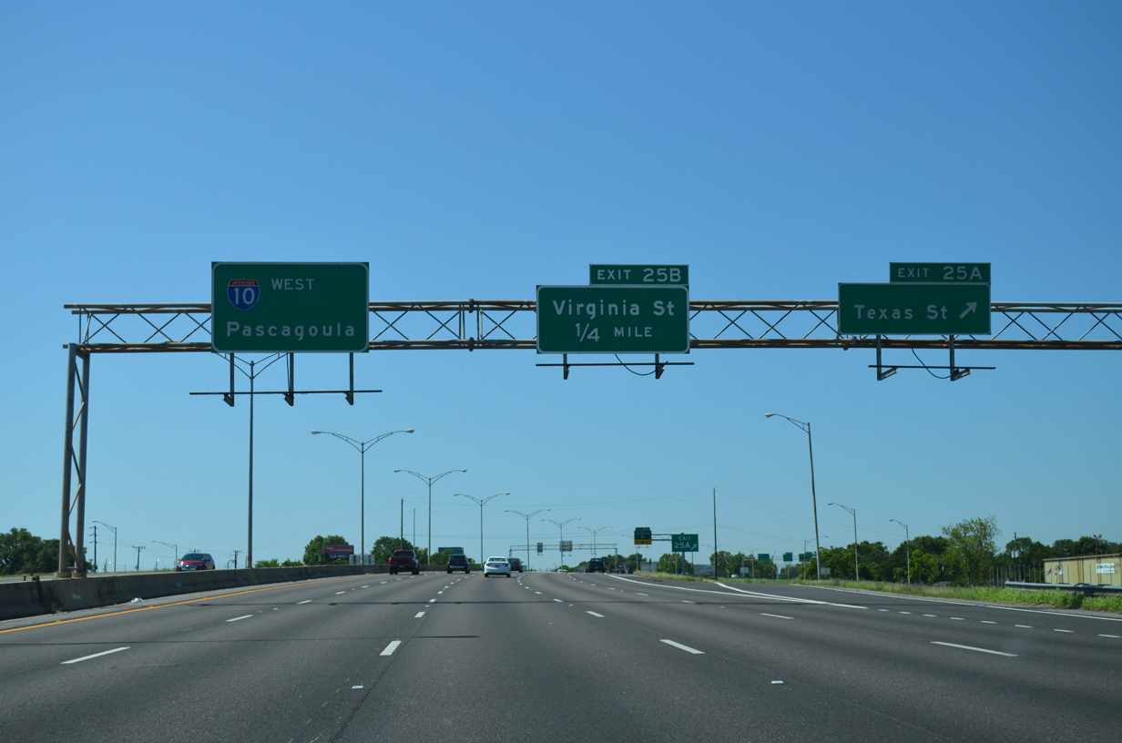
| Paralleling Claiborne and Conception Streets, I-10 turns southward from the Wallace Tunnel to Texas Street at Exit 25A. 05/19/14 |
|
| Encircling the Fort Condé area, the flyover at Exit 26B loops north onto Water Street at Government Street. 11/23/14 |
|
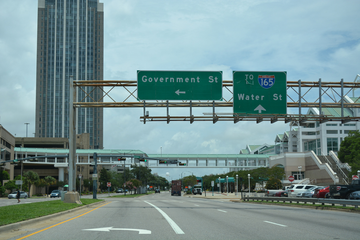
| Water Street extends 0.8 miles north from Government Street to the south end of I-165. The at-grade boulevard was constructed in place of an elevated freeway (I-210). I-210 was approved by AASHTO on June 25, 1981 and replaced with I-165 on June 6, 1989. 06/05/17 |
|
| I-10 advances south across Canal Street to Texas Street at Exit 25A. Future plans outline replacing the exchange at Water Street with a diverging diamond interchange at Canal Street adjacent to the Mobile Civic Center. 05/09/15 |
|
| The left entrance ramp from Water Street expands Interstate 10 westbound to four overall lanes. 11/21/08 |
|
| Auxiliary lanes open on both sides of I-10 between the half diamond interchanges with Canal Street and Texas Street. 11/20/15 |
|
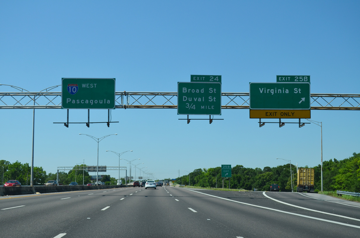
| Texas Street winds westward from the industrial areas east of I-10 at Royal Street to Broad Street and Michigan Avenue. 05/16/16 |
|
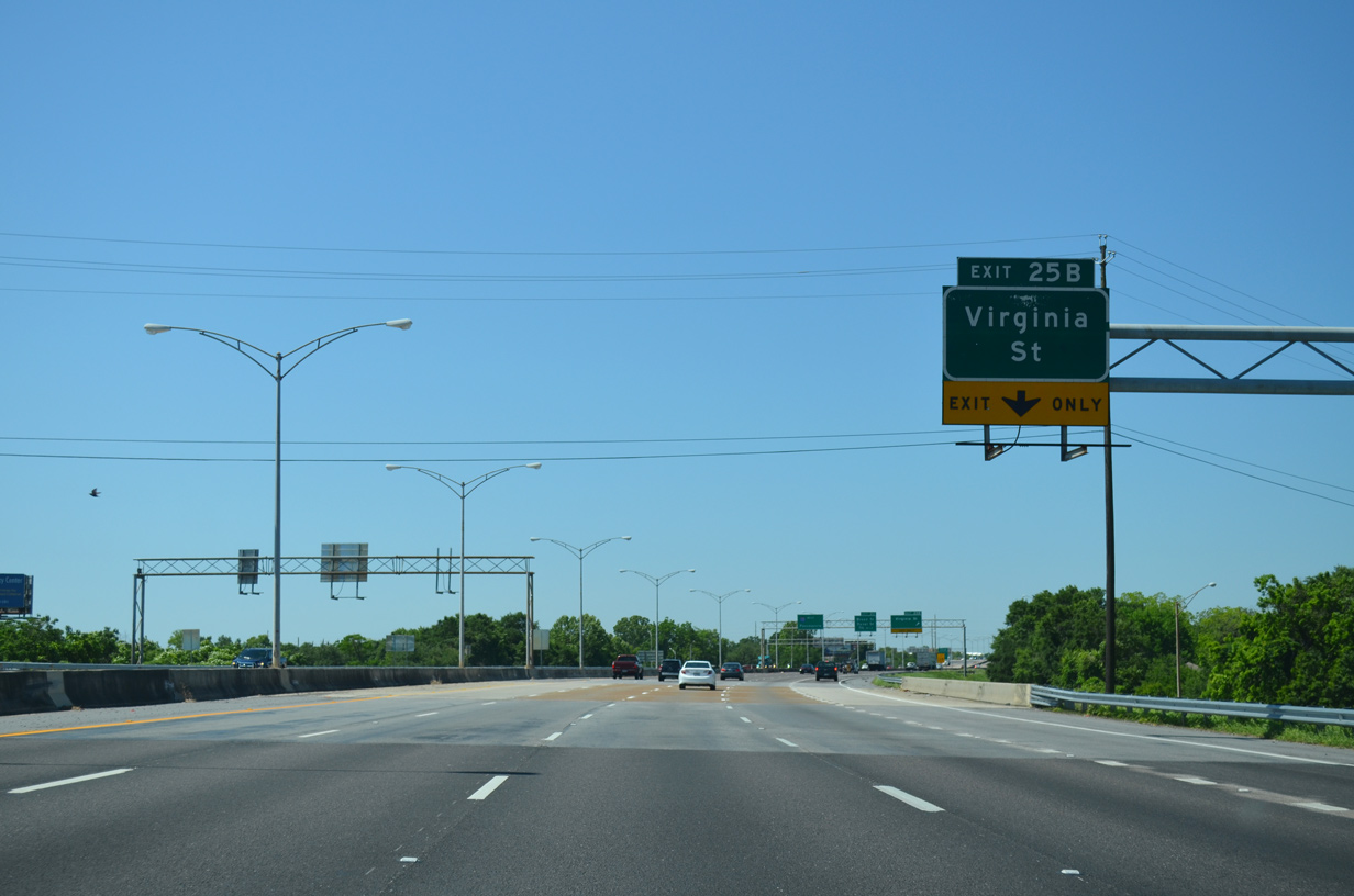
| A parclo interchange (Exit 25B) joins Interstate 10 with Virginia Street to the immediate south of Texas Street. 05/06/16 |
|
| The exit ramp to Virginia Street was previously striped for two lanes. Virginia Street leads west through neighborhood areas to Ladd-Peebles Stadium and Houston Street. The Ezra Trice Boulevard flyover east connects with port facilities on McDuffie Island. 05/06/16 |
|
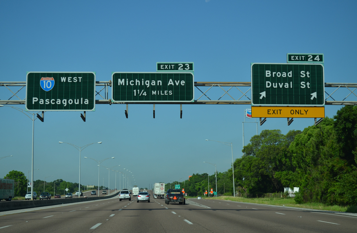
| Broad Street converges with I-10 south at Exit 24 by the Birdville community en route to the USCG Sector Mobile Brookley Complex and Old Bayfront Drive south to the University of South Alabama (USA) Brookley Center. 05/19/14 |
|
| Exit 24 is a split diamond interchange joining I-10 with Duval Street west from Broad Street to Michigan Avenue. Broad Street provides one of two routes from I-10 to Mobile Aeroplex at Brookley and Mobile Downtown Airport (BFM). 05/19/14 |
|
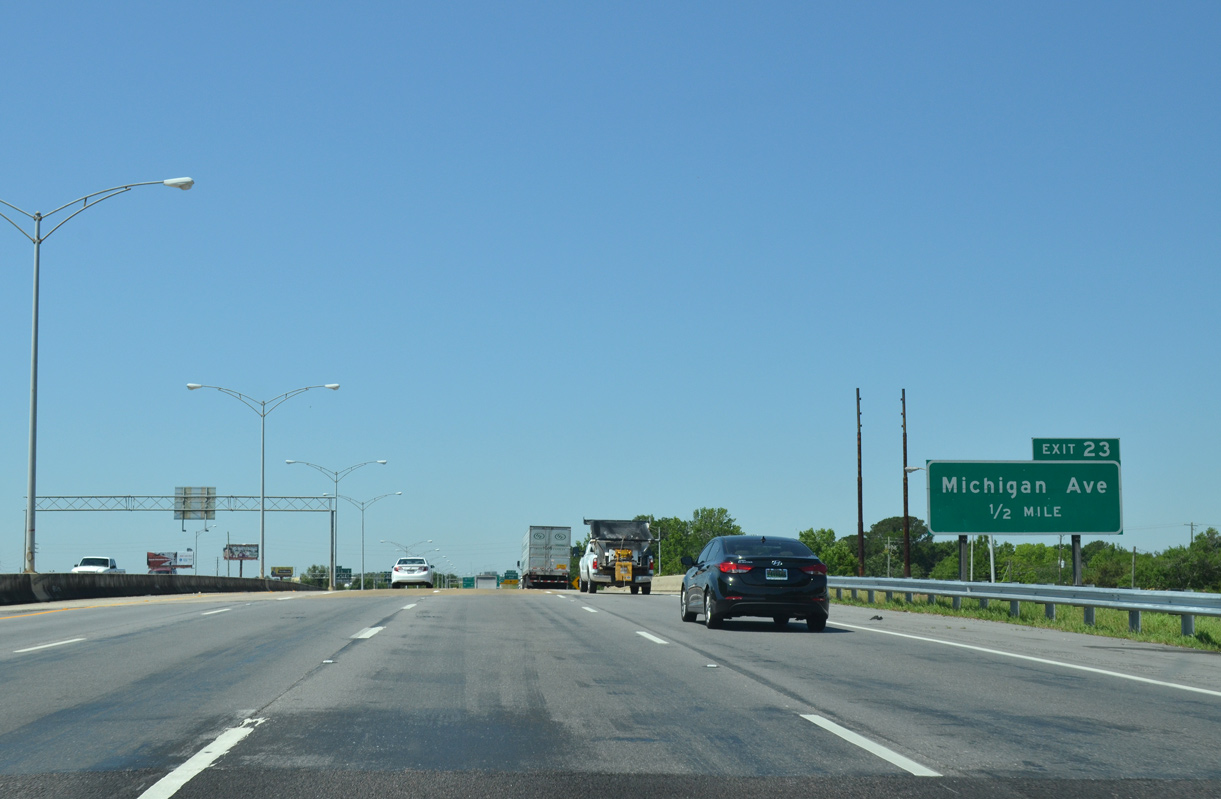
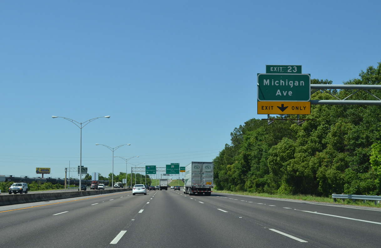
| Continuing southwest, I-10 meets Michigan Avenue at a parclo interchange (Exit 23). 05/06/16 |
|
| Michigan Avenue north leads toward Ladd-Peebles Stadium and U.S. 90 (Government Street). Ladd-Peebles Stadium is home to the Senior Bowl and University of South Alabama football. 05/06/16 |
|
| South from Exit 23, Michigan Avenue enters the Mobile Aeroplex at Brookley. 05/06/16 |
|
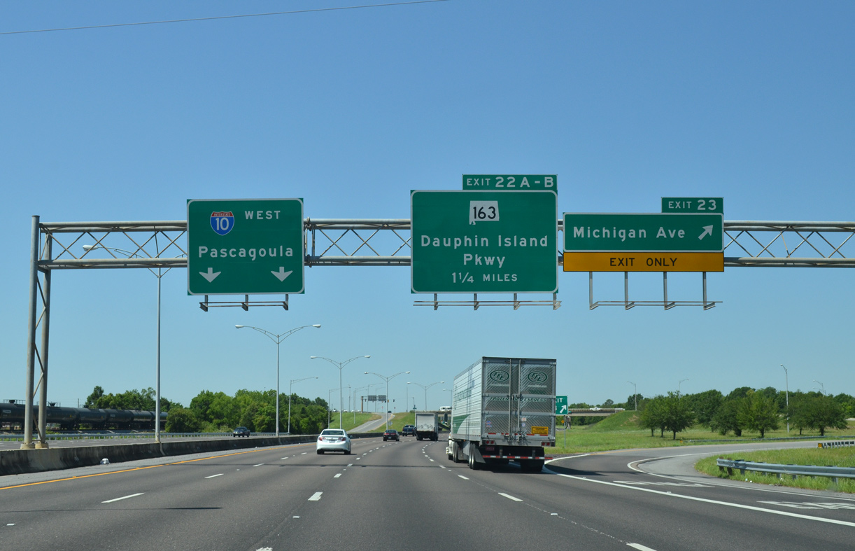
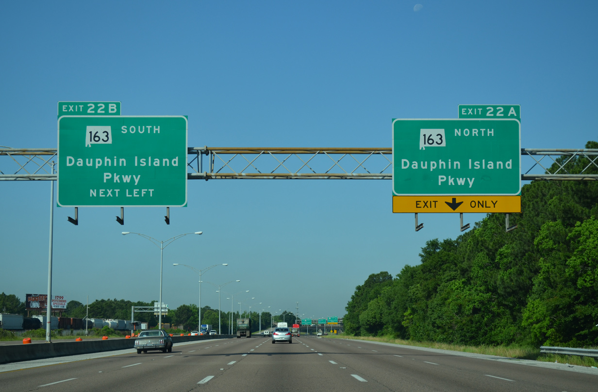
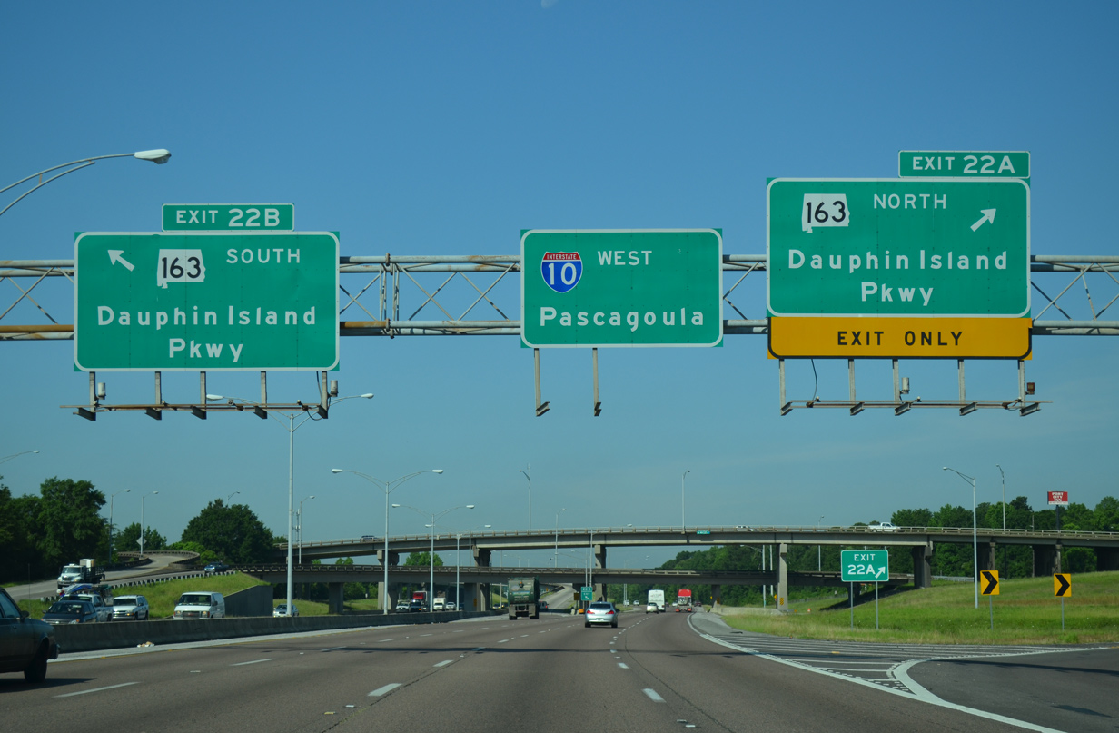
| An auxiliary lane opens from Michigan Avenue west to Exit 22A for SR 163 northbound. 05/19/14 |
|
| The first sign for the south end of Interstate 65 precedes the cloverstack interchange (Exit 22) with SR 163 (Dauphin Island Parkway). 05/19/14 |
|
| SR 163 (Dauphin Island Parkway) forms part of a route between Mobile and Dauphin Island on the Gulf of Mexico. The state route extends south to SR 193 at Hamilton Boulevard. 05/19/14 |
|
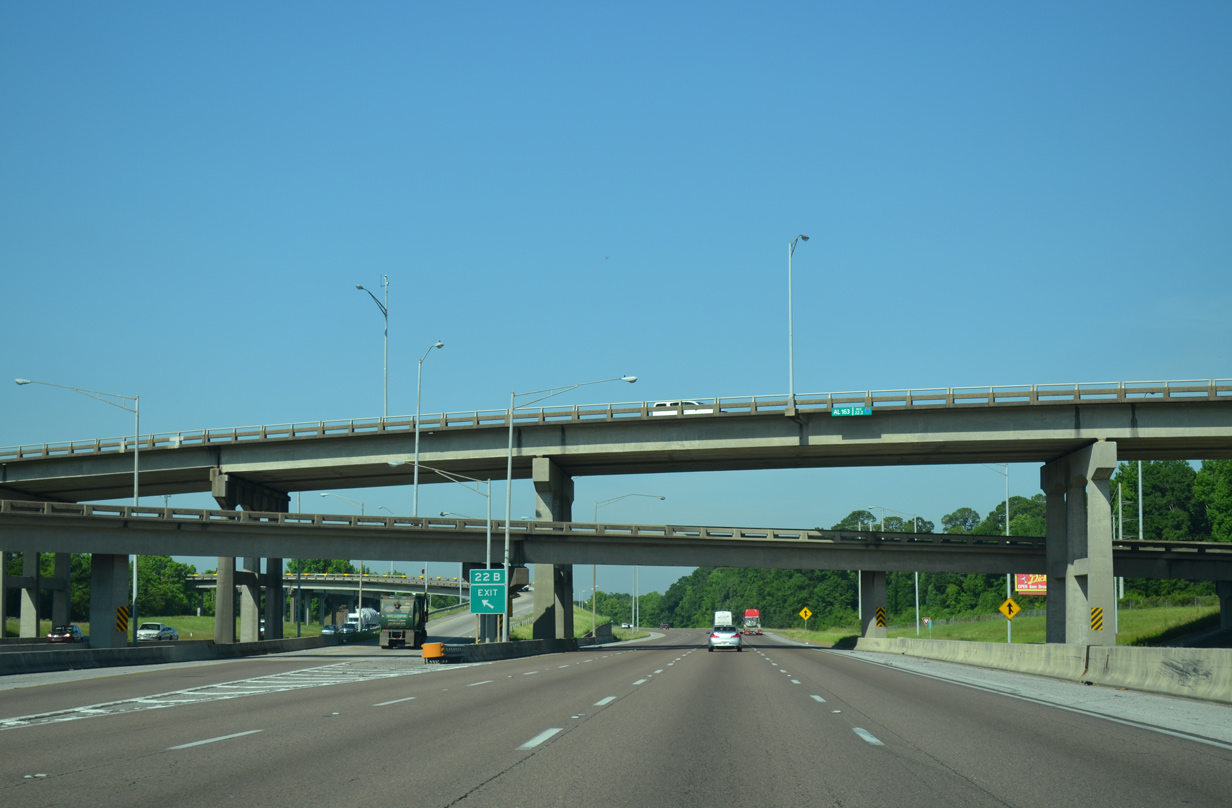
| Exits 22A and 22B depart simultaneously for SR 163 (Dauphin Island Parkway). Locally known as DIP, the urban arterial leads north to the Bishop State Community College Carver Campus and U.S. 90 at Midtown Mobile and south to Dog River. 05/19/14 |
|
| I-10 maintains four westbound lanes through the multi level interchange with SR 163 (Dauphin Island Parkway). 05/19/14 |
|
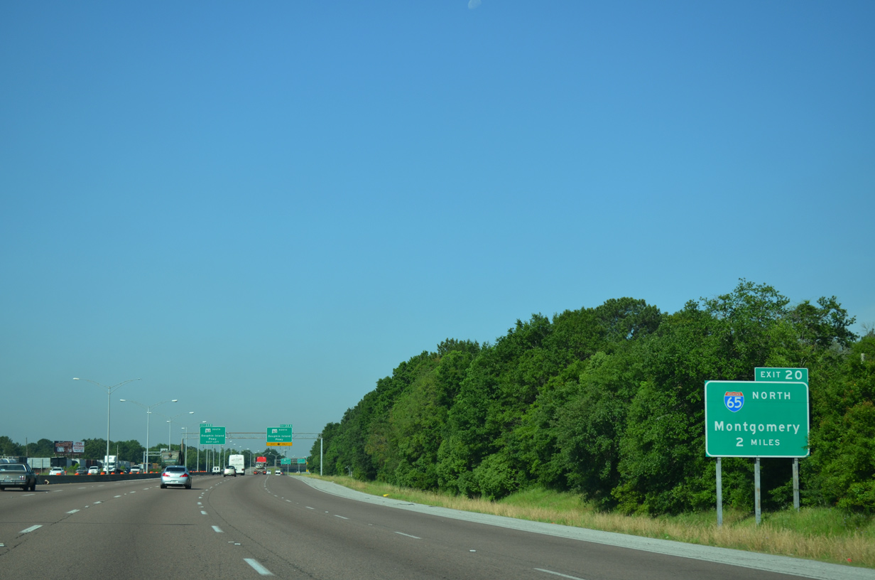
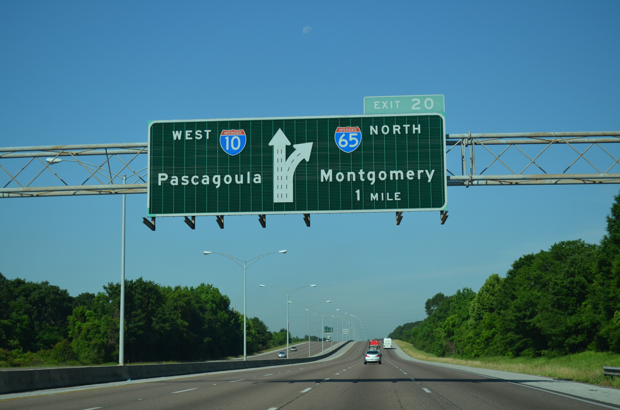
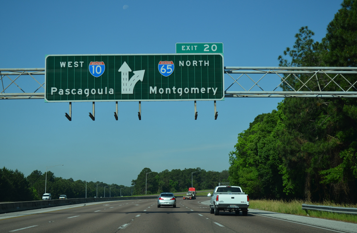
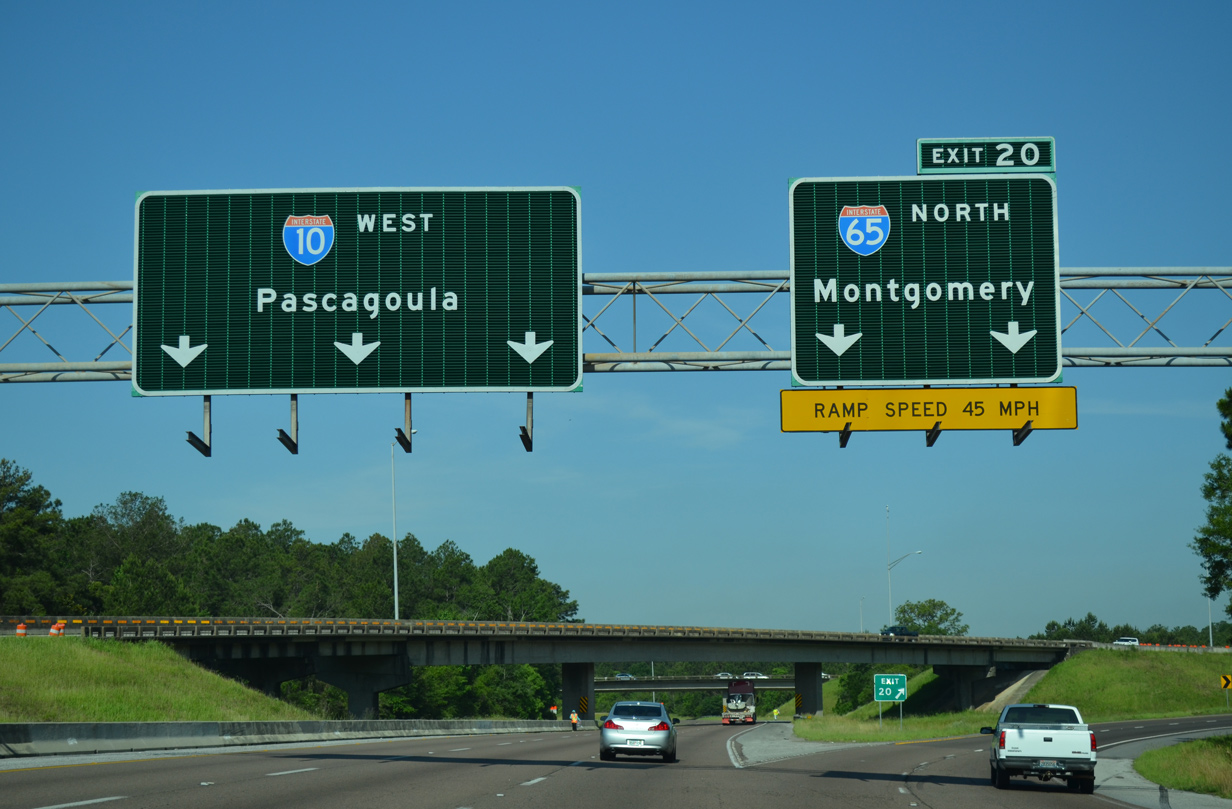
| I-10 crosses the Dog River ahead of the three-wye interchange (Exit 20) with Interstate 65. An 887 mile long route, I-65 joins the Gulf Coast with Birmingham, Nashville, Indianapolis and the Chicago area at Gary, Indiana. 05/19/14 |
|
| Two lanes join I-65 north from I-10 just west of Navco. I-65 follows the Mobile Belt Line to Prichard. The freeway between U.S. 90 and U.S. 45 was completed in January 1963.
This diagrammatic overhead was replaced with separate panels missing arrows by October 2021. 05/19/14 |
|
| Exit 20 is part of a commuter route between Downtown and arterial routes leading to Mid-Town and West Mobile. I-65 leads north through the suburbs of Chickasaw, Saraland and Satsuma to the Mobile and Tensaw Rivers en route to Montgomery. 05/19/14 |
|
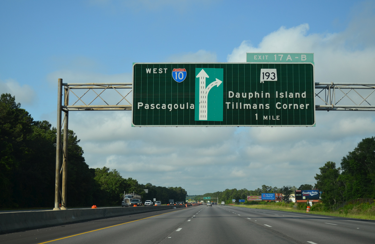
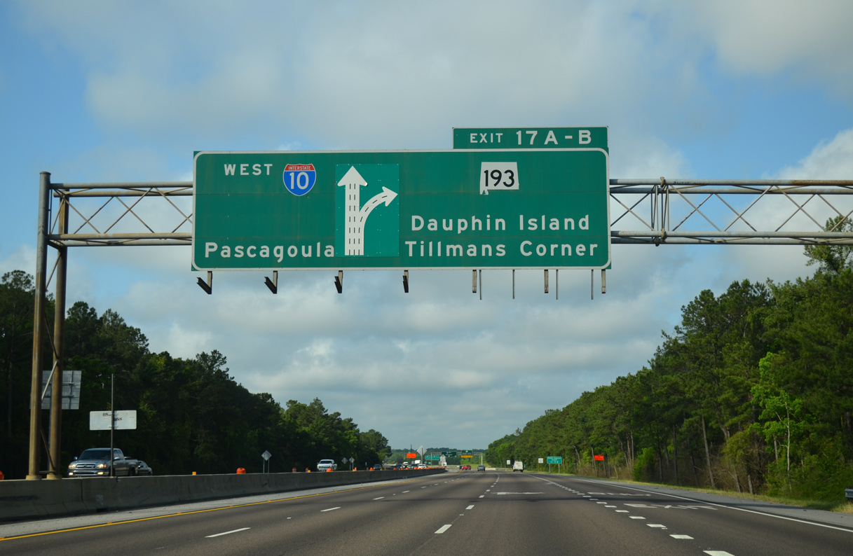
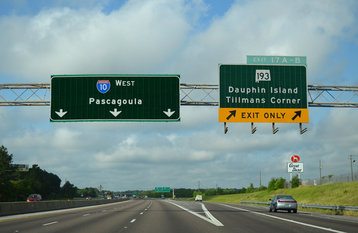
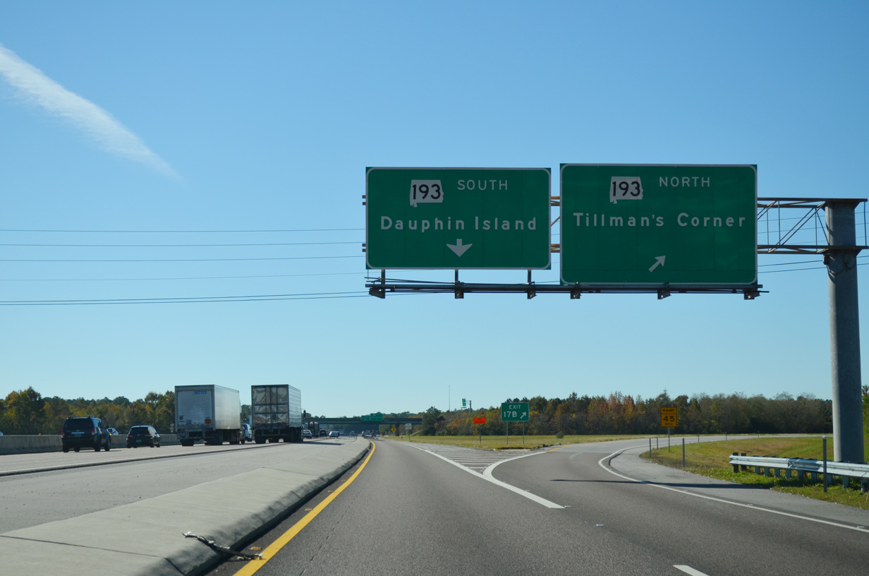
| Continuing southwest from I-65, Interstate 10 advances to a cloverleaf interchange (Exits 17B/A) with SR 193. SR 193 (Rangeline Road) links the Tillman's Corner area with Dauphin Island. 05/09/15 |
|
| An additional lane was added along I-10 west to the collector distributor roadway at Exit 17 during the late 2000s. The exchange with SR 193 opened in 1979 when Rangeline Road replaced Nevius Road.
This diagrammatic sign was replaced with separate panels using Clearview font by January 2022. 05/09/15 |
|
| Construction in 2011-13 widened Interstate 10 to six overall lanes west from Exit 17 to the Carol Plantation Road overpass beyond Exit 15. 05/09/15 |
|
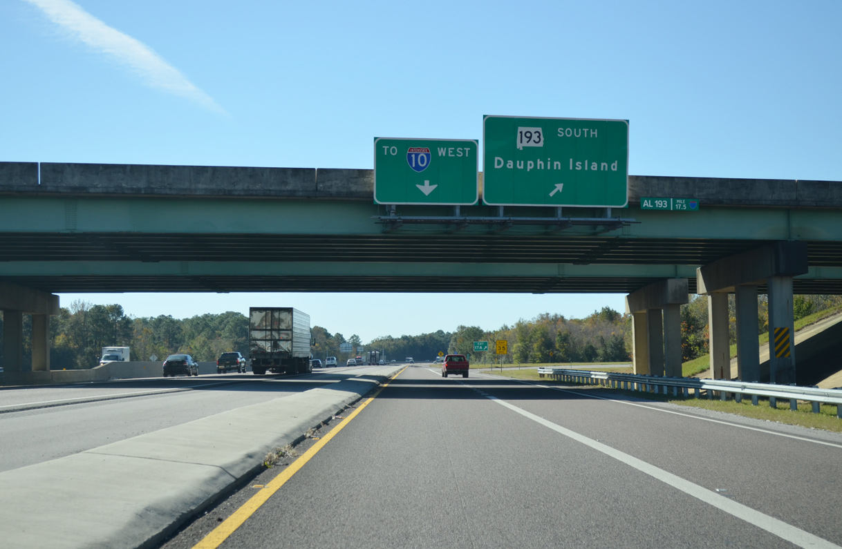
| SR 193 (Rangeline Road) concludes just west of Exit 17B at U.S. 90 and Nevius Road in Tillman's Corner. 11/20/15 |
|
| Exit 17A loops onto SR 193 (Rangeline Road) south toward Mann, Hollingers Island and SR 163 (Hamilton Boulevard). Replacing SR 163 as the main route from Bellefontaine south to Dauphin Island, SR 193 was built in 1979 as a four lane highway to the Theodore Navigational Ship Channel. 11/20/15 |
|
| I-10 trailblazer posted along the c/d roadway at Exit 17. 11/20/15 |
|
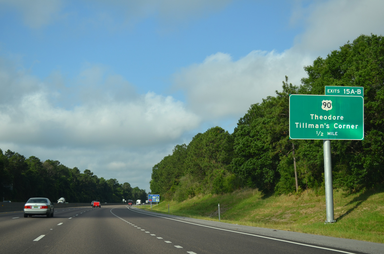
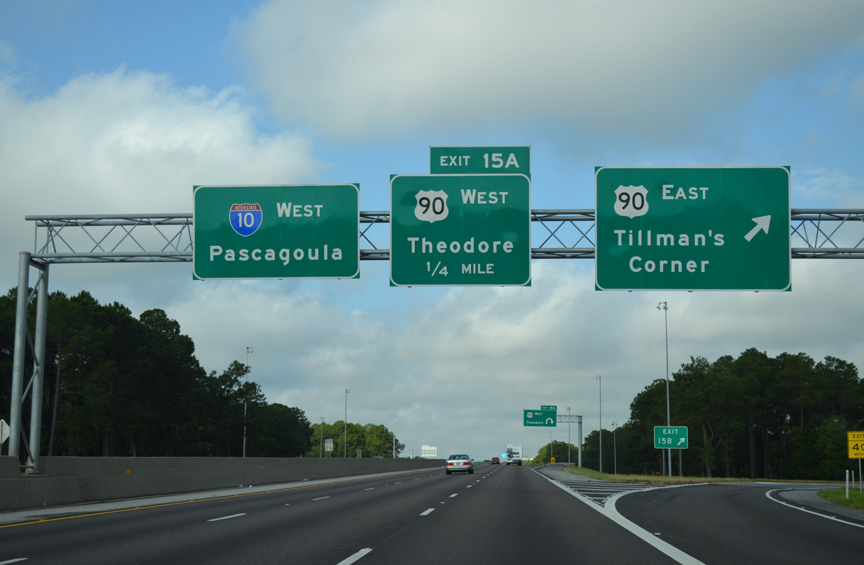
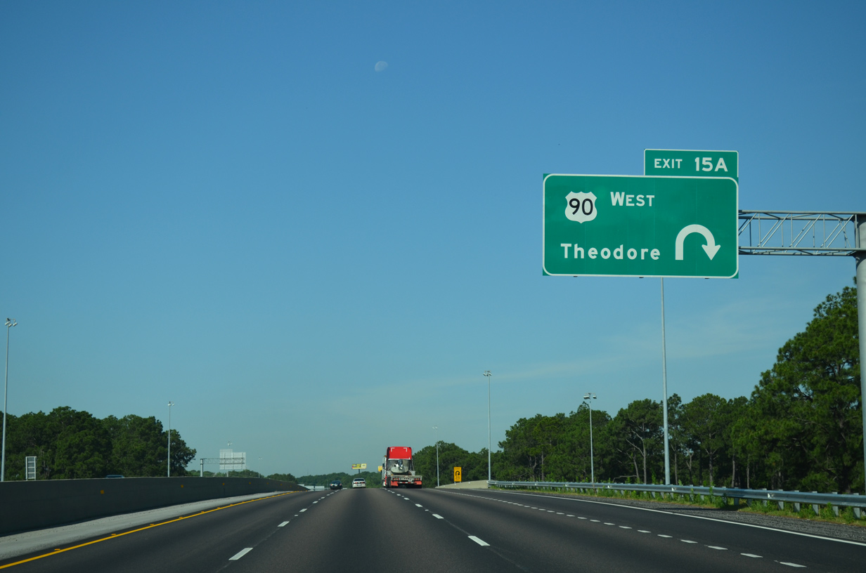
| U.S. 90 heads south through a heavily developed commercial corridor at Tillman's Corner to a six-ramp parclo interchange (Exit 15) with Interstate 10. 05/09/15 |
|
| North from Exit 15B, eight signalized intersections line U.S. 90 between I-10 and SR 193 (Rangeline Road) through Tillman's Corner. The tab for Exit 15B remains missing as of February 2022. 05/09/15 |
|
| Shifting south of I-10, U.S. 90 heads to Theodore and areas of Mobile annexed in 2007-08. West through Irvington, St. Elmo and Grand Bay, U.S. 90 transitions into a rural highway. I-10 and U.S. 90 do not directly meet again until New Orleans, Louisiana.
This overhead was replaced by 2022 and now erroneously references U.S. 90 east to West Theodore. 05/19/14 |
|
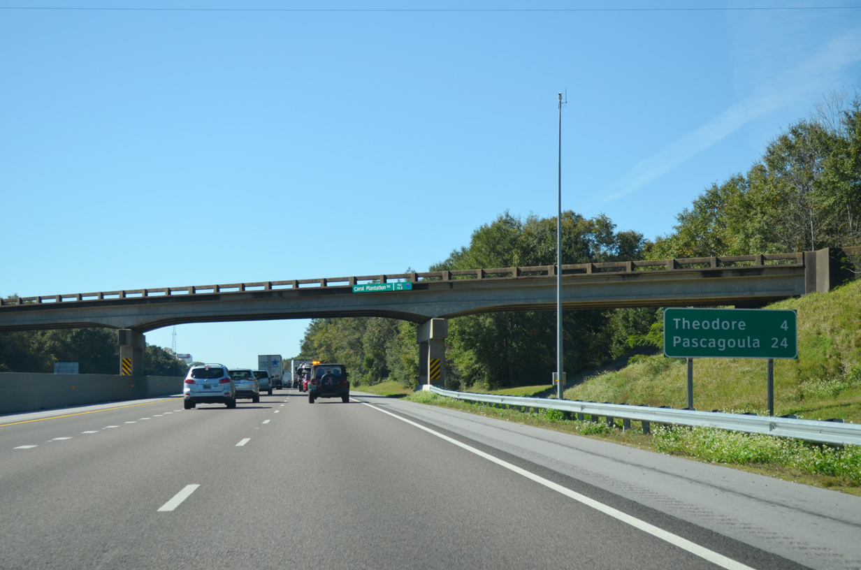
| Costing $26.4 million, six lane expansion of the 3.8 mile stretch of I-10 west to the Carol Plantation Road overpass kicked off in early March 2011.2 I-10 remains with just four lanes west to the Mississippi state line. 11/20/15 |
|
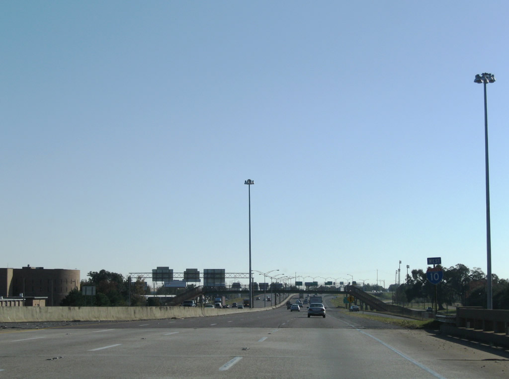
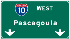
| Pascagoula, Mississippi represents the control city for I-10 from Mobile westward to the state line. The Mississippi Department of Transportation (MDOT) uses Biloxi and New Orleans. 11/20/15 |
|
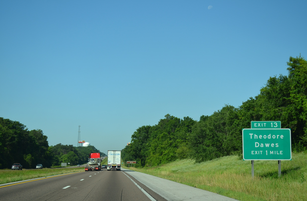
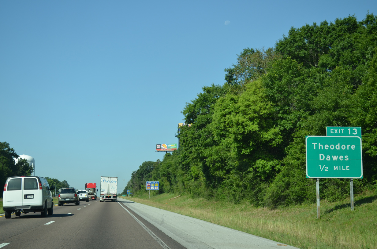
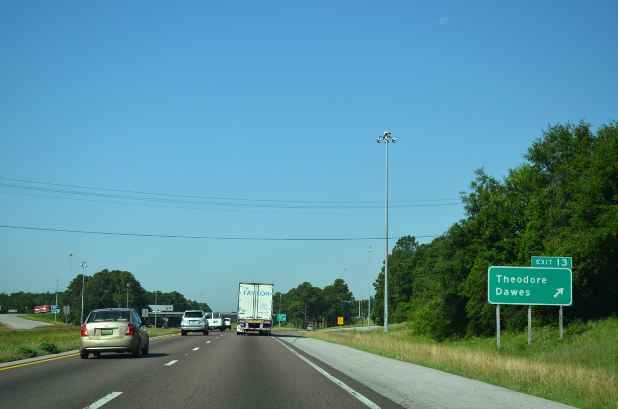
| Theodore-Dawes Road (CR 30) leads west from U.S. 90 at Hamilton Boulevard (CR 26) in Theodore to a diamond interchange with Interstate 10 at Exit 13. 05/09/14 |
|
| Theodore-Dawes Road (CR 30) provides a seamless link from I-10 to Schillinger Road (CR 31), a major arterial route north to West Mobile and Mobile Regional Airport (MOB). 05/19/14 |
|
| CR 30 (Theodore-Dawes Road) leads 2.8 miles northwest from I-10 to CR 39 (McDonald Road). 1999-2000 construction at Exit 13 replaced the Theodore-Dawes Road overpass with a five lane span. 05/19/14 |
|
| Leaving the Theodore area, Interstate 10 proceeds southwest toward Irvington. 04/20/12 |
|
| Prior to the completion of Exit 10, I-10 traveled along a nine mile exit less stretch to SR 188 near Grand Bay. 04/20/12 |
|
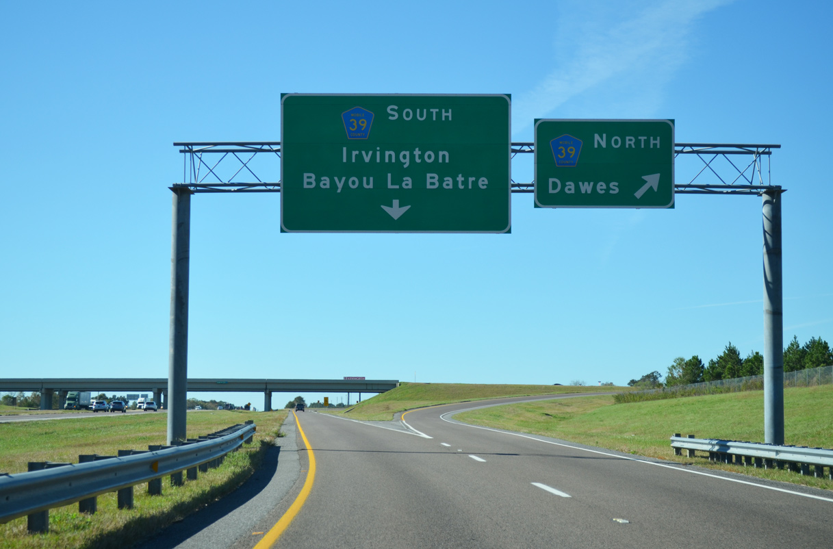
| Forthcoming CR 39 is a 6.9 mile long route between CR 24 (Half Mile Road) south of Irvington and Three Notch Road (CR 32) near Dawes in West Mobile. 04/20/12 |
|
| Completed in stages, road work between Summer 2005 and June 2009 relocated CR 39 eastward from McDonald Road onto a four lane arterial southeast from I-10 to Half Mile Road. 04/05/12 |
|
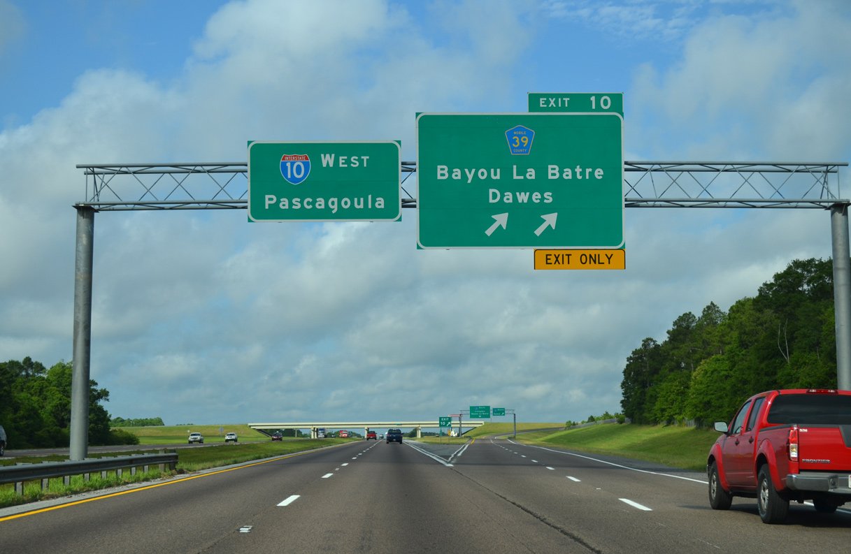
| The six-ramp parclo interchange (Exit 10) with CR 39 (McDonald Road) opened to traffic on January 12, 2005. 05/09/15 |
|
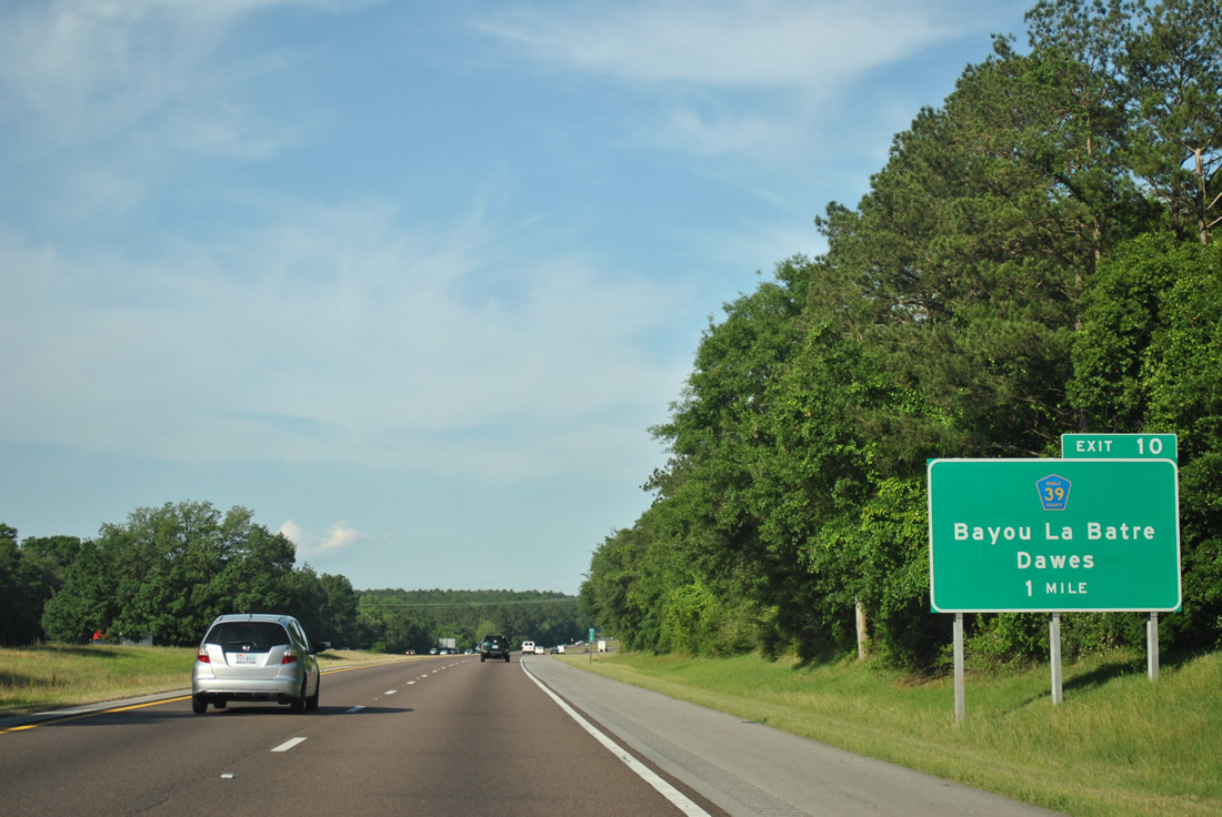
| South from grade separations with U.S. 90 and Park Boulevard at Irvington, CR 39 connects with CR 23 (Padgett Switch Road) south to SR 188 in Bayou La Batre. 11/20/15 |
|
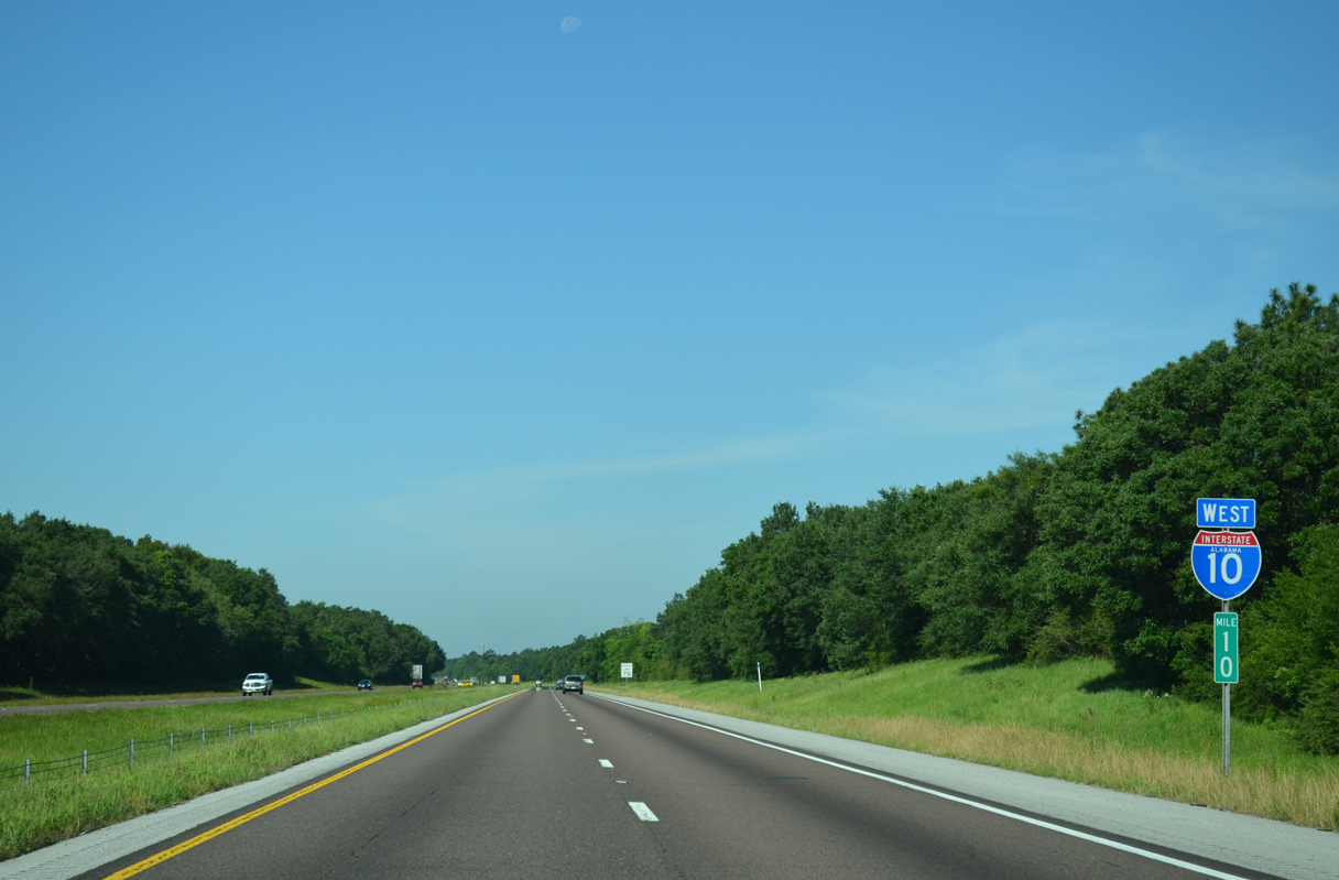
| Interstate 10 parallels Old Pascagoula Road (CR 28) west from CR 39 (McDonald Road) to the Mississippi state line. 05/19/14 |
|
| Not including bridge identification signs, this distance sign was the first along I-10 in Alabama designed with Clearview font. 05/19/14 |
|
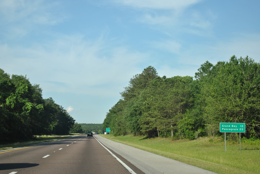
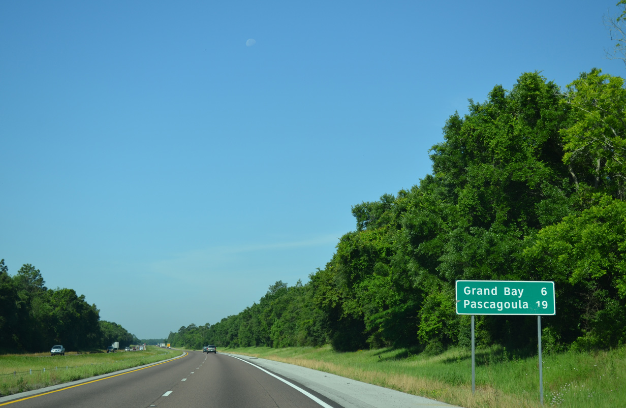
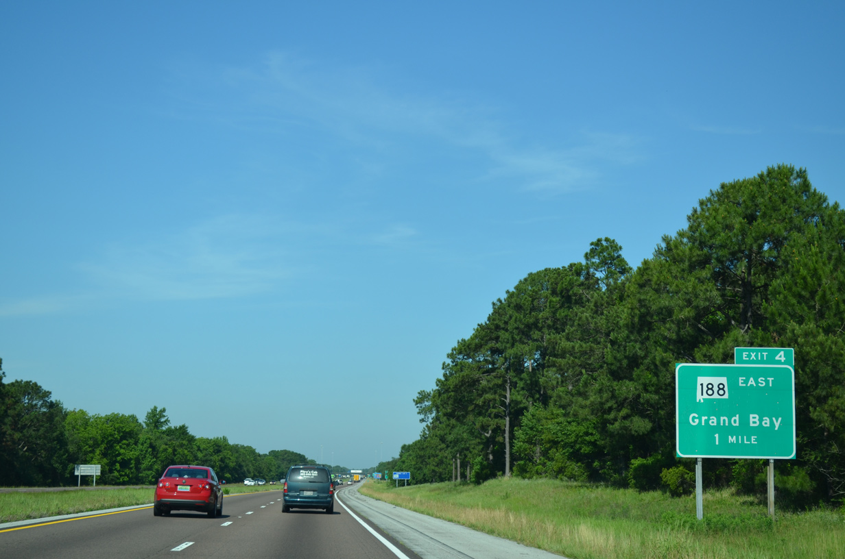
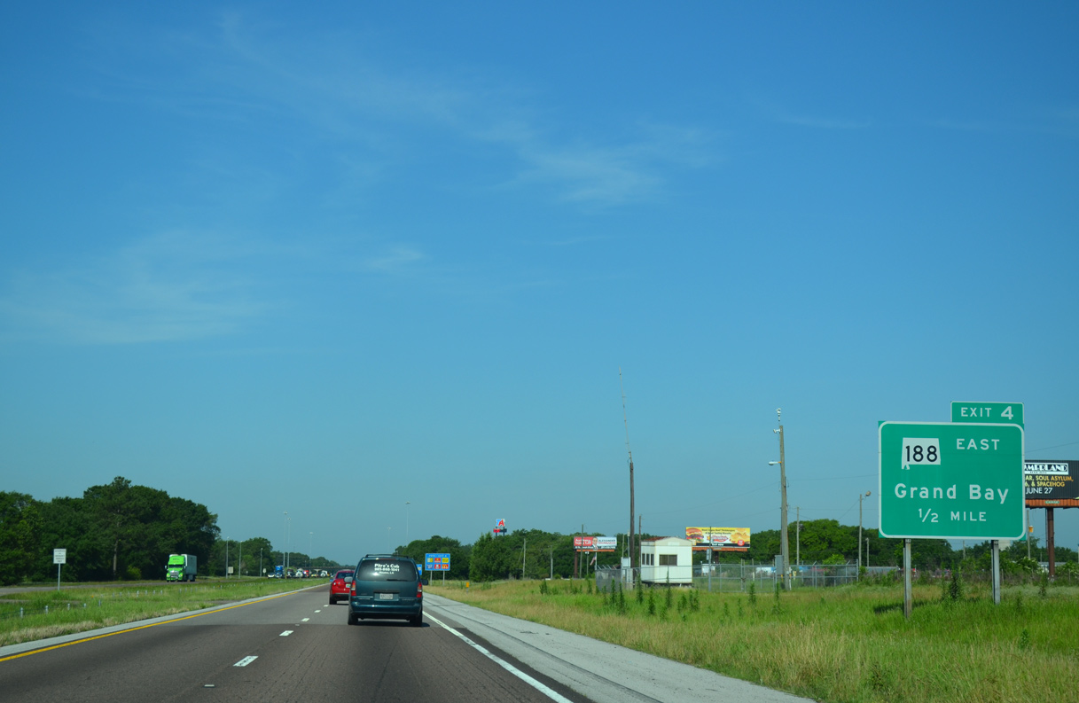
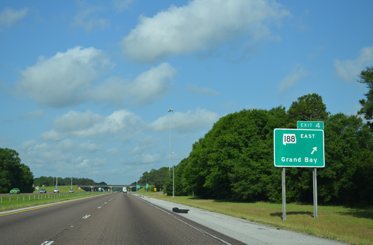
| SR 188 north and CR 11 (Grand Bay-Newman Road) come together at a diamond interchange (Exit 4) with I-10 by the community of Grand Bay. 05/19/14 |
|
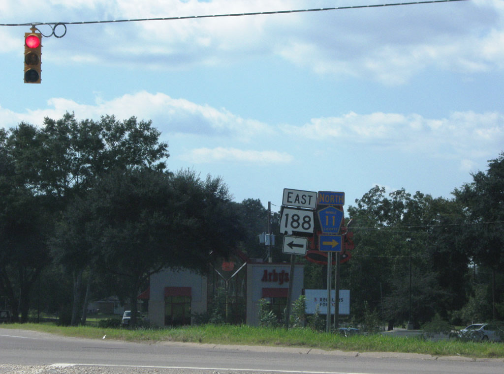
| SR 188 (Grand Bay Wilmer Road) follows a 19.7 mile route southeast from I-10 to the city of Bayou La Batre, Coden and SR 193 at Alabama Port. 05/19/14 |
|
| Motorist services at Exit 4 represent the last available along Interstate 10 westbound for 12 miles to the exchange with MS 63 at Moss Point. 05/09/15 |
|
| CR 11 (Grand Bay Wilmer Road) north connects Interstate 10 with West Mobile via Dawes Road (CR 33) in 4.8 miles and Airport Boulevard (CR 56) in 10.5 miles. 10/01/09 |
|
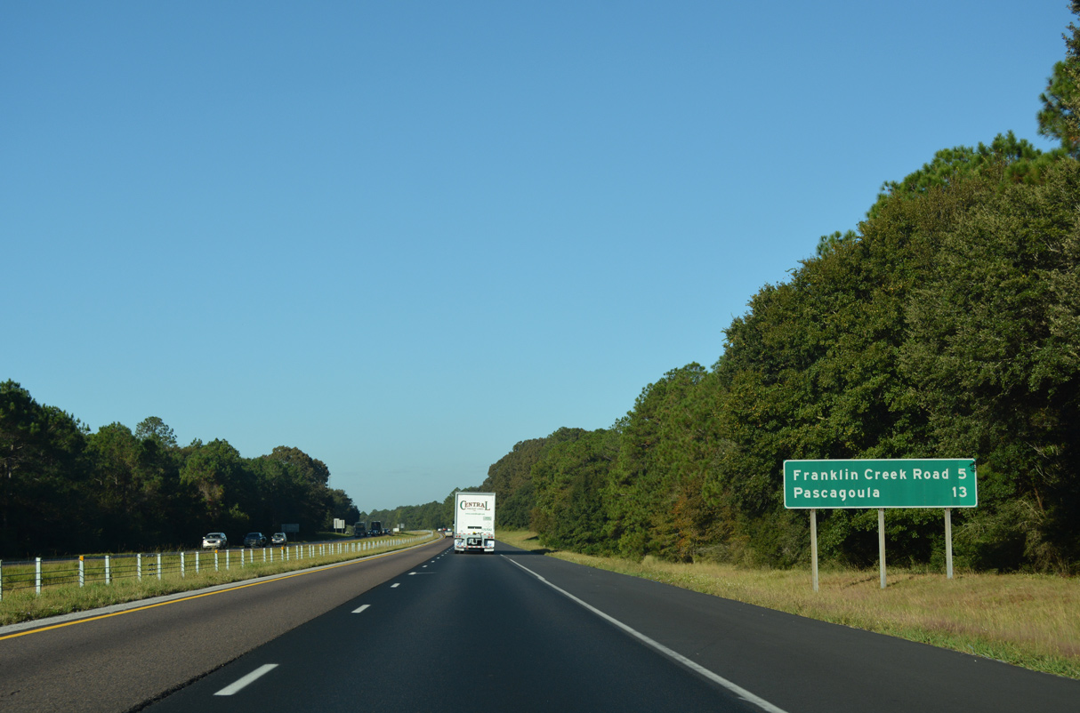
| Interstate 10 parallels Franklin Creek along the ensuing stretch west from Grand Bay. 10/12/16 |
|
| The succeeding exit from I-10 is for Franklin Creek Road, which is the first of three for Pascagoula, Mississippi. 10/12/16 |
|
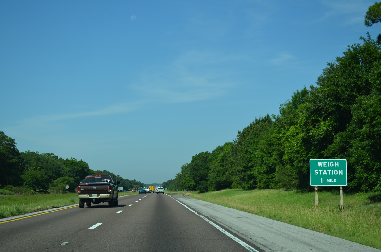
| A weigh station for commercial trucks lies just west of the Alabama state line on Interstate 10. 05/19/14 |
|
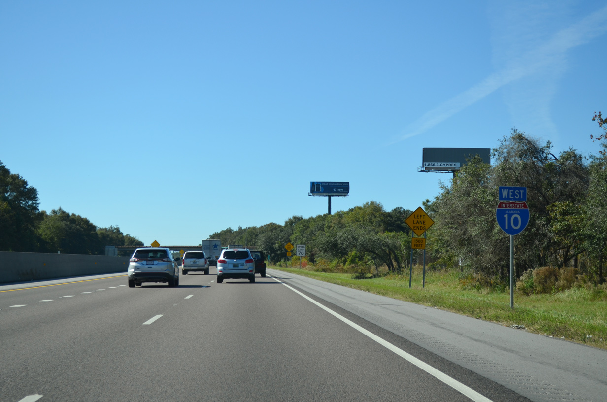
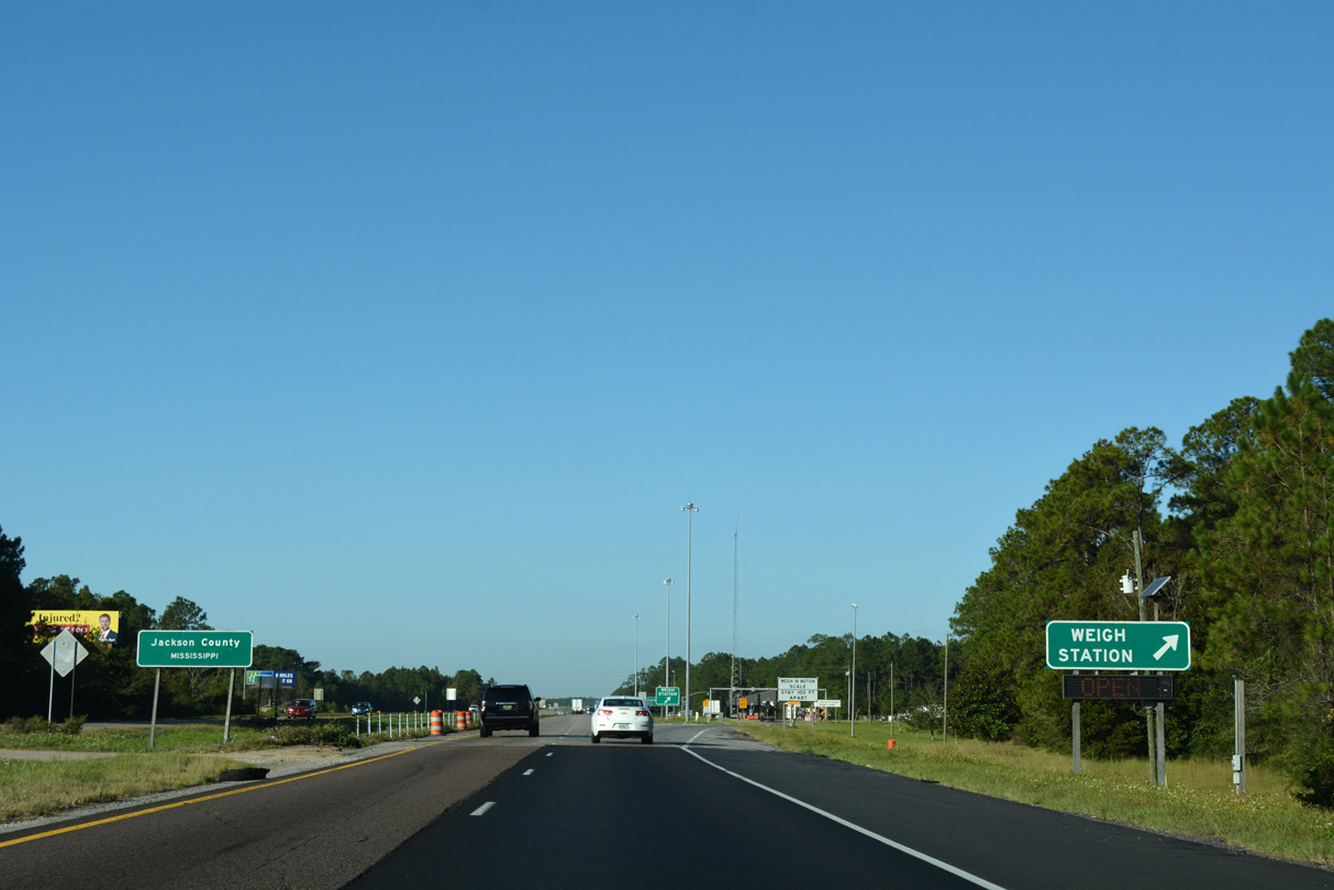
| Interstate 10 crosses into Mississippi adjacent to U.S. 90. The freeway temporarily ended here as the route in Jackson County was not complete until 1982. 10/12/16 |
11/21/08, 10/01/09, 04/05/12, 04/20/12, 05/09/14, 05/19/14, 11/23/14, 11/25/14, 05/09/15, 11/20/15, 05/06/16, 05/16/16, 10/12/16, 06/05/17 by AARoads
Page Updated 11-22-2020.

 West
West