|
| Heading north from the Brevard County line, I-95 passes well west of the Oak Hill city limits at Maytown Road. 09/08/18 |
|
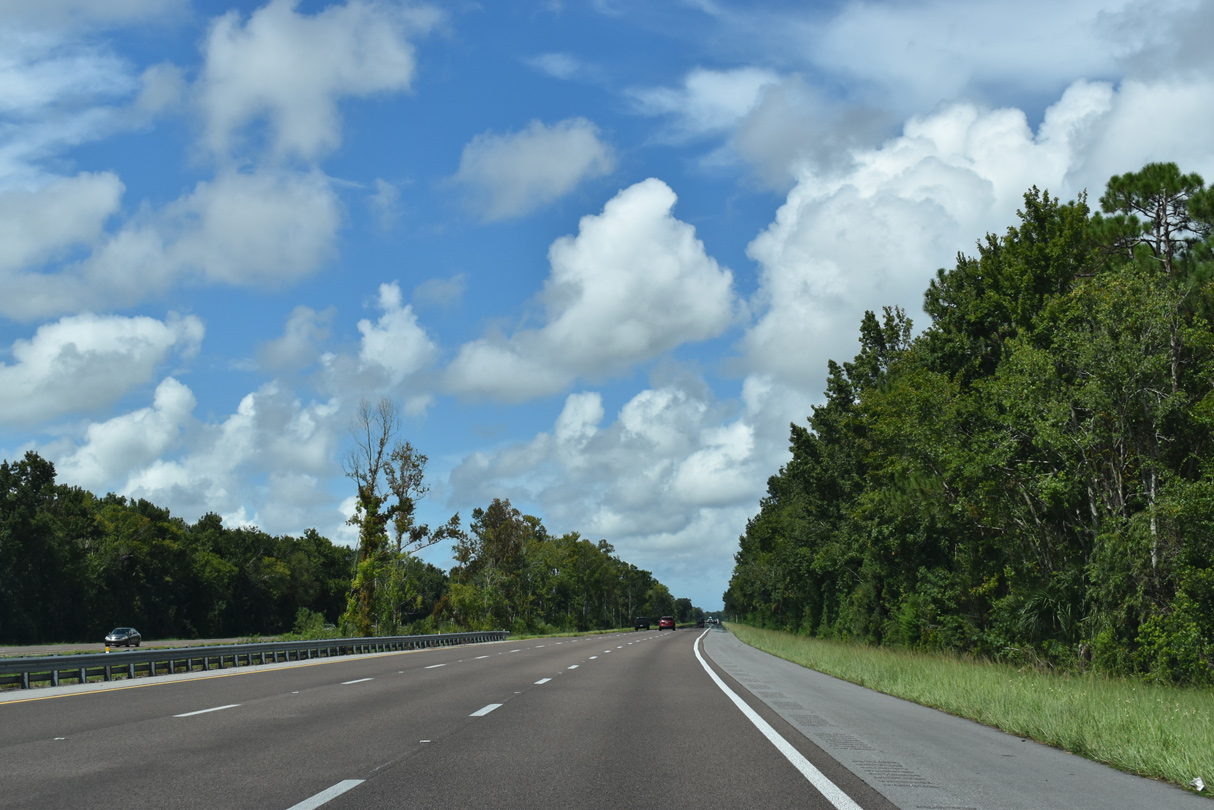
| Beyond Maytown Road, I-95 travels through Turnbull Hammock Conservation Area along a seven mile stretch. 09/08/18 |
|
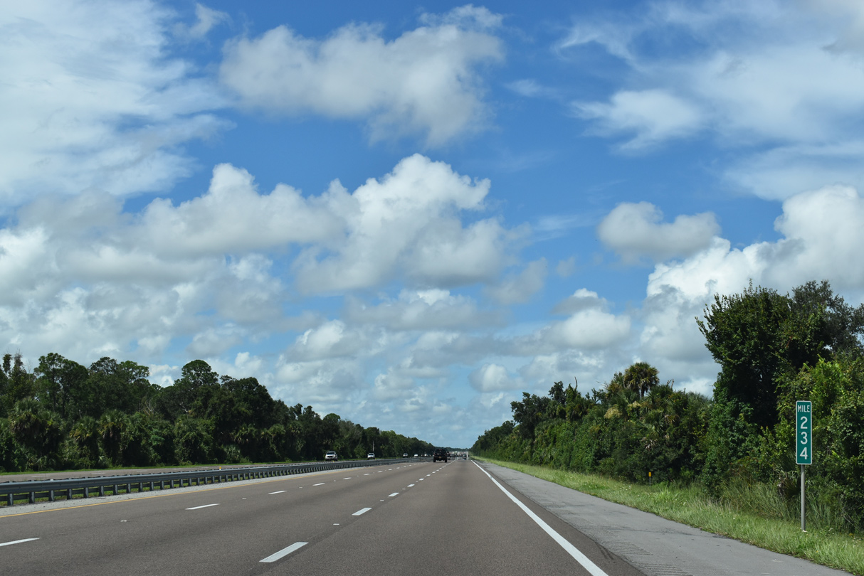
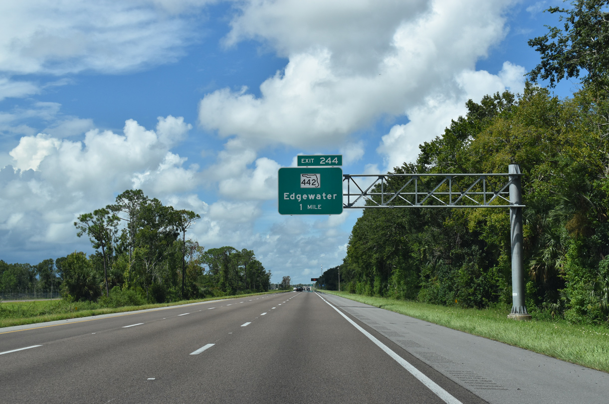
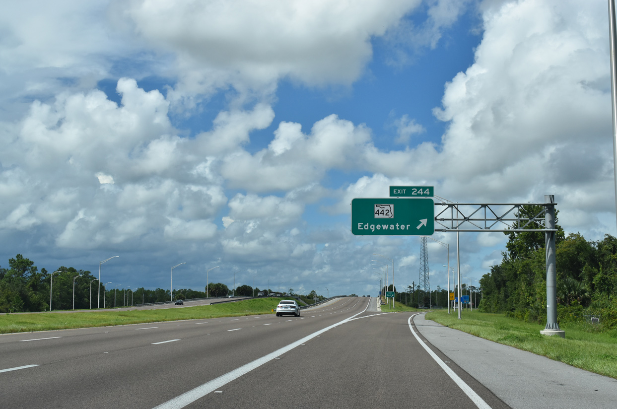
| SR 442 (Indian River Boulevard) consists of a 3.78 mile long route joining I-95 with U.S. 1 (Ridgewood Avenue) at the city of Edgewater. A diamond interchange (Exit 244) joins the two roads on the western outskirts of the city limits. 09/08/18 |
|
| Exit 244 departs I-95 north for SR 442 (Indian River Boulevard). Opossum Camp Road, 0.192 miles of which doubles as unsigned County Road 442, spurs west of the freeway. 09/08/18 |
|
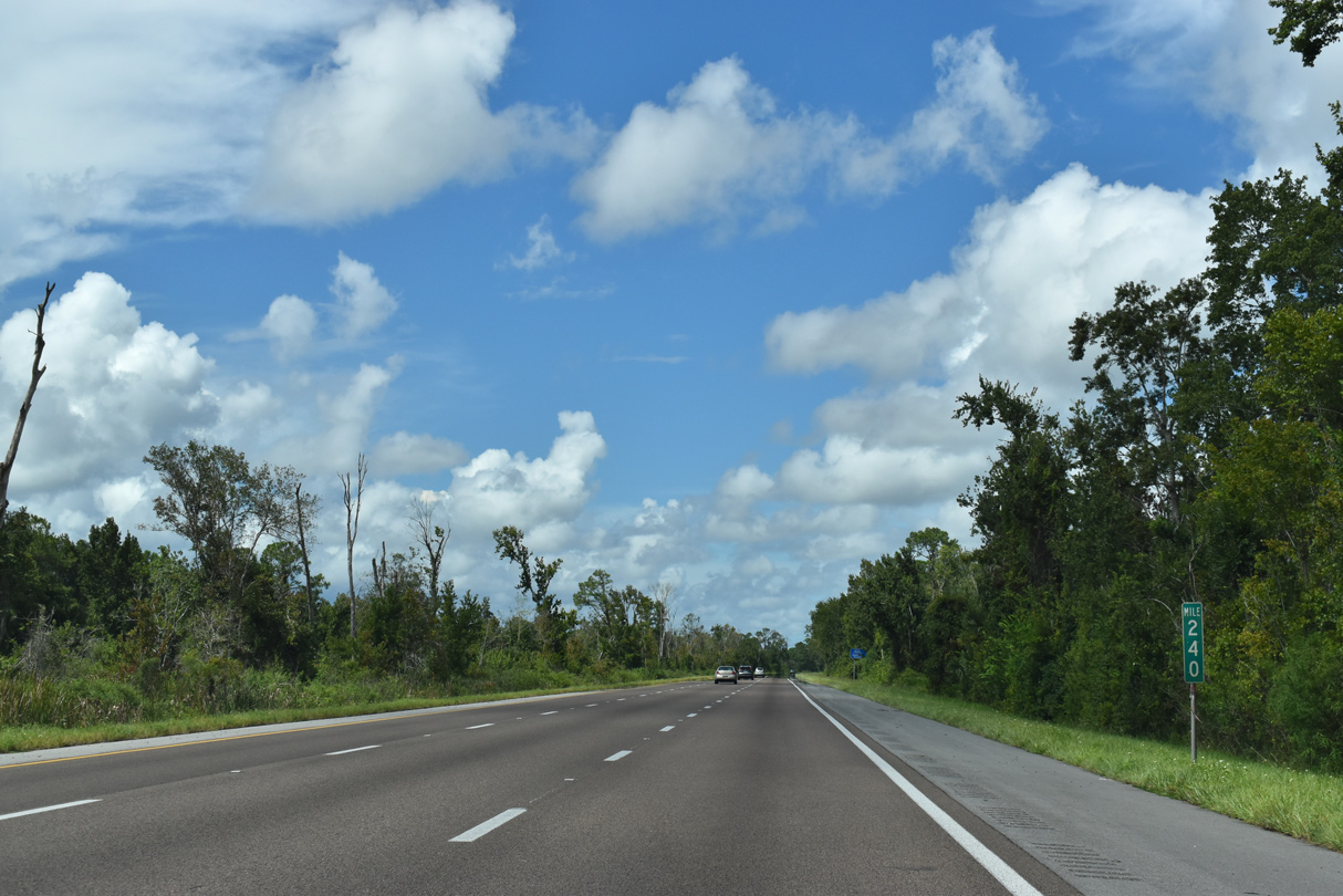
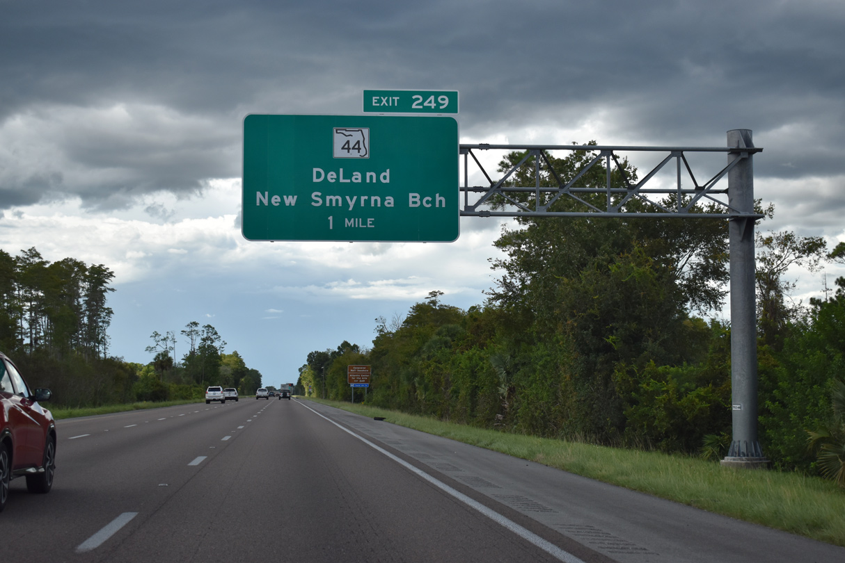
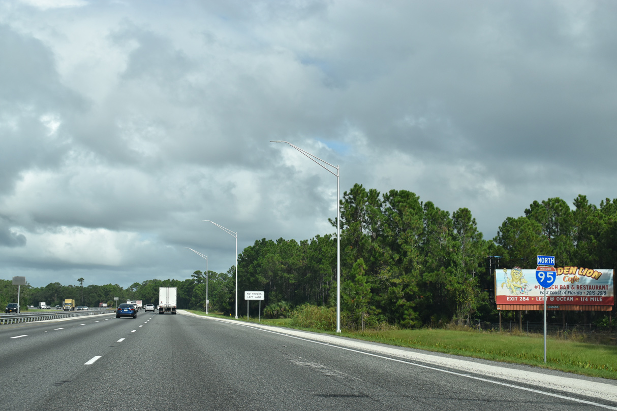
| Interstate 95 next meets SR 44 at the city of New Smyrna Beach in four miles. 09/12/22 |
|
| SR 44 represents a trans-peninsular route between U.S. 19/98 at Crystal River and New Smyrna Beach. Within Volusia County, SR 44 joins Downtown New Smyrna Beach (U.S. 1 and SR A1A) with the county seat of DeLand. 09/12/22 |
|
| SR 44 east ties into SR A1A (South Causeway) over the Intracoastal Waterway, SR A1A leads east to Coronado Beach, where it becomes CR A1A (Atlantic Avenue) south along the Atlantic Ocean to Canaveral National Seashore. 09/12/22 |
|
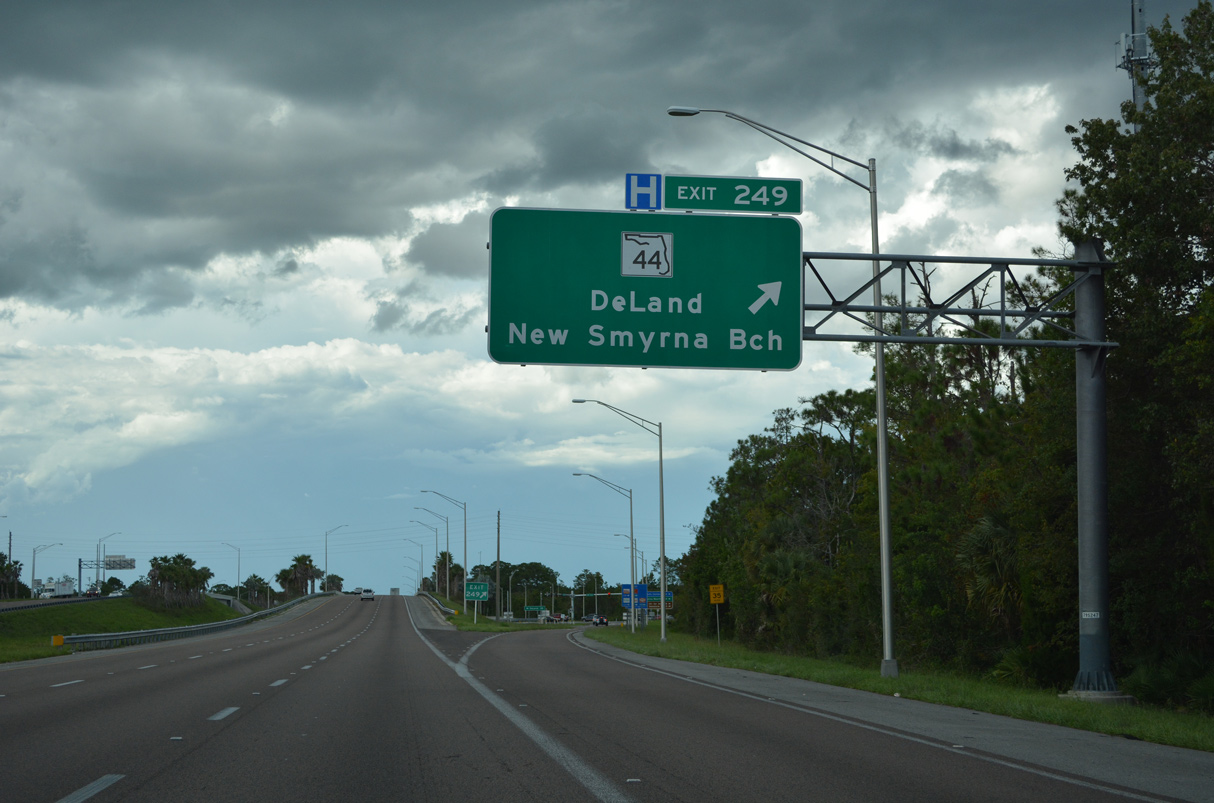
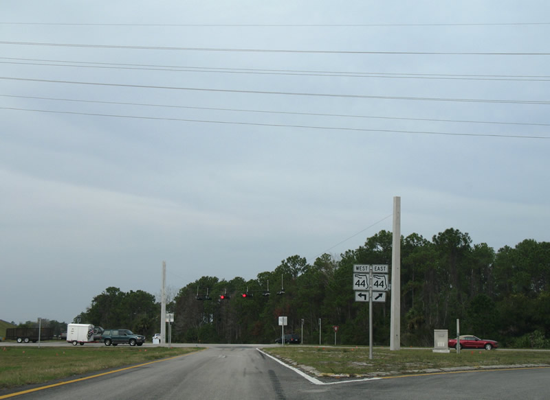
| A parclo interchange connects Interstate 95 and SR 44 (Canal Street) at Exit 249. Westward the state road travels to rural Samsula and across wetland areas to I-4 and Downtown DeLand. 09/12/22 |
|
| SR 44 shields posted at the end of the off-ramp at Exit 249. SR 44 splits with a business route (Canal Street) to the east as the road was realigned onto Lytle Avenue to directly connect with SR A1A. 12/20/06 |
|
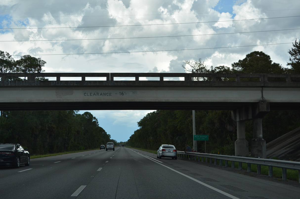
| Although rural nearby, Interstate 95 straddles the city limits of New Smyrna Beach northward to the CR 4118 overpass. 09/12/22 |
|
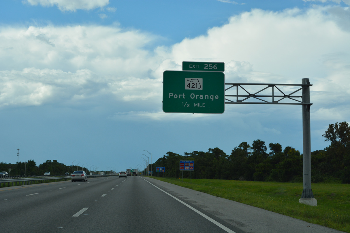
| Interstate 95 continues north six miles to SR 421 (Dunlawton Avenue) in Port Orange while Jacksonville is within 100 miles. 09/12/22 |
|
| Suburban development in New Smyrna Beach spreads westward to CR 4118 (Pioneer Trail), where the freeway enters the Port Orange city limits. Approved in January 2021, the Pioneer Trail Project Development and Environment (PD&E) Study evaluated adding an interchange with CR 4118.1 09/12/22 |
|
| Estimated to cost $48 million to build, the anticipated letting for construction of the interchange with Pioneer Trail (CR 4118) is June 13, 2023.1 09/12/22 |
|
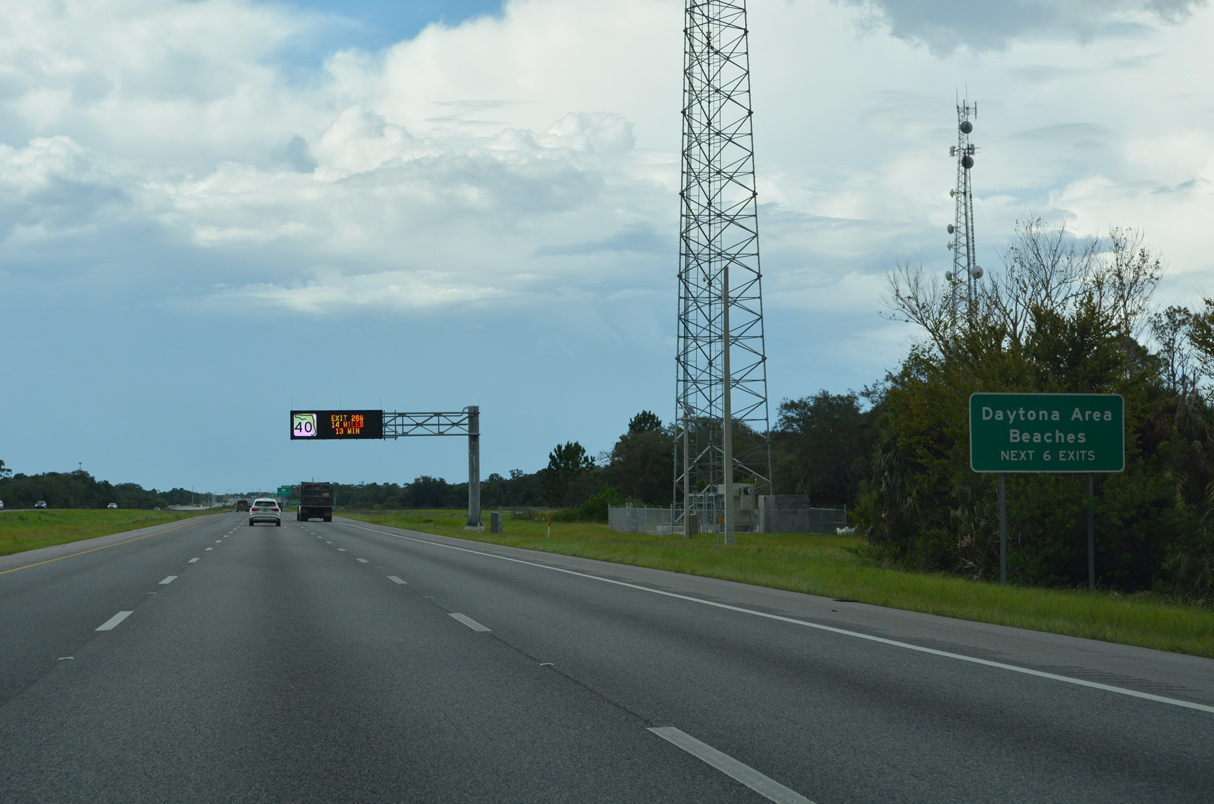
| Exits 256, 260, 261, 265, 268, and 273 serve the greater Daytona Beach area including Ormond Beach, Holly Hill, South Daytona, and Port Orange. 09/12/22 |
|
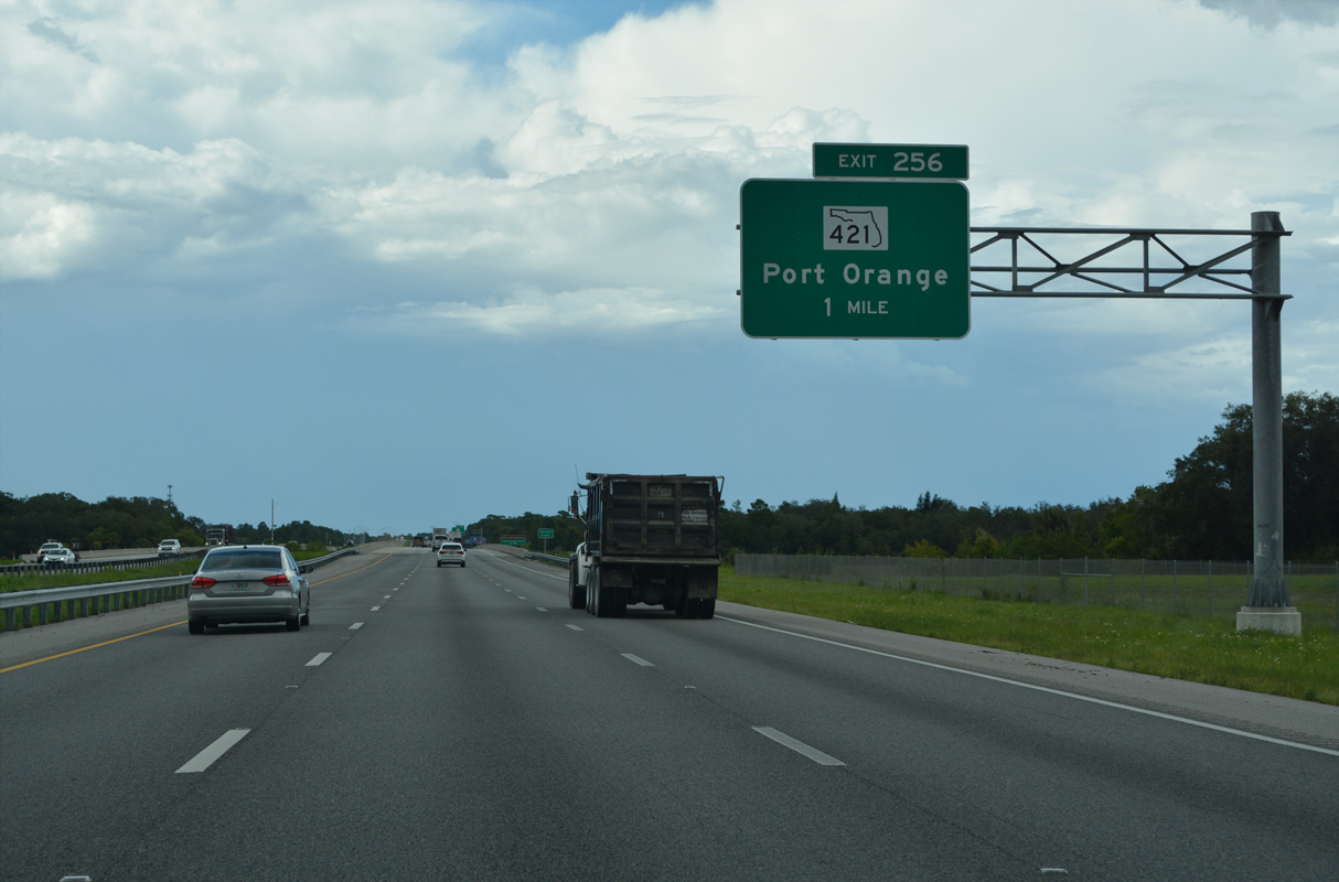
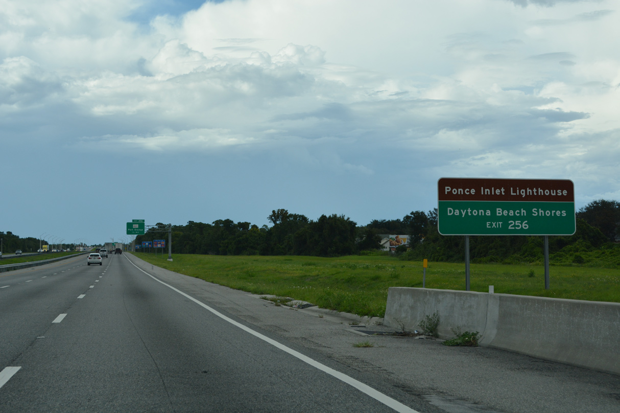
| One mile south of the diamond interchange (Exit 256) with SR 421 (Dunlawton Avenue) on Interstate 95 north at Spruce Creek. SR 421 travels 4.00 miles from adjacent CR 4009 (Williamson Boulevard) to U.S. 1 (Ridgewood Avenue) opposite SR A1A to Daytona Beach Shores. 09/12/22 |
|
| SR A1A branches east to the coast from U.S. 1 and SR 421 through the city of Daytona Beach Shores via Atlantic Avenue to Daytona Beach. The state road serves interests to Ponce Inlet Lighthouse via Atlantic Avenue (CR 4075) south to Peninsula Drive at Ponce Inlet. 09/12/22 |
|
| CR 421 (Taylor Road) extends 2.89 miles southwest from CR 4009 (Williamson Boulevard) to CR 415 at the Tomoka Farms area. 09/12/22 |
|
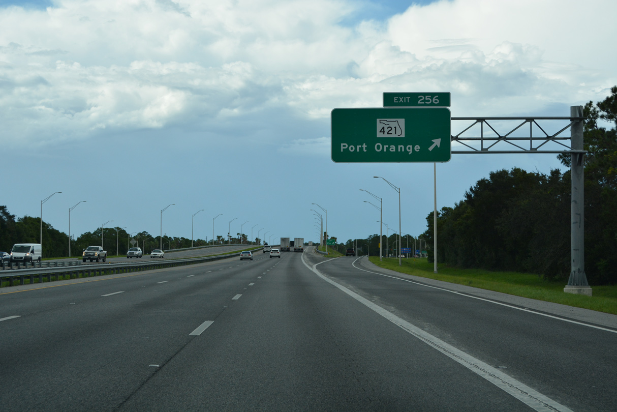
| Exit 256 departs Interstate 95 north for SR 421 (Dunlawton Avenue) north and Taylor Road (CR 421) west. 09/12/22 |
|
| Interstate 95 angles northwest between retail areas to a forested stretch west of CR 4009 (Williamson Boulevard). 09/12/22 |
|
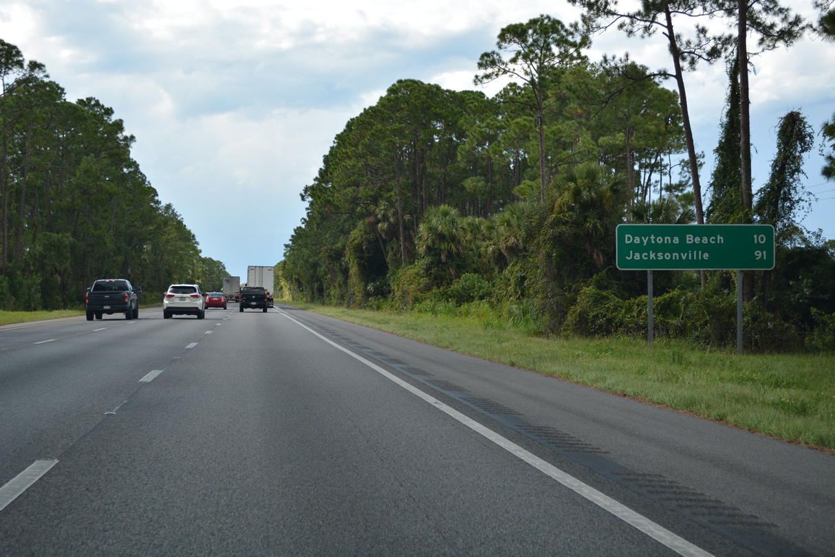
| Downtown Daytona Beach lies ten miles north of Exit 256 via Interstate 95 north and U.S. 92 east. 09/12/22 |
|
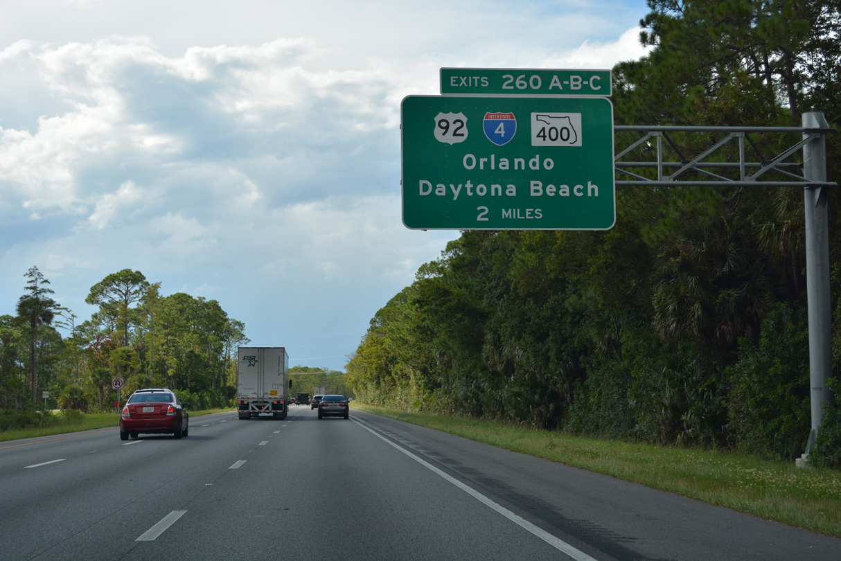
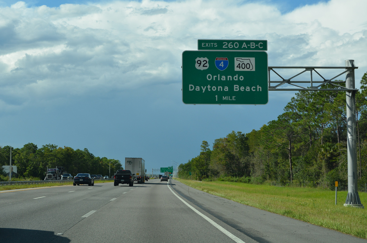
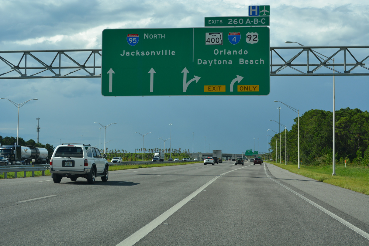
| Interstate 95 continues next to the east end of I-4 and Beville Road (SR 400) east to the city of South Daytona. 09/12/22 |
|
| Construction from Spring 2015 to Spring 2020 upgraded the previous cloverleaf interchange joining I-4/95 into a systems interchange. New collector distributor roadways were built along both sides of I-95 for SR 400 east, I-4 west and U.S. 92. 09/12/22 |
|
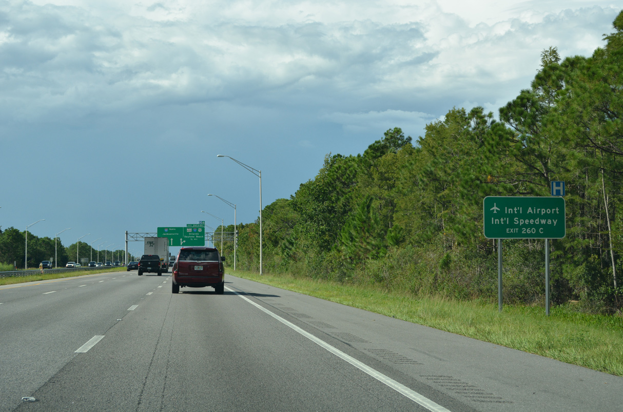
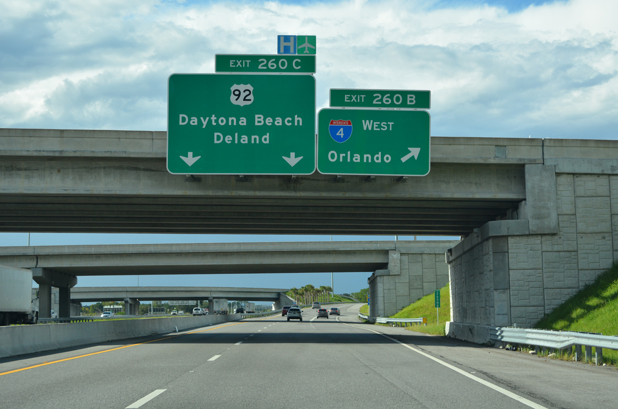
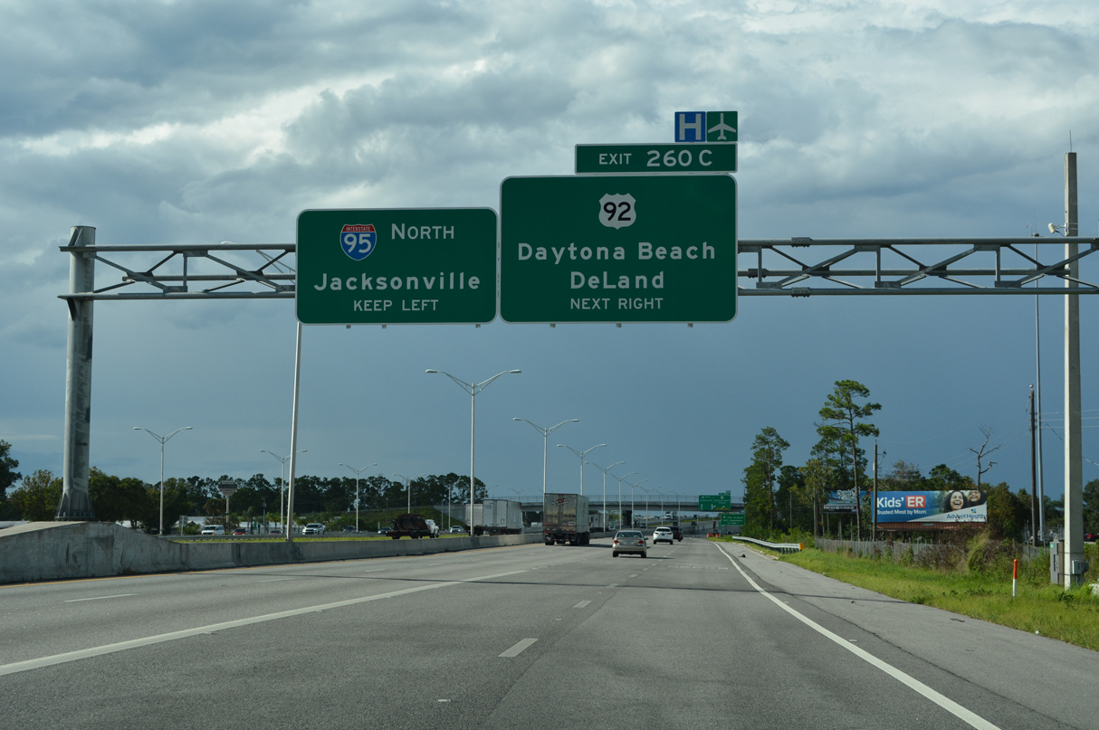
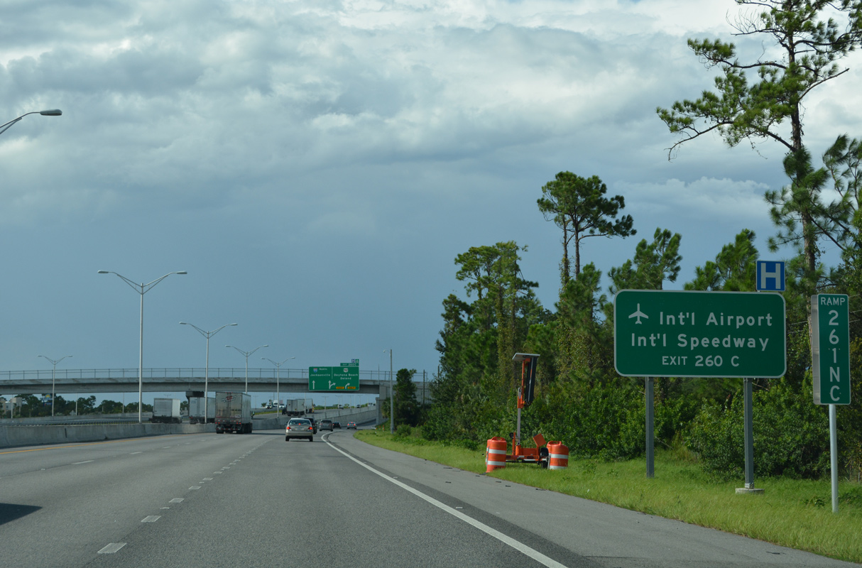
| Travelers bound for Daytona International Airport (DAB) are advised to take Exit 260 C for U.S. 92 (International Speedway Boulevard). Exit 260 C also serves interests to Daytona Beach area Colleges and Universities. 09/12/22 |
|
| Two lanes separate from Interstate 95 north for the c/d roadway to SR 400, I-4 and U.S. 92. Three lanes continue uninterrupted northward to the succeeding exit at LPGA Boulevard. 09/12/22 |
|
| SR 400 is the hidden state road designation of Interstate 4 throughout Florida. SR 400 emerges from the freeway east from I-95 along Beville Road for a distance of 4.22 miles. 09/12/22 |
|
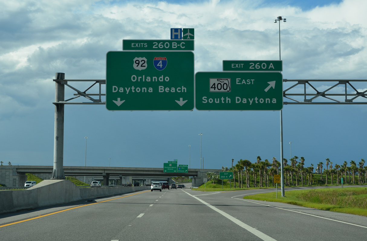
| Beville Road constitutes a divided arterial route from Exit 260 A to U.S. 1 (Ridgewood) between Daytona Beach and South Daytona. 09/12/22 |
|
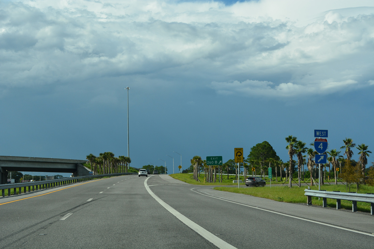
| Exit 260 B loops onto Interstate 4 west 14 miles to eastern DeLand. The intrastate freeway angles southwest to Sanford, Orlando, Lakeland and Tampa. 09/12/22 |
|
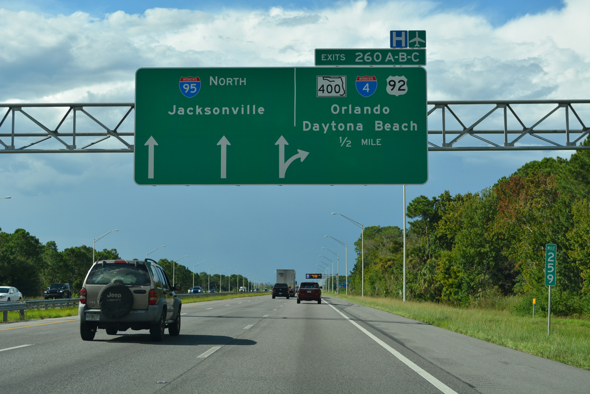
| Traffic from I-4 east and SR 400 (Beville Road) west combines along the c/d roadway ahead of Exit 260 C for U.S. 92 (International Speedway Boulevard. 09/12/22 |
|
| Bellevue Avenue (CR 4068) passes over Interstate 95 west of Daytona Beach International Airport (DAB) ahead of Exit 260 C to U.S. 92 (International Speedway Boulevard). 09/12/22 |
|
| Exit 260 C leaves Interstate 95 north for U.S. 92 (International Speedway Boulevard). 09/12/22 |
|
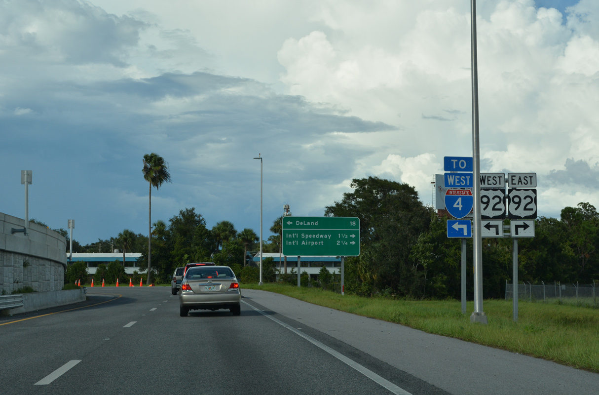
| U.S. 92 comprises an eight lane arterial east to Daytona International Speedway, Volusia Mall, and Daytona Beach Community College. 09/12/22 |
|
| U.S. 92 (unsigned SR 600) concludes at SR A1A (Atlantic Avenue) on Daytona Beach's barrier island east of Downtown. 09/12/22 |
|
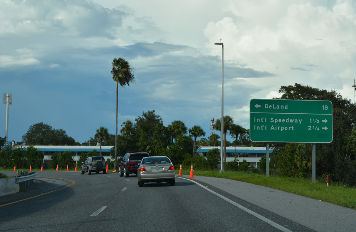
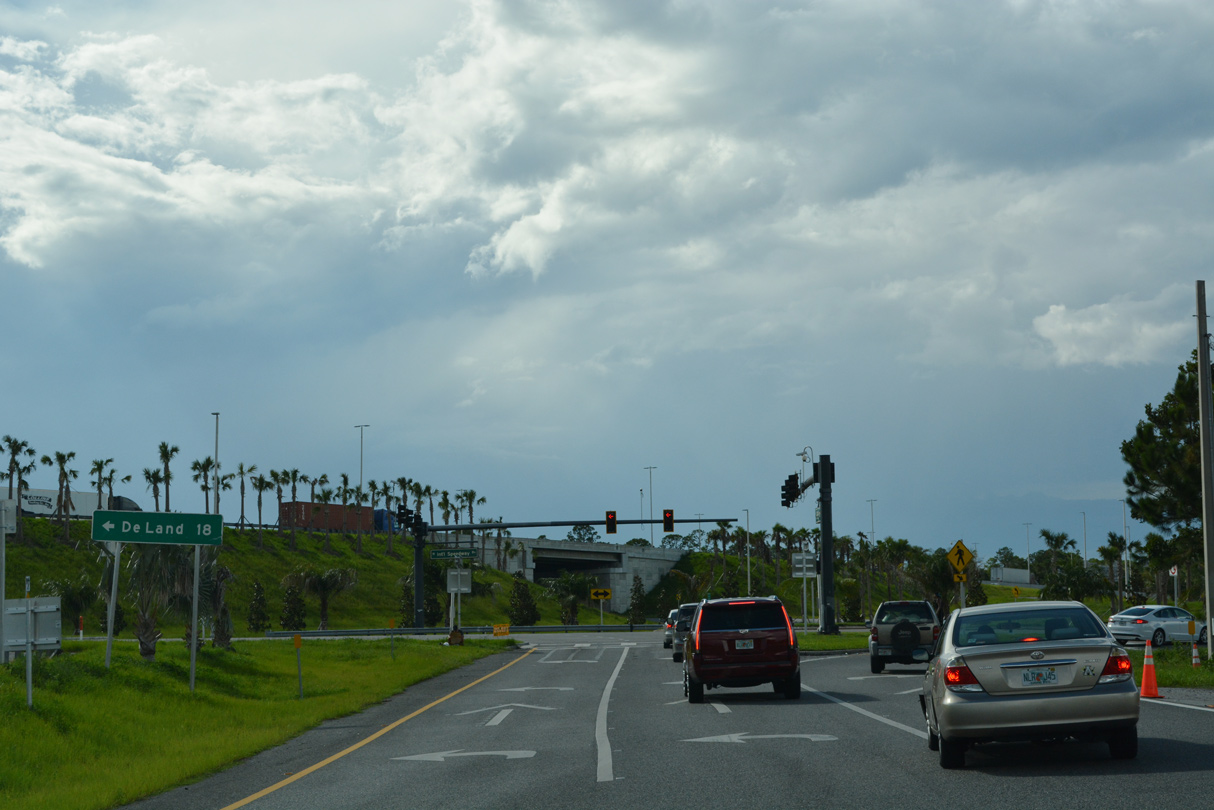
| U.S. 92 enters Daytona Beach from Tiger Bay State Forest and DeLand 18 miles to the southwest. 09/12/22 |
|
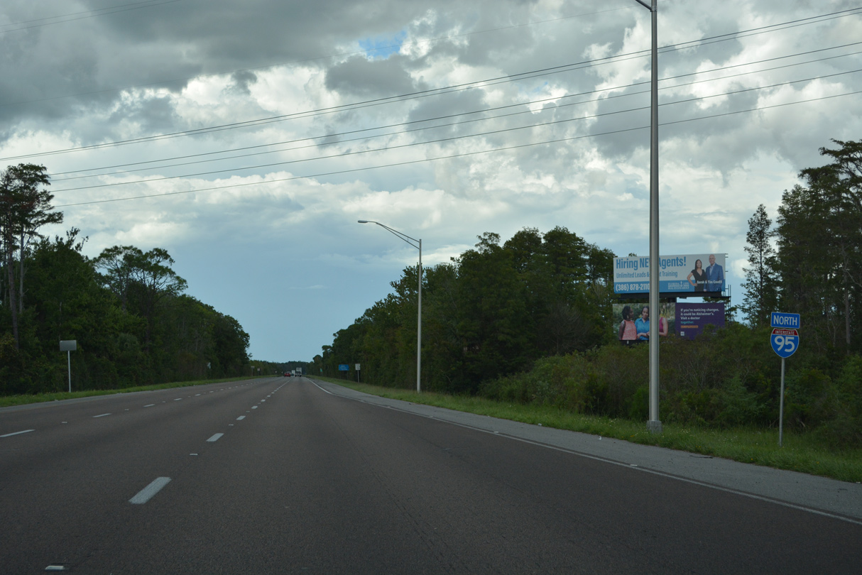
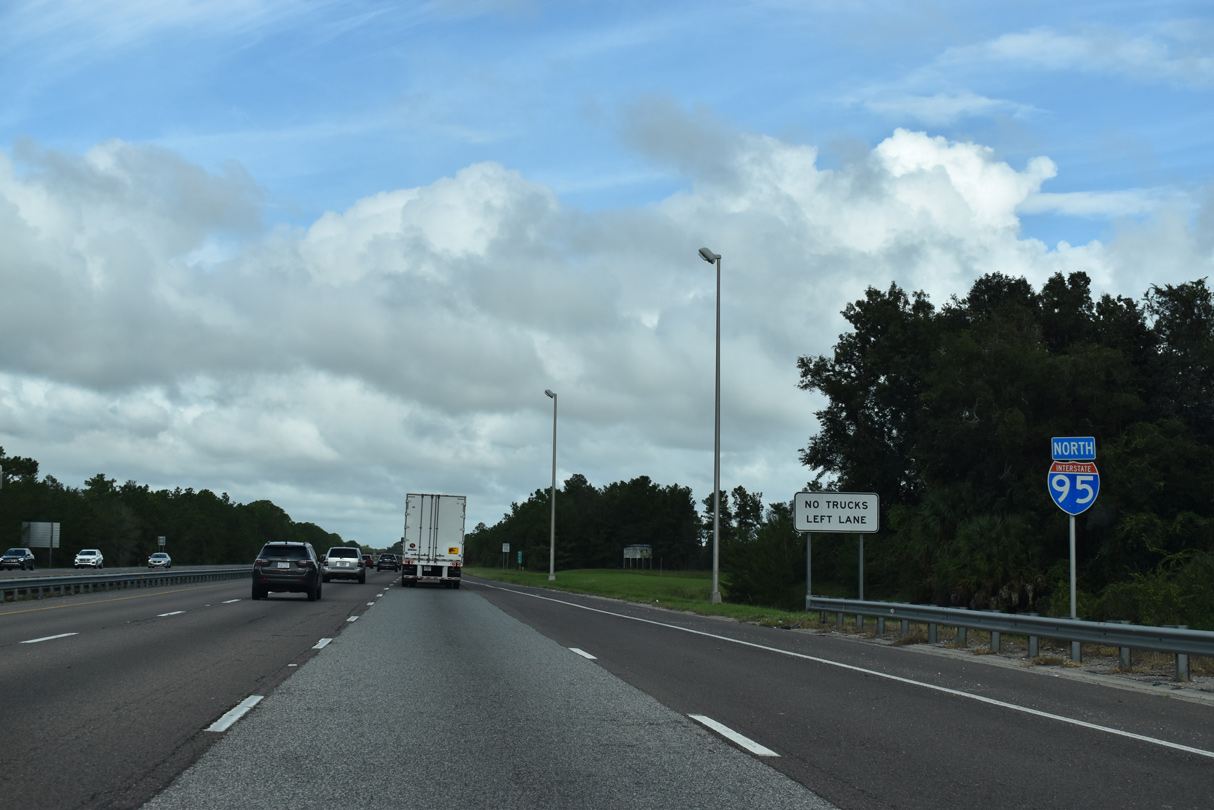
| Beyond Daytona Beach, Interstate 95 enters Ormond Beach on the 85 mile drive to Jacksonville. 09/13/22 |
|
| Forthcoming LPGA Boulevard joins I-95 with Holly Hill to the east. Dunn Avenue, beyond the overhead, was extended westward from parallel CR 4009 (Williamson Boulevard) to tie in with Tomoka Farms Roads Road, a west side frontage road. 09/13/22 |
|
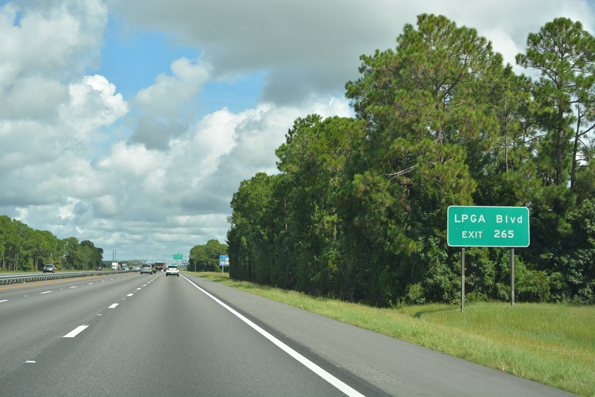
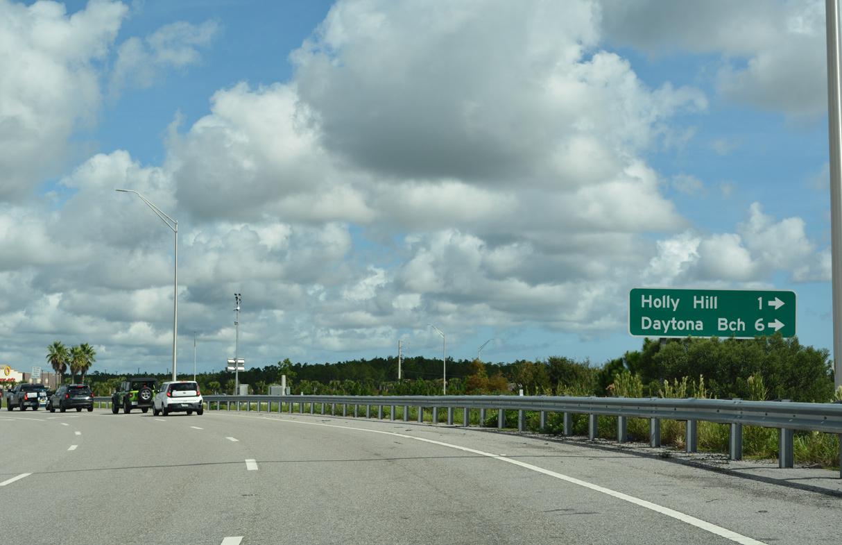
| LPGA Boulevard (unsigned CR 4019) derives its name from the LPGA International Golf Club west of I-95. CR 4019 follows the road northeast 9.93 miles from U.S. 92 (International Speedway Boulevard) to Riverside Drive (CR 4011) at Sunrise Park in Holly Hill. 09/13/22 |
|
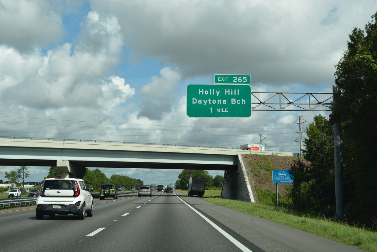
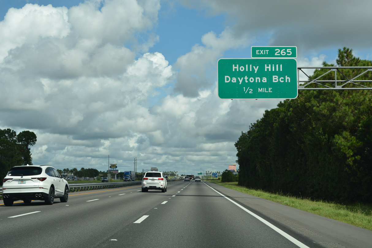
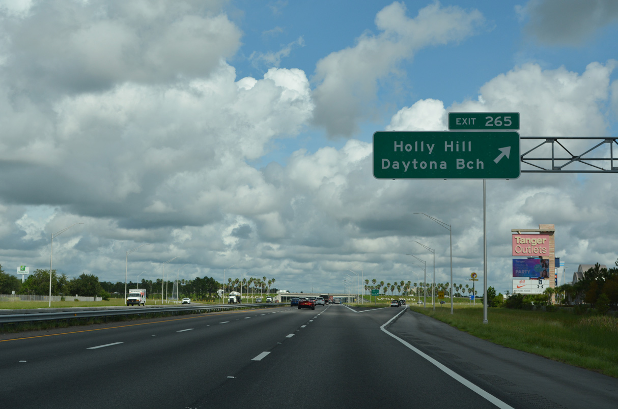
| One half mile south of the six-ramp parclo interchange (Exit 265) with LPGA Boulevard on Interstate 95 north. 09/13/22 |
|
| Interstate 95 northbound at Exit 265 to LPGA Boulevard (CR 4019). 09/13/22 |
|
| Connections from LPGA Boulevard with CR 483 (Clyde Morris Boulevard) and SR 5A (Nova Road) south lead motorists back into Daytona Beach, though the city limits extend northwest to SR 40. 09/13/22 |
|
| Reassurance shield posted along Interstate 95 beyond LPGA Boulevard. The freeway carries four northbound lanes to Exit 268. 09/13/22 |
|
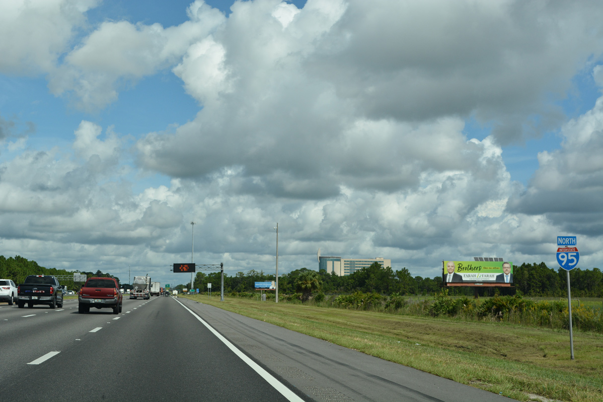
| Jacksonville is another 84 miles to the north. 09/13/22 |
|
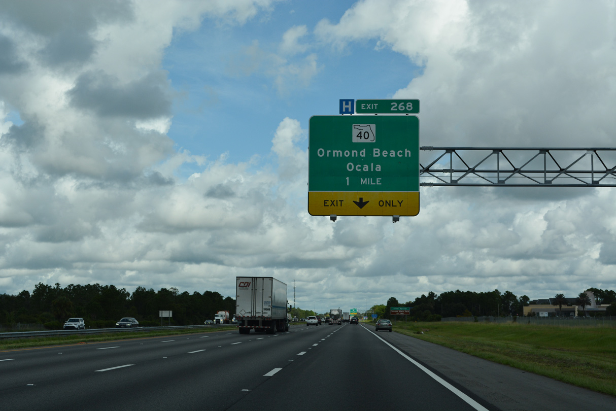
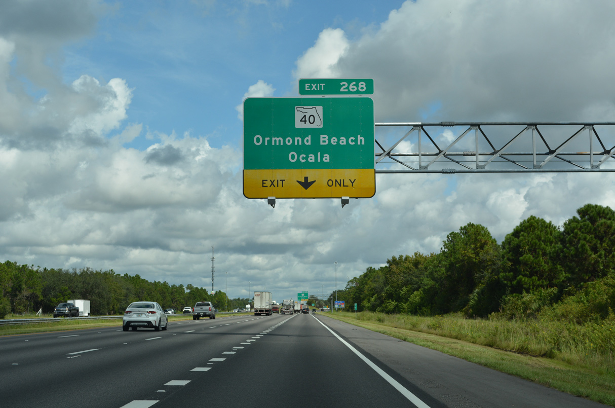
| SR 40 (Granada Boulevard) converges with Interstate 95 at a diamond interchange (Exit 268) in Ormond Beach. The state road joins Barberville and interior Volusia County with the coast at SR A1A. 09/13/22 |
|
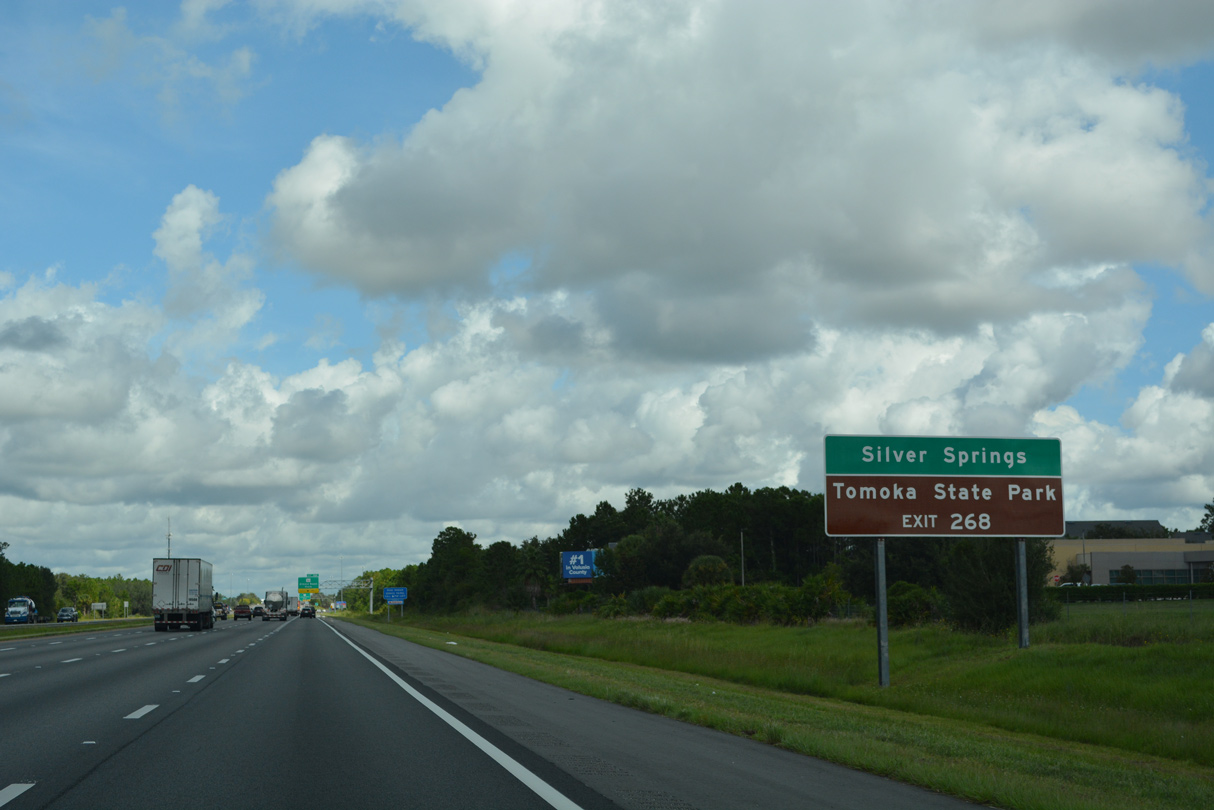
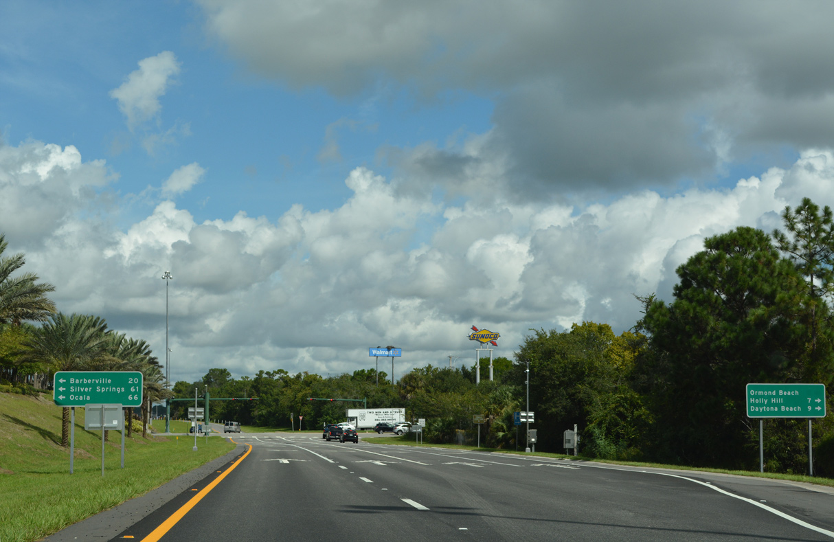
| Heading west, SR 40 crosses the peninsula through Ocala National Forest into Silver Springs and Ocala. Connections with CR 4011 (Riverside Drive) lead motorists northward to Tomoka State Park along the Intracoastal Waterway. 09/13/22 |
|
| SR 40 (Granada Boulevard) joins Downtown Ormond Beach with suburban areas to the west near the Flagler County line. 09/13/22 |
|
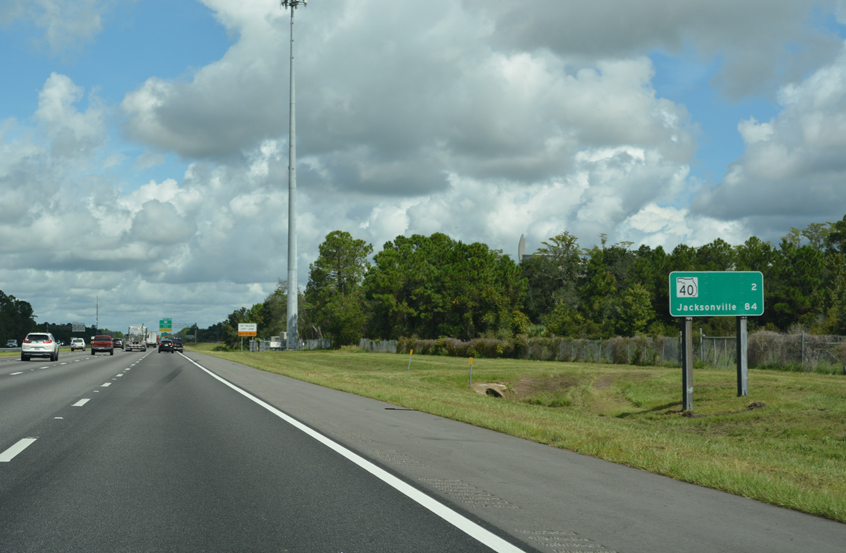
| A two lane ramp departs Interstate 95 north for SR 40 at Exit 268. SR 40 overall travels from U.S. 41, north of Dunnellon, to Ocala and SR A1A on the Atlantic Ocean. 09/13/22 |
|
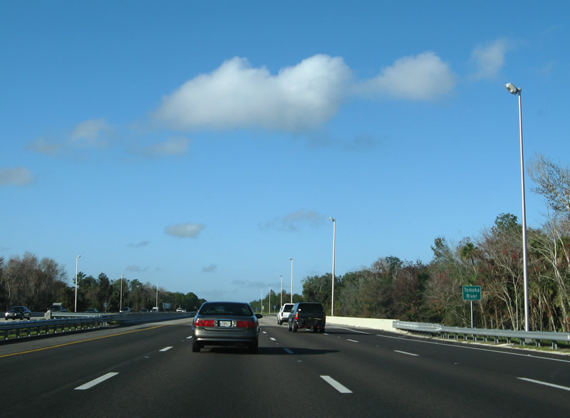
| Interstate 95 spans the Tomoka River north of Exit 268. The Tomoka flows 19.6 miles from wetlands in rural west Daytona Beach to the Intracoastal Waterway. 12/30/06 |
|
| $26.5 million in construction between January 2004 and August 2006 expanded a 6.8 mile stretch of I-95 north from Daytona Beach to Exit 273 in Ormond Beach.2 A set of rest areas once lined this stretch. 11/06/19 |
|
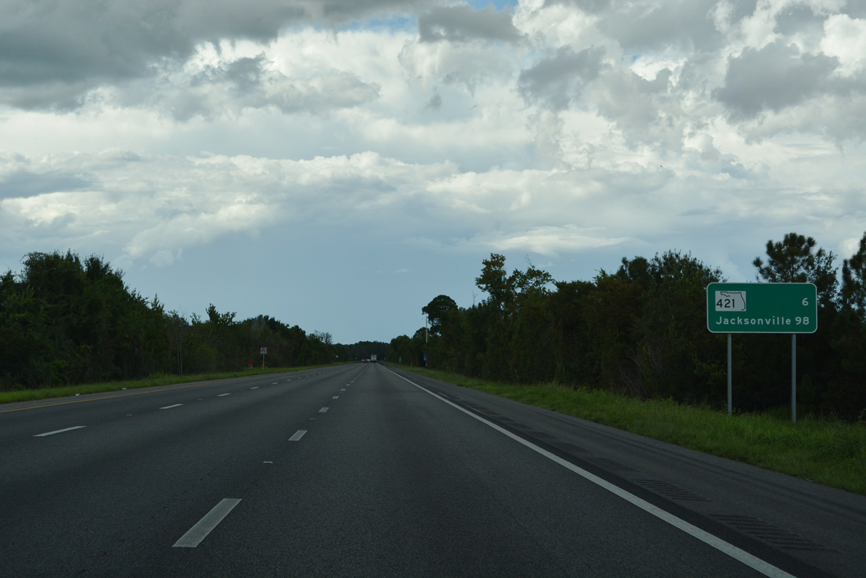
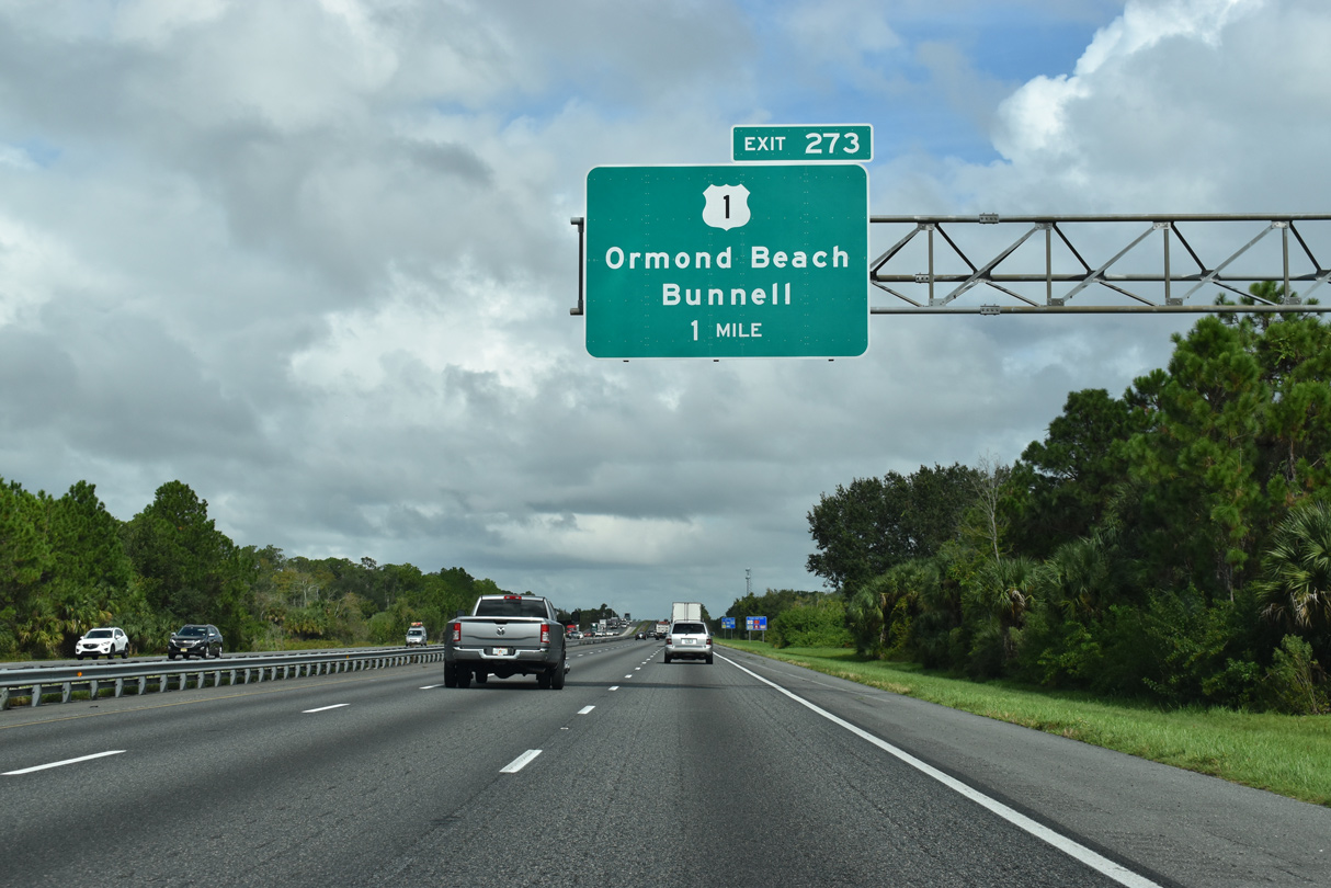
| U.S. 1 shifts well inland for the only time on its course through Florida between Ormond Beach and the Flagler County seat of Bunnell. The US route parallels the Florida East Coast (FEC) Railway to the exchange (Exit 263) with Interstate 95. 11/06/19 |
|
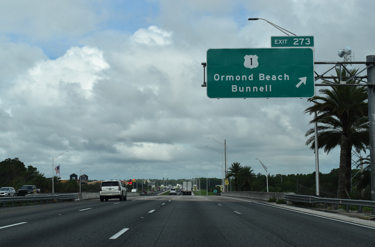
| Northbound at the folded diamond interchange with U.S. 1 (Exit 273). U.S. 1 follows a rural four lane highway through Korona and Dupont to Bunnell. The US route returns to I-95 at Exit 298 in St. Johns County. 11/06/19 |
|
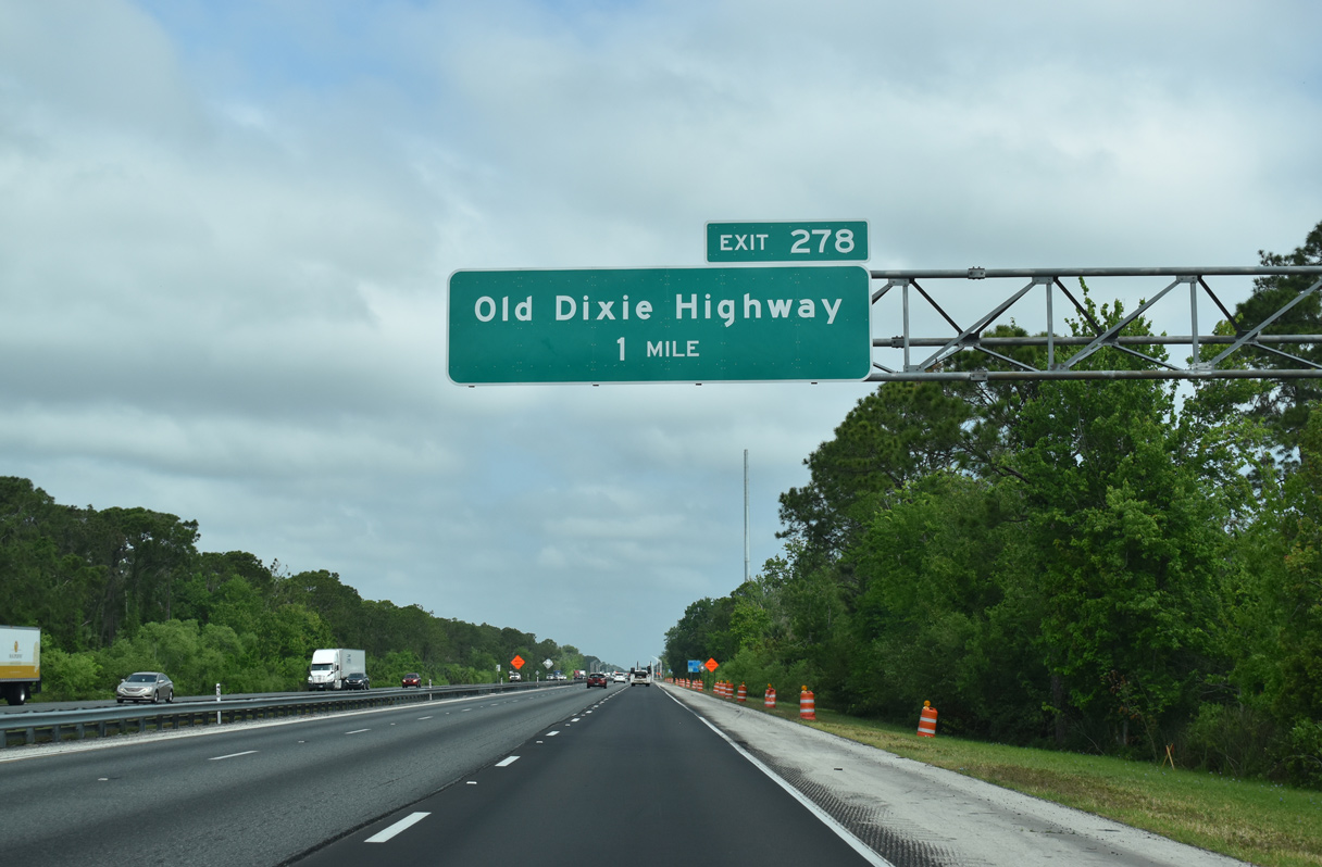
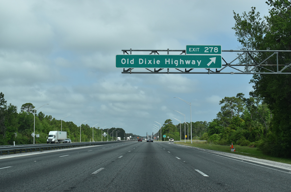
| Interstate 95 leaves Ormond Beach across unincorporated areas north to Exit 278. The Plantation Bay and Halifax Plantation golf course communities line both sides of the freeway. 11/06/19 |
|
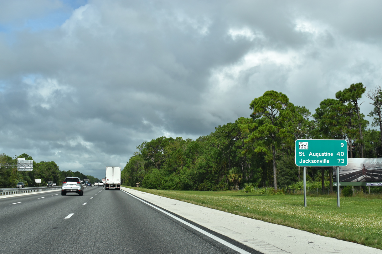
| Distance sign for SR 100 (9 miles) and Jacksonville (73 miles), posted on the final stretch of Interstate 95 north within Volusia County. The previous assembly here omitted St. Augustine (40 miles). 11/06/19 |
|
| Exit 278 joins Interstate 95 with Old Dixie County (CR 4011) south of Palm Coast. 03/26/20 |
|
| Old Dixie Highway, the predecessor to U.S. 1, turns west from Bulow Creek State Park to Exit 278 and U.S. 1 at Korona. Volusia County Road 4011 becomes Flagler County Road 2002 west across I-95. 03/26/20 |
|
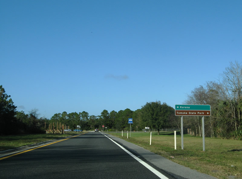
| CR 4011 leads southeast 6.69 miles from I-95 back to Tomoka State Park by way of Bulow Creek State Park; connections with Walter Boardman Lane (CR 2001) connect with North Peninsula State State Park and SR A1A (Ocean Shore Boulevard). 12/30/06 |
|
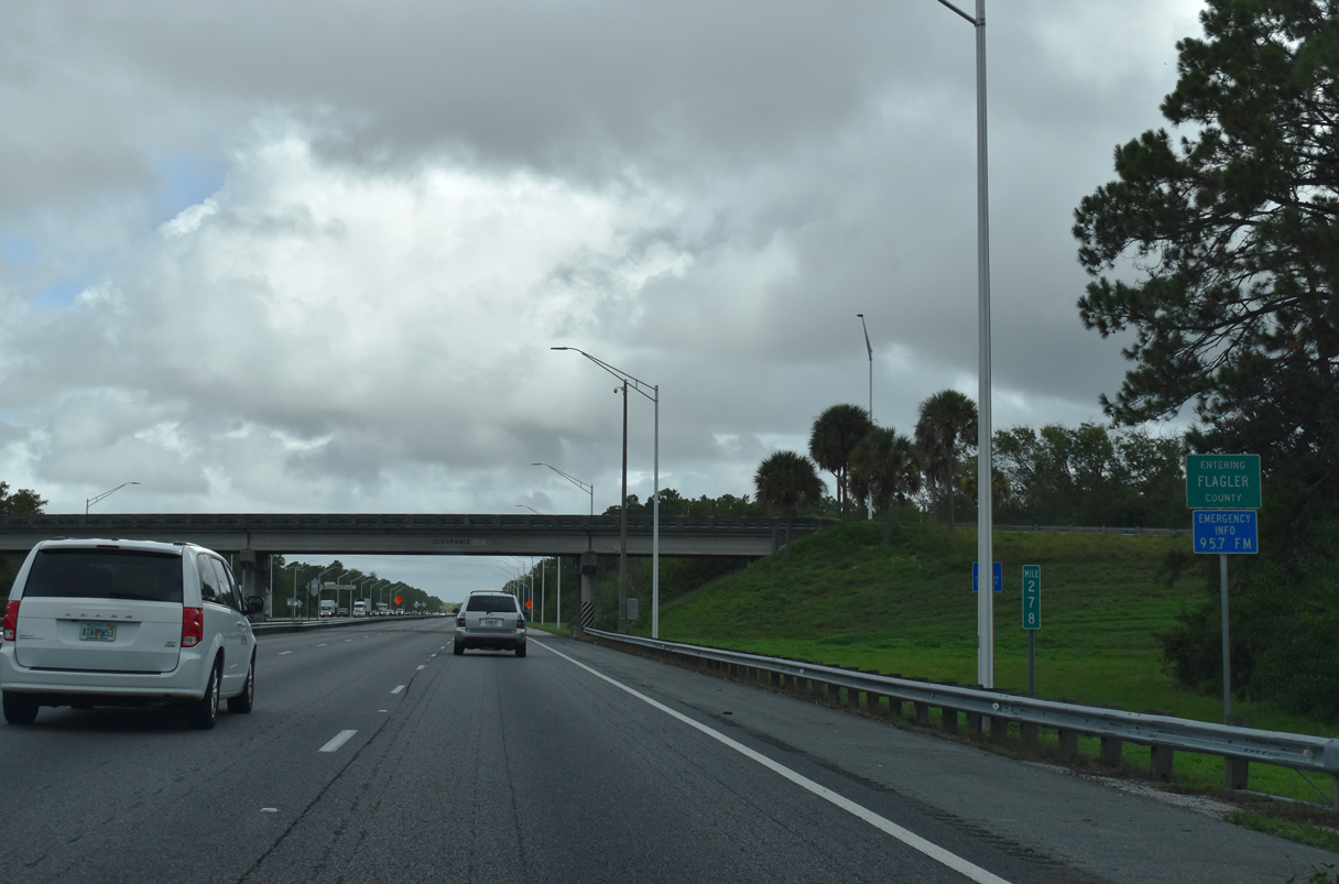
| The Flagler/Volusia County line crosses the diamond interchange at Exit 278. 11/06/19 |
Page Updated 10-30-2022.

 North
North