Built in 1959, a toll bridge previously carried Interstate 95 across the Trout River in Jacksonville. It was replaced with a pair of new spans. The southbound bridge opened to traffic on December 18, 2006,1 followed by the northbound span in Spring 2008.
|
| Completed in 2008 at a cost of $26.1 million, the 3.7 mile segment of Interstate 95 south between I-295 and SR 105 (Exit 358) was expanded to six lanes. 01/05/19 |
|
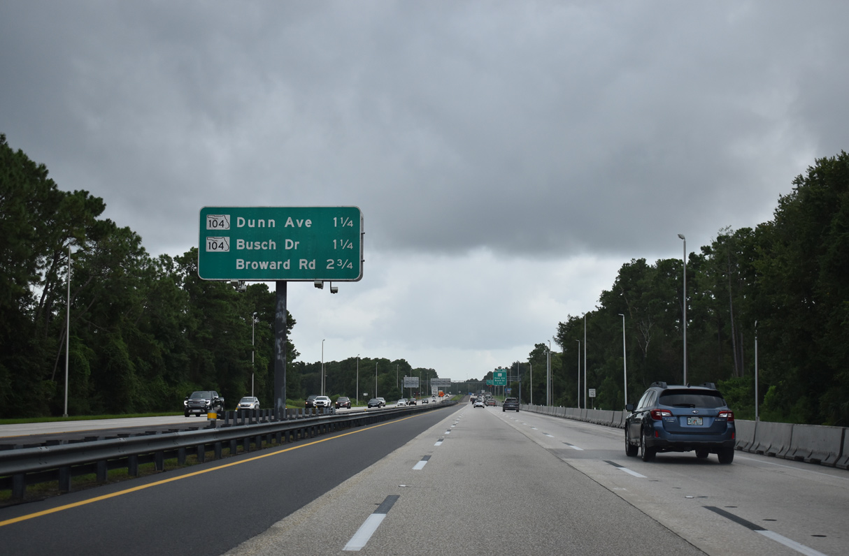
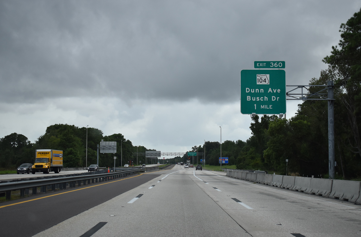
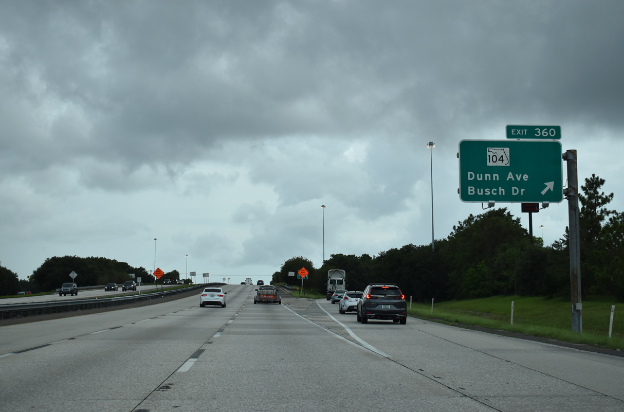
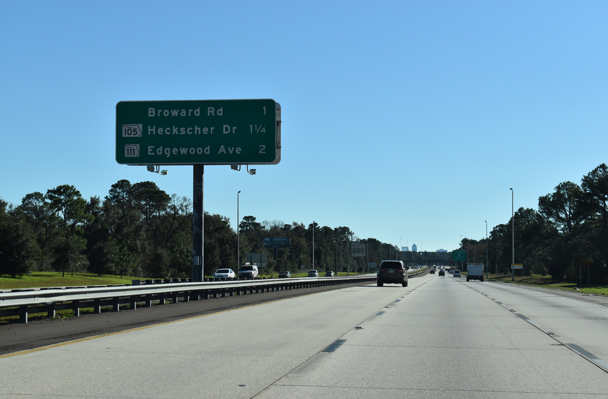
| I-95 advances 1.25 miles south to a diamond interchange (Exit 360) with SR 104 (Dunn Avenue west / Busch Drive east). Broward Road connects with the freeway at the subsequent exit in 2.75 miles. 08/28/21 |
|
| SR 104 meets Interstate 95 near the Anheuser Busch Brewery in one mile. 7.57 miles long, SR 104 stems west from U.S. 17 (Main Street) and unsigned CR 163 (Busch Drive) to Northwood, Garden City and Biscayne Village to U.S. 1/23 at Dinsmore. 08/28/21 |
|
| Exit 360 partitions from the I-95 mainline to SR 104. SR 104 is a multilane arterial between I-295 at Exit 30 and U.S. 17. CR 163 extends Busch Drive 2.194 miles southward through an industrial park to SR 105 (Zoo Parkway) across from Jacksonville Zoo & Gardens. 08/28/21 |
|
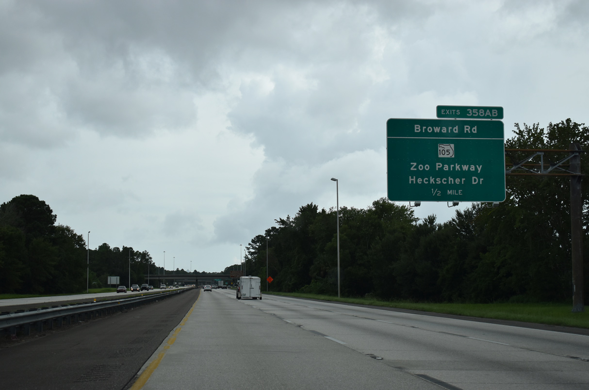
| Forthcoming Broward Road (Exit 358 B) arcs southeast from SR 115 (Lem Turner Road) along the periphery of the Trout River through the Highlands neighborhood. 01/05/19 |
|
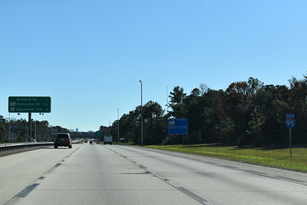
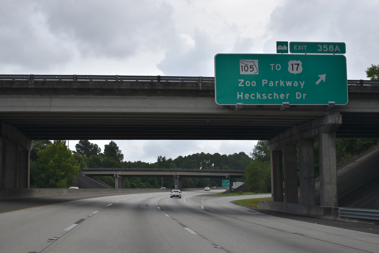
| SR 105 (Zoo Parkway) stems east from I-95 in 1.25 miles, connecting with Jacksonville Zoo & Gardens, the US Navy Fuel Depot along the St. Johns River, and I-295 (East Beltway). 01/05/19 |
|
| State Road 105 (Zoo Parkway) runs 15.06 miles east along the St. Johns River from Interstate 95 to SR A1A at the Ft. George Island - Mayport Ferry. 08/28/21 |
|
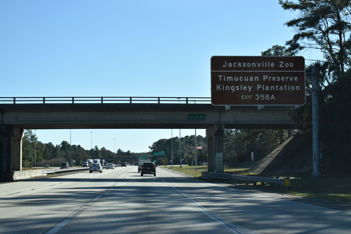
| A loop ramp from the Clark Road overpass joins I-95 south prior to Exit 358B for Broward Road north. East of I-295, Heckscher Drive continues SR 105 through the Timucaun Ecological and Historical Preserve. Kingsley Plantation, established in 1765, lies at the north end of Palmetto Road on Fort George Island. 01/05/19 |
|
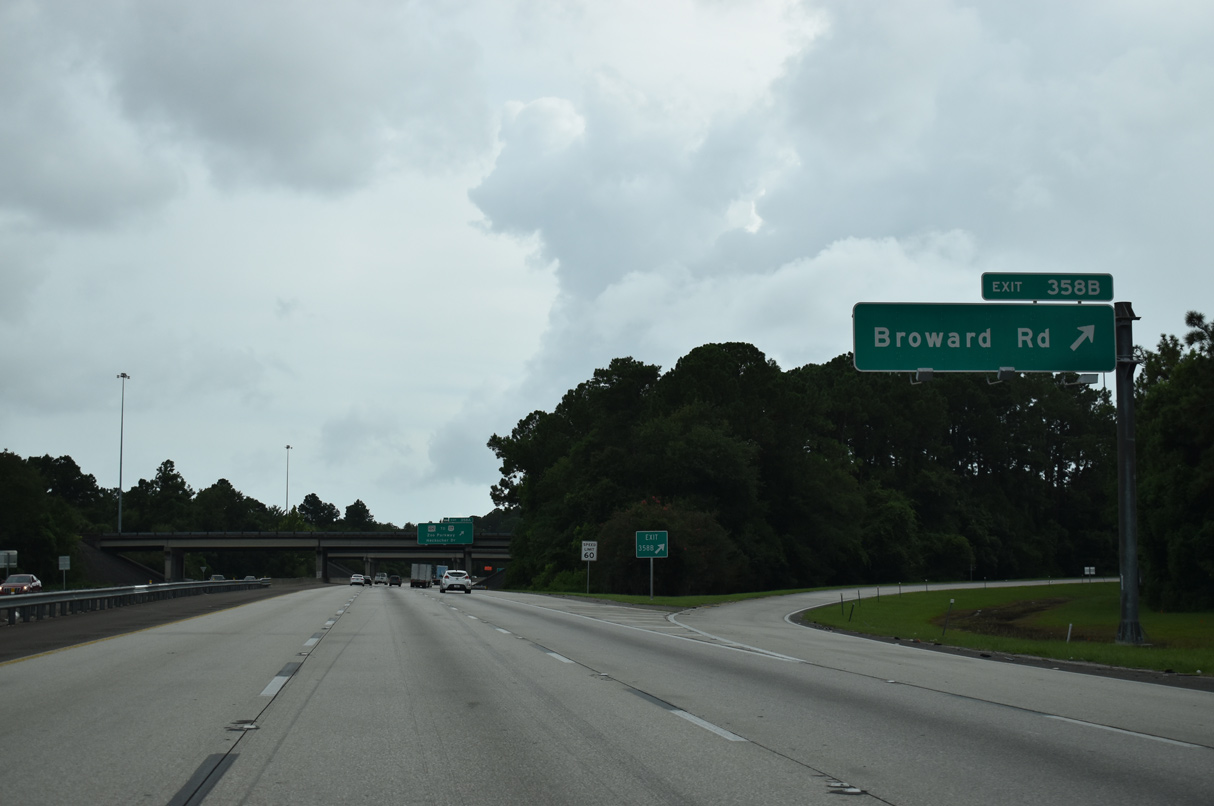
| Broward Road leads north from the Bert Maxwell Boat Ramp adjacent to I-95, to Zoo Parkway and Clark Road east. A second segment of the local road spurs west from U.S. 17 (Main Street) to a dead end at a finger of the Trout River. 08/28/21 |
|
| Curving southwest toward the Trout River, Exit 358A loops away from I-95 to SR 105 (Zoo Parkway) east. Ramps connect Zoo Parkway with parallel U.S. 17 nearby. Traffic from SR 105 west combines with I-95 south via a wye immediately south of the three quarter cloverleaf interchange with Zoo Parkway. 08/28/21 |
|
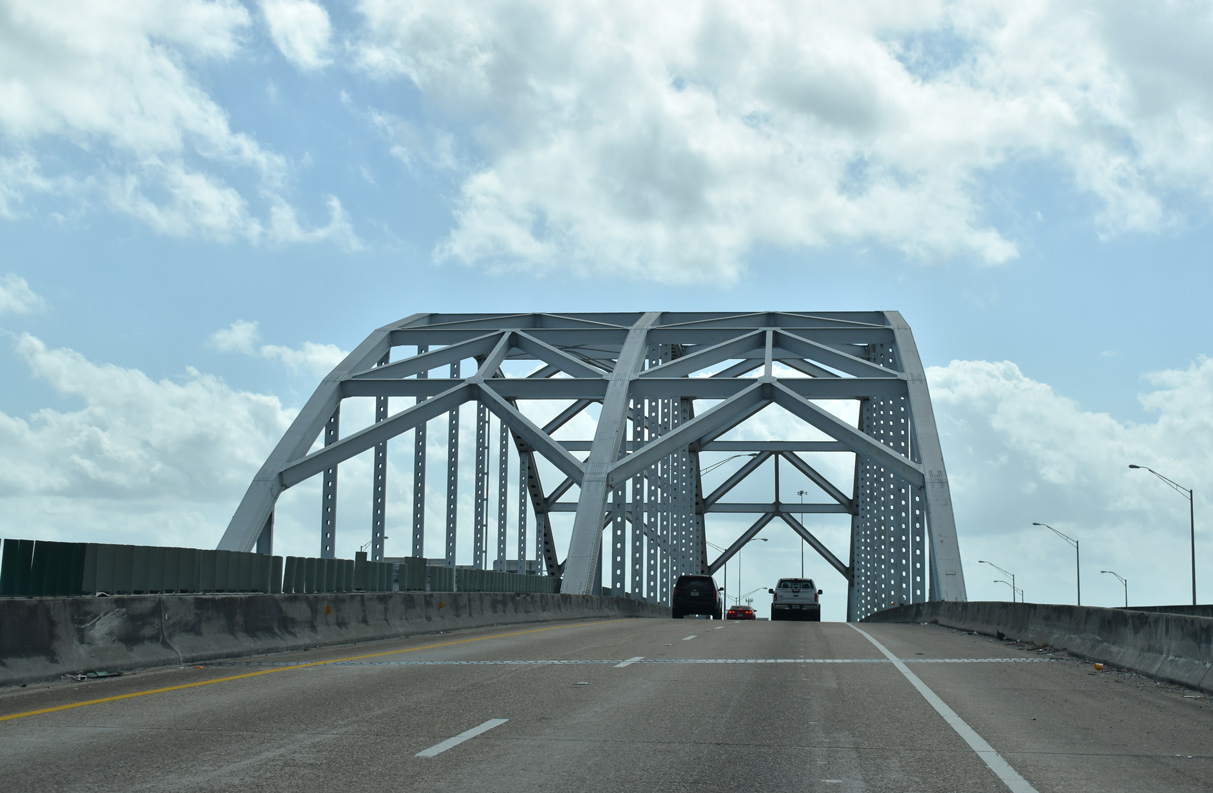
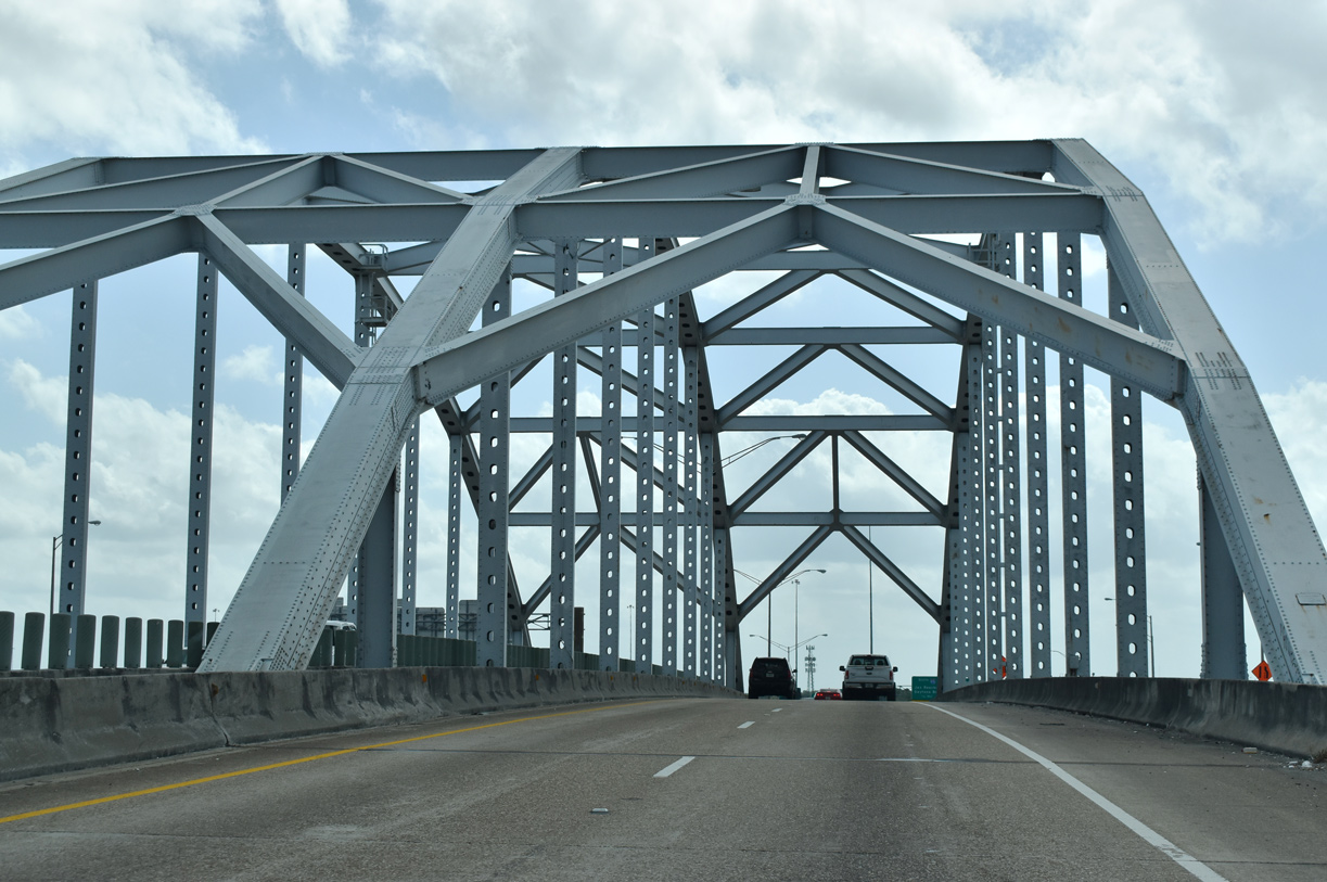
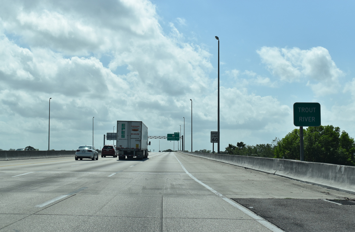
| Interstate 95 spans the Trout River Bridge en route to the Lake Forest community. The Trout River flows wholly within Jacksonville city limits, originating 20 miles in northwest Duval County and merging with the St. Johns River to the southeast at Sandfly Point. 03/26/20 |
|
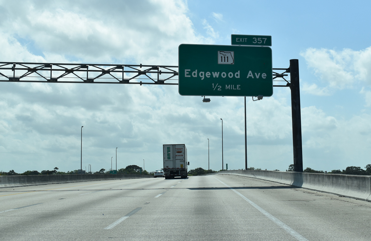
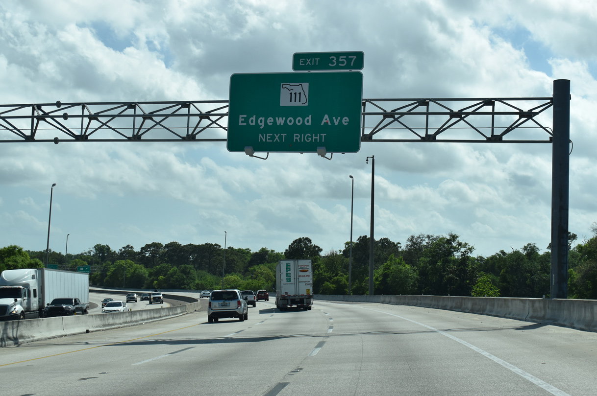
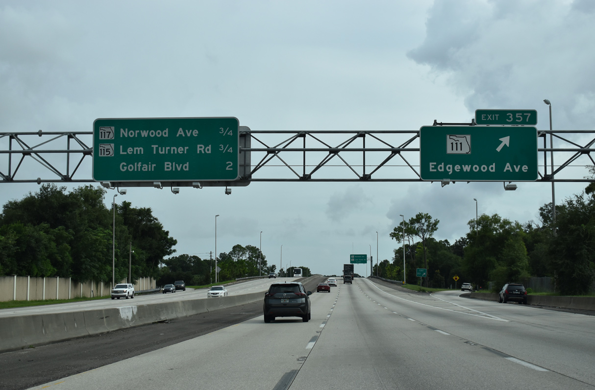
| Reaching the apex of the Trout River Bridge, I-95 advances to within a half mile of Exit 357 for SR 111 (Edgewater Avenue). 03/28/20 |
|
| SR 111 (Tallulah Avenue) angles southeast through the Tallulah / North Shore neighborhood to U.S. 17 (Main Street). Edgewood Avenue carries SR 111 southwest from Interstate 95 along a commercial boulevard through the Lake Forest and Magnolia Gardens neighborhoods. 03/26/20 |
|
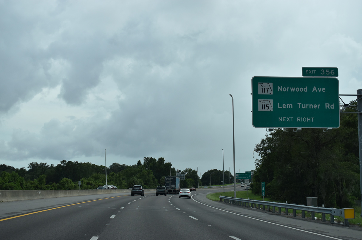
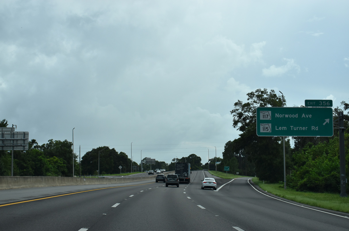
| Exit 357 departs I-95 south, 0.75 miles ahead of the exchange with SR 115 (Lem Turner Road) north and SR 117 (Norwood Avenue) south. 08/28/21 |
|
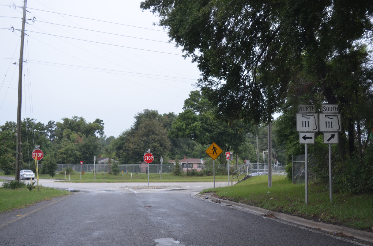
| Measuring 11.88 miles overall, SR 111 turns south from U.S. 1/23 toward Biltmore and Woodstock. SR 111 concludes in the Lakeshore neighborhood at SR 21, just north of the Cedar River. 06/16/16 |
|
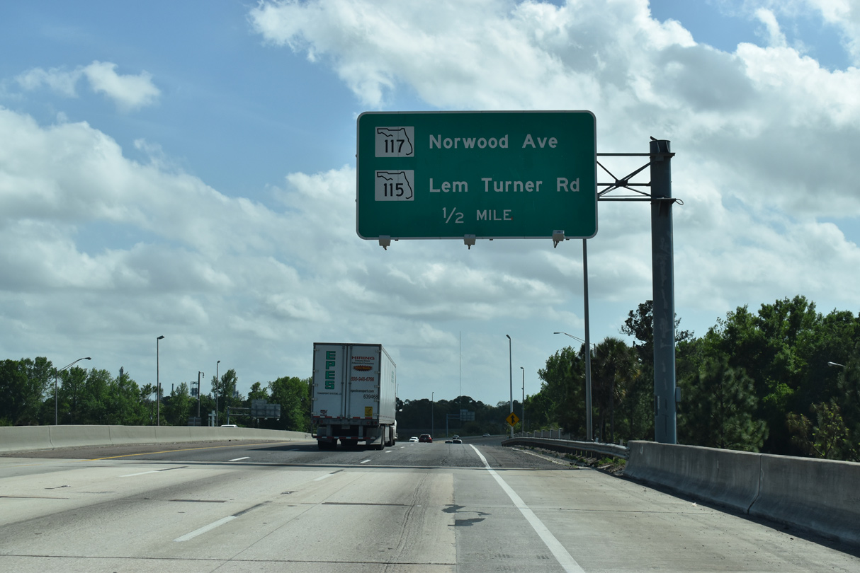
| Upcoming SR 117 (Norwood Avenue) loops 1.49 miles east from I-95 to Gateway Town Center and SR 122 (Golfair Boulevard) just east of Exit 355. SR 115 (Lem Turner Road) extends northwest to Riverview, College Park, Garden City and I-295. 03/26/20 |
|
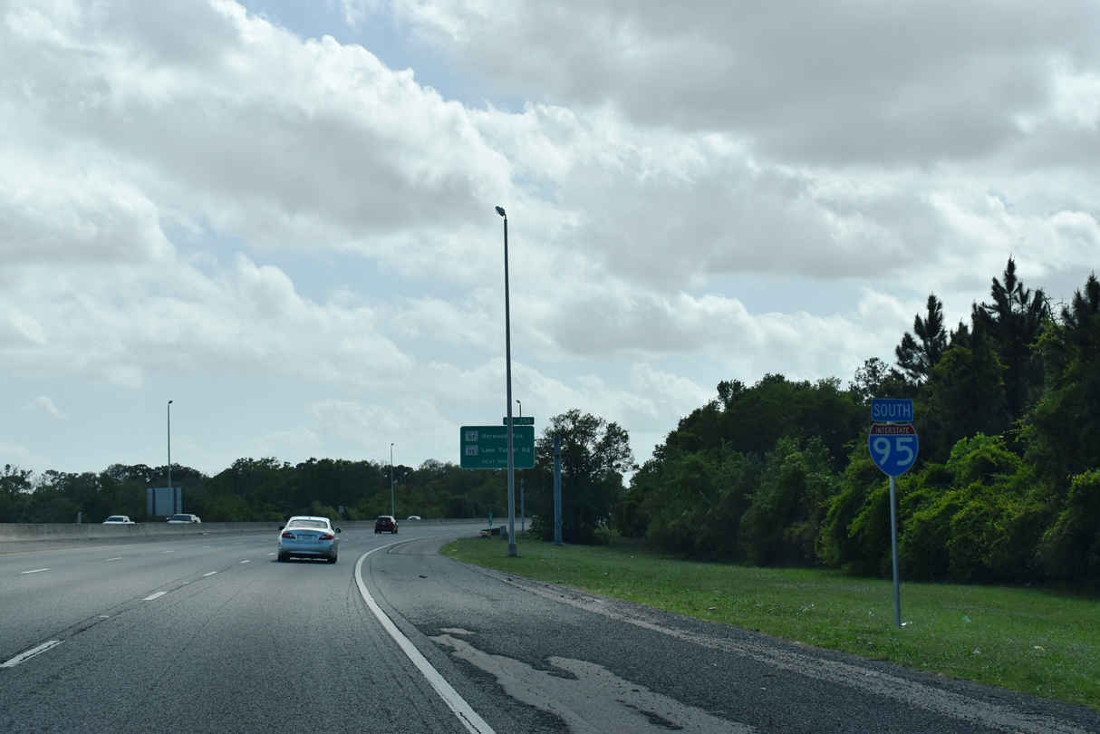
| Unmarked along I-95 south, SR 115 south accompanies the freeway for 1.6 miles from Exit 356 to U.S. 1 at Martin Luther King, Jr. Parkway. 03/26/20 |
|
| Originating in Callahan from U.S. 1/23, SR 115 runs 37.17 miles overall. Within Jacksonville, the state road follows Arlington Expressway east and Southside Boulevard south to conclude at U.S. 1 in Greenland. 08/28/21 |
|
| Exit 356 separates from I-95 south for SR 115 (Lem Turner Road) and SR 117 (Norwood Avenue). Norwood Avenue passes through the Norwood neighborhood to Brentwood Avenue. SR 115 originally followed SR 117 south and Woodbine Street east to U.S. 17. 08/28/21 |
|
| Interchange sequence sign outlining the succeeding ramps for SR 122 (Exit 355), U.S. 1 (Exits 354 B/A) and 8th Street (Exit 353 D). I-95 crosses Moncrief Creek here. 03/26/20 |
|
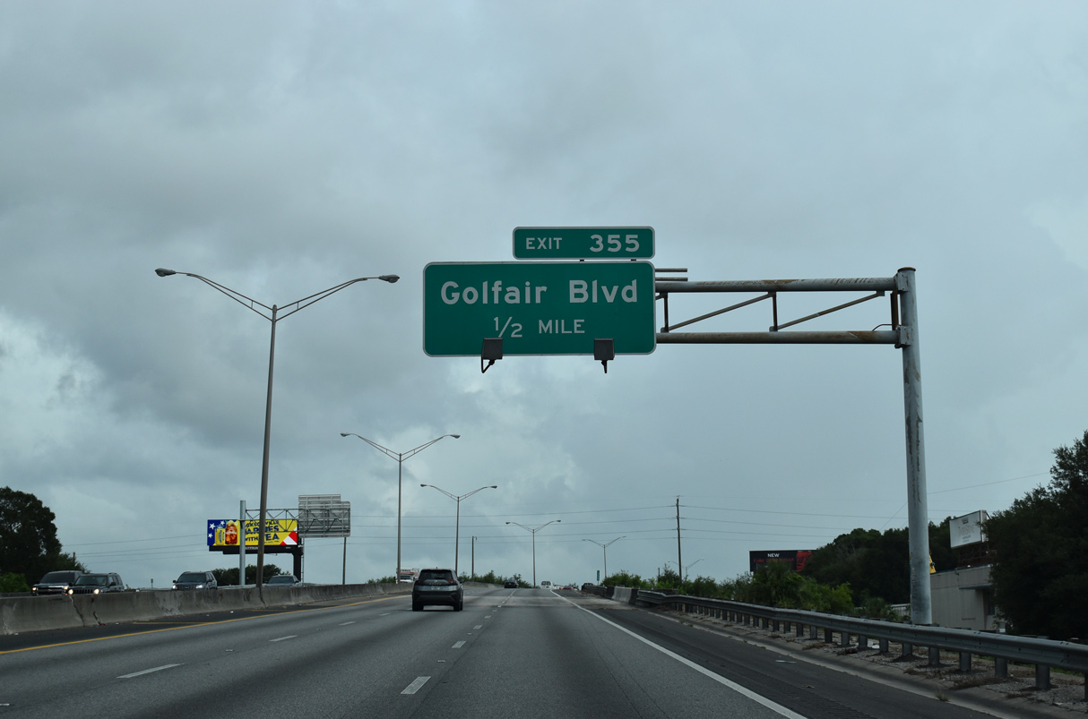
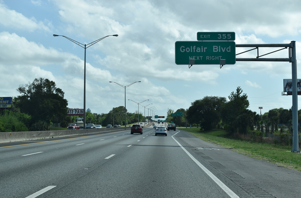
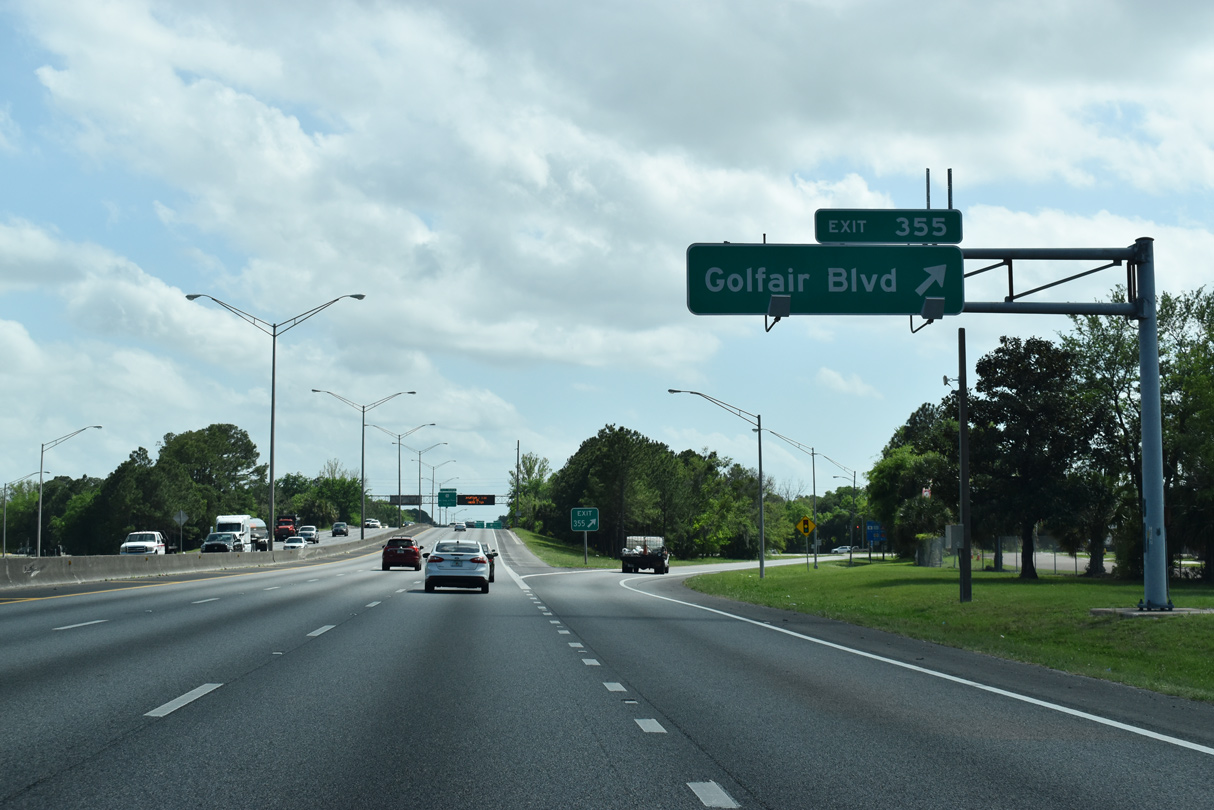
| I-95 south passes over a CSX Railroad line (part of the former Everett Subdivision line) ahead of the diamond interchange (Exit 355) with Golfair Boulevard (SR 122). 08/28/21 |
|
| Golfair Boulevard stems east from Moncrief Road and 34th Street at Moncrief Park to cross I-95 en route to Pearl and 27th Streets in the Brentwood neighborhood. 03/26/20 |
|
| SR 122 runs 1.07 miles east from I-95 to U.S. 17 (Main Street) along Golfair Boulevard and 27th Street. West from the freeway to Moncrief Road, Golfair Boulevard is a part of unsigned CR 21D, which leads northwest 1.97 miles to Royal Terrace and SR 111 (Edgewood Avenue). 03/26/20 |
|
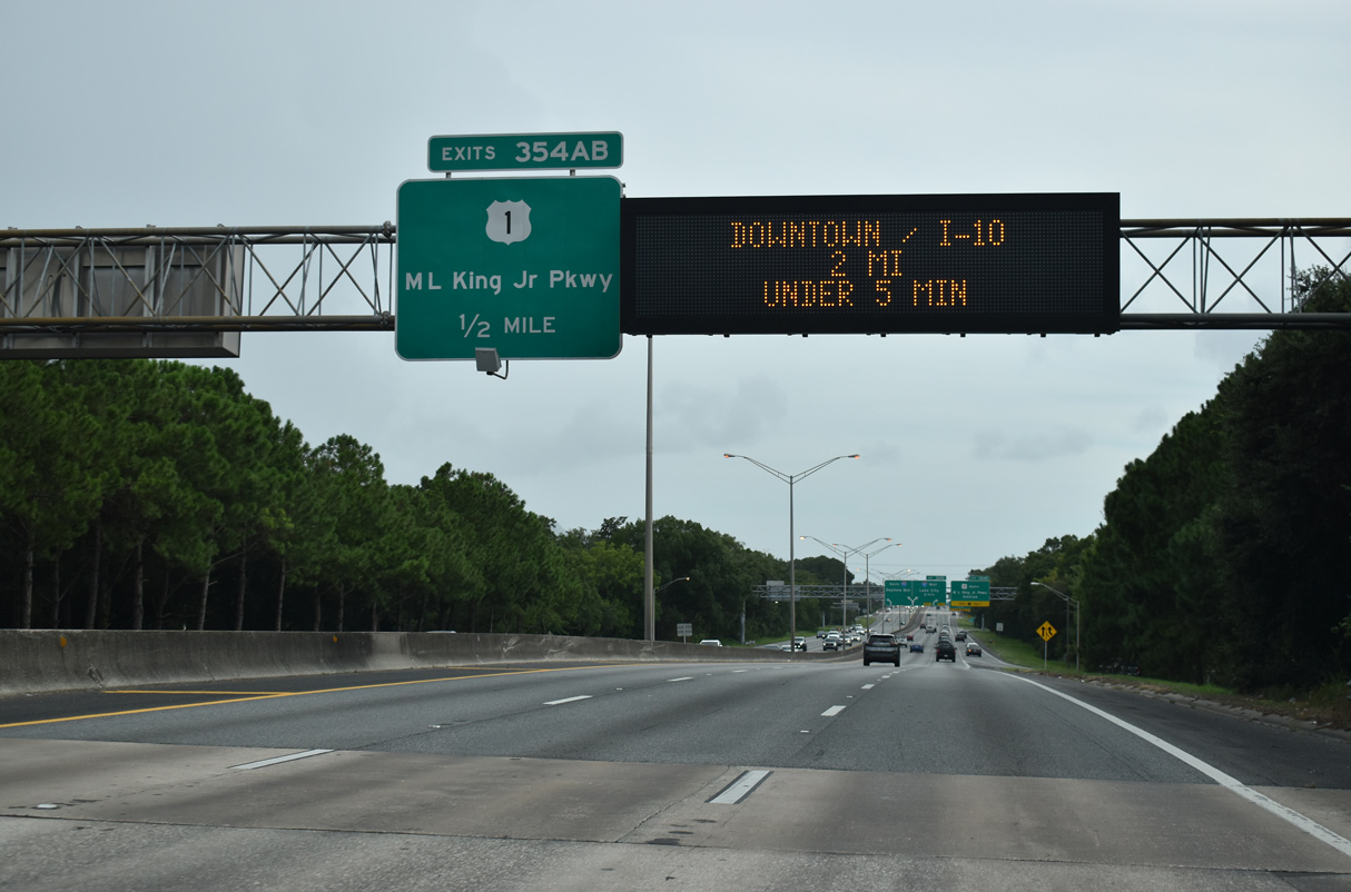
| Continuing south from the Golfair Boulevard (SR 122) underpass, I-95 passes through a residential street grid and next meets U.S. 1 (Martin Luther King, Jr. Parkway) at a three-quarter cloverleaf interchange (Exit 354). 08/28/21 |
|
| U.S. 1 (Martin Luther King, Jr. Parkway) north follows a surface expressway 2.5 miles west from I-95 to U.S. 23 north. The Jacksonville AMTRAK station lies a short distance further via U.S. 1/23 north to Clifford Lane west. The first in a series of APL overheads for I-10 was installed here in 2015. 03/26/20 |
|
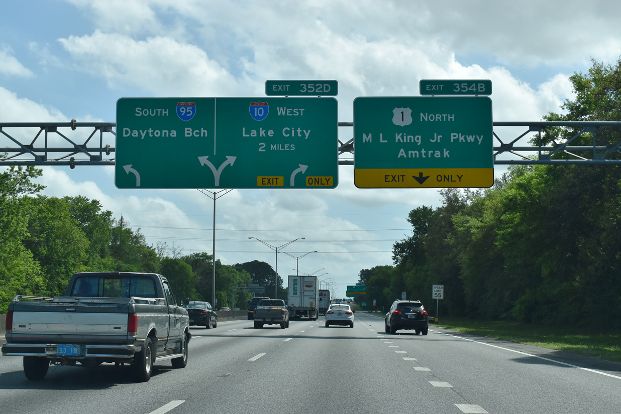
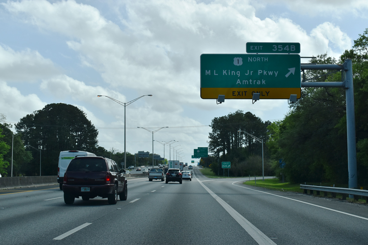
| Exit 354B departs Interstate 95 south for U.S. 1 (MLK Parkway) north. Leading northwest from Grand Park in Jacksonville, U.S. 1/23 overlap for 107 miles to Alma, Georgia, where the two split for Augusta and Macon respectively. 03/26/20 |
|
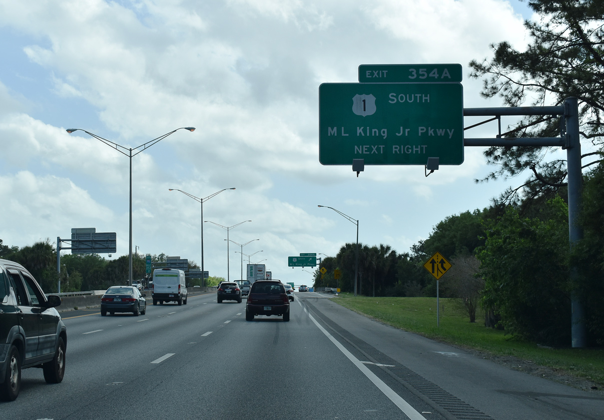
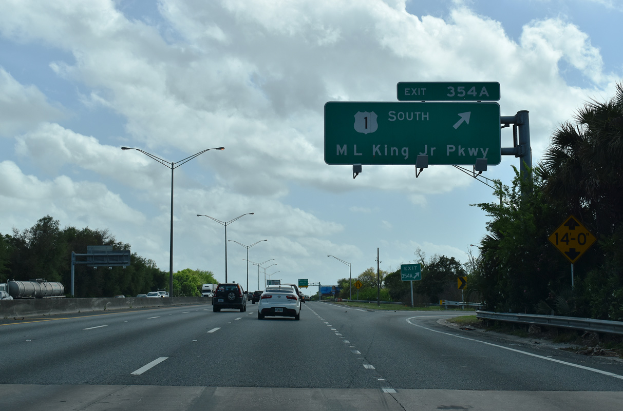
| A loop ramp joins I-95 south with U.S. (Martin Luther King, Jr. Parkway) south. The limited access highway becomes U.S. 1 Alternate east of Main Street (U.S. 17) en route to the Hart Bridge Expressway. Although not signed, SR 115 also follows the freeway loop from Exit 354 A to the John E. Mathews Bridge. 03/26/20 |
|
| U.S. 1 combines with U.S. 17 (Main Street) south to the Jacksonville CBD, 0.9 miles east of I-95 via Martin Luther King, Jr. Parkway. U.S. 1 Alternate constitutes a loop encircling central Jacksonville south to Emerson Street (SR 126) and U.S. 1 at South Riverside. 03/26/20 |
|
| I-95 south spans a CSX Railroad line originating at Grand Crossing by this reassurance marker. 03/26/20 |
|
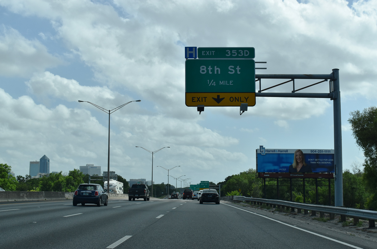
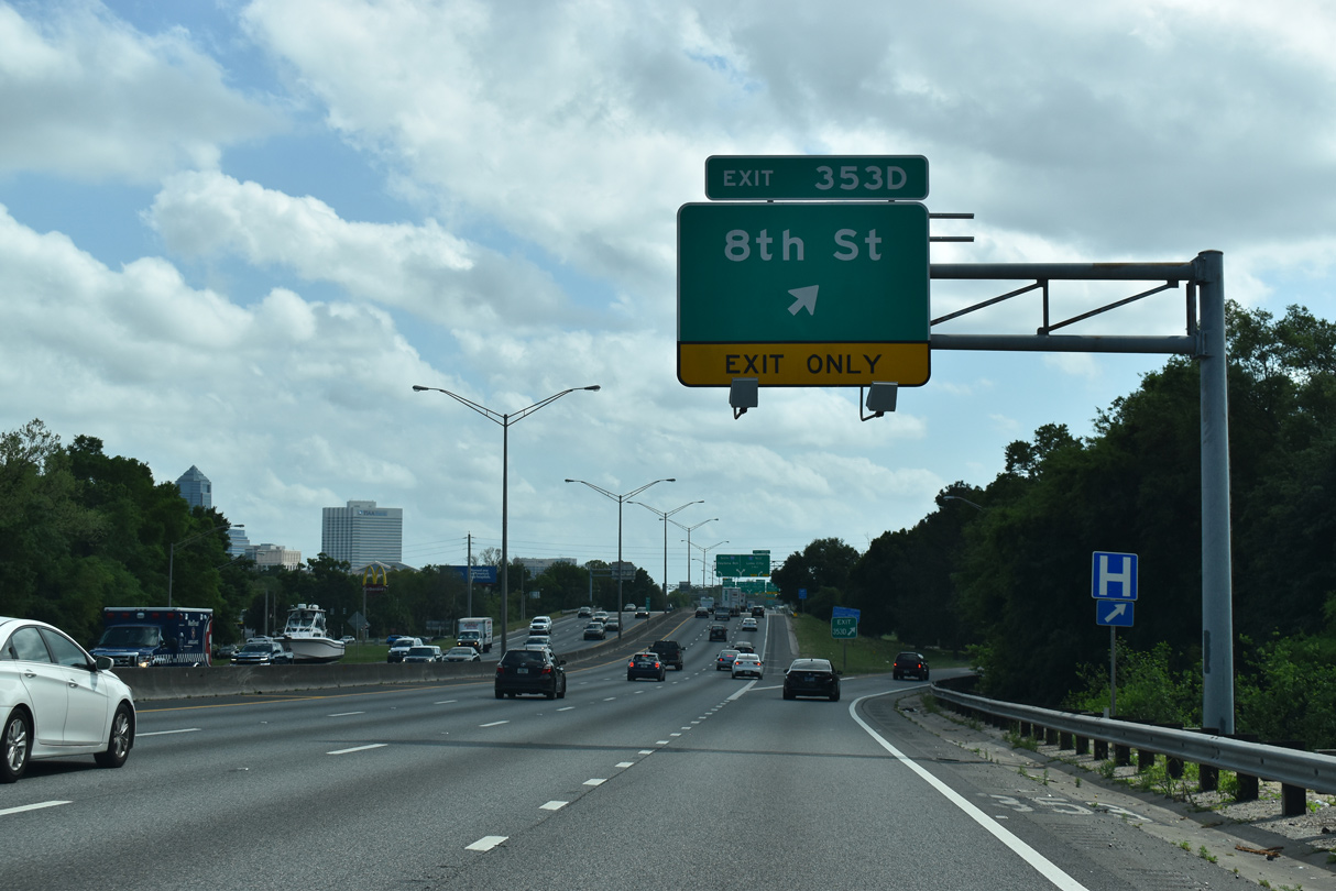
| Though not signed along southbound Interstate 95, forthcoming 8th Street doubles as SR 114 for 0.580 miles between Francis Street and Boulevard. 03/26/20 |
|
| The auxiliary lane from U.S. 1 drops at Exit 353 D to 8th Street (SR 114). 8th Street east connects I-95 with UF Health Jacksonville medical center and the Springfield neighborhood. 8th Street continues west to Myrtle Avenue in the Mid-Westside community. 03/26/20 |
|
| Two lanes separate for a c/d roadway leading to I-10 west beyond the entrance ramp from Adams Street in one mile. I-95 turns east to cross the St. Johns River at the systems interchange locally known as the "The Big I". 01/05/19 |
|
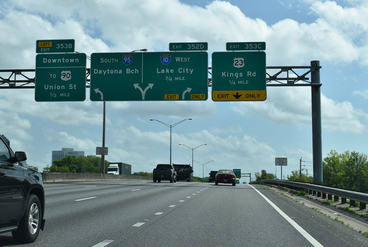
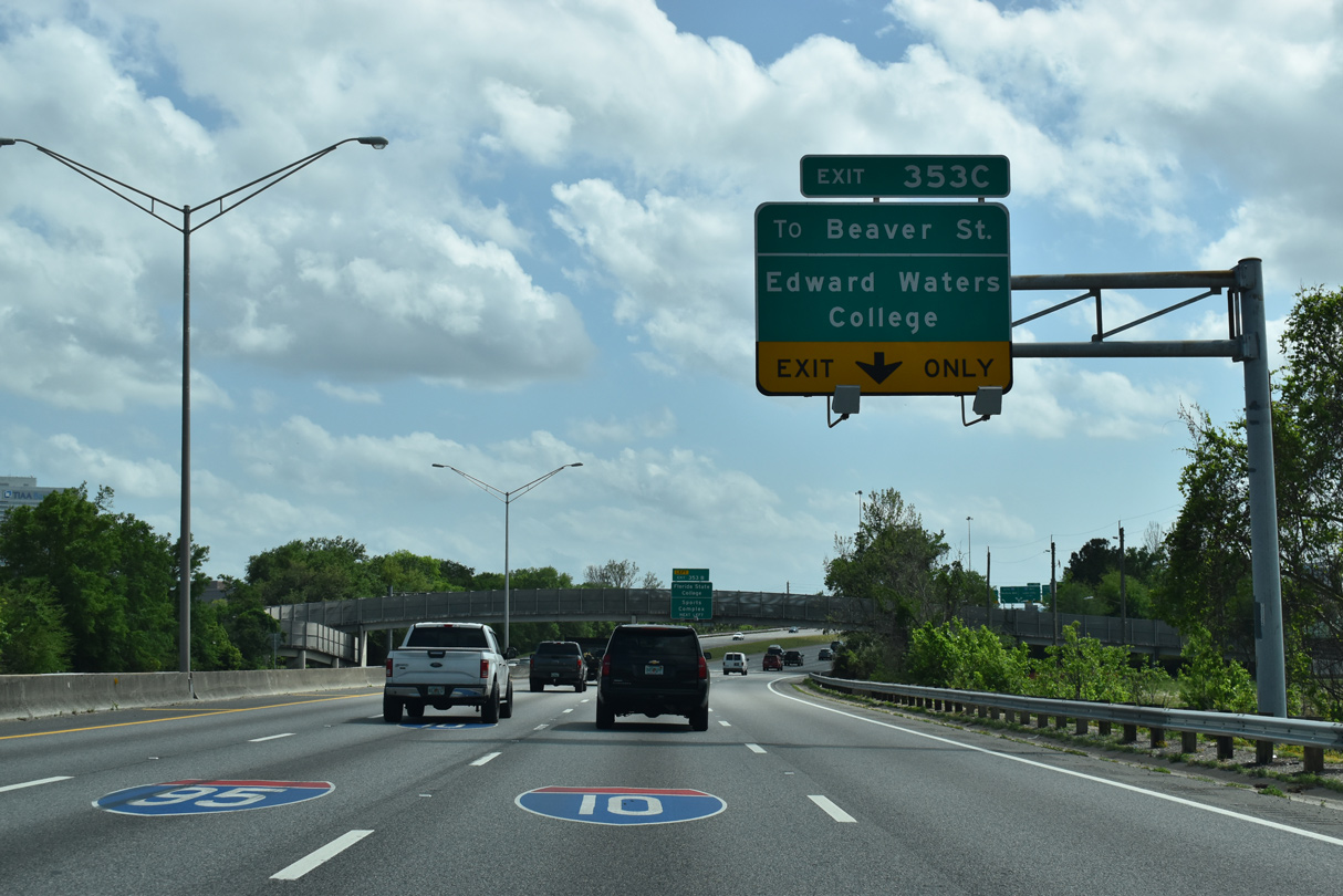
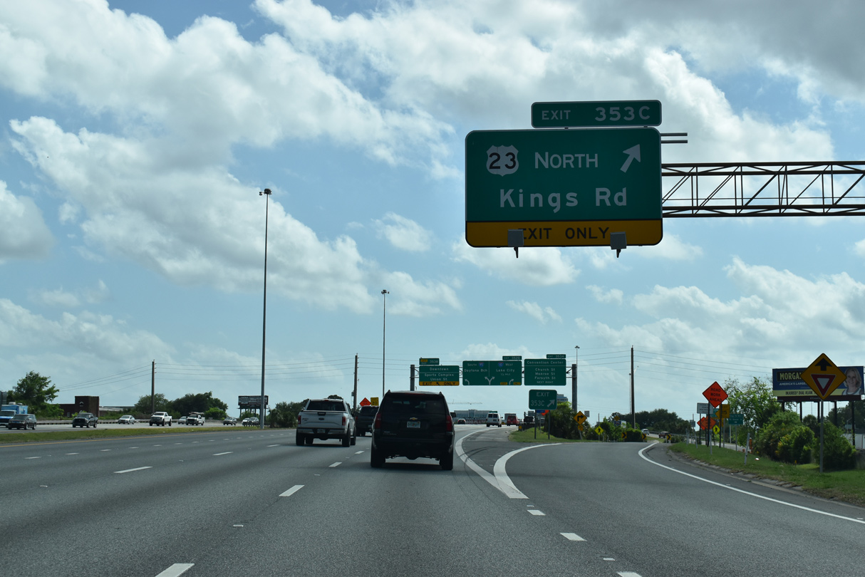
| The ensuing ramp (Exit 353 C) departs Interstate 95 south for U.S. 23 north. 03/26/20 |
|
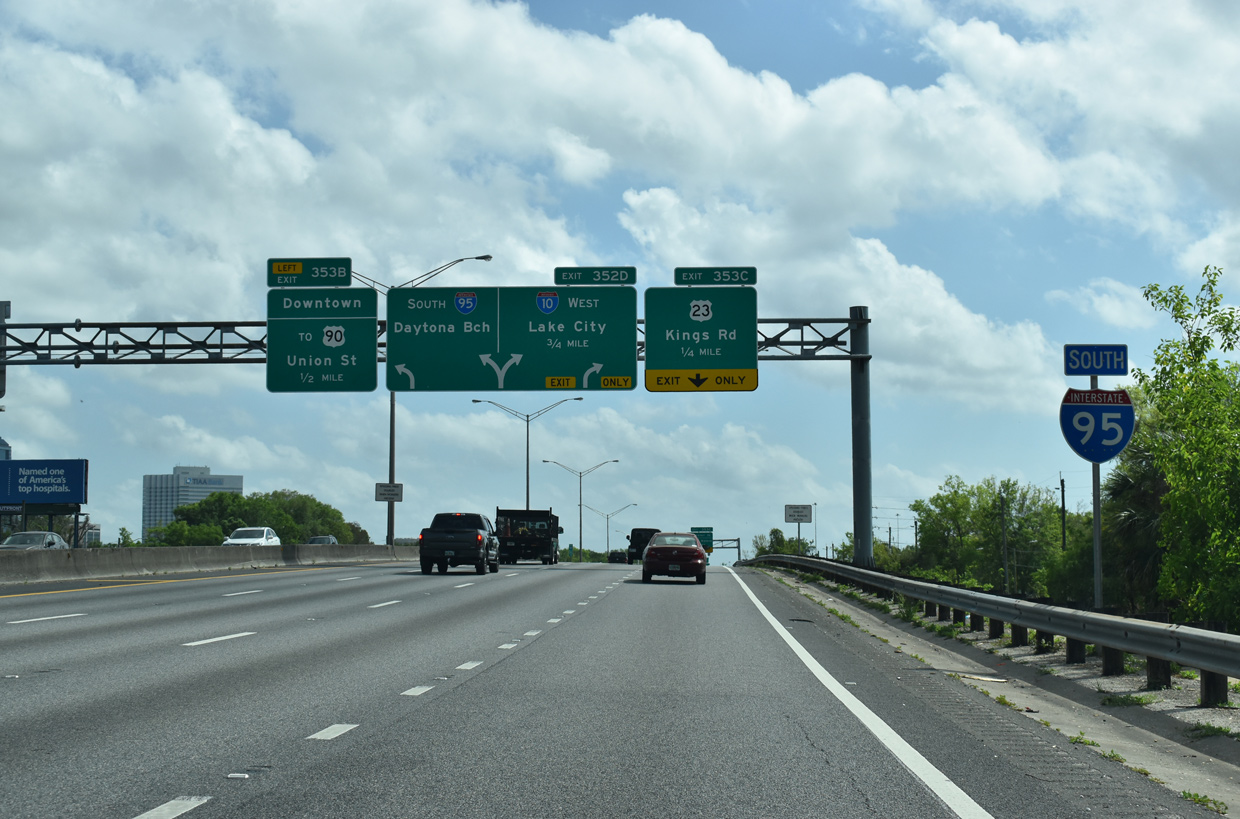
| U.S. 23 follows Kings Road northwest from I-95 between Mid Westside and College Gardens to Grand Park and U.S. 1 north. Exit 353 B to Union Street links with U.S. 17/23 south to Main Street (U.S. 1) at Downtown and parallel U.S. 90 (Beaver Street). 03/26/20 |
|
| Beaver Street (U.S. 90) can also be accessed from I-95 via Eaverson Street from U.S. 23 (Kings Road) north. Edward Waters College is located along U.S. 23 one mile northwest from Exit 353 C. 03/26/20 |
|
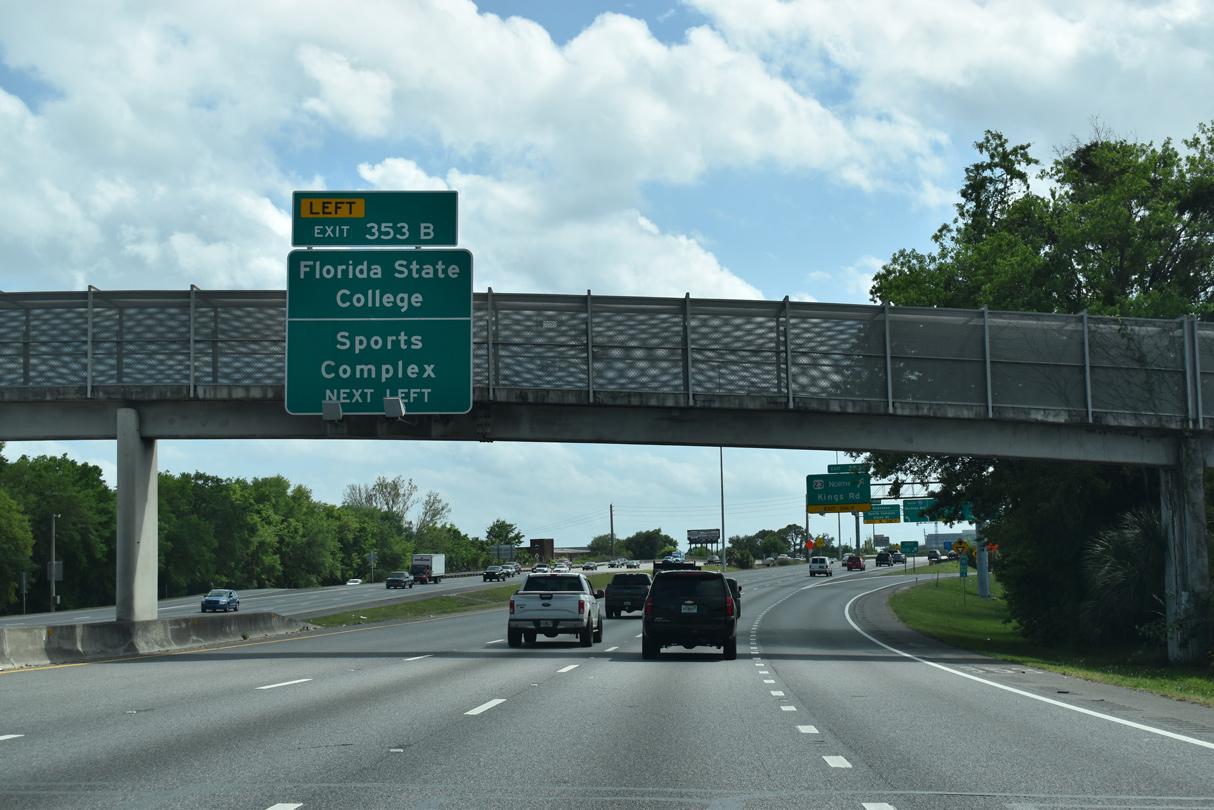
| A pedestrian overpass at 3rd Street spans I-95 south ahead of back to back ramps for U.S. 23. Florida State College lies a half mile east along State Street (U.S. 17 south / U.S. 23 north) between Pearl and Laura Streets. Union Street east is the preferred route from I-95 south to the Jacksonville Sports Complex, consisting of TIAA Bank Field (home of the Jacksonville Jaguars), VyStar Veterans Memorial Arena and 121 Financial Ballpark. 03/26/20 |
|
| Interstate 95 south reaches Exit 353 C to U.S. 23 (Kings Road) north. Overall, the US highway travels 1,435 miles from Jacksonville to I-75 at Mackinaw City, Michigan. 03/26/20 |
|
| Exit 353 B departs for Union Street (U.S. 17/23) east to Downtown. Although unmarked along I-95, U.S. 17 south / SR 228 west combine with the freeway from State Street south to I-10 west / Exit 352 D. U.S. 17/SR 228 were realigned onto I-95 and I-10 from the Avondale and Brooklyn neighborhoods in 2006. 03/26/20 |
|
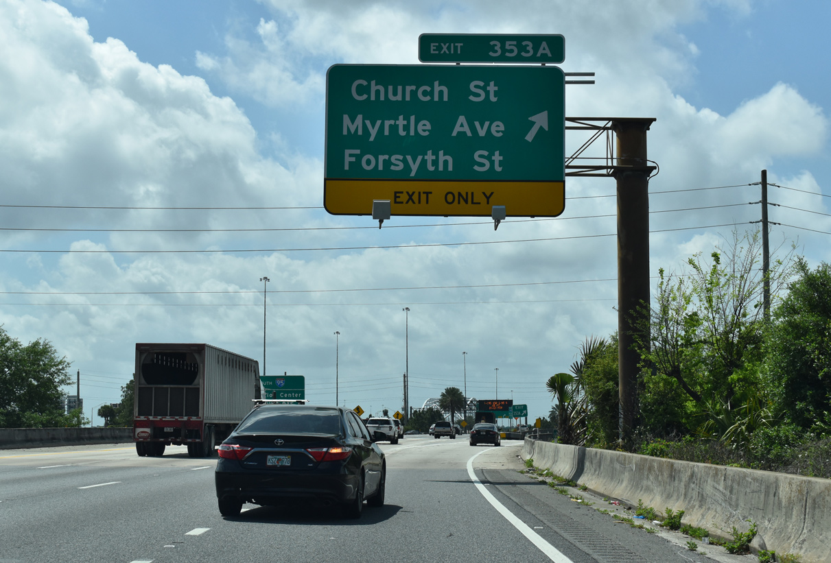
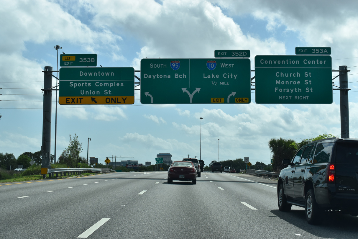
| The subsequent ramp (Exit 353 A) lowers to the intersection of Church and Cleveland Streets, connecting I-95 with parallel Myrtle Avenue. Forsyth Street stems east from Myrtle Avenue to the Prime F. Osborn III Convention Center (1000 Water Street) and the Jacksonville CBD. 03/26/20 |
|
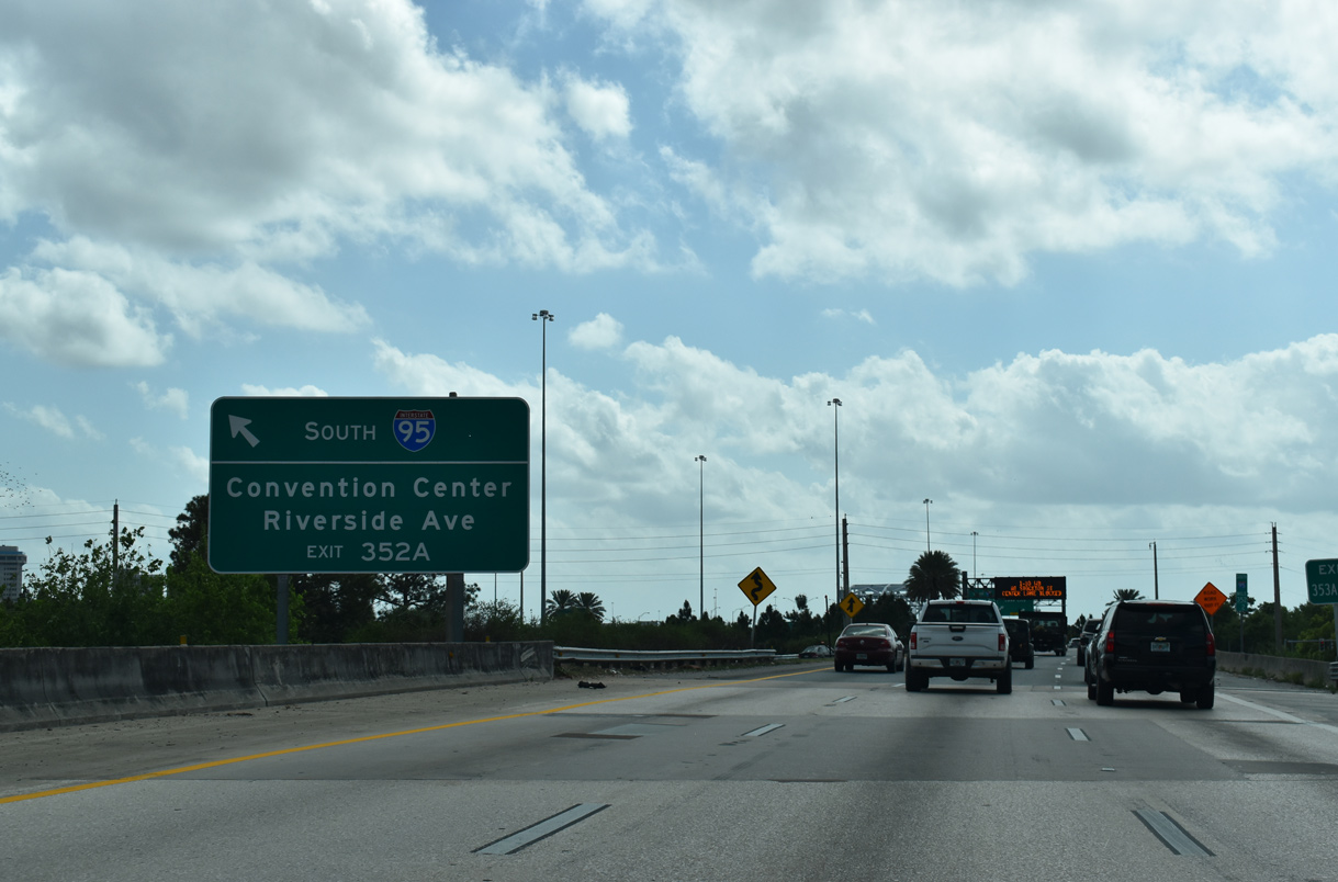
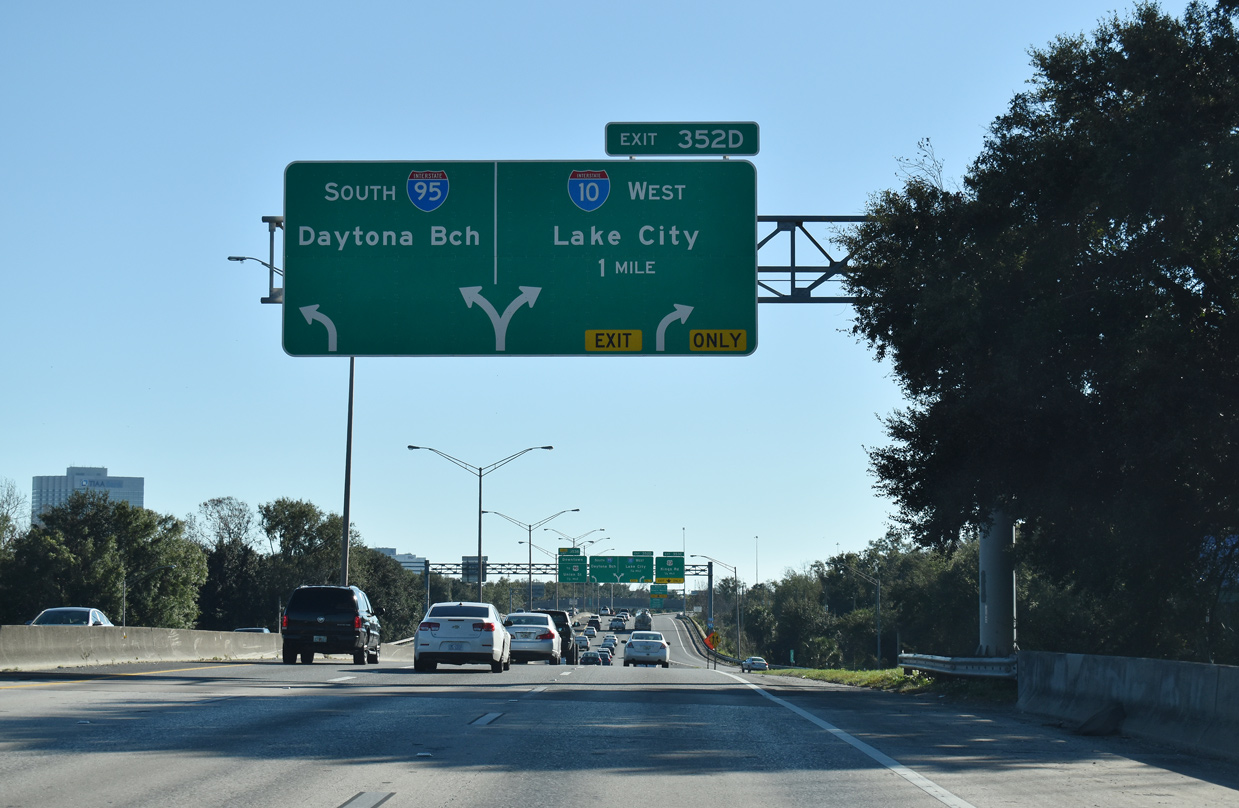
| A left side entrance ramp joins I-95 south from U.S. 90 (Beaver Street) east ahead of the separation with the c/d roadway (Exit 352 D) for Interstate 10 west / U.S. 17 south. Left Exit 352 A (Forest Street) departs for Riverside Avenue and the Convention Center a half mile beyond the roadway split. 03/26/20 |
|
| Underway from February 2005 to a ribbon cutting ceremony on September 17, 2011, the Big I project upgraded the 1950s designed exchange joining I-95 and I-10 into a high speed systems interchange. $154 million in construction involved work on 17 separate bridges and 21 ramps.2 03/26/20 |
|
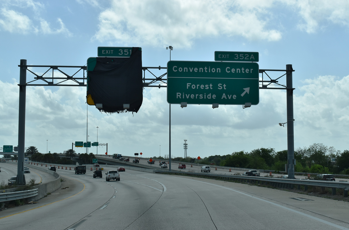
| Exit 352 A to Forest Street partitions from I-95 south just beyond the Myrtle Avenue steel arch bridge. 03/26/20 |
|
| Originally constructed in 1955, the 1,430 feet long Myrtle Avenue bridge3 carries mainline I-95 across Myrtle Avenue and CSX and Florida East Coast (FEC) Railway tracks. 03/26/20 |
|
| The Myrtle Avenue Bridge was expanded in 1991 with c/d roadways in both directions. The outer roadways were used periodically during traffic shifts for both Forest Street and Interstate 95 south during the 2005-11 Big I Project. 03/26/20 |
|
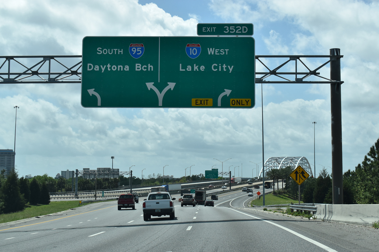
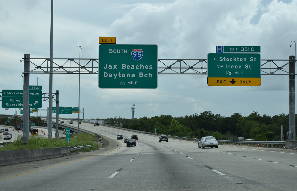
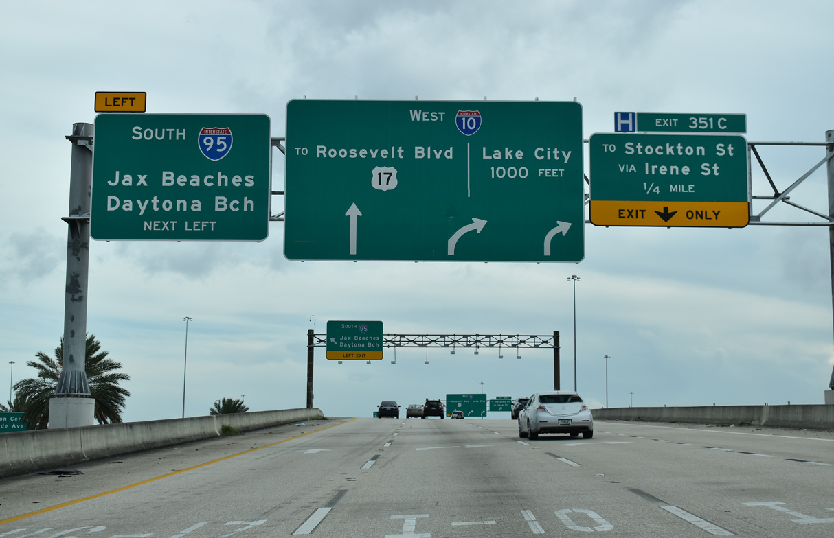
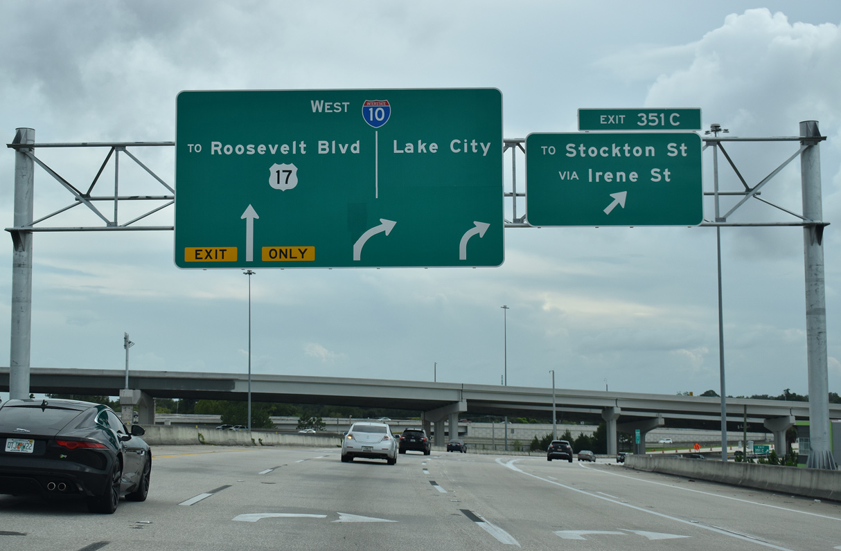
| The c/d roadway for I-10/U.S. 17-SR 228 west partitions with ramps to both Stockton Street (Exit 351 C) and return access to I-95 south after the Bay Street entrance ramp. 08/28/21 |
|
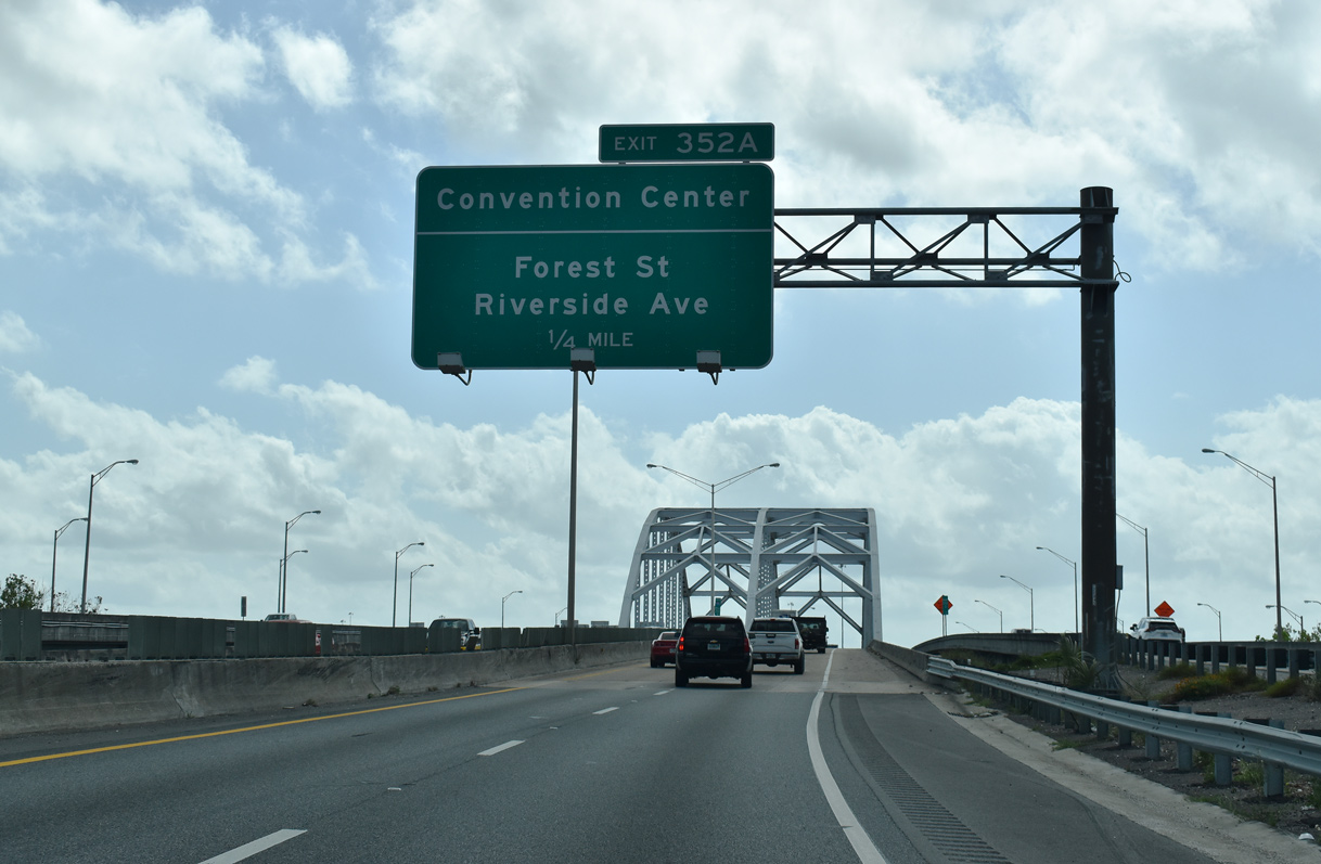
| Exit 352 A leaves from the southbound I-95 mainline to Forest Street at the Brooklyn neighborhood. Park Street leads northeast from Forest Street to the Prime F. Osborn III Convention Center at the LaVilla community. The succeeding ramp connects with I-10 west for motorists that entered the freeway from U.S. 90 (Beaver Street). 03/26/20 |
|
| Exit 351 C departs for Stockton Street by way of Irene Street west while a slip ramp returns to I-95 south as the freeway turns southeast across the St. Johns River on the Fuller Warren bridge. 08/28/21 |
|
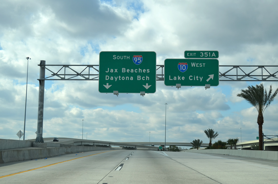
| Leading away from I-95, U.S. 17/SR 228 part ways with Interstate 10 west at Left Exit 361 for Roosevelt Boulevard south. 08/28/21 |
|
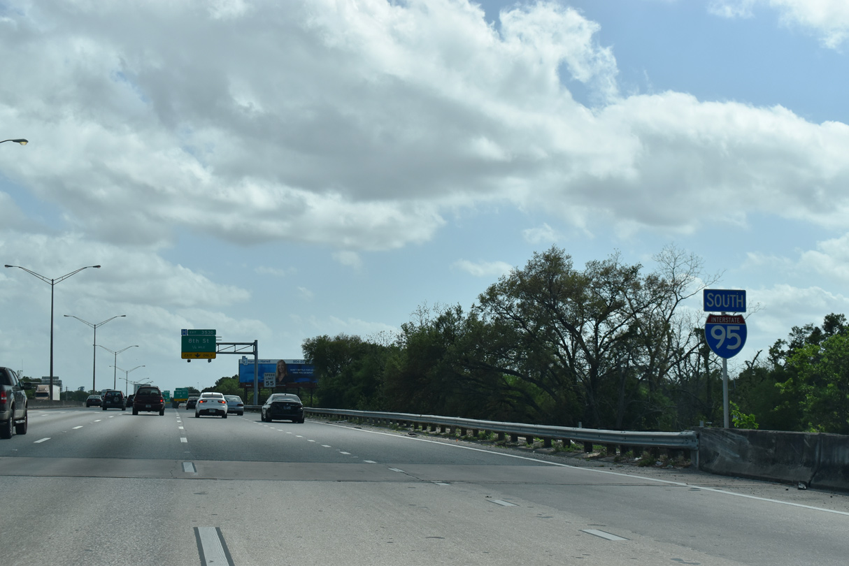
| The second ramp (Exit 351 A) leaves I-95 south for Interstate 10. Lake City is located 59 miles to the west in Columbia County at the cross roads with I-75. Traversing the width of the U.S. to Santa Monica, California, I-10 runs along the upper Gulf Coast from the Big Bend of Florida to Tallahassee, New Orleans and Houston. 03/03/13 |
|
| Big I project improvements smoothed the sharp curve along I-95 at I-10 and eliminated left side ramps. The southbound ramp (Exit 351 A) to Margaret Street was also removed to make way for the slip ramp from the I-10 c/d roadway. 03/26/20 |
|
| The project upgrading the systems interchange at I-10/95 earned the 2011 People's Choice Award in October 2011.4 03/26/20 |
Page Updated 11-12-2021.

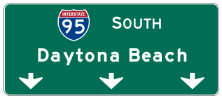
 South
South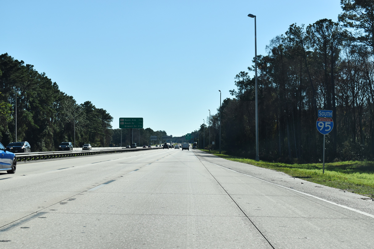
 South
South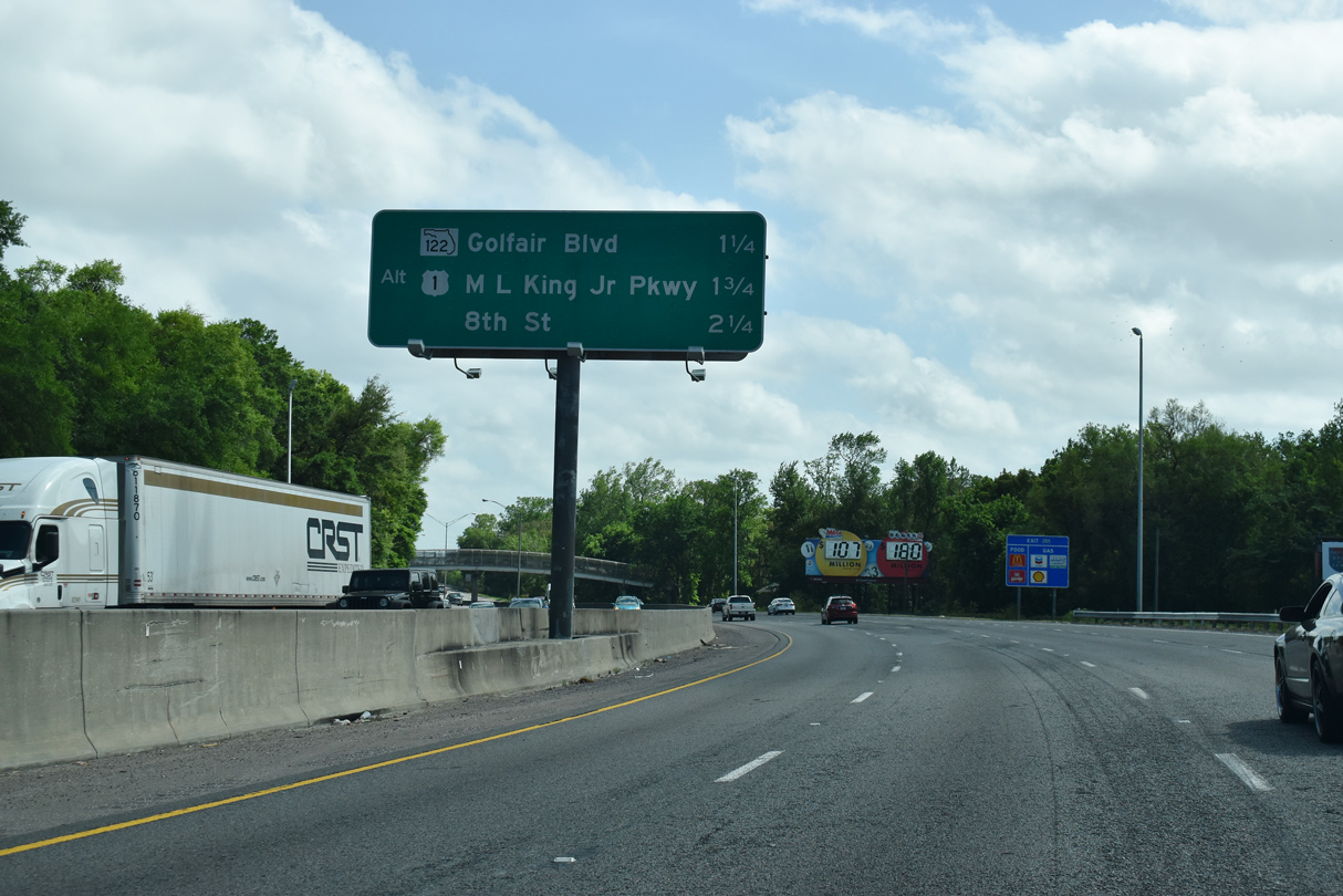
 South
South