

Interstate 440 encircles central Raleigh on the northern half of the Cliff Benson Beltway. Known almost exclusively as the Beltline in Wake County, I-440 overlaps with U.S. 1 for 10.70 miles from Interstate 40 by the Cary city line to U.S. 401 (Capital Boulevard). U.S. 64 Business accompanies I-440 south from New Bern Avenue 1.09 miles to Interstate 87, where U.S. 64 joins I-440 south 2.71 miles to Interstate 40. The renumbering of I-495 to Interstate 87 includes extending I-87 over the southeastern most section of I-440 to connect with I-40.
Beginning in 1991, Interstate 440 was widened nearly all the way around Raleigh. Finished in 1993, the first expanded section of the beltline was from Glen Eden Drive, between Lake Boone Trail and Ridge, to Wake Forest Road. By 1997, all but the westernmost four miles were six lanes wide. Work estimated to cost $475 million reconstructs the final four-lane section, from U.S. 1/64 just south of Walnut Street in Cary to north of Wade Avenue in Raleigh. I-440 Improvements - Project U-2719 includes redesigning the exchange at Western Boulevard into a diverging diamond interchange (DDI) and modifying the cloverleaf interchange at Wade Avenue to eliminate weaving traffic with at least one flyover ramp. Construction started in Fall 2019 continues into Summer 2023 2024.
Interstate 440 North Carolina Guides
The Cliff Benson Beltline predates the Interstate system. The initial section was constructed simultaneously with the U.S. 1 freeway through southeast Chatham and Wake Counties. It opened 3.19 miles east to Hillsborough Street (N.C. 59) in 1960. The ensuing section extended the Beltline 7.5 miles north and east to North Boulevard (Capital Boulevard). This represented the entire U.S. 1 bypass of Downtown Raleigh.
Construction through early 1965 built the 1.87 mile section of the Belt line from U.S. 1/401 to U.S. 64 Business along New Bern Avenue. U.S. 64 was subsequently relocated to follow all of the completed Beltline to circumvent Downtown.
With Interstate 40 finished south of Downtown Raleigh in 1984, the the full beltline for Raleigh was complete. Remaining portions of U.S. and state highways through central Raleigh were rerouted to join the Cliff Benson Beltline or I-40. However motorist confusion resulted from having so many routes assigned to the beltline, so NCDOT eventually renumbered the freeway loop as Interstate 440 in 1991. This included running I-440 concurrently with I-40, so that the entire loop had one designation. Following the establishment of I-440 in 1991, the overlaps with U.S. 70, U.S. 401 and N.C. 50 were eliminated, with the respective routes returning to surface routes through Downtown Raleigh by 1996.
I-440 was initially signed as an east-west route, despite the circuitous route of the beltline. The state attempted to solve this issue by replacing cardinal directions for Interstate 440 with inner banners for clockwise travel and outer banners for the county-clockwise direction. This gave I-440 the distinction of the only Interstate in the system to not officially use cardinal directions. Area drivers never got used to the inner/outer directions, and the state restored east/west signage in 2009. The resigning coincided with the removal of I-440 along the shared alignment with I-40 and U.S. 64 to the south of Downtown, so that I-440 solely traveled north of I-40.
 scenes scenes |
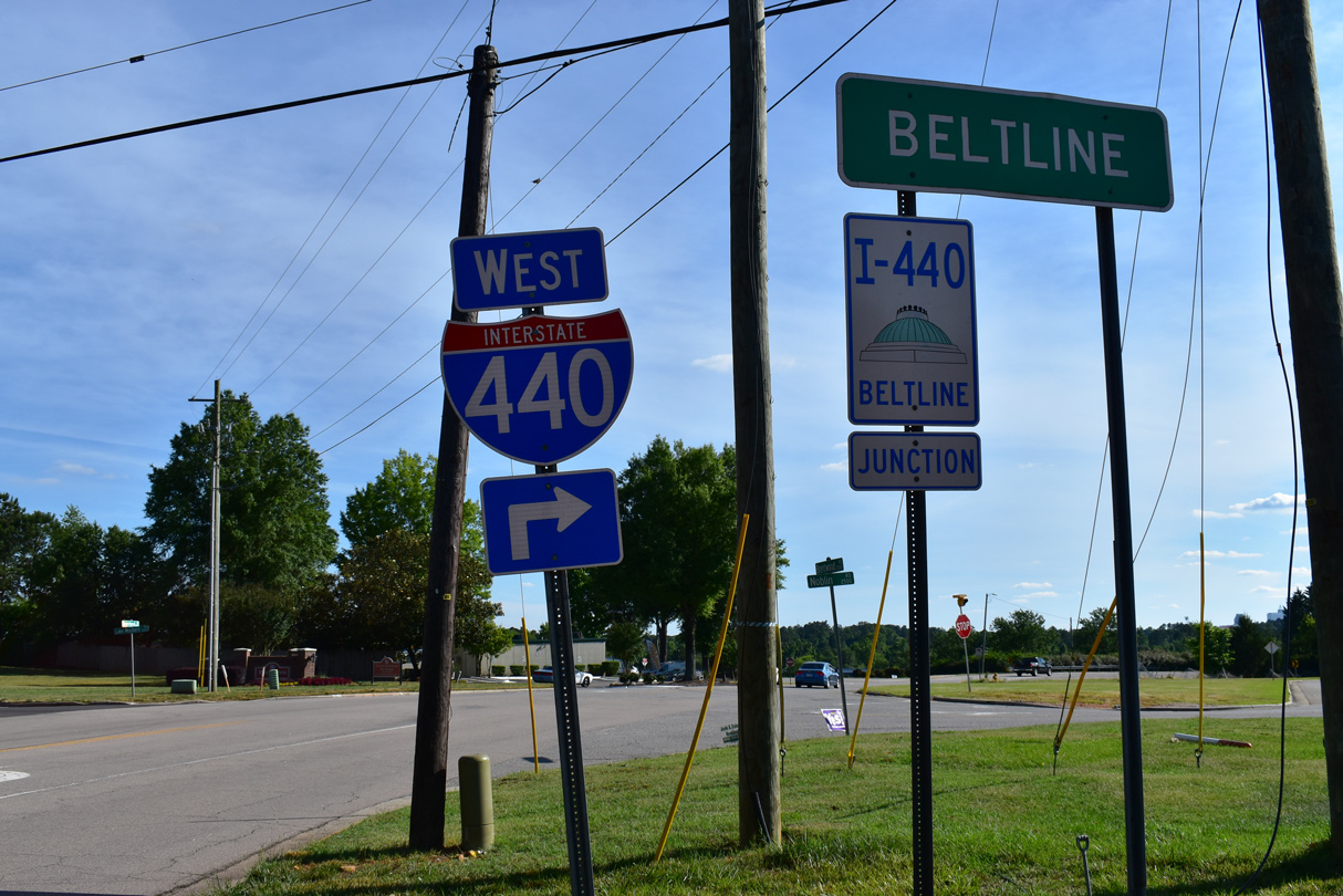 | Brentwood Road ties into Interstate 440 westbound at RIRO ramps (Exit 12). The westbound entrance ramp lies across the freeway along Yonkers Road. 05/31/21 |
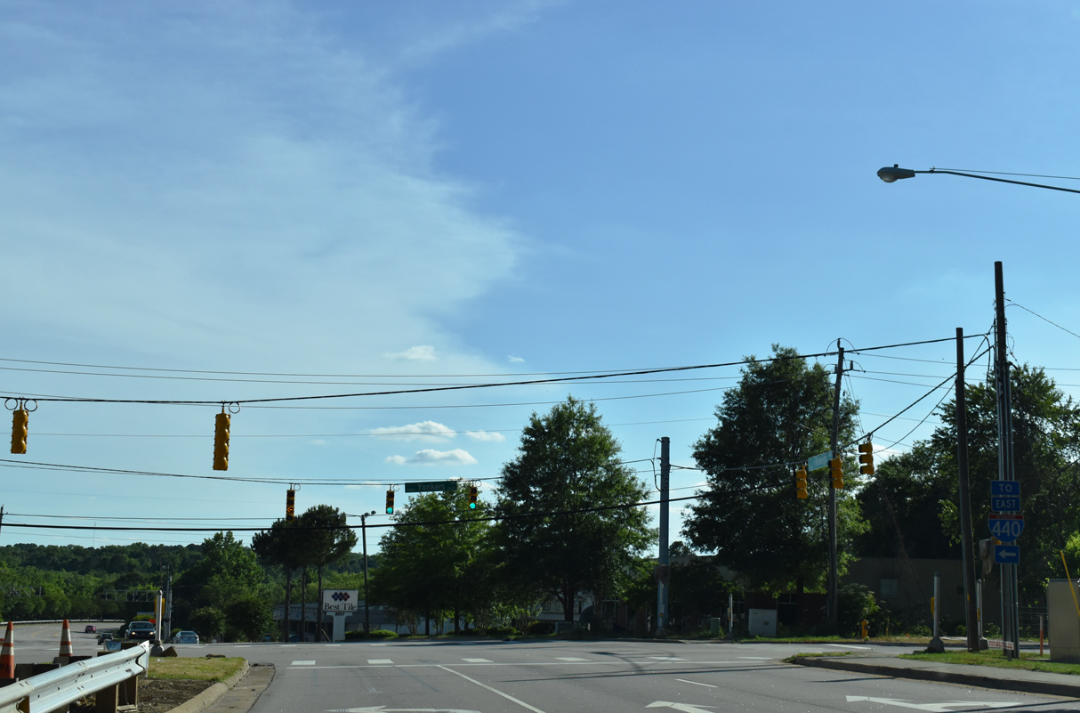 | Raleigh Boulevard west at Yonkers Road south to eastbound Interstate 440. 05/31/21 |
Background information on Interstate 440 originally researched by Brian LeBlanc for the Wake County Roads web site. It was reproduced here with his permission.
Photo Credits:
05/31/21 by AARoads
Connect with:
Interstate 40
Interstate 87
U.S. 1
U.S. 64
U.S. 70
U.S. 264
U.S. 401
Page Updated 01-30-2023.