|
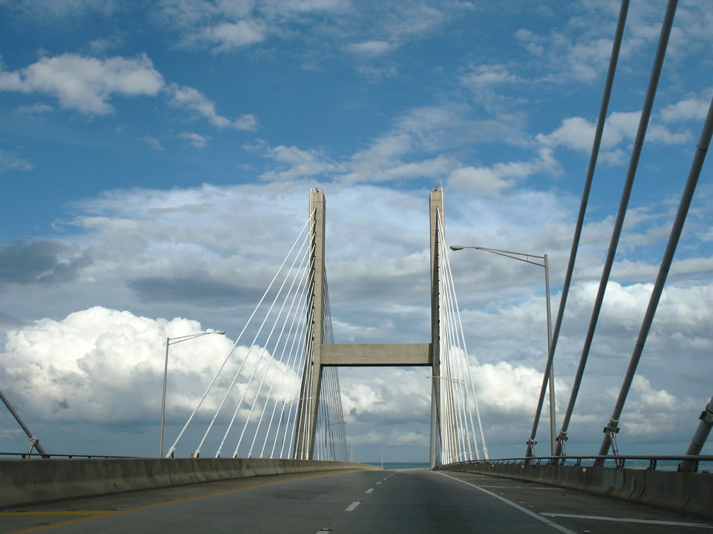
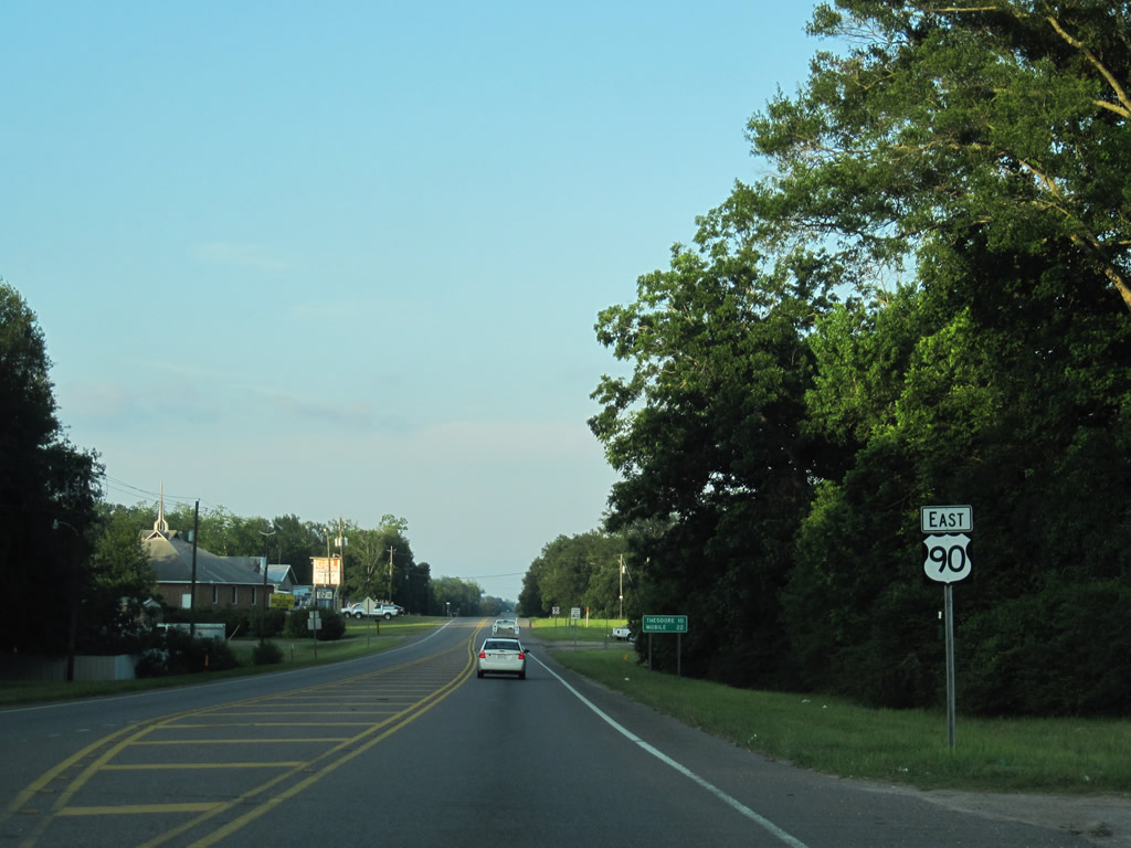
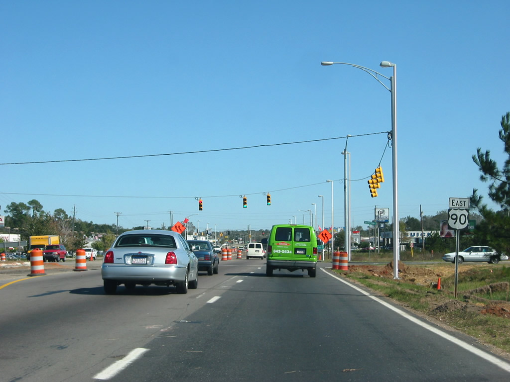
| The first U.S. 90 reassurance shield in Alabama stands a short distance east of the state line. The unincorporated community of Grand Bay lies approximately three miles to the east. 01/16/09 |
|
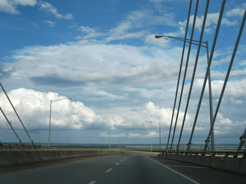
| Distance sign posted 28 miles west of Downtown Mobile on U.S. 90 near the state line. 06/09/10 |
|
| Long since bypassed by U.S. 90, this abandoned section of Old Highway 90 permanently closed when Hall Road was extended southward to meet U.S. 90 directly. 01/16/09 |
|
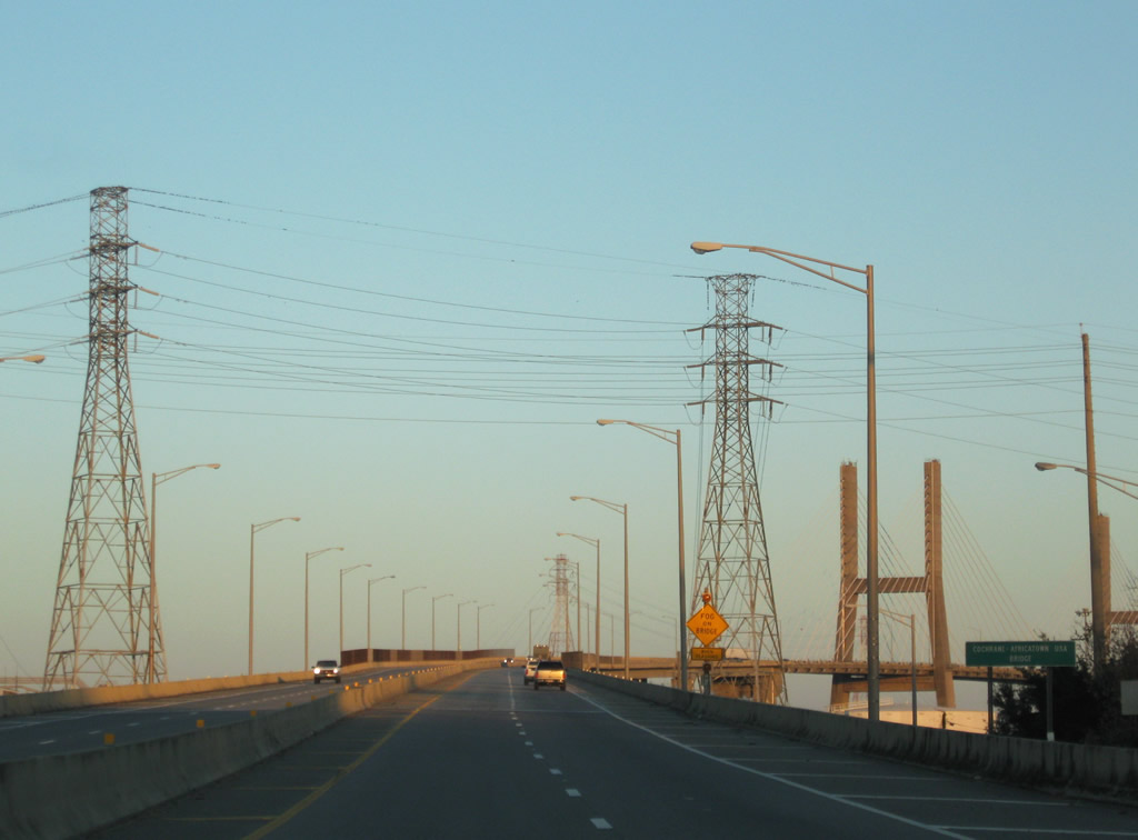
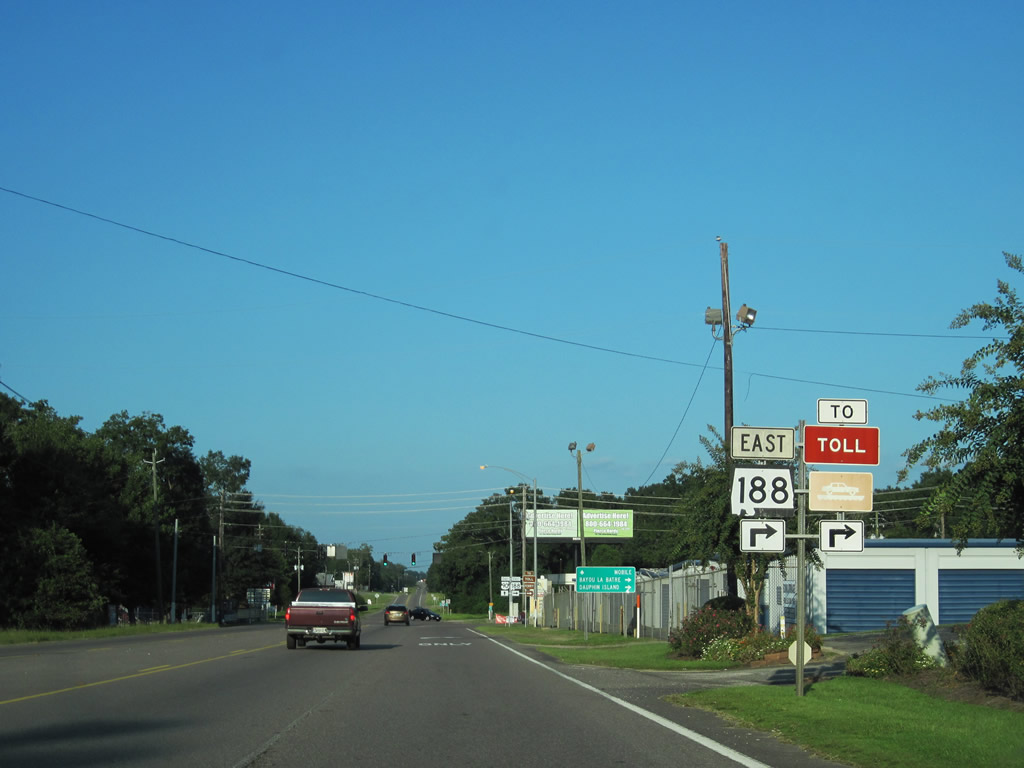
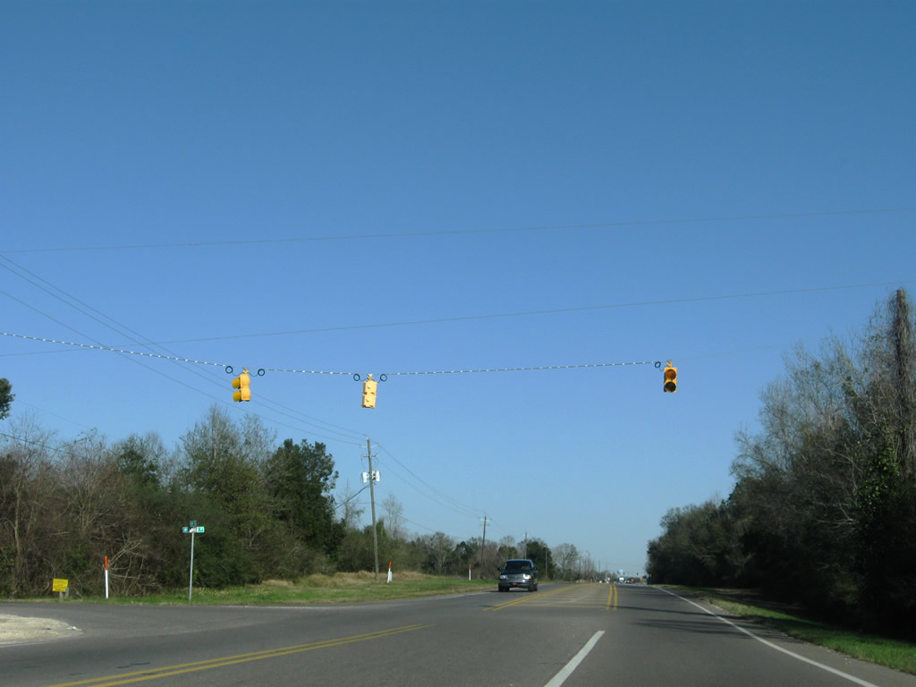
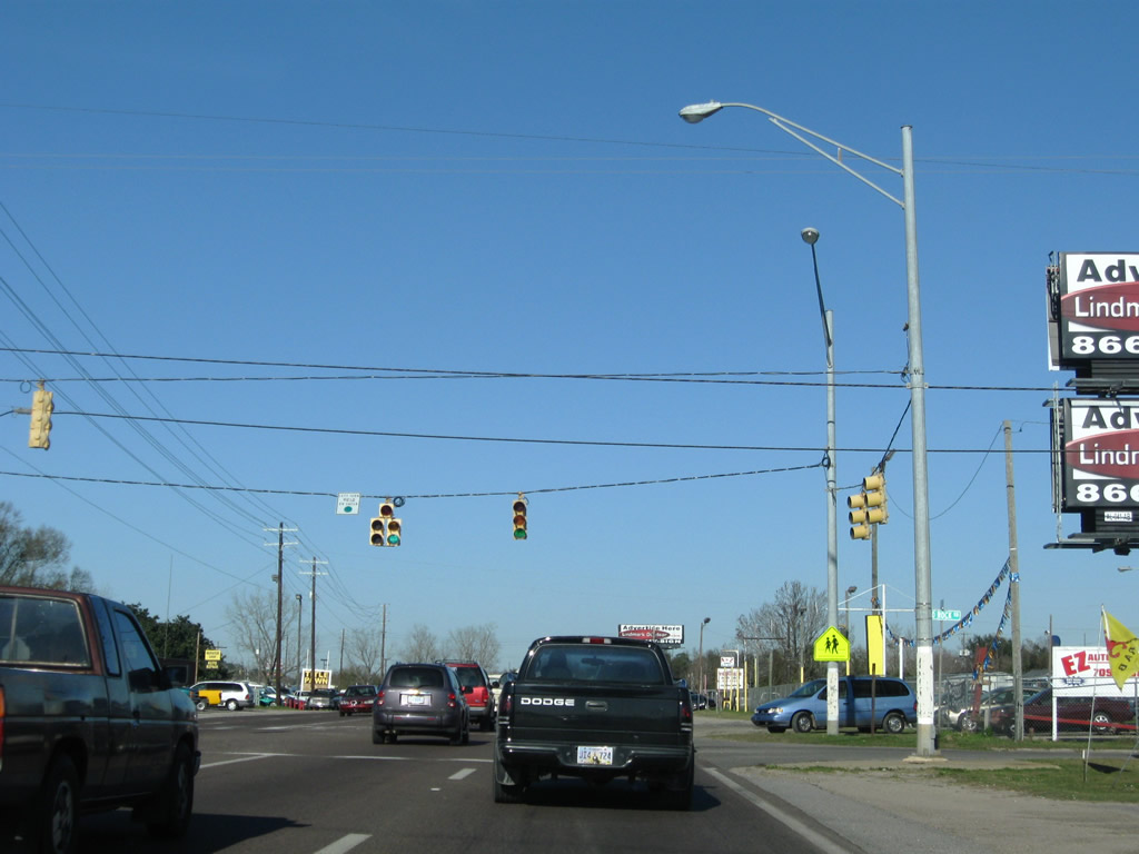
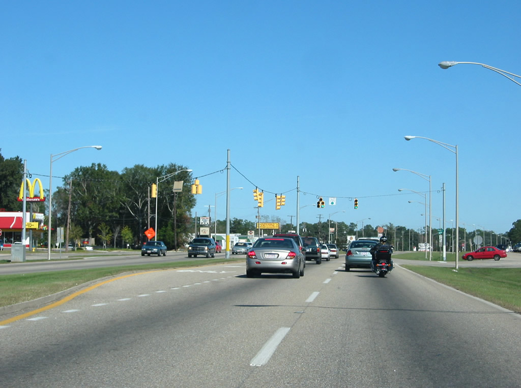
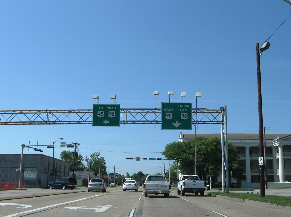
| Entering Grand Bay along U.S. 90 east, motorists approach the merge with SR 188. SR 188 follows Grand Bay Wilmer Road north 1.49 miles to I-10 (Exit 4) and CR 11. 09/12/10 |
|
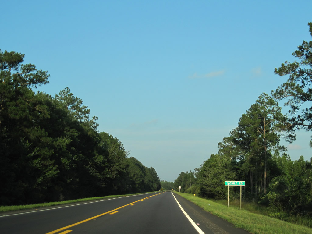
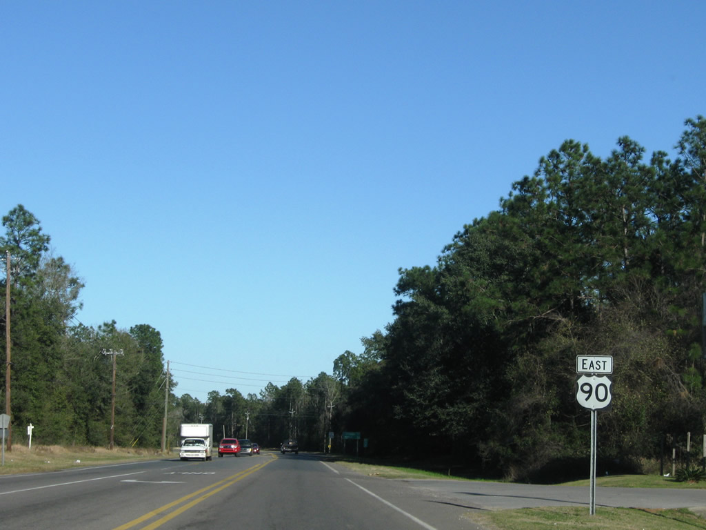
| SR 188 joins U.S. 90 east for 0.179 miles through Grand Bay. 06/09/10 |
|
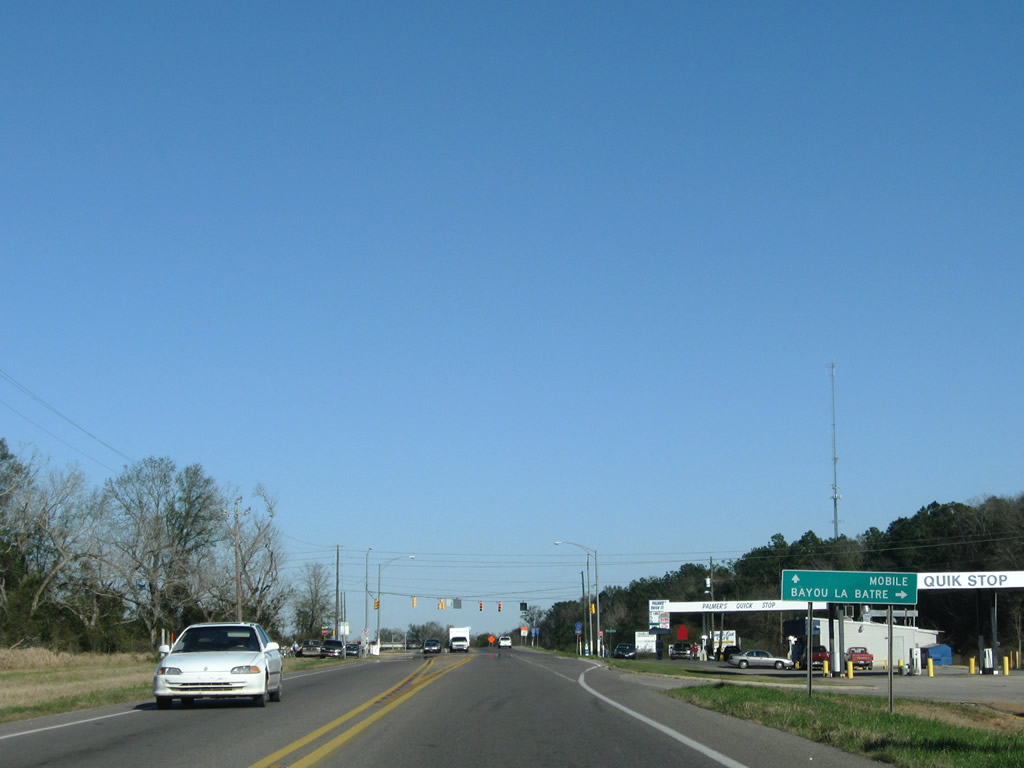
| SR 188 branches south from Grand Bay toward Bayou La Batre and Coden. The state route is part of the Alabama Coastal Connection, a nationally designated scenic byway established on October 19, 2009.5 09/12/10 |
|
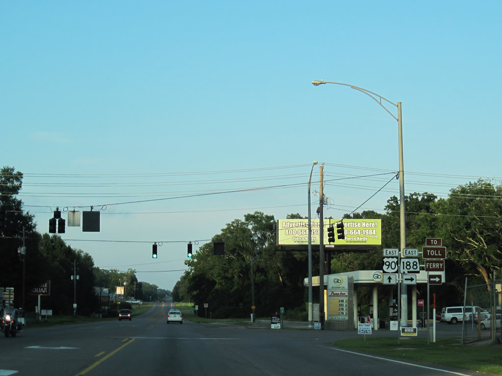
| U.S. 90 and SR 188 eastbound at their split. SR 188 concludes a 19.69 mile route at SR 193 in Alabama Port. SR 193 continues south from there to Dauphin Island, where the Mobile Bay Ferry crosses the mouth of Mobile Bay to Fort Morgan. 06/09/10 |
|
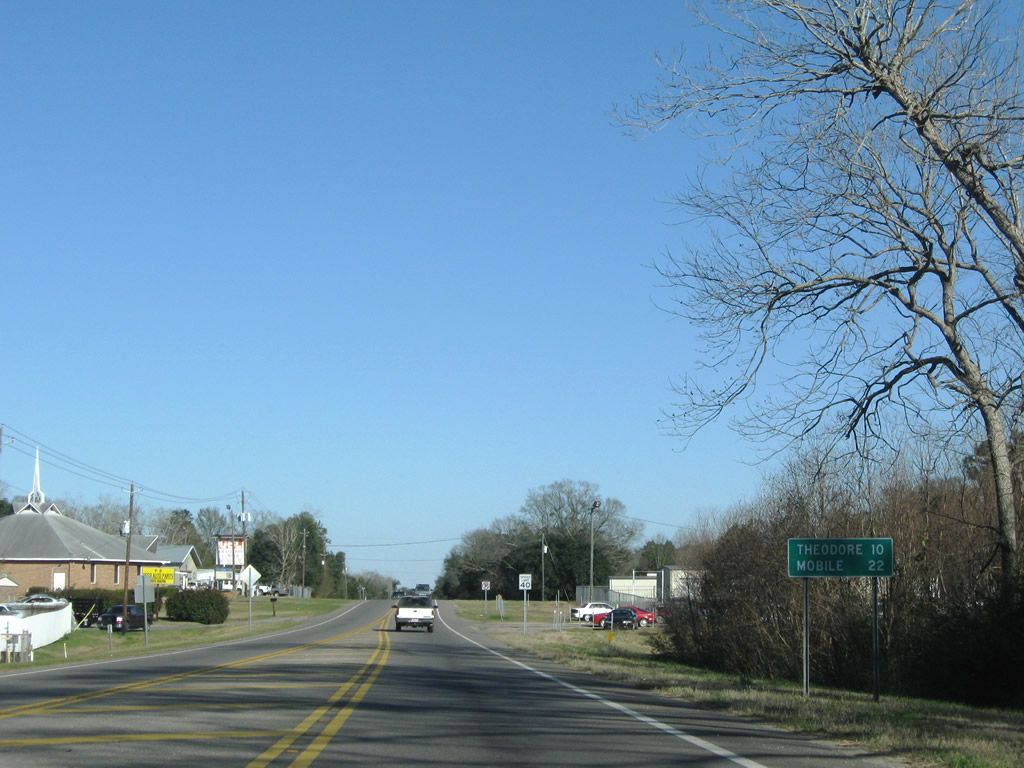
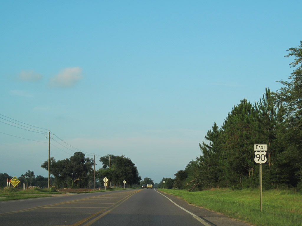
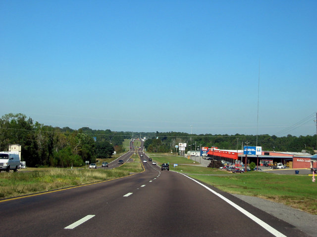
| Leaving Grand Bay, U.S. 90 transitions back into a rural two lane highway through St. Elmo and Irvington. Theodore, the southern extent of the Mobile city limits, is ten miles ahead. 06/09/10, 01/16/09 |
|
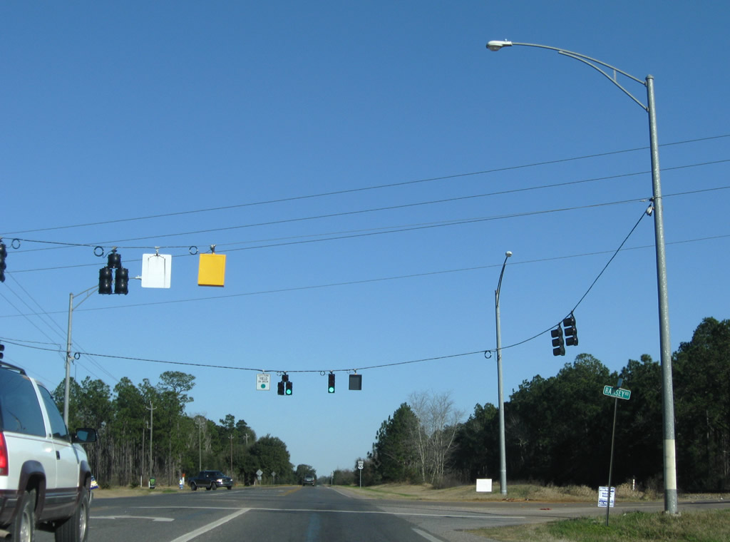
| Ramsey Road crosses paths with U.S. 90 north of SR 188 (Grand Bay Bayou La Batre Highway) and south of Old Pascagoula Road (CR 28). 01/16/09 |
|
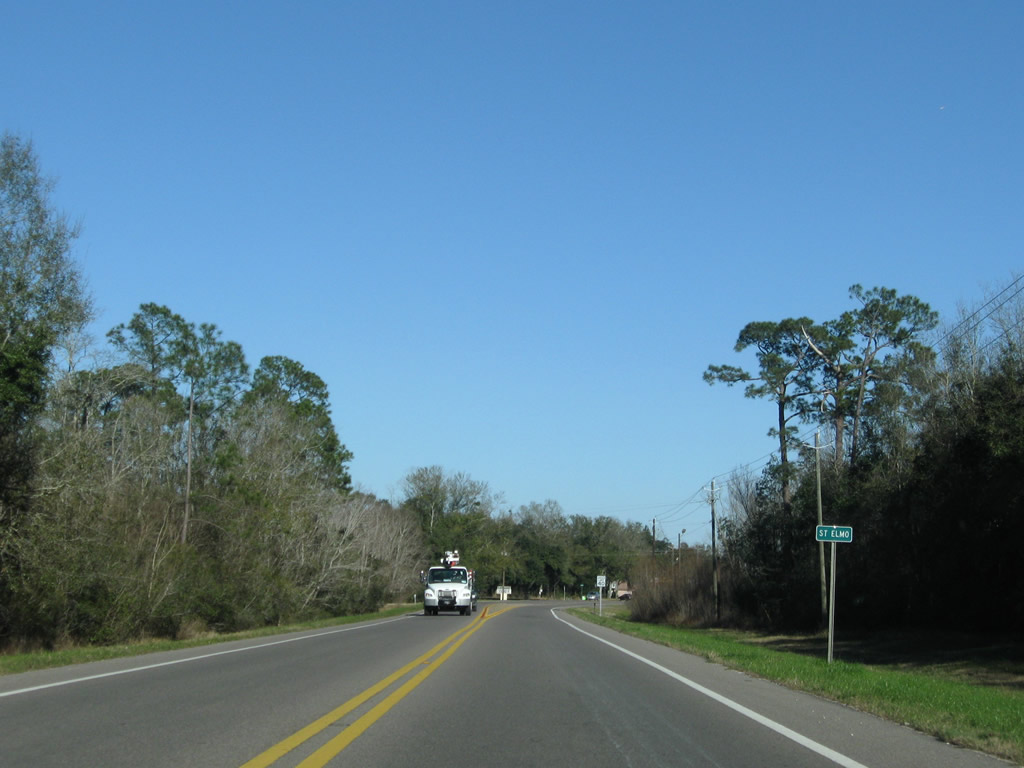
| U.S. 90 and the parallel CSX Railroad continue east toward Fernland and St. Elmo. 06/09/10 |
|
| U.S. 90 kinks northward through the settlement of St. Elmo. March Road ties into the highway from Old Pascagoula Road north of Interstate 10. 01/16/09 |
|
| U.S. 90 eastbound at the former south end of CR 39 (McDonald Road). McDonald Road stems north from U.S. 90 to County Farm Road, which links it with the four lane realignment of CR 39 to the east. 11/05/03, 01/16/09 |
|
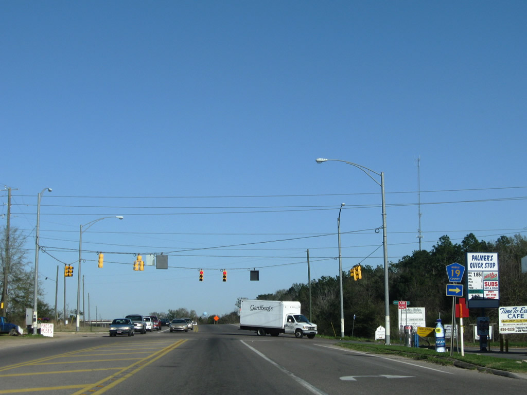
| CR 19 travels 7.8 miles south from U.S. 90 at Irvington to SR 188 north of Bayou La Batre. 01/16/09 |
|
| County Road 19 provides middle of three routes to the coastal town of Bayou La Batre from points north. 01/16/09 |
|
| U.S. 90 widens to four lanes through the folded diamond interchange with CR 39 (McDonald Road Extension). CR 39 shifted to a new alignment east of McDonald Road in stages between 2005 and June 2009. 06/09/10 |
|
| A loop ramp carries drivers onto CR 39 south 1.4 miles to its end at CR 23 (Padgett Switch Road) and CR 24 (Half Mile Road). Padgett Switch Road leads south to SR 188 north of Bayou La Batre. 06/09/10 |
|
| A second folded diamond interchange joins CR 39 with Park Boulevard and Gibson Road to the immediate south by Mobile International Speedway. 06/09/10 |
|
| Mobile County Road 39 (McDonald Road Extension) leads north to Interstate 10 and the Dawes area. The four lane alignment of CR 39 was constructed to improve access to the Bayou La Batre area for both commerce and hurricane evacuation situations. 06/09/10 |
|
| The four lane alignment of CR 39 extends 2.2 miles north to a six-ramp parclo interchange (Exit 10) with Interstate 10 and the original alignment of McDonald Road. 06/09/10 |
|
| Leaving the Irvington area and the exchange with CR 39, U.S. 90 approaches Murray Hill Road north to the Murray Heights community. 01/16/09 |
|
| CR 23 follows Padgett Switch Road north from CR 24 (Half Mile Road) to end at U.S. 90 at the next traffic light. 01/16/09 |
|
| U.S. 90 continues northeast from Padgett Switch Road three miles to Theodore and 11 miles to Downtown Mobile. 01/16/09 |
|
| Swedetown Road North ties into U.S. 90 east from Swedetown and Nan Gray Davis Roads in suburban areas of Theodore just north of its four lane expansion. 01/16/09 |
|
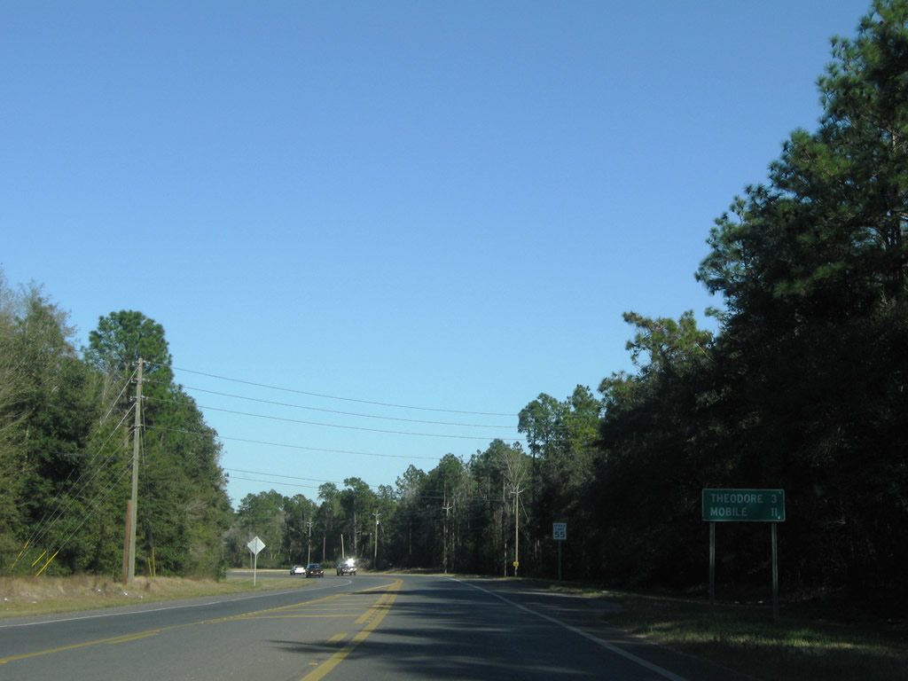
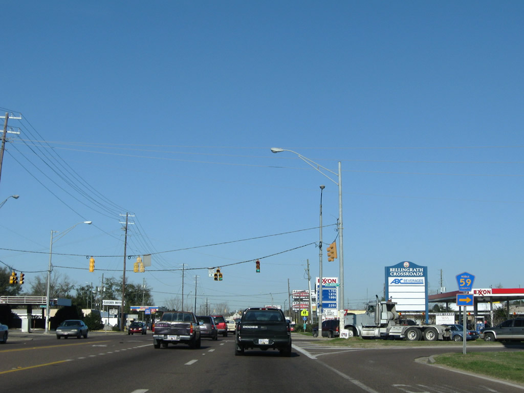
| CR 59 (Bellingrath Road) ventures 12.2 miles north from SR 188 east of Coden and west of Heron Bay to Bellingrath Gardens and U.S. 90 at Carol Plantation Road in Theodore. 11/05/03 |
|
| Old Rock Road ties into U.S. 90 from Cary Hamilton Road in Theodore. 01/16/09 |
|
| CR 30 (Theodore Dawes Road) leads east from Interstate 10 to end at U.S. 90, opposite CR 26 (Hamilton Boulevard). CR 26 follows Hamilton Boulevard 2.9 miles east to SR 163 and SR 193 (Rangeline Road) on Hollingers Island. 11/05/03 |
|
| I-10 trailblazers partition traffic for the freeway westbound via CR 30 (Theodore-Dawes Road) and eastbound along the continuation of U.S. 90 to Tillman's Corner. 01/16/09 |
|
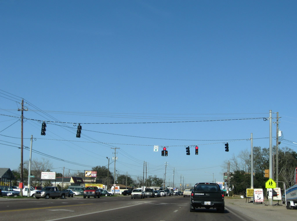
| U.S. 90 travels north through industrial areas of Theodore to Tillman's Corner. The highway widens with a grassy median. 01/16/09 |
|
| Plantation Road crosses U.S. 90 at the first of three signals through an area of industrial parks. Plantation Road leads west to Carol Plantation Road. 01/16/09 |
|
| Larue Steiner Road links U.S. 90 with Middle Road through additional industrial parks. 01/16/09 |
|
| Kooiman Road stems east from U.S. 90 to Todd Acres Road at industrial areas west of SR 193 (Rangeline Road). 01/16/09 |
|
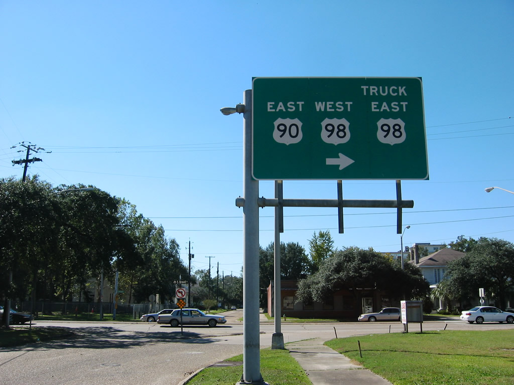
| U.S. 90 leaves Kooiman Road and enters a six-ramp parclo interchange (Exit 15) with Interstate 10. 01/16/09 |
|
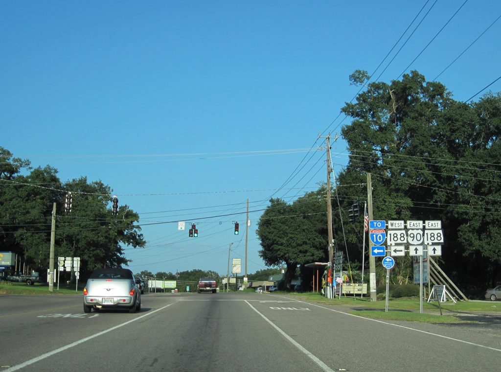
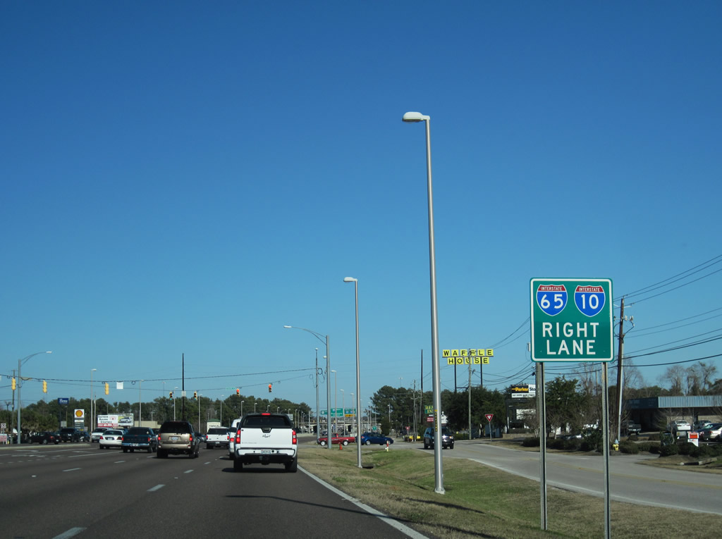
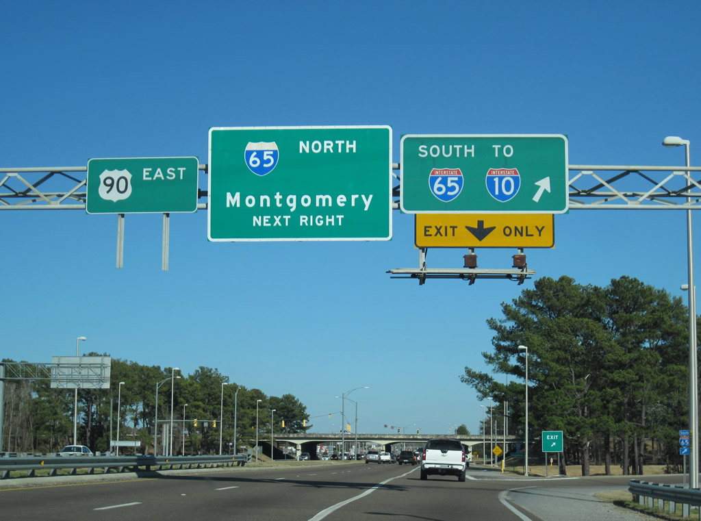
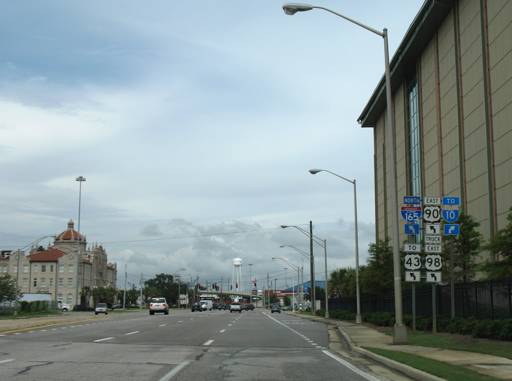
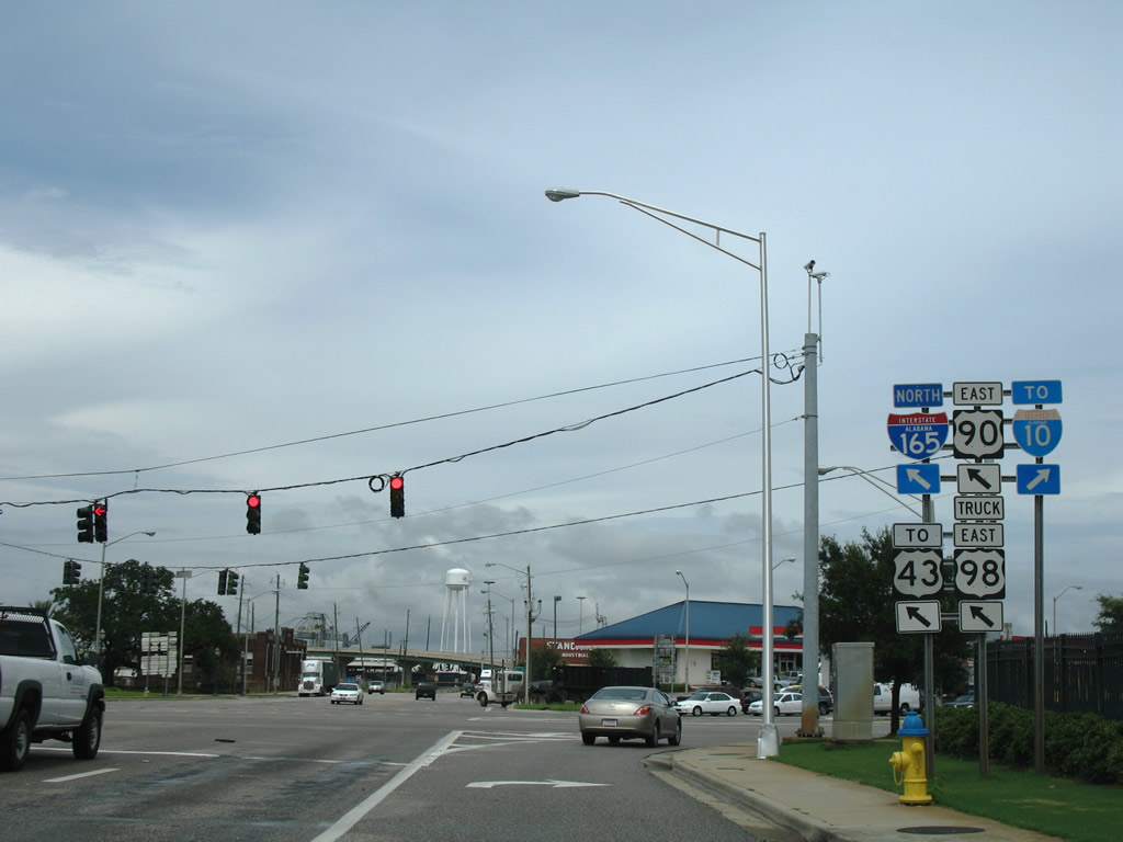
| Drivers bound for Downtown Mobile and Baldwin County depart U.S. 90 east for Interstate 10. The succeeding exits eastbound are with SR 193 and Interstate 65. 01/16/09 |
|
| U.S. 90 eastbound reassurance marker posted beyond the intersection with SR 193 (Rangeline Road) south and Nevius Road west at Tillman's Corner. Rangeline Service Road North ties into U.S. 90 at the ensuing traffic light. 01/26/11 |
|
| Descending toward Halls Mill Creek along Government Boulevard north. U.S. 90 carries four lanes separated by a grassy median eastward toward Midtown Mobile. 10/24/03 |
|
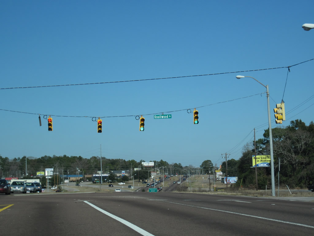
| Knollwood Drive stems north from U.S. 90 (Government Boulevard) to Cottage Hill Road, Medal of Honor Park and Grelot Road. 01/26/11 |
|
| U.S. 90 lowers from Knollwood Drive to Demetropolis Road. Demetropolis Road begins at Halls Mill Road to the south and leads north directly to University Boulevard west of Cottage Hill. Originally the road ended at Cottage Hill Road, but a 2003 project realigned the arterial to meet University at Cottage Hill Road. 01/26/11 |
|
| Expressway style lighting accompanies Government Boulevard northward from Demetropolis Road to Government Street. 01/26/11 |
|
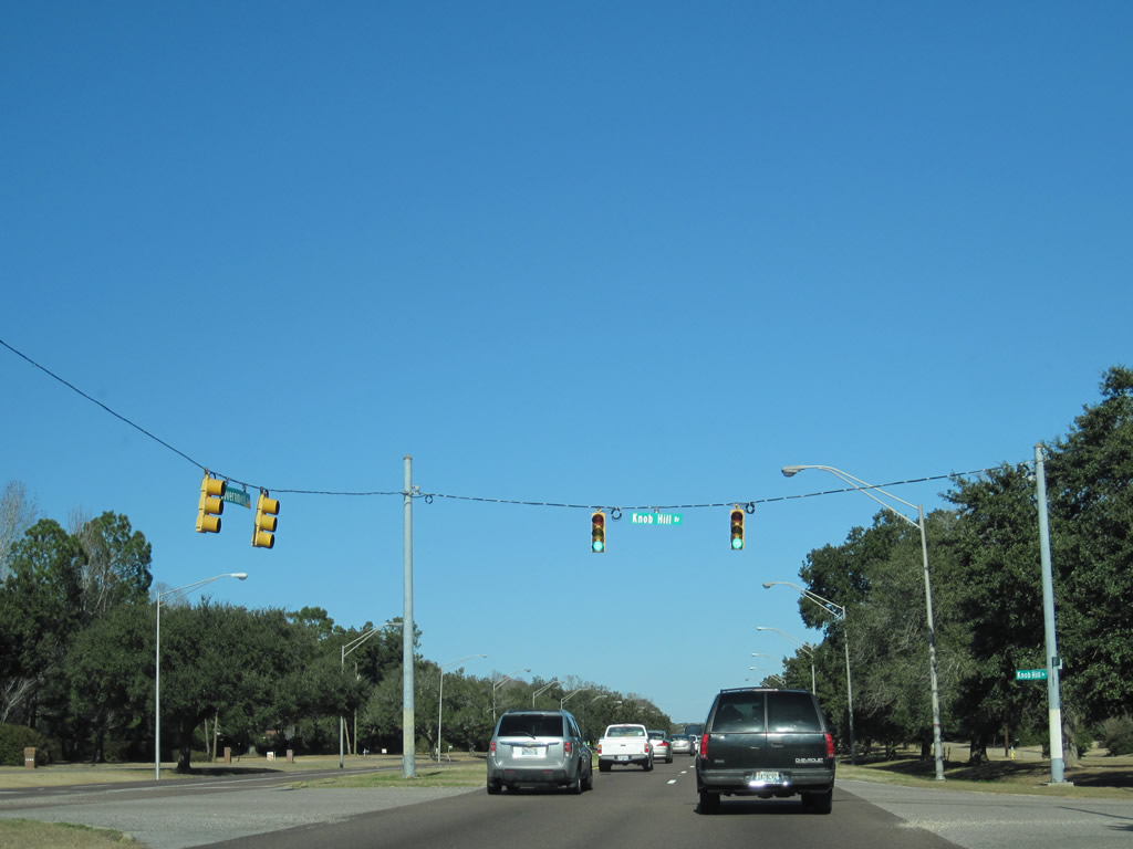
| Service roads line both sides of U.S. 90 (Government Boulevard) at Knob Hill Drive by the Crestview subdivision. 01/26/11 |
|
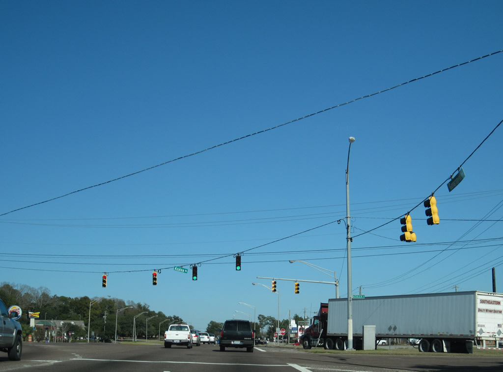
| Azalea Road intersects U.S. 90 south of Cottage Hill and north of Halls Mill Road. Azalea Road and McGregor Avenue provide a north-south through route to Springhill Avenue near Langan Park. 01/26/11 |
|
| Leaving the commercialized intersection with Azalea Road, U.S. 90 advances northeast by the Heron Lakes Country Club gulf course community. 07/17/07 |
|
| Frontage Roads again accompany U.S. 90 (Government Boulevard) ahead of Lakeside Drive. The first of two signals with the frontage road operates at Butler Drive and Skyline Centre Office Park. 01/26/11 |
|
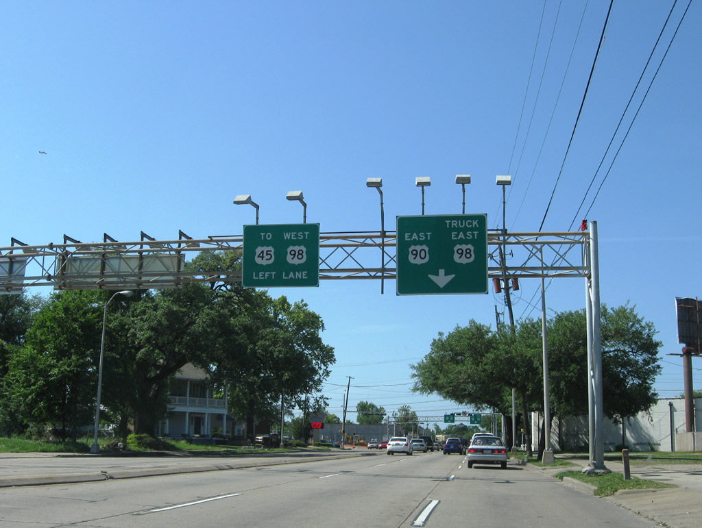
| U.S. 90 (Government Boulevard) expands to six lanes ahead of Lakeside Drive and Interstate 65. The right lane was restriped in 2009 to default onto I-65 south to I-10. 01/26/11 |
|
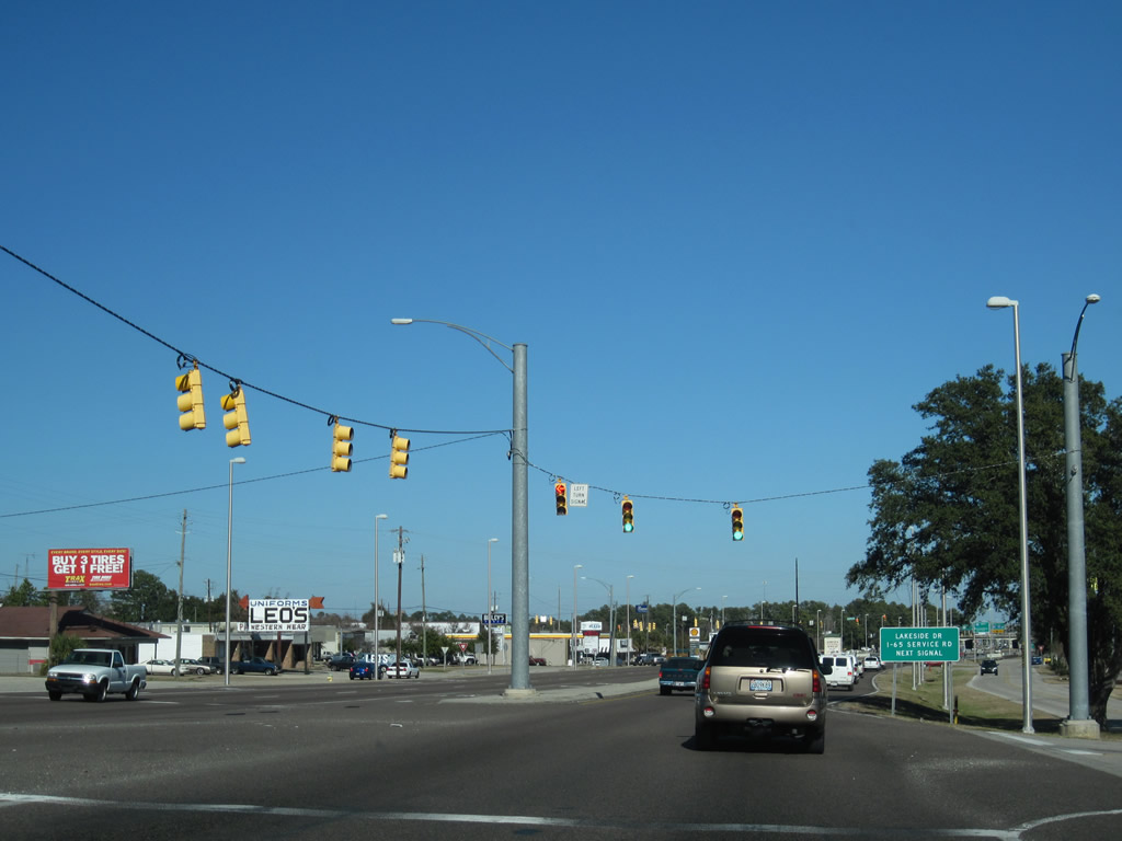
| Lakeside Drive winds through Lakeside Commercial Park, connecting U.S. 90 (Government Boulevard) at I-65 with Cottage Hill Road at Montlimar Drive. 07/16/07 |
|
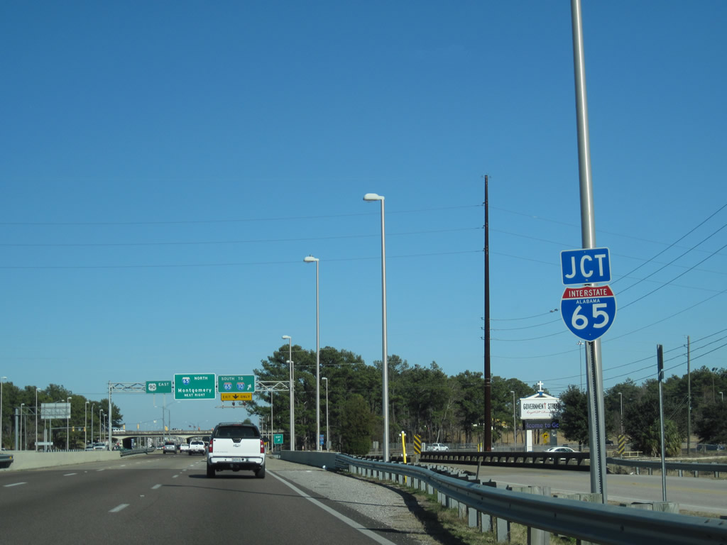
| U.S. 90 spans Montlimar Creek and enters the six-ramp parclo interchange with Interstate 65. This I-65 shield was replaced by 2011. 01/26/11 |
|
| Construction in 2002-04 reconfigured the cloverleaf interchange joining U.S. 90 with Interstate 65. The work removed loop ramps from I-65 to Government Boulevard, eliminating the weaving traffic pattern along the freeway above. This button copy sign for I-65 south was replaced by February 1, 2004.
03/07/02 |
|
| The two loop ramps from I-65 to Government Boulevard permanently closed on February 8, 2004. Additional work in 2009 separated the right lane with pylons, providing a free flow movement from U.S. 90 east to Interstate 65 north. 01/26/11 |
|
| Satchel Paige Drive parallels I-65 south from U.S. 90 (Government Boulevard) to the McGowin Park retail complex, Hank Aaron Stadium and Halls Mill Road (CR 28). 11/13/03 |
|
| U.S. 90 eastbound between Satchel Paige Drive and McVay Drive. Service roads run along the four lane arterial northeast to Eslava Creek. 02/06/09 |
|
| Pleasant Valley Road crosses U.S. 90 (Government Boulevard) east from Cottage Hill Road en route to Halls Mill Road. 11/13/03 |
|
| Howell Avenue west and Brookley Avenue east tie into U.S. 90 just north of Pleasant Valley Road at the ensuing traffic light. 11/13/03 |
|
| Government Boulevard becomes Government Street at the intersection with Pinehill Drive. 11/13/03 |
|
| Advancing east between the Carlen and Rickarby neighborhoods, U.S. 90 approaches SR 163. The state route follows Dauphin Island Parkway (DIP) southward to Interstate 10, South Mobile, and Hollingers Island. 11/13/03 |
|
| Holcombe Avenue, part the historic route of U.S. 90 through southwest Mobile with Halls Mill Road, ties into Government Street just ahead of the CN Railroad and SR 163 (Dauphin Island Parkway). 11/13/03 |
|
| SR 163 (Dauphin Island Parkway) travels 11.10 miles south from U.S. 90 to SR 193. Dauphin Island Parkway extends along SR 193 to Dauphin Island on the Gulf of Mexico. 11/13/03 |
|
| Confirming marker for U.S. 90 east after SR 163 (DIP) north and Williams Drive south. 11/13/03 |
|
| Approaching the intersection with Houston Street on U.S. 90 eastbound. Houston Street links Government Street with Virginia Street east to Ladd-Peebles Stadium. 11/17/03 |
|
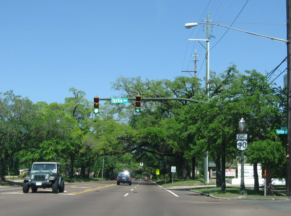
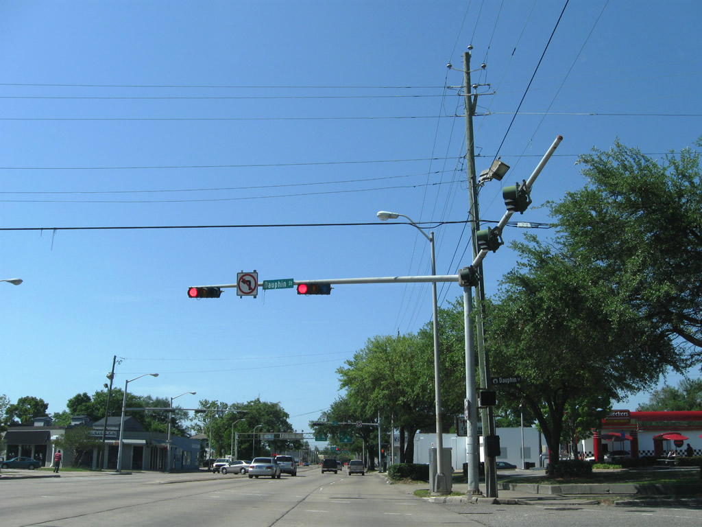
| Catherine Street south and Tuttle Avenue north converge with U.S. 90 (Government Street) at the ensuing traffic light eastbound. Catherine Street is a secondary through route north to Dauphin Street, U.S. 98 and U.S. 45 (St. Stephens Road). Tuttle Avenue is a residential street leading south to Virginia and Dublin Streets. 04/24/09 |
|
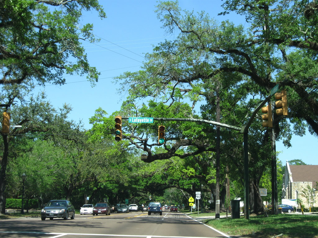
| Lafayette Street parallels Catherine Street two blocks to the east. Both join U.S. 90 with the Lyons Park neighborhood. 04/24/09 |
|
| U.S. 90 reassurance shield posted between Lafayette and Stocking Streets. 04/24/09 |
|
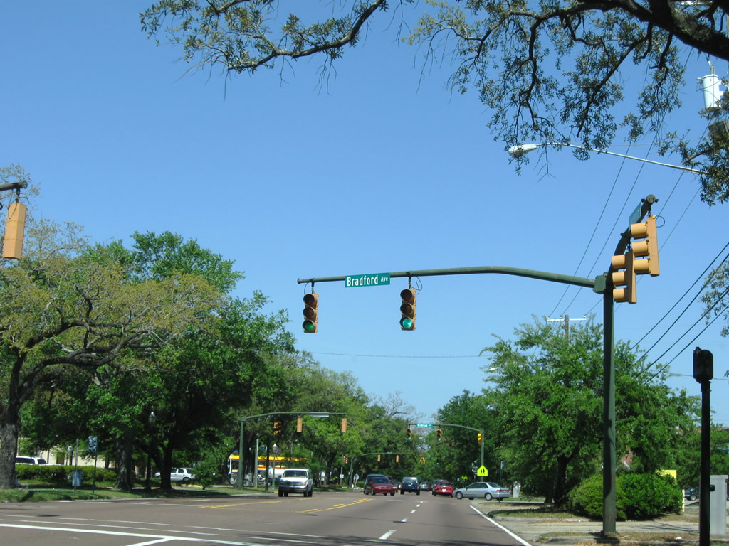
| Three three successive traffic lights operate along U.S. 90 (Government Street) starting with Bradford Avenue. 04/24/09 |
|
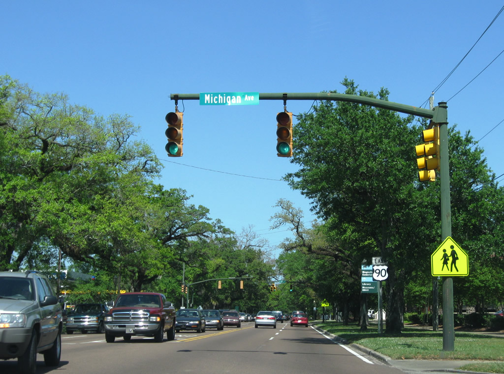
| Michigan Avenue is an urban boulevard extending south from U.S. 90 to Maysville, Arlington, and Interstate 10 by the Mobile Aeroplex at Brookley. 04/24/09 |
|
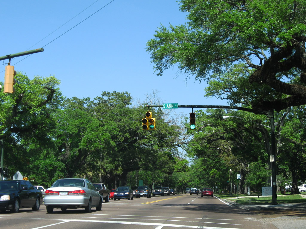
| Ann Street is a collector leading north from U.S. 90 to U.S. 98 (Spring Hill Avenue) at the split with U.S. 45 (St. Stephens Road). 04/24/09 |
|
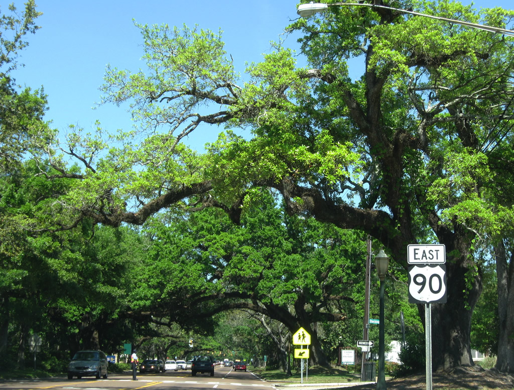
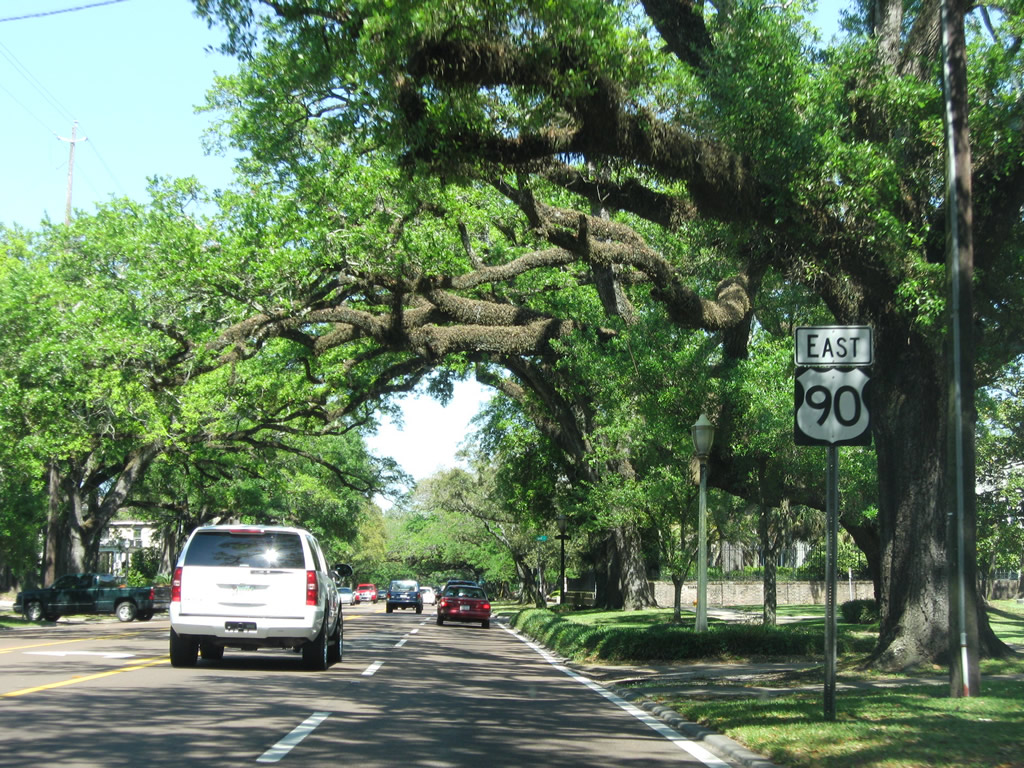
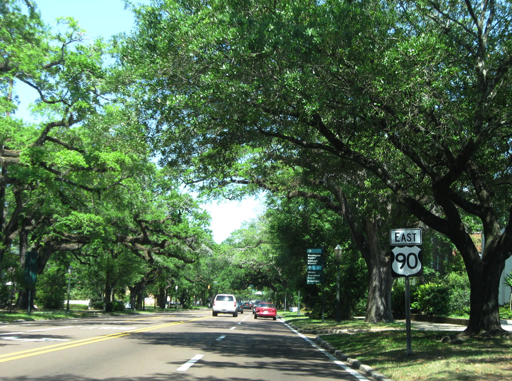
| Continuing east toward Downtown Mobile along the canopied section of U.S. 90 (Government Street) beyond Ann Street. 04/24/09 |
|
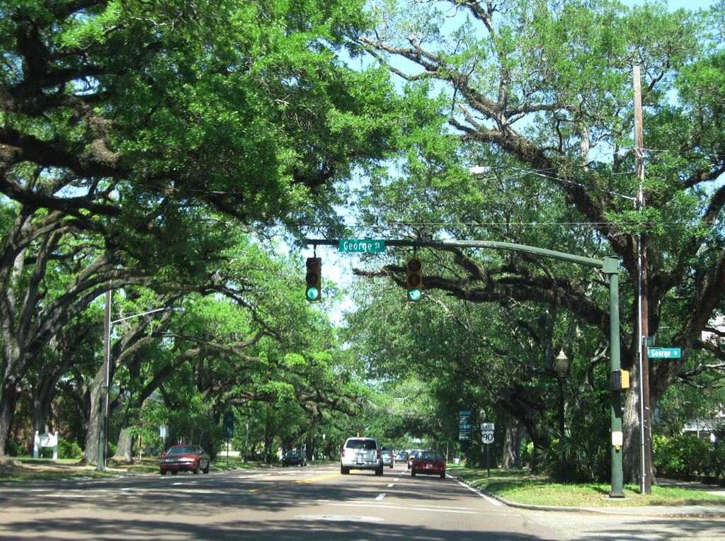
| George Street leads south from U.S. 90 (Government Street) to Selma Street near the Oakleigh Period House Museum. 04/24/09 |
|
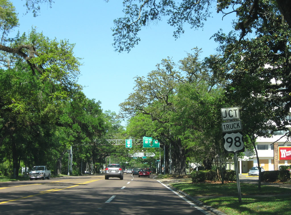
| The first sign of the approaching turn of U.S. 90 eastbound from Government Street onto Broad Street is this U.S. 98 Truck assembly posted after Charles Street. The forthcoming intersection previously marked the beginning of U.S. 90 Truck, which U.S. 90 replaced in 1999. 04/24/09 |
|
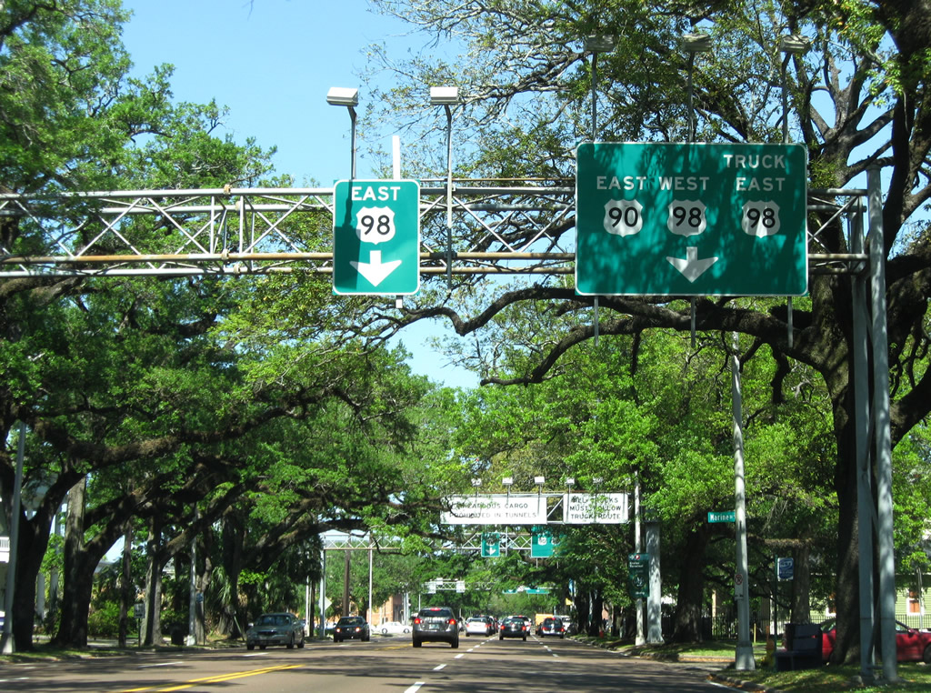
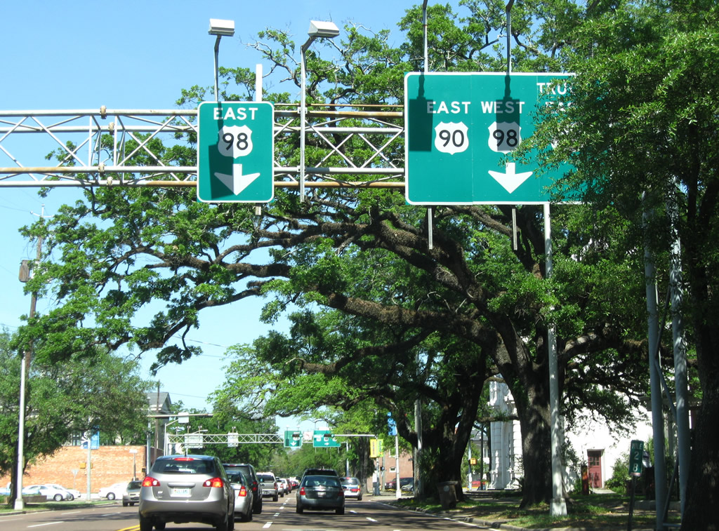
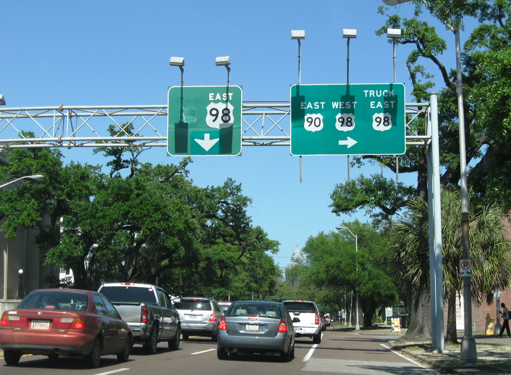
| U.S. 90 east combines with U.S. 98 west for 0.334 miles along Broad Street north. The intersection of Broad and Government Streets represents the historic terminus of U.S. 31, 43, 45 and U.S. 90 Alternate. Signs here were replaced by winter 2002, reflecting the truncation of U.S. 43 north to Prichard and the realignment U.S. 90 approved by AASHTO on October 11, 2002. 04/24/09 |
|
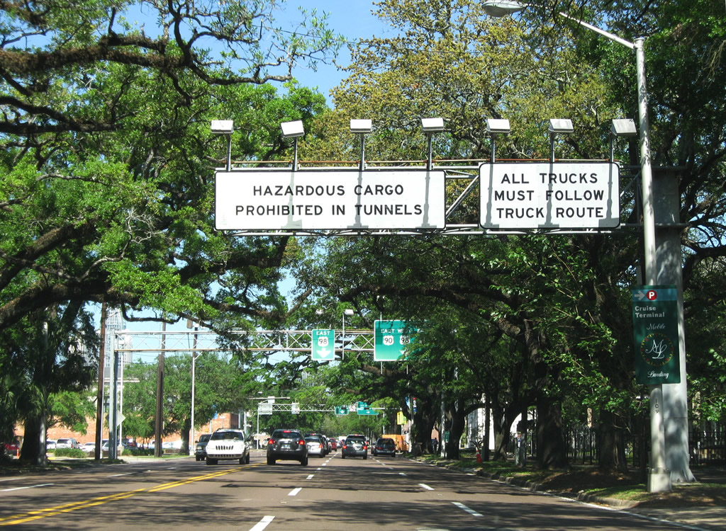
| Overhead signs direct truckers transporting hazardous materials onto U.S. 90/98 Truck east to the Cochrane-Africatown USA Bridge to bypass both the Bankhead and George Wallace Tunnels. 04/24/09 |
|
| Left turns are not permitted from Government Street east onto Broad Street north. The mainline movement of U.S. 90 instead navigates along Jefferson Street south and Church Street west in a jughandle configuration to join Broad Street (U.S. 98 west). 04/24/09 |
|
| Continuing across Broad Street, U.S. 90 turns south onto Jefferson Street. U.S. 98 overtakes Government Street east through the Mobile central business district to the Bankhead Tunnel. 04/24/09 |
|
| Guide sign directing U.S. 90 from Jefferson Street south to Church Street west. 11/03/03 |
|
| U.S. 90 (Church Street) westbound at Broad Street. U.S. 98 west accompanies Broad Street one block to the north from Government Street. 11/03/03 |
|
| Guide signs outline the forthcoming separation of U.S. 90 east and 98 westbound ahead of Dauphin Street. These signs date to November 2001, reflecting the relocation of U.S. 90 northward to Bay Bridge Road and the truncation of U.S. 43 at the time. 04/24/09 |
|
| Dauphin Street flows east from U.S. 90/98 (Broad Street) to the Lower Dauphin Entertainment District (LoDa) and Downtown Mobile. 04/24/09 |
|
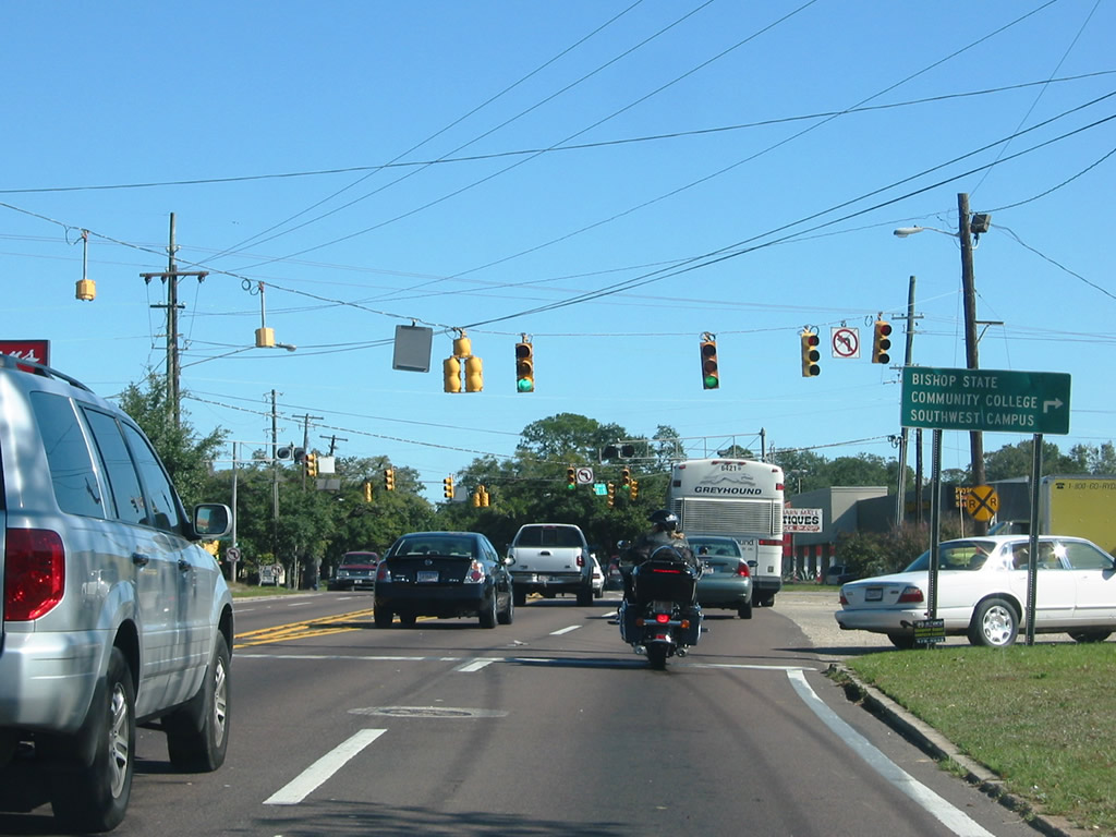
| U.S. 90 east and 98 west separate at the forthcoming intersection with St. Anthony Street. U.S. 98 follows Spring Hill Avenue west to U.S. 45 (St. Stephens Road) and areas of Midtown Mobile. U.S. 90 remains along Broad Street north to the main campus of Bishop State Community College. 04/24/09 |
|
| U.S. 98 extends west from the central business district of Mobile to northwestern reaches of the city and Semmes. U.S. 90 combines with U.S. 98 Truck northward to Prichard and the Cochrane-Africatown USA Bridge. 04/24/09 |
|
| Broad Street transitions to Beauregard Street at the intersection with Dr. Martin Luther King, Jr. Avenue. MLK Avenue comprises a north-south thoroughfare connecting Downtown Mobile with Prichard and U.S. 45 to the northwest. 07/16/07 |
|
| Lawrence Street crosses U.S. 90/98 Truck (Beauregard Street) at this traffic light northwest of Calloway-Smith Middle School. Lawrence Street travels north from the Mobile Civic Center at Canal Street to the Renaissance development by Beauregard Street. 11/25/08 |
|
| Beauregard Street continues east to Water Street and Interstate 165. Truckers transporting hazardous cargo are directed along Water Street south for I-10 west and along I-165 north to Bay Bridge Road for I-10 east. 07/16/07 |
|
| The Mobile Register building rises along the south side of Beauregard Street ahead of the U.S. 90/98 Truck turn onto I-165 at Water Street. Prior to 2001, when the nearby Viaduct Bridge permanently closed, the truck route for U.S. 98 combined with U.S. 43 along Telegraph Road. 07/16/07 |
|
| U.S. 90/98 Truck east at Water Street. Opened to traffic October 28, 1994. Interstate 165 travels 4.90 miles northward from Beauregard Street to I-65 in Prichard. Water Street constitutes a six lane boulevard south to Interstate 10 at the George Wallace Tunnel. 07/16/07 |
|
| Beauregard Street extends east by the GM&O Transit Center to Dekle Street and the Robert M. Hope Overpass spanning the CSX Railroad into the Alabama State Docks. 11/25/08 |
|
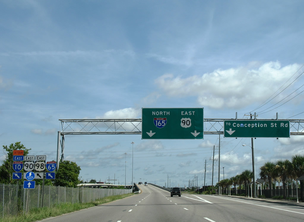
| U.S. 90 merges with Interstate 165 north at the separation with Conception Street Road. 07/17/07 |
|
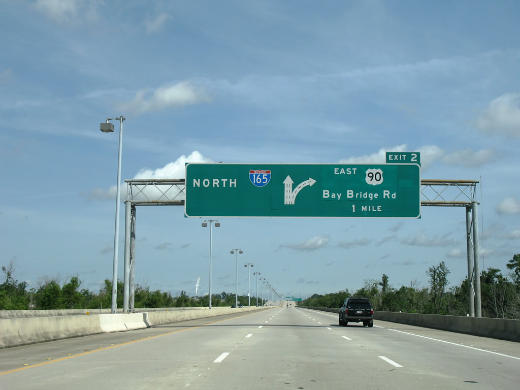
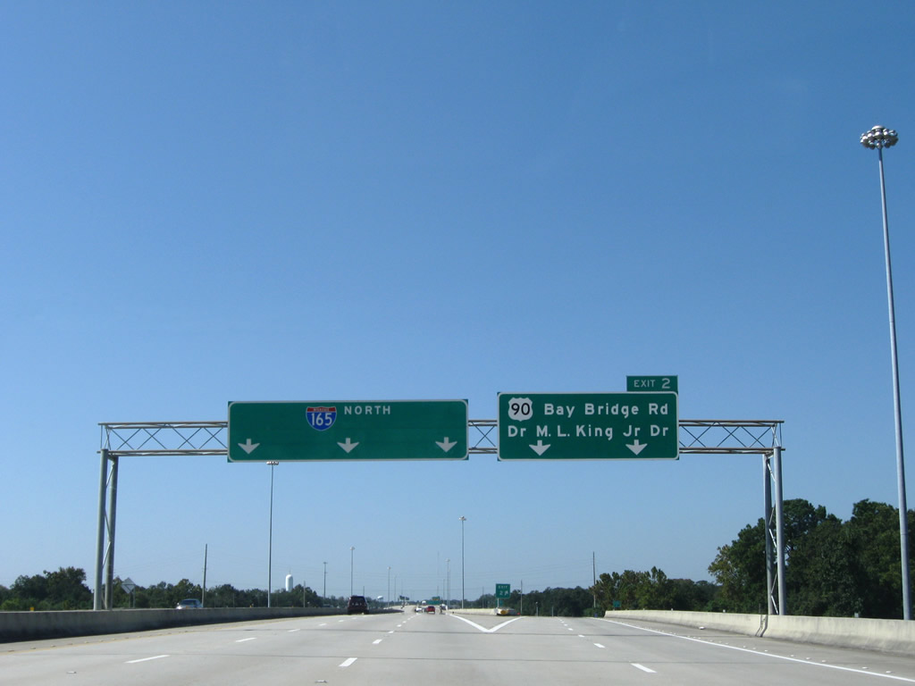
| Diagrammatic overhead posted one mile ahead of the U.S. 90 eastbound split from I-165 north at Exit 2. 07/17/07 |
|
| U.S. 90 leaves the Interstate 165 viaduct for Bay Bridge Road east. I-165 continues northwest to Price Avenue, Whistler Street and Interstate 65 within the city of Prichard. 09/26/08 |
|
| Bay Bridge Road carries U.S. 90/98 Truck east from Interstate 165 to the Plateau and Magazine sections of north Mobile. The arterial transitions to South Craft Highway west en route to Dr. Martin Luther King, Jr. Drive and U.S. 45. 07/17/07 |
|
| The first of three signalized intersections along U.S. 90/98 Truck (Bay Bridge Road) east is with Grover Avenue. Grover Avenue leads north from Buffs Street to old Bay Bridge Road and Meaher Avenue (former SR 194). 11/21/08 |
|
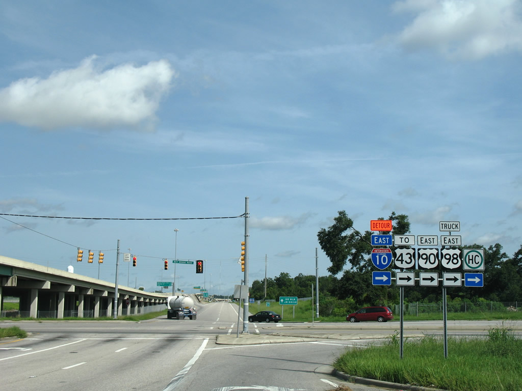
| Bay Bridge Road advances a short distance east from Grover Avenue to the grade separated intersection with U.S. 43 (Telegraph Road). 07/17/07 |
|
| This bank of shields appears at the access road linking Bay Bridge Road with U.S. 43 north at Telegraph Road. Telegraph Road passes under U.S. 90/98 Truck en route to the Alabama State Docks. U.S. 43 travels to Chickasaw, Saraland and Satsuma. 10/25/03 |
|
| Prior to 2001, U.S. 43 extended south from Bay Bridge Road to Downtown Mobile. The Viaduct Bridge joining Telelgraph Road with Conception Street Road and I-165 was demolished in 2002, severing the link of U.S. 43 to U.S. 90. 07/17/07 |
|
| Continuing east along U.S. 90 across Telegraph Road. The 1.2 mile segment of Bay Bridge Road east from I-165 to Telegraph Road was constructed during a 270-project started in fall 1995.1 07/16/07 |
|
| U.S. 90 (Bay Bridge Road) intersects Bay Bridge Cutoff Road east of the Telegraph Road underpass. Bay Bridge Road Cutoff connects U.S. 90/98 Truck with Telegraph Road (old U.S. 43) south through the Plateau community. Historically Bay Bridge Road Cutoff was a part of U.S. 43 and 90. Signals here were removed in 2010. 07/16/07 |
|
| Paper Mill Road Extension connects U.S. 90/98 Truck (Bay Bridge Road) with Paper Mill Road leading north from the Cochrane-Africatown USA Bridge to Summerville in Prichard. 11/22/08 |
|
| An off-ramp links U.S. 90 eastbound with Paper Mill Road directly at the foot of the Cochrane-Africatown USA Bridge. A historical alignment of U.S. 43, Paper Mill Road serves industrial areas of the Magazine community lining Chickasaw Creek and the Mobile River. 06/02/10 |
|
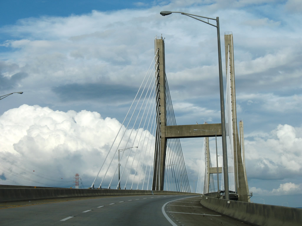
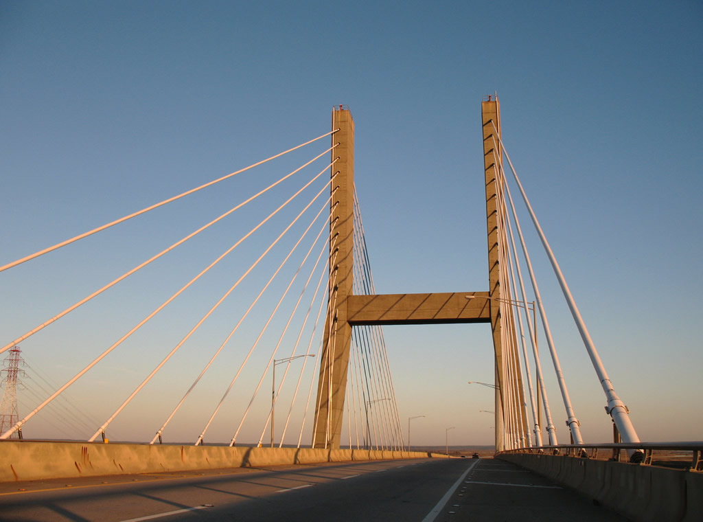
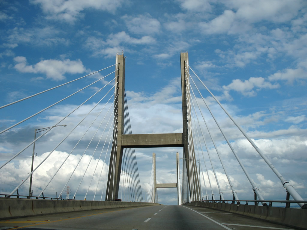
| The Cochrane-Africatown Bridge spans the Mobile River east from Magazine Point and the mouth of Chickasaw Creek to Blakeley Island. The four lane span replaced the two lane Cochrane Bridge, which permanently closed to traffic in 1984 due to structural deficiencies.2 11/21/08 |
|
| Two 350 foot high piers support the four lane deck of the Cochrane-Africatown USA Bridge.3 The cable-stayed bridge was the first built in Alabama.2 07/16/07 |
|
| Costing $68.9 million to construct,3 the Cochrane-Africatown Bridge was dedicated on August 29, 1991.4 The 7,291 foot long span rises 140 feet above the Mobile River.3 11/26/06, 07/16/07 |
|
| Marshland and areas of Mobile-Tensaw Delta State Wildlife Management Area spread along the eastern horizon as U.S. 90/98 Truck descend from the Cochrane-Africatown USA Bridge onto Blakeley Island. 07/16/07 |
|
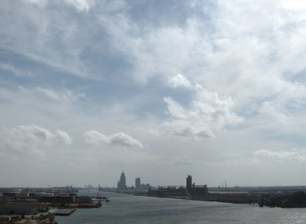
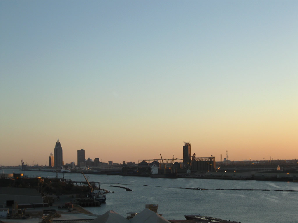
| Looking southward from the Cochrane-Africatown Bridge at the Alabama State Docks, the Mobile skyline and Pinto Island. 02/11/09, 11/21/08 |
|
| U.S. 90/98 Truck (Cochrane Causeway) parallel the Mobile River south from the Blakeley Terminal of the State Docks to Interstate 10. 07/16/07 |
|
| U.S. 98 rejoins U.S. 90 east from the Bankhead Tunnel along Battleship Causeway. The Bankhead Tunnel directly connects Cochrane Causeway with Government Street and the Mobile central business district. 07/16/07 |
|
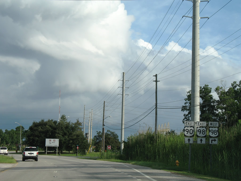
| The hazmat bypass for U.S. 98 concludes at Battleship Parkway. A sign installed here in early 2003 references the restriction for the Bankhead Tunnel westbound. 07/16/07 |
|
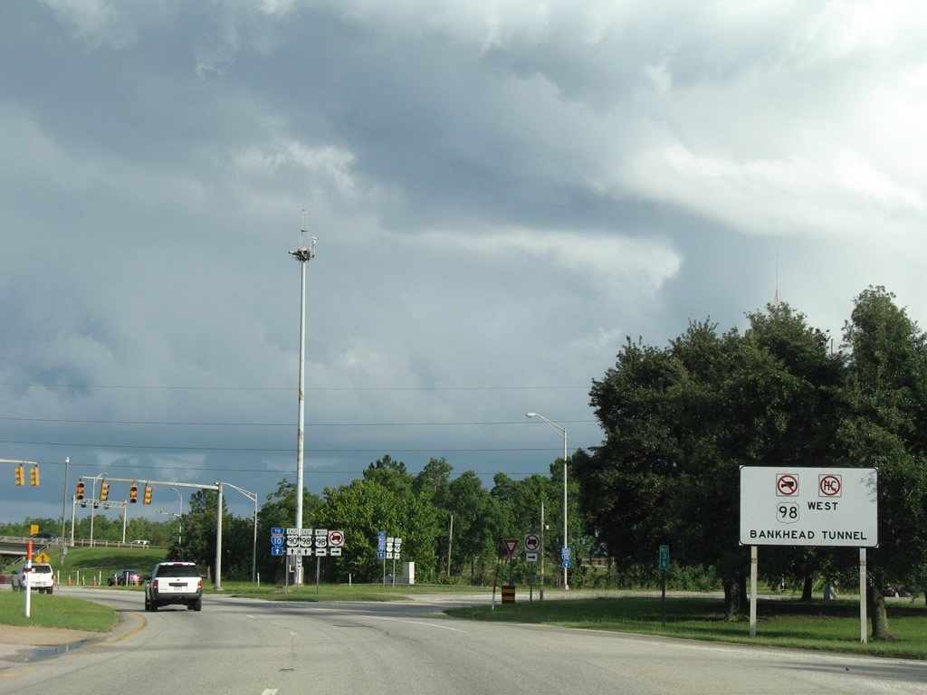
| The westbound off-ramp from I-10 to U.S. 90/98 ties in the signalized intersection with the Bankhead Tunnel entrance. U.S. 98 west through the Bankhead Tunnel was historically a part of U.S. 31 and U.S. 90 Alternate prior to the removal of tolls in 1973. 07/16/07 |
|
| Travelers originating from the Cochrane-Africatown Bridge on U.S. 90/98 Truck (Cochrane Causeway) must continue three miles to access I-10. A westbound on-ramp provides access for the nearby industrial and shipbuilding businesses to Interstate 10 west. 07/16/07 |
|
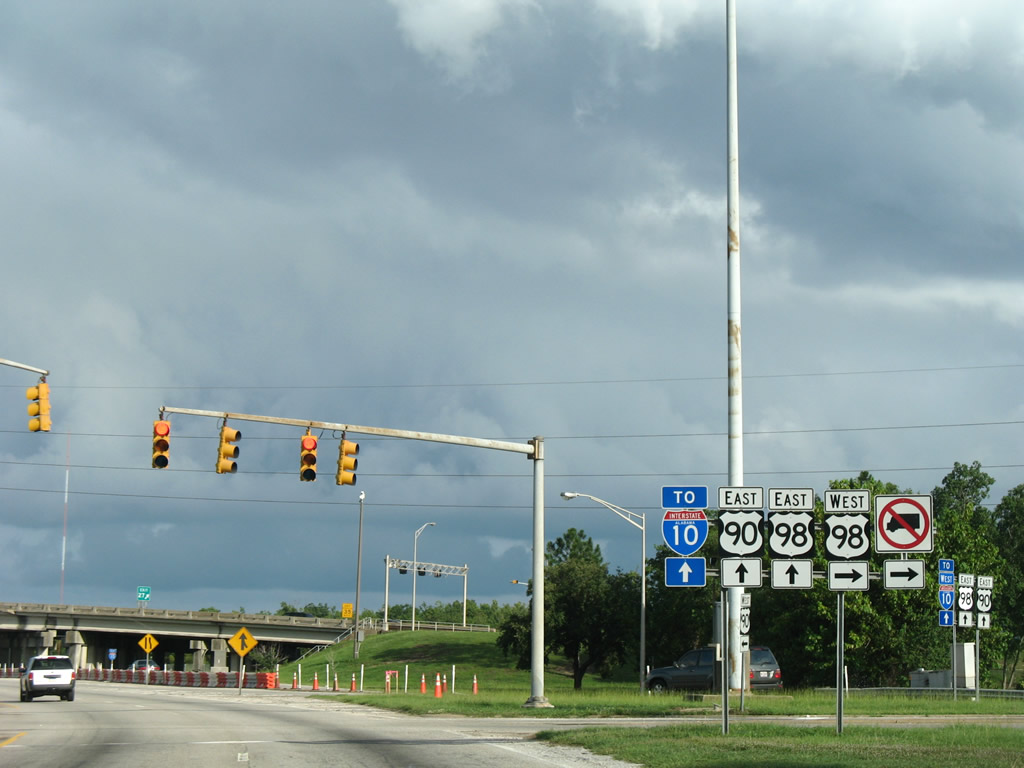
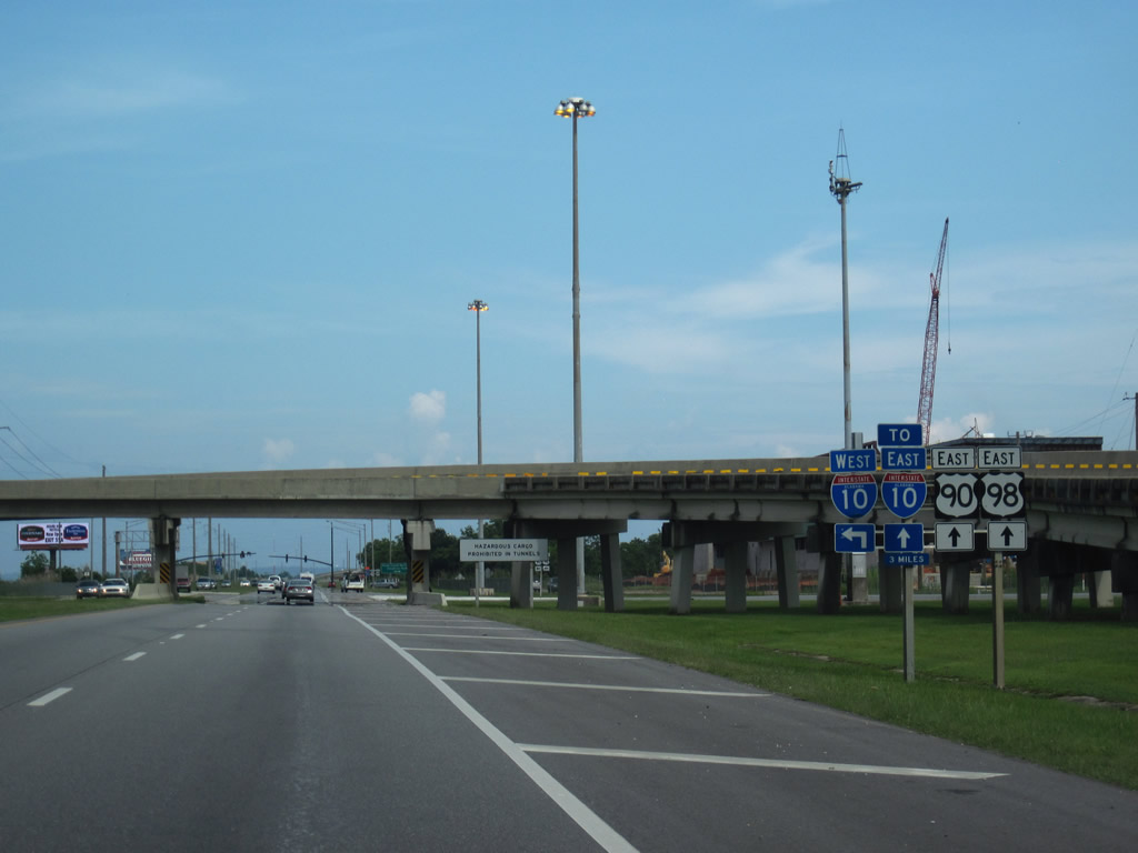
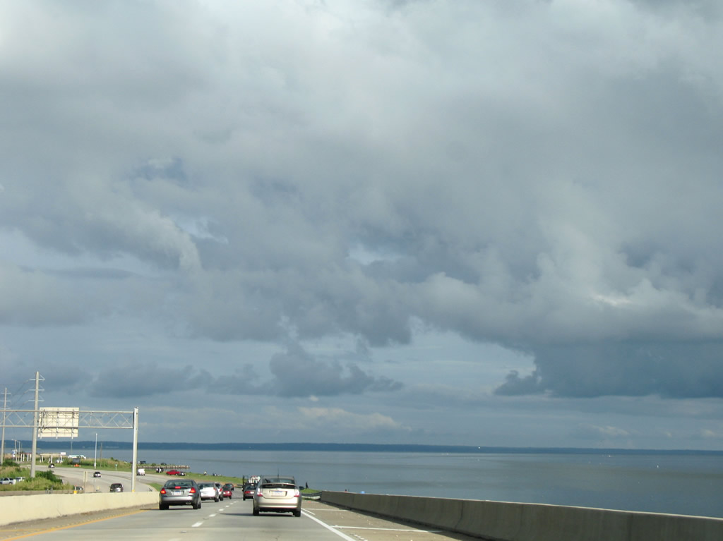
| U.S. 90 eastbound overlaps with U.S. 98 for eight miles across Mobile Bay. The ramp to Interstate 10 eastbound departs from the Bankhead Tunnel and U.S. 98 to the right. This ramp previously was accessible to motorists along U.S. 90 eastbound. However following repairs from a truck fire on the ramp bridge in 2000, the slip ramp from U.S. 90 east to the entrance ramp remain closed. 06/02/10 |
|
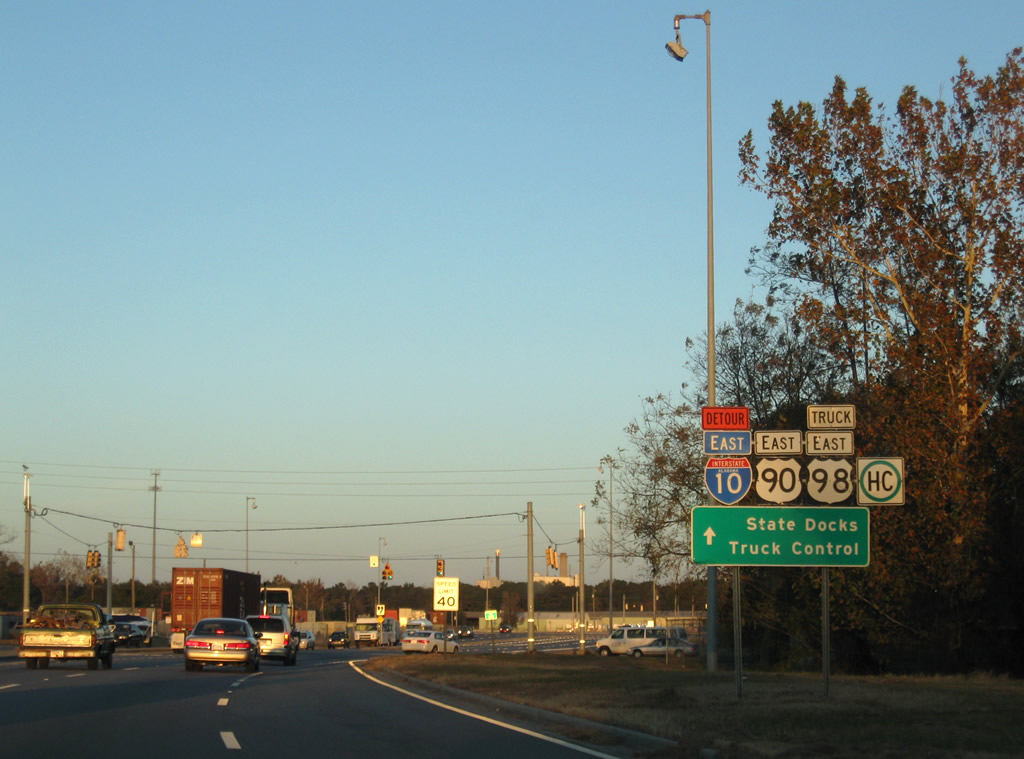
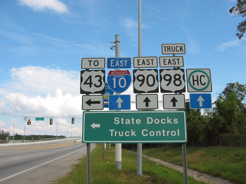
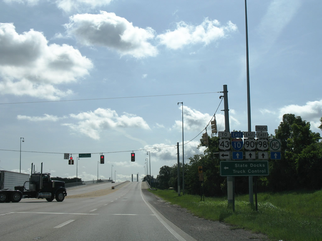
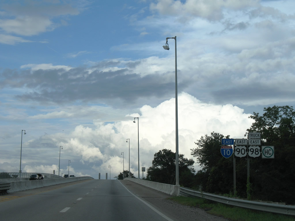
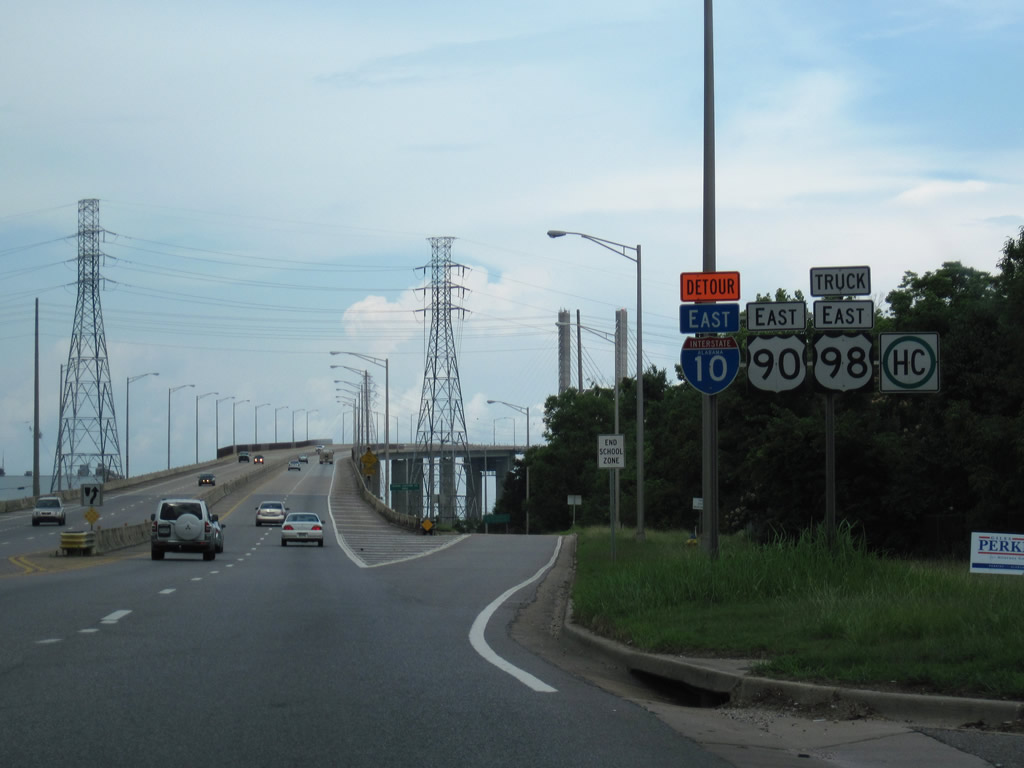
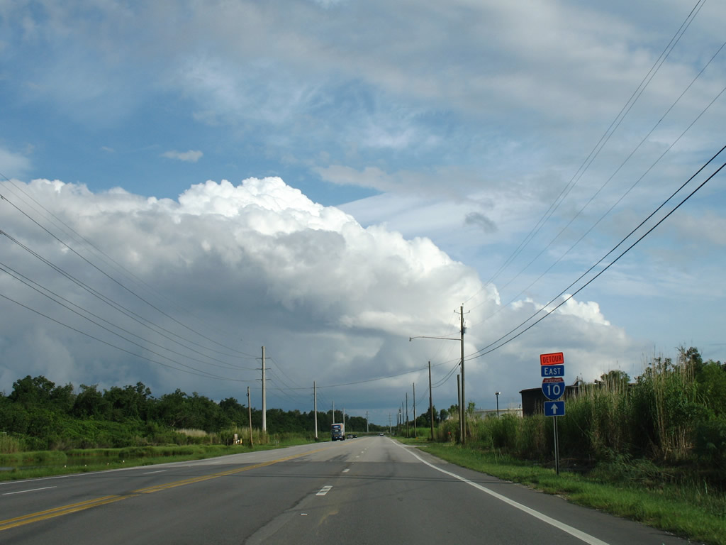
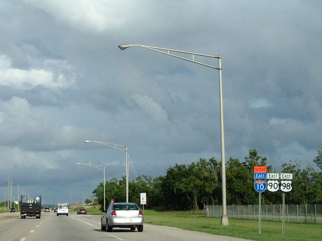
| This set of reassurance shields stands beyond the exchange with I-10 by the Wallace Tunnel. The Interstate 10 Detour shield references the hazmat route signed in 1999 across the Cochrane Bridge and Truck U.S. 98. 07/16/07 |
|
| Mast-arm traffic light assemblies were added to the intersection of U.S. 90/98 at Addsco Road in 2010. A shipbuilding plant opened along Addsco Road during this time period. 05/27/10 |
|
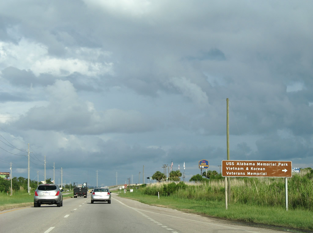
| USS Alabama Battleship Memorial Park lies on the east end of Blakeley Island. The park is also home to the Vietnam and Korean War Veterans Memorial. 07/16/07 |
|
| U.S. 90/98 (Battleship Parkway) span the Tensaw River and enter Baldwin County. The eastbound bridge was opened in 1998; the westbound span has been in service since 1965. 07/16/07 |
Page Updated 02-08-2011.


 East
East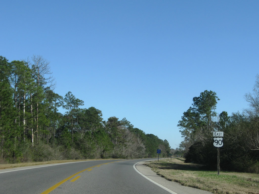


 West - Broad Street
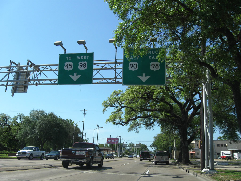
 North
North