
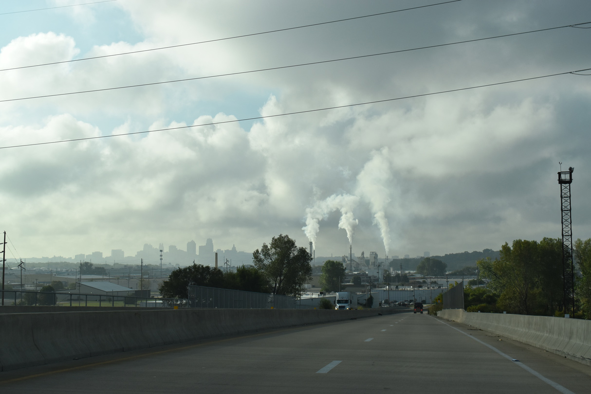
Continuing with Day 6 of our Midwest/Great Plains trip, we drove throughout Kansas City as peak hour traffic set in, with a path taking us back and forth from the Alphabet loop Downtown to suburbs such as Grandview and Lees Summit. Culminating our trudge through the I-435, K-10 and I-35 construction zone, we departed the area for Ottawa and Emporia, taking the toll-free portion of Interstate 35 to the Kansas Turnpike.
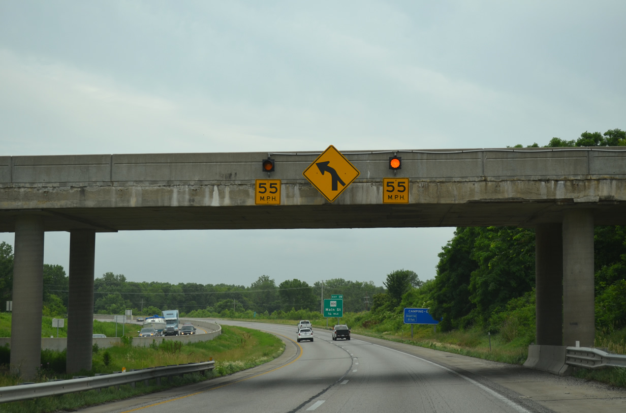
Approaching Platte City, Interstate 29 makes a sharp curve from Exit 20 with Missouri 20 to cross the Platte River. A set of beacons and a regulatory sign advise motorists to adjust their speed through the diamond interchange with MO 273.
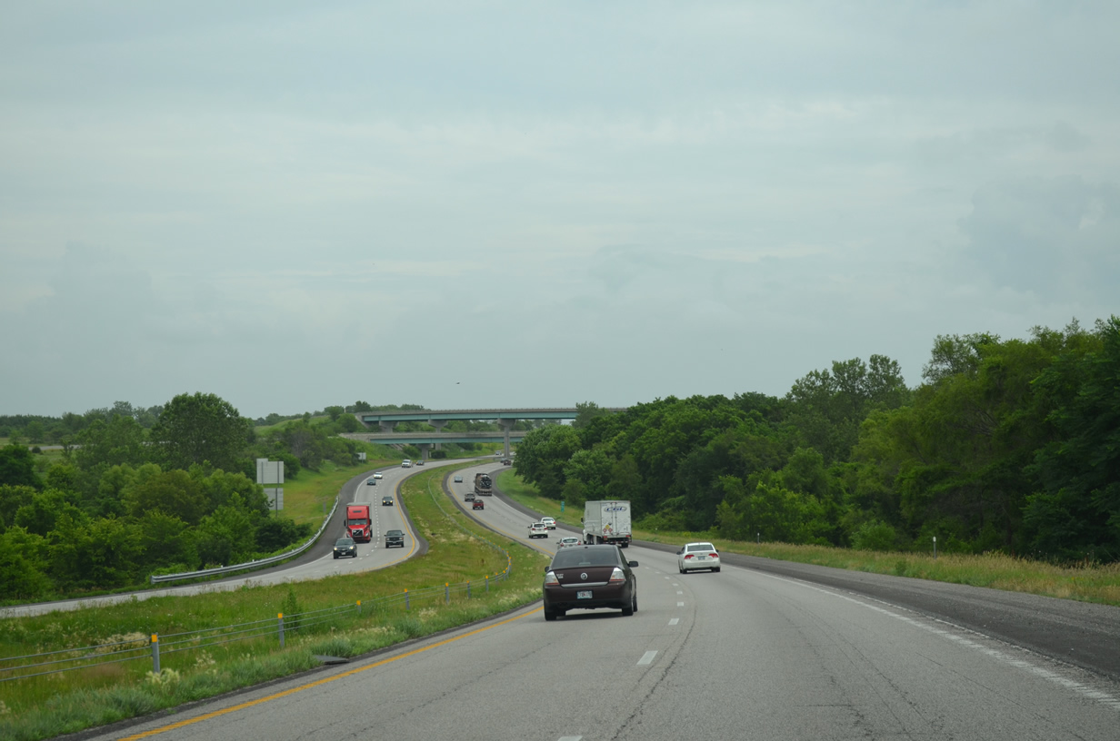
A directional-T interchange joins Interstate 29 south with Interstate 435 east on the southeast side of Platte City. The two freeways overlap for 2.3 miles through to Kansas City International Airport (MCI).
The Diverging Diamond Interchange (DDI) craze has spread to the Kansas City area with the a fourth DDI constructed at Tiffany Springs Parkway near MCI Airport. The $14-million project upgraded the standard diamond interchange at Exit 10 while also expanding NW Prairie View Road, the west side frontage road, to four lanes. Work ran from March 2013 to September 2014. A fifth DDI is under construction between Interstate 49 and MO 291 in Cass County.
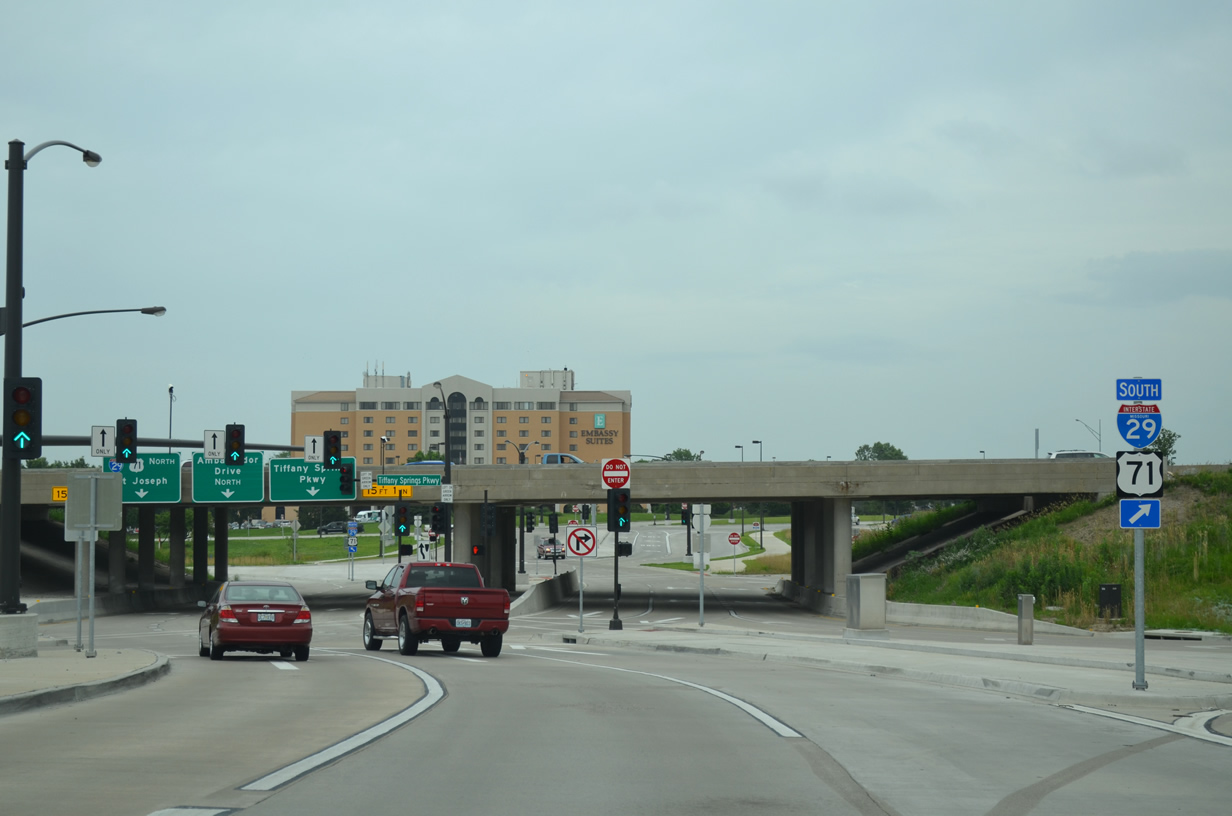
Passing through the DDI with I-29 along Tiffany Springs Parkway. The arterial sees six overall lanes below I-29, with Ambassador Drive tieing into the junction from the east.
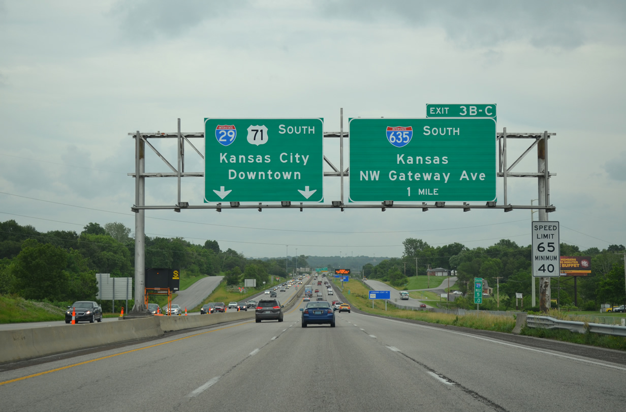
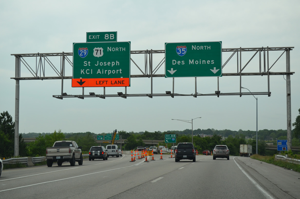
Interstate 29 & U.S. 71 remain overlapped southward to Downtown Kansas City. The pair meet the north end of I-635, a commuter bypass route to the west into Kansas City, Kansas at Exit 3B.
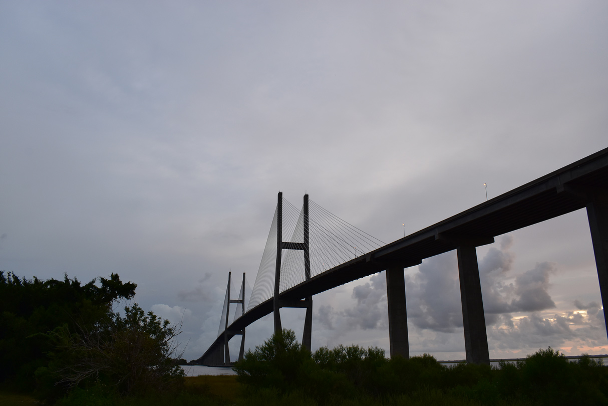
Interstates 29 & 35 combine for 5.50 miles through to Downtown Kansas City. Along the stretch is the Christopher S. Bond Bridge across the Missouri River. The cable-stayed bridge was constructed as part of the $245-million KcICON project to upgrade 4.7 miles of freeway. The project scope focused on modernizing I-29 & 35 from I-70 north to MO 210 (Armour Road) while replacing the substandard Paseo suspension Bridge across the Missouri. This work was completed six months ahead of schedule. It ran from March 2008 to February 2011, with the new Bond Bridge dedicated on September 27, 2010.
The KcICON project included changes to several interchanges both north and south of the river. South at the wye interchange with The Paseo, construction relocated the left-hand on-ramp to I-29 & 35 northbound to the right while realigning and expanding the northbound lanes. Southbound was also expanded from two to four lanes.
Further north, the folded diamond interchange with Front Street was replaced with a new single point urban interchange (SPUI) linking the freeway with a realigned and expanded Front Street.
North of the river, the split diamond interchange with Levee Road was expanded to utilize new collector distributor roadways, eliminating weaving traffic along the I-29 & 35 mainline. This work lied south of a viaduct across a railroad yard. North of the elevated roadway was the removal of the 16th Avenue loop ramp and construction of a new off-ramp to the south.
The northernmost aspect of the KcICON project was the redesign of the cloverleaf interchange with Missouri 210 and Armour Road to eliminate the northbound loop ramp and the associated weaving traffic pattern.
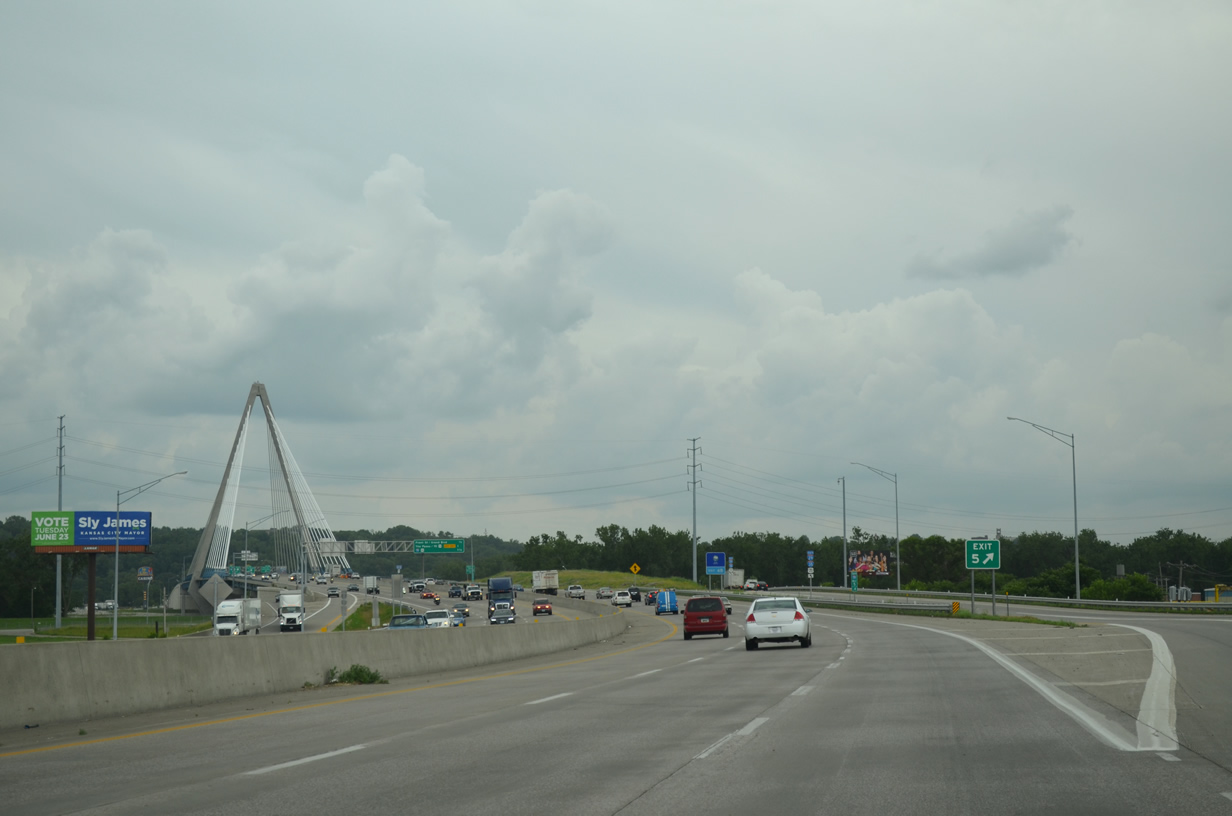
The single 316 foot high tower of the Christopher S. Bond Bridge rises prominently along Interstates 29 & 35 south at the Bedford Avenue on-ramp.
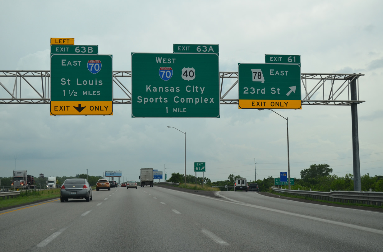
An arrow-per-lane (APL) sign was installed just beyond the left-hand off-ramp to The Paseo for the junction with Interstate 70.
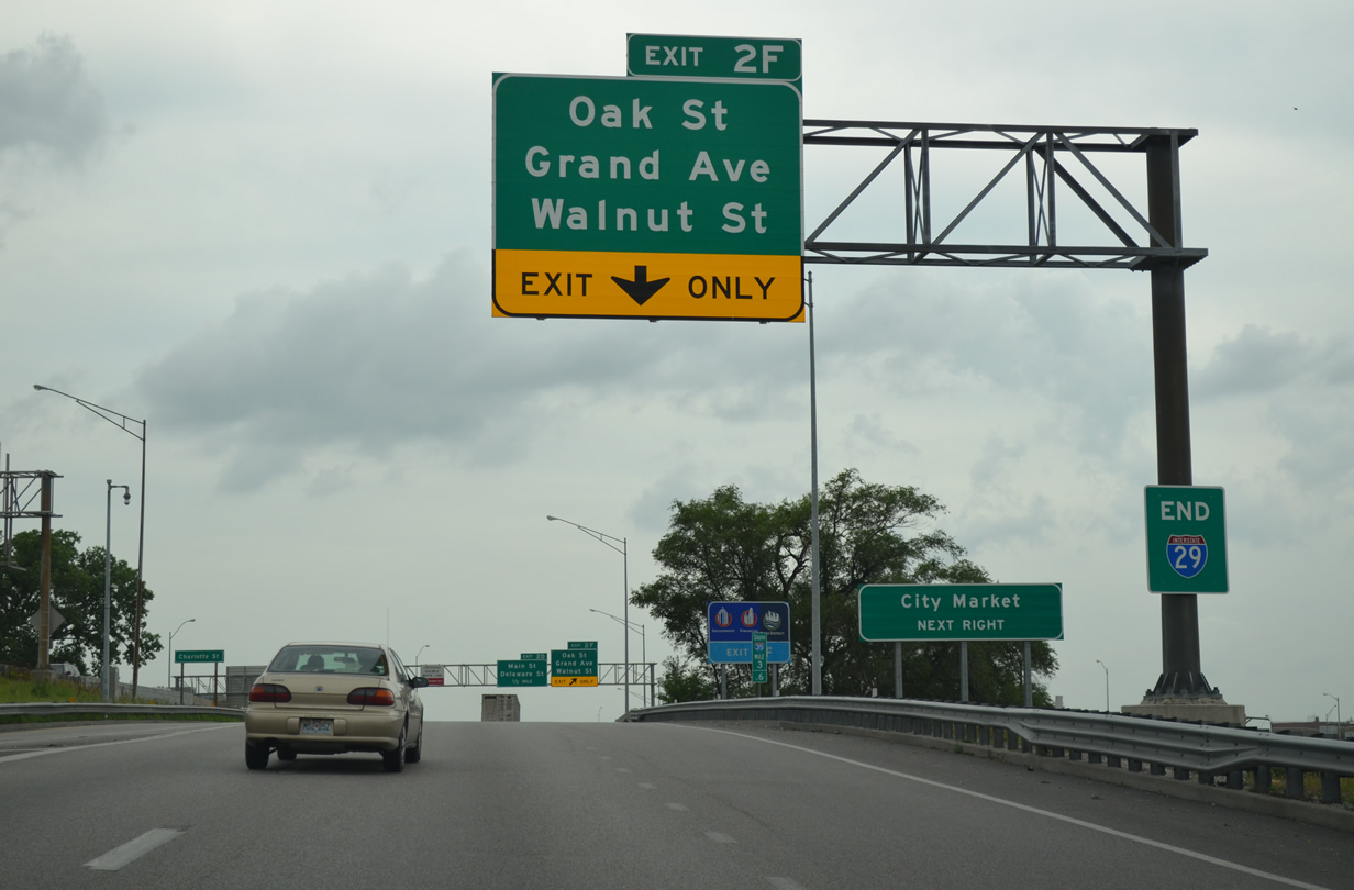
Our two-day drive along Interstate 29 from end to end concludes formally with the END sign posted where Interstate 35 joins Interstate 70 west on the north leg of the Alphabet Loop.
The Alphabet Loop is essentially a road enthusiast nickname for the inner belt freeway encircling Downtown Kansas City due to the lettered suffixes of Exit 2 used for all off-ramps along the route. Every letter of the alphabet is used along the loop with the exceptions of I and O, to offset potential confusion as the numbers 21 and 20, and Z, which is unassigned. Speed limits are posted at just 45 miles per hour on the loop.
Interstates 35 & 70 overlap on the north leg of the Alphabet Loop, while I-35 travels solo on the south leg and I-70 solo on the east leg. Interstate 670 follows the south leg as the through route bypass. Additionally U.S. 24 takes the north leg along side U.S. 40, while the east leg doubles as U.S. 40 and 71. U.S. 169 also briefly ties in to the northwest quadrant of the inner belt.

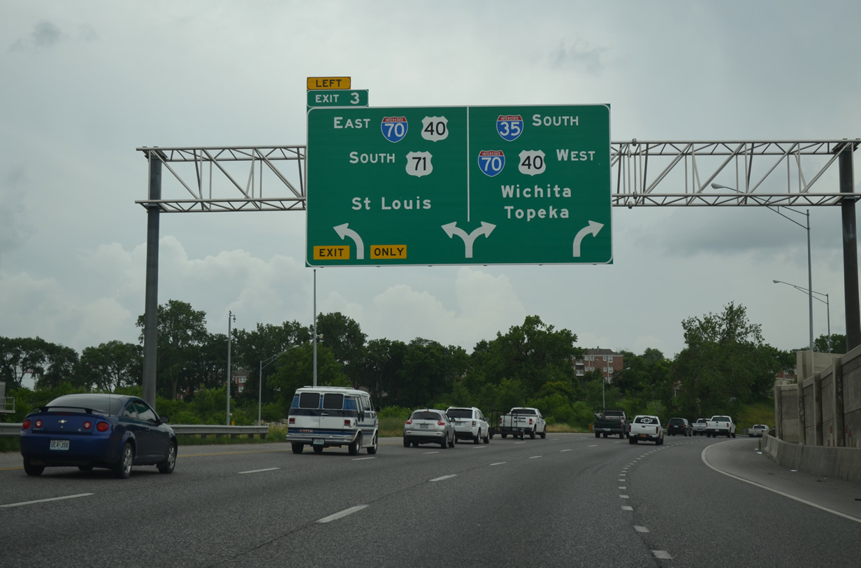
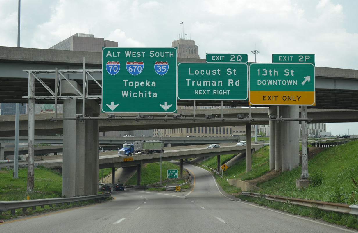
Taking the left-hand ramp from I-35 south to I-70 east, motorists joining Interstate 670 as it passes below the Kansas City Convention Center at Broadway.
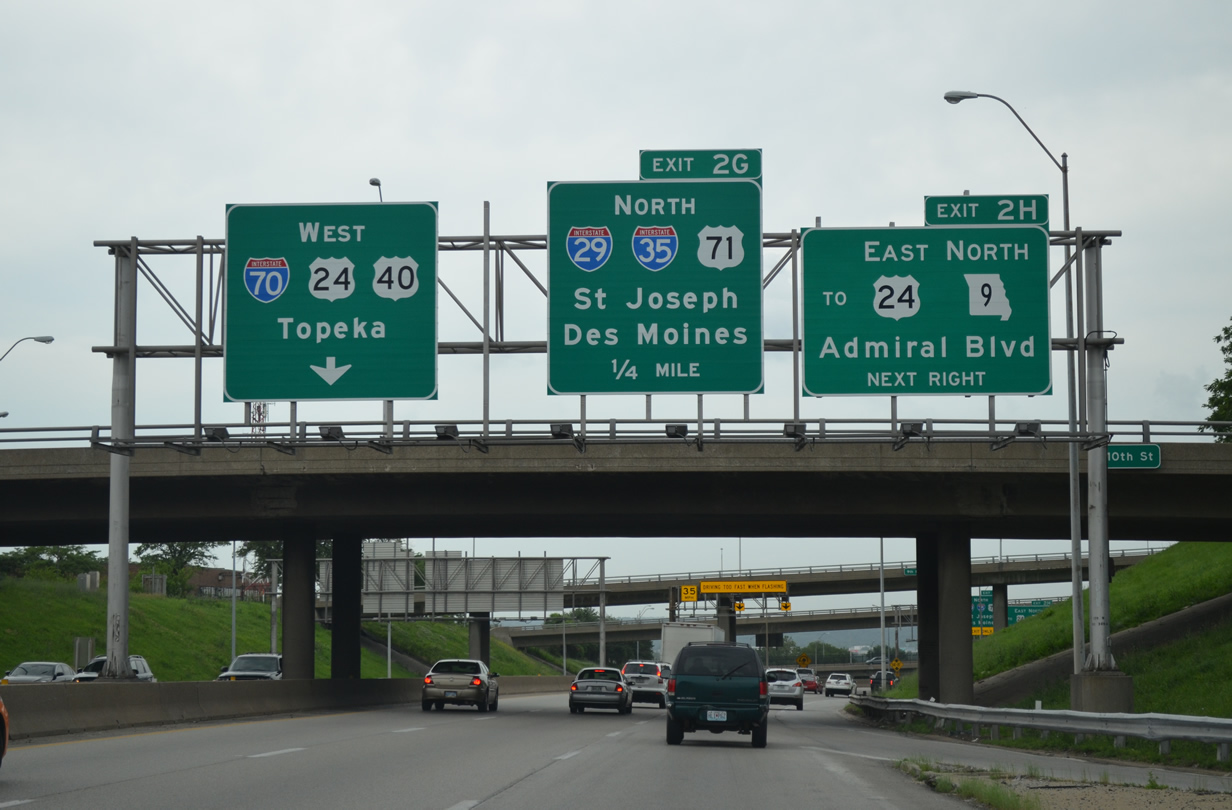
Interstate 70 turns north at I-670 and U.S. 71 to connect with Interstate 35 and the southern terminus of Interstate 29 at Exit 2G.
Heading back north from Downtown, Interstates 29 and 35 separate at at three-wye interchange by the Northgate neighborhood.
Construction started on April 21 to rehabilitate 12 bridges along Interstate 29 between I-435 and I-635 through northwest Kansas City. Work through October includes a variety of lane closures and narrowing at bridge locations.
Interstate 35 took us northeast to Claycomo, where we joined Interstate 435 back south across the Missouri River to Blue Summit and the cloverstack interchange with Interstate 70. Just north of that junction, a $32.4-million project between 2010 and 2012 added new ramps from U.S. 40 onto I-435 north and from I-435 south onto U.S. 40. These additions were built in conjunction with work to separate the c/d roadway on I-70 east from the beltway on-ramp.
The interchange between Interstates 70 and 435 features left-hand ramps from the Kansas City Beltway to I-70.
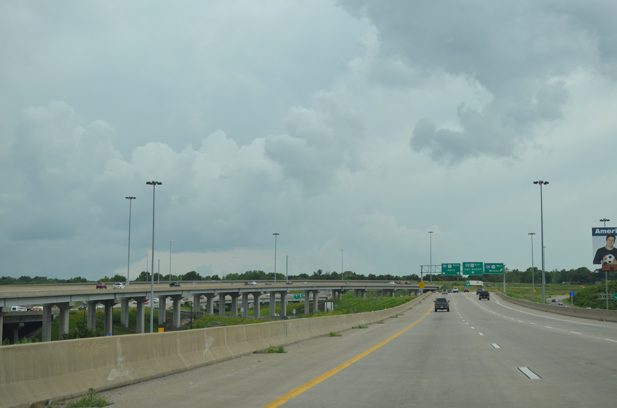
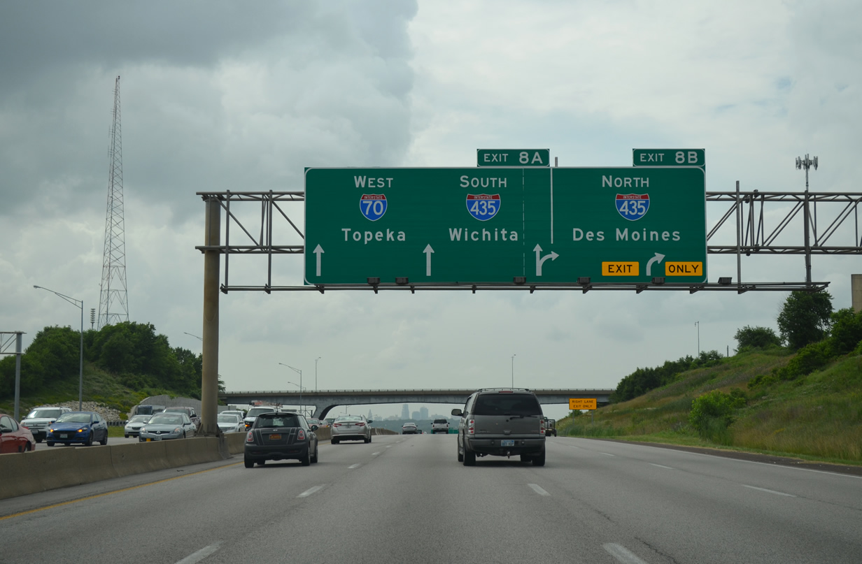
Entering the Grandview Triangle Interchange, where Interstates 49, 435, 470 and U.S. 71 come together. An elevated c/d roadway shuttles motorists from I-435 south to the southbound beginning of I-49 and the eastbound beginning of I-470.
The Grandview Interchange was the site of chronic congestion until MoDOT embarked on a seven-year, $300-million project to redesign the confluence of five freeways. Among the upgrades, work shifted the left-hand ramp from I-435 east to both I-49 & U.S. 71 south and I-470 east to the right.1 The project was pronounced complete by MoDOT on December 14, 2007, though work building the Longview Road overpass across I-49 & U.S. 71 and three roundabouts along the local road continued through May 2008. All in all 28 lane-miles were added to the Grandview Triangle Interchange. U.S. 71 (Bruce R. Watkins Drive) was expanded by three lanes in each direction between Red Bridge Road and Blue Ridge Boulevard while two lanes were added from I-435 east to I-470.
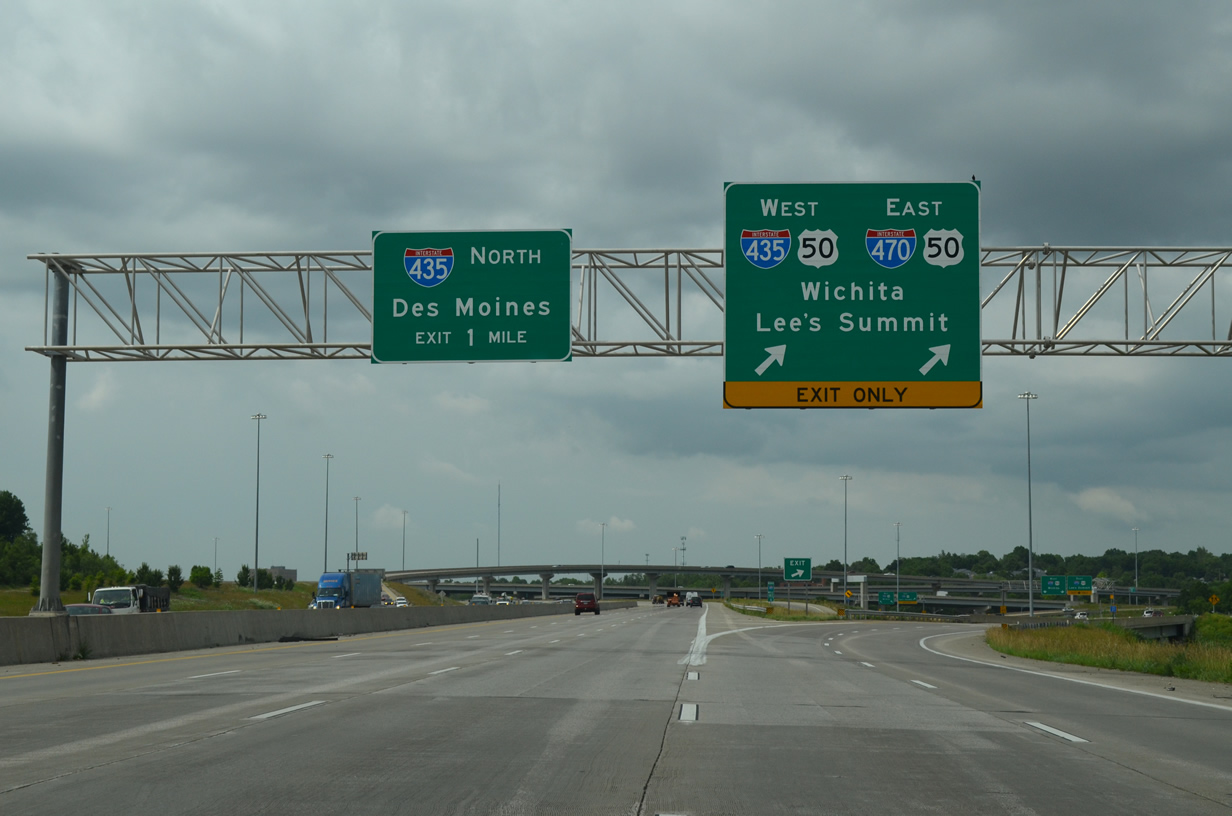
Interstate 49 & U.S. 71 north reach the off-ramp serving Interstate 470 & U.S. 50 east to Lee’s Summit and Interstate 435 & U.S. 50 west to Overland Park, Kansas. The I-49 mainline continues through the Three Trails Crossing Memorial Highway interchange to become U.S. 71 (Bruce R. Watkins Drive) north toward Downtown Kansas City.
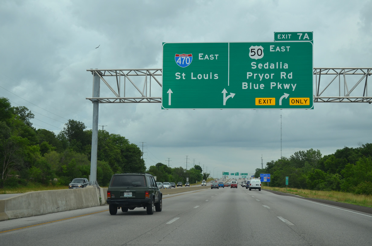
Traveling along Interstate 470 east ahead of the distributor roadway for Pryor Road, U.S. 50 east and Blue Parkway. U.S. 50 splits with I-470 here for its own freeway around Lee’s Summit.
$46-million in road work added a split diamond interchange with Pryor Road west of Missouri 350 and Blue Parkway east of it between 2006 and 2010. The Pryor Road interchange was finished in summer 2008 and the Blue Parkway exit in 2009.3 The service roads, which pass over the U.S. 50 and M0 350 freeway, were constructed last. Included was the lengthening of the U.S. 50 off-ramp taking the US route away from I-470 toward Sedalia.
Turning back west to Kansas City along Interstate 70.
Interstate 670 splits from Interstate 70 west to run along the south side of the Alphabet Loop. The Interstate is routinely signed as Alternate I-70 as it is the preferred through route for crosstown traffic.
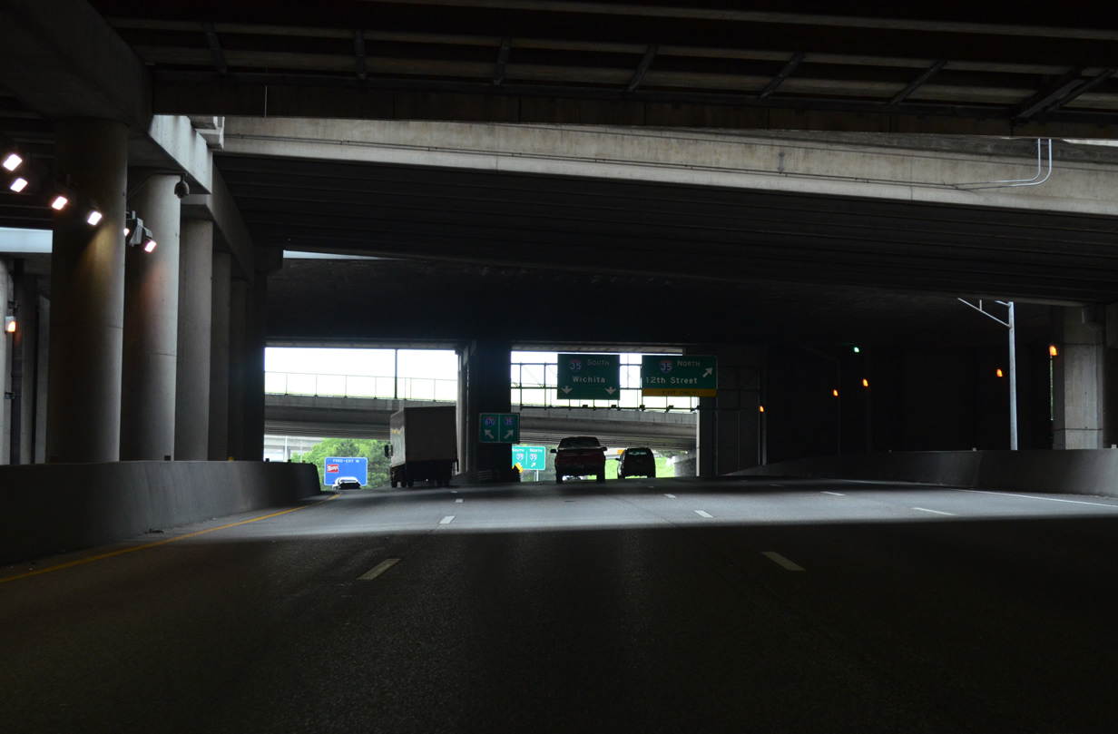
Interstate 670 reaches Exit 2T with Interstate 35 at the tunnels below the Kansas City Convention Center.
We crossed into Kansas and then headed south along Interstate 635 to Interstate 35 north for another round to complete our documenting of the Alphabet Loop.
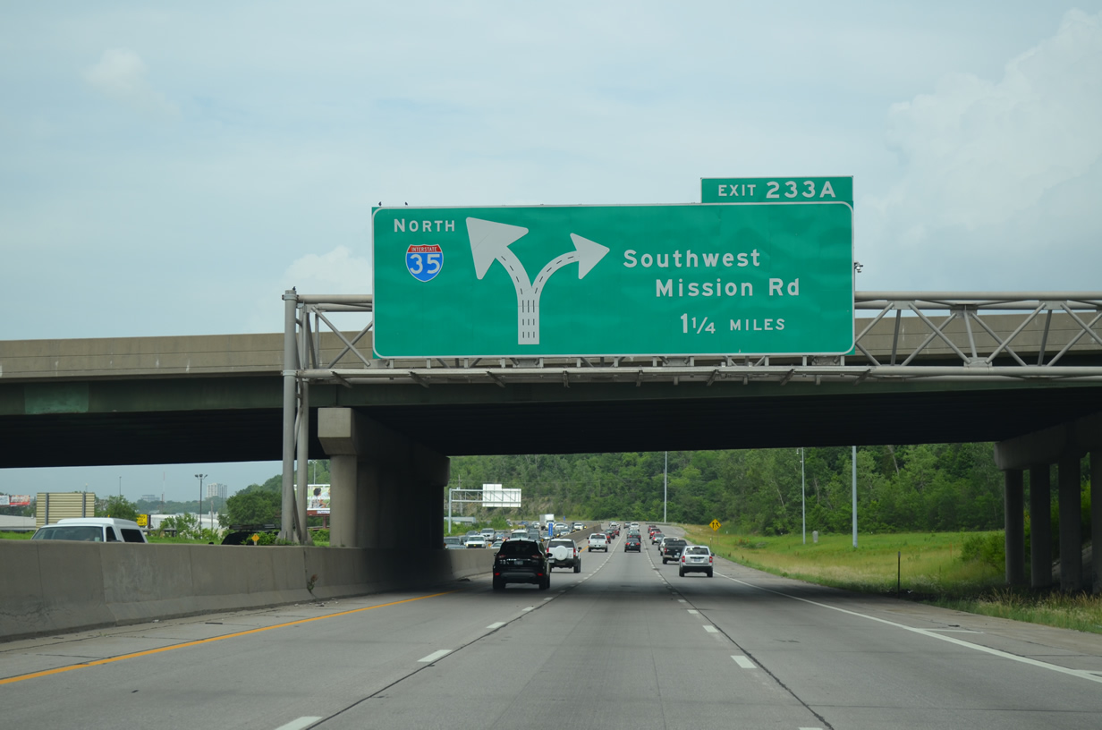
The first of three diagrammatic signs along I-35 north with over sized arrows for Southwest Boulevard (these were covered previously by Justin in 2008). Diagrammatic signs are being phased out for Arrow-Per-Lane signs, so this sign is likely on borrowed time.
The Turkey Creek Expressway section of Interstate 35 transitions into the Southwest Trafficway portion of freeway by Penn Valley Park. Southwest Trafficway was the original name given to I-35 northward to the Alphabet Loop. The older design of I-35 through here sees the southbound mainline pass over 27th and Summit Streets on 1966-built bridges while northbound utilizes a short tunnel below their intersection.
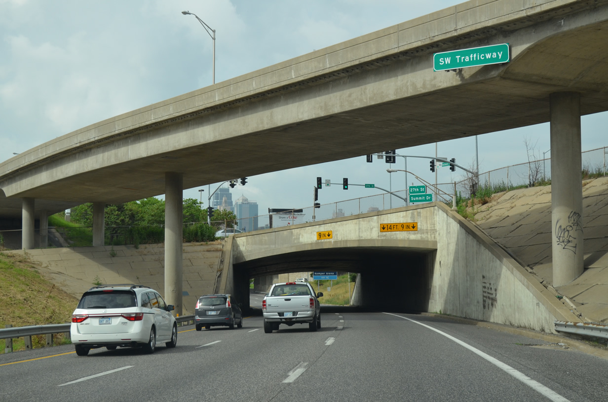
A left-hand ramp leads to Southwest Trafficway from I-35 south above I-35 north as motorists enter the tunnel below 27th and Summit Streets.
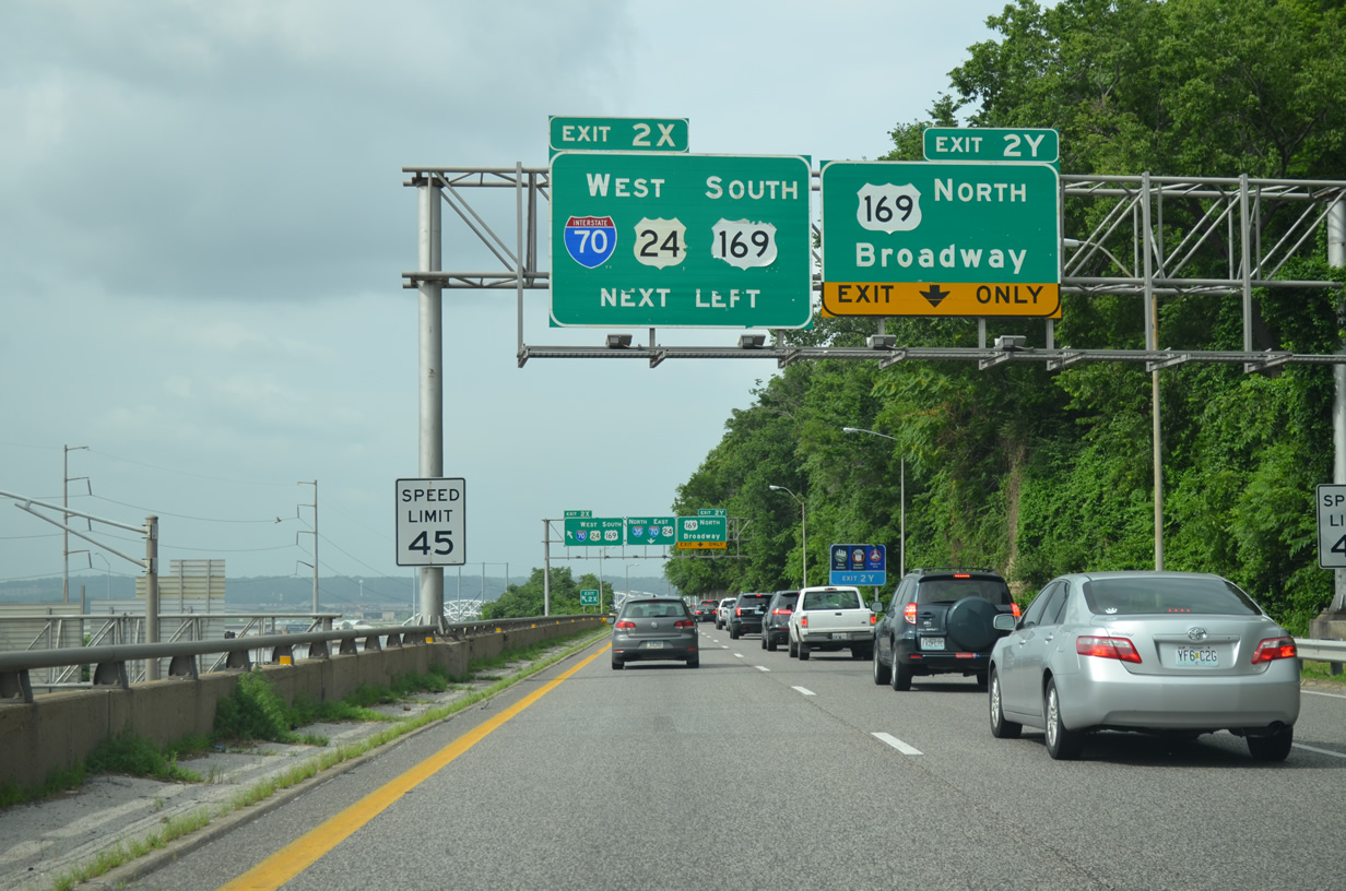
Interstate 35 hugs a cliff just west of Downtown Kansas City through to the two-wye interchange with Interstate 70 & U.S. 24-169.
Rejoining Interstate 70 west, we leave Downtown Kansas City for the final time and head out toward Edwardsville and the western suburbs.
I-70 spans the Kansas River and makes a sharp turn south then southwest to overtake I-670 around the Riverview section of Kansas City, Kansas.
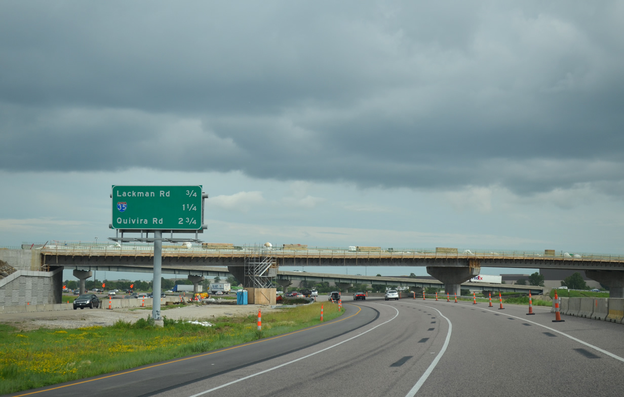
Interstate 435 meets the east end of Kansas 10 at a three-wye interchange at Lenexa. The exchange is currently midway through construction to add collector distributor roadways to I-435.
The Johnson County Gateway Project is a $600-million three-phase project affecting the Kansas 10 freeway and Interstates 435 and 35. Phase 2 construction along the Kansas City Beltway adds c/d roadways from K-10 east to Lackman Road (Exit 1A) and the cloverstack interchange with Interstate 35. A new flyover is also being built from K-10 east to I-435 north. This will join the new northbound c/d roadway. A second flyover to be added will form the eastbound beginning of a c/d roadway to Lackman Road. Phase 2 work runs through December 2016.
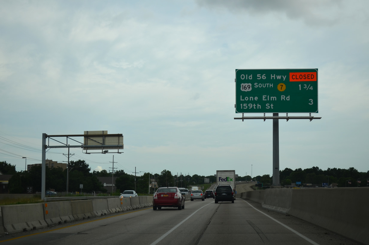
A two-mile stretch of Interstate 35 from Santa Fe Street (Exit 218) to north of 151st Street (Exit 215) is midway through a pavement replacement project.
The I-35 pavement project started on March 16.Phase One work shifts the southbound lanes to the northbound side as crews replace the concrete surface. This resulted in the temporary closure of the Old Highway 56 off-ramp. Phase Two of the work moves traffic over to the newly paved southbound lanes from August to December 2015. The northbound Santa Fe Street exit will be closed during this time period.
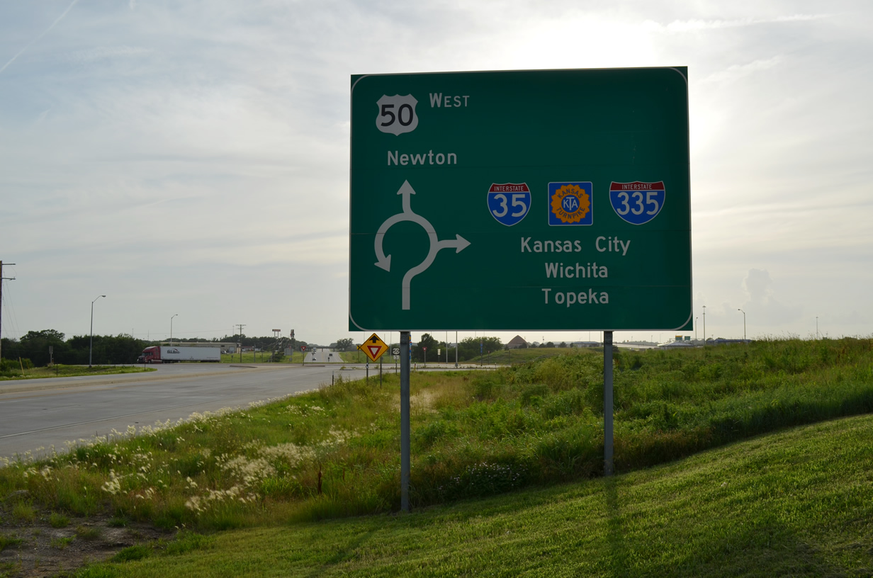
Interstate 35 continues with six overall lanes to the weigh station south of Exit 214 (Lone Elm Road). U.S. 56 west peels off the freeway at Exit 210 for Gardner, while U.S. 50 remains paired with the freeway to Emporia. U.S. 59 also briefly joins I-35 to bypass Ottawa.
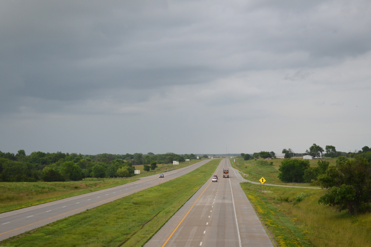
Looking east from the rural diamond interchange where Kansas 31 south joins Interstate 35 north & U.S. 50 east. 11,800 vehicles per day (vpd) were recorded on this stretch by KDOT in 2015.
The west end of the free portion of Interstate 35 ties into the south end of Interstate 335 on the Kansas Turnpike. A complicated interchange once connected I-35 and U.S. 50 with the access road and trumpet interchange with the turnpike mainline. KDOT officials dubbed this the “Spaghetti Bowl.” A $32.9-million project started in 2006 simplified the connection by defaulting the I-35 mainline directly to the Turnpike and separating U.S. 50 on a new alignment to the south. Connecting the two parallel roadways is a two-lane road tethered by roundabouts at either end. The new lanes for U.S. 50 opened on July 1, 2008, followed by the new trumpet interchange with the Turnpike mainline the next day.
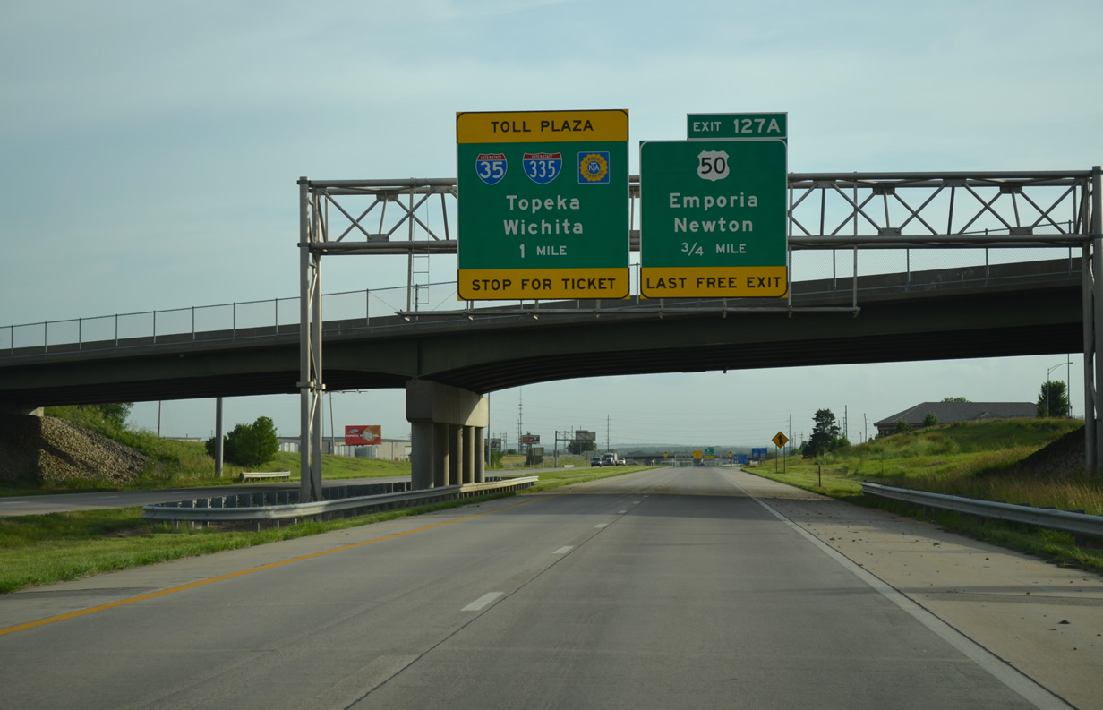
Passing under Graphic Arts Road, Interstate 35 approaches the diamond interchange (Exit 127A) with the connector road south to adjacent U.S. 50. Drivers taking Exit 127A use a roundabout to head south.
U.S. 50 westbound at the 2008-constructed roundabout for the access road north to Interstate 35 and the Kansas Turnpike.
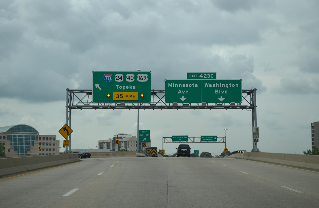
Rounding out a long drive through Topeka, we headed west through the city, taking Interstate 70 to the end of I-470 and calling it a day. I-70 winds through Downtown Topeka along the Polk-Quincy Viaduct, a 50-year old roadway in need of replacement. A concept study was conducted by KDOT and the City of Topeka on alternatives to replace the roadway. The preferred alternative incorporates two split diamond interchanges and a realignment of I-70 across a four-block section between SW 1st and 2nd Streets between Kansas and Topeka Avenues. This would require the acquisition of several industrial businesses and homes along Harrison Street. Funding is not yet available for right of way acquisition or construction.
The Polk-Quincy Viaduct consists of a narrow four-lane roadway without any shoulders. A pavement repair project was underway along the eastbound lanes in this scene.
While writing this post, I also made some changes to the various Interstate guides for 229, 435, 470, 635 and 670, including revisions of the historical sections and the addition of old map scans.
Sources:
- “Road work begins next spring to replace Grandview Triangle – Other – work targets south Lee’s Summit.” The Kansas City Star, September 20, 2000.
- “Triangle traffic traumas will soon fade.” The Kansas City Star, December 13, 2007.
- “I-470 interchange in Lee’s Summit is done.” The Kansas City Star, June 30, 2010.


I’ve enjoyed these posts. If you had time, maybe you could start off with a summary Google map of the route you travelled. It would make it easier to follow along in places I’ve never been to :)
I like this blog.
There’s another DDI being constructed at Ridgeview Rd over K-10.
The Johnson County Gateway project is badly needed, but it’s a traffic nightmare. Due to Renner Blvd being closed under K-10, all Renner traffic is being funneled to Lackman Rd. It’s like herding cats!
I loathe the current Lackman Rd exit at 435. You have to cut across 2 lanes of traffic just to get to the mainline in either direction, otherwise your’re forced onto westbound K-10 or Exit 83 towards 35.