
Day 7 of our Midwest/Great Plains trip takes us east from Topeka back through Kansas City and then north to Des Moines before ending the day in the Quad Cities. We started out deciding to explore the Topeka area freeway system with spurs north and south along U.S. 75 before returning to Kansas City to finish our documentation there.
Passing through the tri-level stack interchange from Interstate 70 east onto the continuation of U.S. 75 north across the Kansas River.
The U.S. 75 freeway connects Topeka with several industrial plants along U.S. 24 and outlying suburban areas northward to NW 46th Street. The limited access portion ends at NW 62nd Street, with an expressway extending the route northward from there to Hoyt.
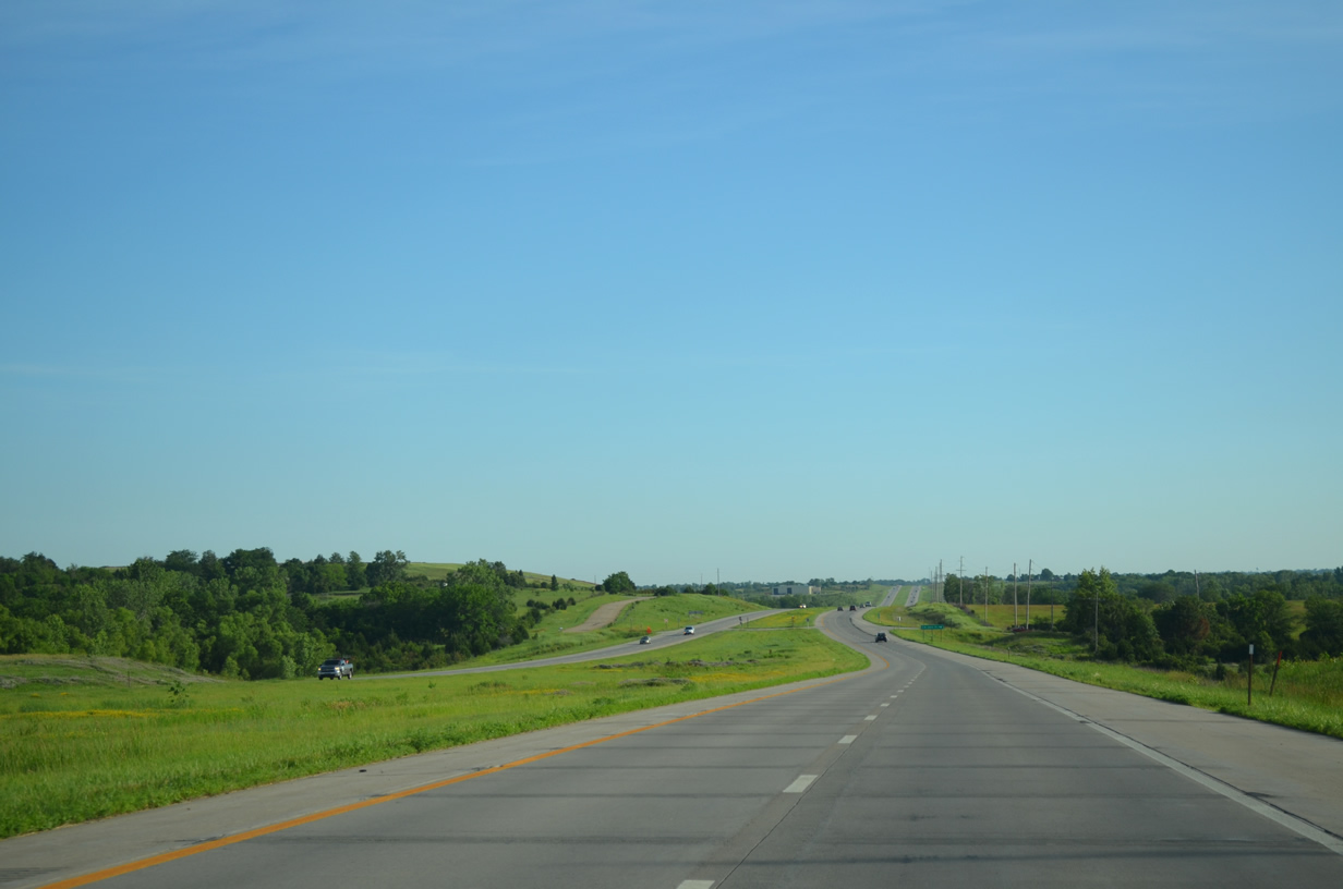
The generous right of way takes the U.S. 75 expressway north of NW 62nd Street. Speed limits remain at 70 miles per hour on this stretch.
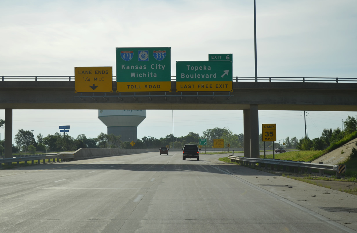
Interstate 470 forms a southern bypass of Topeka, with the southwestern half traveling a free route and the southeastern section lining the tolled Kansas Turnpike. A trumpet interchange joins I-470 with the north end of I-335 just beyond the Topeka Boulevard off-ramp (Exit 6).
U.S. 75 extends south from I-470 as a freeway to the Topeka Regional Airport (FOE) area and Carbondale.
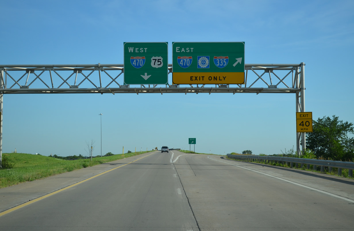
U.S. 75 uses a high flyover to merge onto Interstate 470 west at the north end of its freeway. A diamond interchange below provides access from I-470 west to U.S. 75 south via Burlingame Road.
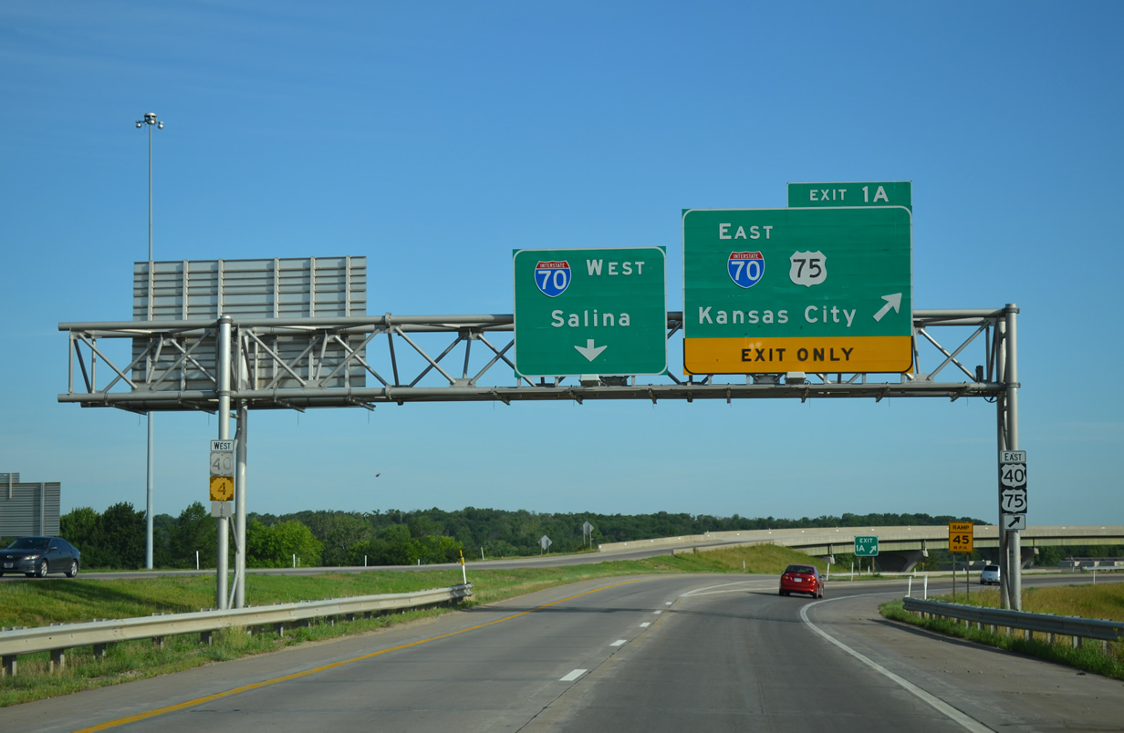
The west end of Interstate 470. U.S. 40 and K-4 overlap with I-70 but are shown as after-the-fact with just shield assemblies mounted on the sign bridge supports.
The city of Topeka is devoid of any surface street based routes. U.S. 40, U.S. 75 and K-4 all overlap with either Interstates 70 or 470 while U.S. 24 travels an expressway along the north side of the city.
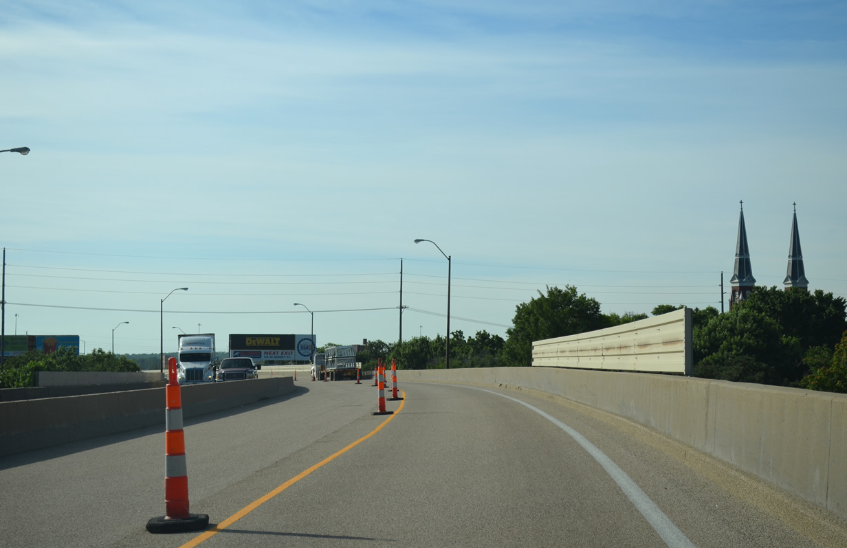
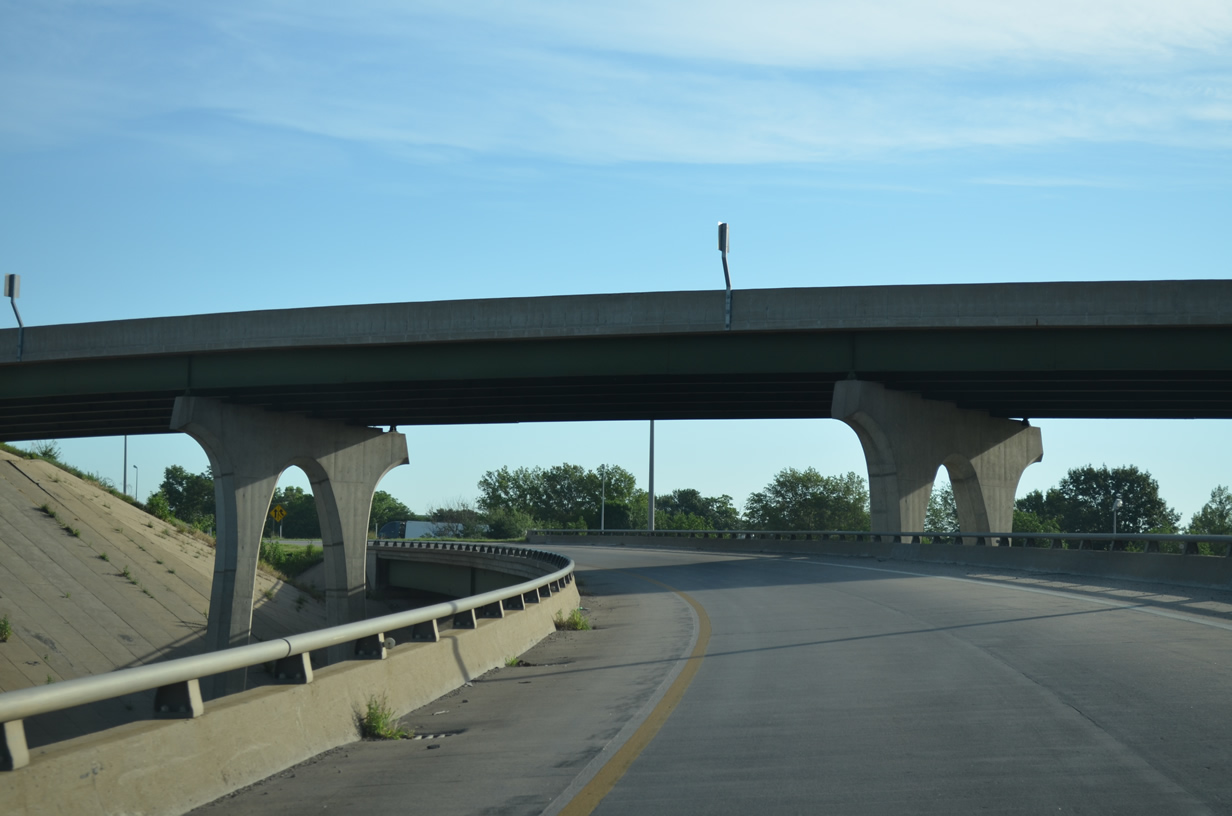
Traveling eastbound along the Polk-Quincy Viaduct over Topeka Boulevard.
The Polk-Quincy Viaduct comprises 30 spans of reinforced concrete box girders running 3,373 feet in length. The elevated roadway was built in 1963 and redecked in 1981. Design planning for the replacement of the roadway was approved by KDOT for Fall 2011. Anticipated funding may lead to the start of construction in 2021. http://www.topeka.org/polk.shtml
The Rand McNally North American Road Atlas has shown an extension of the K-4 freeway north from U.S. 24 as under construction for over ten years. Known as the Oakland Expressway, the K-4 freeway was one of the System Enhancement projects selected by KDOT in 1990 as a part of the Comprehensive Highway Program. An EIS was conducted between 1991 and 1993, with the portion south of U.S. 24 constructed and the right of way acquired for the the section north from U.S. 24 north to NE 54th Street. Funding for additional corridor work was halted in 2000.
The Oakland Expressway Extension Improvement Plan includes work to complete the interchange with U.S. 24, construct a new two-lane facility north to NE 46th Street, where a diamond interchange would be constructed. Construction of the Super-Two expressway was estimated to cost $25.8-million in 2012.
A sweeping loop ramp takes K-4 south from U.S. 24 west. The overpass for the U.S. 24 expressway includes space allocated for the Oakland Expressway Extension and eventual four-laning of K-4.
The Kansas Turnpike is six lanes wide from the east end of Interstate 470 to Exit 197 with K-10. The toll road again expands back into six lanes at Exit 202 with McDonald Drive.
The West Lawrence Interchange (Exit 202) on the Kansas Turnpike was converted from a trumpet interchange to a diamond interchange with a roundabout as part of a $130-million project to replace the 1955-built Kansas River bridges on I-70. The new interchange at Exit 202 opened June 11, 2010.
Similar modifications occurred at Exit 204, where a trumpet interchange was modified into a diamond interchange and roundabout with the access road to U.S. 24-40-59. It reopened on October 6, 2010. The new Kansas Turnpike bridges were completed by early December 2010.
Further east, a new diamond interchange (Exit 222) opened along the Kansas Turnpike at 222nd Street to serve the city of Tonganoxie. The $16.7-million project originated in the early 1990s but was delayed due to funding. The exit opened on December 29, 2009.
Interstate 70 combines with U.S. 24 & 40 at the Bonner Springs Interchange as the tolled section of the Kansas Turnpike ends. The trio proceed east from there toward Edwardsville and Kansas City.
Construction started in July 2013 added new ramps from Interstate 70 to U.S. 24 & 40 and from U.S. 24 & 40 to I-70. This work removed a portion of the original trumpet interchange to the east of the U.S. 24 & 40 and K-7 overpass.
The new ramps on the eastbound side of Interstate 70 at K-7 opened on November 21, 2014. Subsequent work will shift Interstate 70 southward with the construction of a new eastbound carriageway, bringing the Turnpike up to six lanes from K-7 to 110th Street. Phase 3 work is scheduled to run through fall 2016.
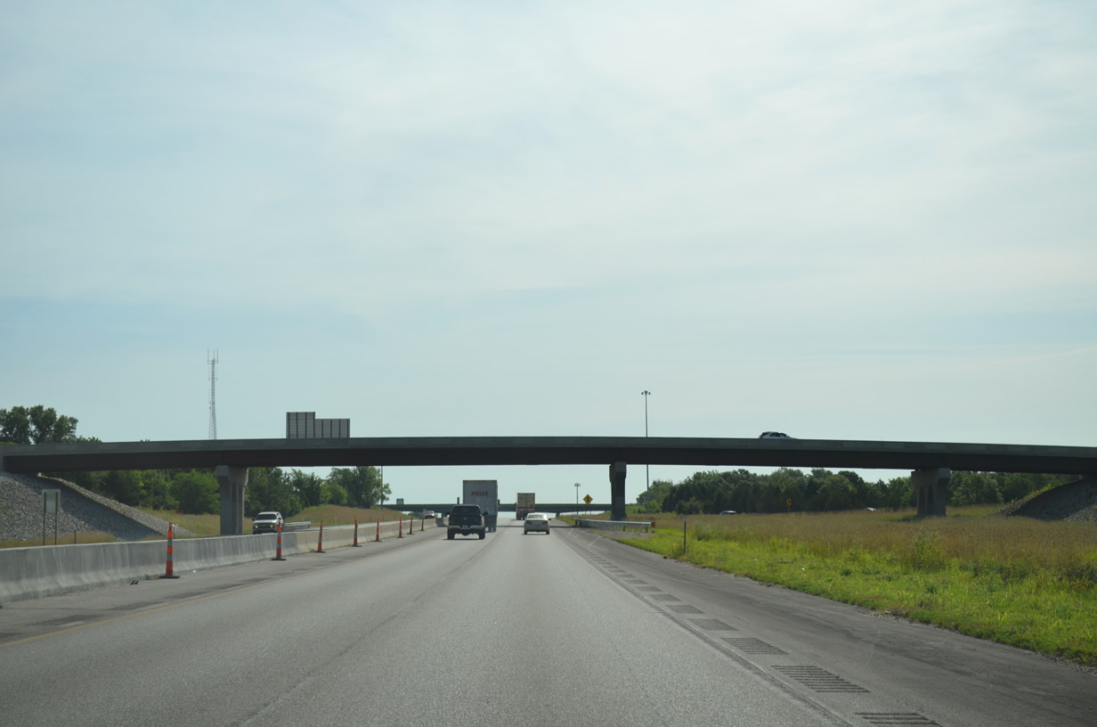
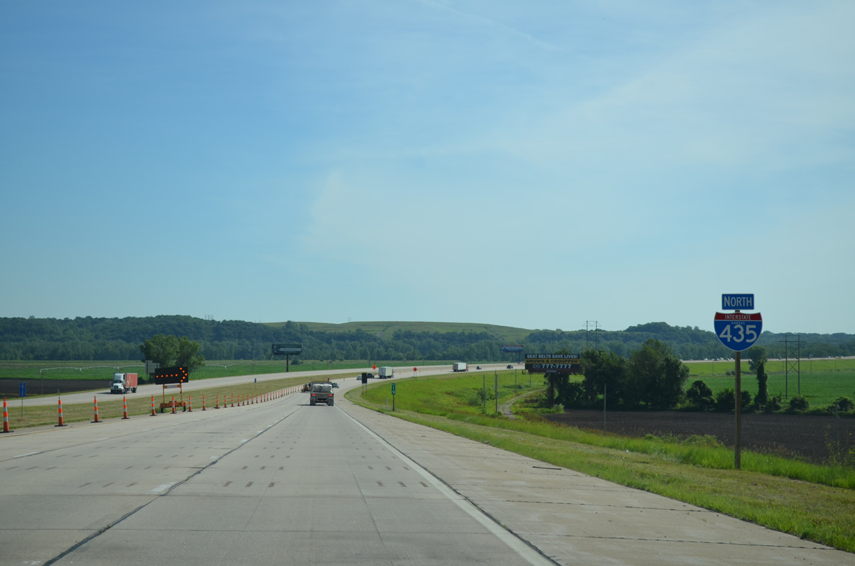
Turning north we headed on the rural portion of the Kansas City Beltway. Interstate 435 through this stretch was not completed until the 1980s and the route remains with just four lanes with lighter areas of development mainly consisting of large spread out subdivisions.
Interstate 435 shares a three-mile overlap with K-5 before traversing the Missouri River flood plain near Wolcott.
A bridge repair project started on April 30 continues through until December 2015 along the northbound lanes of the upcoming Missouri River Bridge. https://www.ksdot.org/kcmetro/laneclose.asp
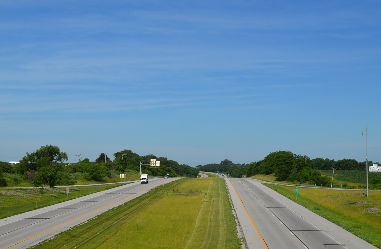
The rural feel of Interstate 435 extends the northern arc through Missouri as well. This scene looks west from the Woodland Avenue overpass near Nashua.
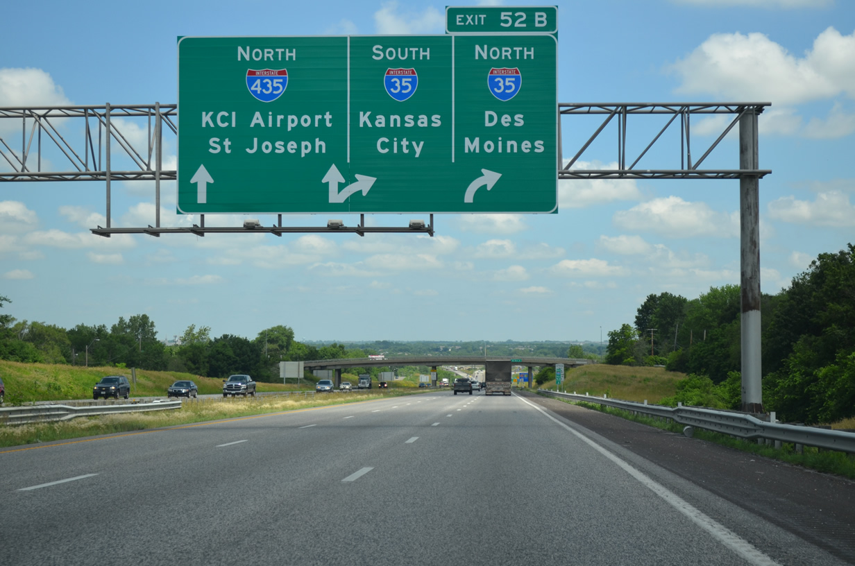
Missouri 110, the western leg of the Chicago Kansas City Expressway (CKC), ends along Interstate 35 at the interchange with Interstate 435. The CKC was designated in 2010 along a collection of routes joining to the two major cities independent of Interstates 70 and 55 (the main route). The route was meant to spur commerce through the smaller cities and towns while providing an alternate four-lane route to the busy trucking corridor of I-70.
Within Missouri, MO 110 runs along side I-35 north to U.S. 36 and cross U.S. 36 to Interstate 72 and the Mark Twain Bridge into Illinois. Within Illinois, IL 110 turns northward along side Interstate 172 and IL 336 to Carthage where it turns east on U.S. 136 to Macomb. U.S. 67 extends the route north to Monmouth and the U.S. 34 freeway east. Interstates 74 west, 80 west and 88 east bring the route to the Eisenhower Expressway (I-290) into Chicago.
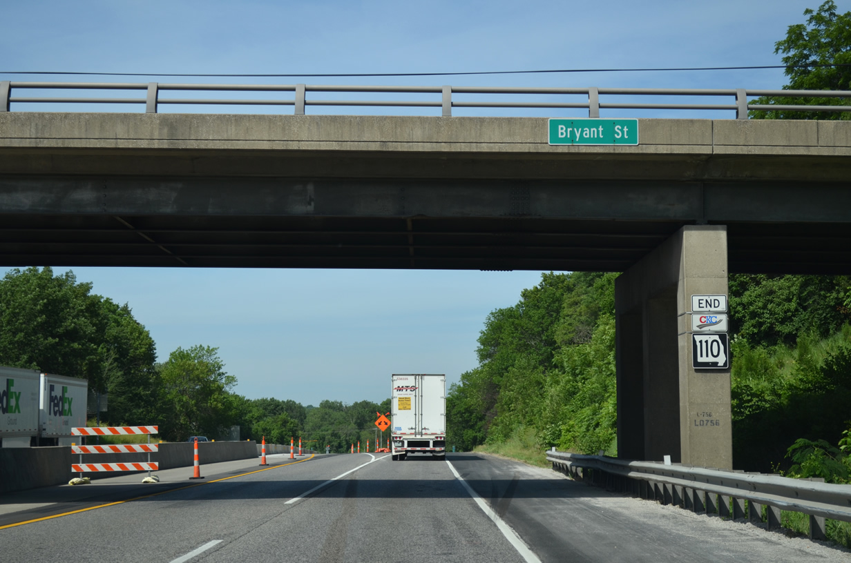
An end shield for Missouri 110 appears at the Bryant Street overpass on I-35 south. Bridge reconstruction along I-35 here ran from May 15th to today.
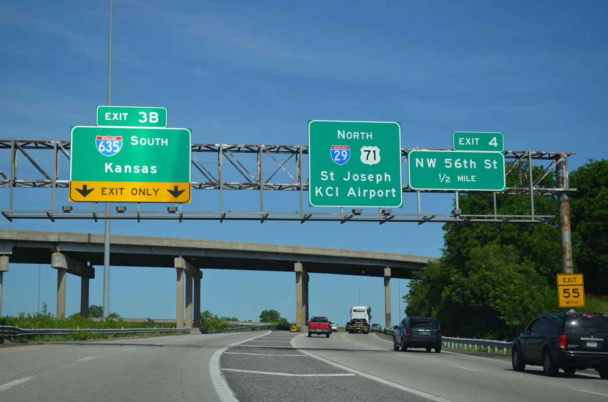
A left-hand ramp takes motorists from Interstate 29 & U.S. 71 north onto the southbound beginning of Interstate 635.
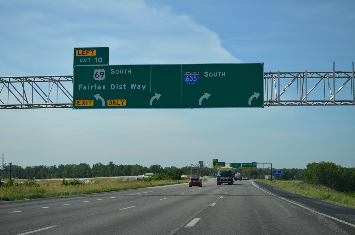
I-635 travels through Riverside where it briefly combines with U.S. 69 ahead of the Fairfax Bridge (Exit 10).
The Fairfax Bridge was a steel cantilever bridge built in 1933. It carried two-way traffic until 1957, when the adjacent Platte Purchase Bridge opened as the new northbound lanes of U.S. 69 & 169. Due to age and the inability to handle heavy truck loads, MoDOT embarked on a replacement project for the bridges, with construction commencing in fall 2014. All new lanes of traffic are to be in operation by December 1, 2016.
The old southbound span (Fairfax Bridge) was demolished on January 26, 2015. The new span is being built in its place, with the footprint extending westward slightly. As for the design, it consists of a nondescript bridge but with a pedestrian and bicycle walkway on the northbound side.
Changes made by KDOT and AASHTO in 2008 removed U.S. 24 & 40 from State Avenue and shifted the pair southward onto an overlap with Interstate 70 from Exit 224 to the Missouri state line. Greenouts reflect these changes along Interstate 635 south.
Further south, construction on Interstate 70 east from I-635 to Kaw Drive is underway to make repairs and bridge deck replacement. This work started on March 28 and runs through December 2015. The ramps from I-635 to I-70 east are closed in both directions.
Interstate 70 continues east from the 18th Street Expressway (U.S. 69) toward the split with Interstate 670. The freeway runs along side a large Union Pacific Railroad yard on this stretch.

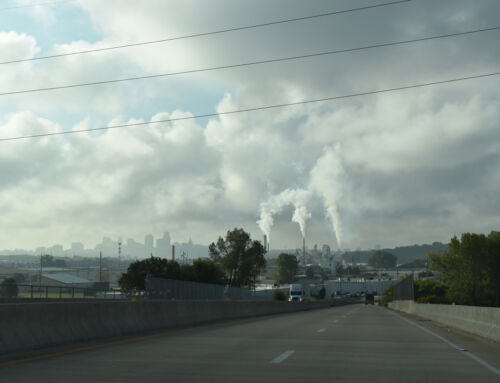
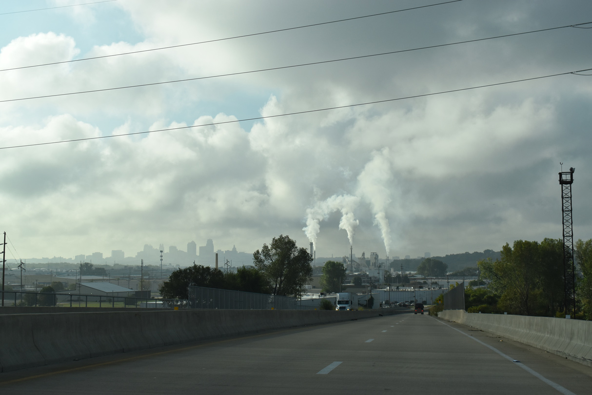
Crossing the Kansas River, Interstate 70 & U.S. 24-40 approach Downtown Kansas City.
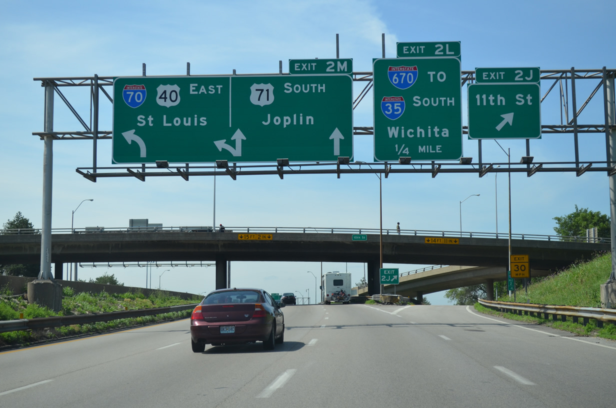
Interstate 70 turns south along side U.S. 40 & 71 on the east leg of the Alphabet Loop.
U.S. 71 extends south from Downtown Kansas City along Bruce B. Watkins Drive to Mount Hop, Blue Hills and South Kansas City. The roadway is mostly a freeway, with the exception of two at-grade stretches. The arterial portions of U.S. 71 sees signalized intersections at 55th and 59th Streets and at Gregory Boulevard. Staunch neighborhood opposition blocks the construction of overpasses on these stretches to bring U.S. 71 to full limited access standards.
U.S. 71 (Bruce B. Watkins Drive) south at 55th Street in the Blue Hills area. The right of way is already allocated for the potential upgrade to a freeway on this stretch and the subsequent at-grade section at 69th Street and Gregory Boulevard.
Interstate 49 was established in Missouri following a ceremony held in Joplin on December 12, 2012. The 180-mile route runs south from Kansas City (Interstate 435) to Joplin and Pineville.
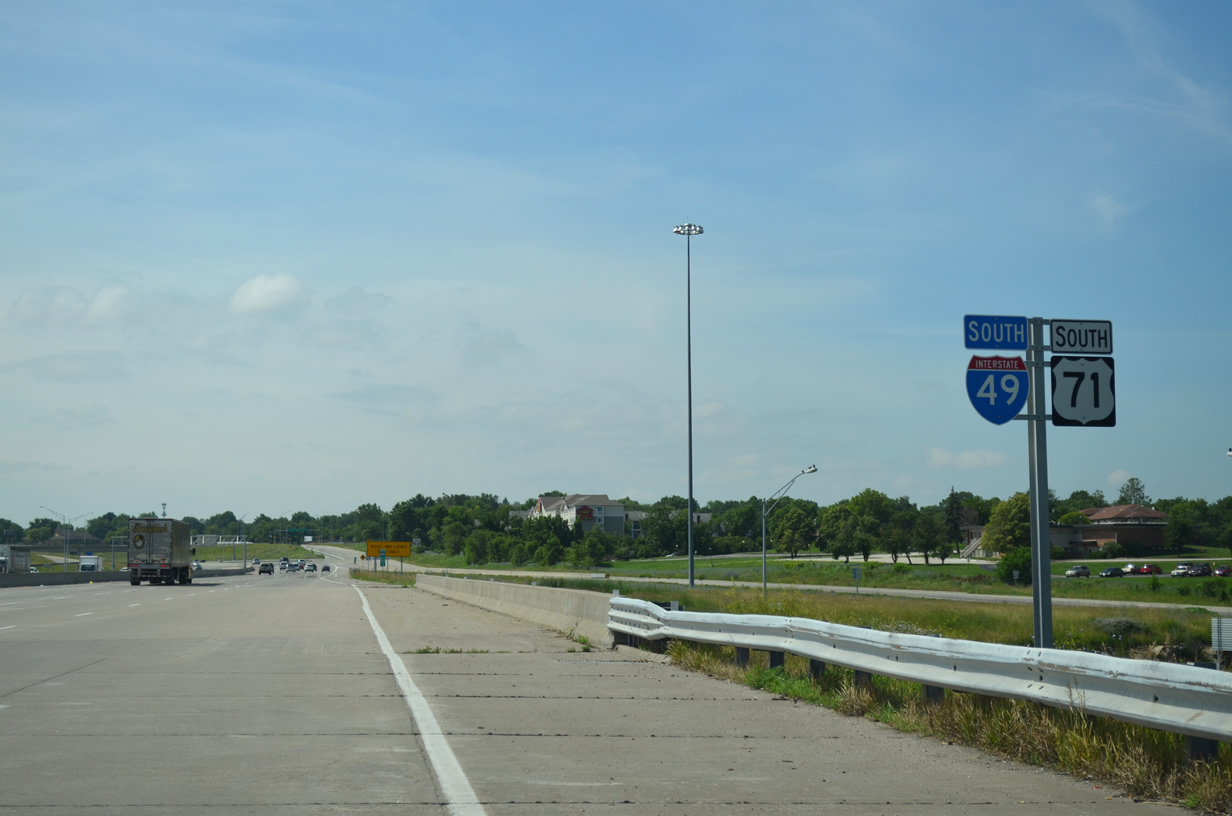
U.S. 71 directly transitions into the southbound beginning of Interstate 49 at the Three Trails Crossing Interchange. The first shield appears at the Red Bridge Road underpass.
A series of projects took place along the preexisting U.S. 71 freeway between Grandview and Joplin from 2010 onwards in anticipation of signing I-49. Work upgraded limited access sections of U.S. 71 to Interstate standards while replacing at-grade intersections with overpasses or new interchanges.
A new flyover is being built to replace the existing one from Interstate 435 west to I-35 south.
This work is part of the Johnson County Gateway Project that expands I-435 from U.S. 69 to 87th Street.
nterstate 70 swings south from the Jackson Curve to East 27th Street, where a second abrupt turn returns the freeway to an eastward heading.
Per the 1956 Expressway Plan, the turn at East 27th Street includes a ramp stub intended to link I-70 with a the canceled South East Trafficway, an unbuilt route to Swope Parkway east of the Blue River. An interchange planned at the Jackson Curve would have linked with the Southeast Freeway, an unconstructed route north to Paseo and south to U.S. 71 (South Midtown Freeway).
Further east, Interstate 70 crosses the Blue River, Manchester Trafficway and a railroad yard on a pair of bridges built in the early 1950s. A $63-million project started in February 2014 replaces the elevated roadway and redesigns the folded diamond interchange with Manchester Trafficway. Construction should wrap up on December 15, 2015.
Interstate 435 north approaching its original northern terminus at I-35 in Claycomo.
Leaving Kansas City, we encountered one final stretch of construction along Interstate 35 at Pleasant Valley Road. Work here runs from early 2015 to July 2017. Presently the carriageways of I-35 separate to surround the intersection of U.S. 69 with Pleasant Valley Road, with three left-hand ramps tieing the surface roads in with the freeway. Changes being made here include a realignment of the I-35 mainline so that it runs side by side with new ramps built on the outside, with the exception of the southbound off-ramp, which will wind under I-35 to connect with the departing U.S. 69 to the south.
Traveling through the Pleasant Valley Interchange area along Interstate 35 north.
All reassurance markers posted on I-35 from Claycomo to Cameron, where the freeway doubles as the Chicago-Kansas City Expressway (CKC), omit Interstate 35. This is a MoDOT policy implemented where an Interstate overlaps with another route. The logic is that the new mile markers, which display an Interstate shield, are sufficient for motorists and that the removal of shields otherwise helps reduce their sign inventory.
The city of Cameron, home to nearly 10,000, is the location of a Business Loop for Interstate 35. The 3.2-mile loop runs west along Highway BB to U.S. 69 (Walnut Street) north through Downtown. The loop returns to I-35 via the U.S. 36 expressway.
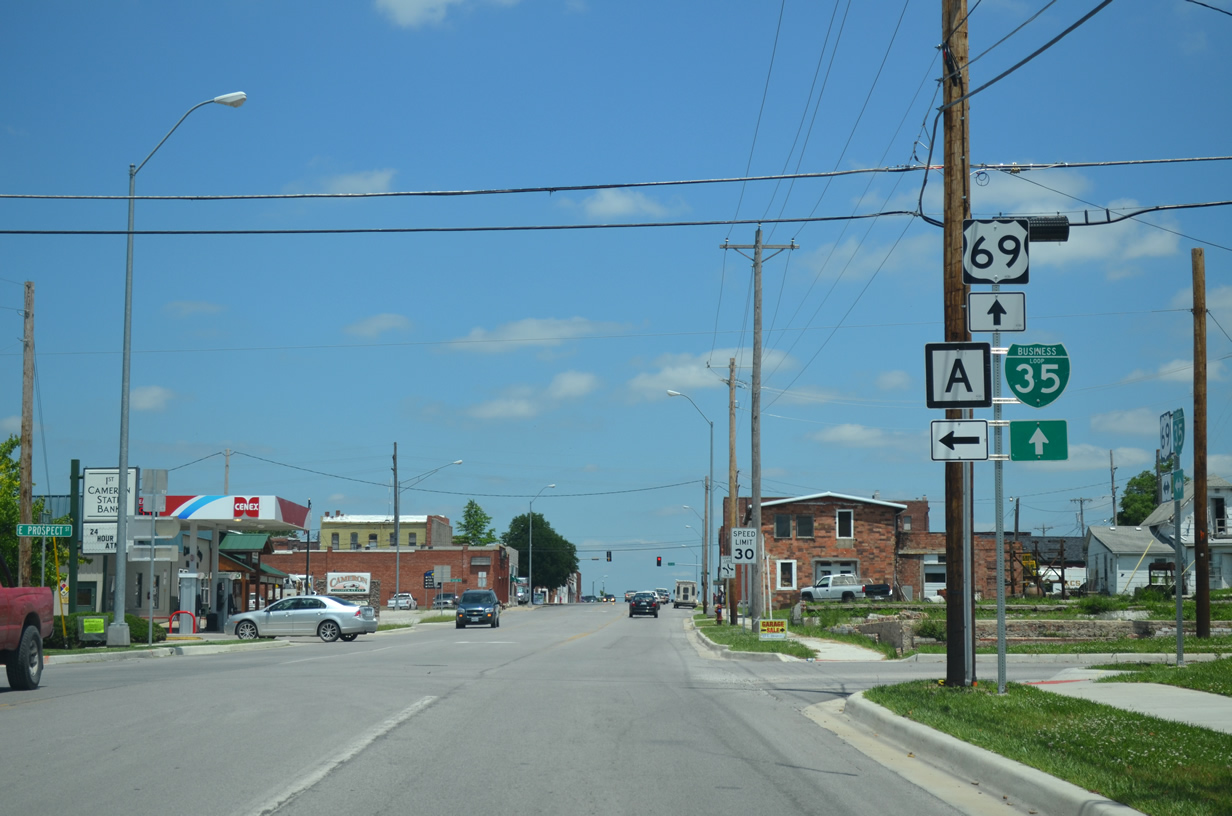
U.S. 69 & Business Loop I-35 (Walnut Street) north at Highway A (Prospect Street) in Cameron. The stretch north of Downtown doubles as U.S. 36 Business as well.
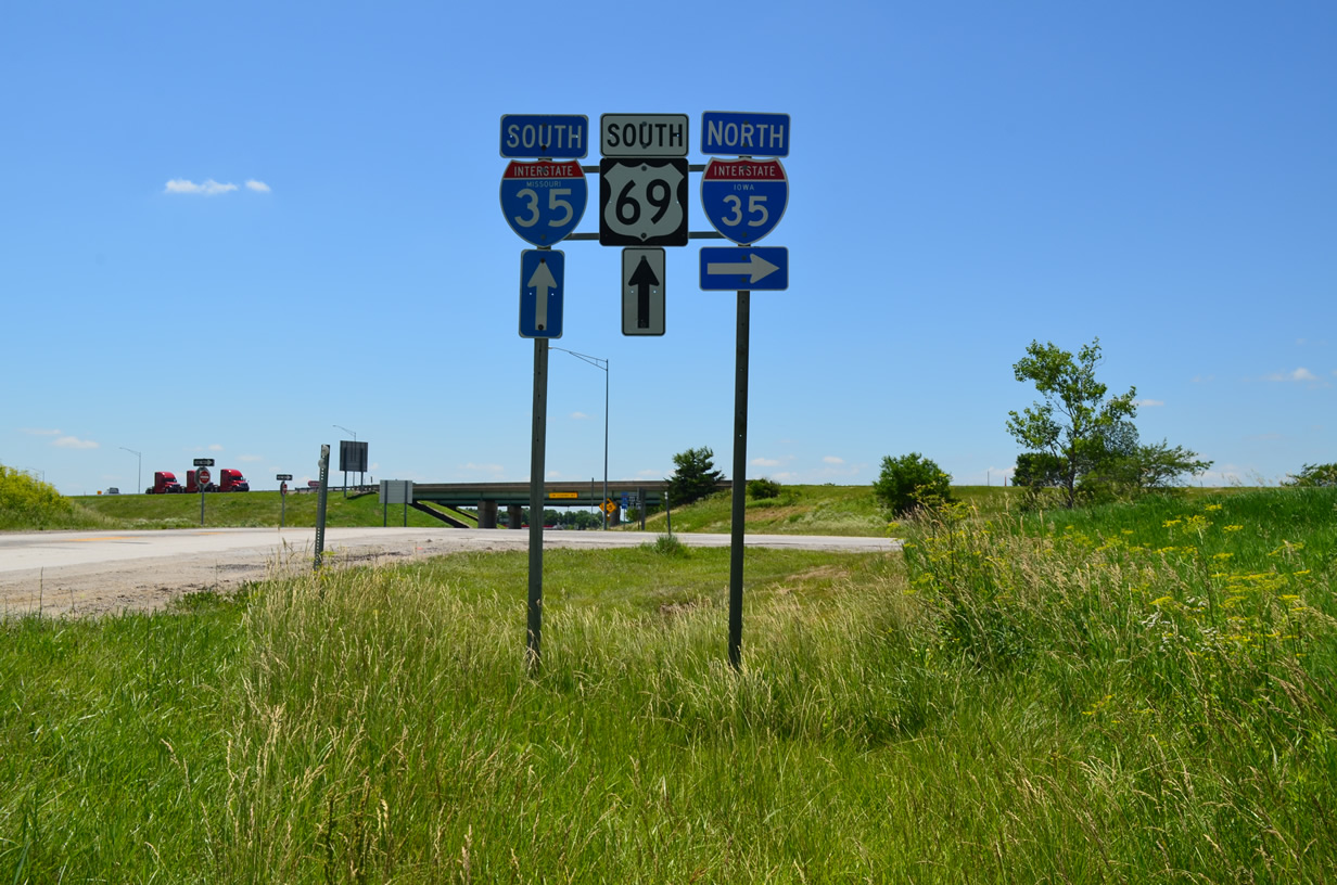
A signing rarity exists at the Missouri and Iowa border where state-named shields are posted for Interstate 35 from each state. These are likely on borrowed time as both MoDOT and IowaDOT are moving away from including the state name on their Interstate shields. Additionally IowaDOT generally posts small guide signs in place of stand alone shields at interchanges now.
Interstate 35 northbound at the North River in Iowa. A new span was built for the eventual southbound lanes here.
Work replaced the 1957-built bridge over the North River and the span over Badger Creek in conjunction with a project to reconstruct the diamond interchange at County Road G14 to meet current geometric standards. Work to resurface Interstate 35 northbound along this stretch and replace the North River Bridge runs through October 31, 2016.
Some temporary ground level signs remain along Interstate 35 between the Raccoon River and Interstate 235.
This stretch of I-35 was expanded as part of $65-million in road work from 2011 to November 2014.
Interstate 235 eastbound at Downtown Des Moines. The entire freeway was rebuilt to modern standards from 2003 to 2007. This included redesigning of many interchanges and widening of the Des Moines River Bridge.
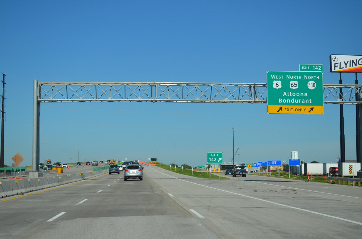
Interstate 80 east at the new two-lane off-ramp (Exit 142) for U.S. 6 (Hubbell Avenue) west and U.S. 65 & Iowa 330 north in Altoona.
Construction to reconfigure Exit 142 at Altoona wraps up on November 25, 2015. Work here eliminated a left-hand directional ramp to U.S. 65 north and realigned the eastbound lanes to run directly along side the westbound carriageway. A loop ramp was also added from U.S. 6 east to I-80 west.
The Cedar River bridge replacement along Interstate 80 includes stubs on the eastbound carriageways built for the eventual plan to six-lane the entire freeway from Des Moines to Davenport.
The plan to widen 170 miles of I-80 from the capital city to the Quad Cities is expected to cost more than $1 billion. The freeway is a busy trucking corridor, with trucks accounting for 31% of the average 29,400 vehicles per day (vpd) recorded between Des Moines and Iowa City. The average vpd increases to 35,100 and 33% trucks east to Davenport and Bettendorf. Shorter widening projects, such as the one at the Cedar River and 2016 project to widen 1.5 miles of I-80 across the Skunk River are part of the overall plan in development. http://yourweeklypaper.com/blog/2014/12/30/plans-being-developed-to-widen-i-80-between-des-moines-and-davenport/
The currently rural trumpet interchange between Interstates 74 and 80 in Davenport is undergoing a major change with construction of a new $110-million casino, event center and hotel complex nearby. The gambling venue replaces the Rhythm City Casino in Downtown Davenport, with the new site chosen do to its proximity to both freeways. Work broke ground in June 2015 and its anticipated for completion in spring 2016. http://kwqc.com/2015/06/04/rhythm-city-casino-resort-breaks-ground-in-davenport/
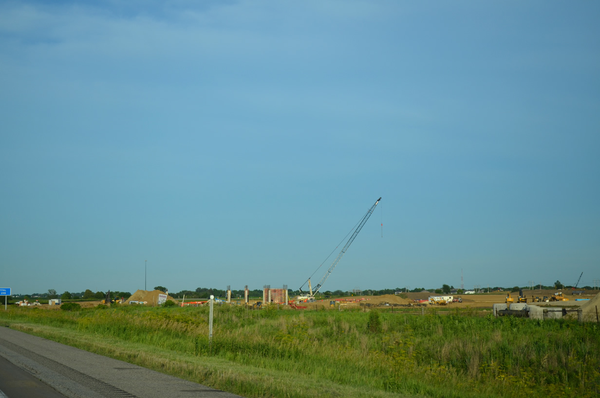
Earth moving and initial work at the future Rhythm City Casino Resort taking place at the southwest quadrant of Interstates 74 and 80. A new overpass above I-74 is under construction at 67th Street to enhance access to the facility.
Last up is our return to Chicago and O’Hare International Airport via Interstate 80.


