|
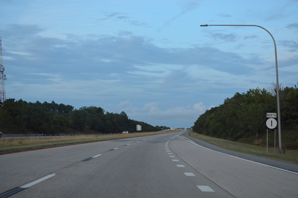
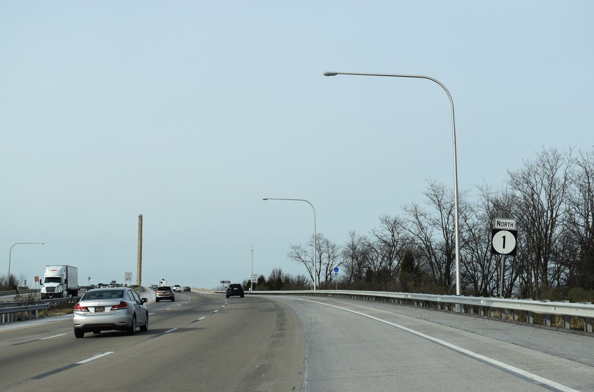
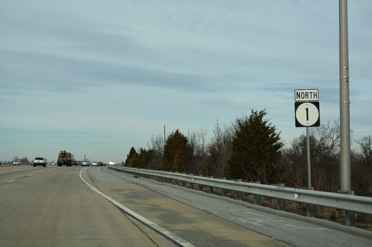
| SR 1 northbound reassurance marker posted beyond the entrance ramp from Exit 119. 06/18/12 |
|
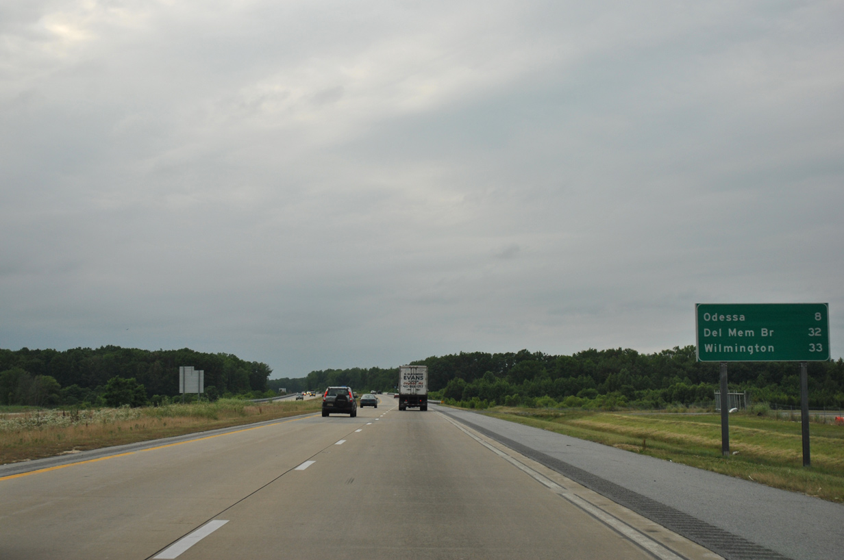
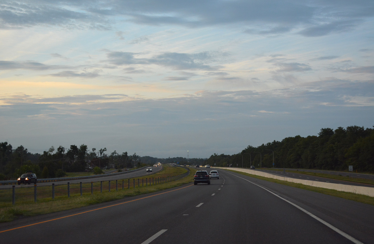
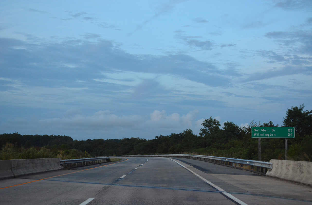
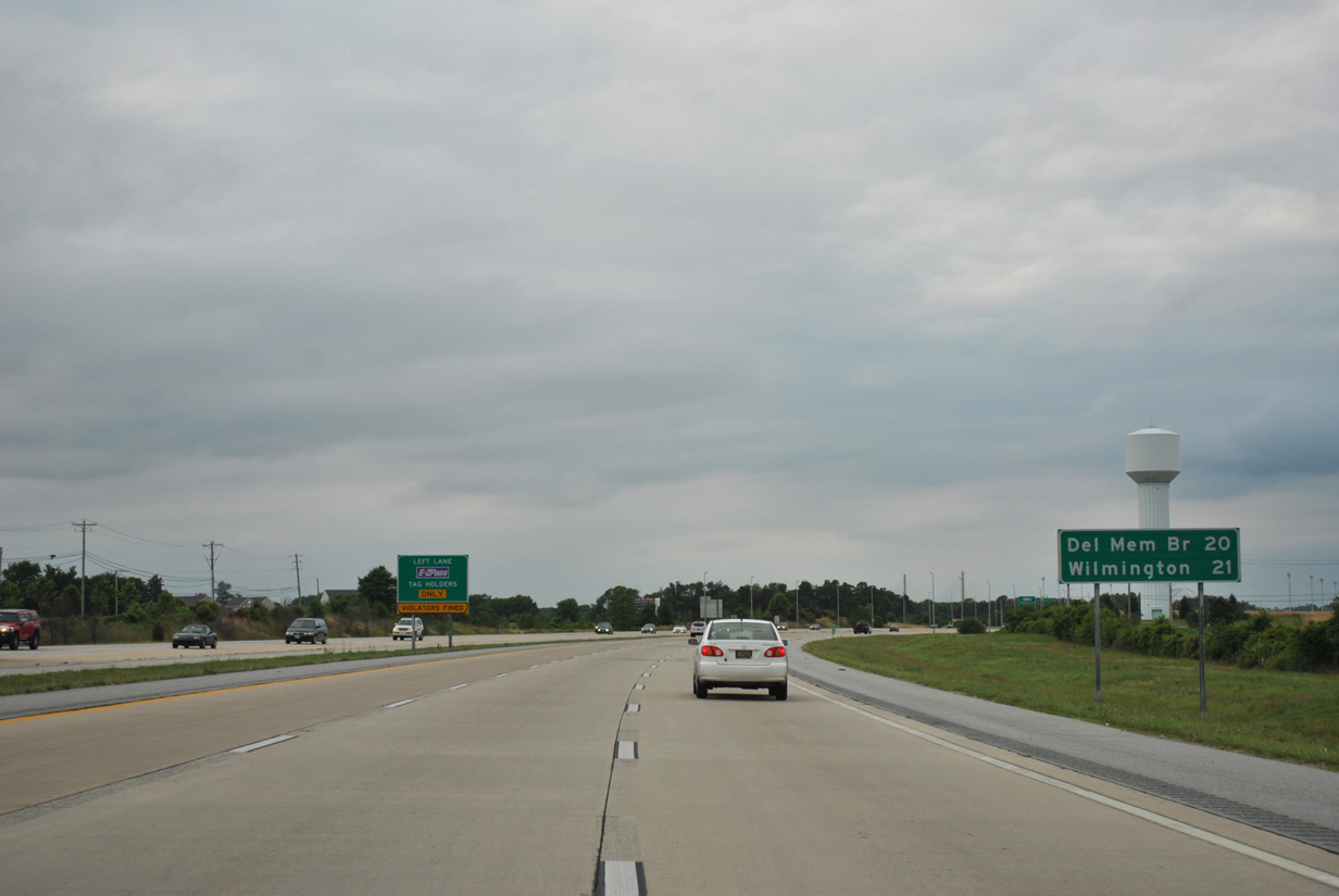
| The longest exit less stretch of SR 1 concludes at Odessa in eight miles. 32 miles remain for motorists headed to New Jersey via the Delaware Memorial Bridge. 06/18/12 |
|
| U.S. 13 and SR 1 trade places south and north of nearby SR 71. An interchange planned between SR 71 and the turnpike was shelved due to funding issues and by local area residents expressing concerns that the exit will overrun the predominantly rural area with development. 06/18/12 |
|
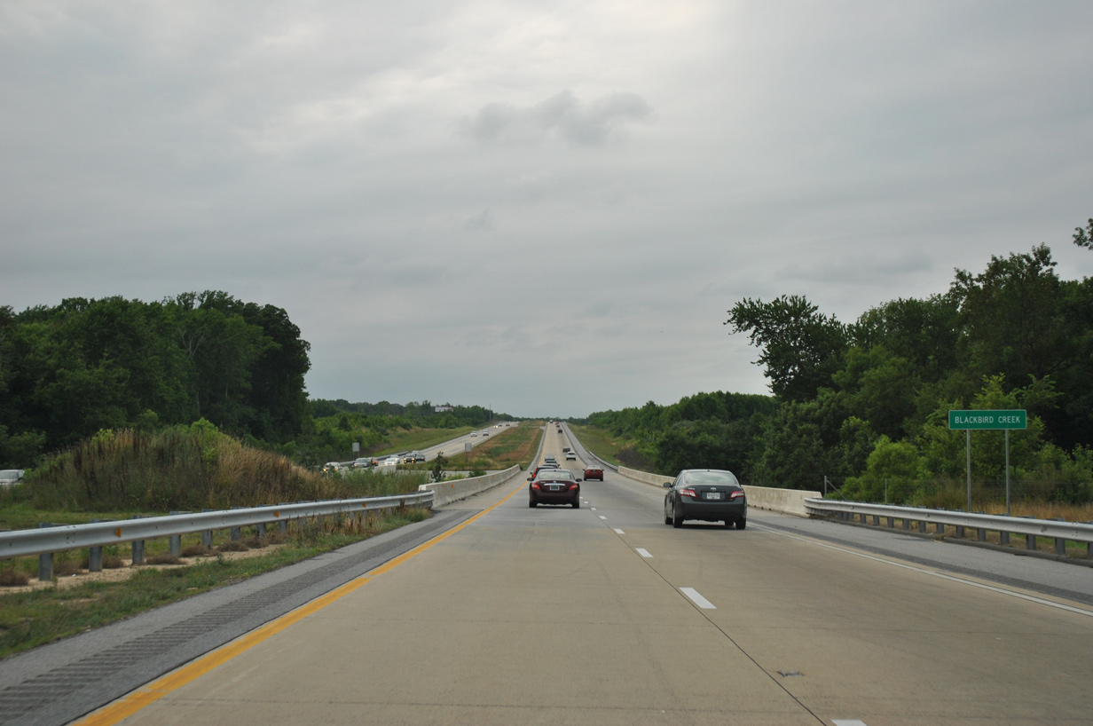
| Spanning Blackbird Creek along SR 1 northbound near the settlement of Blackbird and the U.S. 13 junction with SR 71 (Summit Bridge Road). 06/18/12 |
|
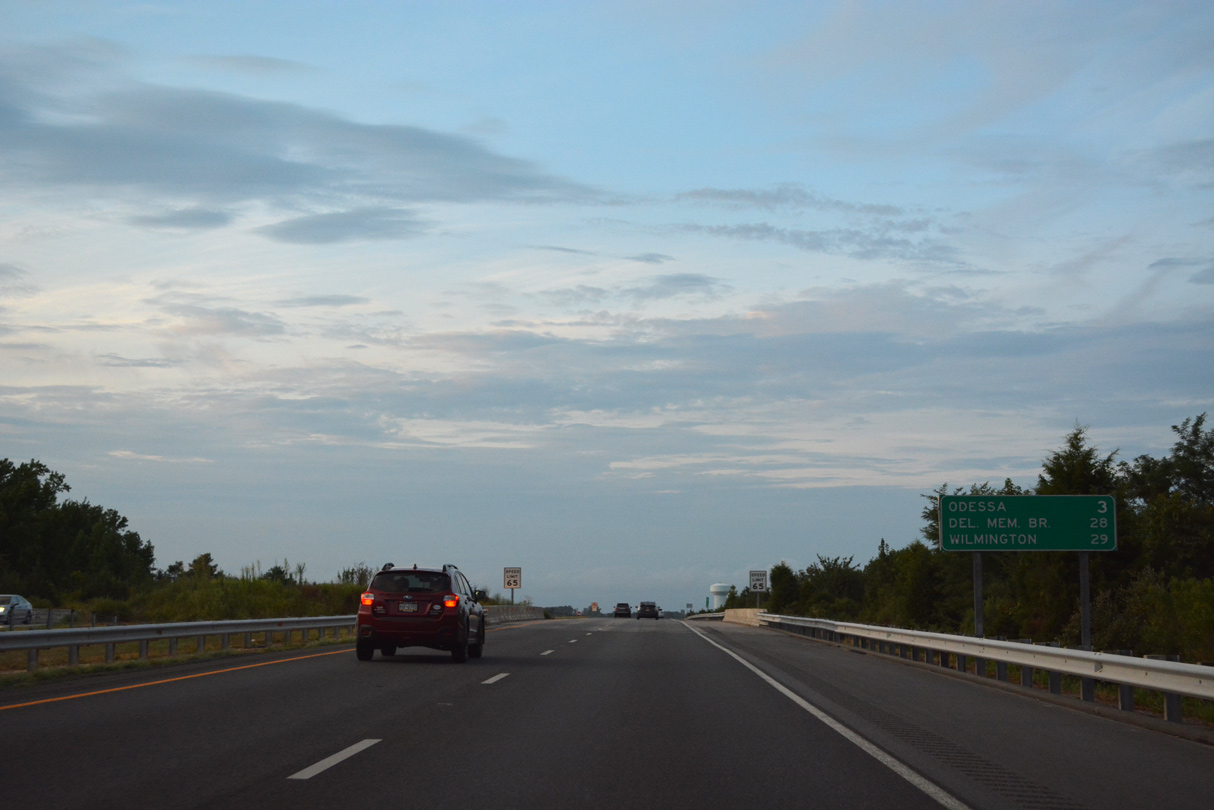
| A reassurance marker appears as SR 1 again parallels the west side of U.S. 13. The turnpike between north Smyrna and Odessa opened to traffic on May 20, 2003. 08/17/21 |
|
| Spanning Pine Tree Road. SR 1 advances three miles north to the town of Odessa. Exceptional development took place in the mid 2000s surrounding Odessa with many subdivisions built east of parallel U.S. 13. 08/17/21 |
|
| U.S. 13 (DuPont Parkway) and SR 1 travel side by side between Fieldsboro Road and Chestnut Lane south of Odessa. Portions of the original Dupont Parkway were relocated due to the construction of the SR 1 toll road here. 08/17/21 |
|
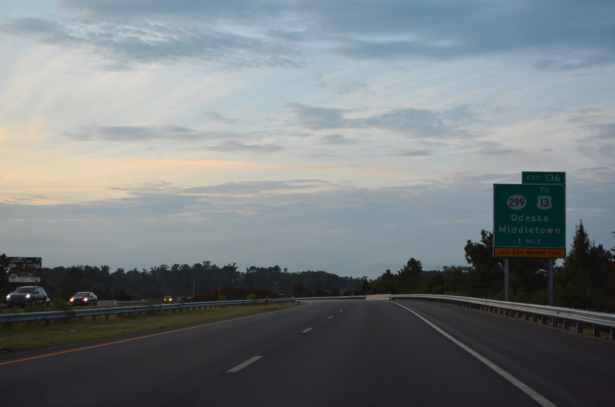
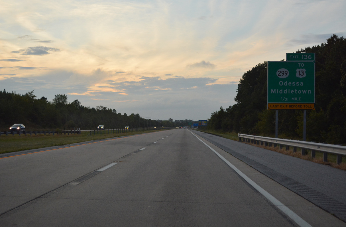
| Entering the Odessa Bypass portion of the SR 1 toll road one mile south of Exit 136. The expressway arcs west of Odessa through a diamond interchange with SR 299. Placards on advance signage reference the last exit before toll as the entranced ramp from U.S. 13 at north Smyrna is not tolled. 08/17/21 |
|
| Annexations by the town of Middletown extend outward to encompass part of SR 1 to Exit 136. Housing development abuts the west side of SR 1 to SR 299 (Middletown Odessa Road) as suburban growth replaced large swaths of farmland between Odessa and Middletown. 08/17/21 |
|
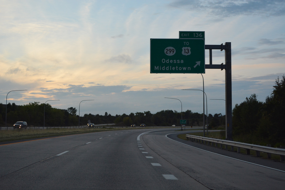
| Exit 136 connects with SR 299 (Middletown Odessa Road) just west of the Odessa town limits. SR 299 overall travels 9.77 miles west from SR 9 at Mathews Corners to MD 282 near Warwick. 08/17/21 |
|
| SR 1 curves northeastward to cross over U.S. 13 (DuPont Parkway) and Drawyer Creek. 08/17/21 |
|
| SR 1 and U.S. 13 intertwine northward for another 10.6 miles to Tybouts Corner. Northeast from there, U.S. 13 continues to I-295 for the Delaware Memorial Bridge and the city of Wilmington. 08/17/21 |
|
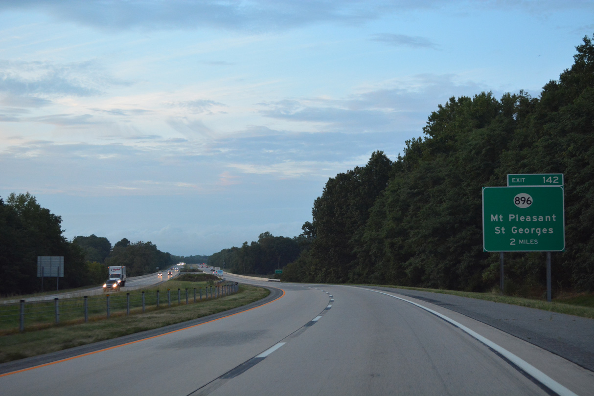
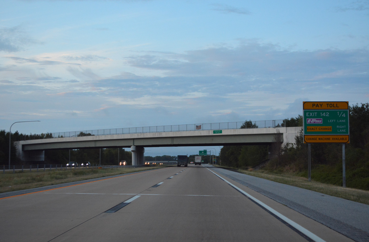
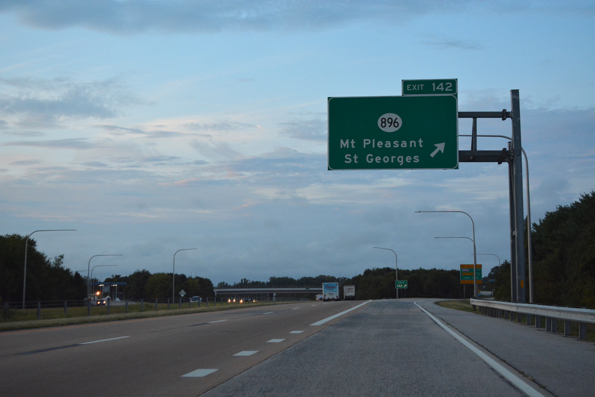
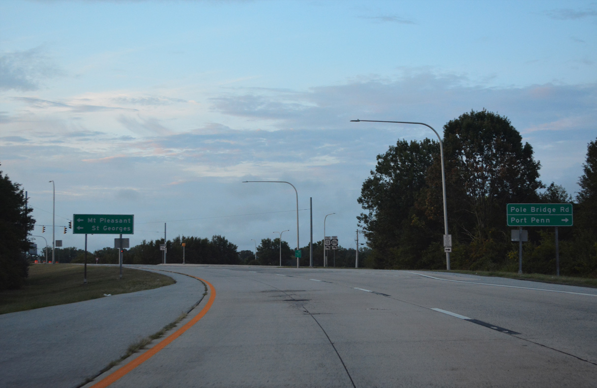
| Pole Bridge Road (Rd 420) links the forthcoming diamond interchange at Exit 142 with U.S. 13 (DuPont Parkway) and SR 896 (Boyds Corner Road) to the west at Boyds Corner and Port Penn Road (Rd 2) to the east near Thorntown. 08/17/21 |
|
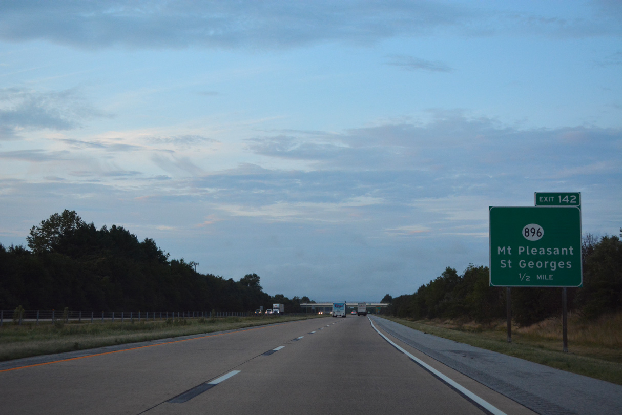
| Exit 142 serves the Bayberry development west along SR 896 (Boyds Corner Road) between U.S. 13 at Boyds Corner and SR 71 at Mount Pleasant. 08/17/21 |
|
| Tolls are collected along Exit 142 from SR 1 northbound. 08/17/21 |
|
| Exit 142 leaves SR 1 north for Pole Bridge Road west to SR 896 north and U.S. 13 (Dupont Highway). There are no further exits along SR 1 north ahead of the Chesapeake and Delaware Canal at St. Georges. 08/17/21 |
|
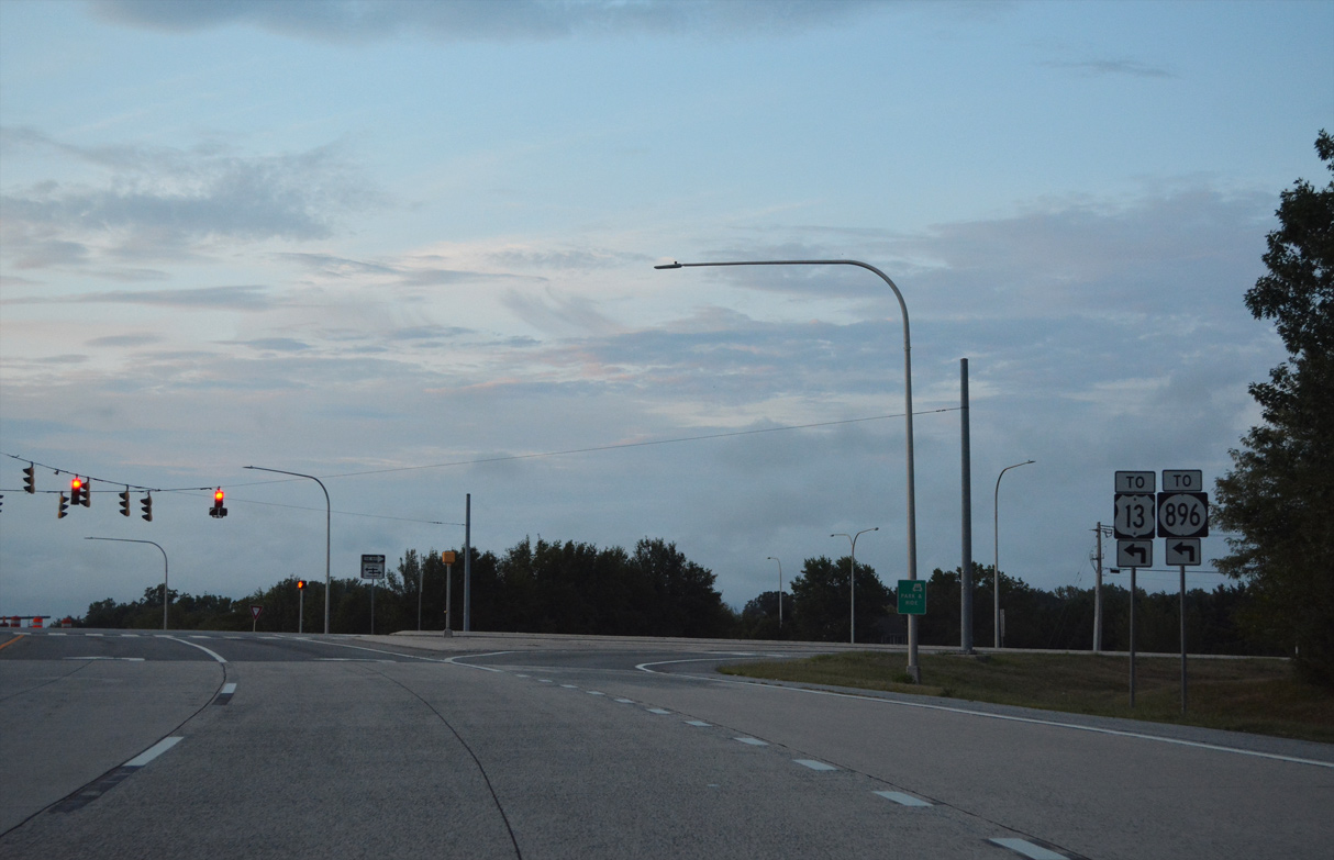
| Pole Bridge Road (Road 420) branches 2.52 miles west from Port Penn Road (Road 2) to U.S. 301 and the south end of SR 896 at Boyds Corner. 08/17/21 |
|
| SR 896, in conjunction with SR 71, serves suburban areas of Middletown to the south and Summit Bridge to the north. 08/17/21 |
|
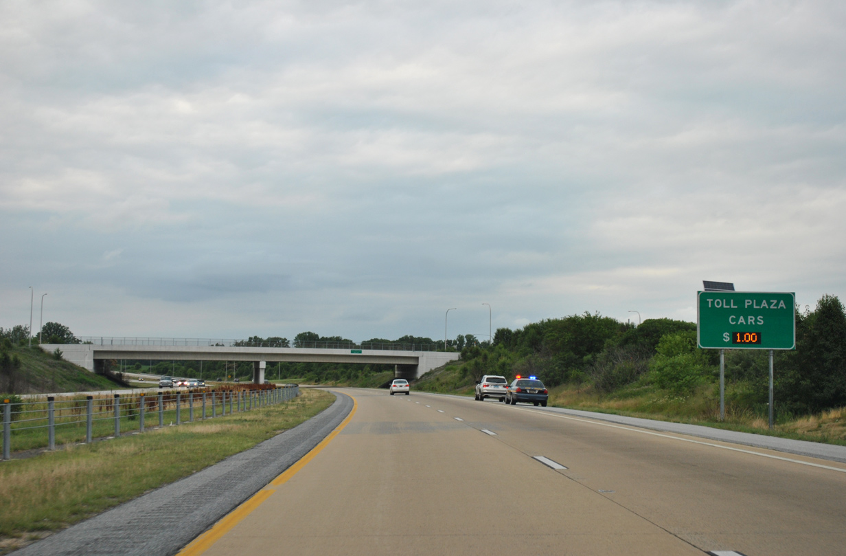
| SR 1 advances north from Boyds Corner to the Biddles Corner Toll Plaza. 06/18/12 |
|
| SR 1 shifts west of U.S. 13 (DuPont Parkway) again leading into the Biddles Corner Toll Plaza. 06/18/12 |
|
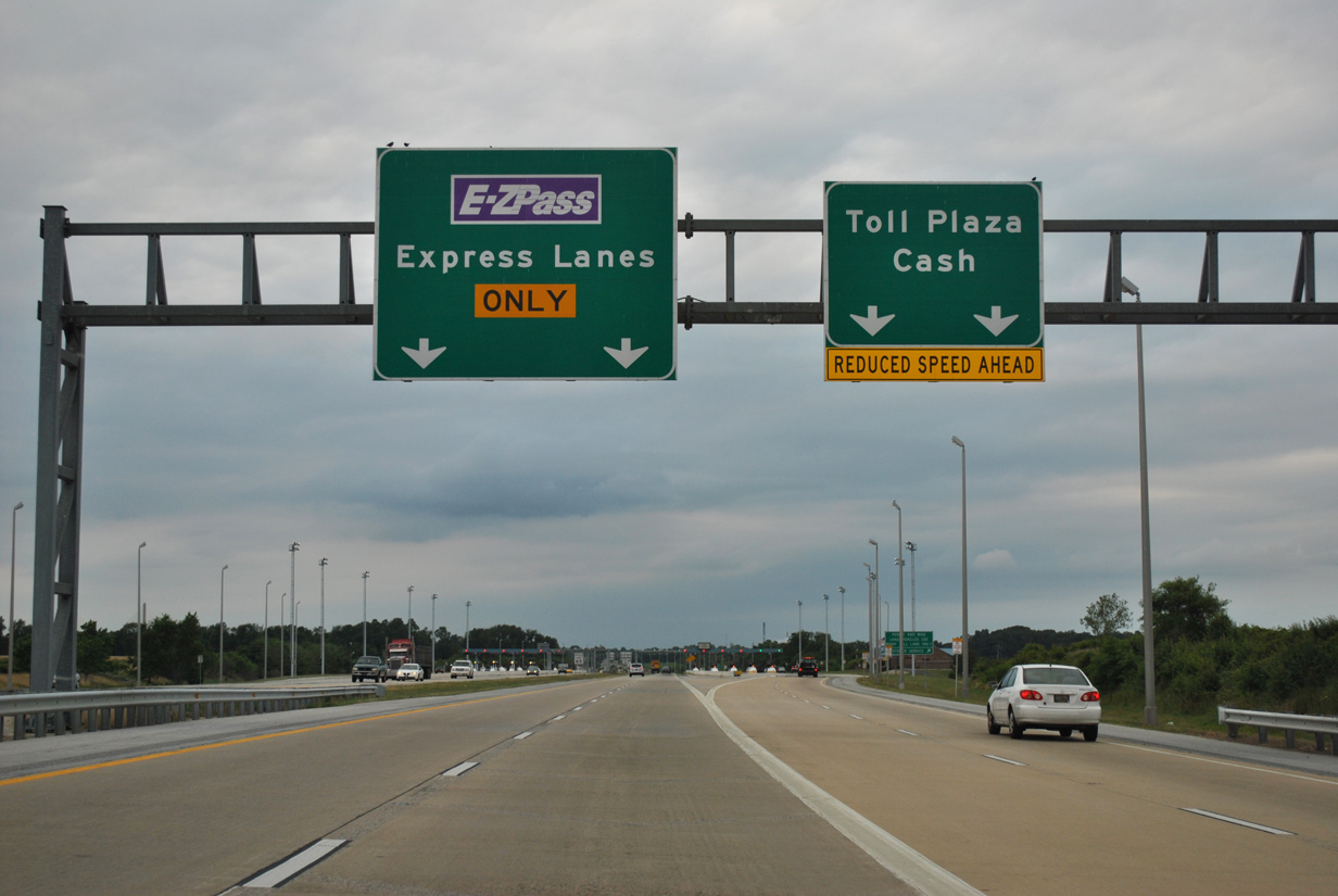
| Built in 1999, the Biddles Corner Toll Plaza separates E-ZPass customers from cash paying customers similar to the Dover plaza. 06/18/12 |
|
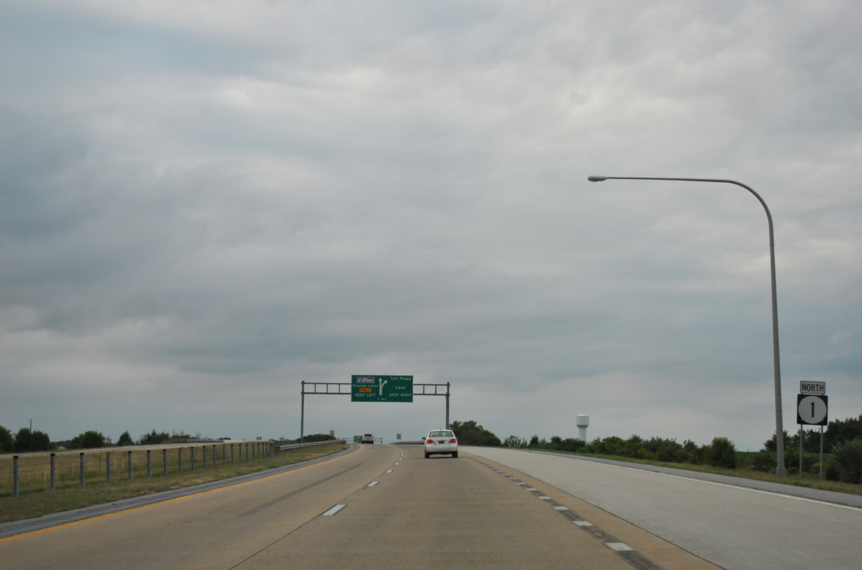
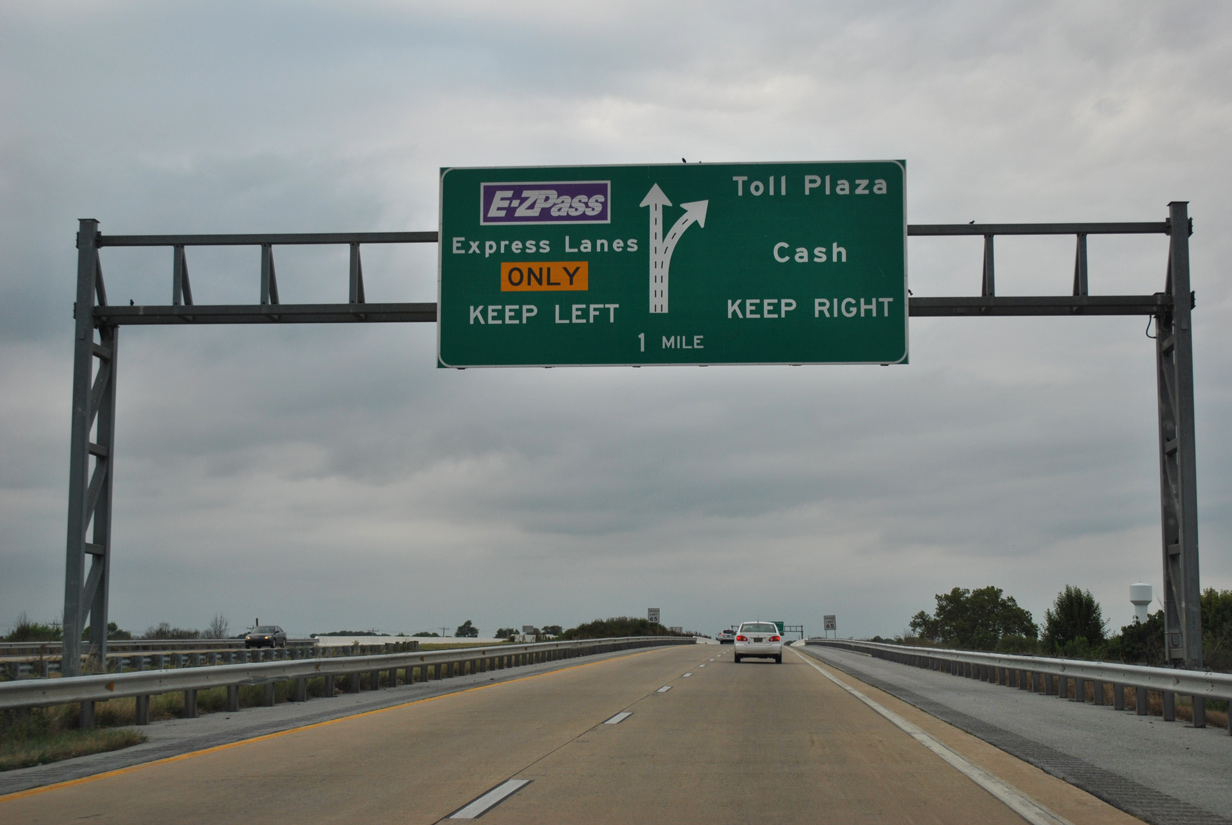
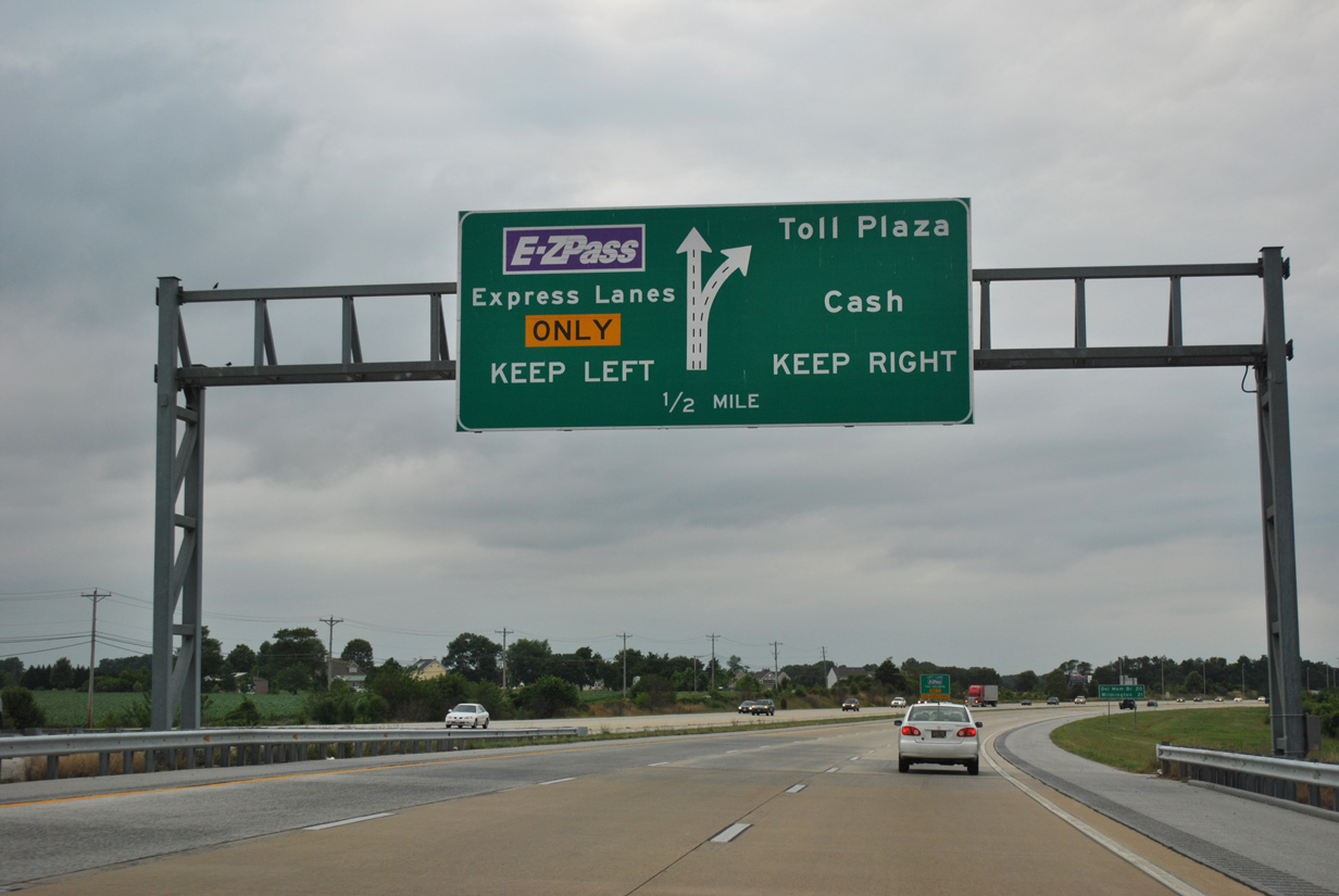
| Traffic partitions in a half mile at the Biddles Corner Toll Plaza. High speed E-ZPass are to the left while the attended booths for cash toll collection are to the right. 06/18/12 |
|
| 21 miles south of Wilmington, a distance sign precedes the toll collection point. 06/18/12 |
|
| Cash toll rates vary with $1.00 charged for passenger vehicles during weekdays and $3.00 on weekends. Variable rates went into effect on October 1, 2007 and increased on August 1, 2014. 06/18/12 |
|
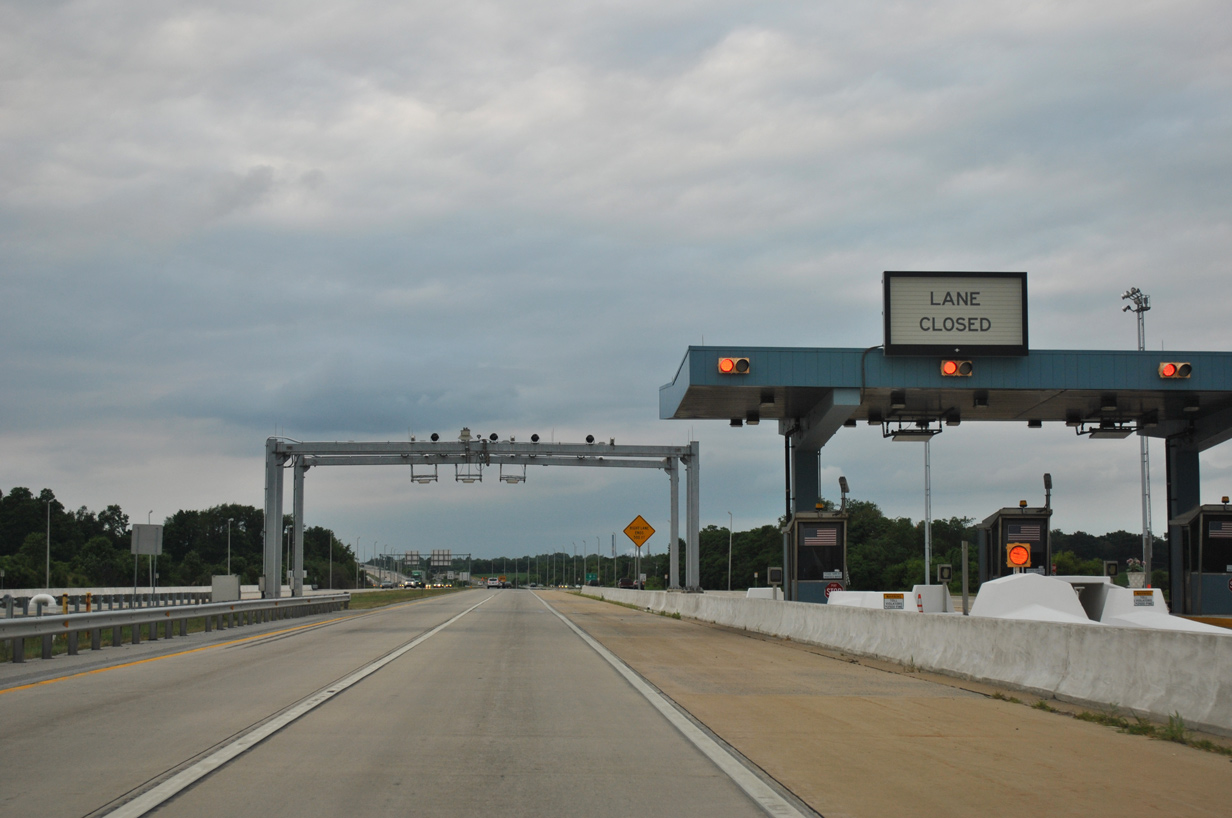
| Open road tolling accommodates four lanes through the Biddles Corner Toll Plaza. 06/18/12 |
|
| U.S. 13 (Dupont Highway) travels alongside SR 1 into South St. Georges. Providing local access across the Chesapeake and Delaware Canal Bridge, an entrance ramp joins the freeway from U.S. 13 at Port Penn Road. 12/30/18 |
|
| Opened to traffic on January 10, 2019, U.S. 301 (First Responders Memorial Highway) concludes at a wye interchange with SR 1. The entrance ramp from Port Penn Road merges with U.S. 301 just ahead of the SR 1 northbound roadway. 12/30/18 |
|
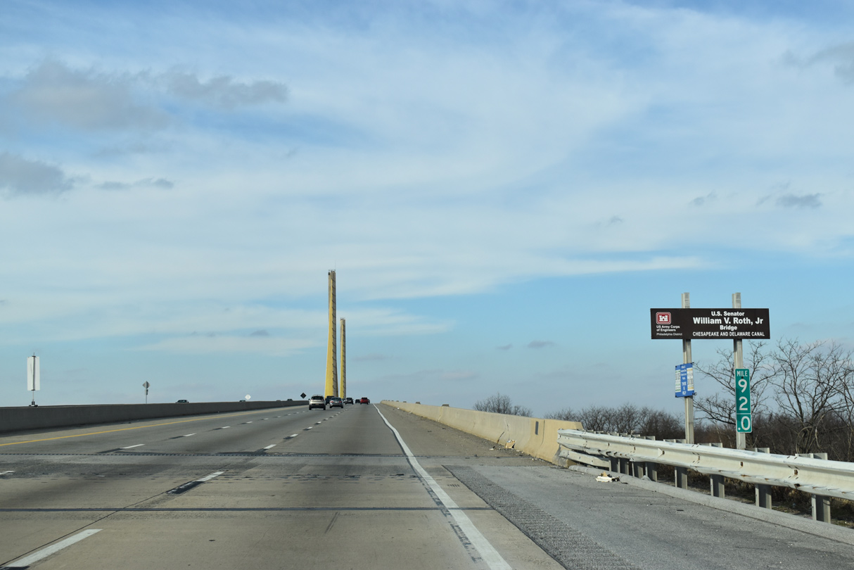
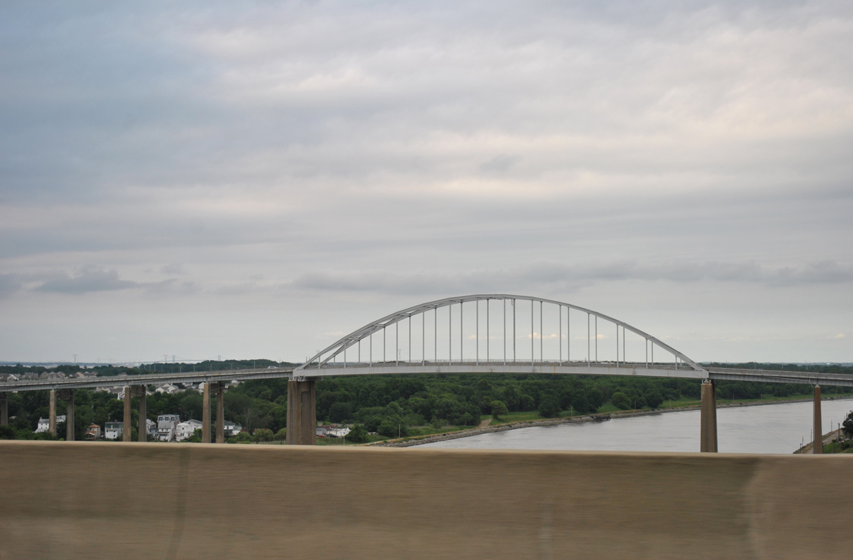
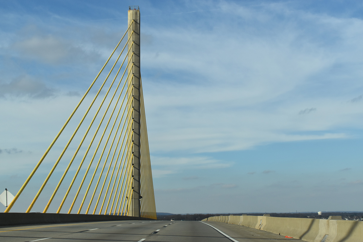
| SR 1 spans the Chesapeake and Canal between South and North St. Georges. Carrying six lanes of traffic, wide shoulders on either side of the span can be restriped to accommodate an additional lane. 12/19/20 |
|
| The Cheasapeake & Delaware Canal Bridge was dedicated as the U.S. Senator William V. Roth, Jr. Bridge by the Delaware Legislature on July 9, 2007. The span opened to traffic on December 23, 1995. 12/30/18 |
|
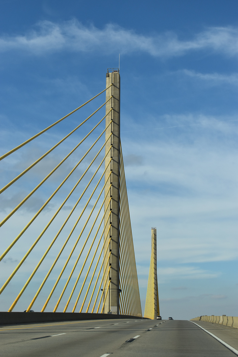
| The 4,498 foot long cable-stayed bridge crosses the C & D Canal at a height of 145 feet. Costing $57.8 million overall to build, the first contract for construction of the span was awarded on April 1, 1992.1 12/30/18 |
|
| Cables supporting the Chesapeake and Delaware Canal Bridge are painted gold, a tribute to one of the state colors (the other being blue). 12/30/18 |
|
| The SR 1 canal bridge replaced the adjacent St. Georges Bridge as the main route between Wilmington and Dover. Built in 1943, the steel arch bridge joins North and South St. Georges along U.S. 13 (Dupont Parkway). 06/18/12 |
|
| Since removed, one the original features of the C&D Canal Bridge was illumination of the towers and cables. Unfortunately during a 2005 snowstorm, a snow plow left in the upright position knocked over several of the light poles. Lighting also resulted in sight issues for mariners along the canal. 12/30/18 |
|
| Descending toward North St. Georges along SR 1 north on the Roth Bridge. Iron Hill, with an elevation of 331 feet, rises along the northern horizon from near Newark. 12/19/20 |
|
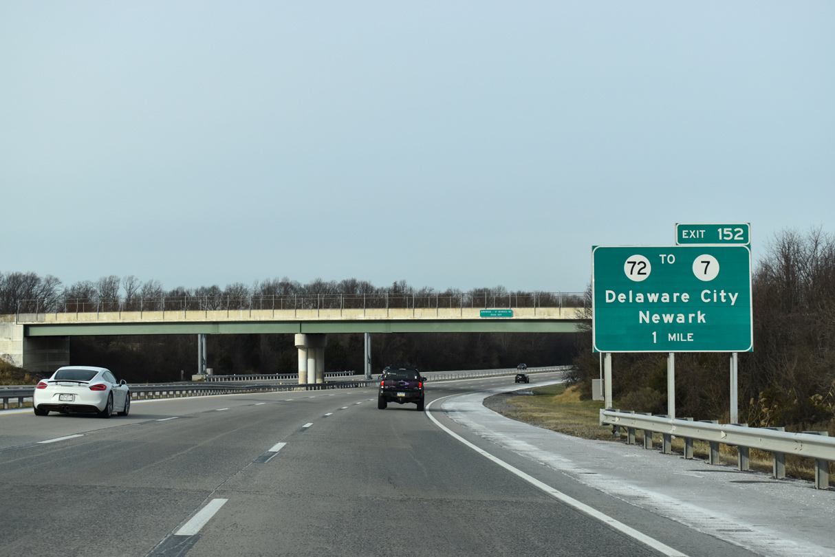
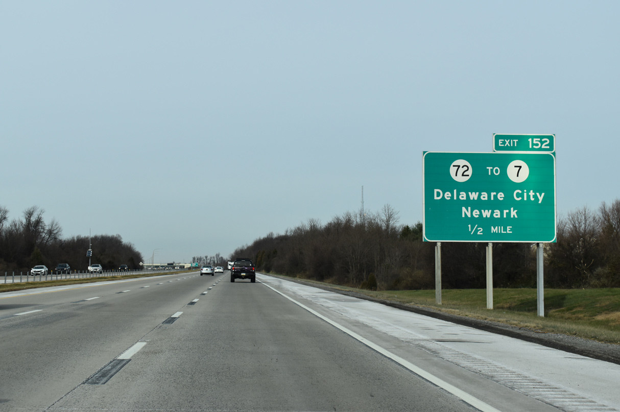
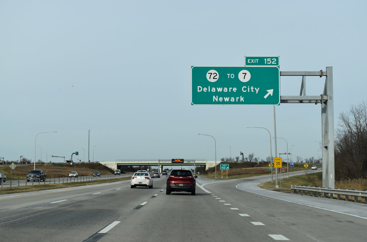
| The succeeding exit joins SR 1 north with U.S. 13 south and SR 72 (Wrangle Hill Road) at Wrangle Hill. U.S. 13 accompanies SR 1 north between Exit 152 and 156 while Dupont Highway north to Bear Corbitt Road is a part of SR 7 north to Red Lion. 12/19/20 |
|
| Forthcoming SR 72 arcs northwest from SR 9 near Delaware City to the city of Newark. Area points of interest include Fort DuPont, Fort Delaware and Lums Pond State Park. 12/19/20 |
|
| Exit 152 departs for SR 72 north to Newark, U.S. 13 south to St. Georges and SR 7. SR 7 runs 16.87 miles north from Wrangle Hill to Bear, Christiana, Churchmans Crossing and the Pennsylvania state line north of Pike Creek Valley. Road work from Spring 2016 to January 2017 reconfigured Exit 152 into a diverging diamond interchange (DDI), the first in the state of Delaware. 12/19/20 |
|
| U.S. 13/SR 1 pass over both a Norfolk Southern Railroad spur and SR 7 (Dupont Highway) beyond this confirming marker. 12/26/22 |
|
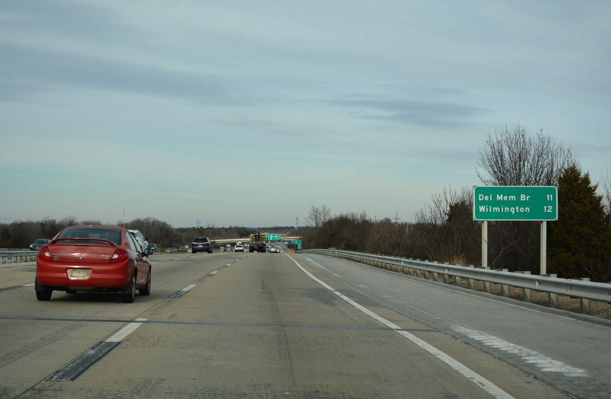
| Wilmington is 12 miles to the northeast via SR 1 and U.S. 13 (Dupont Highway) and 14 miles via SR 1 and Interstate 95. 12/26/22 |
|
| This guide sign is a copy of one posted along U.S. 13 (Dupont Highway) north for the first section of SR 1 built north of Milford. The Bear-Tybouts segment of SR 1 was constructed between 1990 and 1992. 12/26/22 |
|
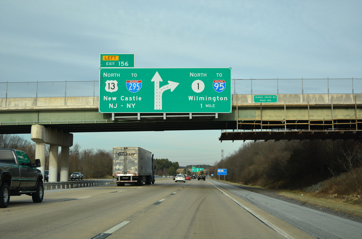
| School House Road (Rd 406) passes over U.S. 13/SR 1 north, one mile from the separation at Exit 156. Travelers headed to I-295 and the Delaware Memorial Bridge are directed to take U.S. 13 north to the Farnhurst interchange instead of SR 1 north to I-95. 12/26/22 |
|
| U.S. 13 (Dupont Parkway) continues northeast to combine with U.S. 40 in 3.5 miles ahead of Hares Corner. U.S. 13/40 run concurrent for 3.56 miles to New Castle County Airport (ILG) and Interstate 295 at Farnhurst. 12/26/22 |
|
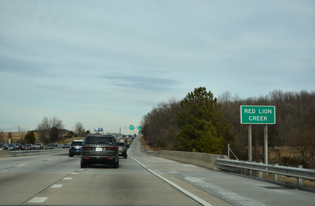
| Construction of SR 1 directly replaced U.S. 13 (Dupont Highway) across Red Lion Creek. Two segments of old Dupont Highway remain in service for local access to the southwest. 12/26/22 |
|
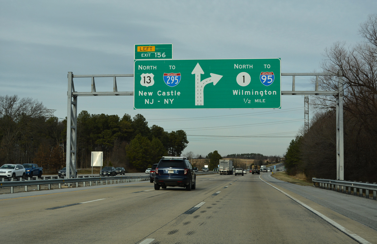
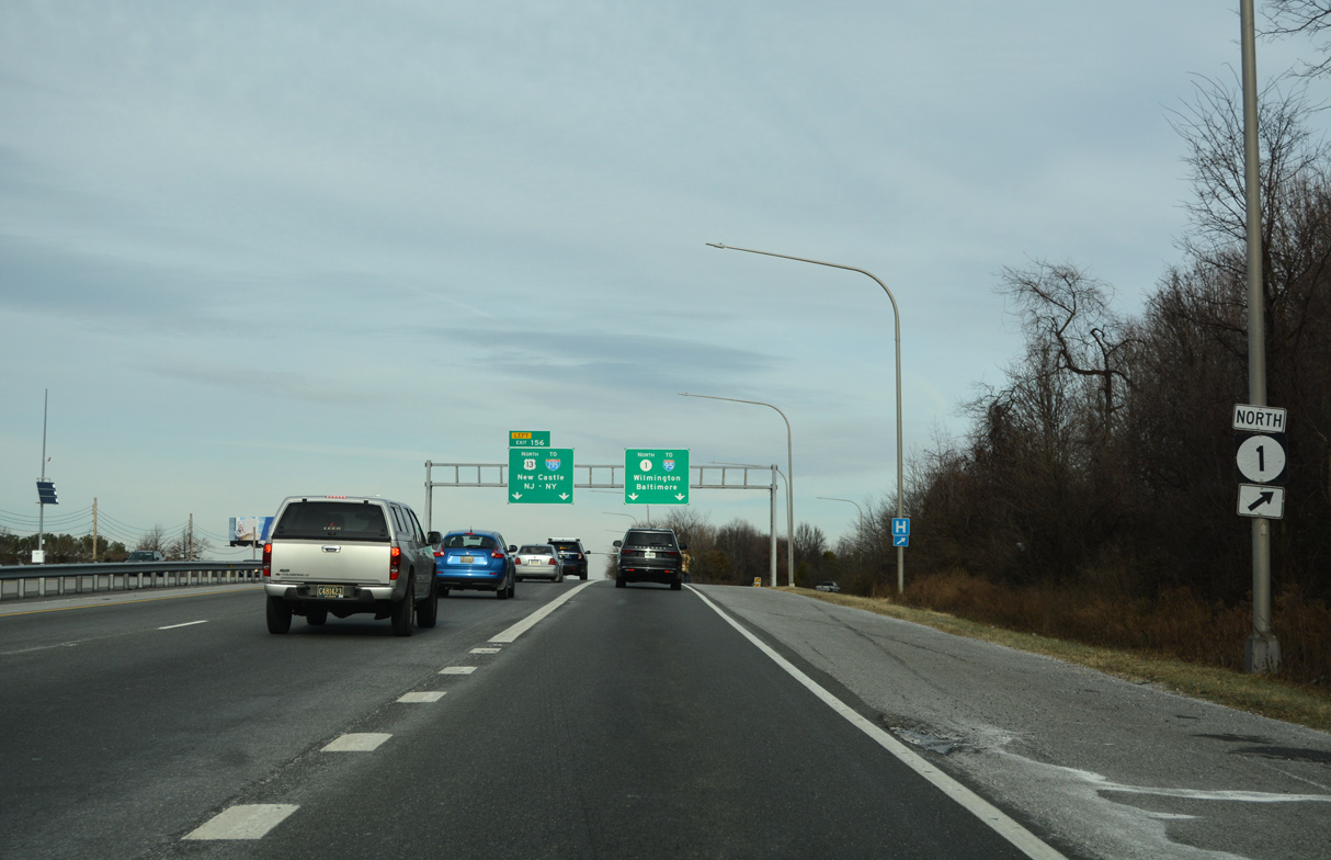
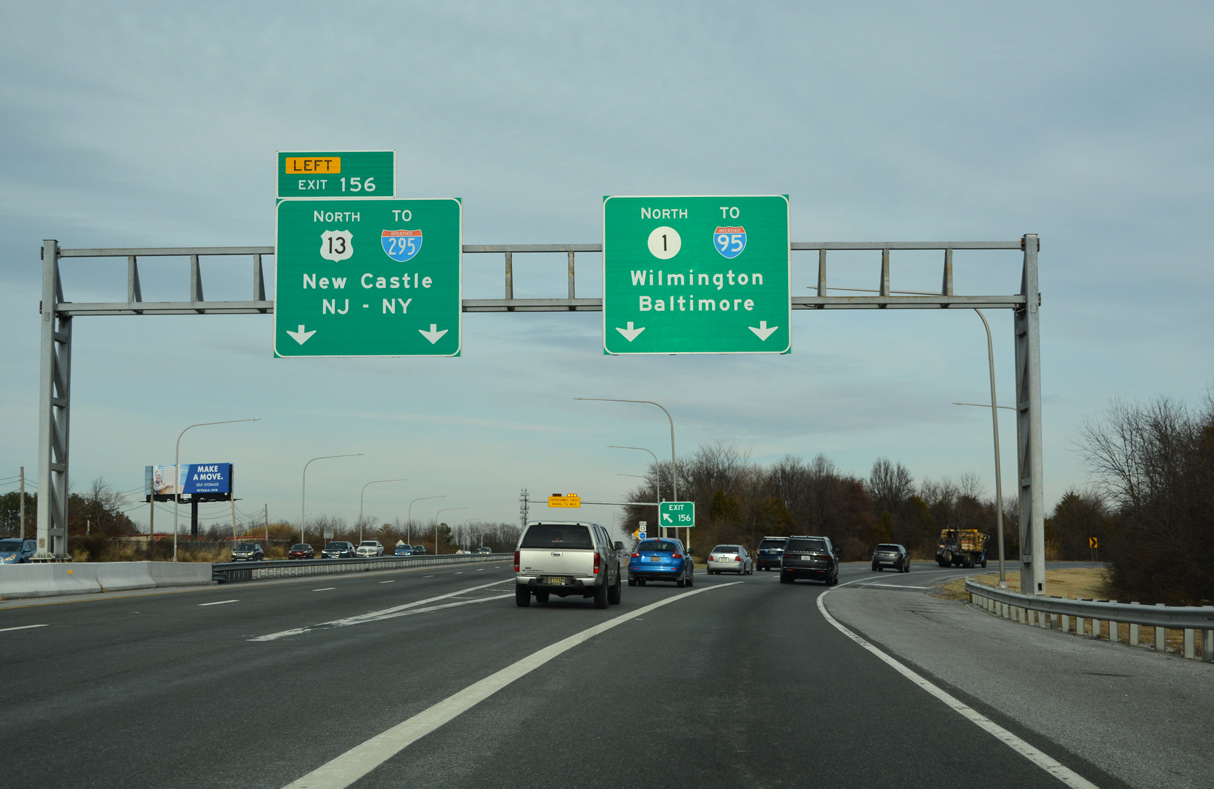
| SR 1 splits with U.S. 13 north at a trumpet interchange (Left Exit 156). A project study evaluates improvements at this exchange with potential new ramps between U.S. 13 and adjacent SR 71 (Red Lion Road). 12/26/22 |
|
| U.S. 13 remains along Dupont Highway from Tybouts Corner to Wilmington as SR 1 branches northward from Exit 156 to Bear, Christiana and Churchmans Crossing. 12/26/22 |
|
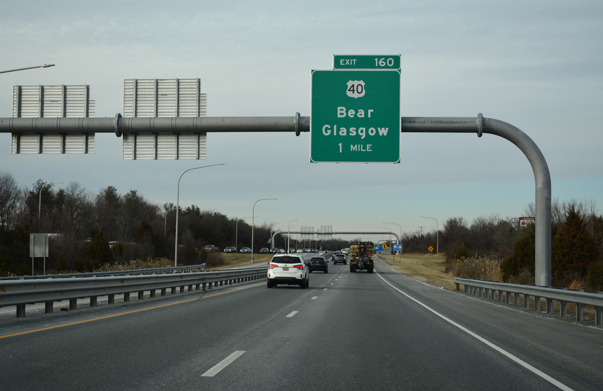
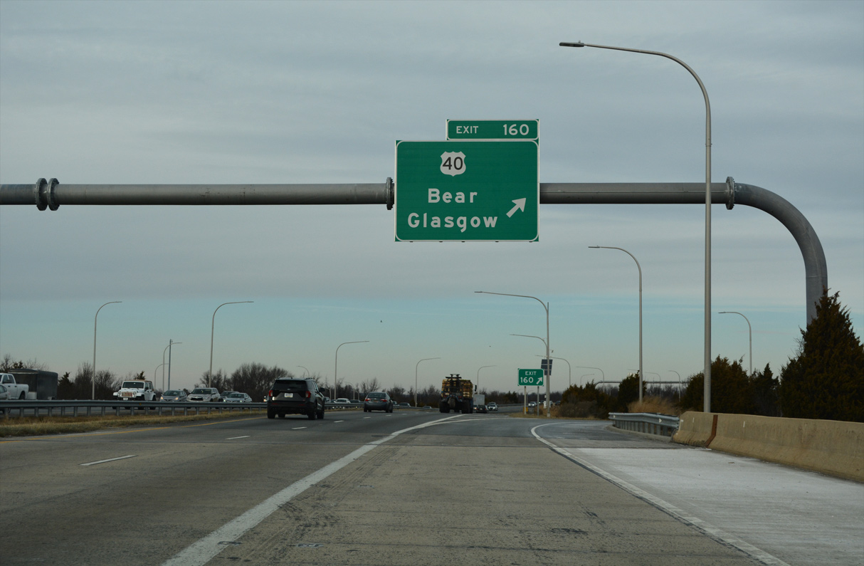
| SR 1 turns north along a suburban corridor to Churchmans Crossing. Meeting the freeway next is U.S. 40 (Pulaski Highway) at a parclo interchange (Exit 160). 12/26/22 |
|
| Signs for Exit 160 were changed in 2013 to reflect Bear and Glasgow in place of State Road and Elkton, Maryland. Bear is an unincorporated community centered around the crossroads of U.S. 40 and SR 7, while Glasgow lies west along U.S. 40 at SR 896. 12/26/22 |
|
| Exit 160 departs SR 1 north for U.S. 40 (Pulaski Highway) just east of SR 7 at Bear. 12/26/22 |
|
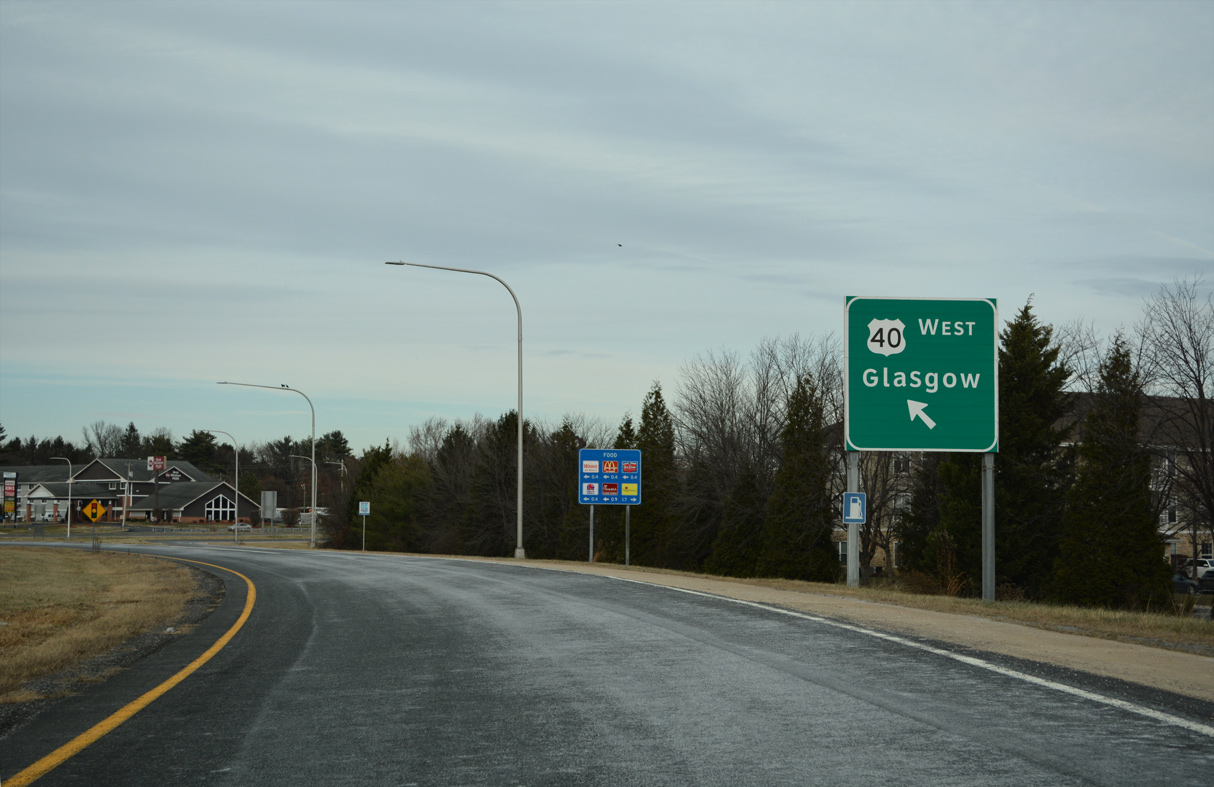
| U.S. 40 follows Pulaski Highway west from U.S. 13 at State Road to Baltimore, Maryland. The arterial route through Delaware is entirely suburbanized, with numerous traffic lights and heavy development. 12/26/22 |
|
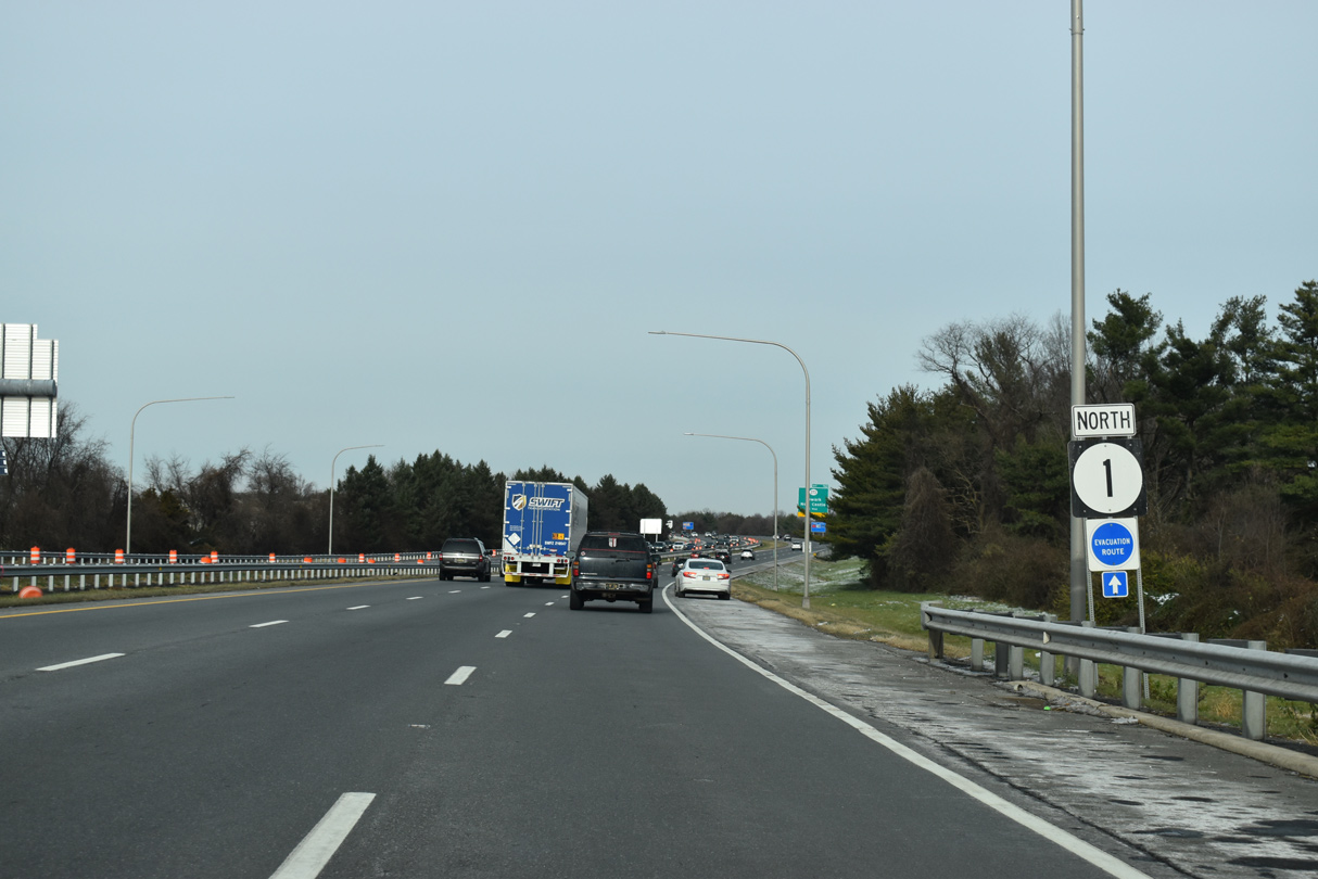
| Construction in Fall 2015 expanded SR 1 north with an auxiliary lane from U.S. 40 to SR 273. 12/19/20 |
|
| SR 273 is a heavily traveled commuter route between the cities of Newark and New Castle. The four lane arterial was widened from SR 1 east to U.S. 13/40 at Hares Corner in the mid 1990s. 12/19/20 |
|
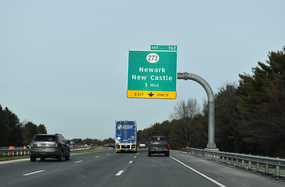
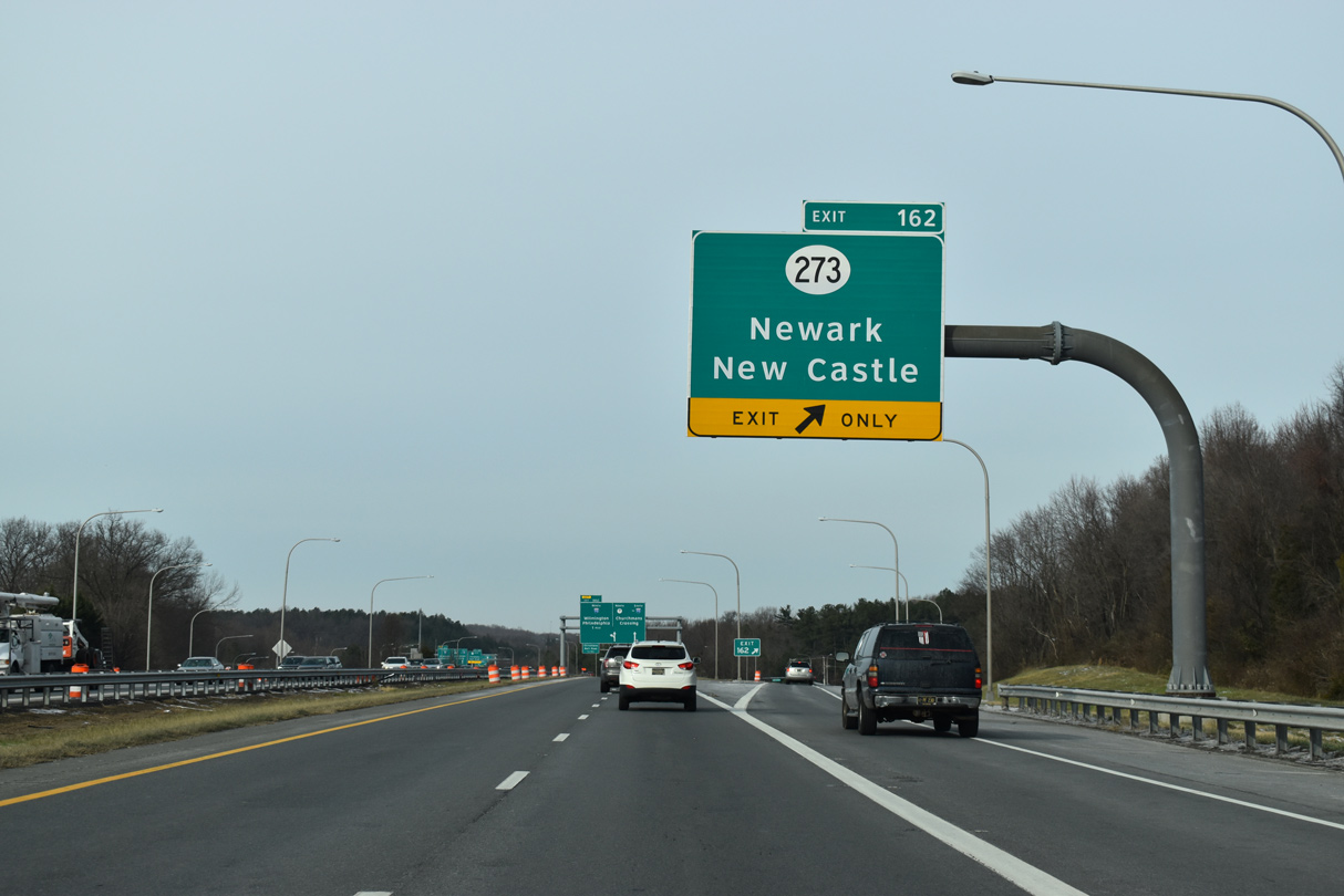
| A diamond interchange (Exit 162) joins SR 1 with SR 273 (Christiana Bypass). SR 273 locally serves the community of Christiana via connections with SR 7 (E Main Street) and Old Baltimore Pike. Until 1987, when the Christiana Bypass opened west to I-95, SR 273 overlapped with SR 7 into Christiana. 12/19/20 |
|
| Exit 162 departs SR 1 north for SR 273 (Christiana Road) to Christiana and Hares Corner.
Future construction will address congestion at this exchange. 12/19/20 |
|
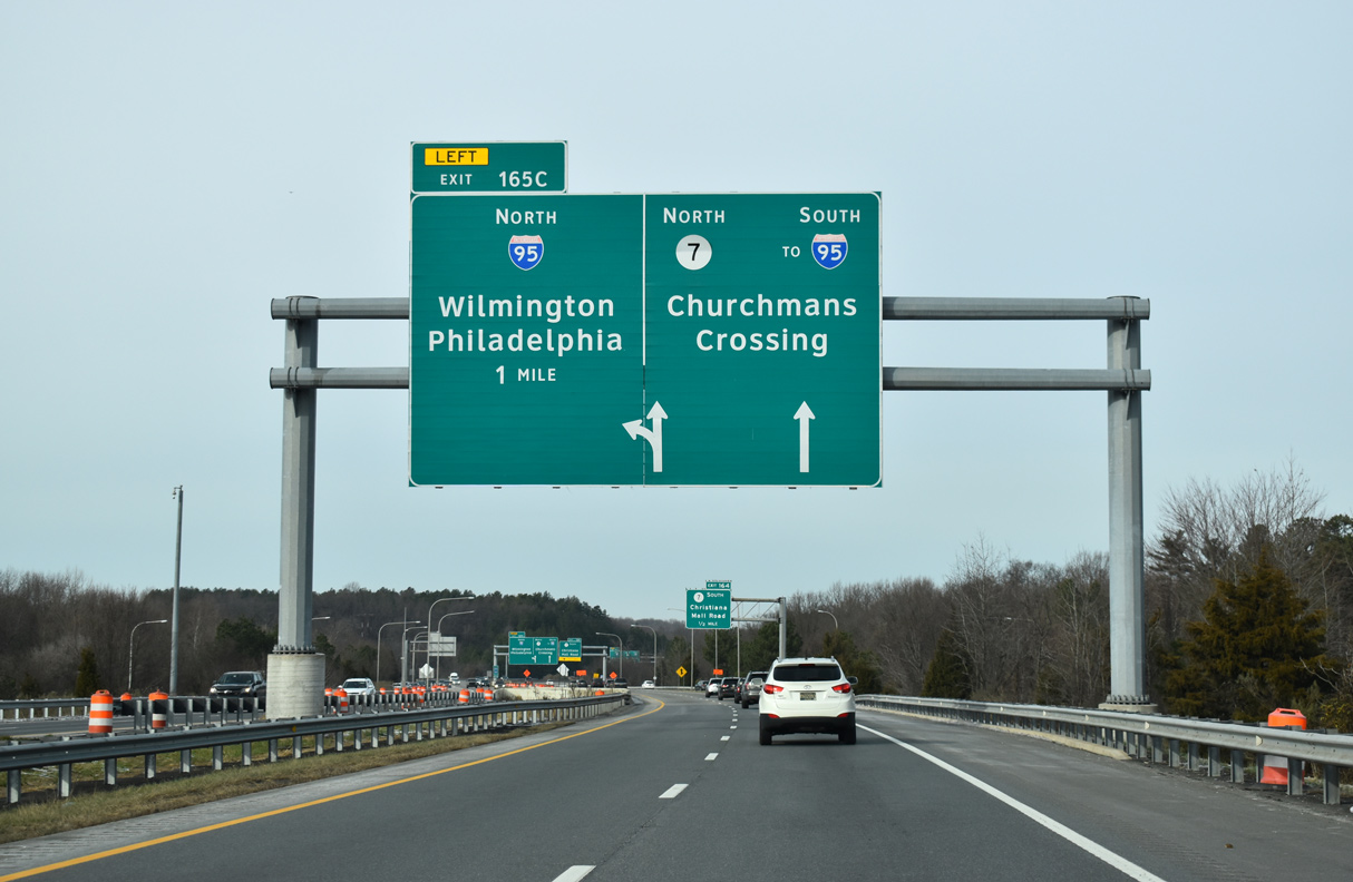
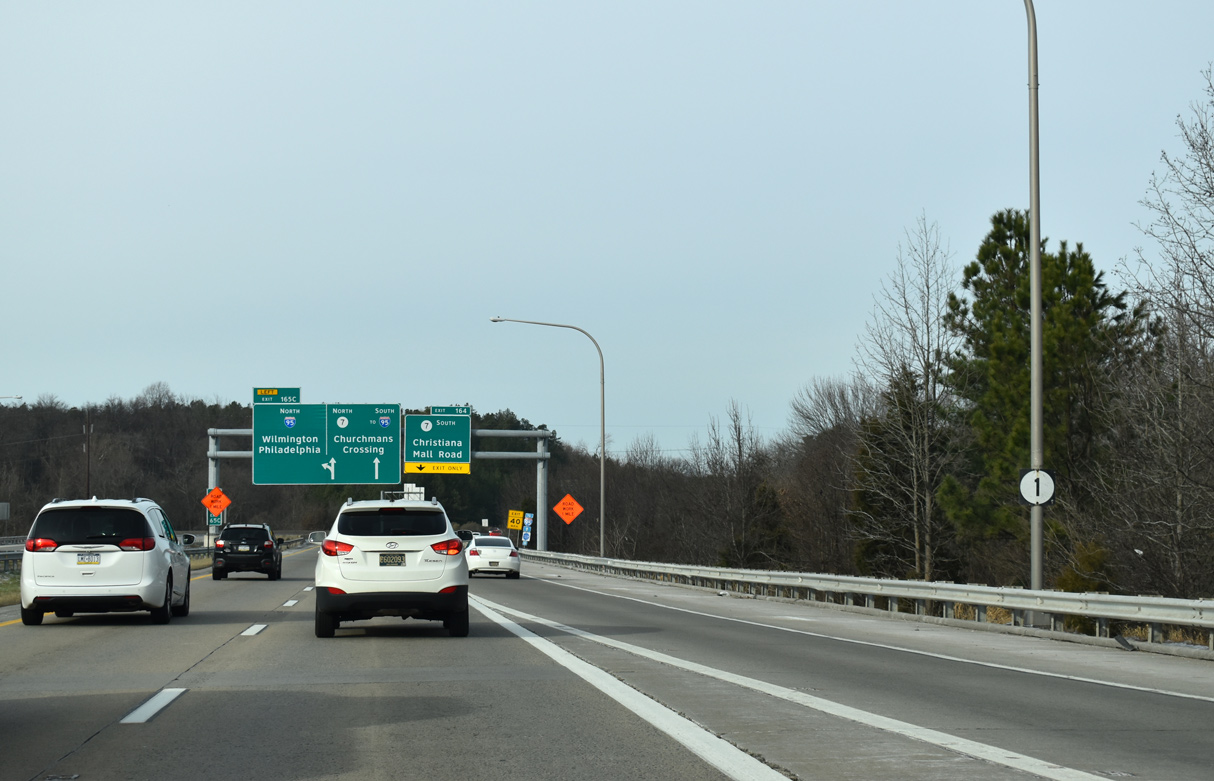
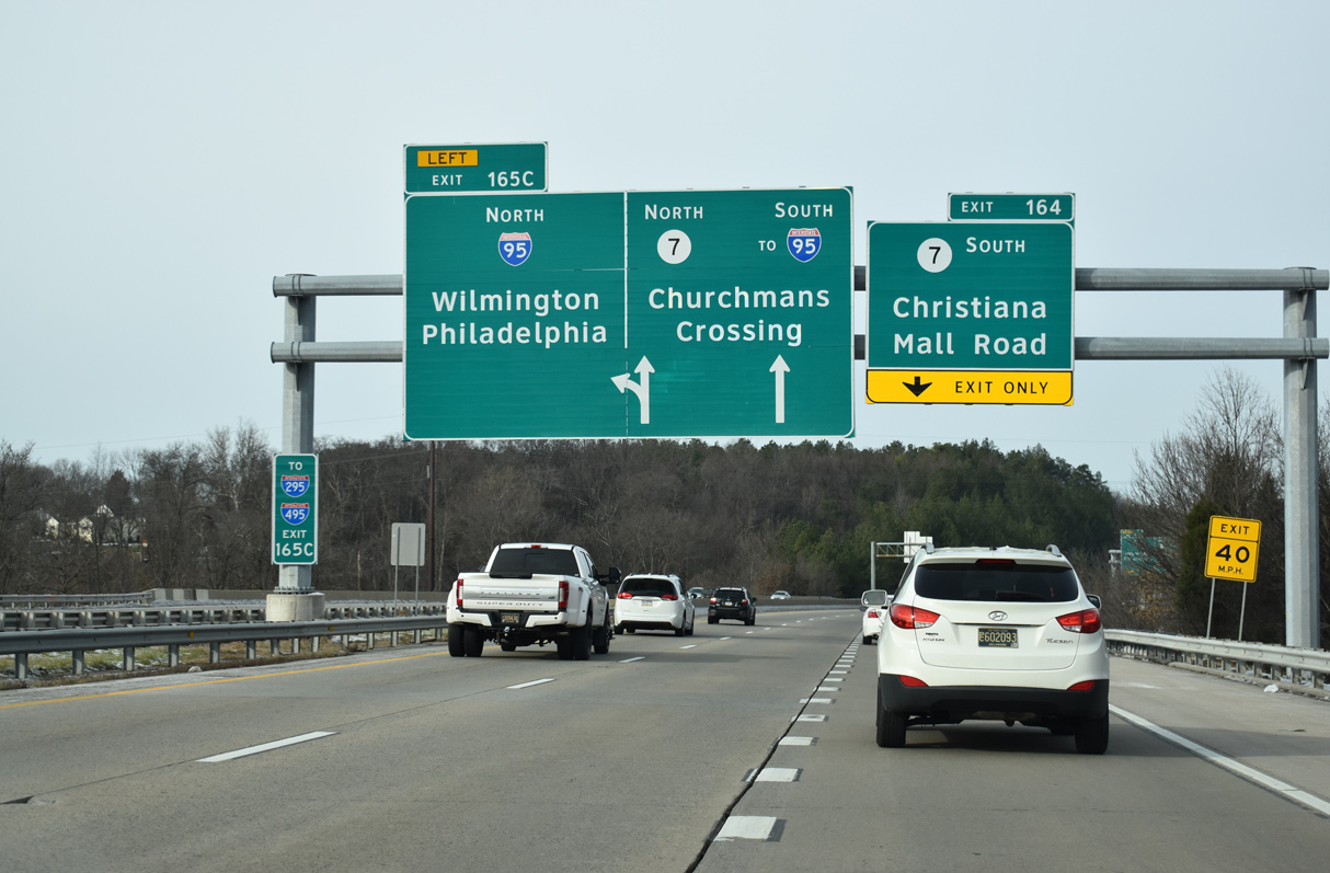
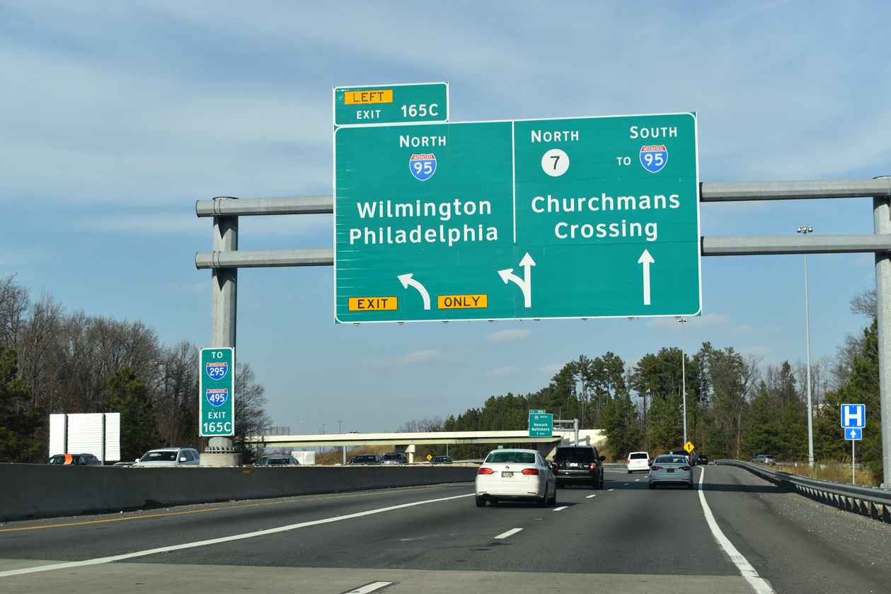
| The initial sign for the flyovers (Exit 165C) joining SR 1 north with I-95 northbound appears above SR 273. The SR 1 mainline defaults onto I-95 north to Wilmington while the right lanes continue to SR 7 north through Churchmans Crossing. 12/19/20 |
|
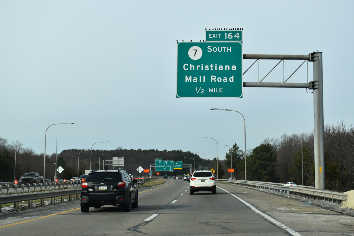
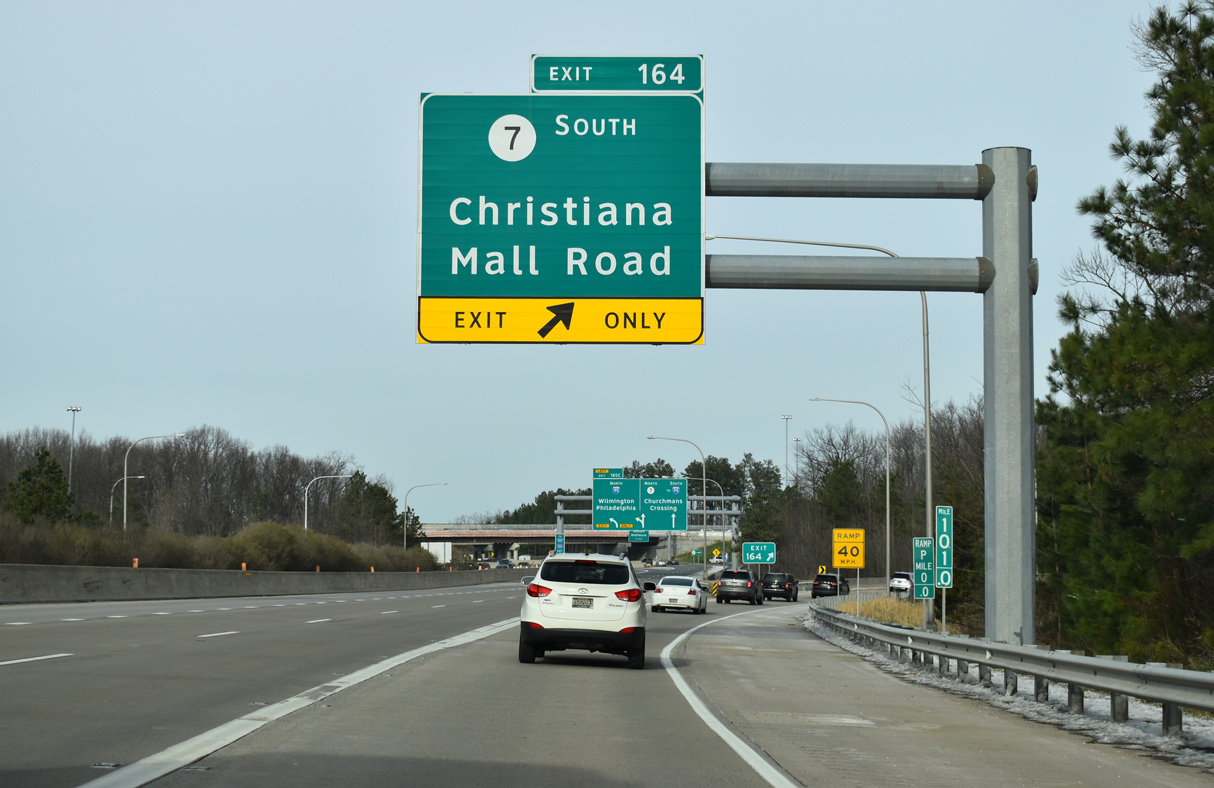
| A folded diamond interchange (Exit 164) with SR 7 (Road A) and Center Boulevard to Christiana Mall precedes the exchange with Interstate 95. 12/19/20 |
|
| SR 1 crosses the Christiana River beyond the final northbound confirming marker. This section of freeway opened to traffic in April 1993. 12/19/20 |
|
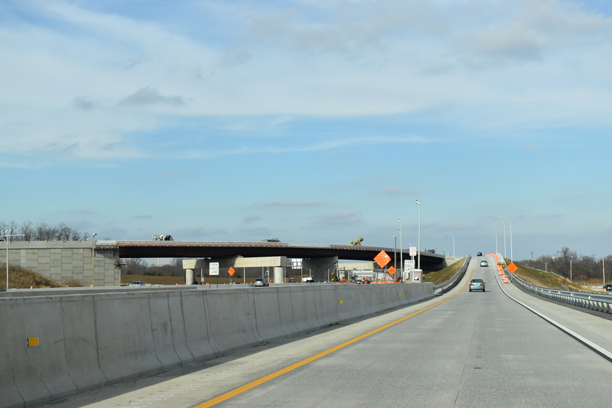
| Two lanes advance beyond the lane drop for Exit 164 and SR 7 (Road A) south to I-95 (JFK Memorial Highway). Construction between Spring 2019 and Spring 2021 expanded Road A above SR 1 with a new westbound overpass to accommodate traffic demands for area retail development. 12/19/20 |
|
| SR 7 joins SR 1 north from Road A to SR 58 (Churchmans Road) east of Christiana Hospital. 12/19/20 |
|
| A third northbound lane opens for Exit 165C to I-95 north as Exit 164 departs for SR 7 (Road A) south 0.48 miles to Old Baltimore Pike and Stanton Christiana Road (old SR 7) north. 12/19/20 |
|
| Construction of SR 1 in the early 1990s overlaid the alignment of SR 7 north from Christiana to Churchmans Crossing. Mall Road, the loop encircling Christiana Mall, ties into Exit 164 via Center Boulevard from SR 1 northbound and directly from SR 1 southbound via Road B. 12/19/20 |
|
| Exit 164 ties into an intersection joining SR 7 (Road A) south to Christiana, Center Boulevard north to Christiana Mall and Fashion Center Boulevard east. A turn off to Christiana Fashion Center precedes the traffic light. 12/19/20 |
|
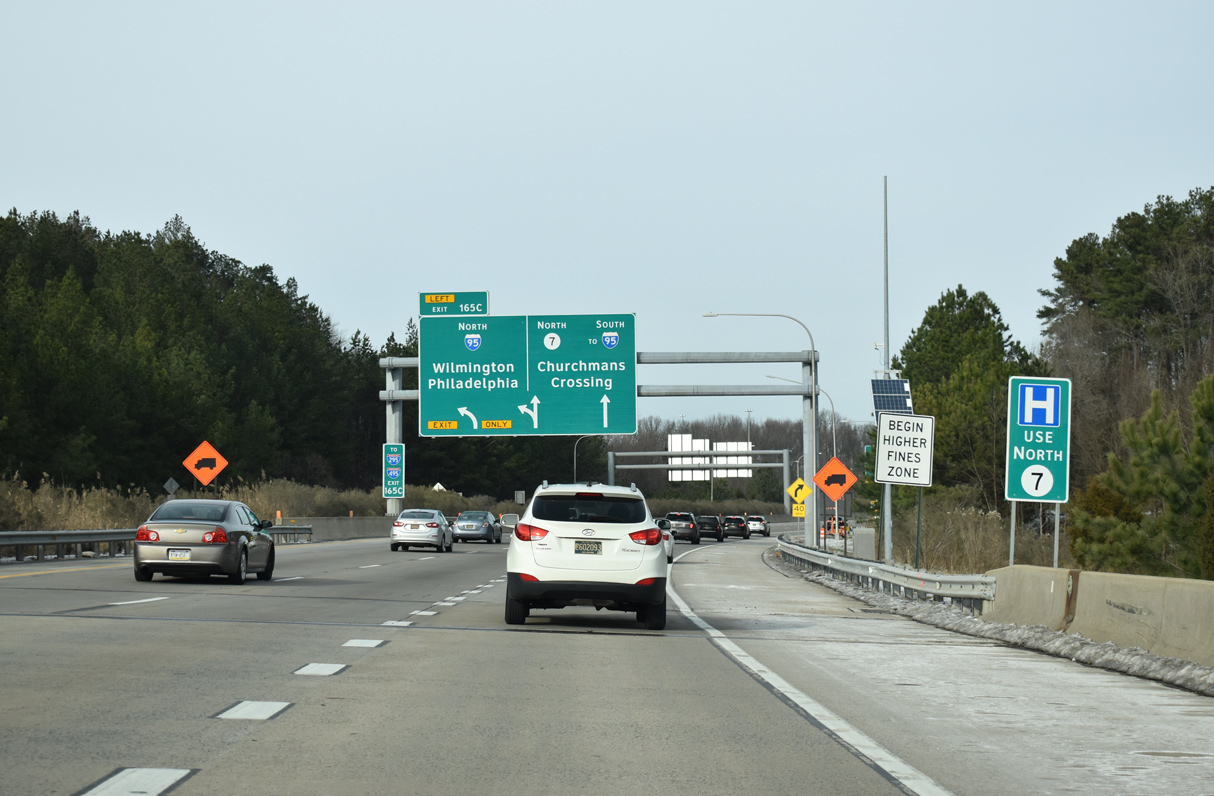
| The next in the series of APL's for Exit 165C partitions traffic into two lanes for I-95 north to Wilmington and Philadelphia and SR 7 north to Churchmans Crossing, Stanton and Pike Creek Valley. A concrete barrier separates traffic ahead of the upcoming SR 7 overpass. 12/30/18 |
|
| A loop ramp brings SR 7 north onto SR 1 beyond the split with Left Exit 165C to I-95 north and one mile from Exit 165A to I-95 south. An end sign for Route 1 was added here in 2020. 12/22/20 |
|
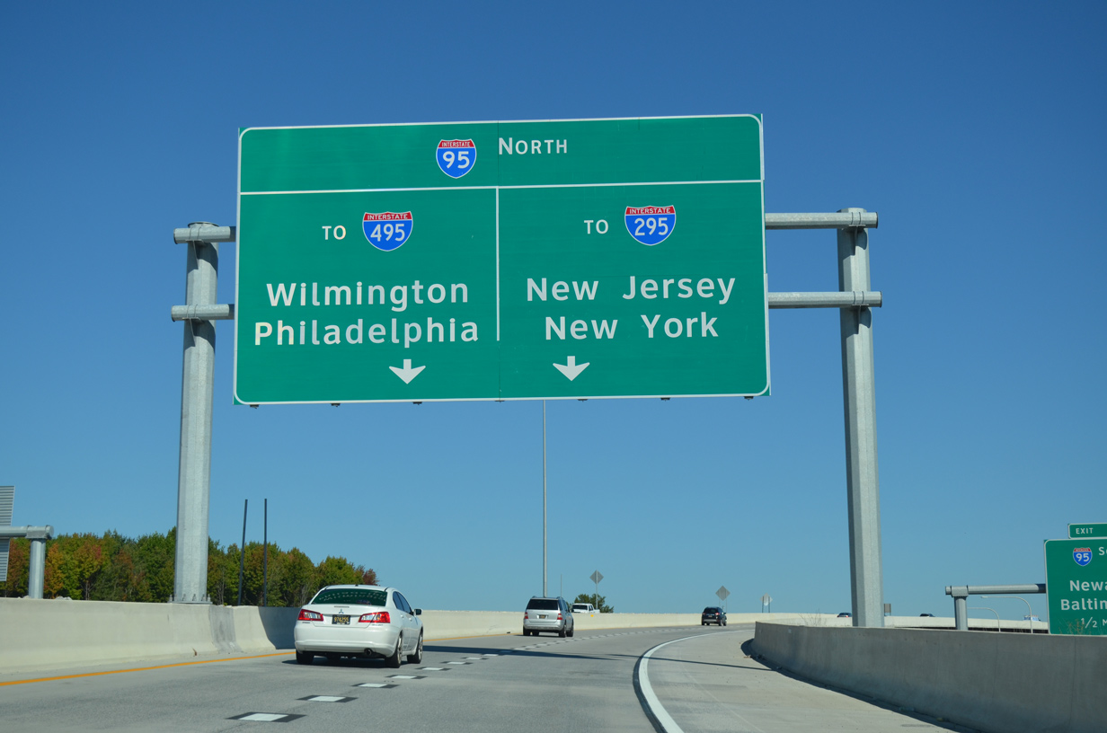
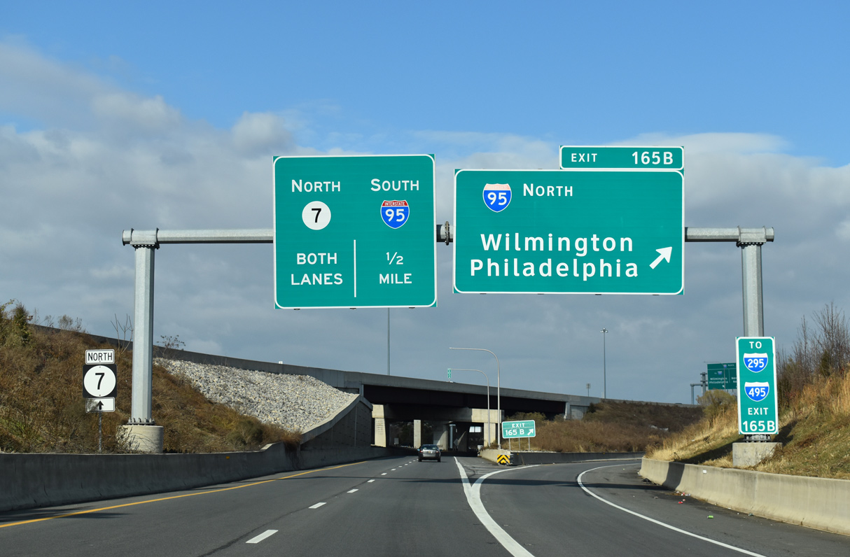
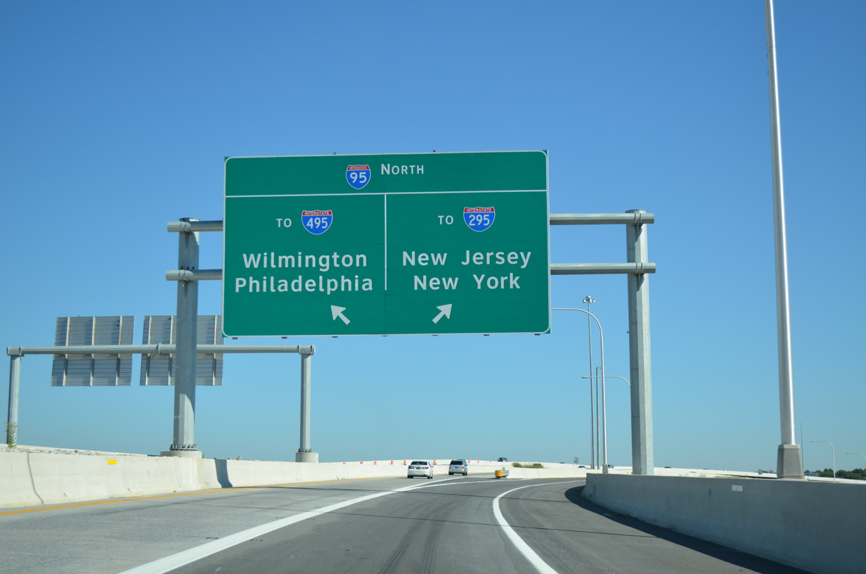
| Exit 165C partitions into separate ramps to I-95 north. The outside flyover joins the right lanes of I-95 two miles ahead of the separation with I-295 north to New Jersey. The inside flyover ties into the left lanes ahead of the I-95/495 split to Wilmington. 09/27/14 |
|
| Entrance ramps from Center Boulevard and Mall Road combine ahead of SR 1/7 north at the Mall Road overpass. Exit 165B serves traffic from Christiana Mall and SR 7 north from Christiana to I-95 north. 12/19/20 |
|
| The flyover from SR 1 north to I-95 north was built as part of a $118.8 million overhaul of the cloverleaf interchange between the two freeways.2 Work started in July 2011 and the flyover at Exit 165C opened to traffic on October 17, 2013. 09/27/14 |
|
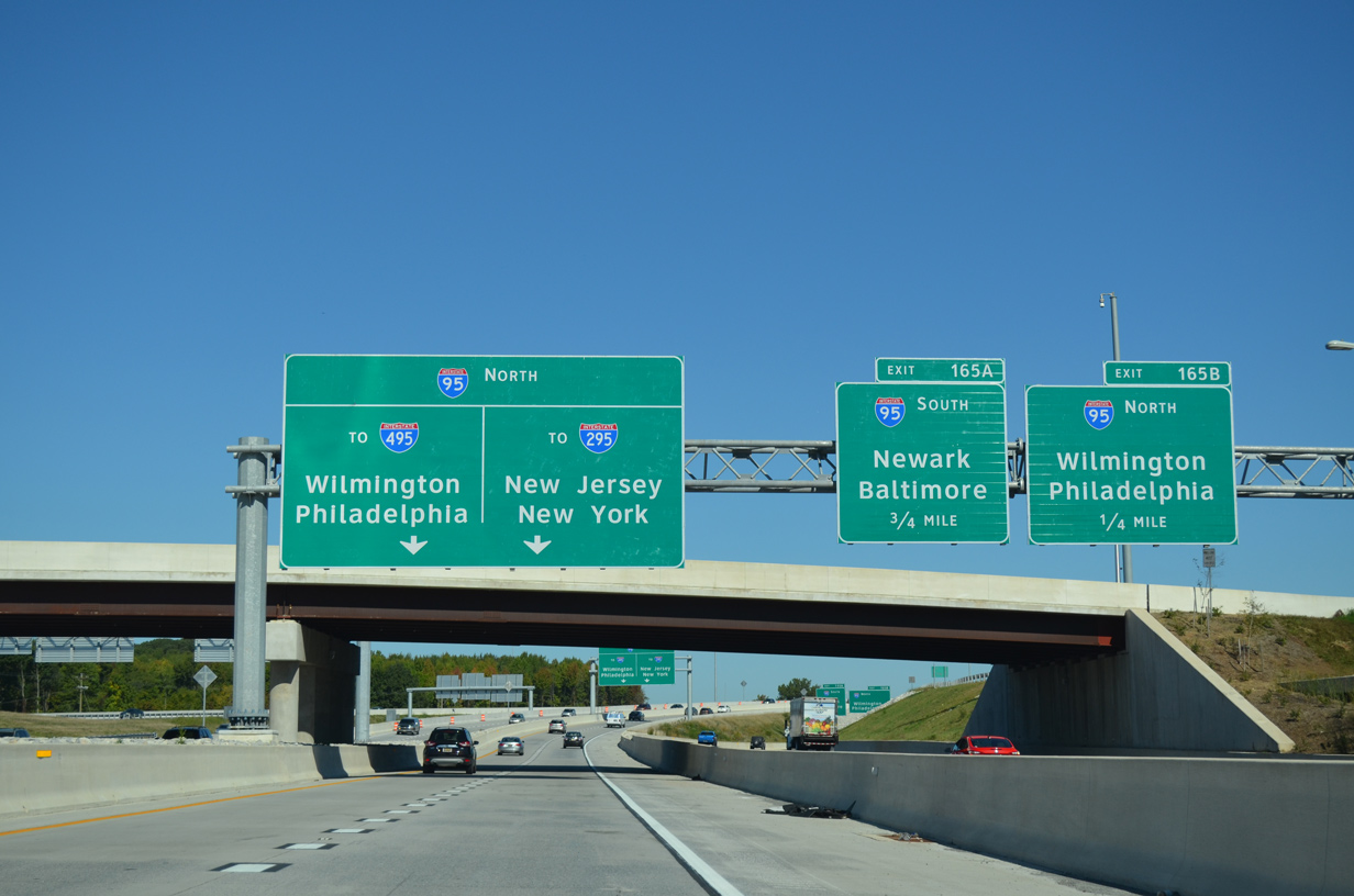
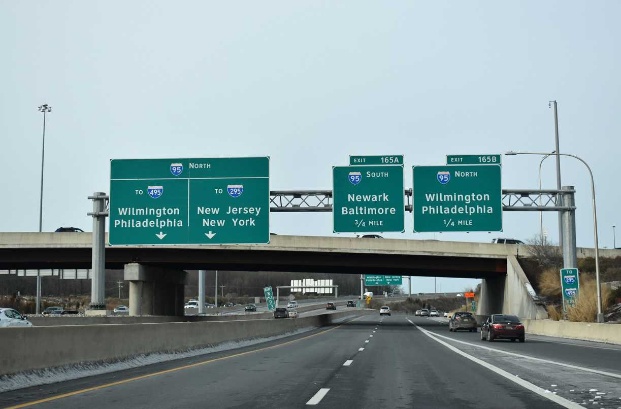
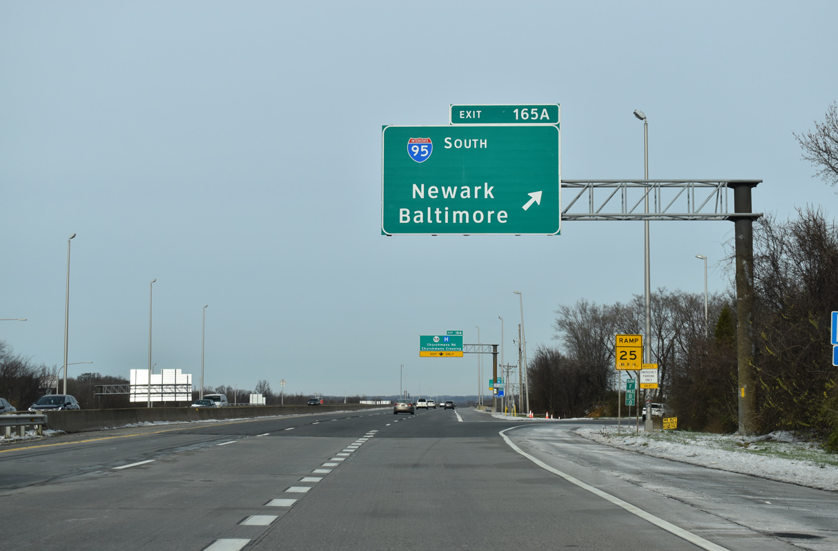
| Exit 165B leaves SR 1/7 north for I-95 north. I-95 splits with I-495, the Wilmington bypass to Philadelphia, in 3.5 miles. A sign change made by 2016 replaced the Exit 165A panel with a sign referencing both I-95 south and the continuation of SR 7 north. 12/22/20 |
|
| Exit 165C separates into single lane flyovers for I-95 north at the Churchmans Road (SR 58) overpass. I-95 northbound expands to five overall lanes from SR 1 across Christiana Marsh to I-295 north and the exchange with SR 141 (Basin Road). 09/27/14 |
|
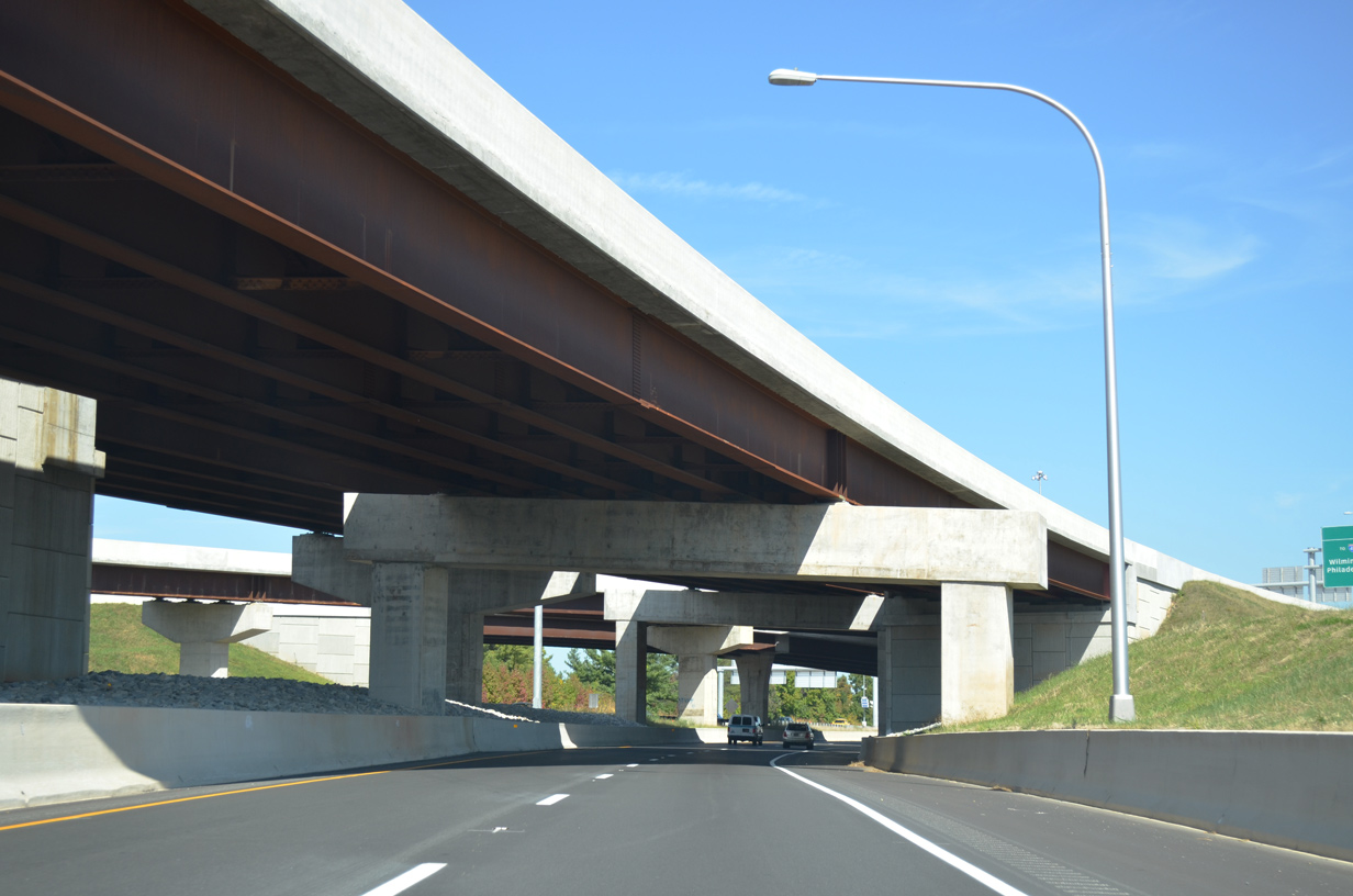
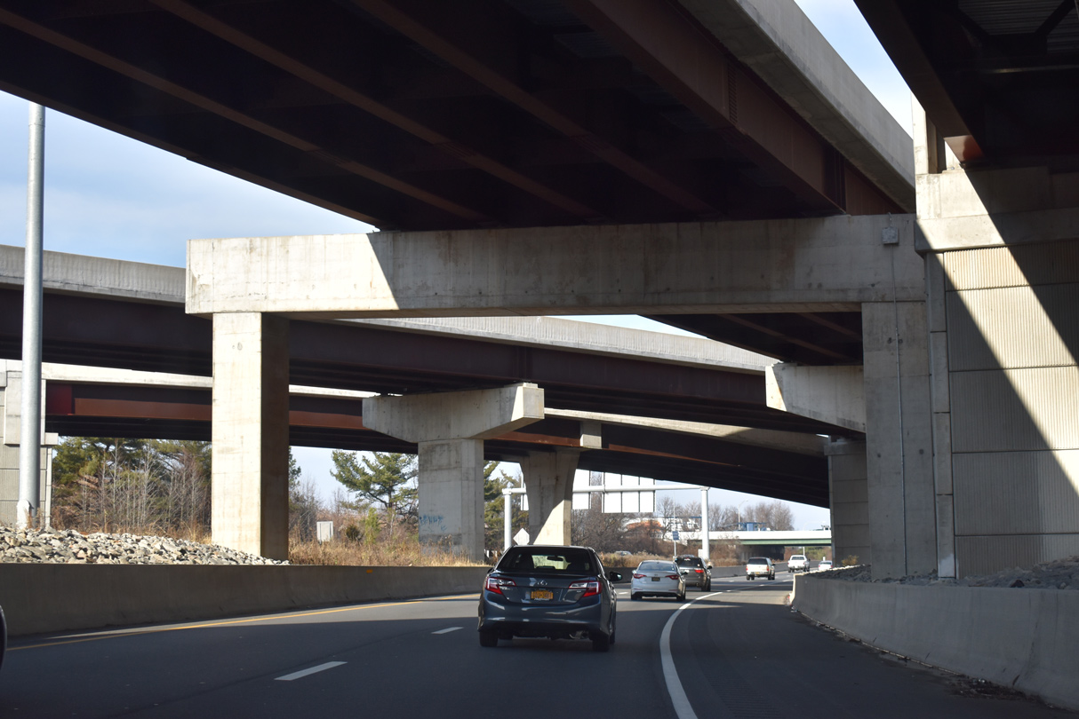
| SR 1/7 continues north under the flyovers from I-95 south to SR 1/7 south and I-95 north to SR 1/7 north. 09/28/14 |
|
| The flyovers between SR 1 and I-95 removed a weaving traffic pattern caused by closely placed loop ramps between both freeways. 12/30/18 |
|
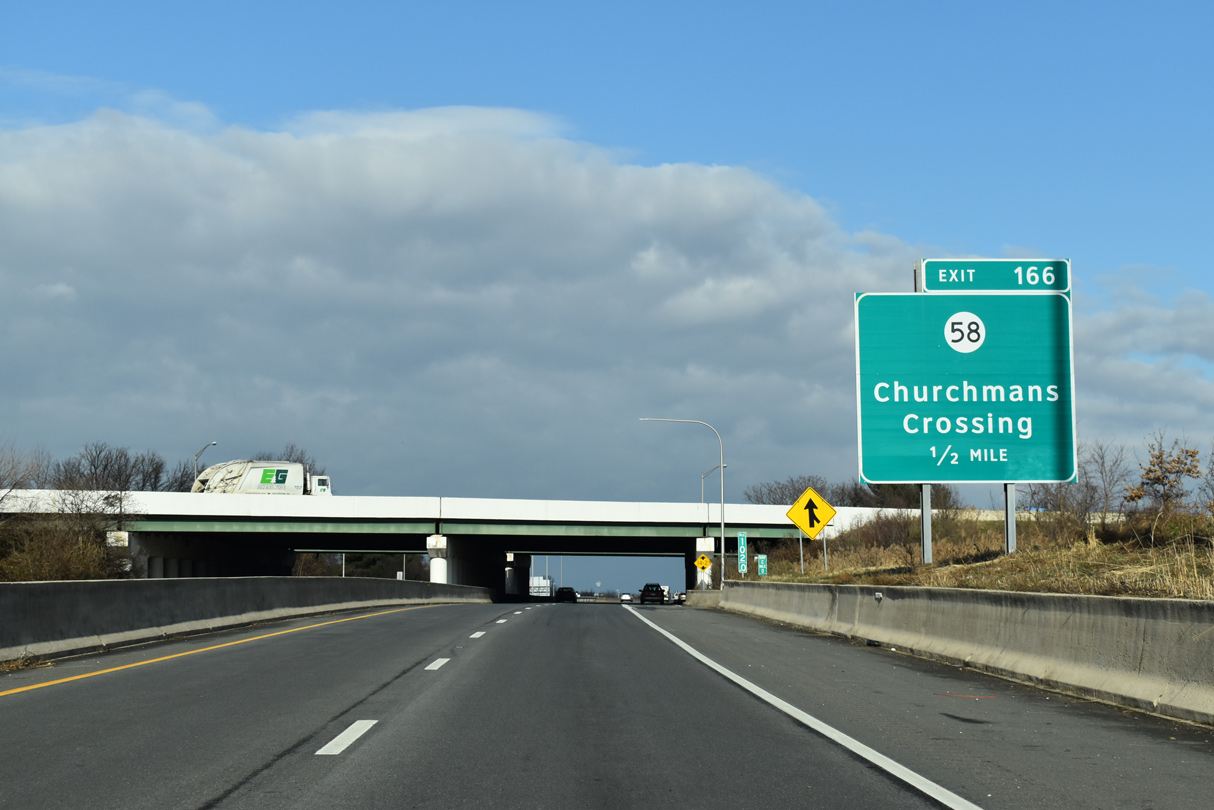
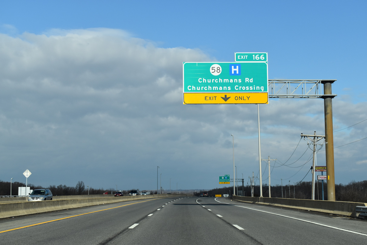
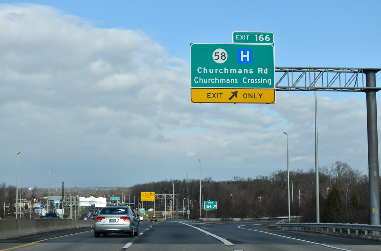
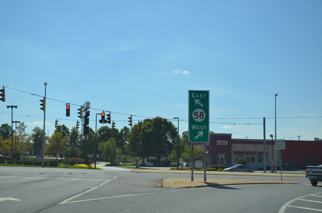
| A parclo interchange (Exit 166) joins the north end of SR 1 with SR 58 (Churchmans Road) just beyond I-95. SR 58 runs 3.86 miles between SR 4 and SR 273. 12/22/20 |
|
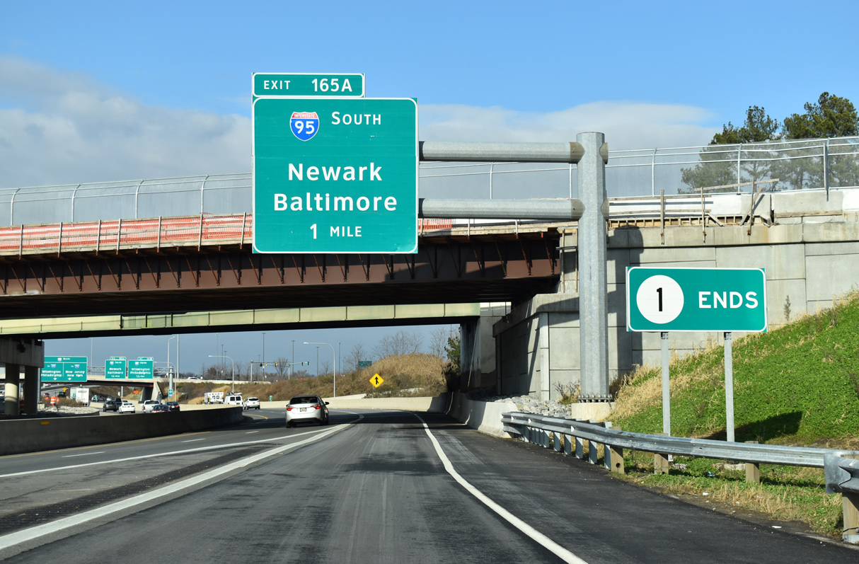
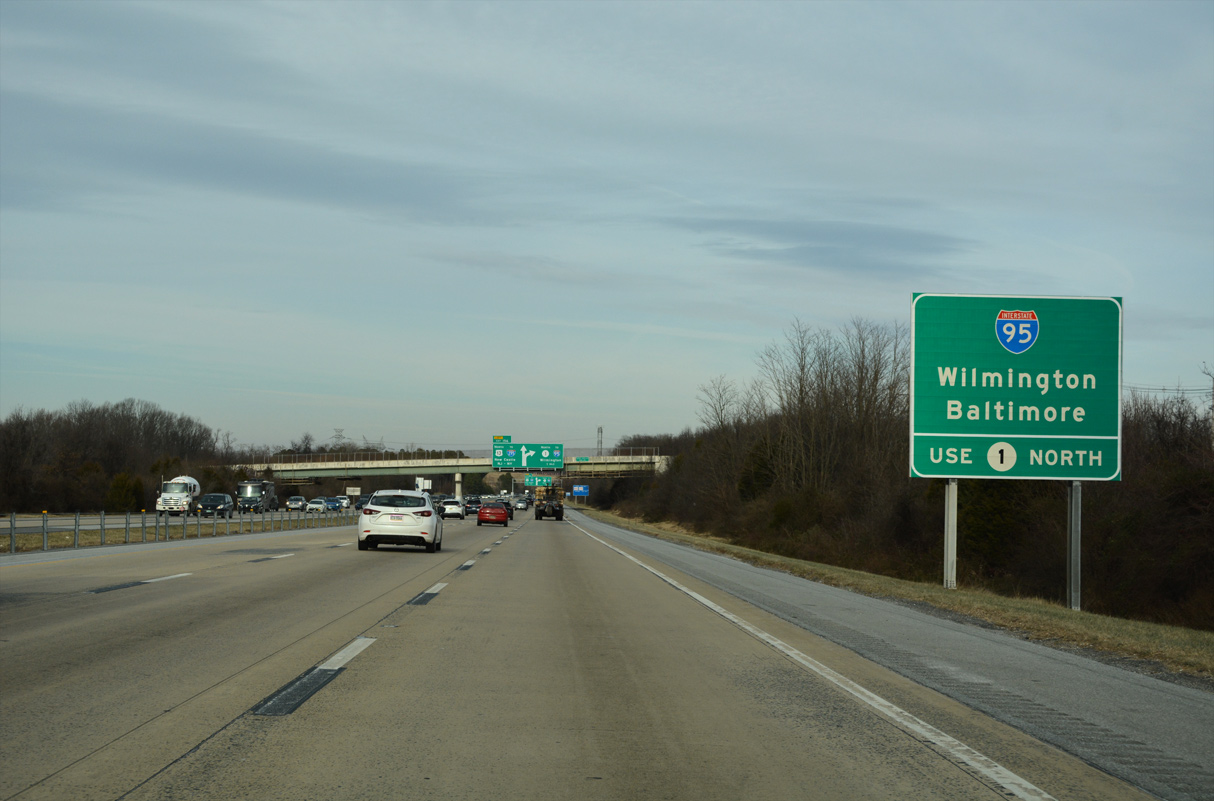
| Exit 165A loops onto Interstate 95 (Delaware Turnpike) south. Two exits follow to Newark before I-95 passes through the Newark Toll Plaza en route to Baltimore, Maryland. 12/19/20 |
|
| SR 58 (Churchmans Road) links SR 1/7 with Christiana Hospital and Delaware Park to the west and New Castle Airport (ILG) and SR 273 by Hares Corner to the east. 12/22/20 |
|
| Replacing a heavily congested intersection, the exchange joining SR 1/7 with SR 58 (Churchmans Road) was constructed between 1996 and 1999. When Exit 166 was completed, SR 1 was extended north from I-95. 12/22/20 |
|
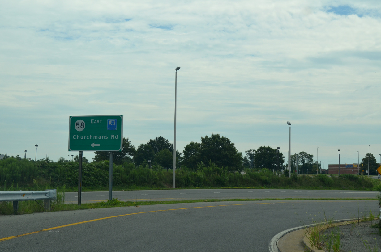
| The off-ramp to SR 58 (Churchmans Road) ties into an adjacent shopping center midway between the SR 1/7 overpass and entrance to the Stanton Campus of Delaware Technical and Community College (DTCC). Nine signals line a 1.7 mile stretch of Churchmans Road. 08/03/13, 09/26/14 |
|
| SR 7 transitions into a six lane arterial at AAA Boulevard (Rd 339B) and the Del-Tech Connector. SR 7 (Christiana Stanton Road) extends 0.20 miles northward to combine with SR 4 east to Stanton. 12/22/20 |
Page Updated 12-29-2022.


 North
North


 North
North