|
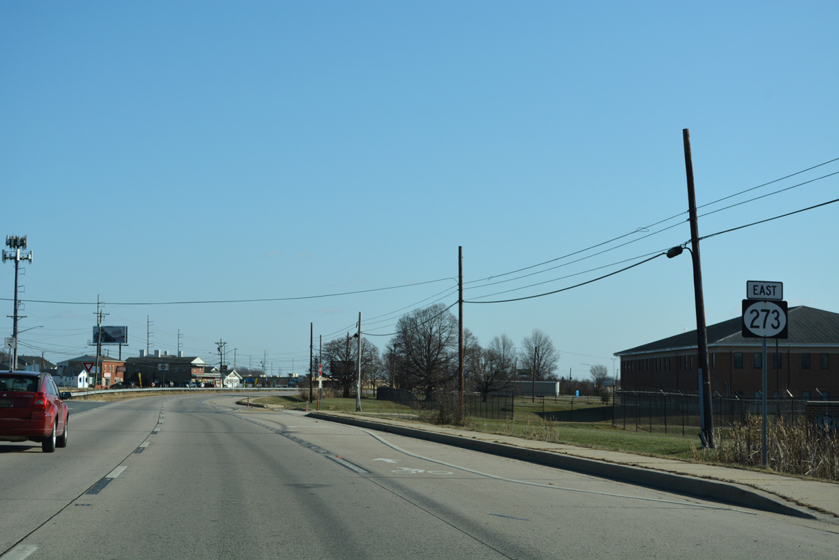
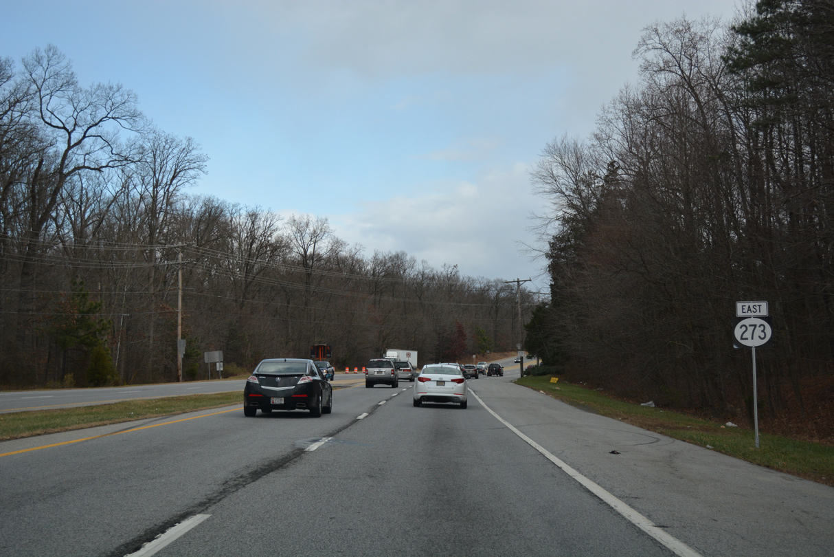
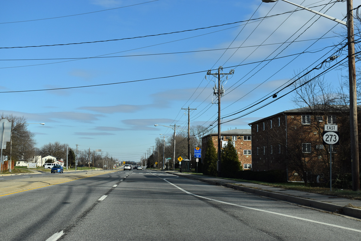
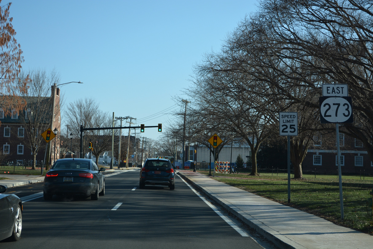
| Wedgewood Road south and Jackson Hall School Road north come together as MD 273 transitions to SR 273 (Nottingham Road). Wedgewood Road arcs north to SR 896 (New London Road) and White Clay Creek State Park. 06/30/10 |
|
| SR 273 (Nottingham Road) lowers to cross the Christina River and intersect Casho Mill Road south and Delrem Drive north. Casho Mill Road heads south from the Timber Creek and Nottingham Green residential area to Barksdale Park and SR 896 (Elkton Road). Delrem Drive links SR 273 with the West Branch and Fairfield subdivisions to the north, with a connection to SR 896 (New London Road). 06/20/12 |
|
| SR 273 rises alongside the Newark Country Club golf course to Bent Lane, where Nottingham Road becomes W Main Street. The state route gradually lowers from there to intersect SR 896 (Hillside Road) southbound. 01/02/19 |
|
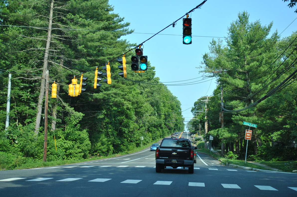
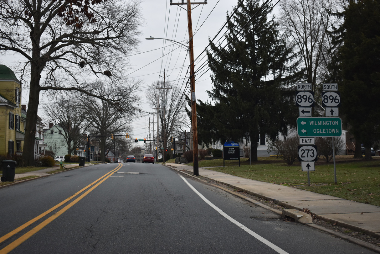
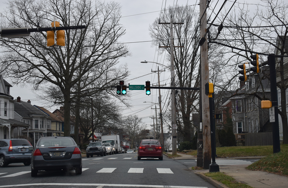
| SR 896 partitions into a couplet between Hillside Road and Delaware Avenue outside Downtown Newark. SR 896 south dog legs west from nearby New London Road to combine with SR 273 (W Main Street) east while SR 896 north follows New London Road from SR 273 west. 01/02/19 |
|
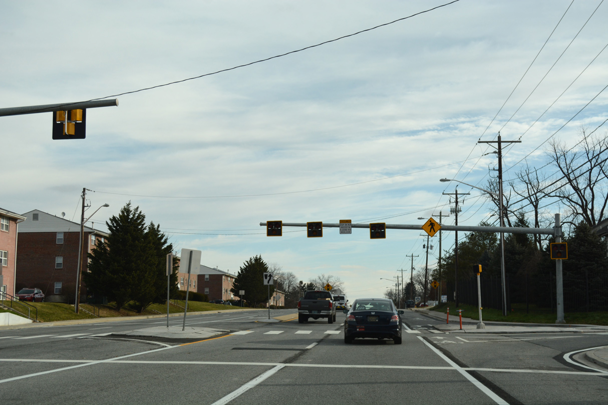
| Hillside Road heads west from W Main Street to the Oaklands community and as Barksdale Road west to Cecil County, Maryland. East from SR 896 (New London Road), Hillside Road becomes Cleveland Avenue, a busy commuter street to the Newark auto mall and SR 2/72 (Capitol Trail). 01/02/19 |
|
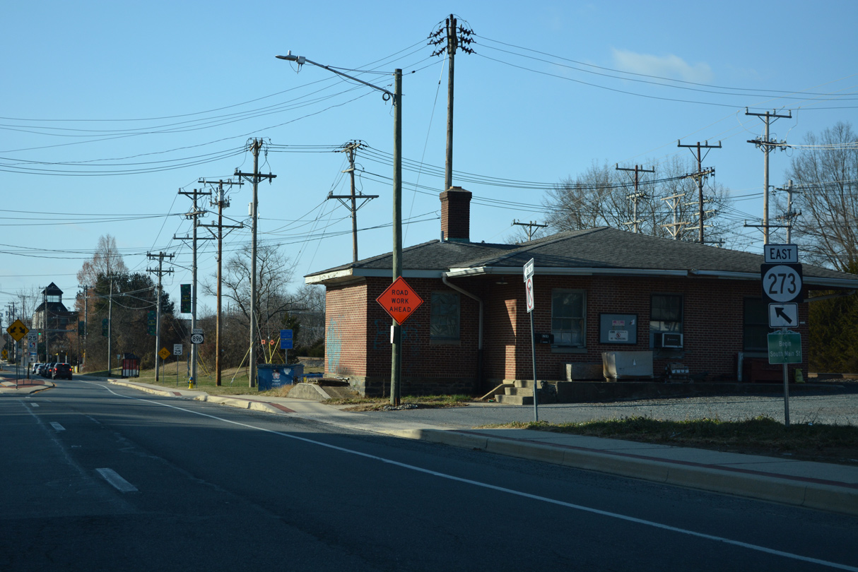
| W Main Street continues east with two-way traffic as both SR 273 east / SR 896 south to an at-grade crossing with the CSX Railroad. Beyond the railroad, the two routes turn onto S Main Street westbound and merge with traffic from SR 273 (W Main Street) westbound. 06/23/12 |
|
| S Main Street bee lines southwesterly to I-95 and Elkton, Maryland as SR 273 turns east toward the University of Delaware (UD) via W Delaware Avenue. SR 896 south follows S Main Street and Elkton Road to SR 4 (Christina Parkway) while SR 896 north runs along W Delaware Avenue for two blocks. 12/24/22 |
|
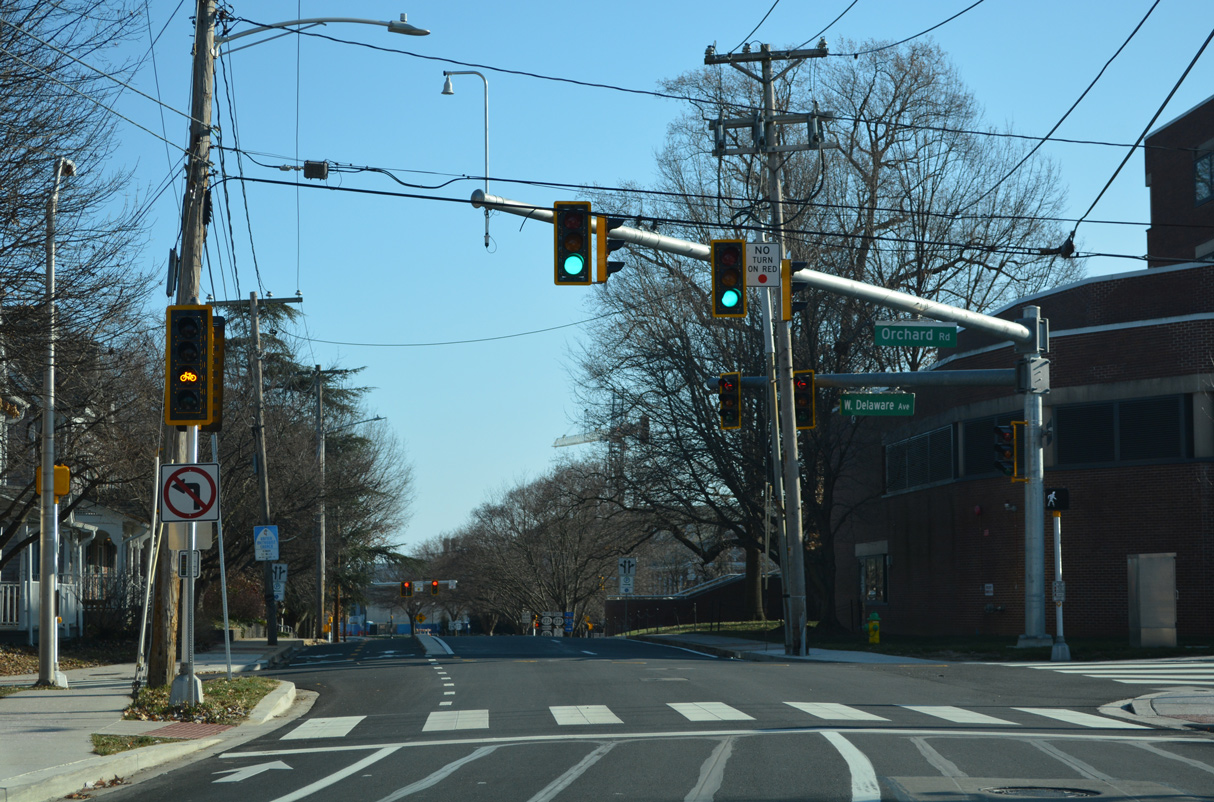
| Orchard Road intersects W Delaware Avenue just beyond the merge of SR 273 east / SR 896 north. The street leads south from the UD Parking Garage service road to residential areas to Ritter Lane. 12/24/22 |
|
| SR 896 north splits with SR 273 (Delaware Avenue) east for the final block of S College Avenue north to SR 273 (W Main Street) west as part of its movement to New London Road and Chester County, Pennsylvania. S College Avenue (SR 896 until 1988) southbound passes through the UD campus to an overpass above the AMTRAK Northeast Corridor. Beyond the bridge, the avenue expands into a commercial arterial to the UD sports complex. 12/24/22 |
|
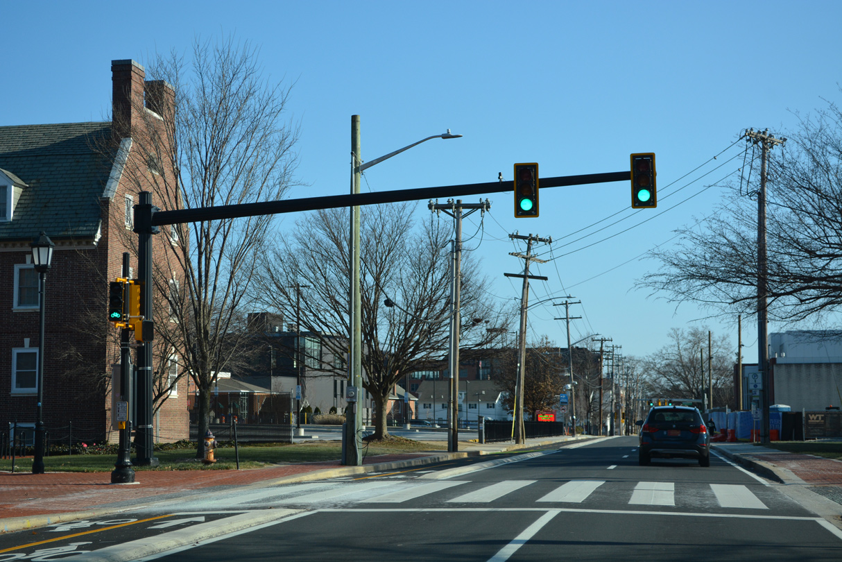
| SR 273 (E Delaware Avenue) advances east across the University of Delaware Green after South College Avenue.
A SR 2 Business shield was previously posted here as well. Coinciding with the truncation of SR 2 east to Library Avenue and E Main Street, the business route was decommissioned in Fall 2013. 12/24/22 |
|
| An additional pedestrian signal was installed along eastbound SR 273 (E Delaware Avenue) beyond S College Avenue in 2018. 12/24/22 |
|
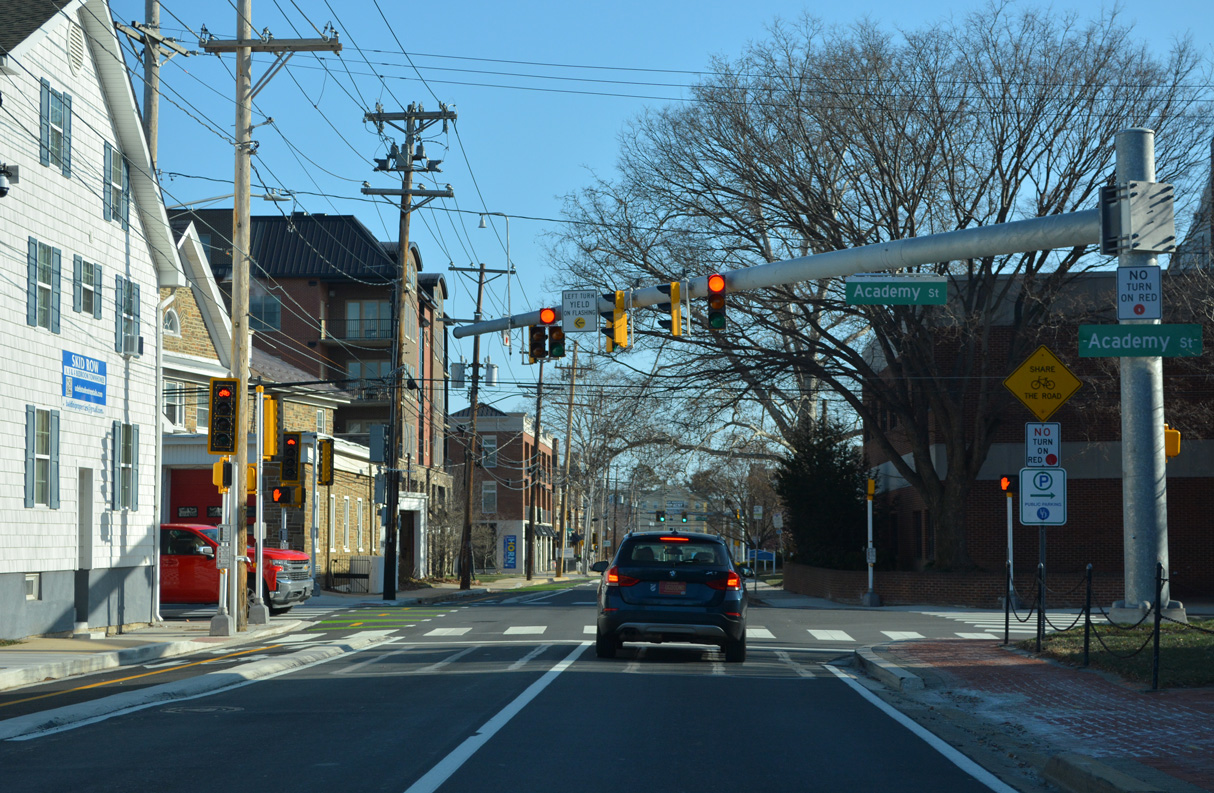
| Academy Street stems south from parallel E Main Street to intersect SR 273 (E Delaware Avenue) at the next traffic light. Academy Street extends south through the UD campus to the Perkins Student Center and residential areas south of Park Place to Lewis Park. 12/24/22 |
|
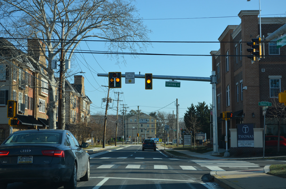
| Addressing pedestrian safety, traffic signals added along E Delaware Avenue at Haines Street were included in the Delaware Avenue improvement project underway from Fall 2020 to 2022.1 12/24/22 |
|
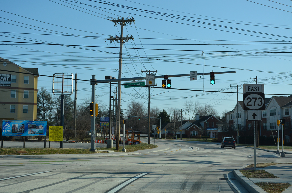
| Delaware Avenue east next intersects S Chapel Street. Chapel Street was formerly a part of SR 72 northward to Paper Mill Road and south to Sunset Lake Road. Chapel Street serves commuters northward to the Pike Creek Valley and local traffic south to a number of apartments before a dead end by the AMTRAK Northeast Corridor. 12/24/22 |
|
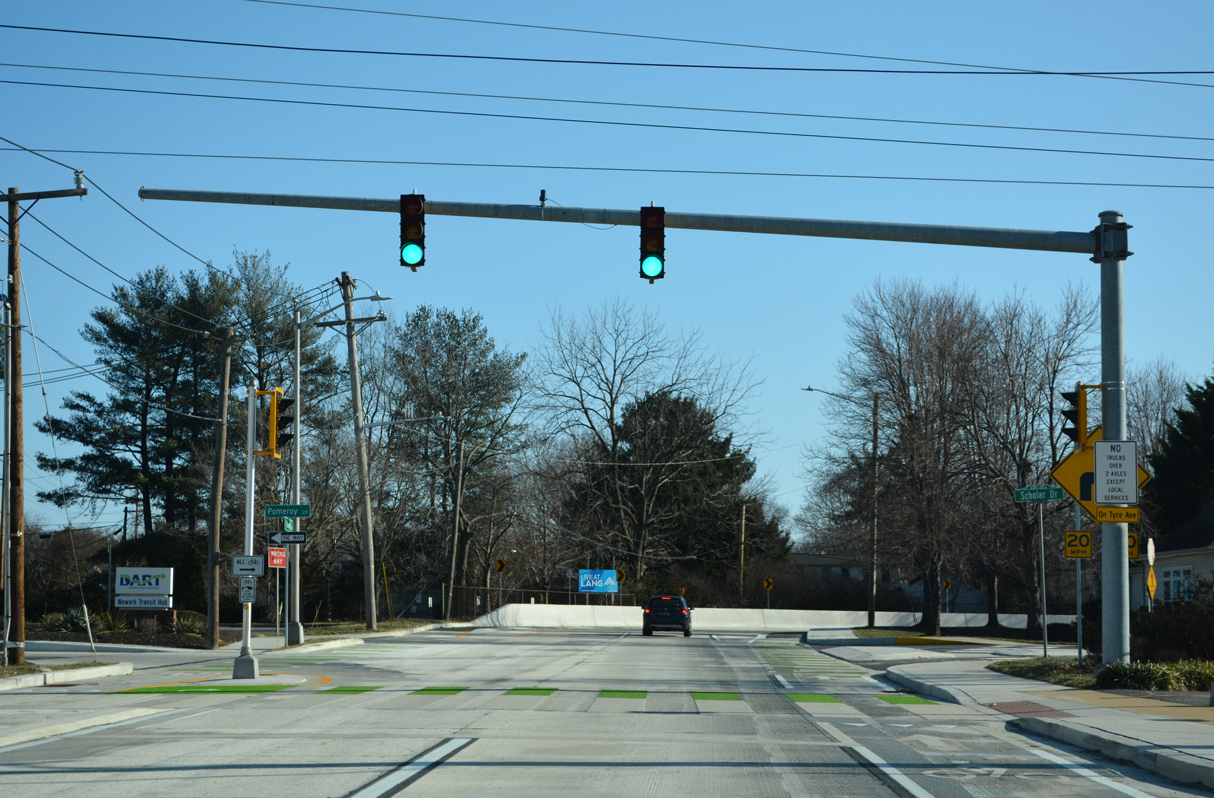
| A pedestrian signal operates at Palmer Lane and Scholar Drive as SR 273 enters the Delaware Avenue S-curve south to Tyre Avenue. A span wire set of signals previously metered traffic at the adjacent 90 degree turn. 12/24/22 |
|
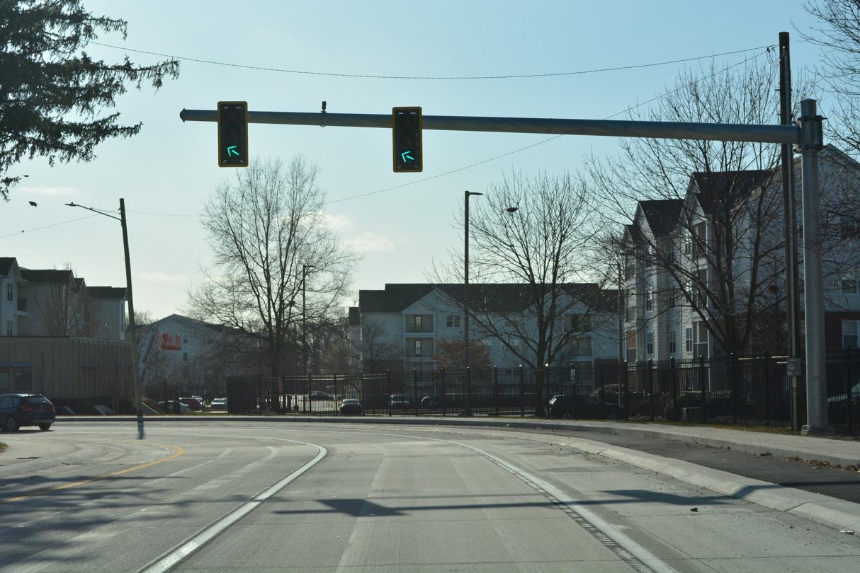
| The second metering signal along the Delaware Avenue S-curve operates in conjunction with the forthcoming traffic light at Tyre Avenue. 12/24/22 |
|
| Tyre Avenue travels north from the Christina School District bus yard to E Main Street (SR 273 west). 12/24/22 |
|
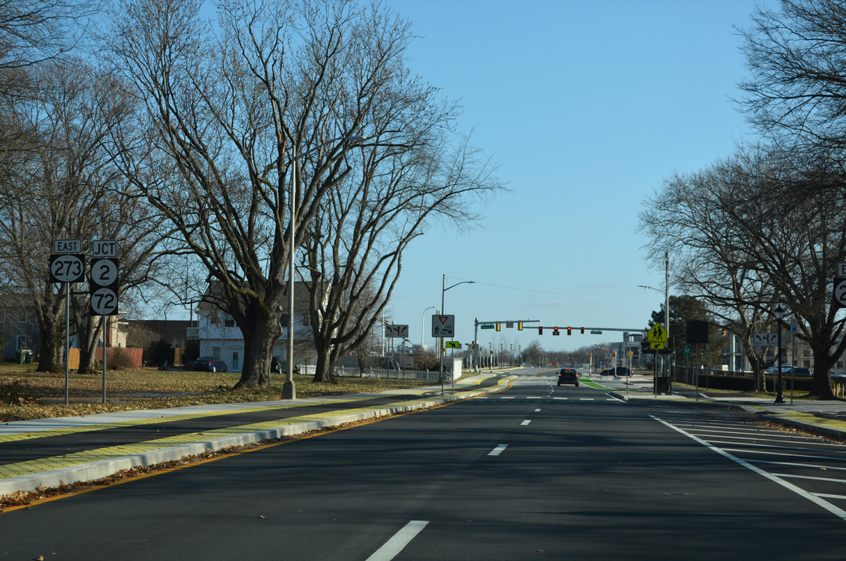
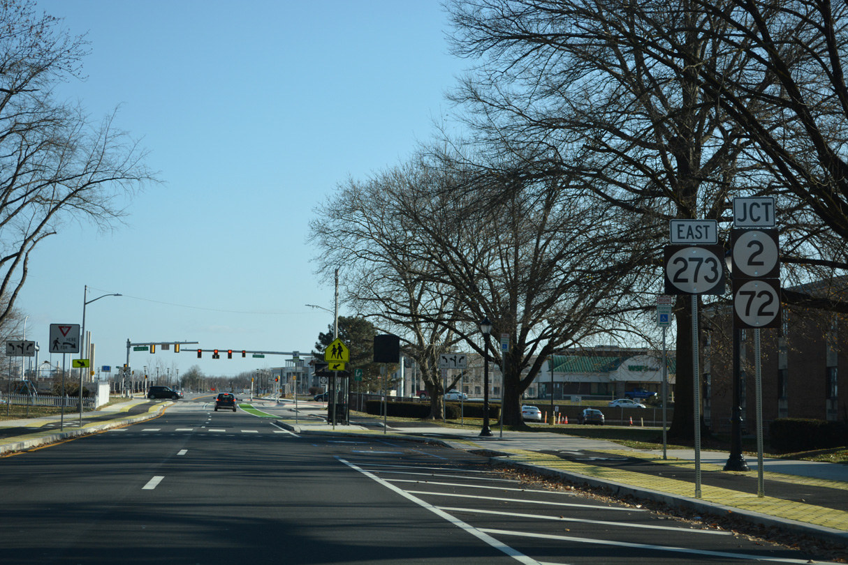
| E Delaware Avenue continues between Newark High School and the George Read Village community to meet SR 72 and the eastbound beginning of SR 2 at Library Avenue. 12/24/22 |
|
| E Delaware Avenue historically curved northward at Library Avenue to SR 2 (Capitol Trail). Library Avenue south across the AMTRAK Northeast Corridor was constructed in 1979, altering the previous curve into a T-intersection. 12/24/22 |
|
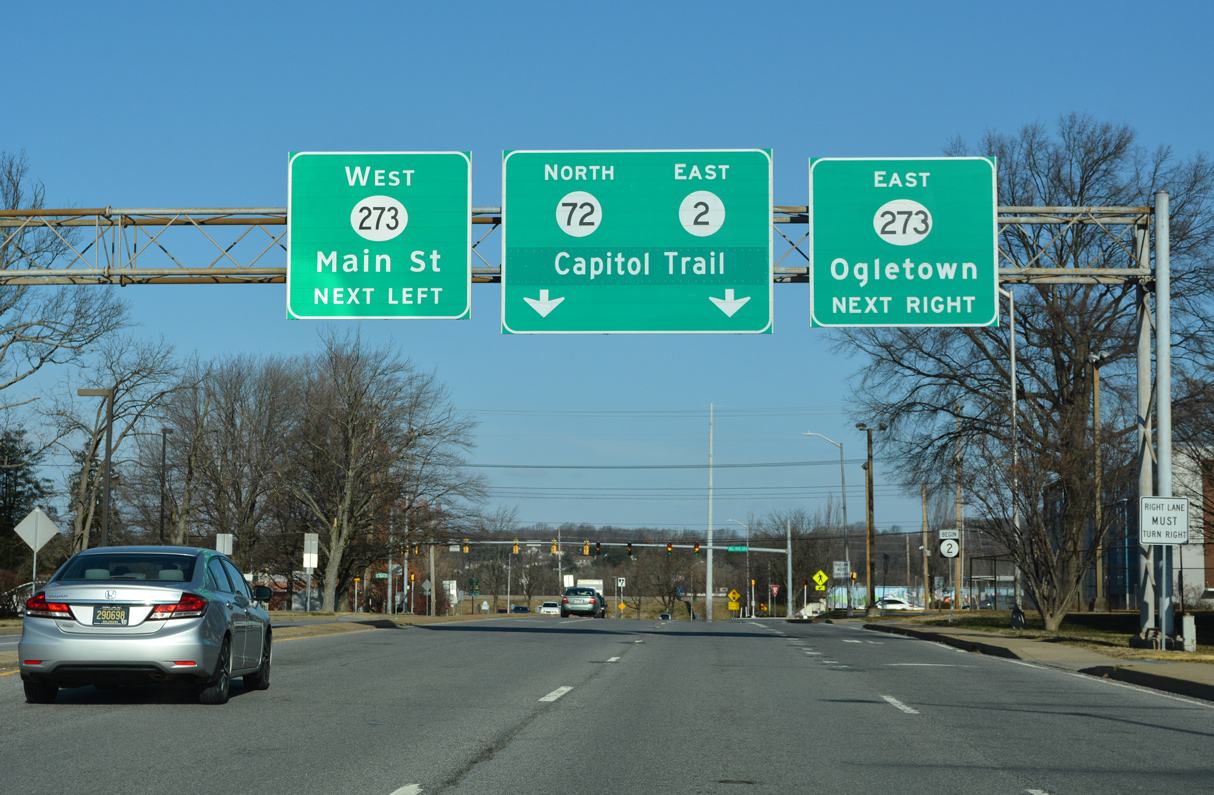
| SR 273 east combines with SR 72 (Library Avenue) north from the entrance to The Grove at Newark mixed use development to Ogletown Road. 12/24/22 |
|
| SR 72 (Library Avenue) south joins Newark with suburban areas beyond I-95 to U.S. 40 (Pulaski Highway) and U.S. 13 at Wrangle Hill. SR 72 (Wrangle Hill Road) arcs southeast to SR 9 outside Delaware City. 12/24/22 |
|
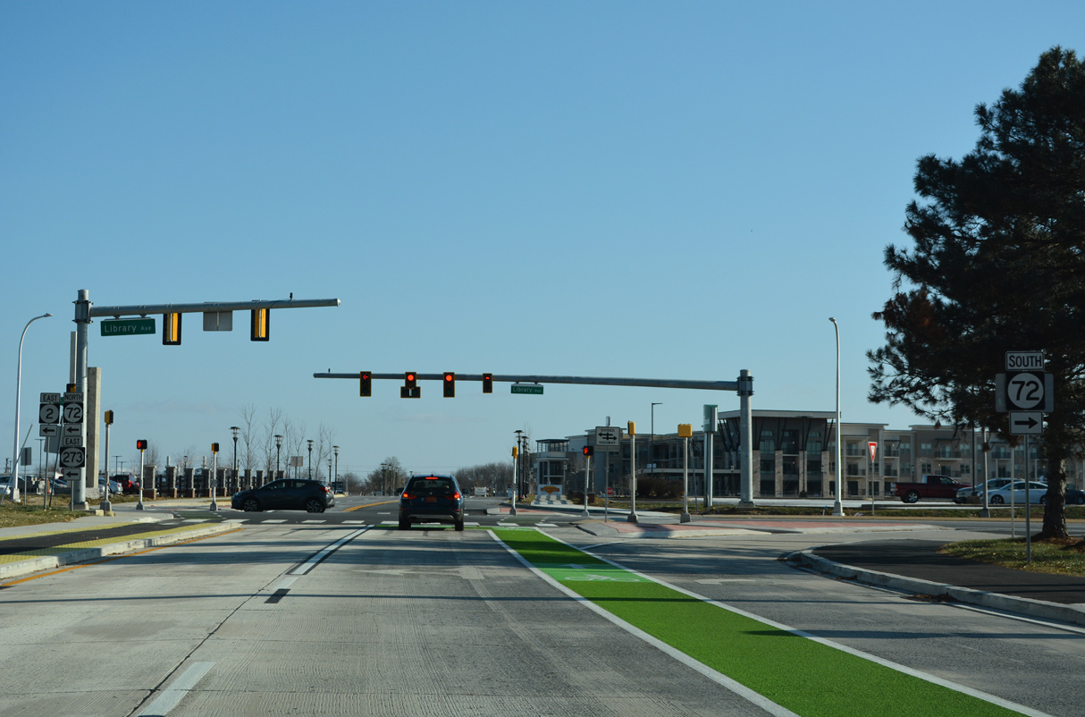
| SR 72/273 east combine for 0.20 miles from E Delaware Avenue to E Main Street. The four lane arterial passes between College Square Shopping Center and the Newark Free Library ahead of this sign bridge posted for the eastbound beginning of SR 2 (Capitol Trail).
A green out was added to this overhead by 2015 to display Capitol Trail in place of Kirkwood Highway. 12/24/22 |
|
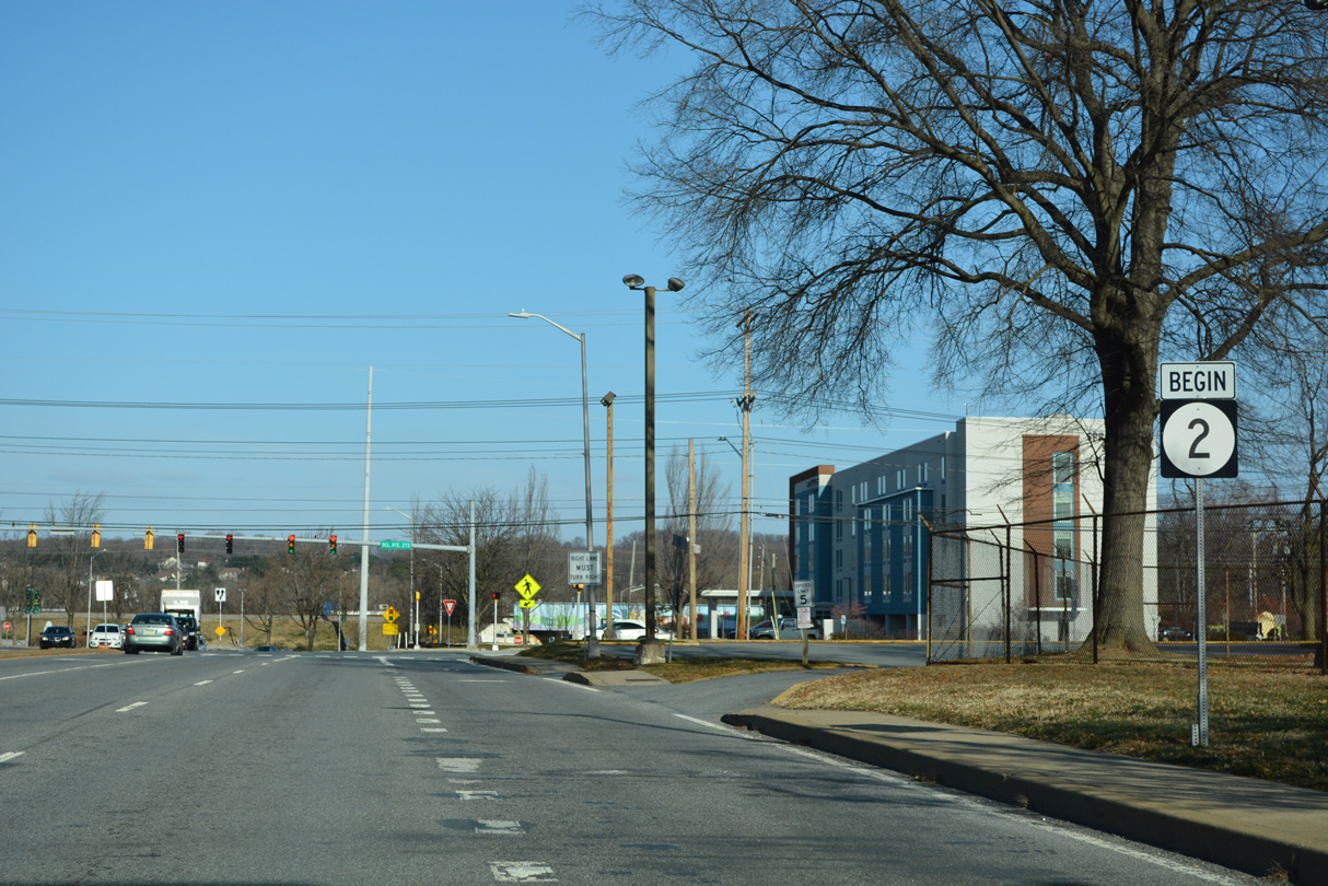
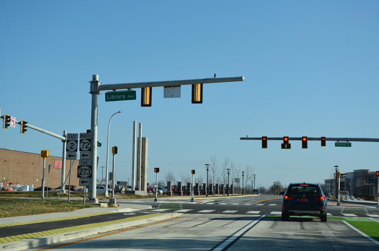
| The Fall 2013 truncation of SR 2 dropped the state route west from the intersection of E Main Street, Library Avenue and Capitol Trail. A new begin sign was added ahead of the SR 72/273 partition. Capitol Trail / Kirkwood Highway constitutes the main arterial linking Newark with Wilmington. 12/24/22 |
|
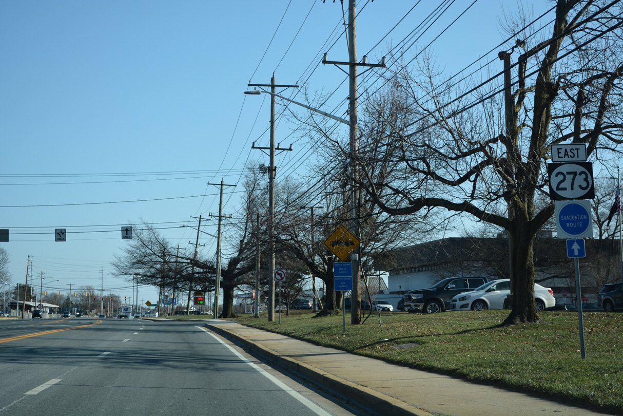
| SR 273 turns west from SR 2/72 (Library Avenue) onto Ogletown Road. 12/24/22 |
|
| Marrows Road (Road 351) constitutes a major collector south from SR 273 (Ogletown Road) across the AMTRAK Northeast Corridor to the Kimberton and Brookside communities, and SR 4 (Chestnut Hill Road). A business entrance ties into the intersection from the north. 12/24/22 |
|
| SR 273 expands into a four lane, divided arterial from Marrows Road east to the split with Ogletown Road. Widening was completed along this stretch in 1997. 12/24/22 |
|
| SR 273 (Ogletown Road) advances through an area populated by warehouses, distribution centers, an FMC plant and several car dealerships. White Clay Center Drive ties into the state route at the succeeding signal eastbound. 12/24/22 |
|
| Ogletown Road separates with SR 273 southward through the old Avon Underpass to the Chestnut Estates and Greenleaf Manor communities. The state route shifts onto an expressway to span the AMTRAK Northeast Corridor ahead of SR 4. 12/24/22 |
|
| Ogletown Road initially forms a south side frontage road to SR 273 by a handful of industrial businesses. A signalized entrance to the former Avon plant follows from the north. 12/24/22 |
|
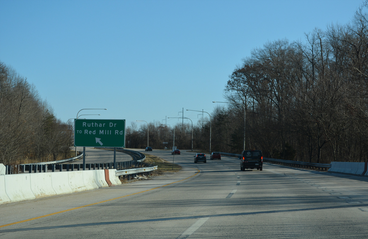
| The SR 273 expressway crosses over a tributary of White Clay Creek ahead of the jug handle with Ruthar Drive east and return access to SR 273 west. 12/24/22 |
|
| Ruthar Drive (Road 65) connects the state route with Red Mill Road (Road 352) north to the Upper Pike Creek Valley and the adjacent Harmony Industrial Park. 12/24/22 |
|
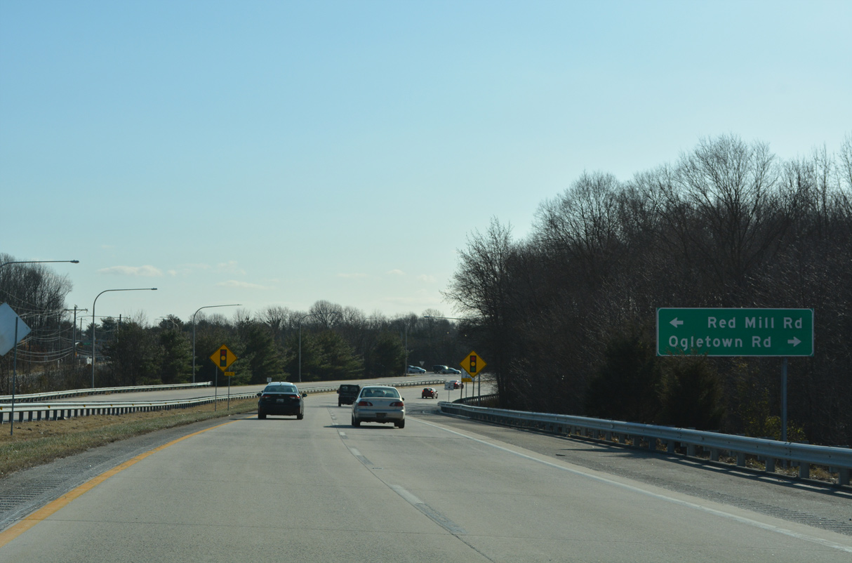
| Curving south, SR 273 next approaches Bala Road (Rd 91) the access road linking the expressway with parallel Red Mill Road to the east and Ogletown Road west at Chestnut Hill Estates. 12/24/22 |
|
| Red Mill Road formerly tied directly into SR 4 and SR 273 (Ogletown Road) to the south. The road was severed from that intersection with the construction of the parclo interchange between the two state routes. It now defaults onto Prides Crossing, a north side frontage road for SR 4. Ogletown Road was similarly disconnected from SR 4 to the west. 12/24/22 |
|
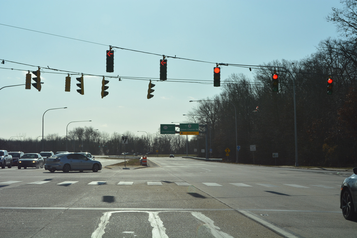
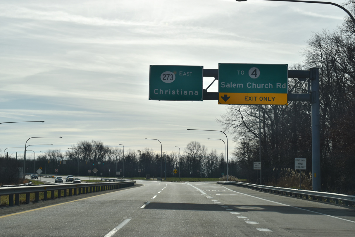
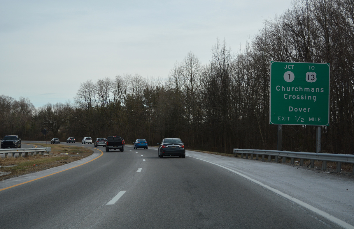
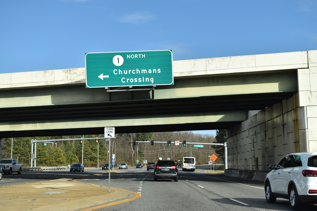
| The eastbound exit ramp to Salem Church Road connects SR 273 with SR 4 at Ogletown. SR 4 (Ogletown Road) heads east toward Christiana Hospital and Churchmans Crossing. SR 4 west lines Chestnut Hill Road to Brookside and south Newark. 12/23/20 |
|
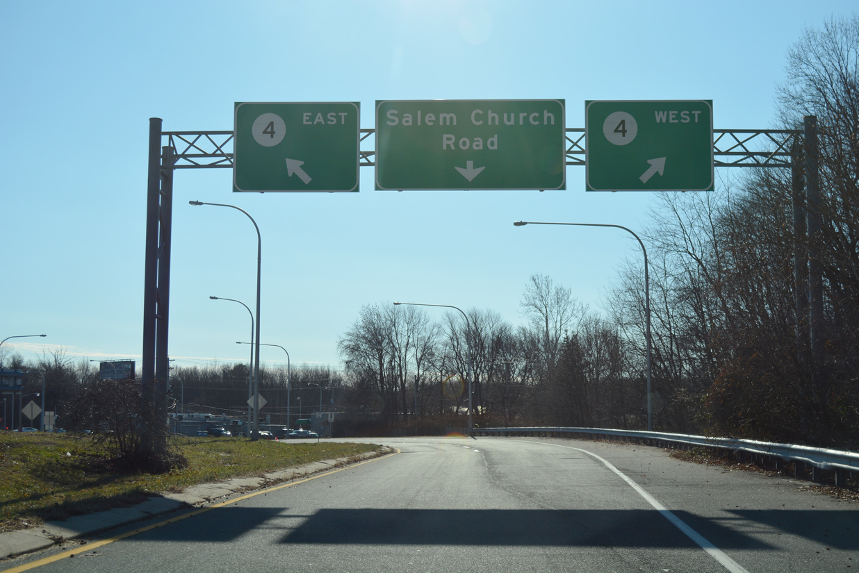
| A signalized intersection connects SR 4 (Ogletown Road) west and Salem Church Road (Rd 348) north with SR 273. 12/23/20 |
|
| Salem Church Road stems south from the SR 273 off-ramp to SR 4 en route to Christiana High School and suburban areas south of I-95 and along Old Baltimore Pike. 12/26/17 |
|
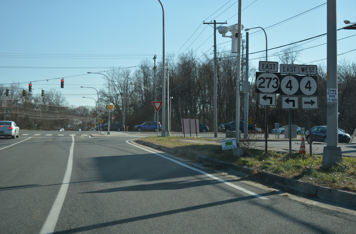
| Prior to 1997, SR 4/273 briefly overlapped between Ogletown Road west and Christiana Road east. 12/26/17 |
|
| Beyond the parclo interchange with SR 4, SR 273 (Christiana Road) transitions into an at-grade arterial ahead of Brownleaf Road, a residential roadway serving the Birchwood Park and Hillside Heights subdivisions. 12/22/20 |
|
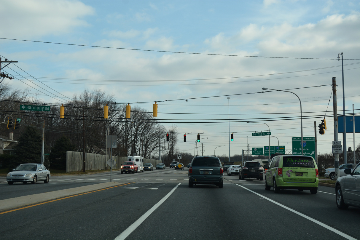
| Harmony Road south and Gerald Drive north from the Birchwood Park community come together at a busy intersection with SR 273 (Christiana Road) just prior to I-95. Harmony Road constitutes a commuter road north to SR 4 near Christiana Hospital and SR 2 (Capitol Trail).
Traffic congestion and safety concerns led to a two phase improvement project. The first phase, completed in October 2011, involved pedestrian improvements, an extended left turn lane from SR 273 west, and signal upgrades.2 12/28/16 |
|
| All traffic bound for I-95 (John F. Kennedy Memorial Highway) departs from SR 273 (Christiana Road) east in unison immediately following Gerald and Harmony Roads. Underway from Spring 2021 to Fall 2022, phase two of the HSIP, SR 273 and Harmony Road Intersection Improvements project addressed the weaving traffic pattern between the adjacent intersection and ramps for I-95.3 12/22/20 |
|
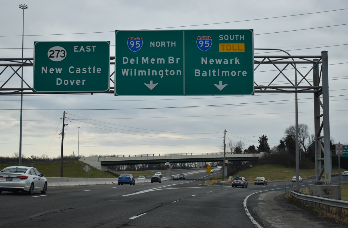
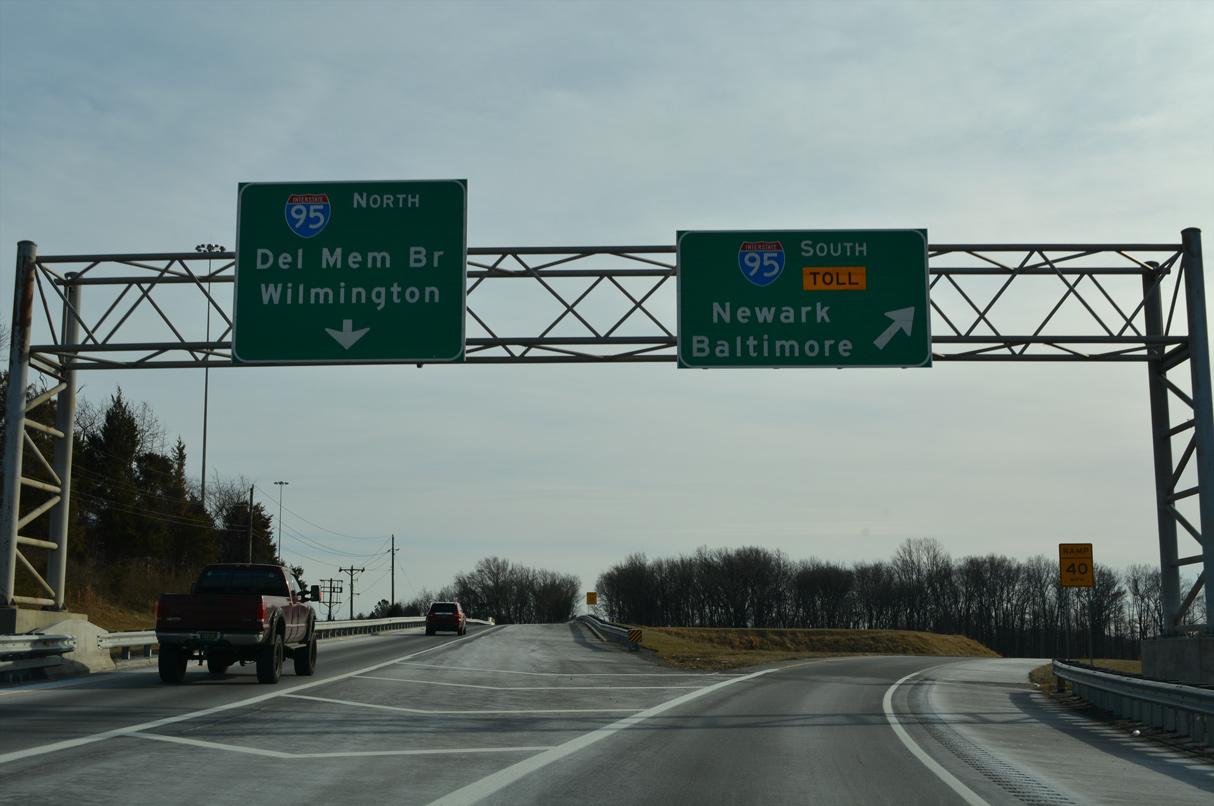
| A two lane entrance ramp leaves SR 273 east for I-95 south to Newark and Baltimore and north to Newport, the Delaware Memorial Bridge and Wilmington. Originally a diamond interchange joined SR 273 with the Delaware Turnpike here. The exchange was expanded into a directional cloverleaf interchange in 1979. 12/22/20 |
|
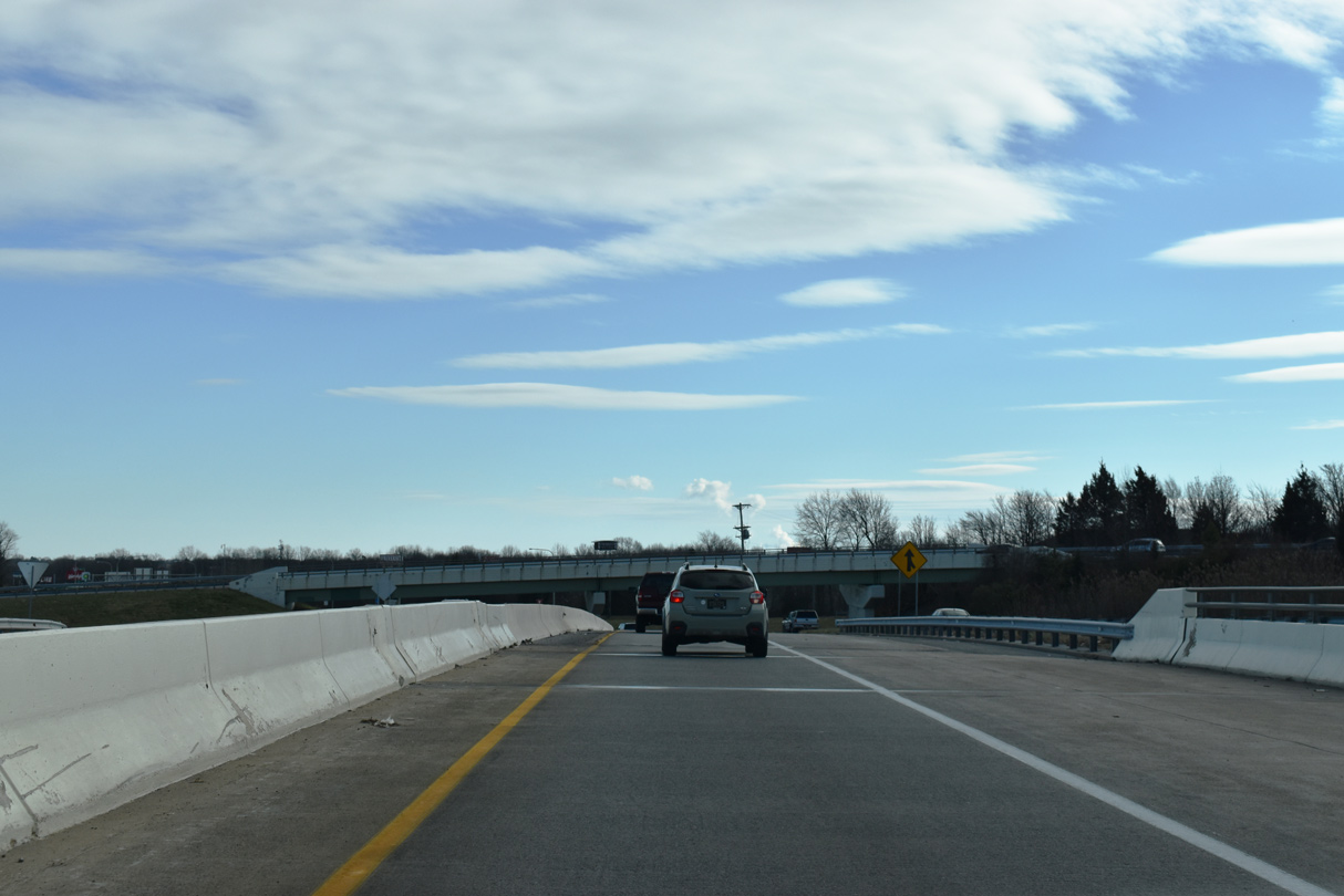
| Traffic partitions for I-95 south ahead of the Biden Welcome Center and a single lane flyover for I-95 north ahead of SR 1/7 by Christiana Mall. 12/26/22 |
|
| The SR 273 eastbound mainline tapers to a single lane above Interstate 95. Back to back exit ramps join Christiana Road east ahead of Chapman Road. 12/26/20 |
|
| Chapman Road (Road 347) heads east from Salem Church Road at Christiana High School to span I-95 en route to University Plaza Office Park and Shopping Center. Chapman Road intersects SR 273 (Christiana Road) opposite Eagle Run Road north to the Promenade at Christiana retail development. 12/26/22 |
|
| Confirming marker posted where SR 273 curves southward toward the Christiana Bypass between Christiana Town Center and University Plaza Shopping Center. The original alignment continued straight onto W Main Street into Christiana. 12/26/22 |
|
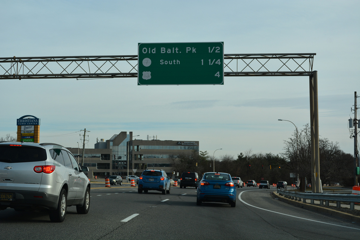
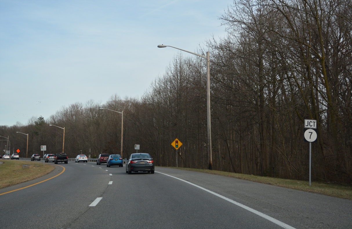
| An interchange sequence sign precedes the signalized intersection with Old Baltimore Pike by a half mile as SR 273 shifts onto the Christiana Bypass. The bypass circumvents unincorporated Christiana to the west and south. Prior to the completion of SR 1, SR 273 east to SR 7 south was the preferred route from I-95 to U.S. 40 at Bear. 12/26/22 |
|
| W Main Street was realigned to default traffic into Christiana Town Center at Browns Lane. An adjacent access road leads back south to the street through Christiana. 12/26/22 |
|
| Turning south, this reassurance marker for SR 273 (Christiana Bypass) was posted after W Main Street. It was removed by 2015. 06/17/12 |
|
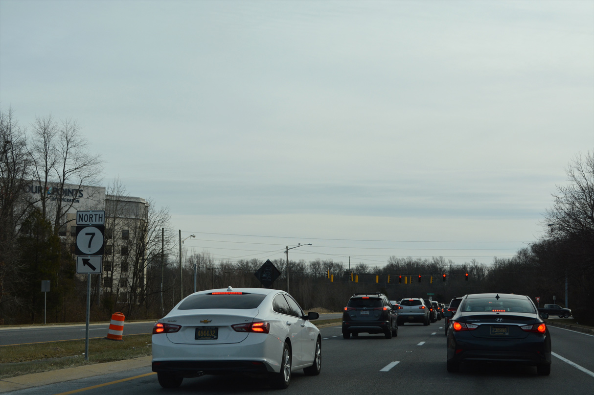
| Motorists headed to SR 7 north to Christiana Mall are directed to remain along SR 273 east to Old Baltimore Pike (Rd 26) east. 12/26/22 |
|
| Old Baltimore Pike heads west from the center of Christiana to suburban areas between I-95 and U.S. 40 to Iron Hill and Elkton, Maryland. 12/26/22 |
|
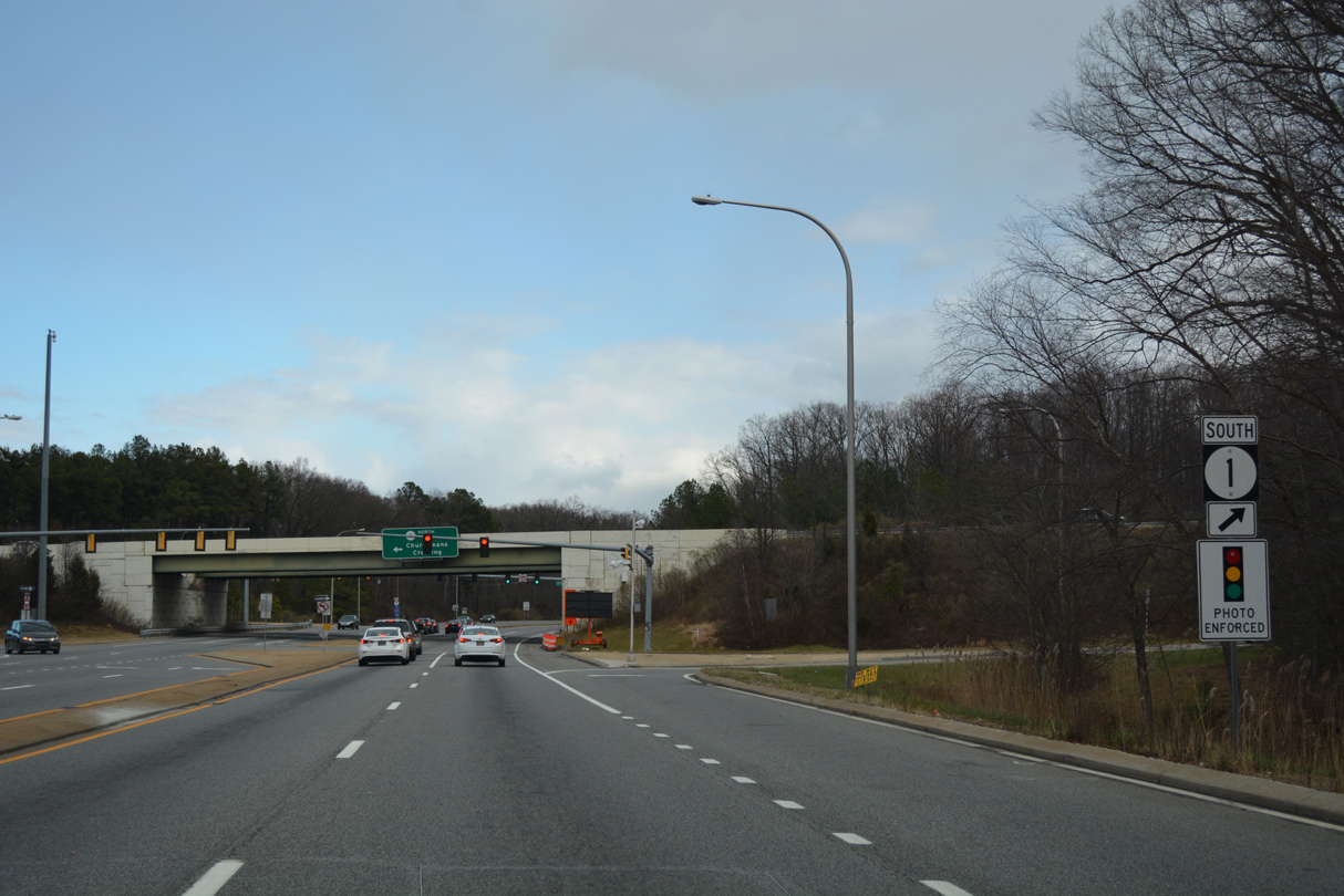
| Curving east across the Christiana River, SR 273 (Christiana Bypass) advances to both SR 7 (E Main Street) and the diamond interchange with SR 1. 12/26/22 |
|
| Forthcoming SR 7 (Bear Christiana Road) parallels SR 1 south to Bear, Red Lion and Wrangle Hill. 12/26/22 |
|
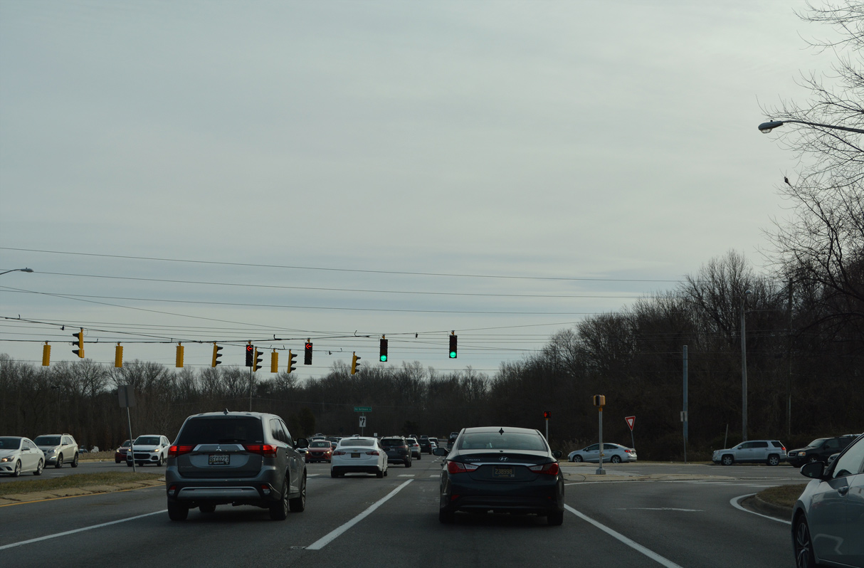
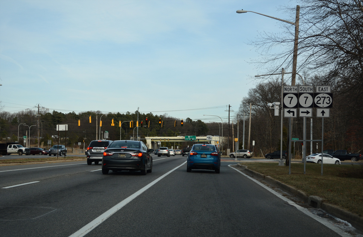
| Multiple signals slow traffic along SR 273 (Christiana Bypass) east at SR 7 (Bear Christiana Road) and the adjacent ramps with SR 1. Long range plans call for improving the interchange with SR 1 and traffic pattern with adjacent SR 7. 12/26/22 |
|
| The southbound entrance ramp for SR 1 to Bear, St. Georges, Smyrna and Dover follows on SR 273 east. 12/30/16 |
|
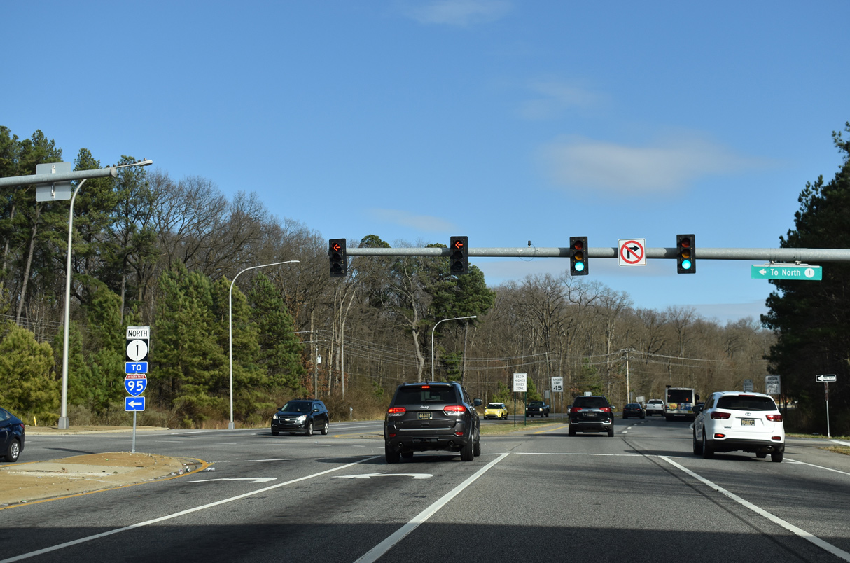
| SR 1 constitutes a heavily traveled commuter freeway north from Bear to Interstate 95 by Christiana Mall. SR 7 extends the limited access highway north to SR 58 in Churchmans Crossing. 12/26/20 |
|
| Continuing east, SR 273 transitions from the Christiana Bypass onto a four lane arterial between Lewden-Greene Park and the Hawk's Nest and Eagle Glen subdivisions. 12/30/16 |
|
| Appleby Road (Rd 343) heads south by an array of subdivisions and town home communities to link SR 273 with U.S. 40 (Pulaski Highway) near State Road. 12/26/20 |
|
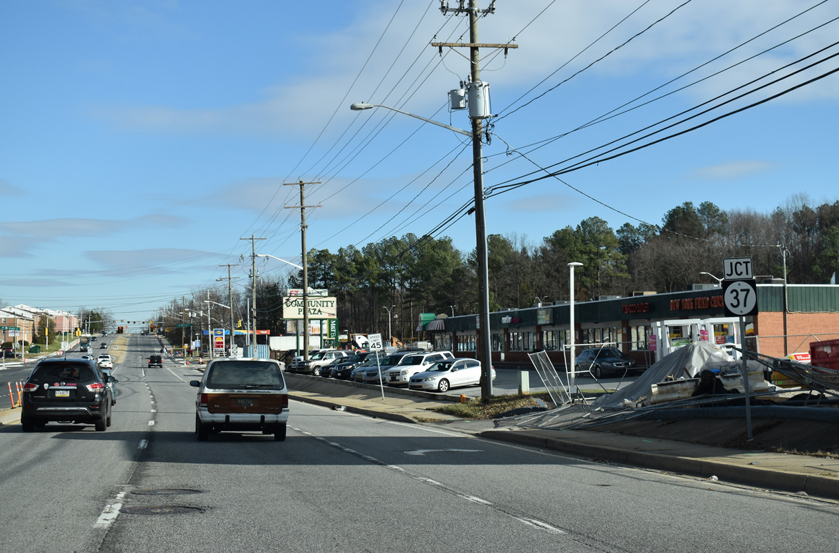
| The ensuing eastbound signal on SR 273 operates at Community Plaza shopping center and the south end of SR 37 (Airport Road). 12/26/20 |
|
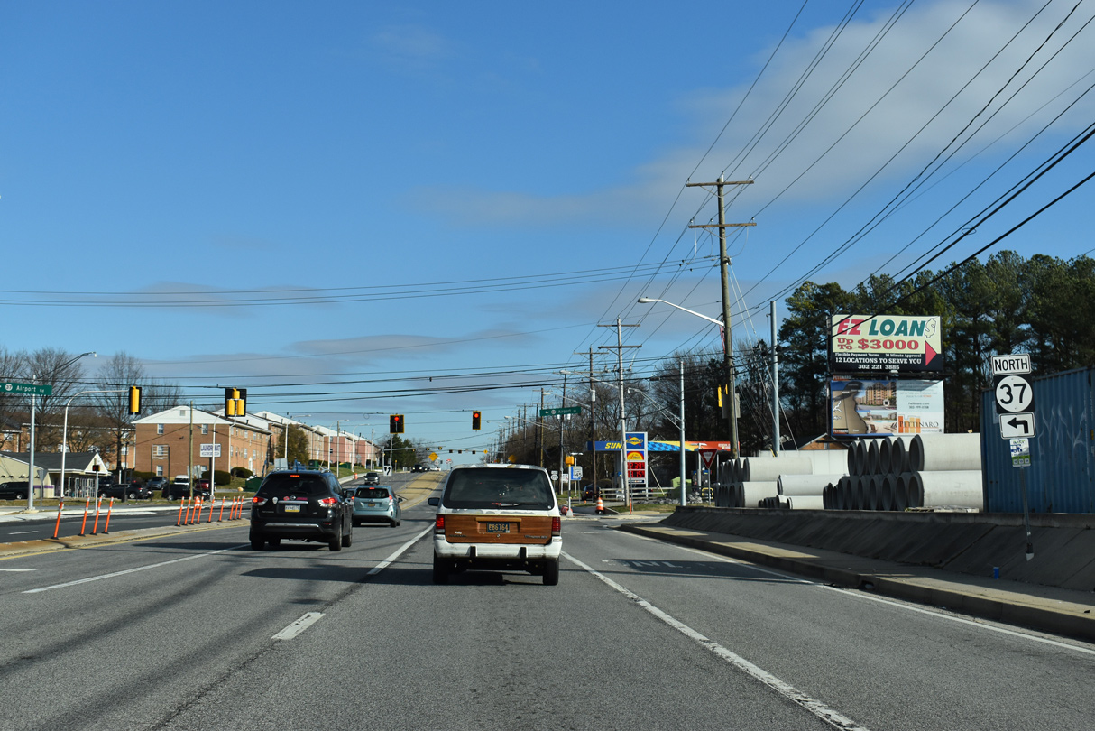
| Airport Road takes SR 37 northeast to SR 58 (Churchmans Road), the north side of New Castle County Airport (ILG) and Commons Boulevard at New Castle Corporate Commons business park. The 3.11 mile long route connects SR 273 with SR 141 (Basin Road) near I-95/295. 12/26/20 |
|
| SR 273 east confirming marker posted after SR 37 (Airport Road). 12/26/20 |
|
| HAWK (High-Intensity Activated crossWalK) pedestrian signals were installed along SR 273 at Freedom Trail and Georgetown Manor Apartments in Fall 2017. 12/24/17 |
|
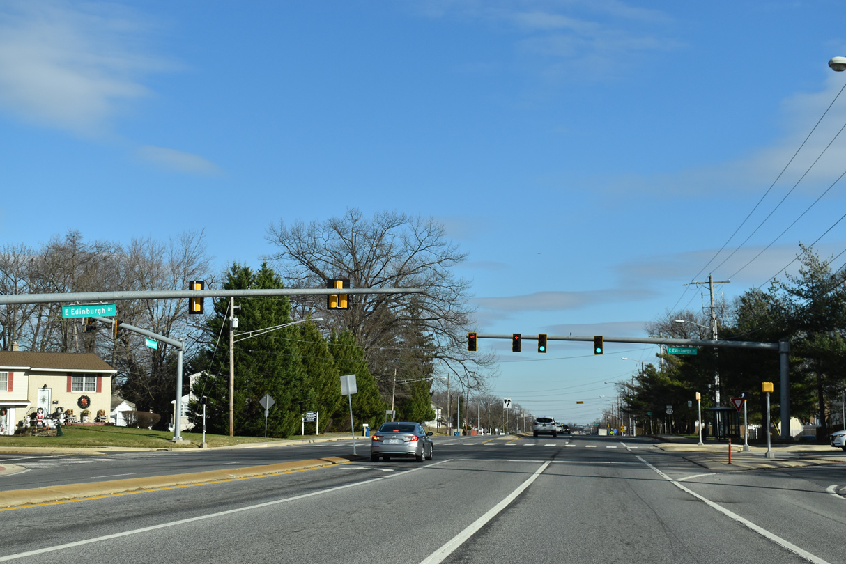
| Widening of SR 273 east from the Christiana Bypass to Hares Corner in the 1990s resulted in several new signalized intersections for adjacent subdivisions. Mast arms replaced span wire assemblies at Edinburgh Drive north to the Stratford community and south to Edinburgh Villas by 2016. 12/26/20 |
|
| Advancing east from Edinburgh Drive along SR 273 (Christiana Road). 12/26/20 |
|
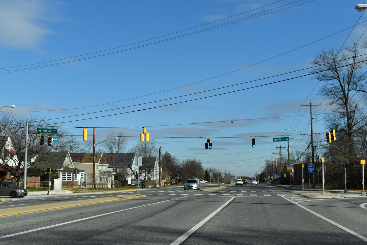
| The traffic light on SR 273 at Scottie Lane south and Pleasant Place north serves Pleasantville Elementary. 12/26/20 |
|
| This shield for SR 273 stands along Christiana Road eastbound after Scottie Lane. 12/26/20 |
|
| Prangs Lane spurs south from SR 273 at Ramble Acres Shopping Center to the Rambleton Acres community. A remaining farm access road ties in from the north. 12/24/17 |
|
| This reassurance marker precedes Churchman Corporate Commons to the north and Churchmans Industrial Park to the south along SR 273 east. 12/26/20 |
|
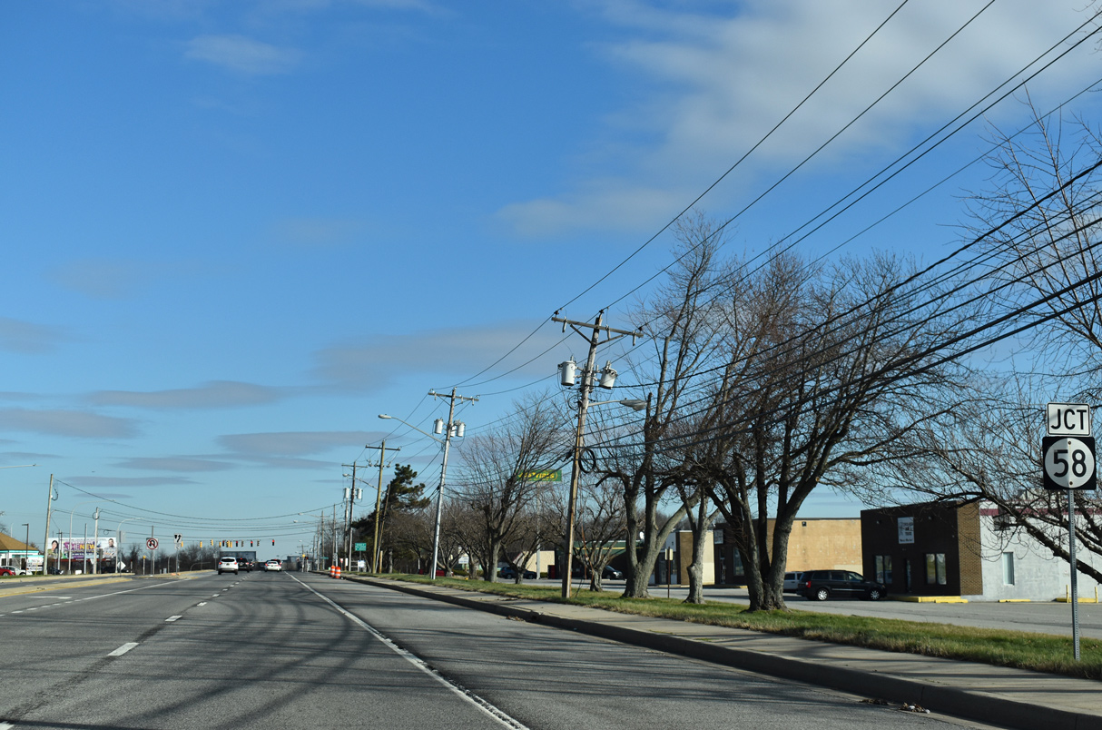
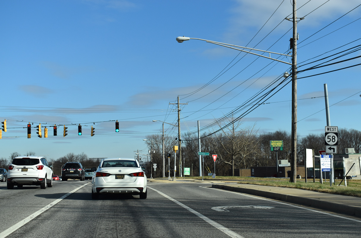
| SR 58 (Churchmans Road) arcs southeast from SR 37 (Airport Road) through an industrial park area west of New Castle County Airport (ILG) to end at SR 273 (Christiana Road). 12/26/20 |
|
| SR 58 follows Churchmans Road northwest for 3.86 miles to Churchmans Crossing and SR 4 by Christiana Hospital and Delaware Park. 12/26/20 |
|
| SR 273 (Christiana Road) dips across a tributary of Army Creek east of SR 58 (Churchmans Road). 12/26/20 |
|
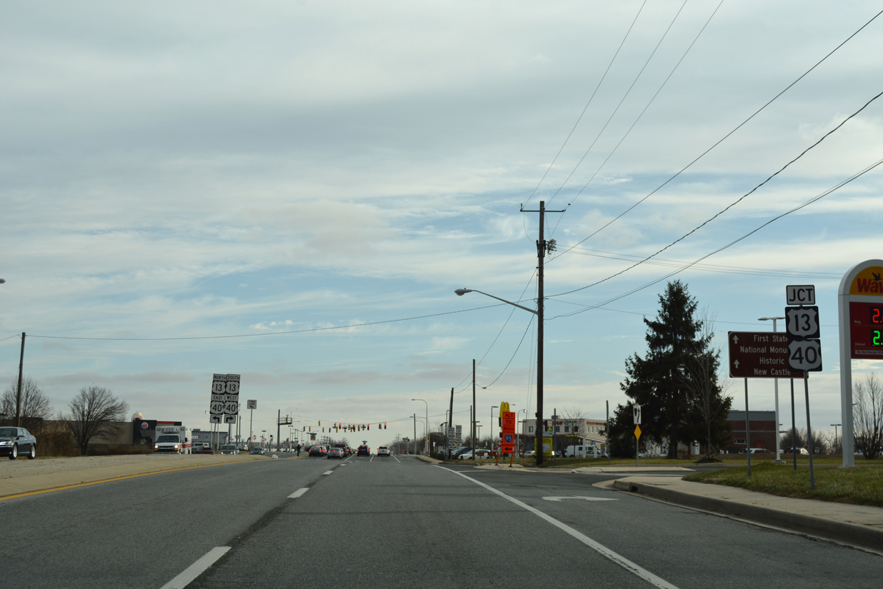
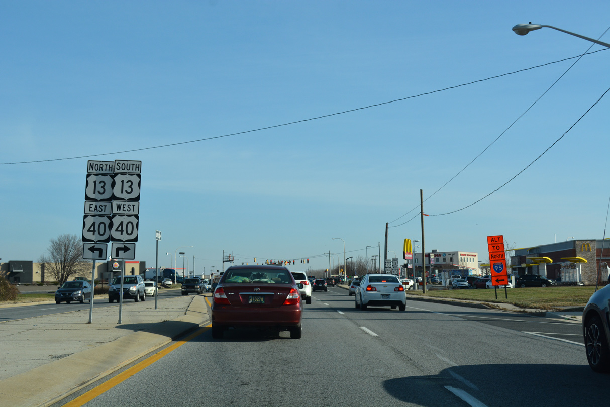
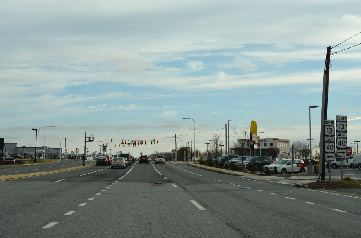
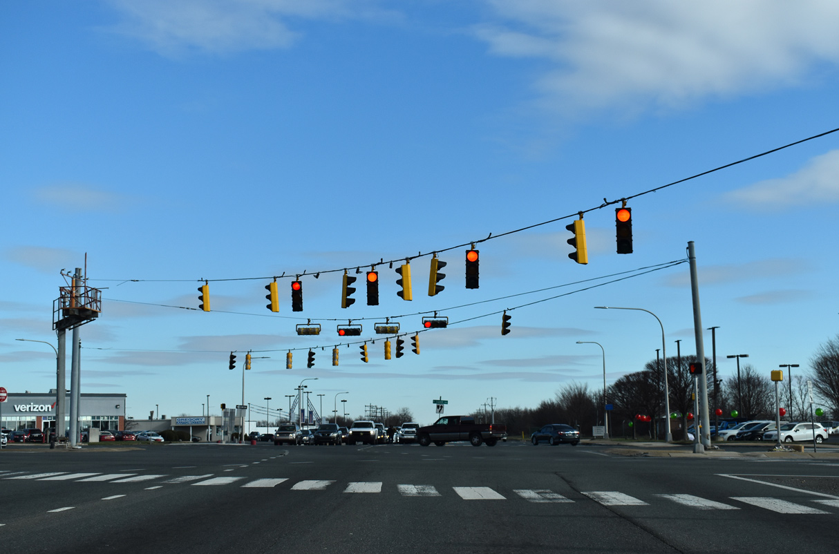
| Eastbound motorists along SR 273 reach Hares Corner and the busy junction with U.S. 13/40 (Dupont Highway). 12/24/17 |
|
| U.S. 13/40 combine along an eight lane stretch of Dupont Highway south to State Road and north to the Farnhurst interchange with Interstate 295. 12/23/16 |
|
| U.S. 13 travels the height of Delaware from Delmar to Seaford, Harrington, Dover, Smyrna and Wilmington. U.S. 40 overlaps with Dupont Highway north from State Road to I-295 and the Delaware Memorial Bridge. 12/24/17 |
|
| Hares Corner lies adjacent to the south end of New Castle County Airport (ILG). Runway lighting for the airport extends across the angled intersection between SR 273 and U.S. 13/40 (Dupont Highway). 12/26/20 |
|
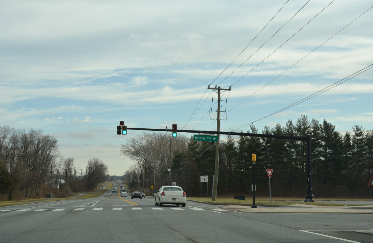
| Quigley Boulevard north and Traders Lane south come together at a signal just east of U.S. 13/40 (DuPont Parkway). The local roads connect SR 273 with Airport Industrial Park and New Castle Farmers Market respectively. 12/24/17 |
|
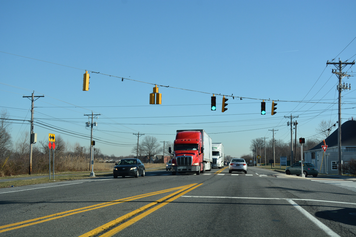
| SR 273 (Frenchtown Road) reduces to two lanes along farm land to the north and Centerpoint Business Complex to the south. A traffic light serves truck traffic headed south along Centerpoint Boulevard in this scene. 12/20/16 |
|
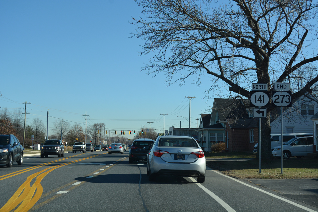
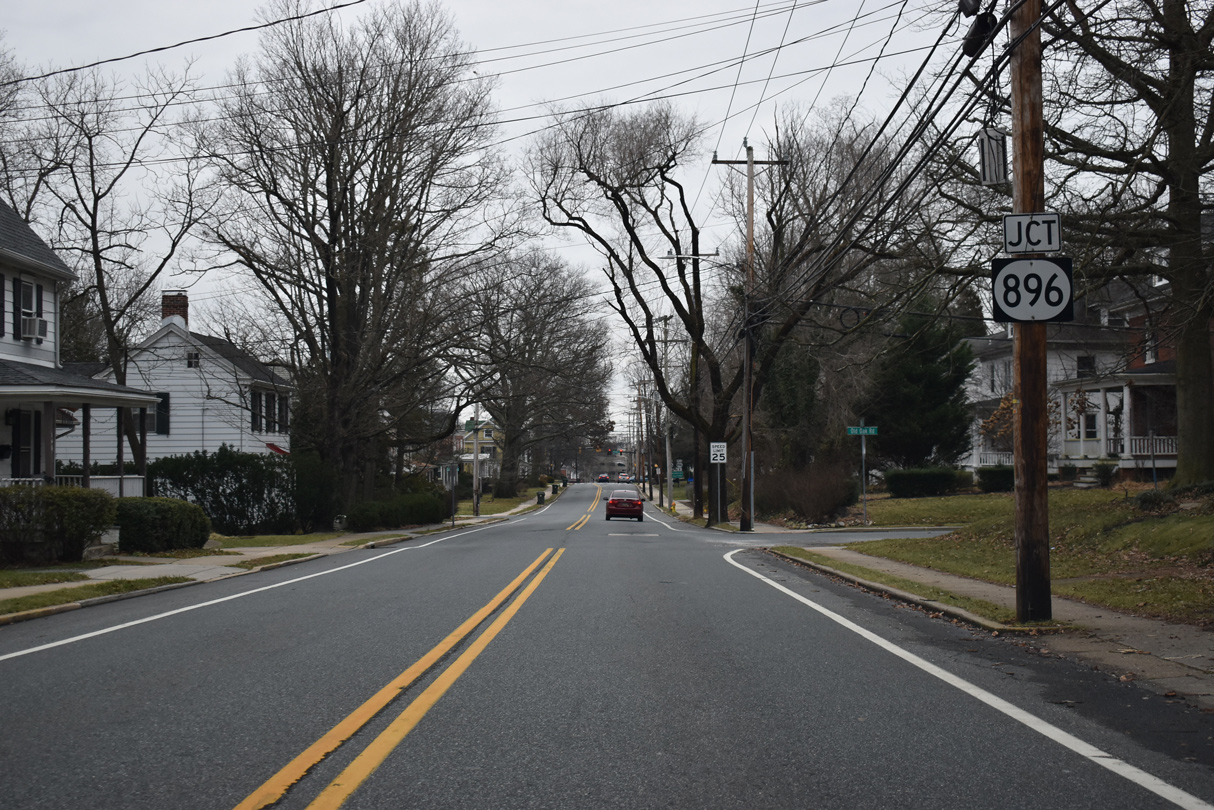
| An end shield for SR 273 was installed ahead of the intersection with SR 141 (Basin Road) north and the turn of SR 9 from Washington Avenue to Delaware Street. SR 273 formerly extended east alongside SR 9 on Delaware Street and Chestnut Street to 6th Street. 12/20/16 |
|
| SR 9 bypasses the city of New Castle street grid east from Washington Avenue to 6th Street as part of its north-south route between Delaware City and Wilmington. SR 141 commences its loop north to Newport and east to Fairfax from here as well. 12/20/16 |
06/30/10, 06/17/12, 06/20/12, 06/23/12, 12/20/16, 12/23/16, 12/28/16, 12/30/16, 12/24/17, 12/26/17, 01/02/19, 12/22/20, 12/23/20, 12/26/20, 12/24/22, 12/26/22 by AARoads
Page Updated 01-03-2023.

 East
East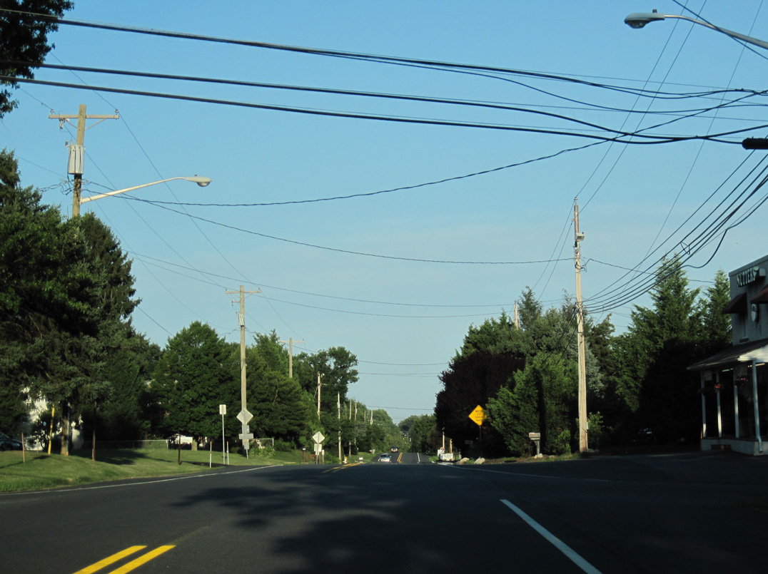
 South
South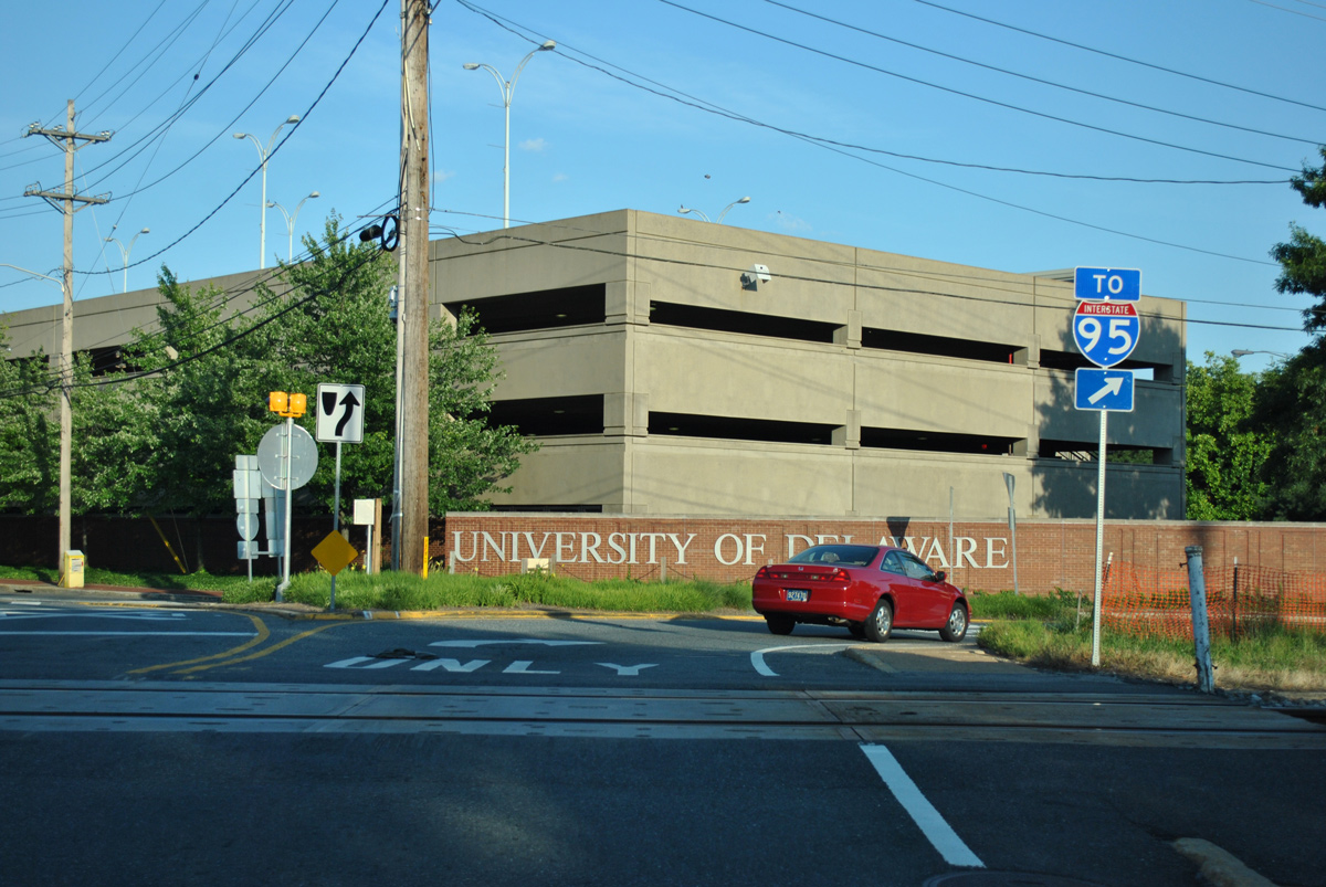


 North
North