Map Updated March 20, 2014.
Santa Rosa County is much larger than adjacent Escambia County, but populated areas are concentrated along the peninsula between Santa Rosa Sound and East Bay and the US 90 corridor between Pace and Milton. Much of northern Santa Rosa is rural in nature and areas to the southeast lie within Eglin Air Force Base. Therefore there are not as many county roads in Santa Rosa as compared with Escambia.
A loose grid of County Roads crisscross the northern half of the county. County Roads fall within the 100 to 300 series strata coinciding with State Roads 10 and 30. Unlike Escambia and Walton, replicated county road numbers were left in tact.
| County Road |
West / South End |
East / North End |
Mileage |
Signed? |
| 87A |
Point Baker - SR 87 |
N.A.S. Whiting Field - West Gate |
0.994 |
Yes |
| 87A |
N.A.S. Whiting Field - East Gate |
Roeville - CR 191 |
3.13 |
Yes |
| 87A |
SR 4 |
south of Dixonville - SR 87 |
2.99 |
Yes |
| 89 |
Pine Bluff |
East Milton - US 90 & SR 87 |
5.80 |
Yes |
| 164 |
Brownsdale - CR 197 |
SR 89 |
3.81 |
Yes |
| 164 |
SR 89 |
SR 4 |
8.85 |
Yes |
| 178 |
New York - CR 197 |
SR 87 |
9.03 |
Yes |
| 182 |
Chumucka - CR 197 |
Allentown - SR 87 |
10.92 |
Yes |
| 184 |
Escambia County line - CR 184 |
south of Wallace - CR 197, 197A, 184A |
5.86 |
Yes |
| 184 |
Ward Basin - CR 89 |
SR 87 |
3.34 |
Yes |
| 184A |
south of Wallace - CR 184, 197, 197A |
Milton - SR 89 |
7.88 |
Yes |
| 191 |
Milton - SR 87 |
Alabama state line - CR 19 |
30.24 |
Yes |
| 191 |
Downtown Milton - US 90 & SR 87 |
Milton - CR 191 (Munson Hwy) |
0.75 |
Partially |
| 191 |
west of Dickerson City - SR 281 |
Downtown Milton - US 90 & SR 87 |
10.91 |
Yes |
| 191 |
Garcon Point Park |
Garcon Point - SR 281 |
1.23 |
No |
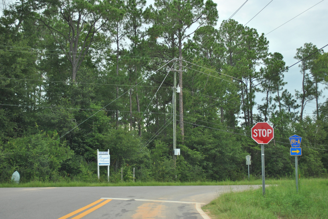
| 191A |
Galt City - SR 281 |
Bagdad - CR 191 |
2.50 |
Yes |
| 191A |
Villa Venyce - west of Coronado Drive |
Oriole Beach - CR 191 |
1.28 |
No |
| 191A |
Oriole Beach - unsigned CR 191 |
Oriole Beach - US 98 |
0.76 |
Yes |
| 191B |
CR 197A |
north of Harp - CR 281B |
0.86 |
Yes |
| 191B |
east of Oriole Beach - US 98 |
Midway - east end of Soundside Drive |
4.61 |
Yes |
| 191C |
west of Blackwater Bay - CR 191 |
Bagdad - CR 191 |
4.48 |
Partially |
| 191C |
west of Woodlawn Beach - CR 191B |
Midway - US 98 |
0.79 |
Yes |
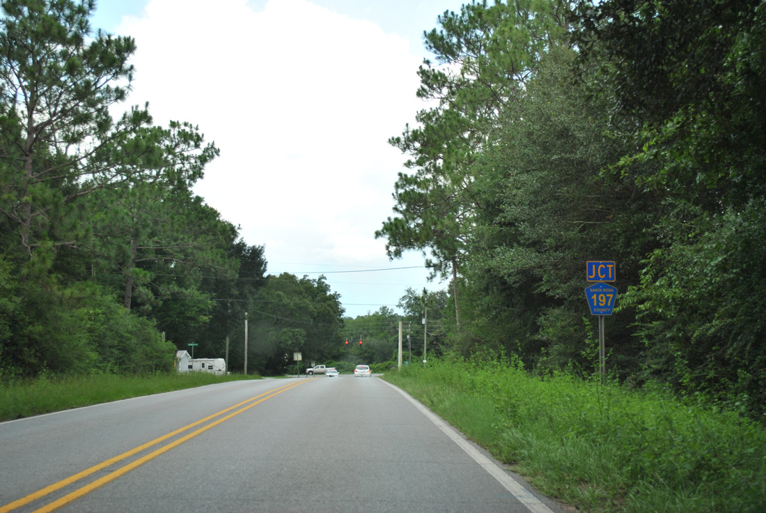
| 197 |
Floridatown - Parkview Street |
south of Jay - SR 89 |
27.63 |
Yes |
| 197A |
CR 191B |
Pea Ridge - US 90 |
1.995 |
Yes |
| 197A |
Pace - US 90 |
south of Wallace - CR 184, 184A, 197 |
3.73 |
Yes |
| 197A |
CR 197 |
Jay - SR 4 |
3.24 |
Yes |
| 197B |
Pace - US 90 |
Pace - CR 197 |
1.76 |
Yes |
| 281 |
Avalon Beach - SR 281 |
Harp - Mulat Road |
2.31 |
Partially |
| 281B |
north of Harp - CR 191B |
south of Galt City - SR 281 |
0.64 |
Yes |
| 399 |
Escambia County line - Navarre Beach |
Navarre - US 98 |
4.84 |
Yes |
| 399 |
Midway - US 98 |
Navarre - SR 87 |
9.87 |
Yes |
| 399 |
Whitfield - SR 87 |
east of Jay - SR 4 |
7.08 |
Yes |
| 399 |
east of Jay - SR 4 |
Mt. Carmel - SR 89 |
1.86 |
Yes |

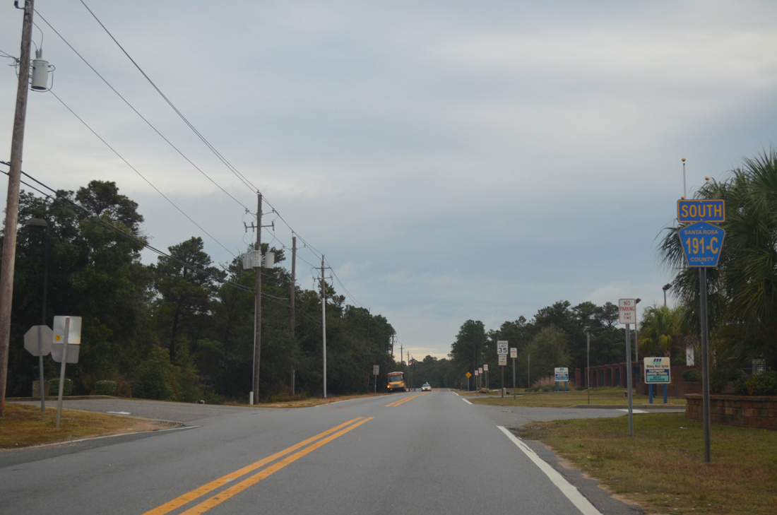
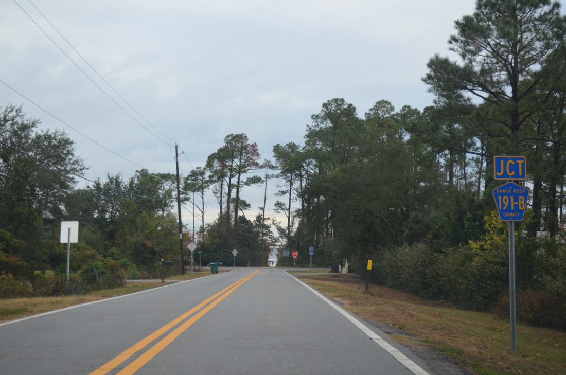
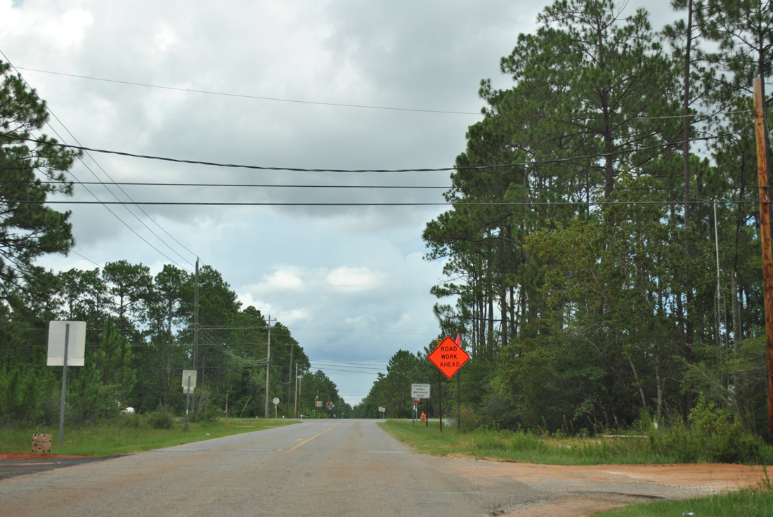
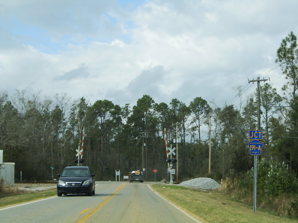
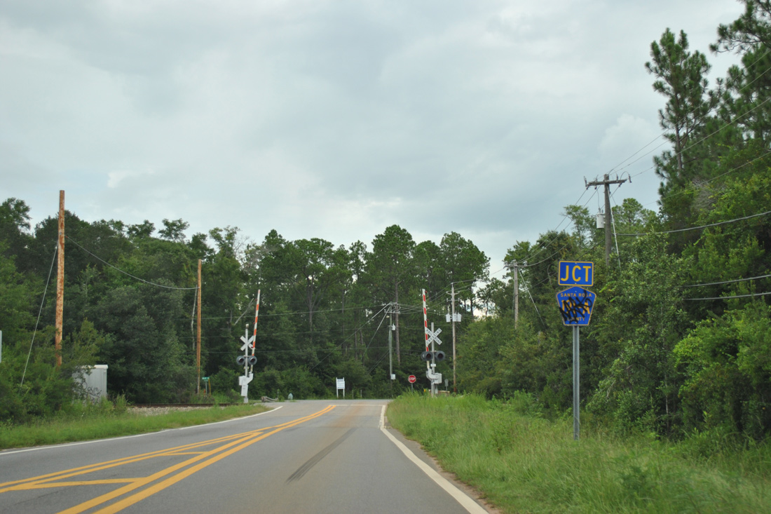
County Road 191C
Like County Road 191B, CR 191C sees two alignments in Santa Rosa County. Nantahala Beach Road doubles as CR 191C, between Soundside Drive (CR 191B) and U.S. 98 (Gulf Breeze Parkway) at Midway. Robinson Point Road constitutes a 4.48 mile loop east from CR 191 (Garcon Point Road) along Blackwater Bay.
Santa Rosa County 191C - Robinson Point Road
|
| The lone reassurance shield for County Road 191C stands just southeast of CR 191 (Garcon Point Road) at Bagdad. Robinson Point Road swings south ahead and crosses over Interstate 10. 01/22/11 |
|
| Robinson Point Road turns westward from the Robinson Point area off Blackwater Bay to return to CR 191 (Garcon Point Road). No shields are posted for either route at their rural junction. 04/09/09 |
Santa Rosa County 191C - Nantahala Beach Road
|
| County Road 191C comprises the western of three roads leading north from Soundside Drive to U.S. 98 (Gulf Breeze Parkway). The road also serves a satellite campus of Pensacola State College. 02/09/06 |
|
| The stop sign at U.S. 98 was upgraded to a traffic light in November 2008. A right turn lane was added as well. U.S. 98 travels east from Midway to Holly By The Sea and Navarre and west to Oriole Beach and Gulf Breeze. 02/09/06 |
|
| The northern half of Nantahala Beach Road differs from the residential southern half, with businesses and the Midway Water System office alongside CR 191C. 11/27/12 |
|
| Approaching the south end of County Road 191C at County Road 191B (Soundside Drive). 11/27/12 |
|
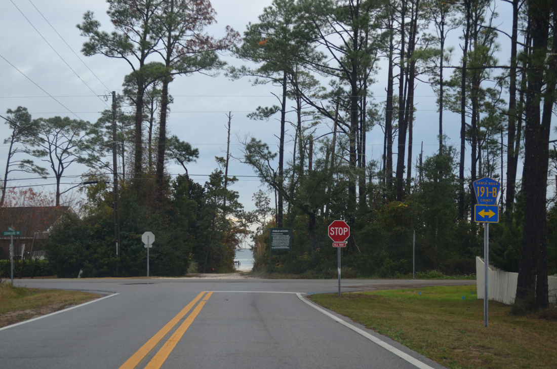
| A public beach access point lies south of the intersection between County Road 191C and 191B (Soundside Drive). Soundside Drive straddles the coastline of Santa Rosa Sound east to Woodlawn Beach and west to U.S. 98 near Tiger Point. 11/27/12 |
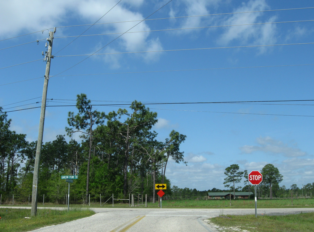
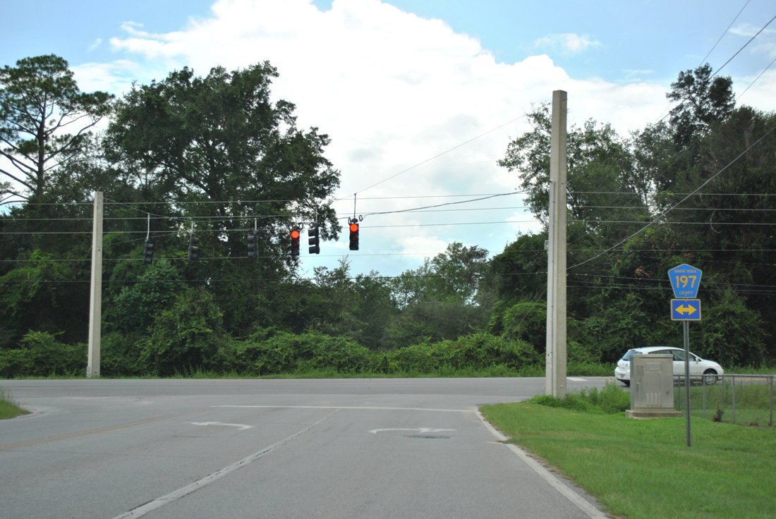
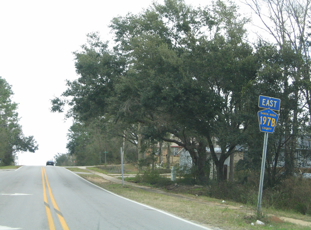
County Road 197B
Santa Rosa County 197B follows West Spencer Field Road north from U.S. 90 to Norris Road and Norris Road west to County Road 197 (Chumuckla Highway) in Pace.
|
| Heading north along West Spencer Field Road, drivers see the first reassurance marker for CR 197B just north of U.S. 90. 07/24/11 |
|
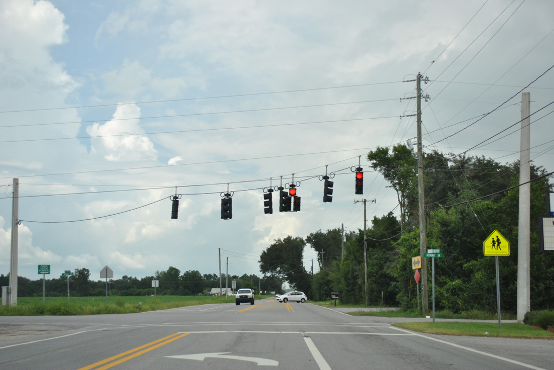
| Although unsigned, County Road 197B turns west from West Spencer Field Road at this traffic light with Attaway Drive onto Norris Road. NOLF Spencer Field lies just to the north. 07/24/11 |
|
| Norris Road lines the north side of Pace High School on the 0.74 mile drive west to CR 197 (Chumuckla Highway). 07/24/11 |
|
| Approaching the west end of both CR 197B and Norris Road. 07/24/11 |
|
| County Road 197A takes Chumuckla Highway north from U.S. 90 in Pace to SR 89 south of Jay. 07/24/11 |
|
| No longer posted, what was an eastbound shield for Santa Rosa County Road 197B posted on Norris Road by CR 197. 02/06/06 |
|
| West Spencer Field Road leads south from NOLF Spencer Field to become County Road 197B at Norris Road. Unsigned CR 197B follows the road south 1.02 miles to a commercialized stretch of U.S. 90 through Pace. 02/06/06 |
|
| West Spencer Field Road continues north from CR 197B another 2.3 miles to County Road 184A (Berryhill Road). 02/06/06 |
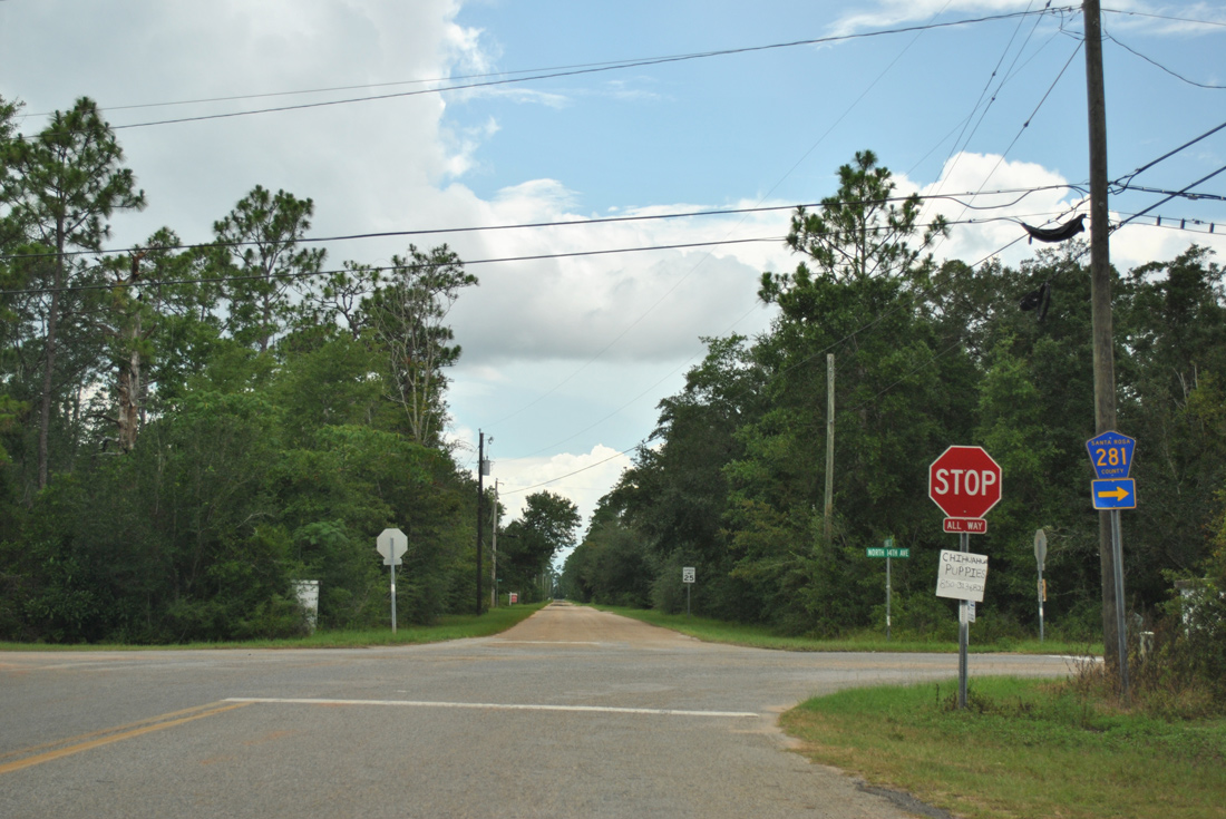
Santa Rosa County 281
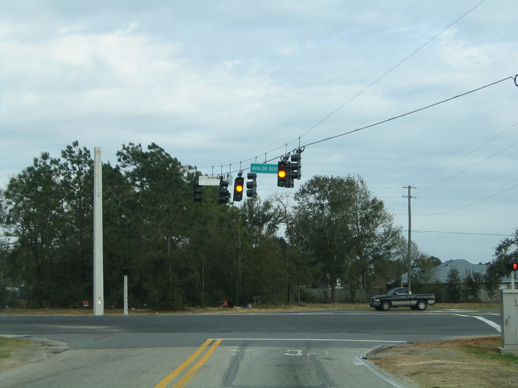
County Road 281 forms an L-shaped route west from Florida 281 (Avalon Boulevard) through the community of Avalon Beach. Following Del Monte Street, CR 281 travels west through a rural street grid before turning north onto 14th Avenue to a bridge over Mulatto Bayou. Montecito Boulevard extends the route north to Mulat Road (former County Road 191A) at Harp.
|
| Santa Rosa County Road 281 turns east from 14th Avenue onto Del Monte Street in the heart of Avalon Beach. 14th Street continues south and then west alongside I-10 to the Archie Glover Boat Ramp. 07/24/11 |
|
| Approaching SR 281 (Avalon Boulevard) along CR 281 (Del Monte Street) east at 30th Avenue. No signs are posted for the state road, which leads south to the Garcon Point Bridge and north to U.S. 90 at Pea Ridge. 07/24/11 |
|
| CR 281 takes Del Monte Street west 1.1 miles from SR 281 to 14th Avenue north. Del Monte Street extends west to 1st Avenue by Mulatto Bayou. 07/24/11 |
|
| 14th Avenue north after Del Monte Street. No reassurance marker for CR 281 is posted. 07/24/11 |
|
| Montecito Boulevard splits with Atlas Drive just north of the Mulatto Bayou bridge. 07/24/11 |
|
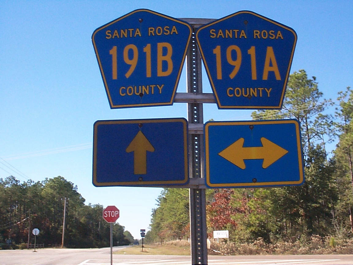
| A short distance further north is the end of County Road 281 at Mulat Road. County Road 191A followed Mulat Road northeast from Meloy Avenue to Avalon Boulevard historically. Pentagons remain along the route and at intersecting roadways. 02/06/06, 07/24/11 |
|
| Drivers along CR 281 cross a CSX Railroad line at-grade before reaching the stop sign with Mulat Road at Harp. 07/24/11 |
Santa Rosa County 281B
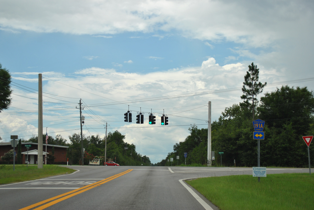
Cyanamid Road represents the southeastern third of a route between SR 281 (Avalon Boulevard) north to U.S. 90 at Pea Ridge. Signed as County Road 281B, Cyanamid Road links Avalon Boulevard with Mulat Road (old CR 191A) opposite CR 191B (Sterling Way) west to Bell Lane (CR 197A) north.
|
| Sterling Way transitions to Cyanamid Road east beyond Mulat Road by this Santa Rosa County Road 281B reassurance marker. 07/24/11 |
|
| Cyanamid Road passes between the Bon View and Crestwood Estates subdivisions to end at SR 281 opposite Pebble Ridge Drive. 02/06/06 |
|
| No shield is posted along Cyanamid Road west for County Road 281B. The 0.6 mile stretch concludes at a traffic light with Mulat Road, with CR 191B taking over along Sterling Way west. 11/28/99 |
|
| A sign replacement at Mulat Road removed CR 191B but retained CR 191A. Mulat Road leads southwest from SR 281 to Mulat, and several signs posted along it reference CR 191A. 07/24/11 |
There are several branches of County Road 399 in Escambia and Santa Rosa Counties. The segments are as follows:
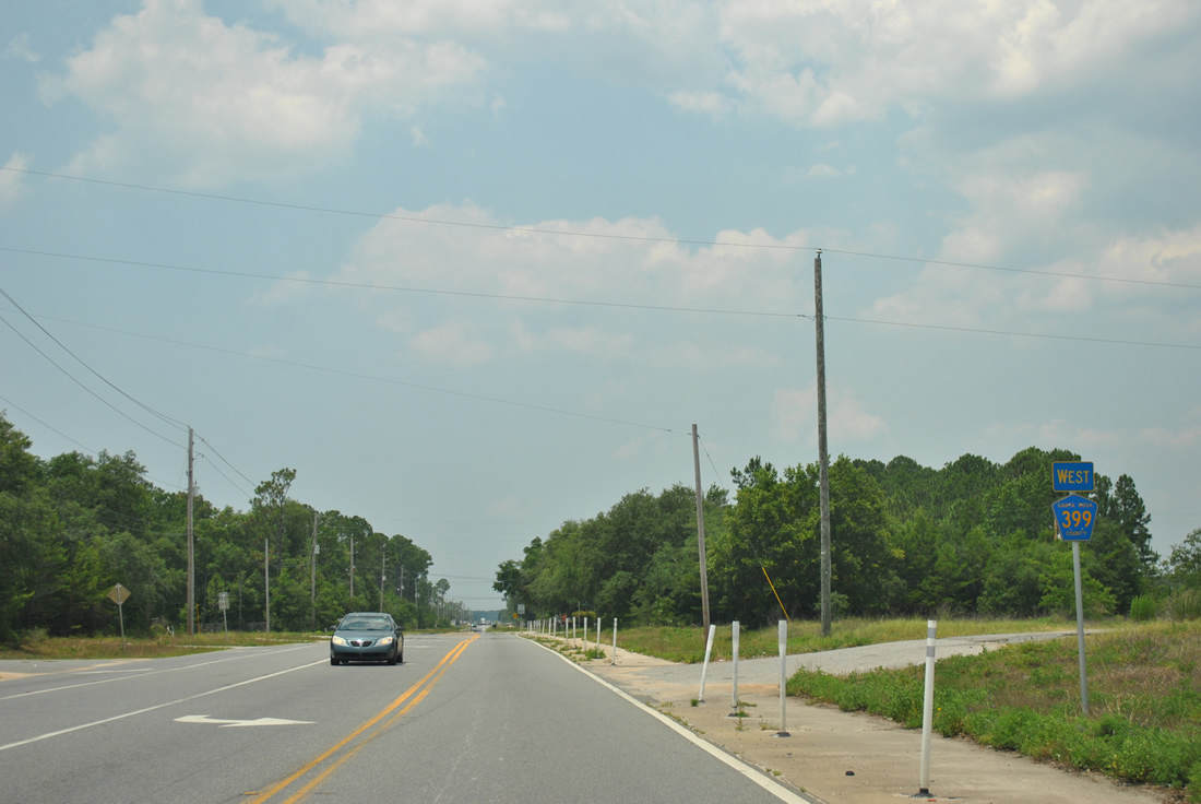
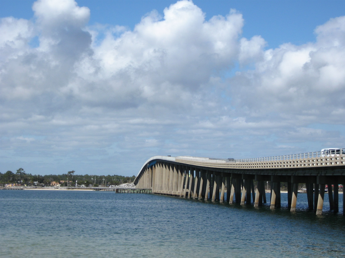
Santa Rosa County 399 links Navarre with Navarre Beach via Navarre Beach Causeway and the Navarre Beach Bridge. The two-lane roadway opened in 1960 as a toll bridge. Photo taken March 10, 2009.
East Bay Boulevard
East Bay Boulevard travels 9.87 miles from U.S. 98 at Midway to SR 87 in Navarre. The two-lane county road parallels much of East Bay as it bypasses the Holley By The Sea community along U.S. 98. East Bay Boulevard also serves OLF Holley of Naval Air Station Whiting Field.
|
| The lone eastbound reassurance marker for CR 399 along East Bay Boulevard stands just north of U.S. 98 at Midway. Encircling Holley By The Sea between Midway and SR 87 in Navarre, CR 399 generally hugs the shoreline of East Bay. 11/30/08 |
|
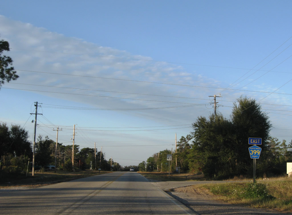
| Nearing the east end of the East Bay Boulevard segment of Santa Rosa County Road 399. A signalized intersection lies at the end with Turkey Bluff Road and SR 87. 11/01/08 |
|
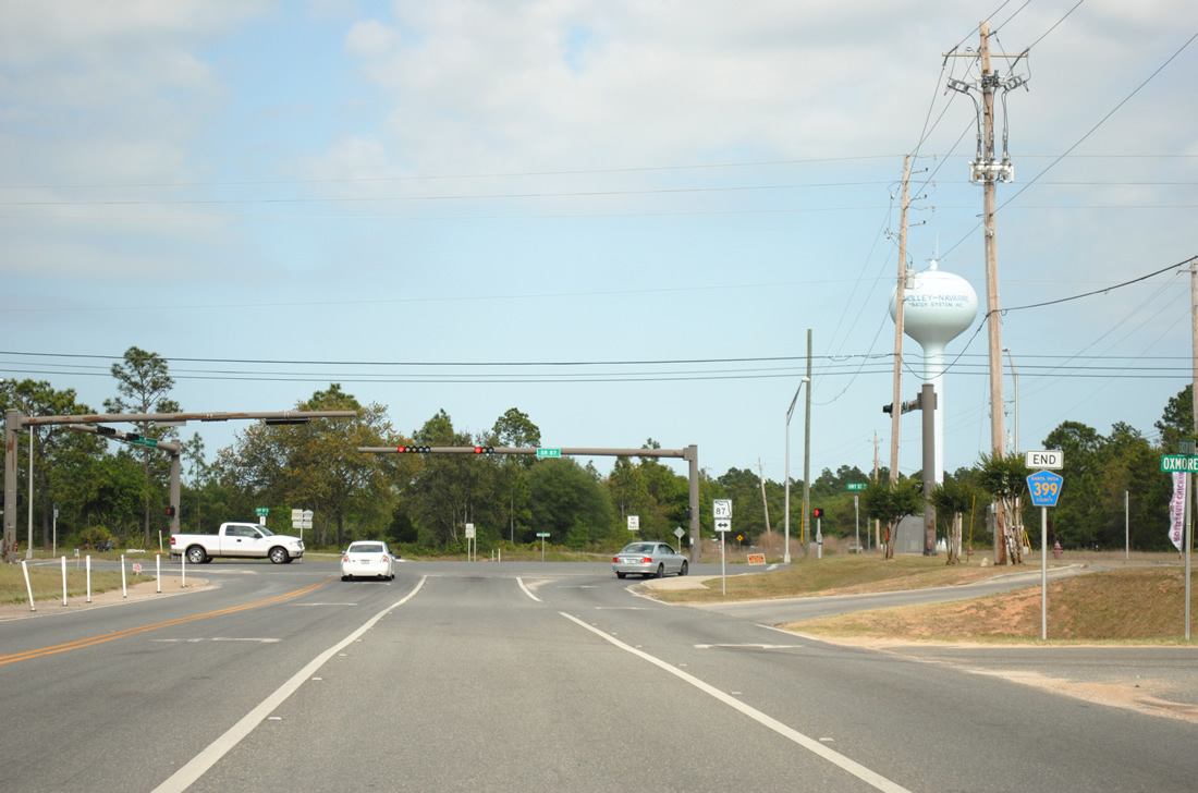
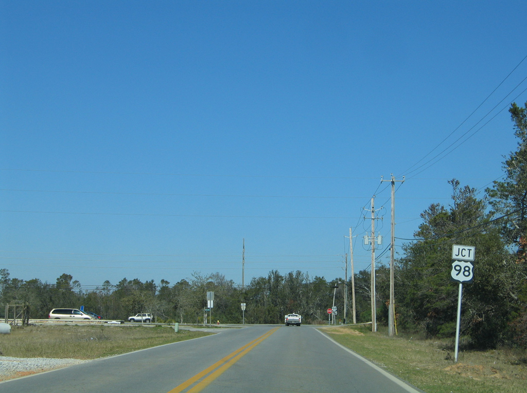
| A rare end sign is posted for Santa Rosa County Road 399's terminus at SR 87. 04/30/11 |
|
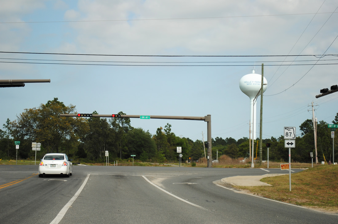
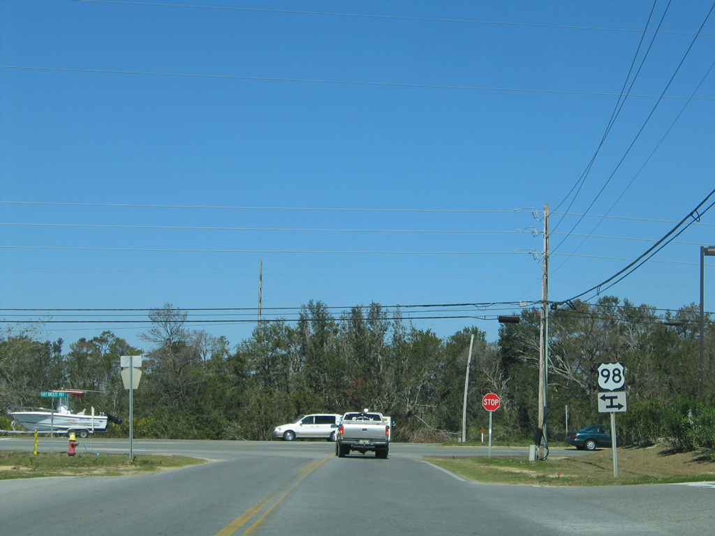
| SR 87 travels south 2.2 miles to U.S. 98 through Navarre and northwest to Harper and Holley on the 15.5 mile drive to Interstate 10. The road is four laned northward to U.S. 90. 04/30/11 |
|
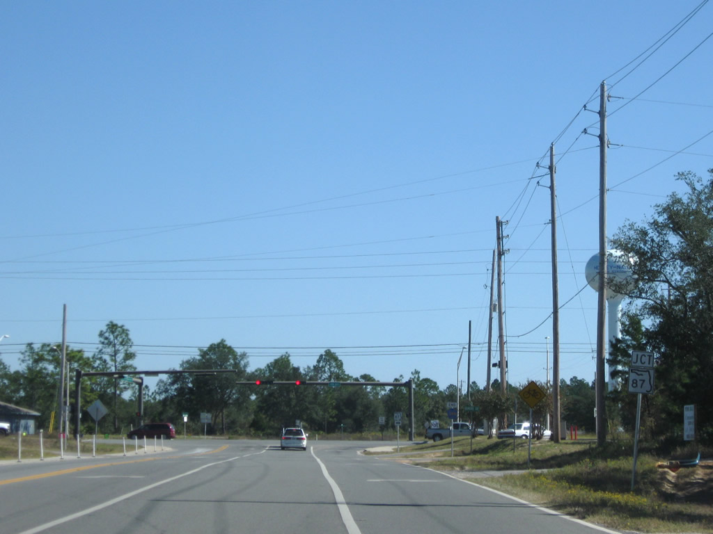
| Heading west from SR 87 on Santa Rosa County Road 399 (East Bay Boulevard) at Navarre. East Bay Boulevard includes a multi-use path from its beginning to Holley By The Sea. NOLF Holley lies 1.75 miles westward. 05/26/12 |
Country Mill Road
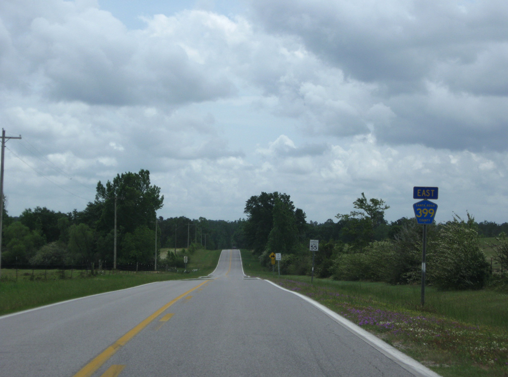
Country Mill Road acts as a 7.077 mile rural connector between SR 4, east of Jay, and SR 87 at Whitfield.
|
| Leading south from SR 4 by the first reassurance marker for CR 399 on Country Mill Road. 05/03/09 |
|
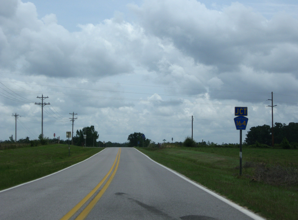
| Country Mill Road generally travels across open farm land before spanning the West Fork of Big Coldwater Creek. The route meets County Road 164 (Greenwood Road) just east of the crossing. 05/03/09 |
|
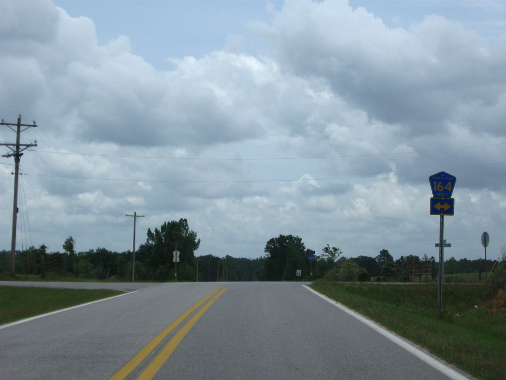
| Santa Rosa County Road 164 follows Greenwood Road northward to SR 4 and west to Cobbtown and SR 89. 05/03/09 |
|
| The remainder of County Road 399 along Country Mill Road heads east toward SR 87. 05/03/09 |
|
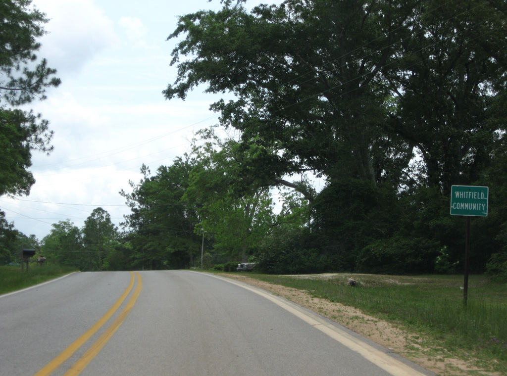
| CR 399 (Country Mill Road) reaches the Whitfield community ahead of SR 87. 05/03/09 |
|
| CR 399 south ends at a stop sign with SR 87 opposite Whitfield Road east to Lewis Road. SR 87 represents one of the main highways through Santa Rosa County, ending at Navarre off Santa Rosa Sound to the south and as Alabama State Route 41 to the north. 05/03/09 |
Tractor Trail
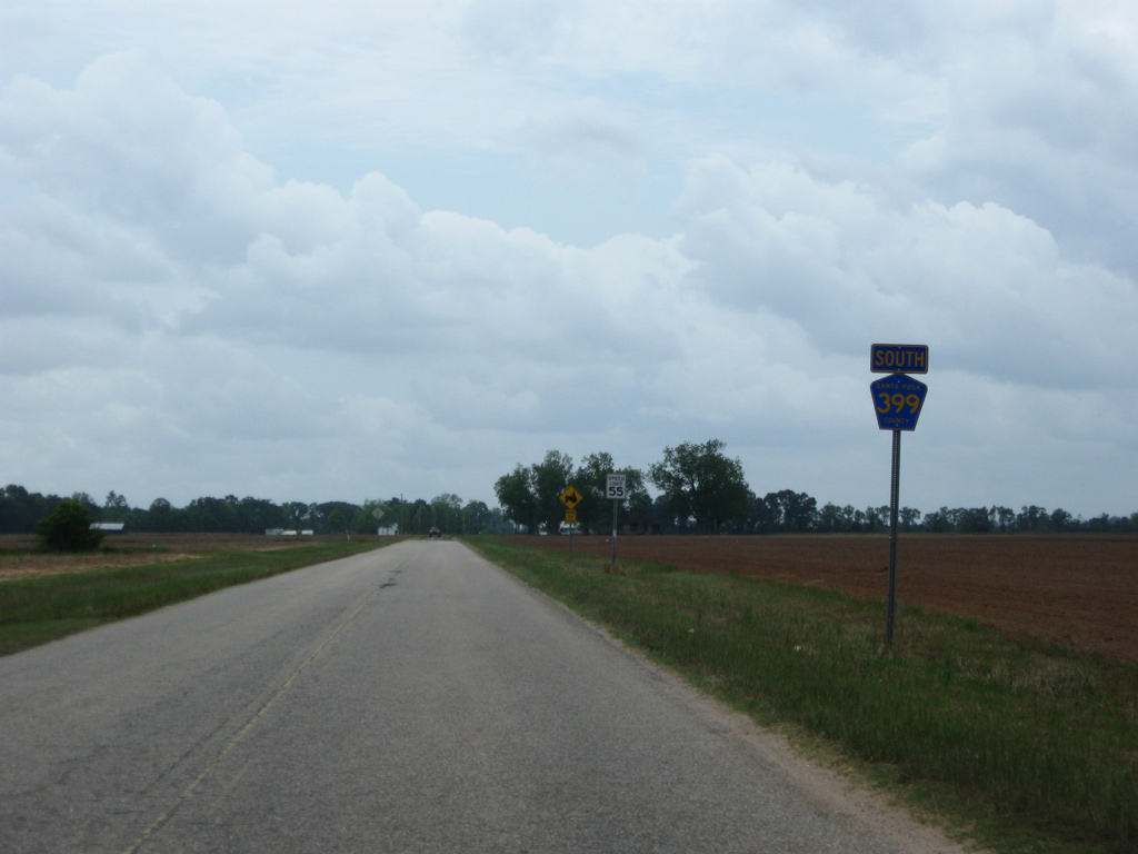
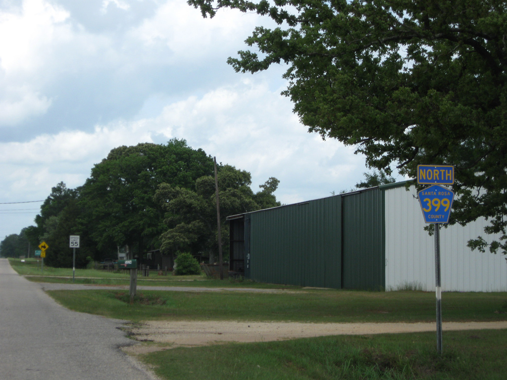
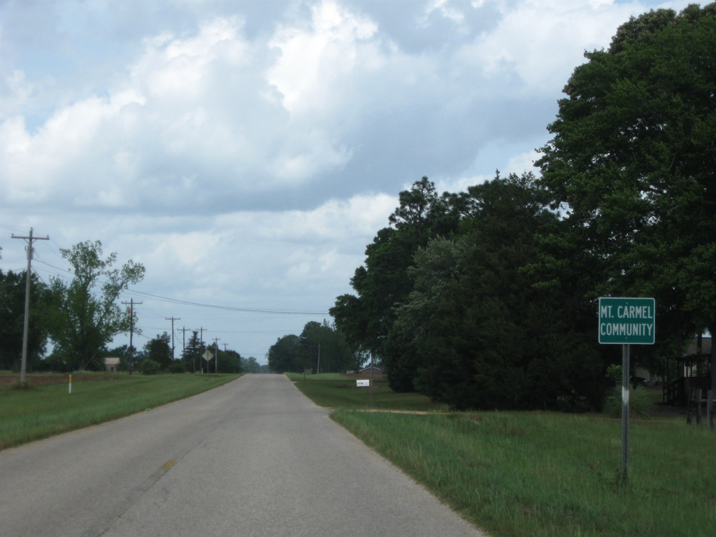
The northernmost portion of County Road 399 constitutes a 1.856 mile route connecting SR 89 at Mt. Carmel with SR 4 east of Jay. Tractor Trail ties into SR 4, one half mile west of the CR 399 loop along Country Mill Road southeast.
|
| Northbound reassurance marker posted as County Road 399 (Tractor Trail) stems north from SR 4 at Neal Jones Road. 05/03/09 |
|
| Santa Rosa County Road 399 (Tractor Trail) travels through the rural Mt. Carmel community to its end at SR 89. 05/03/09 |
|
| CR 399 ends at SR 89. SR 89 angles southwest into the city of Jay while curving northward to the state line. Escambia County Road 55 continues the roadway northeast to Riverview and Alabama Route 41, south of Brewton. 05/03/09 |
|
| County Road 399 (Tractor Trail) leads due south from SR 89 at Mt. Carmel across open farm land to SR 4. 02/07/06 |
|
| Tractor Trail Road ends opposite Neal Jones Road south at SR 4. SR 4 enters Jay just to the west while traveling a half mile east to the continuation of CR 399 south along Country Mill Road. 02/07/06 |
Page Updated 03-22-2014.

 South
South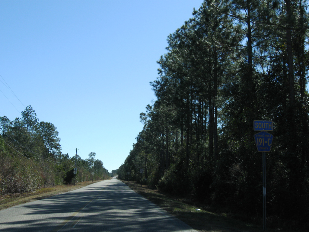
 North
North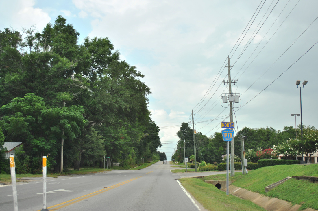
 West
West
 East
East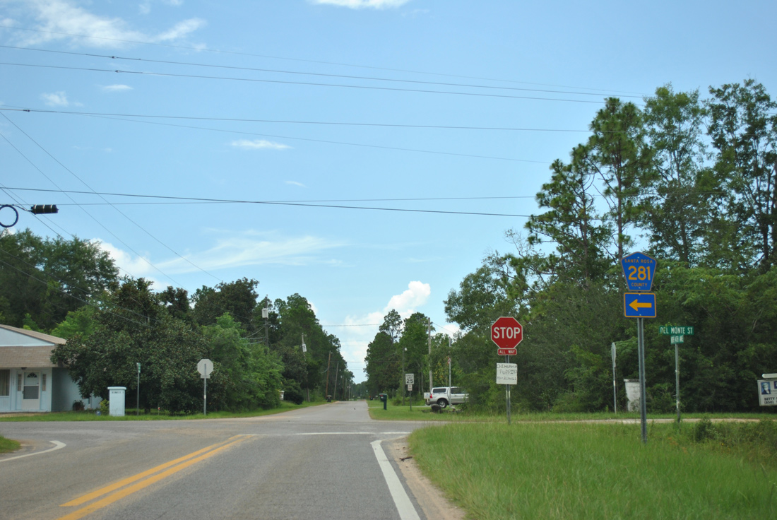
 East
East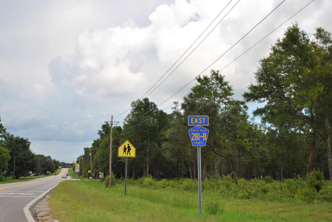
 East
East