

 North North |
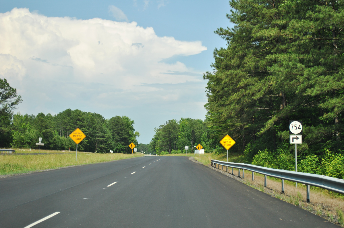 | U.S. 1 intersects SR 754 (Alpine Road) south just beyond the parclo interchange (Exit 15) with Interstate 85. 06/01/12 |
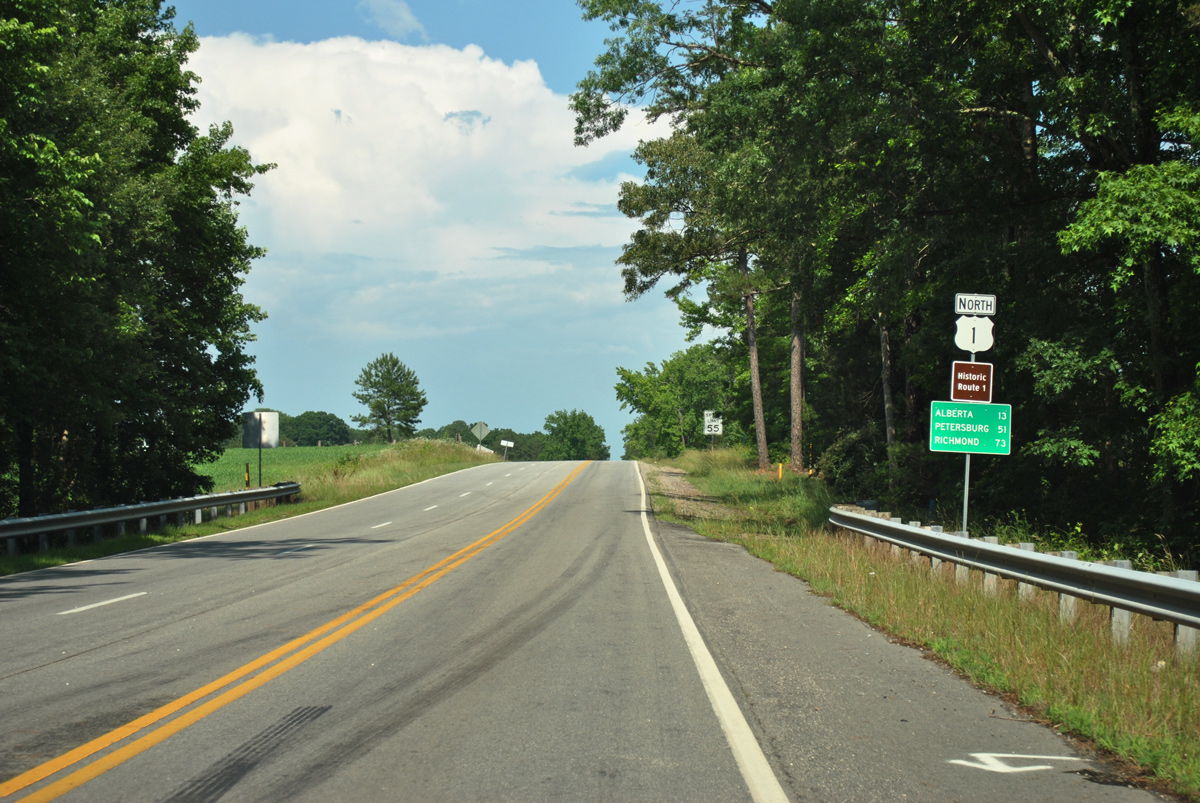 | U.S. 1 advances east from I-85 near Burnt Store along a two lane road with alternating passing lanes 13 miles to Alberta. 06/01/12 |
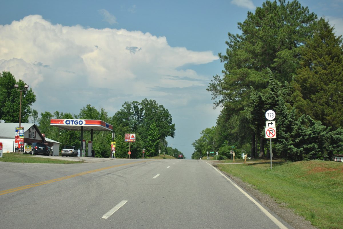 | Taylor Road (SR 778) spurs south from U.S. 1 to SR 621 at South Hill Country Club. 06/01/12 |
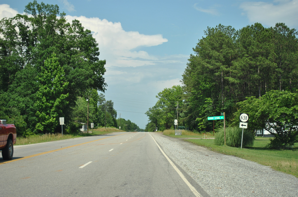 | Burnt Store Road (SR 638) ties into U.S. 1 from the west. The road was severed between SR 138 (Union Mill Road) and U.S. 1 during construction of Interstate 85. 06/01/12 |
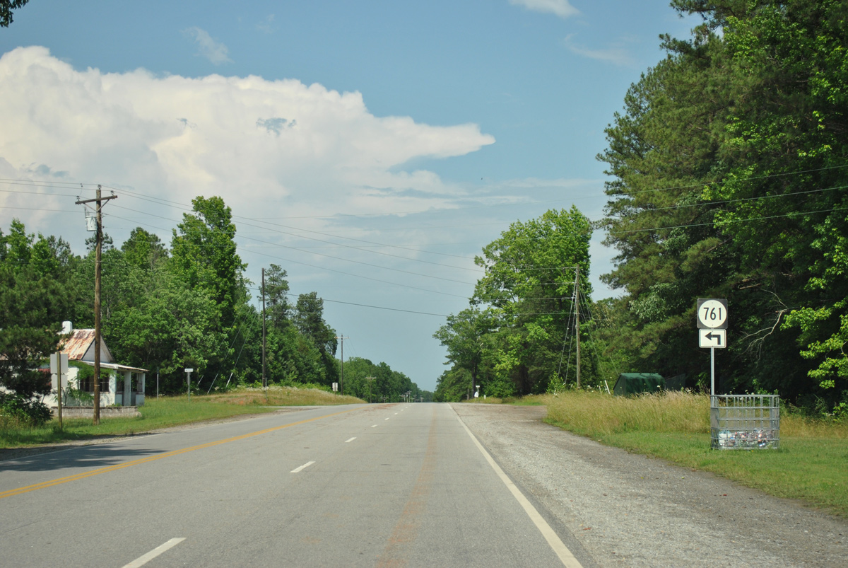 | SR 761 spurs northeast along Oak Road from U.S. 1 next. 06/01/12 |
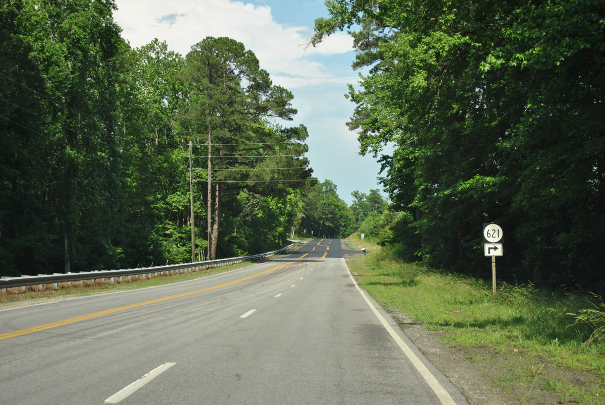 | Country Club Road (SR 621) travels 5.01 miles north from U.S. 58 at La Crosse to U.S. 1. A northern branch of the road follows Dixie Bridge Road into Lunenburg County. 06/01/12 |
 | East of SR 637 (Old Indian Road), U.S. 1 spans Shining Creek, a tributary of the Meherrin River. 06/01/12 |
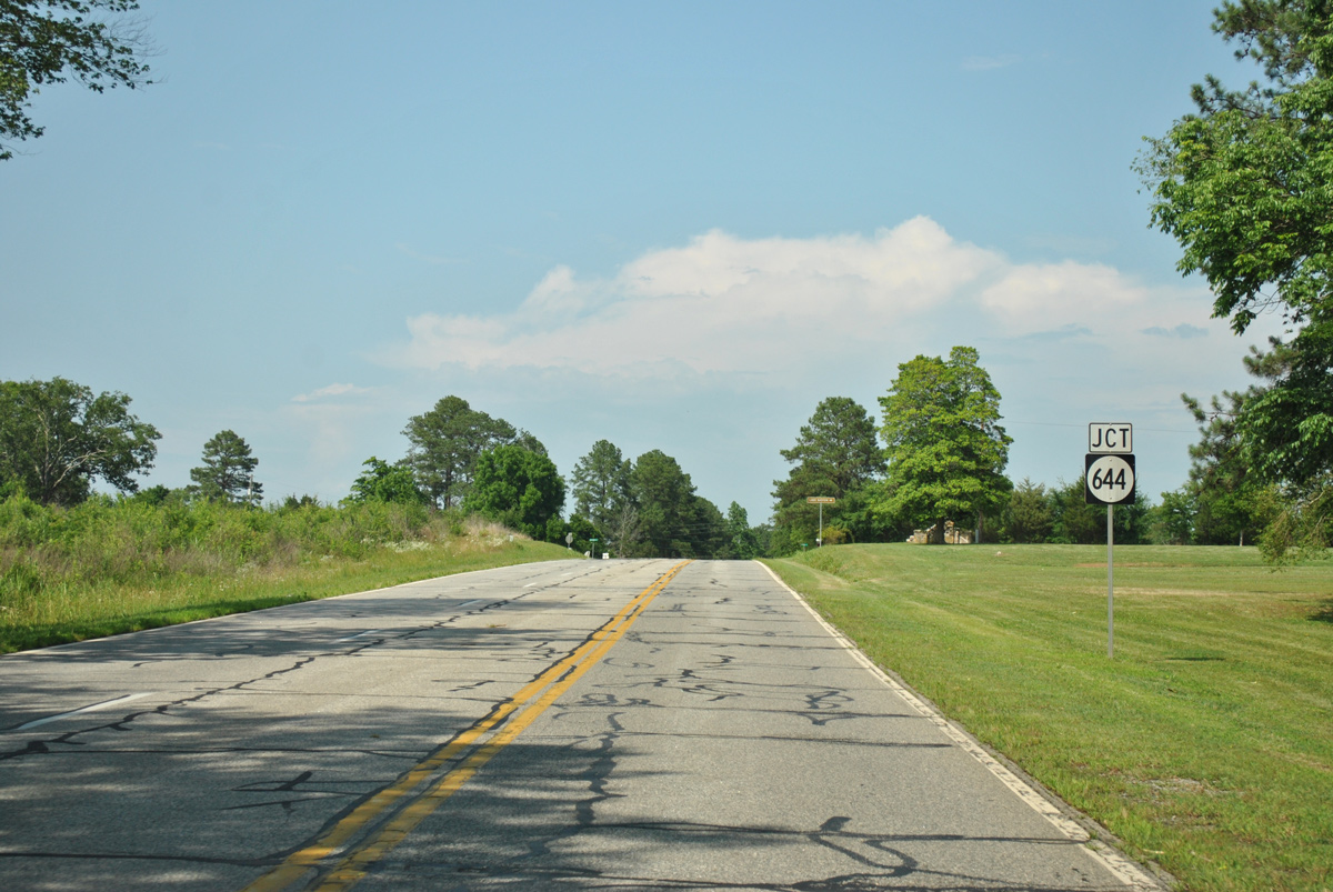
 | Forthcoming SR 644 (Brunswick Drive) joins U.S. 1 at the unincorporated community of Meredithville with Interstate 85, 0.94 miles to the north. 06/01/12 |
 | SR 644 follows Brunswick Drive north from Meredithville to SR 46 and south along Grandy Road to Charlie Hope and U.S. 58. 06/01/12 |
North  East East |
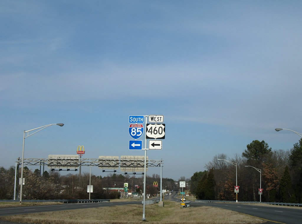
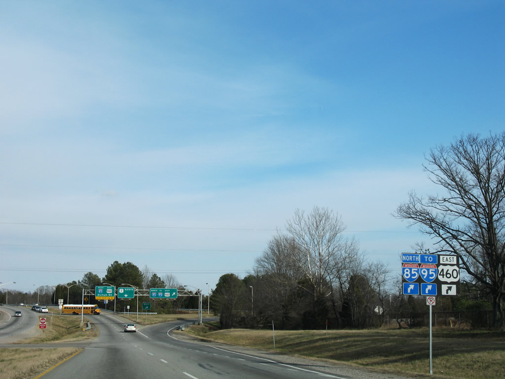 | U.S. 1/460 Business (Boydton Plank Road) enter a six-ramp parclo interchange with I-85/U.S. 460 just north of SR 142 (Simpson Road). 01/02/08 |
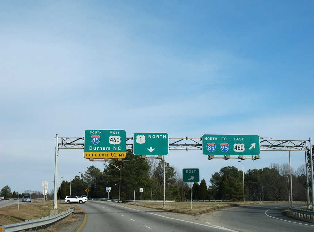 | I-85 concludes 4.6 miles to the east at I-95, where U.S. 460 turns south to Wagner Road (Exit 48A). 01/02/08 |
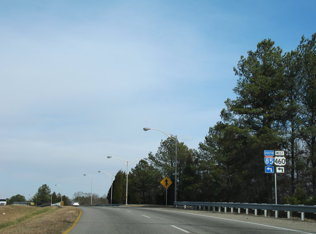 | U.S. 460 and Interstate 85 part ways 1.8 miles to the west at Exit 61 near Dinwiddie County Airport (PTB). 01/02/08 |
 | U.S. 1/460 Business (Boydton Plank Road) continue east from I-85/U.S. 460 into the city of Petersburg. I-85 travels south to South Hill and Durham, North Carolina. 01/02/08 |
| North |
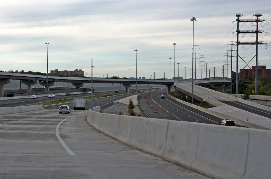
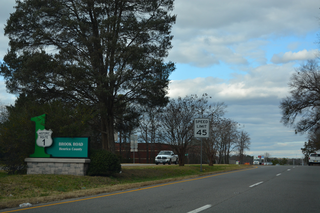 | U.S. 1 heads north from I-95 at Exit 51 and the city of Richmond along Brook Road to the communities of Lakeside and Glen Allen. 12/16/22 |
 | Brook Run Shopping Center lines the west side of U.S. 1 (Brook Road) among other retail and the Lakeside Landing town home community. 12/16/22 |
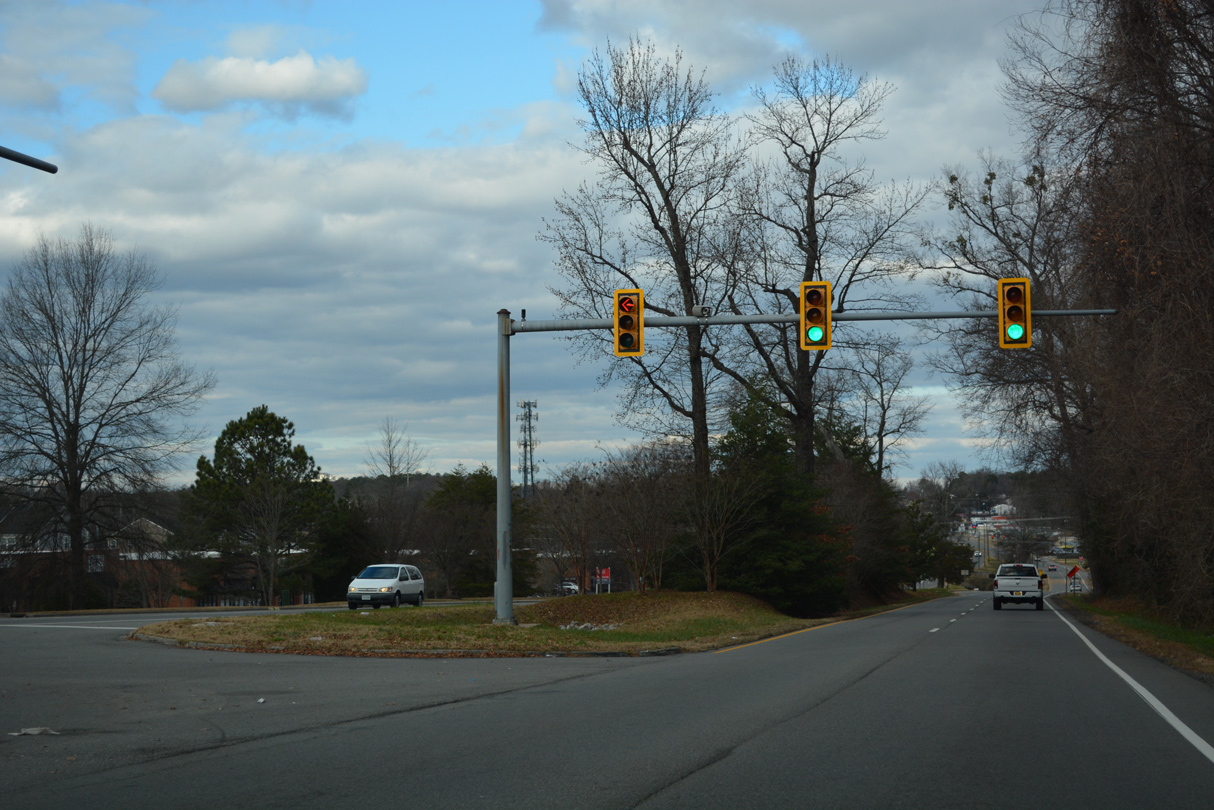
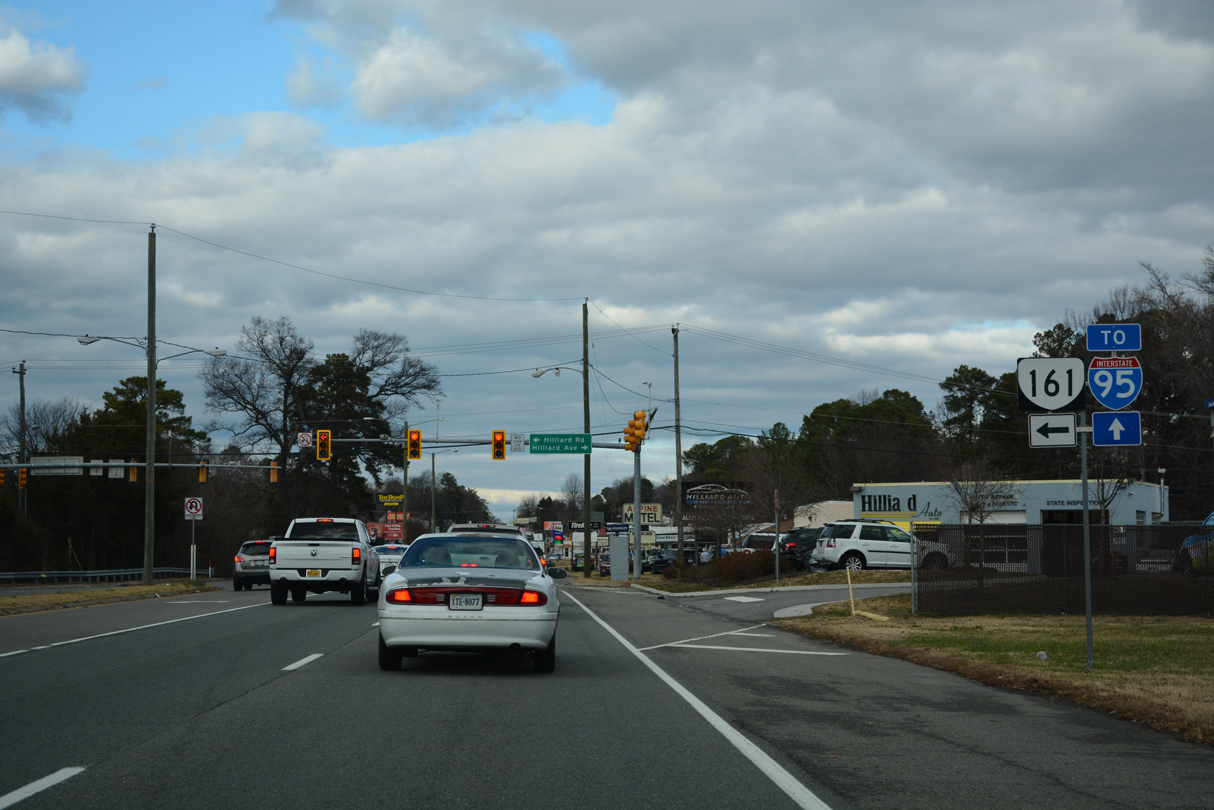 | The north end of SR 161 ties into U.S. 1 (Brook Road) at Hilliard Road in Lakeside. SR 161 constitutes a 14.04 mile long route to I-95 in south Richmond. 12/16/22 |
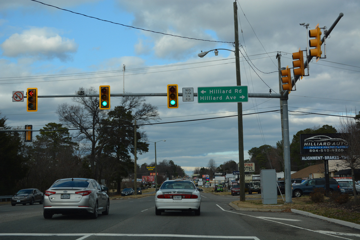 | Hilliard Avenue stems east from U.S. 1 and SR 161 into a residential street grid. SR 161 lines Hilliard Road west 0.74 miles to SR 356 at Lakeside Avenue. 12/16/22 |
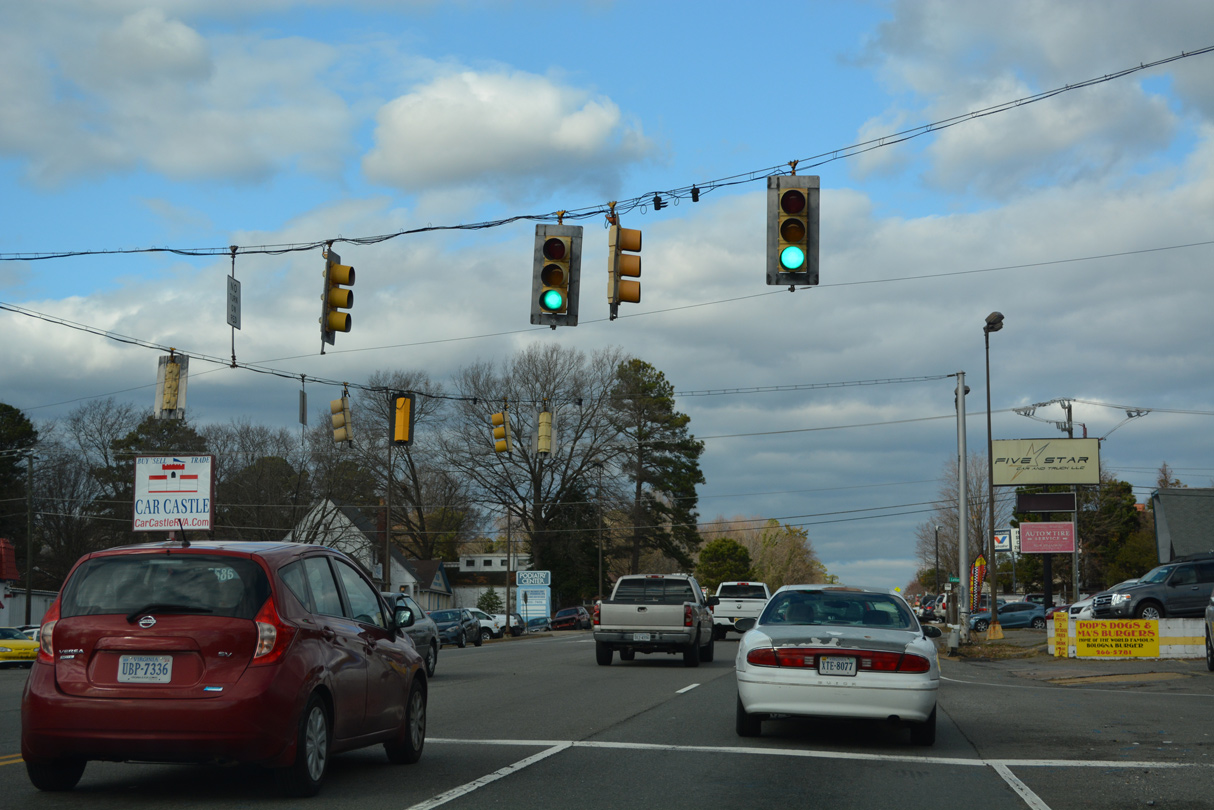 | Lakeside Avenue loops northeast from SR 161/356 to Lewis Ginter Botanical Garden and U.S. 1 (Brook Road) across from Lakeside Boulevard. 12/16/22 |
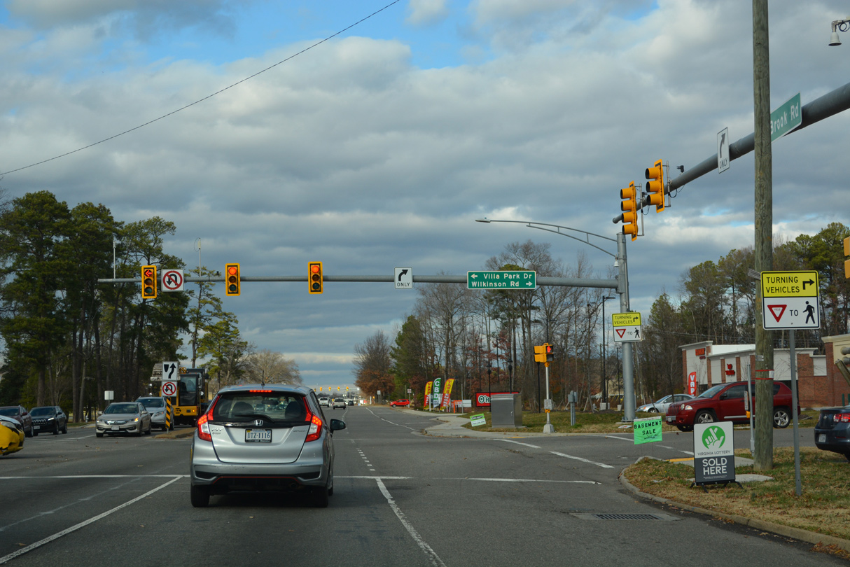 | Wilkinson Road arcs 3.31 miles southeast from U.S. 1 (Brook Road) at Villa Park Drive to the Chamberlayne community and Azalea Avenue near Richmond Raceway. 12/16/22 |
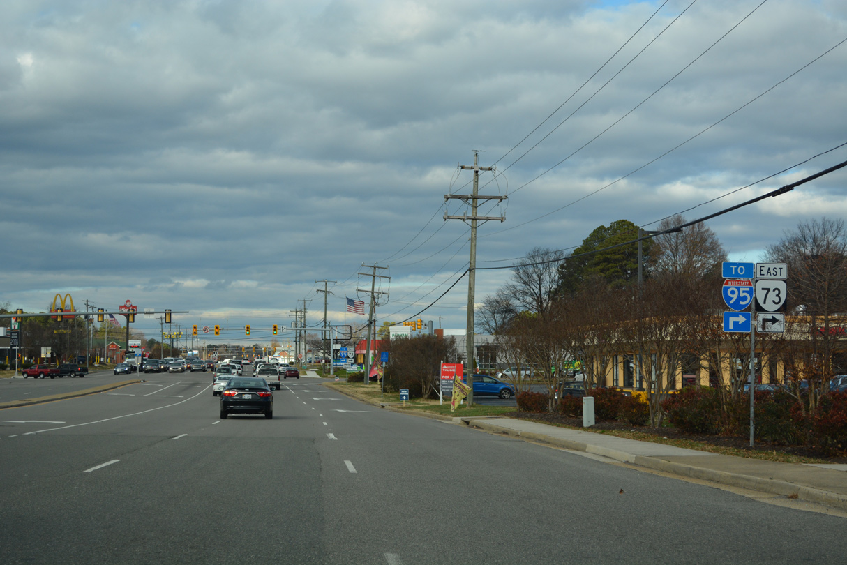 | SR 73 lines Parham Road for 0.78 miles between U.S. 1 (Brook Road) and the cloverleaf interchange (Exit 83) with Interstate 95. 12/16/22 |
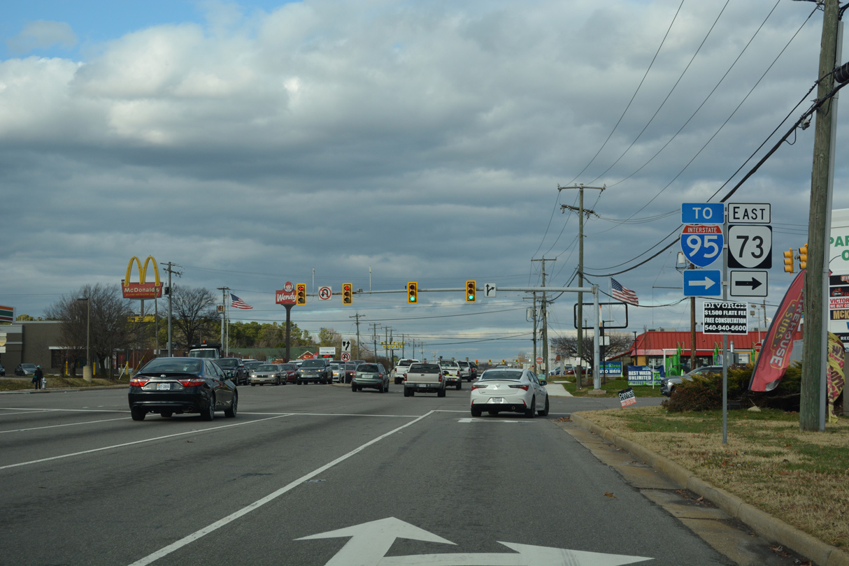 | Parham Road comprises a 12.08 mile long arterial loop around Richmond southwest to SR 150 (Chippenham Parkway) at Tuckahoe and east to U.S. 301/SR 2 by the Northfield neighborhood at Chamberlayne. 12/16/22 |
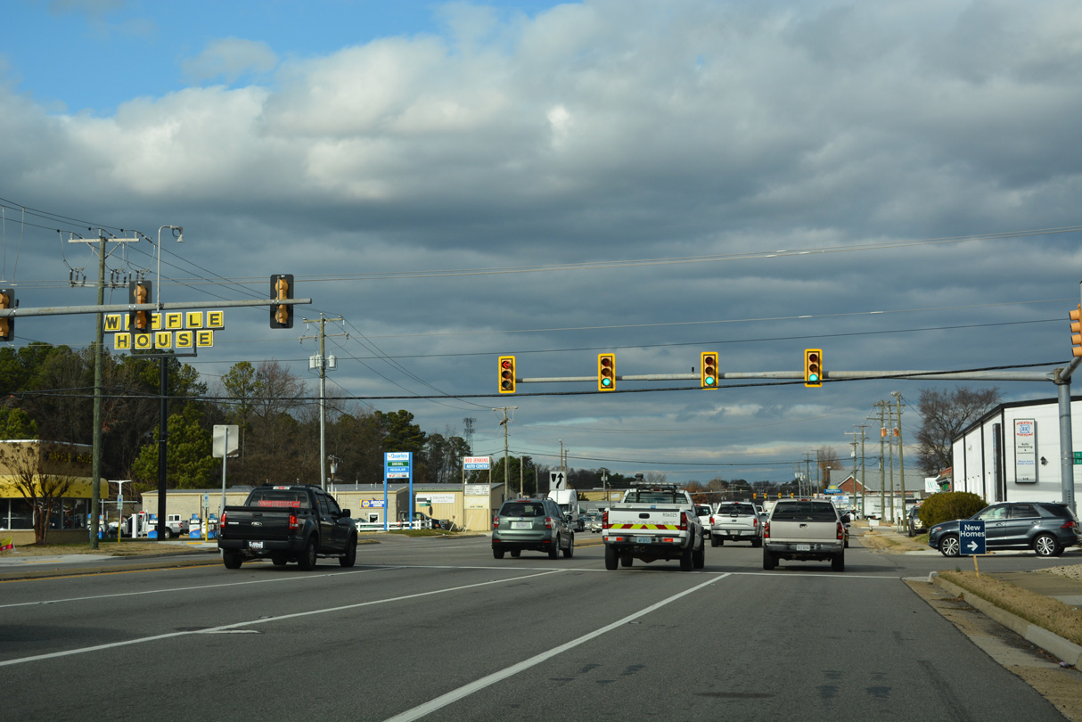 | The succeeding traffic light on U.S. 1 (Brook Road) north in Glenn Allen is at Athens Avenue. 12/16/22 |
 | Mountain Road branches 5.35 miles northwest from U.S. 1 (Brook Road) across Glen Allen to U.S. 33 (Staples Mill Road). 12/16/22 |
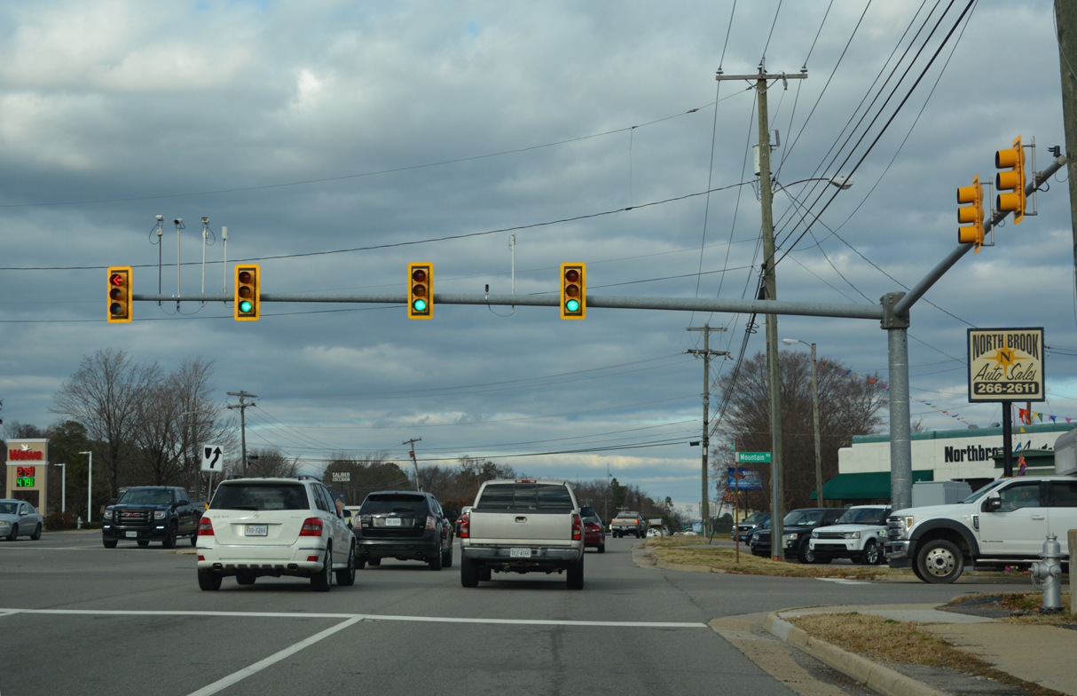
 | Connecticut Avenue stems west from U.S. 1 (Brook Road) to Longdale Avenue in Glen Allen. 12/16/22 |
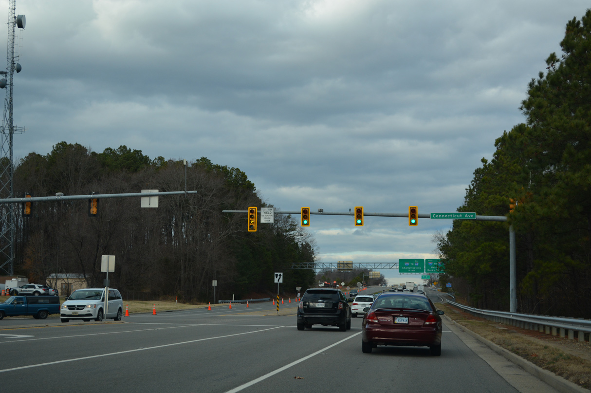
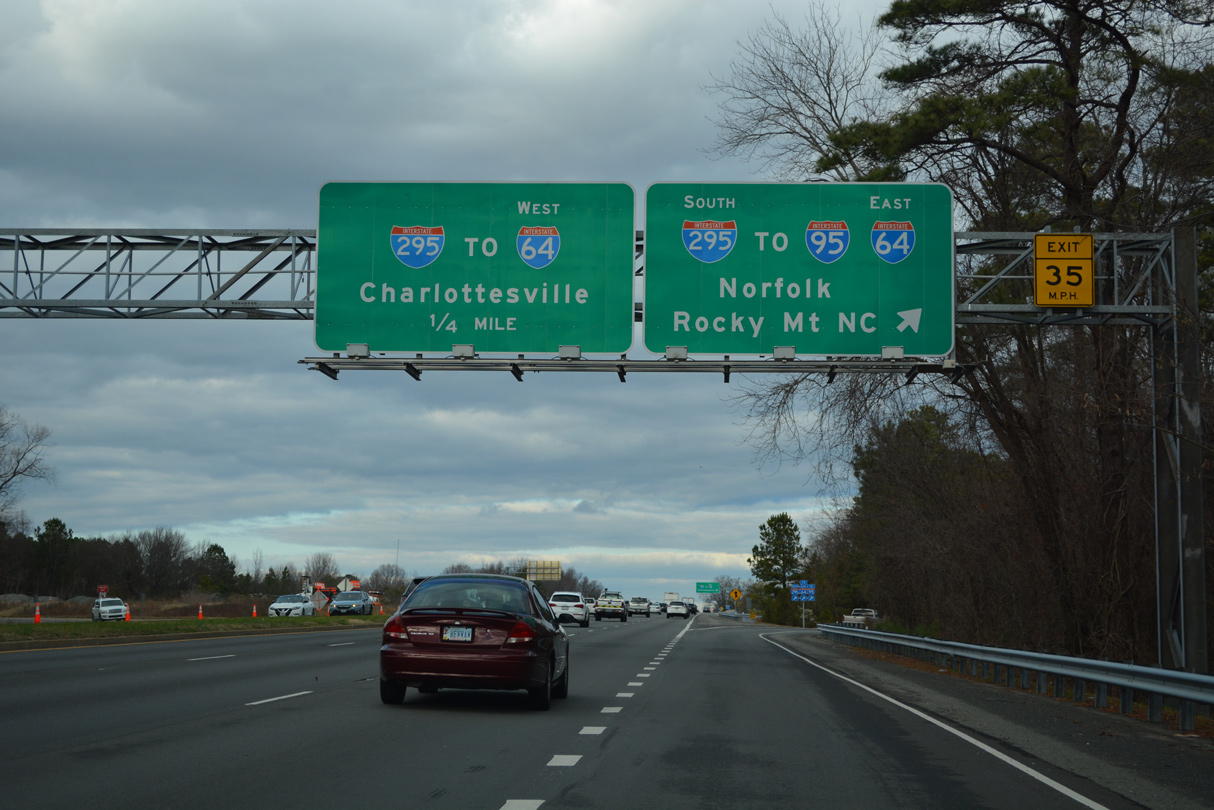 | U.S. 1 (Brook Road) proceeds north at Glen Allen to a cloverleaf interchange with Interstate 295. 12/16/22 |
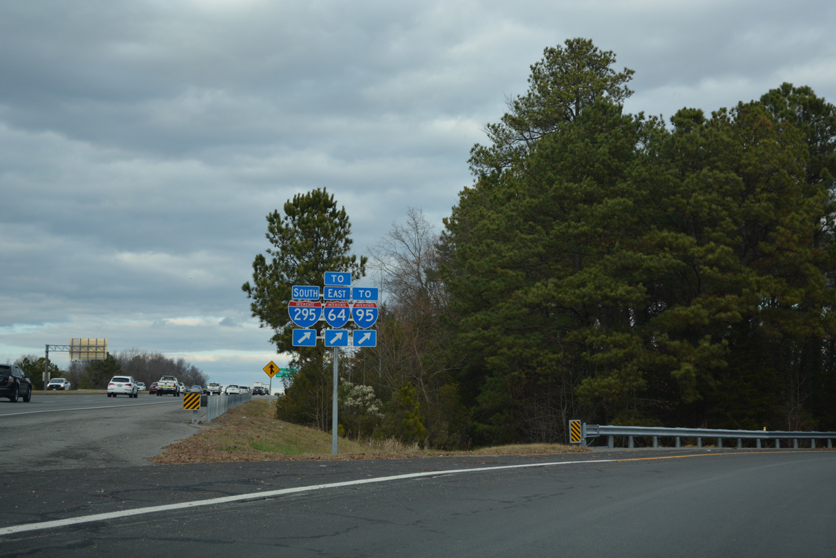 | Interstate 295 meets I-95 at the adjacent interchange east of U.S. 1. The bypass leads west to I-64 at Short Pump and I-95 south of Petersburg. 12/16/22 |
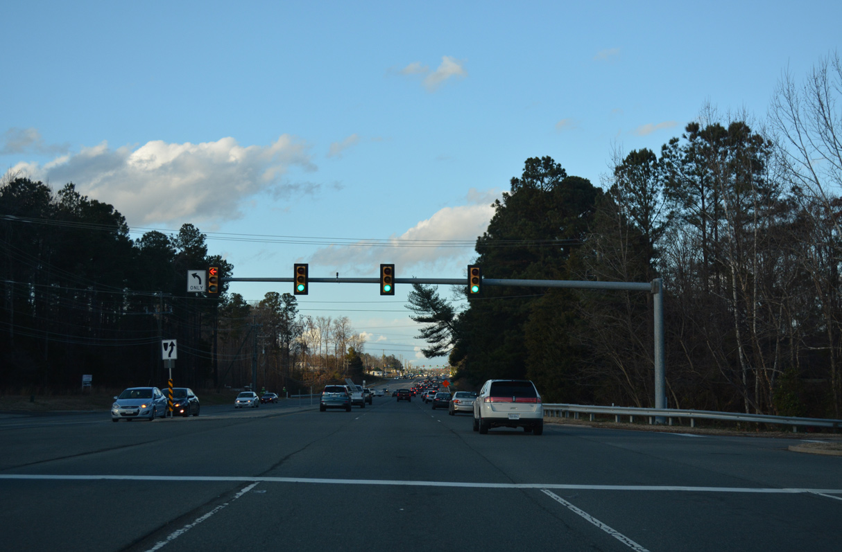
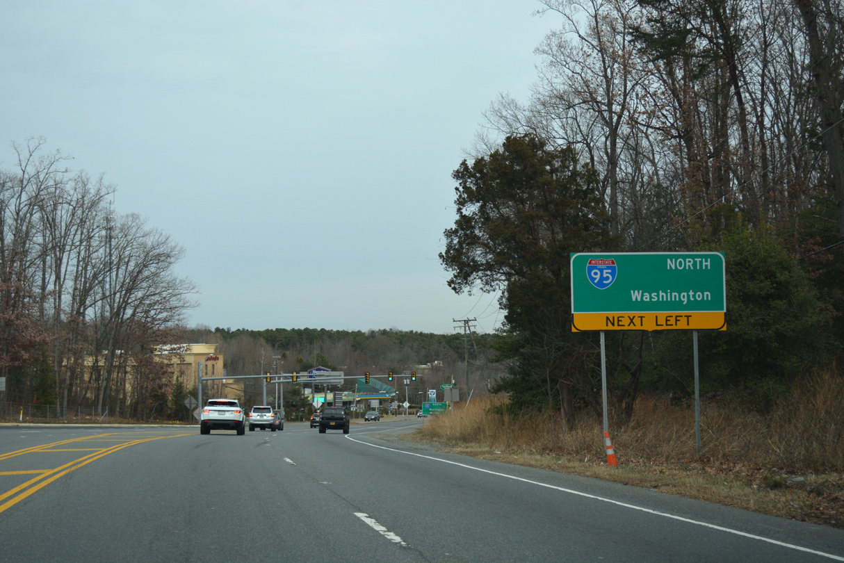
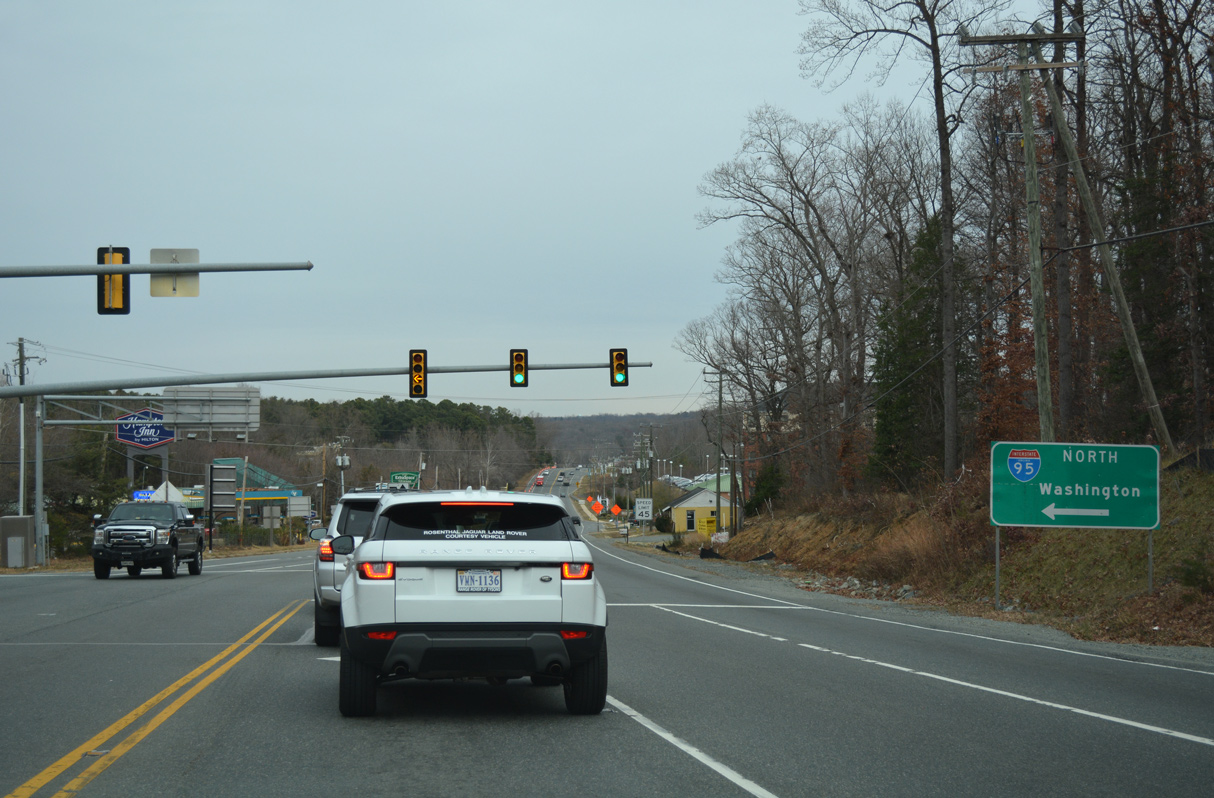
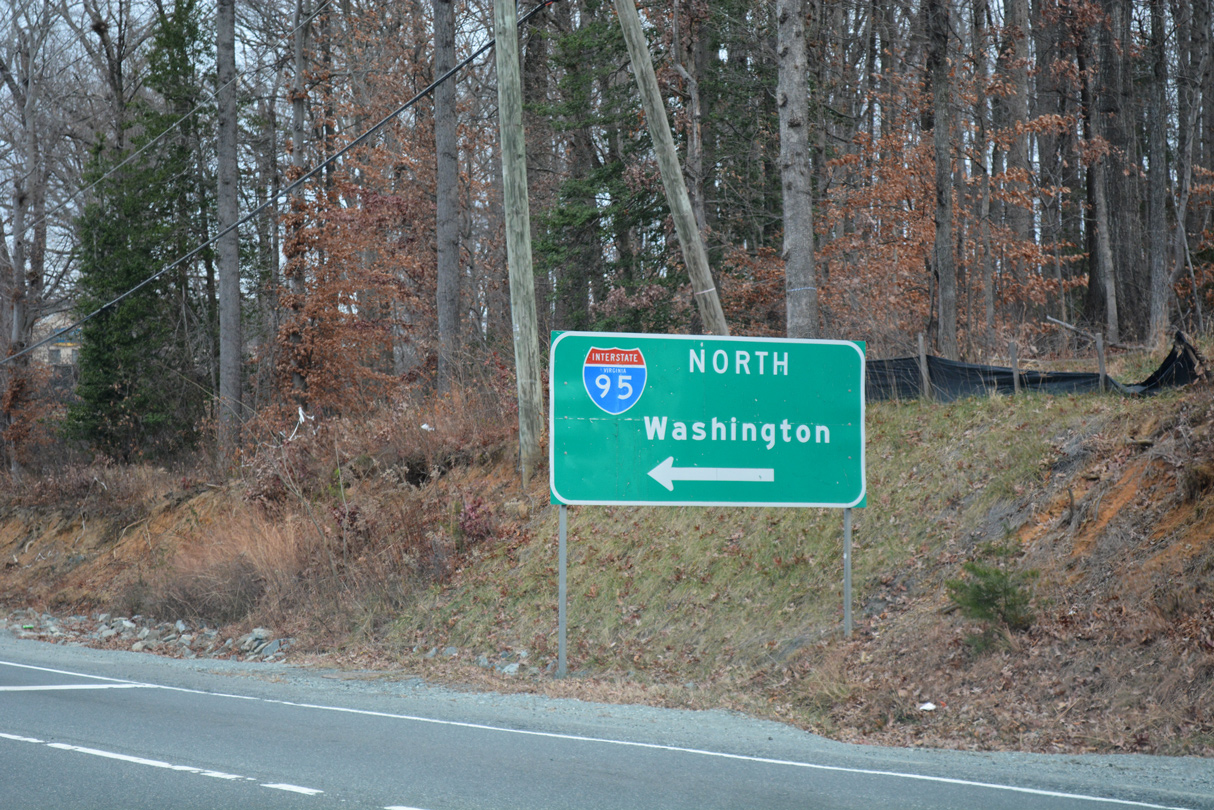
 | U.S. 1 (Brook Road) enters a commercialized stretch north from Interstate 295 to the town of Ashland. 12/21/18 |
 | Magnolia Ridge Drive ties into U.S. 1 (Brook Road) on the north side of Virginia Center Marketplace west from the north entrance to Virginia Center Commons mall. 12/21/18 |
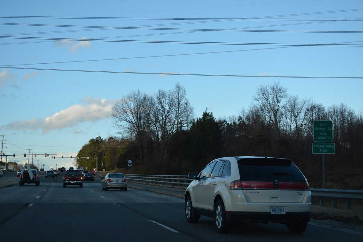 | Crossing the Chickahominy River, U.S. 1 (Brook Road) north enters Hanover County. 12/21/18 |
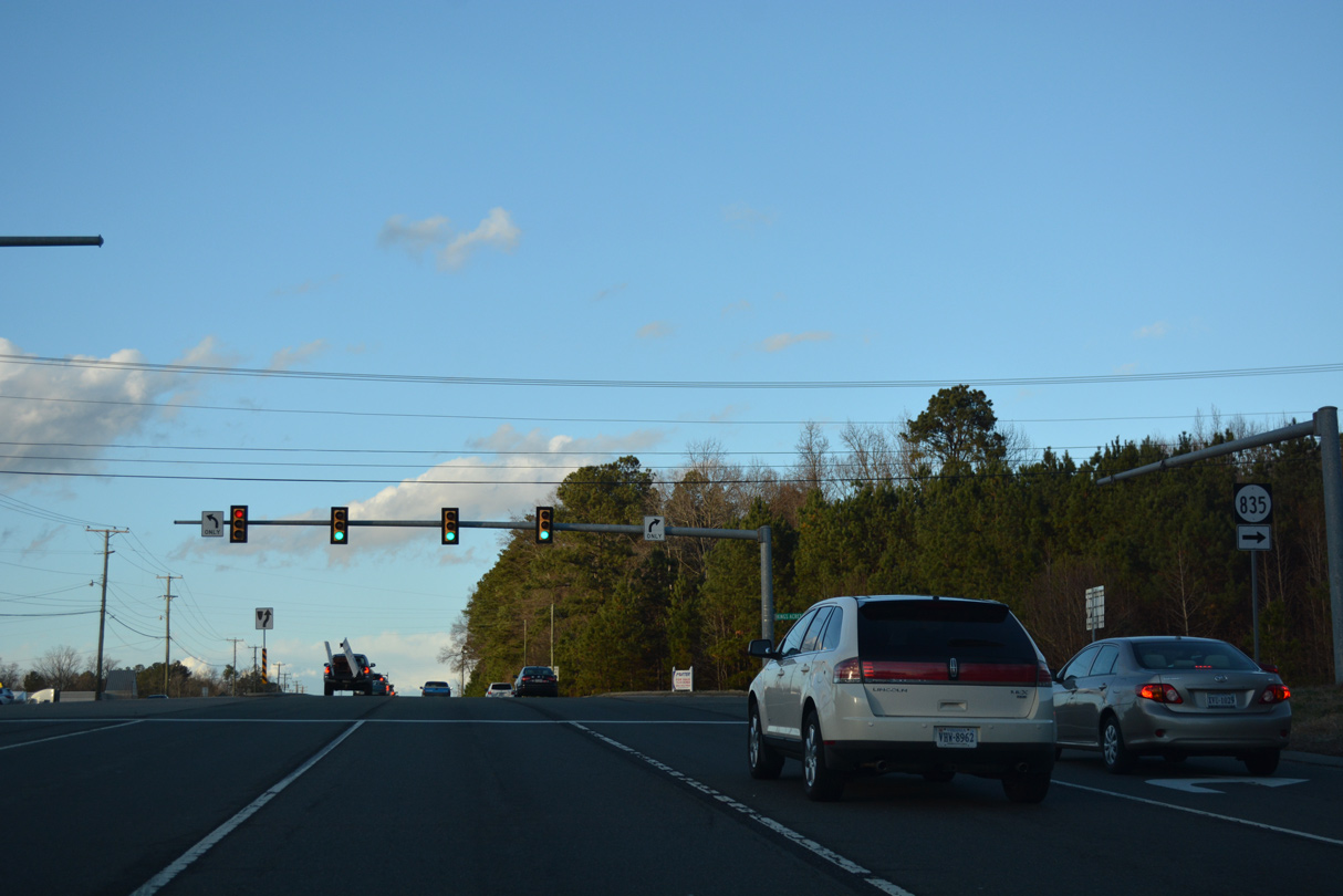 | Kings Acres Road (SR 835) is a major collector running 1.42 miles east from U.S. 1 to SR 637 (Atlee Station Road). 12/21/18 |
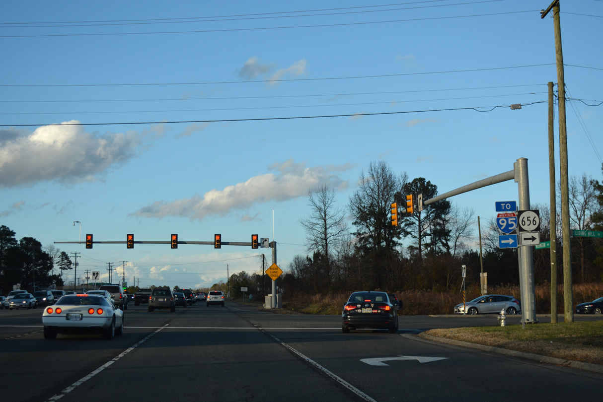
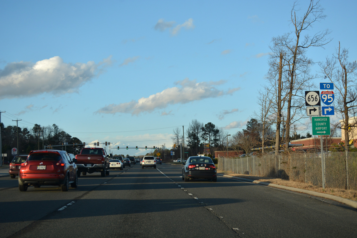 | SR 656 (Sliding Hill Road) is a four lane arterial connecting U.S. 1 at French Hay with Interstate 95 at Exit 86. 12/21/18 |
 | SR 656 (Sliding Hill Road) continues beyond I-95 northeast to Poindexters, Hanover County Airport (OFP) and SR 657 (Ashcake Road). 12/21/18 |
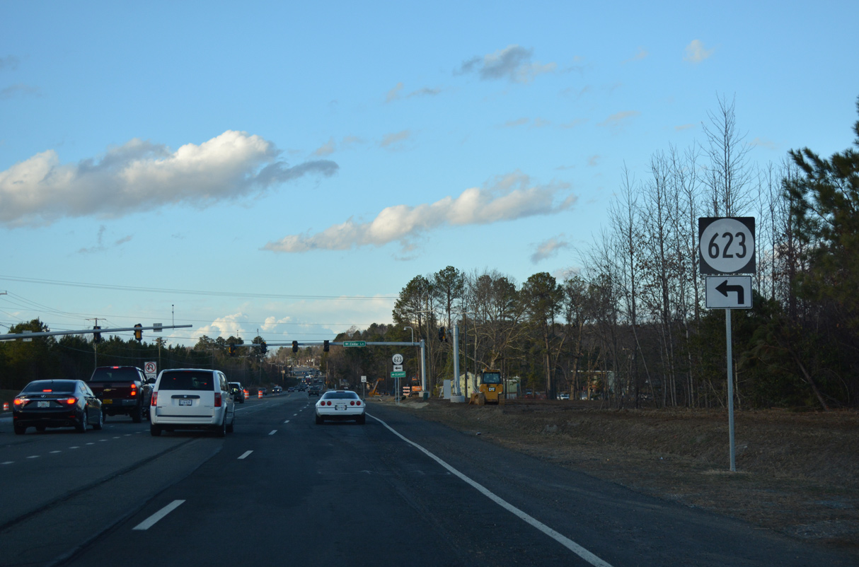 | SR 623 (Cedar Lane) branches northwest from U.S. 1 to Elmont along a 9.29 mile long course to Ashland Road. 12/21/18 |
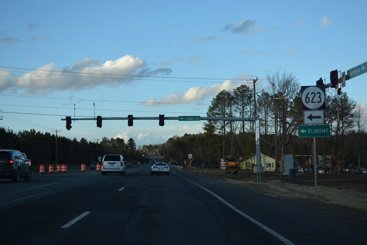 | Accommodating increased development, SR 623 (Cedar Lane) was realigned to a new signalized intersection with U.S. 1 in 2018. 12/21/18 |
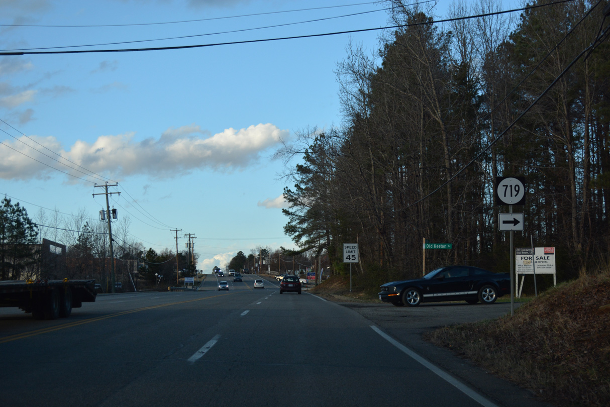 | SR 719 is Old Keeton Road, a residential street east to SR 661 (Old Telegraph Road). 12/21/18 |
 | SR 692 is Dellwood Road, a short residential street to the west. 12/21/18 |
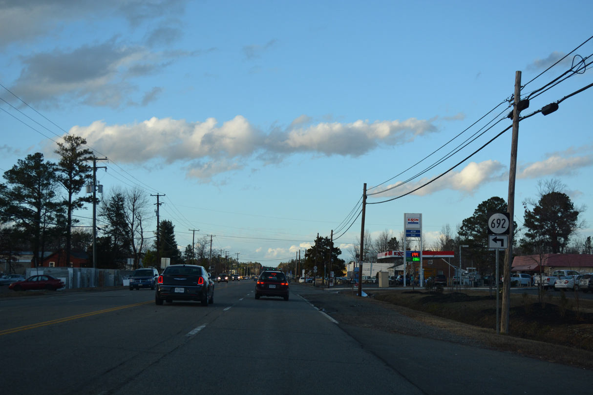
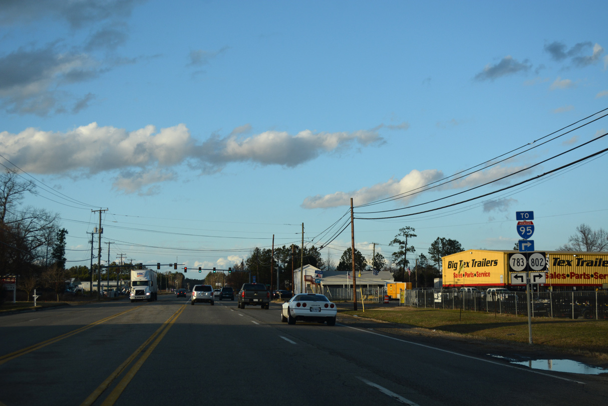 | SR 802 (Lewistown Road) links U.S. 1 with I-95 east of Lewistown. 12/21/18 |
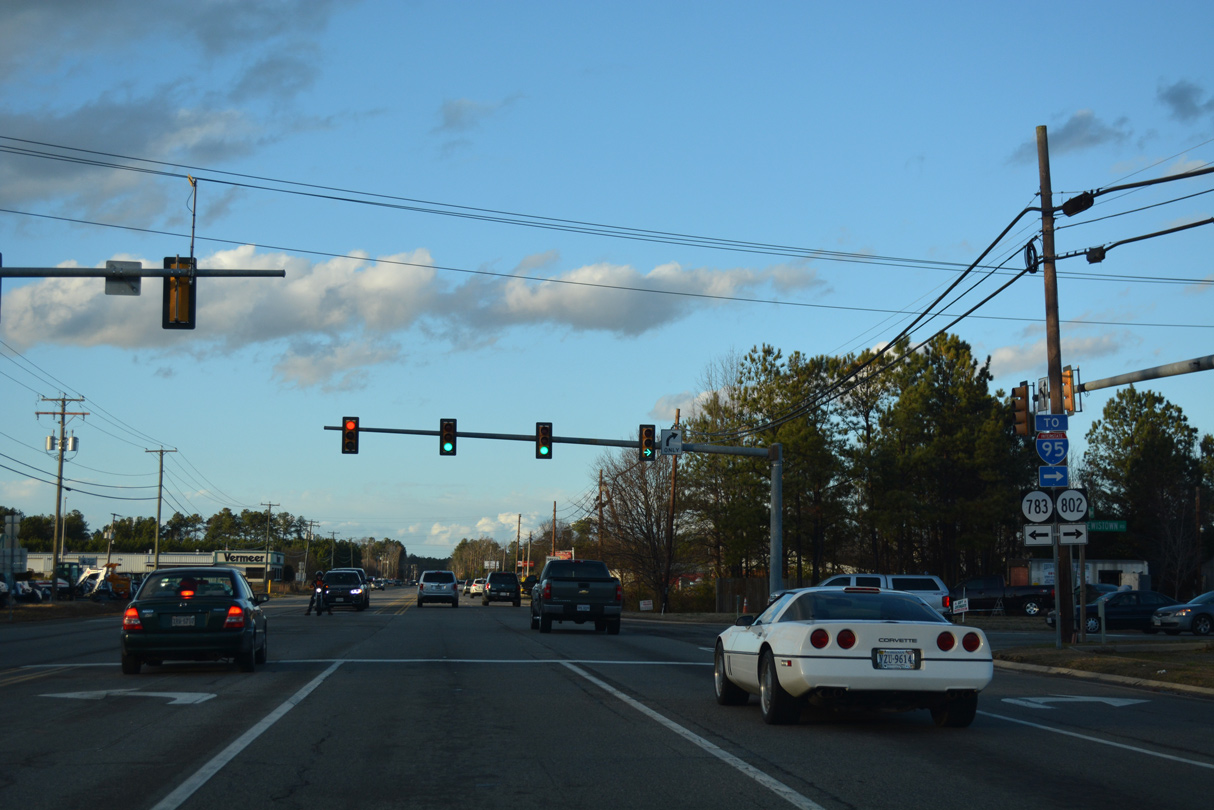 | SR 802 (Lewistown Road) runs 1.63 miles east from U.S. 1 at SR 783 to SR 657 (Ashcake Road). 12/21/18 |
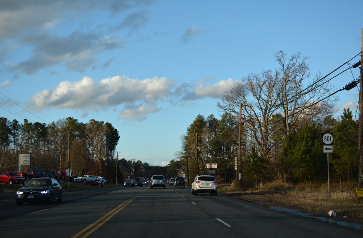 | SR 801 (Cobbs Road) is a minor collector leading 1.50 miles west from U.S. 1 to SR 626 (Elmont Road) at Elmont. 12/21/18 |
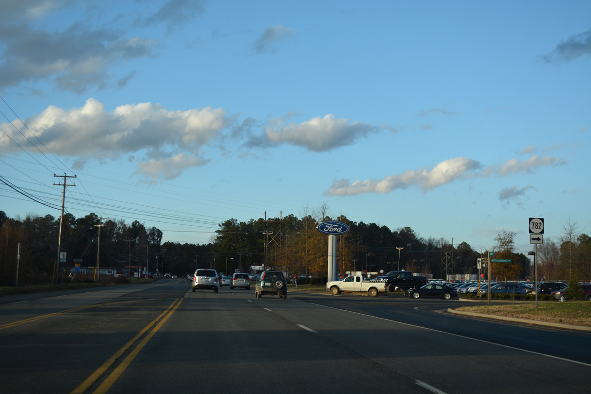 | SR 782 (N Lakeridge Parkway) arcs southeast to Lewistown. 12/21/18 |
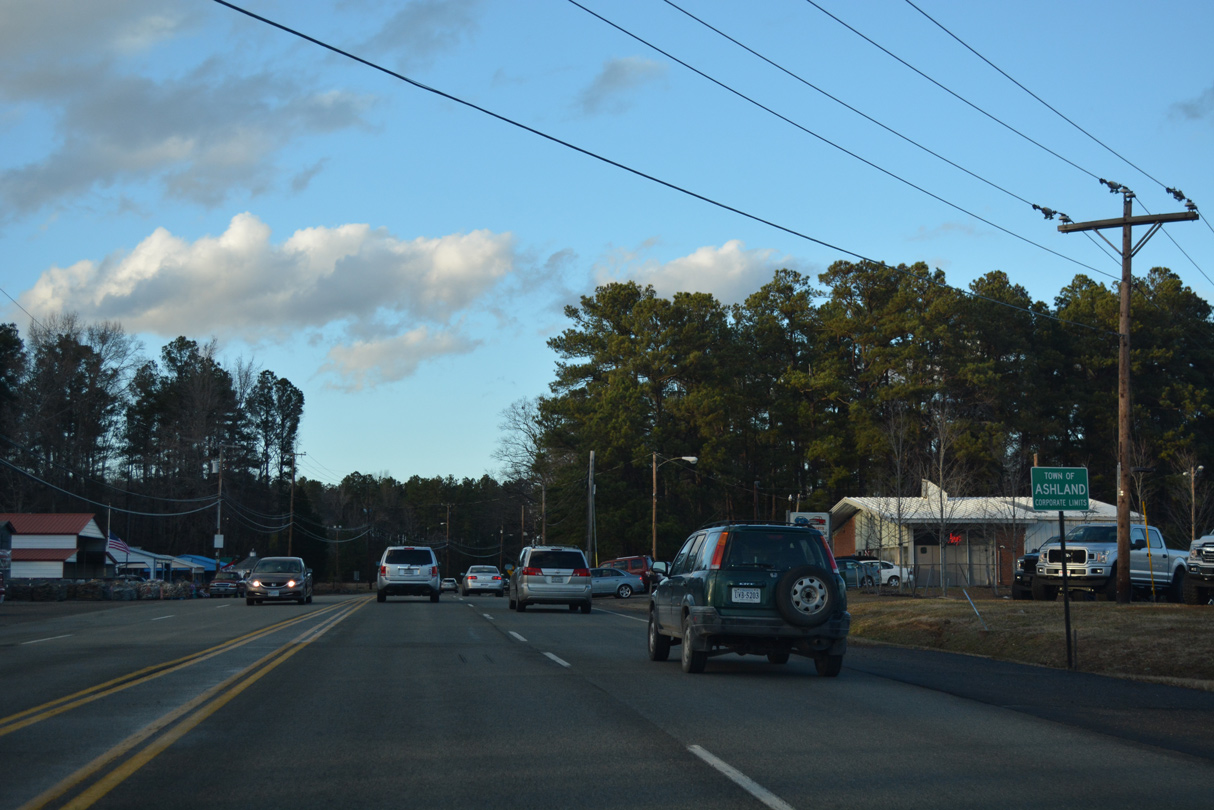 | U.S. 1 (Washington Highway) enters the town of Ashland northbound at Johnson Road. 12/21/18 |
 | U.S. 1 north at SR 825 (Design Road) east. 12/21/18 |
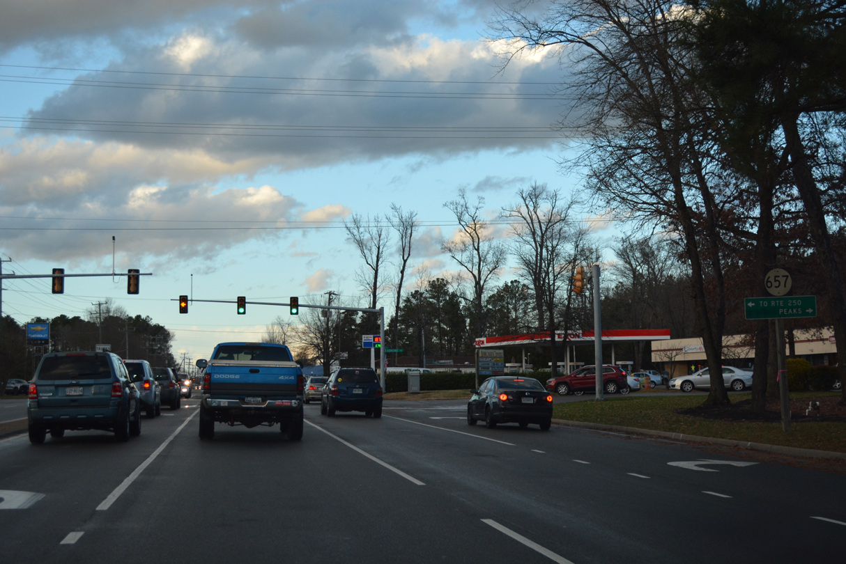 | SR 657 (Ashcake Road) runs east to Peaks and U.S. 301/SR 2 at Crosses Corner and west U.S. 33 (Mountain Road) near Montpelier. 12/21/18 |
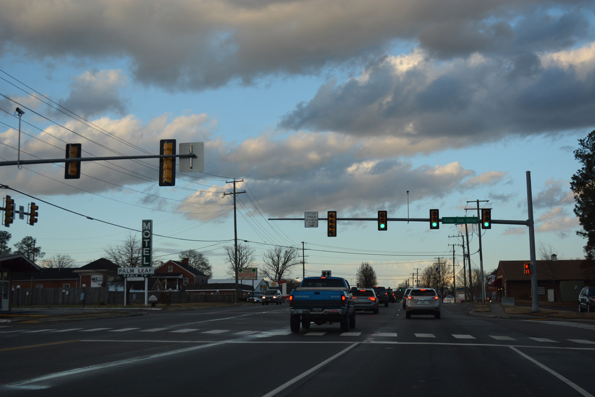 | Arbor Oak Drive is the entrance to the Sedgefield mobile home community. 12/21/18 |
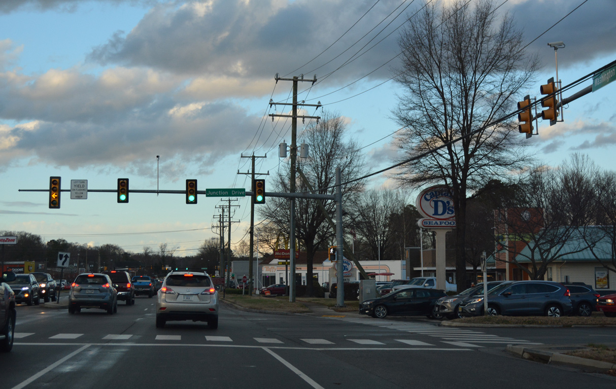 | U.S. 1 (Washington Highway) intersects Junction Drive by Ashland Junction Shopping Center. 12/21/18 |
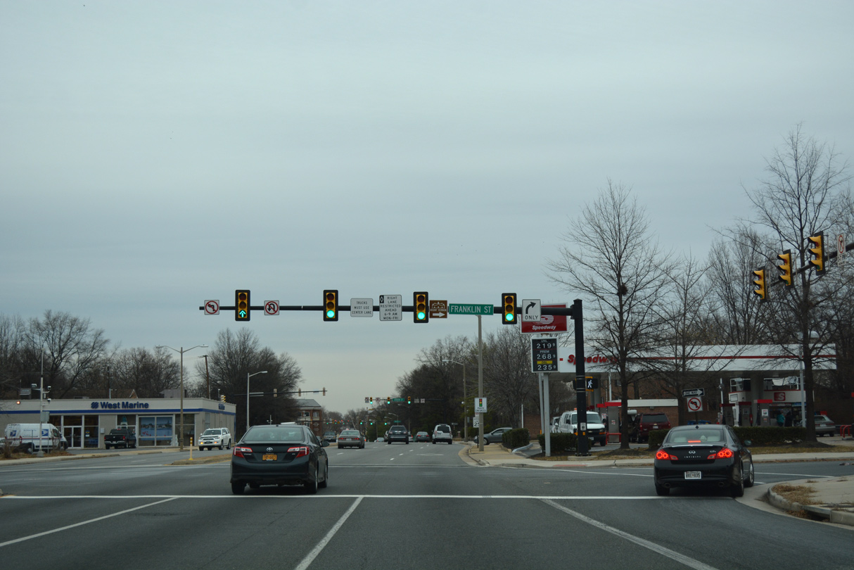
 | SR 54 (England Street) crosses paths with U.S. 1 (Washington Highway) east of Downtown Ashland and Randolph-Macon College. 12/21/18 |
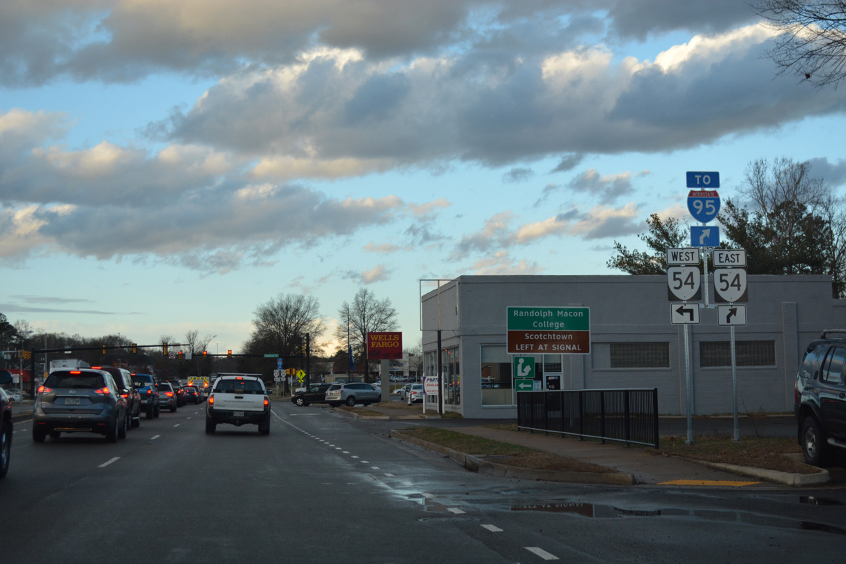 | SR 54 heads 12.45 miles west from U.S. 1 in Ashland to U.S. 33 outside Montpelier. SR 54 east continues 5.97 miles to I-95 and U.S. 301/SR 2 at Hanover. 12/21/18 |
| North |
 | U.S. 1/17 split at the entrance ramp for I-95 northbound at Exit 126. U.S. 17 bypasses Fredericksburg with I-95 to Exit 133 while U.S. 1 continues along Jefferson Davis Highway to Fourmile Fork and Confederate Ridge in Frederick. 12/26/06 |
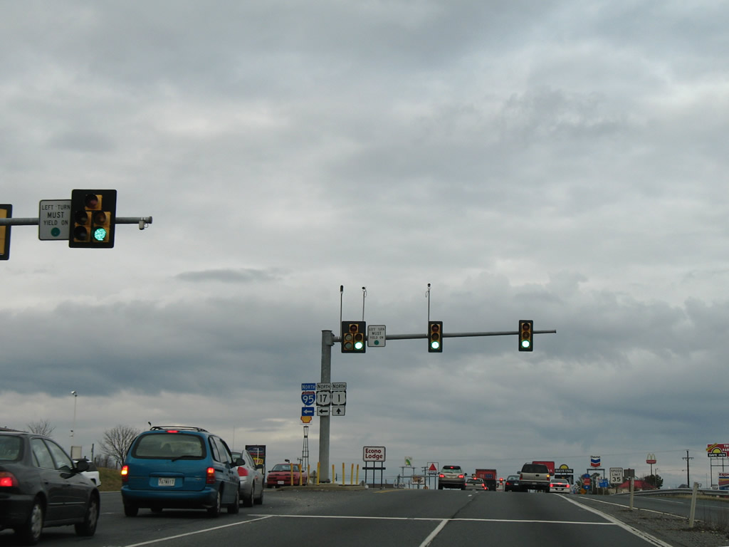 | I-95 travels north to Washington while U.S. 1 parallels through Frederick, Stafford, Triangle, Dumfries and Woodbridge. U.S. 17 branches northwest from the freeway to Opal and Warrenton. 12/26/06 |
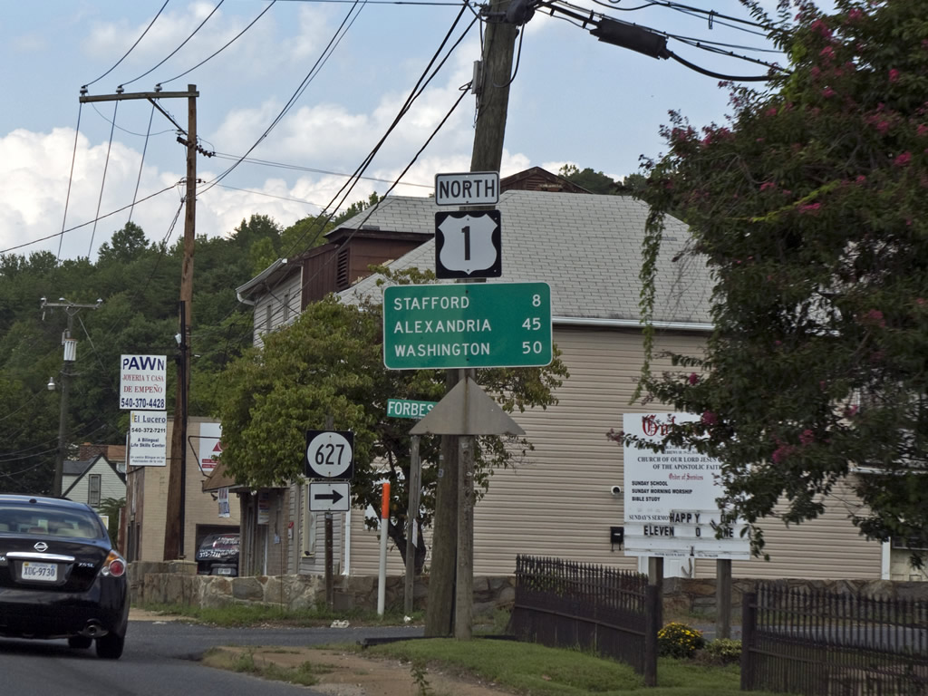 | U.S. 1 (Cambridge Street) north at SR 627 (Forbes Street) and Cranes Corner. Forbes Street meanders southward parallel to U.S. 1 through Spring Valley to Falmouth. 08/31/09 |
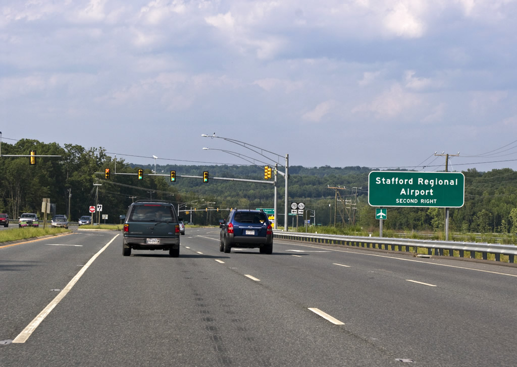 | U.S. 1 advances north from Forbes Street to the signal with Enon Road (SR 753) west to SR 628 north and Cranes Corner Road (SR 676) east. A grade separated intersection follows with SR 8900 (Centreport Parkway) west to I-95 (Exit 136) and Stafford Regional Airport (RMN). 08/31/09 |
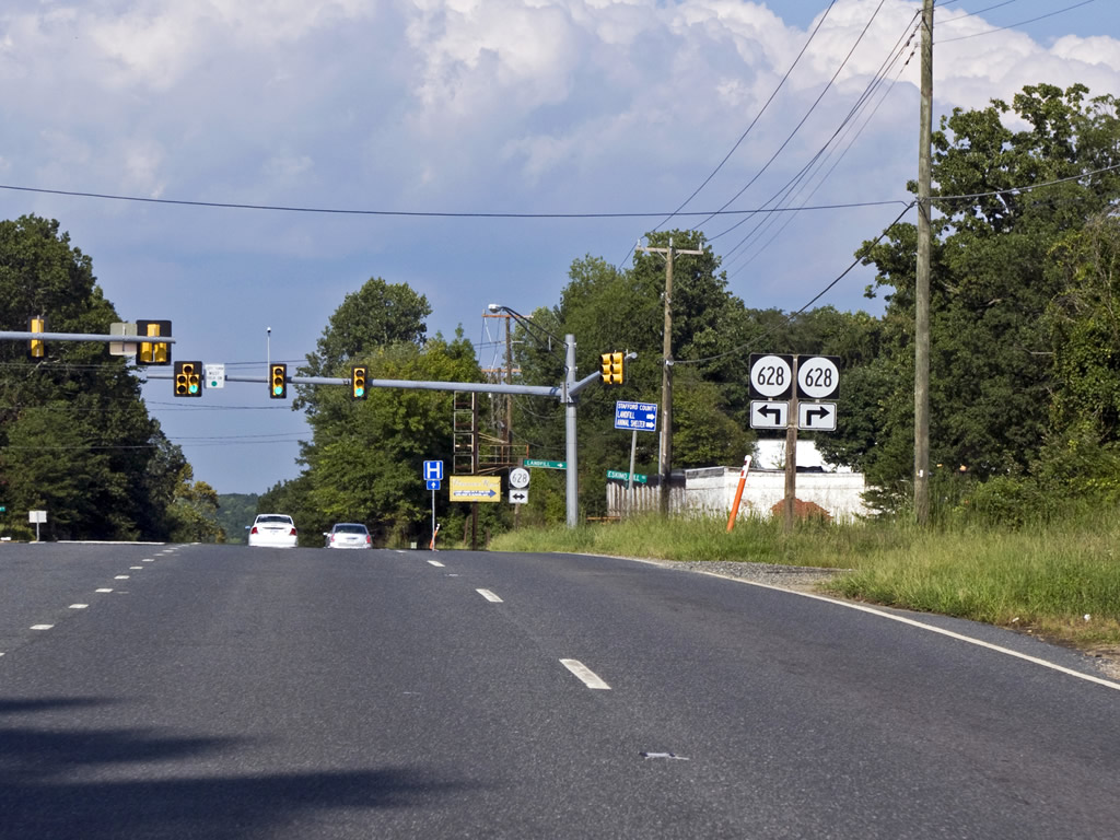 | SR 628 crosses U.S. 1 (Jefferson Davis Highway) near Stafford Regional Airport (RMN). Ramoth Church Road carries the route northwest to Ramoth and SR 630 (Courthouse Road). SR 628 follows Eskimo Hill Road east to SR 608 south of Brooke. 08/31/09 |
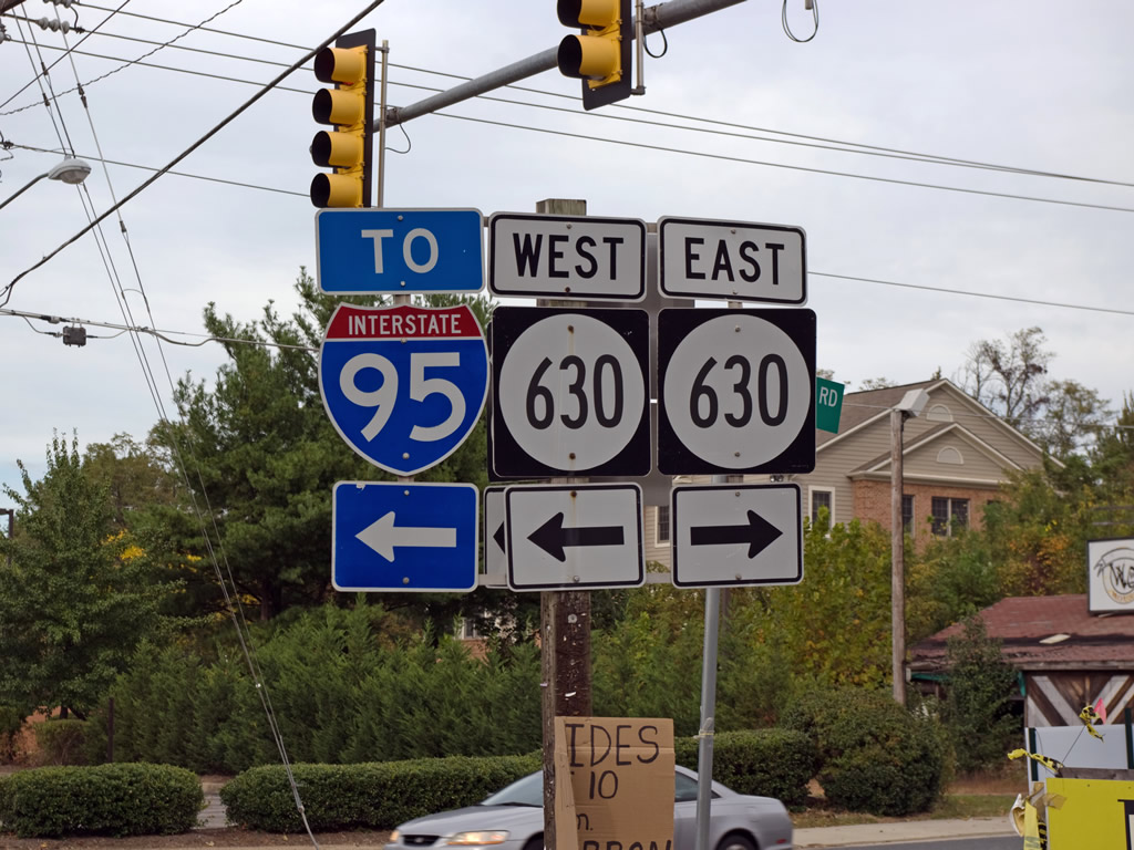 | Meeting U.S. 1 (Jefferson Davis Highway) in Stafford is SR 630 (Courthouse Road). Courthouse Road heads west to a DDI with Interstate 95 and SR 648 (Shelton Shop Road) near Moores Corner. 10/10/09 |
 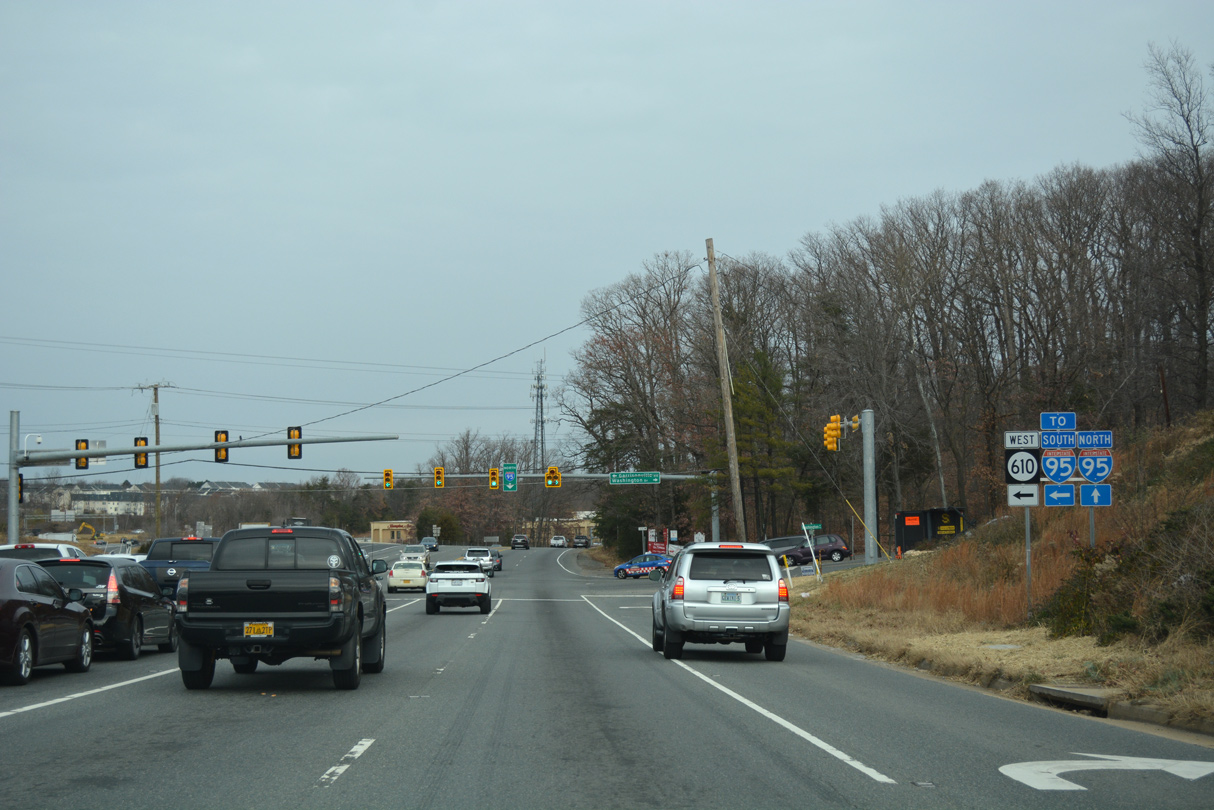 | A cloverleaf interchange joins adjacent I-95 with U.S. 1 (Jefferson Davis Highway) at SR 610 (Garrisonville Road) at Aquia Harbor. 12/16/16 |
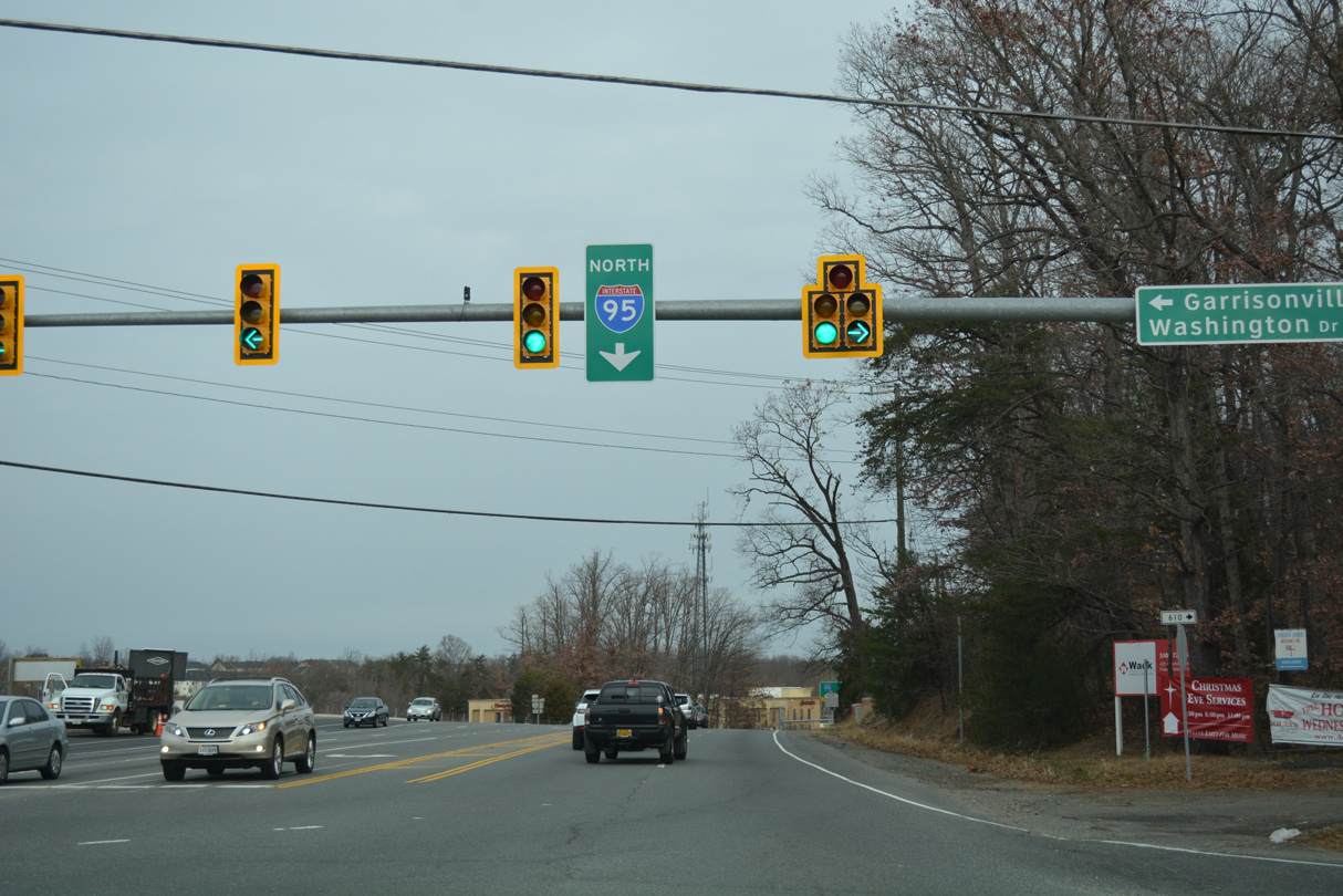 | SR 610 extends east from U.S. 1 along Washington Drive into Aquia Harbour. Garrisonville lies just beyond I-95 to the northwest along SR 641 (Onville Road). 12/16/16 |
  | The entrance ramp connecting SR 610 (Garrisonville Road) with I-95 north departs from U.S. 1 (Jefferson Davis Highway). 10/10/09, 12/16/16 |
  | U.S. 1 and I-95 next meet directly at Colchester just north of Woodbridge. 12/16/16 |
 | SR 619 (Joplin Road) west links U.S. 1 (Jefferson Davis Highway) with Interstate 95 at a parclo interchange (Exit 150) nearby. 08/31/09 |
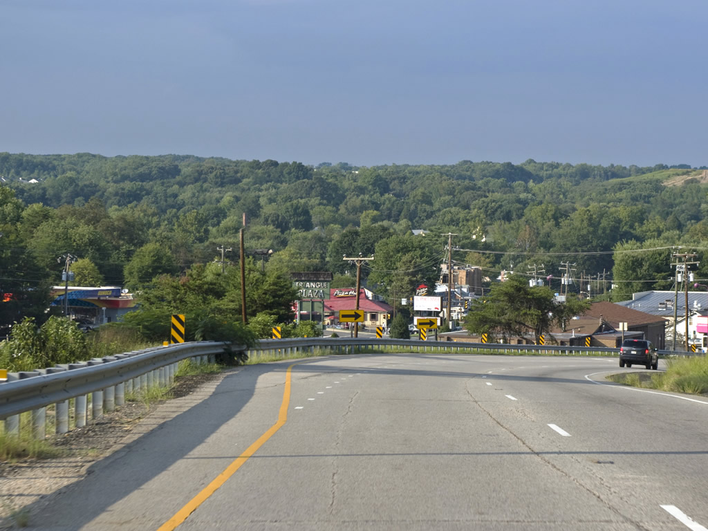 | U.S. 1 splits into a one way couplet between Triangle and Dumfries. Northbound U.S. 1 follows Fraley Boulevard while southbound utilizes Main Street. 08/31/09 |
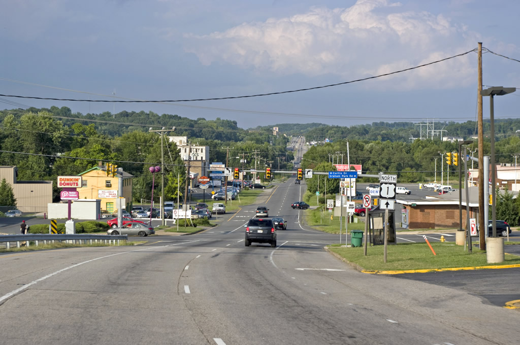 | Graham Park Road spurs east from U.S. 1 (Fraley Boulevard) in Dumfries to residential areas south of Quantico Creek. Curtis Drive west is the entrance to a subdivision between U.S. 1 and Interstate 95. 08/31/09 |
| U.S. 1 undulates through northern Virginia, including on the approach to SR 610 (Cardinal Drive west / Neabsco Road east) at Garfield Estates. Bridge replacement was underway at this time for U.S. 1 (Jefferson Davis Highway) across Neabsco Creek. 08/31/09 |
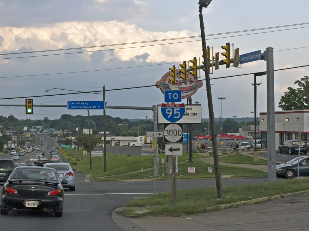 | U.S. 1 follows a commercial arterial through the Dale City and Woodbridge area. SR 294 (Prince William Parkway) begins at U.S. 1 opposite Longview Drive south to Marumsco Acres. Prince William Parkway (old SR 3000) comprises a busy route west through Dale City to SR 234 at Manassas. 08/31/09 |
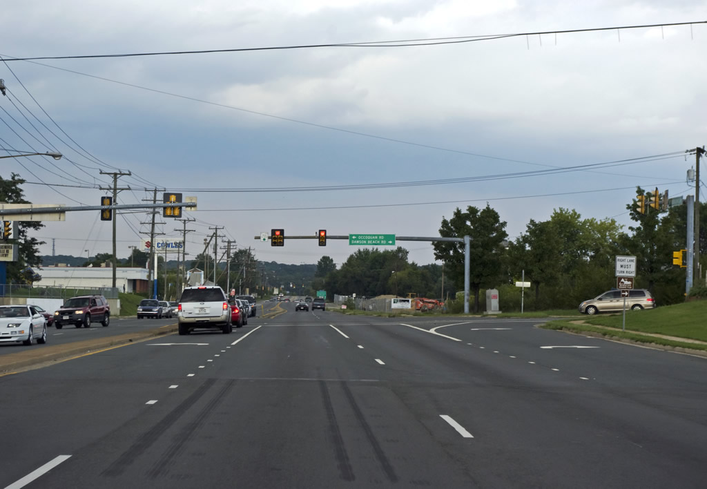 | Occoquan Road (SR 906) intersects U.S. 1 (Jefferson Davis Highway) opposite Dawson Beach Road (SR 687) south to Occoquan Bay National Wildlife Refuge. Until 1998, SR 906 was a part of SR 253 leading north to Occoquan.1 08/31/09 |
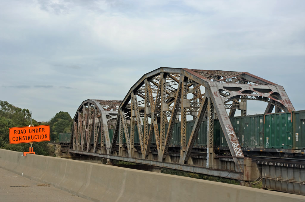 | Paralleling a CSX Railroad bridge, U.S. 1 (Jefferson Davis Highway) spans the Occoquan River north into Fairfax County. 08/31/09 |
 | Continuing north from SR 611 (Furnace Road), U.S. 1 (Richmond Highway) splits with a wye interchange ramp onto adjacent Interstate 95 north at Exit 161. 10/10/09 |
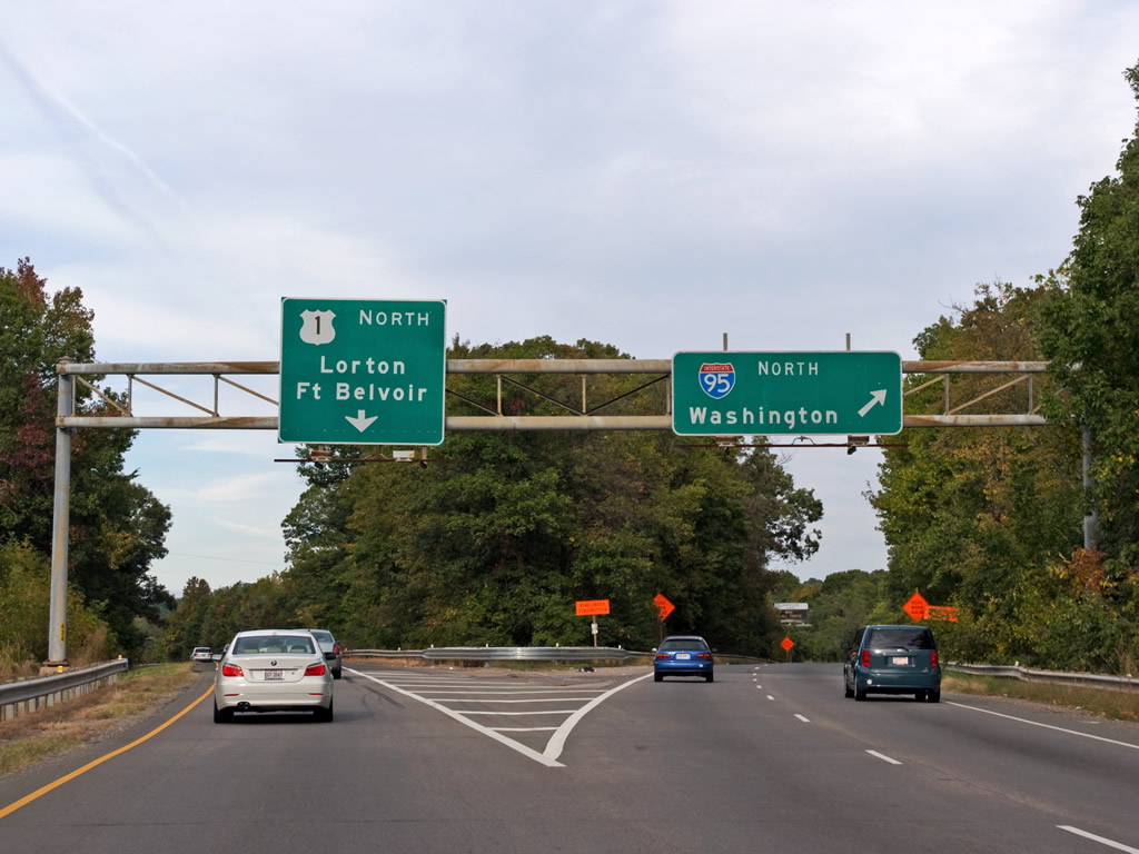 | A two lane ramp departs U.S. 1 (Richmond Highway) north for both the I-95 mainline and the tolled Express Lanes for Alexandria and Washington, DC. U.S. 1 turns eastward at Lorton and Pohick to Fort Belvoir. 10/10/09 |
 | U.S. 1 (Richmond Highway) advances north to SR 633 (S Kings Highway) at Fair Haven and Penn Daw. SR 633 runs southwest to Virginia Hills and Telegraph Road (SR 611). 10/10/09 |
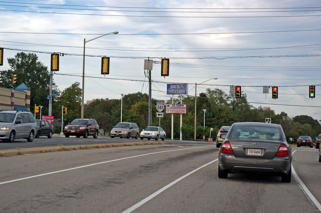 | SR 241 (N Kings Highway) travels from U.S. 1 (Richmond Highway) and SR 633 through Jefferson Manor to SR 611 (Telegraph Road). SR 241 measures just 1.88 miles between Richmond Highway and SR 236 (Duke Street) in the city of Alexandria. 10/10/09 |
 | U.S. 1 (Richmond Highway) continues from SR 629 (Fort Hunt Road) near Belle Haven to the Capital Beltway. 10/10/09 |
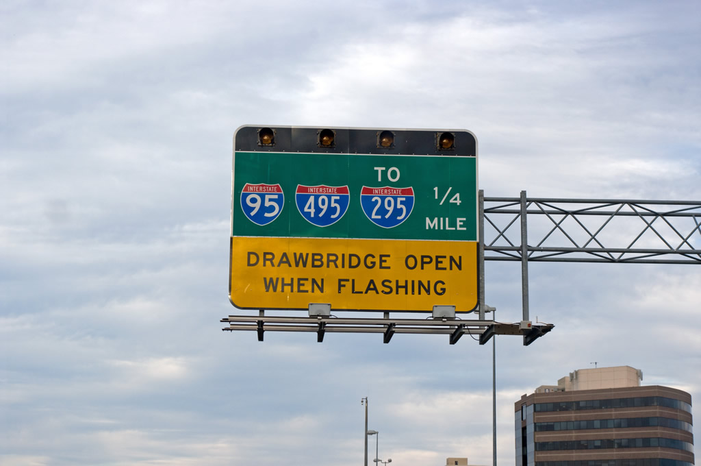
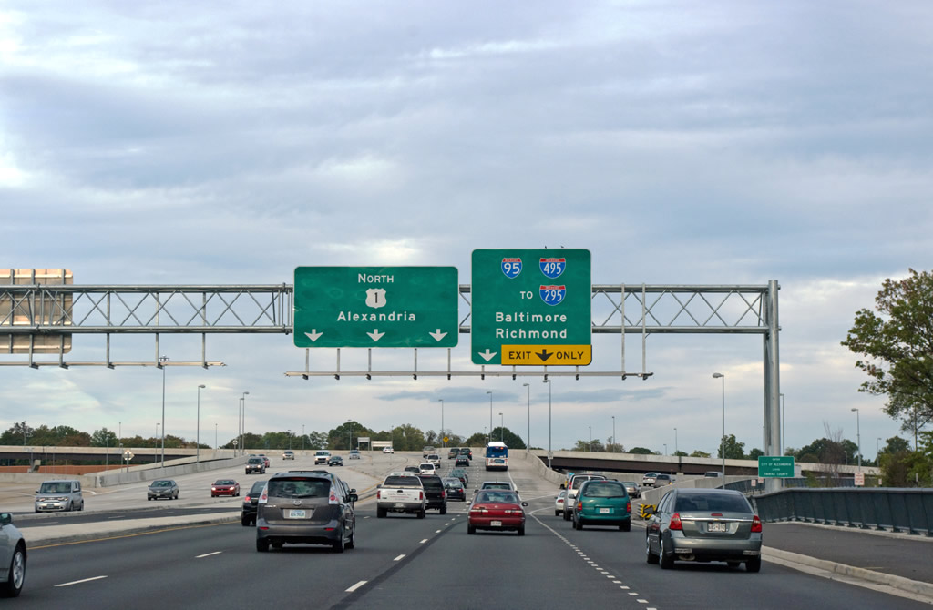 | Flyover ramps connect U.S. 1 (Richmond Highway) with I-95/495 east to I-295 near Oxon Hill, Glen Arden and College Park, Maryland and I-95/495 west to Springfield. 10/10/09 |
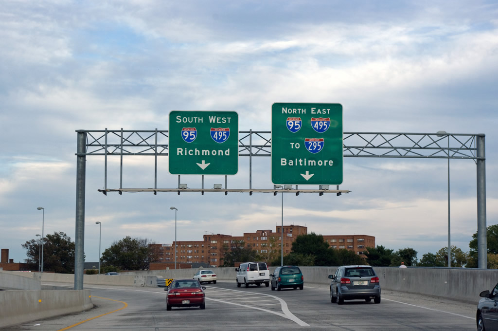 | U.S. 1 crosses Hunting Creek and the Alexandria city line where entrance ramps partition for Interstate 95 south to Richmond and north to Baltimore. 10/10/09 |
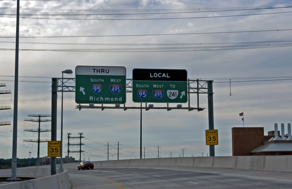 | The high flyover from U.S. 1 north to I-95/495 west splits into separate ramps for the Through roadway to the Springfield Interchange and the Local roadway ahead of the exit for SR 241 (Telegraph Road). 10/10/09 |
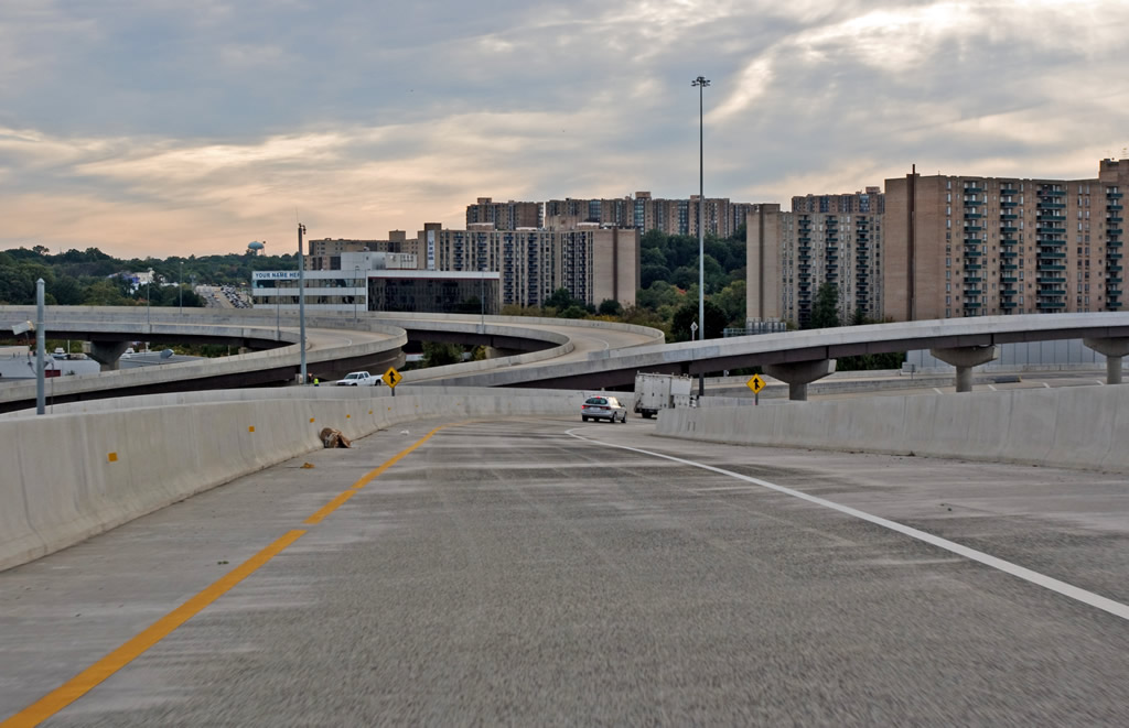  | The U.S. 1 northbound entrance ramp onto the Capital Beltway Through lanes west. This interchange was upgraded by 2009 during the Woodrow Wilson Replacement Project. 10/10/09 |
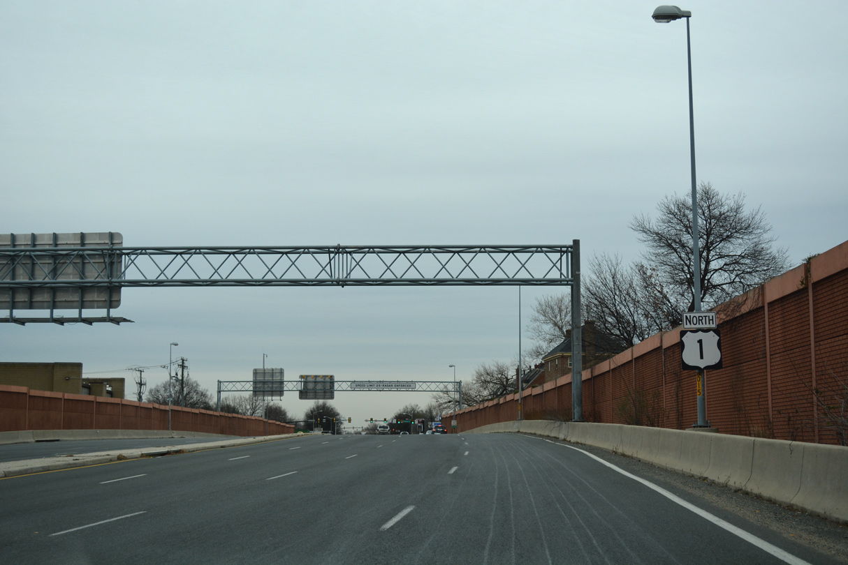 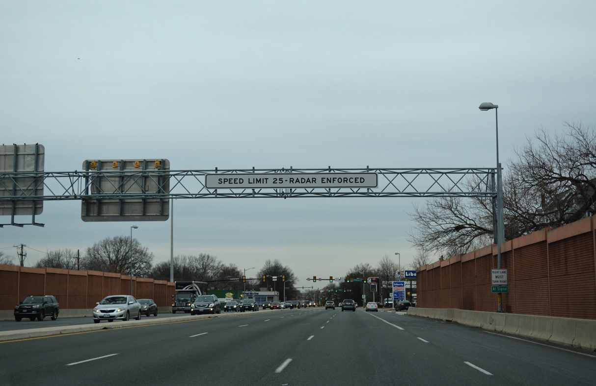  | U.S. 1 extends 0.24 miles north from the exchange with I-95/495 onto Patrick Street at Franklin Street in Alexandria. 12/16/16 |
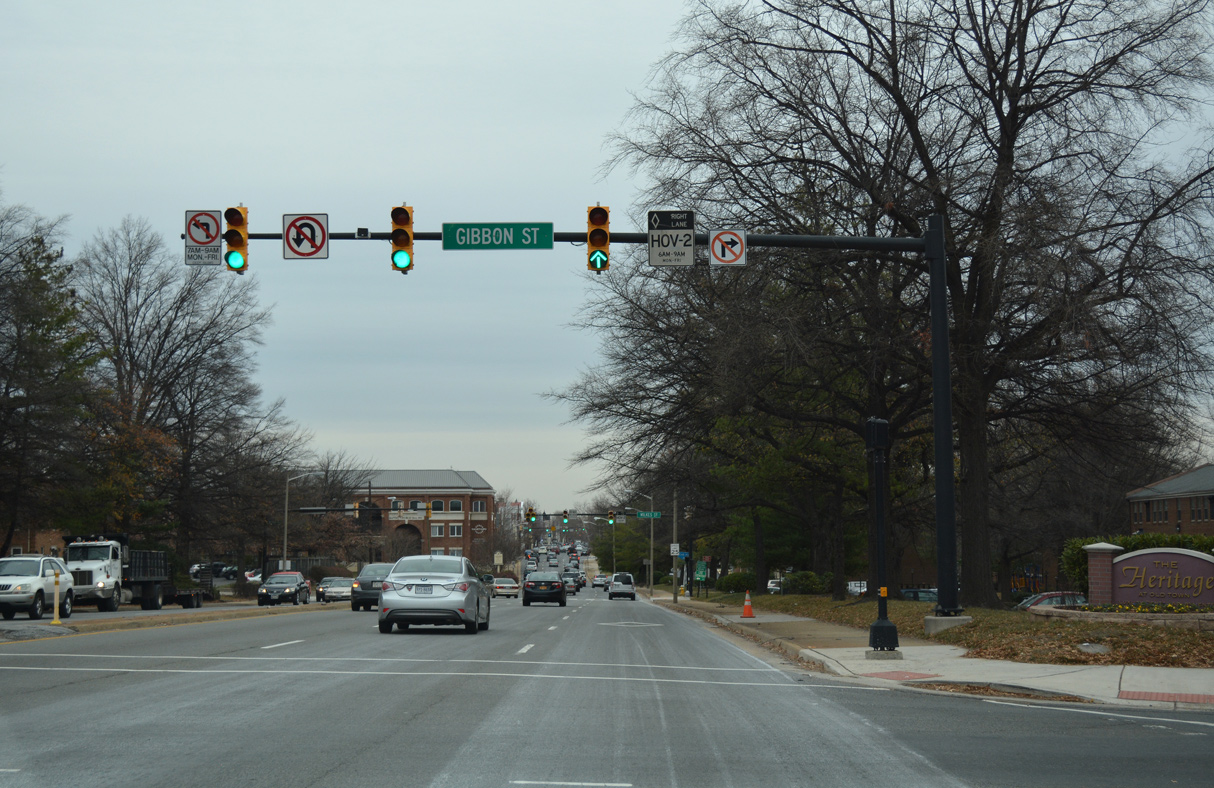 | Patrick Street north at Gibbon Street. 12/16/16 |
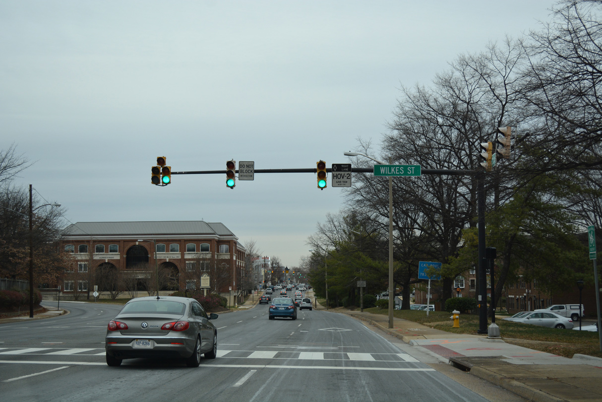 | U.S. 1 partitions into a couplet along Patrick Street north and Henry Street south beyond Wilkes Street. 12/16/16 |
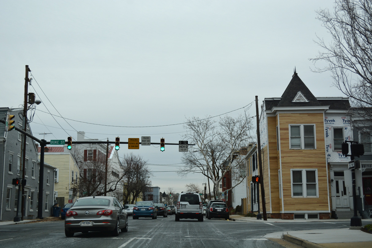 | Unmarked along U.S. 1 (Patrick Street) north, Duke Street is part of SR 236 east to SR 400 (Washington Street) and west to I-395 and the Fairfax County line. 12/16/16 |
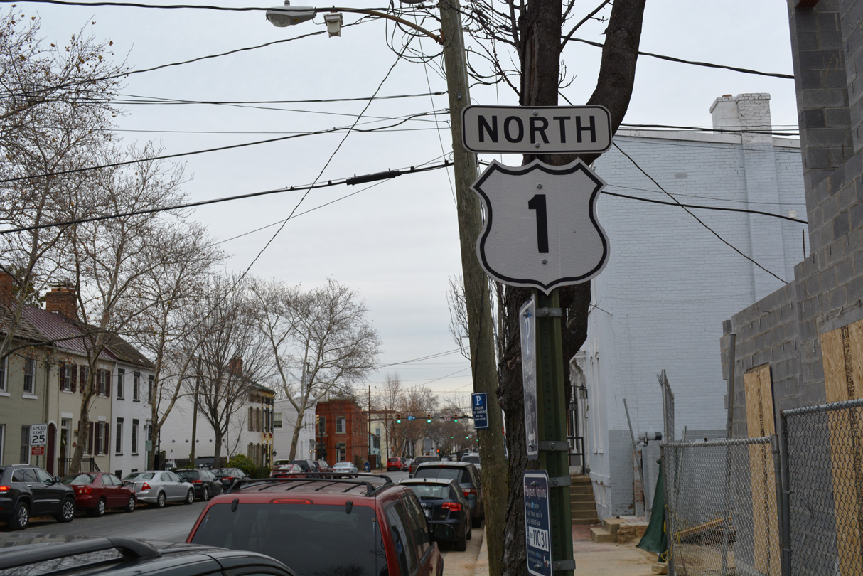
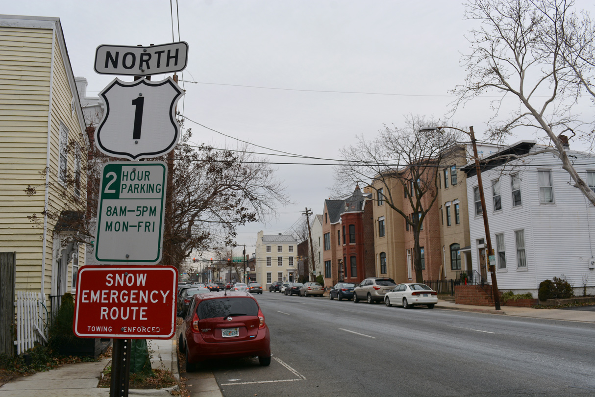 | A U.S. 1 cutout stands along the left side of Patrick Street north after SR 236 (Duke Street). 12/16/16 |
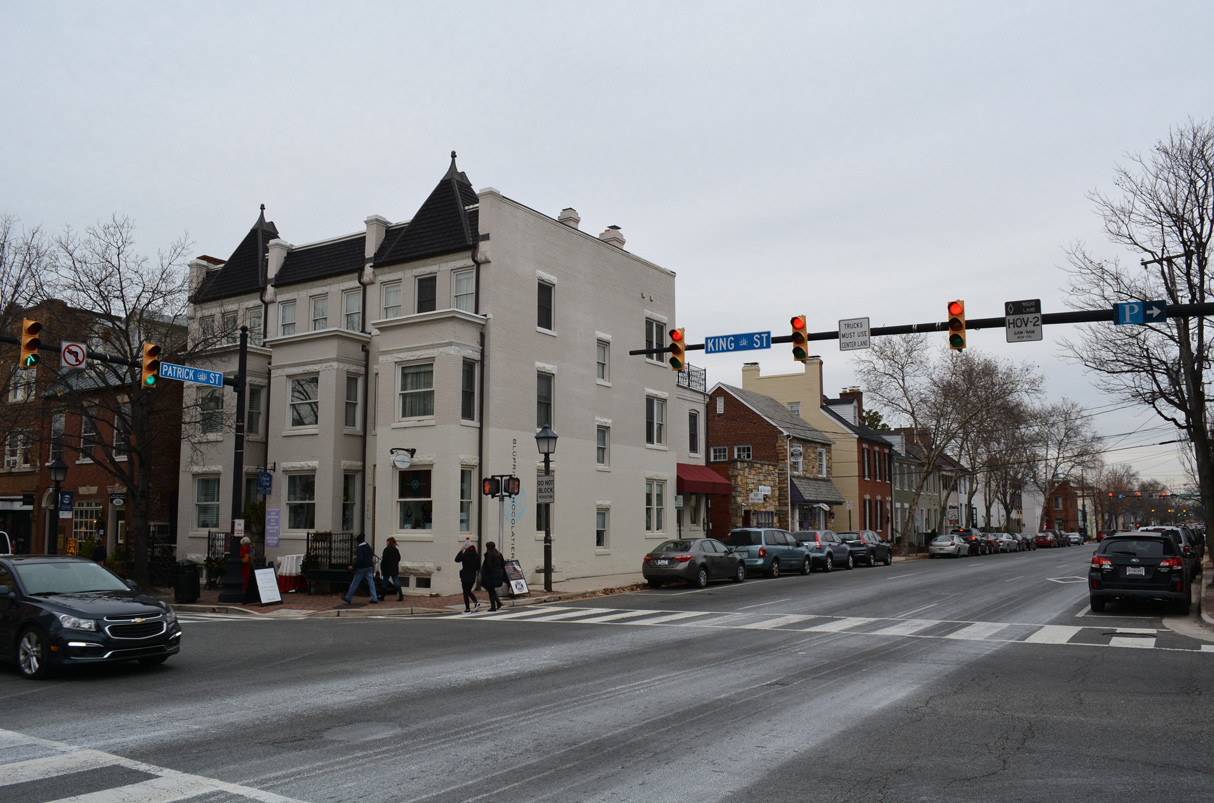 | King Street west from Washington Street (SR 400) doubles as SR 7 across the city of Alexandria. The state route leading west to Winchester is not acknowledged from U.S. 1 north. 12/16/16 |
 | A U.S. 1 confirming marker appears along the right side of Patrick Street north beyond SR 7 (King Street). 12/16/16 |
Sources:
- VA 241 to 260. Virginia Highways Page.
Connect with:
Interstate 85
Interstate 95
Interstate 295
Interstate 395 - Henry G. Shirley Memorial Highway
Interstate 495 / Capital Beltway
U.S. 17
U.S. 58
U.S. 301
U.S. 360
U.S. 460
State Route 7
State Route 10
State Route 123
State Route 234
Page Updated 02-21-2023.