|
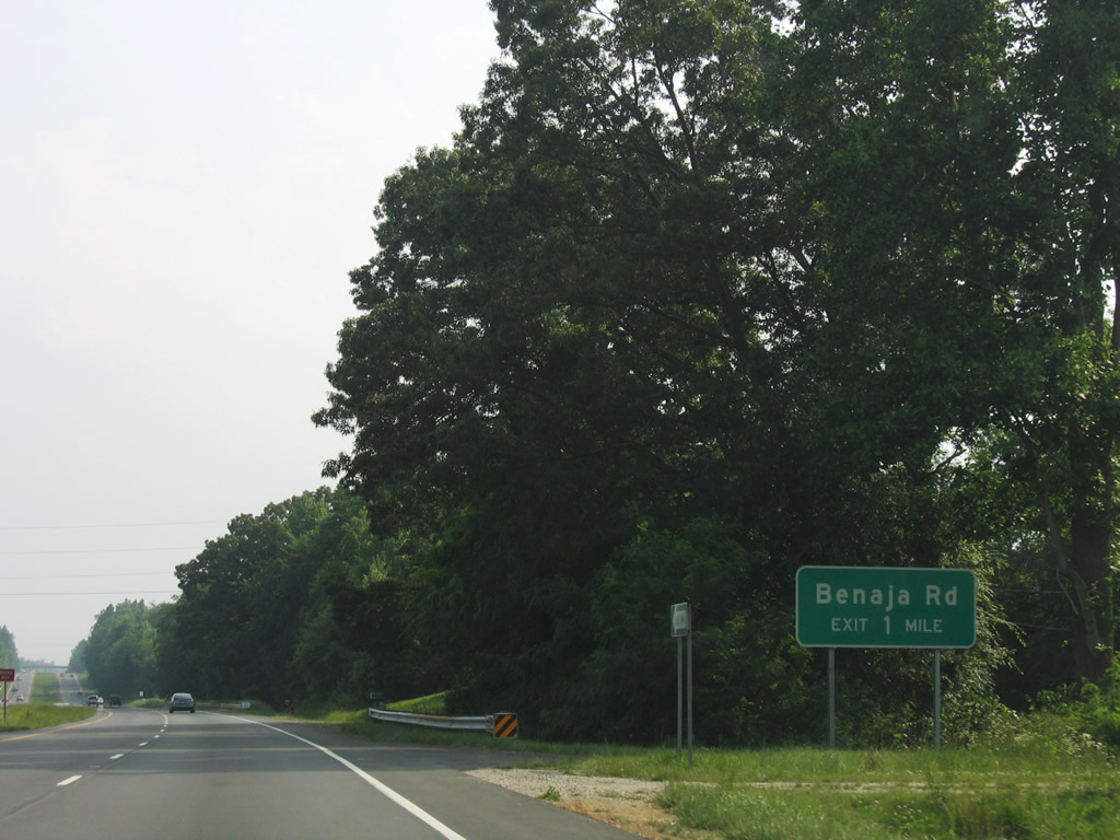
| The southern branch of Benaja Road heads south from Benaja Road (SR 2427) near the Rockingham County to a parclo A2 interchange with U.S. 29 near Monticello. 06/05/05 |
|
| 0.32 miles south of U.S. 29, Benaja Road (SR 2510) ties into Old Reidsville Road, the original alignment of U.S. 29 from Monticello north to the county line. 06/05/05 |
|
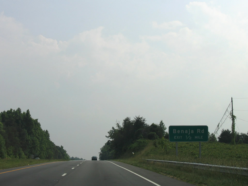
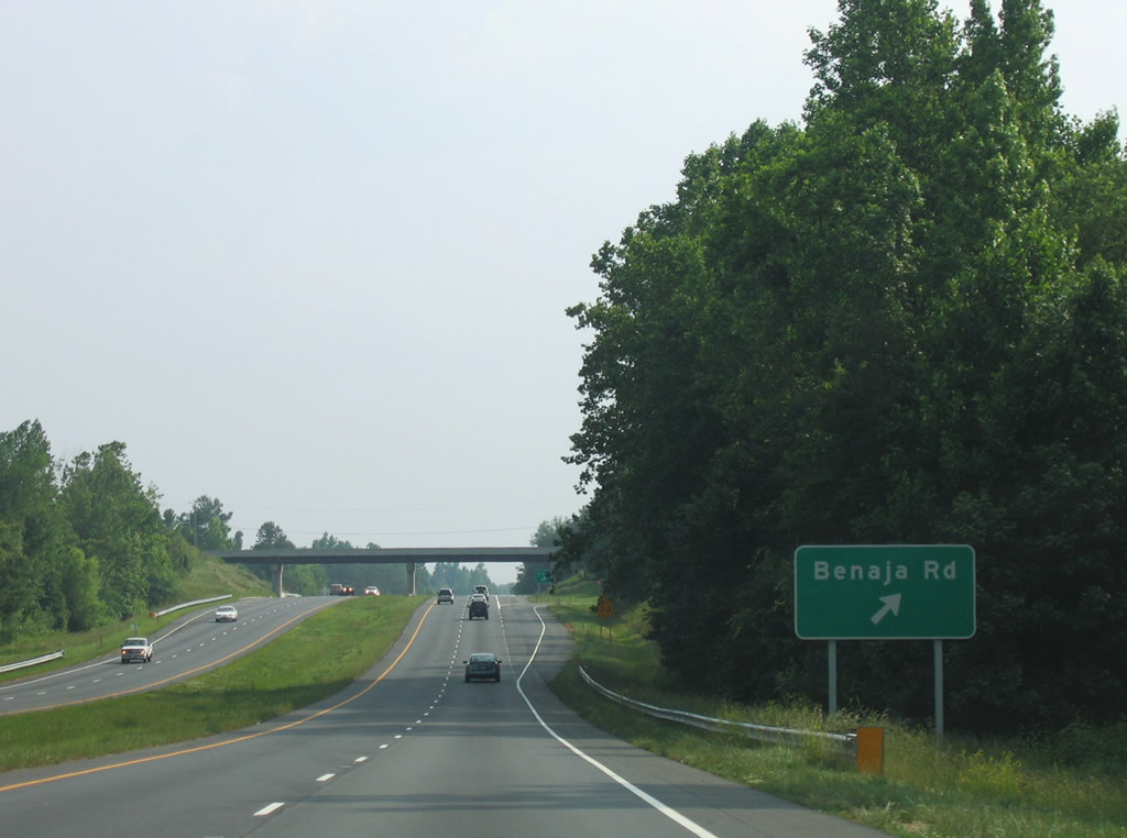
| U.S. 29 south at Benaja Road (SR 2510) east to Old Reidsville Road. 0.25 miles south Old Reidsville Road (SR 2514), connects with NC 150 east from Monticello to Osceola and NC 87. 06/05/05 |
|
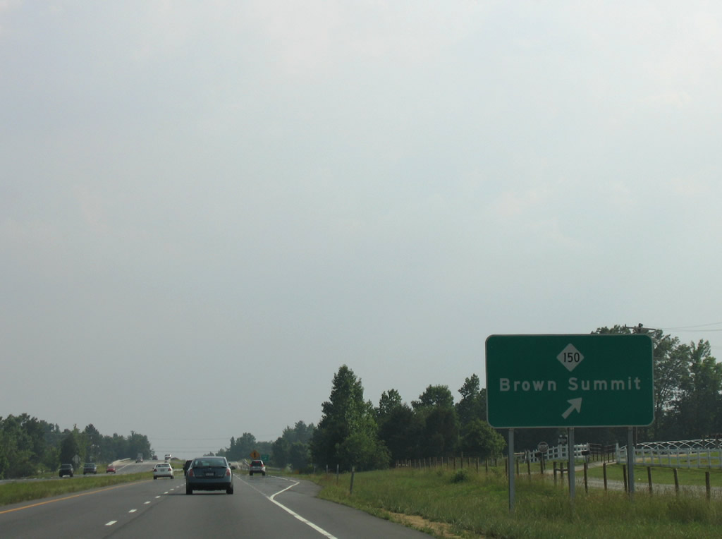
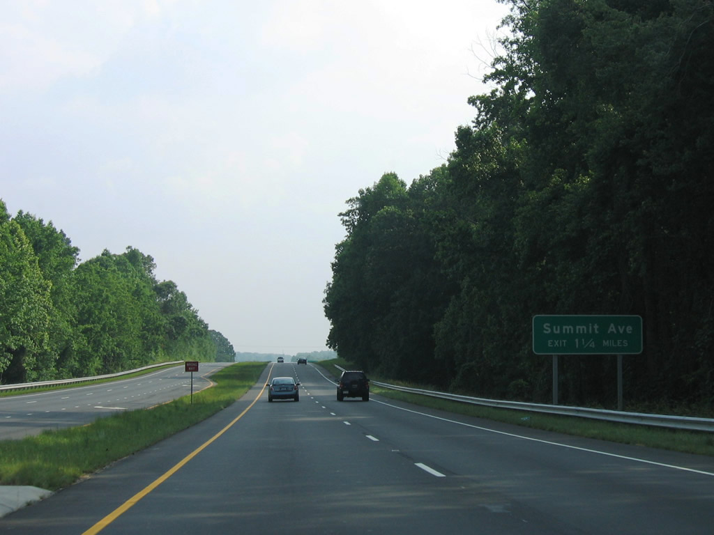
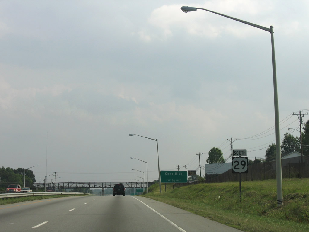
| NC 150 continues west from Monticello to a parclo interchange with U.S. 29 at Summit Avenue. Summit Avenue represents the old alignment of U.S. 29 south from Browns Summit. NC 150 west proceeds 14 miles to U.S. 220 at Summerfield. 06/05/05 |
|
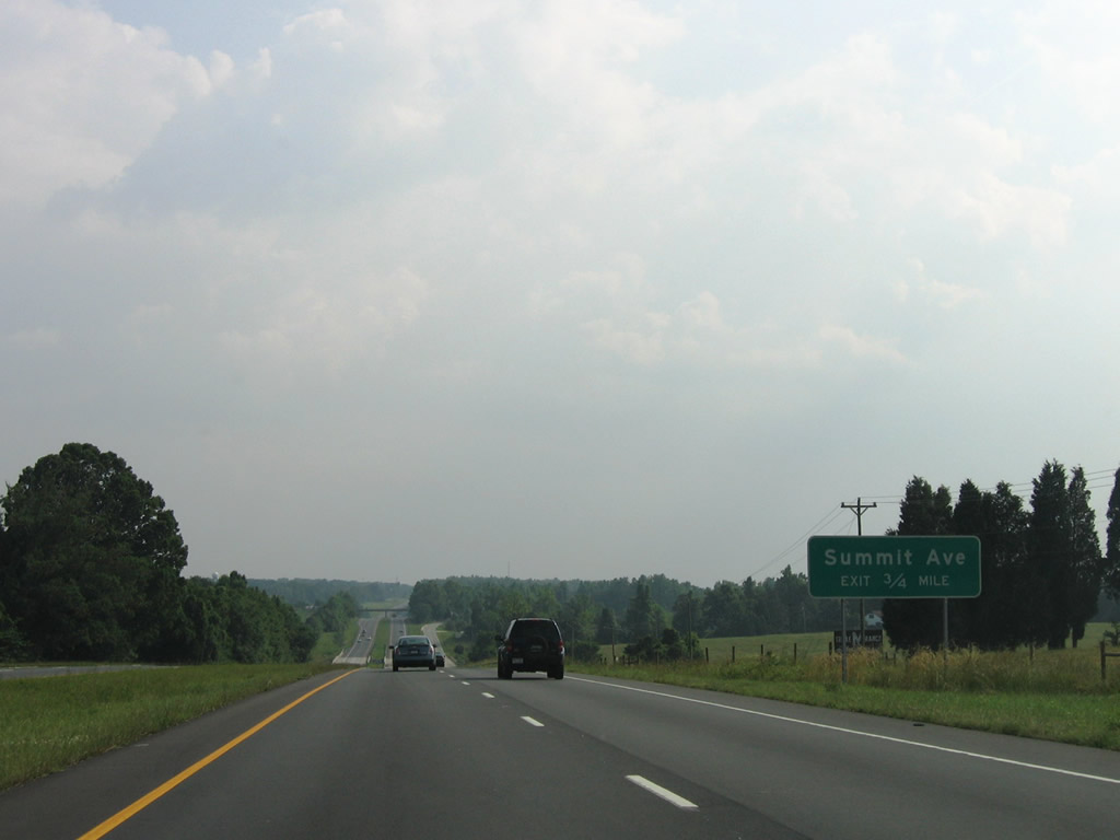
| Summit Avenue (SR 2526) converges with Brown Summit Road (SR 2515), an even older alignment of U.S. 29,1 in 1.87 miles and then closely parallels U.S. 29 south to the folded diamond interchange with Reedy Fork Parkway. 06/05/05 |
|
| Reedy Fork Parkway (SR 4771) stems east from Summit Avenue (old U.S. 29) to a number of subdivisions between U.S. 29 and Turner Smith Road. 06/05/05 |
|
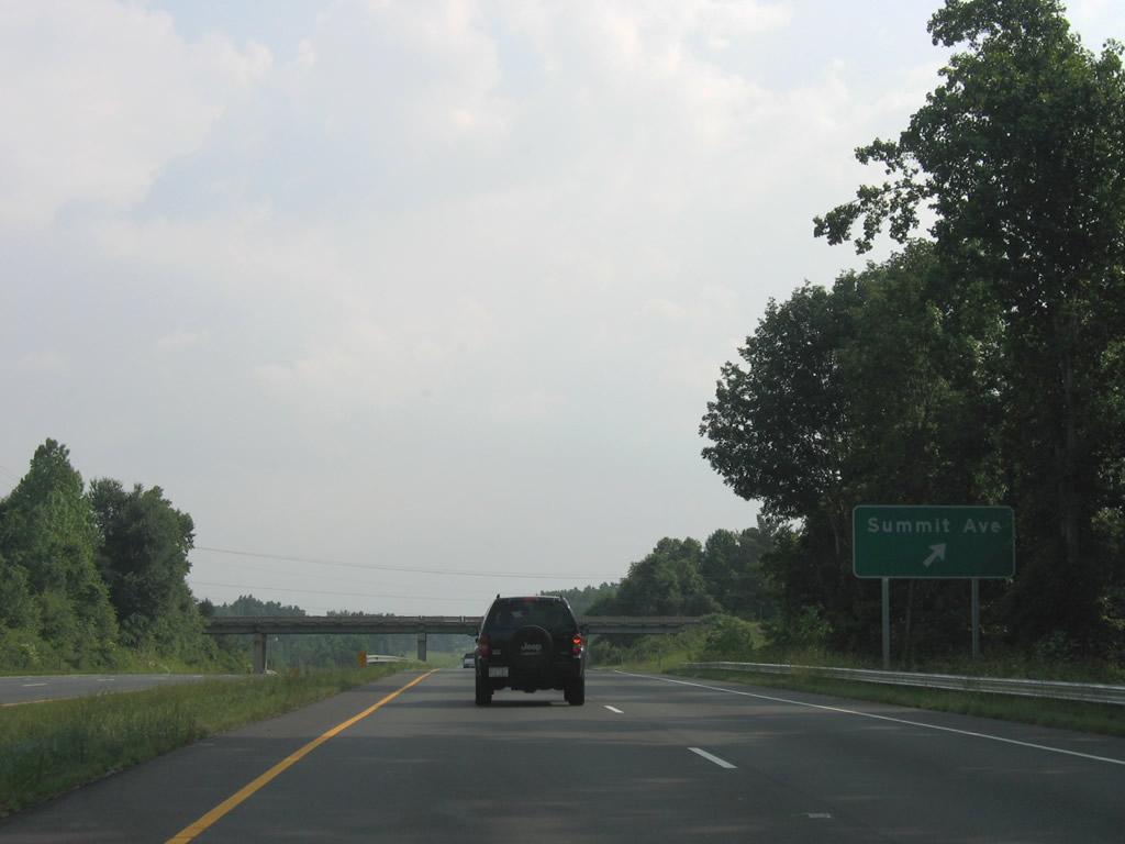
| Summit Avenue (SR 2526) continues southwest toward Bryan Park, Lake Herman and northeastern sections of Greensboro. The ensuing expressway along U.S. 29 was built in the early 1950s.1 06/05/05 |
|
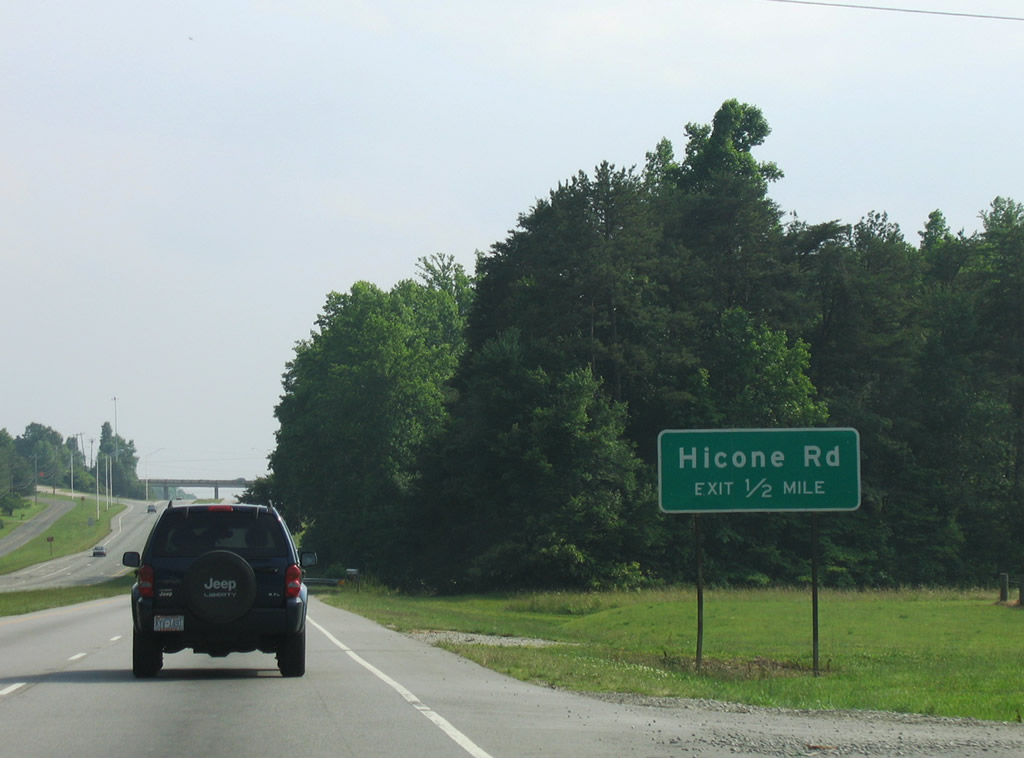
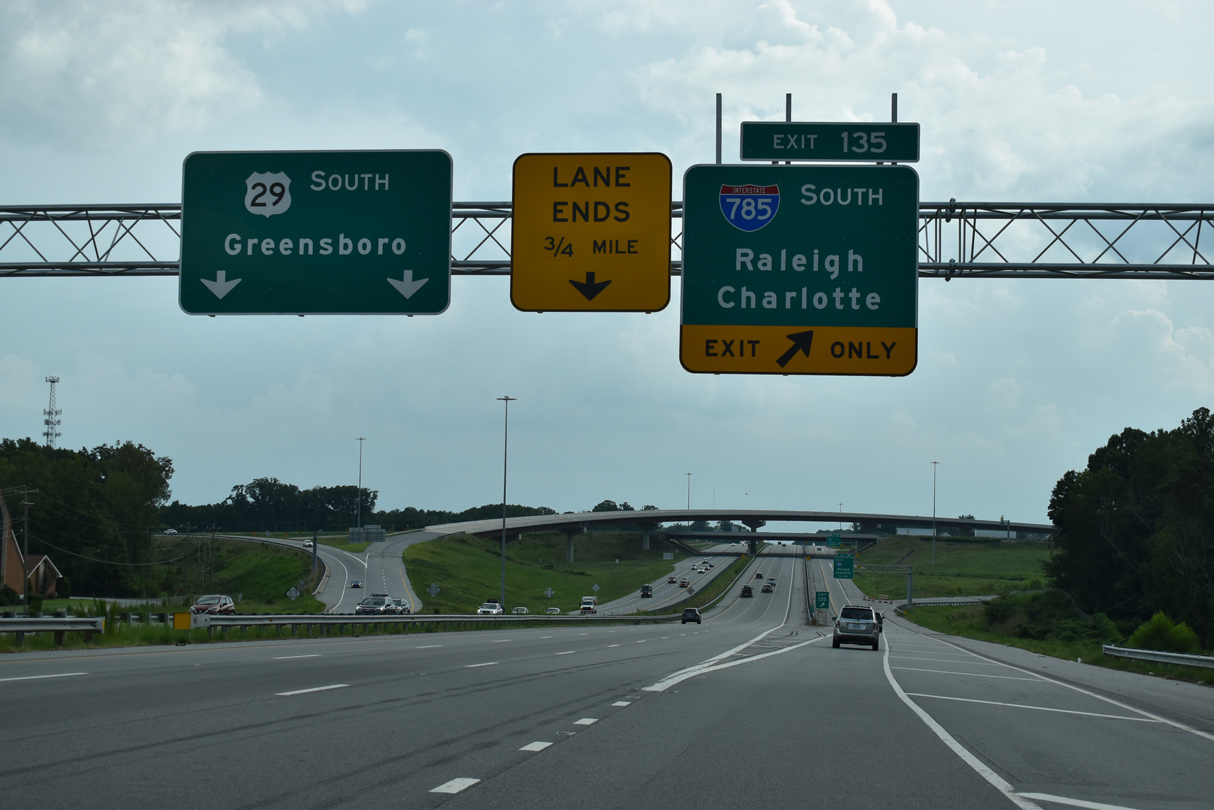
| A folded diamond interchange joins U.S. 29 south with Hicone Road (SR 2565) at Exit 136. Construction upgrading U.S. 29 to I-785 replaced the previous diamond interchange with SR 2565. 06/05/05 |
|
| Hicone Road (SR 2565) runs 0.78 miles west from Exit 136 to Summit Avenue (old U.S. 29) and east 5.50 miles to Huffine Mill Road (SR 2770) beyond the outer Greensboro suburbs. 06/05/05 |
|
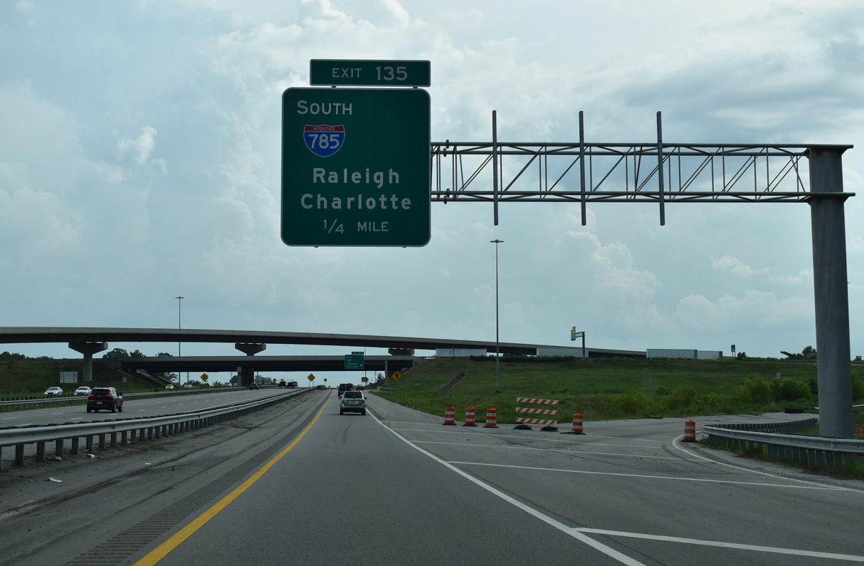
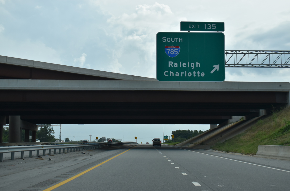
| I-785/840 along the Greensboro Urban Loop opened to traffic south from U.S. 29 at Exit 135 to U.S. 70 (Burlington Road) on December 6, 2017. 08/14/21 |
|
| Construction to 2023 completes the Greensboro Urban Loop (Interstate 840) west from I-785/U.S. 29 at Exit 135 to N Elm Street. 08/14/21 |
|
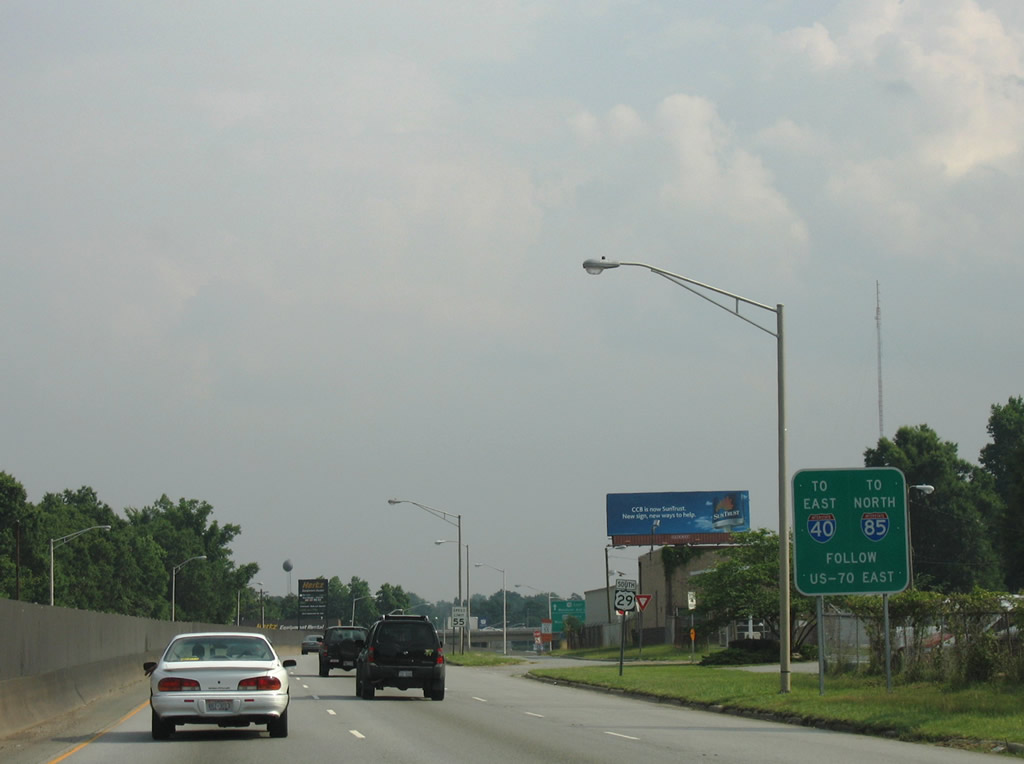
| I-785/840 combine 7.65 miles south from the cloverstack interchange at Exit 135 to the west split of I-40/85. 08/14/21 |
|
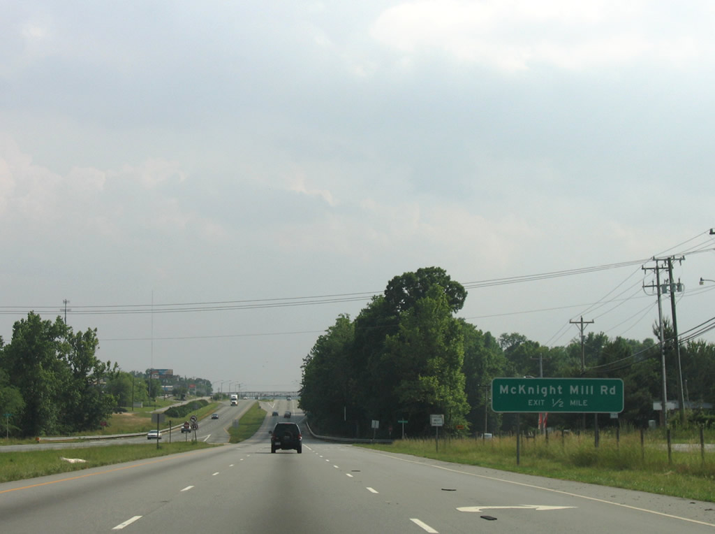
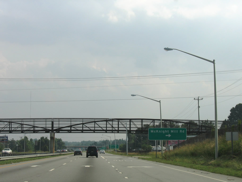
| Transitioning into an urban expressway, U.S. 29 south fully enters the city of Greensboro at Lakeview Memorial Gardens. Forthcoming McKnight Mill Road connects U.S. 29 with Summit Avenue (SR 2526) and the Rankin community. 06/05/05 |
|
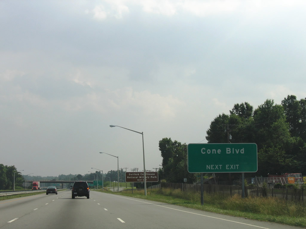
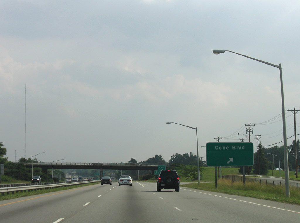
| Service roads accompany portions of U.S. 29 along O'Henry Boulevard south. This reassurance marker was formerly posted after the turn off for Terry Lane (SR 2612). A parclo interchange follows with Cone Boulevard east of Broadview and Buffalo Lake. 06/05/05 |
|
| A right in right out (RIRO) intersection links southbound U.S. 29 with McKnight Mill Road adjacent to a pedestrian overpass. McKnight Mill Road stems 0.6 miles west to Summit Avenue at Rankin. 06/05/05 |
|
| Cone Boulevard leads west through the Broadview and Kirkwood neighborhoods to U.S. 220 (Battleground Avenue) south of Guilford Courthouse National Military Park. Eastward the arterial serves adjacent big box retail built at the site of Carolina Circle Mall. 06/05/05 |
|
| Cone Boulevard stretches west across Greensboro to Benjamin Parkway at U.S. 220 (Battleground Avenue). Adjacent Carolina Circle Mall closed in 2002 and was demolish in 2005. 06/05/05 |
|
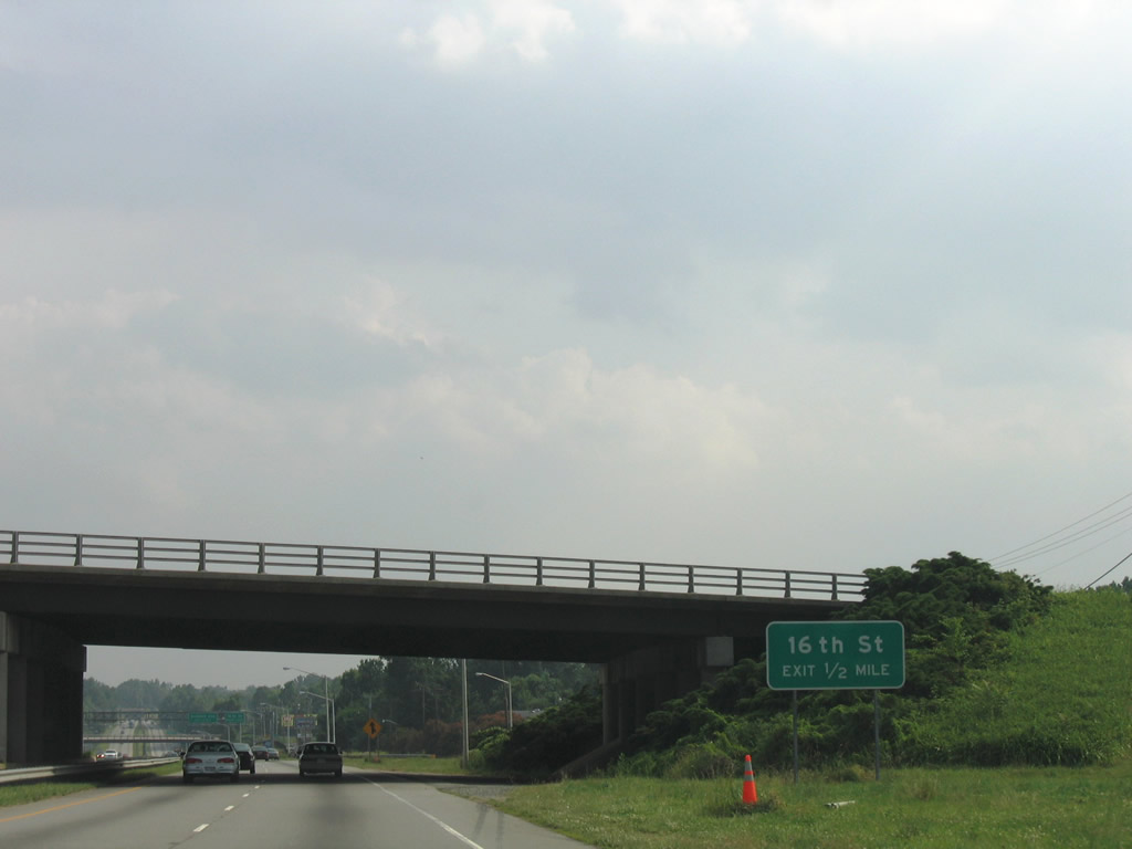
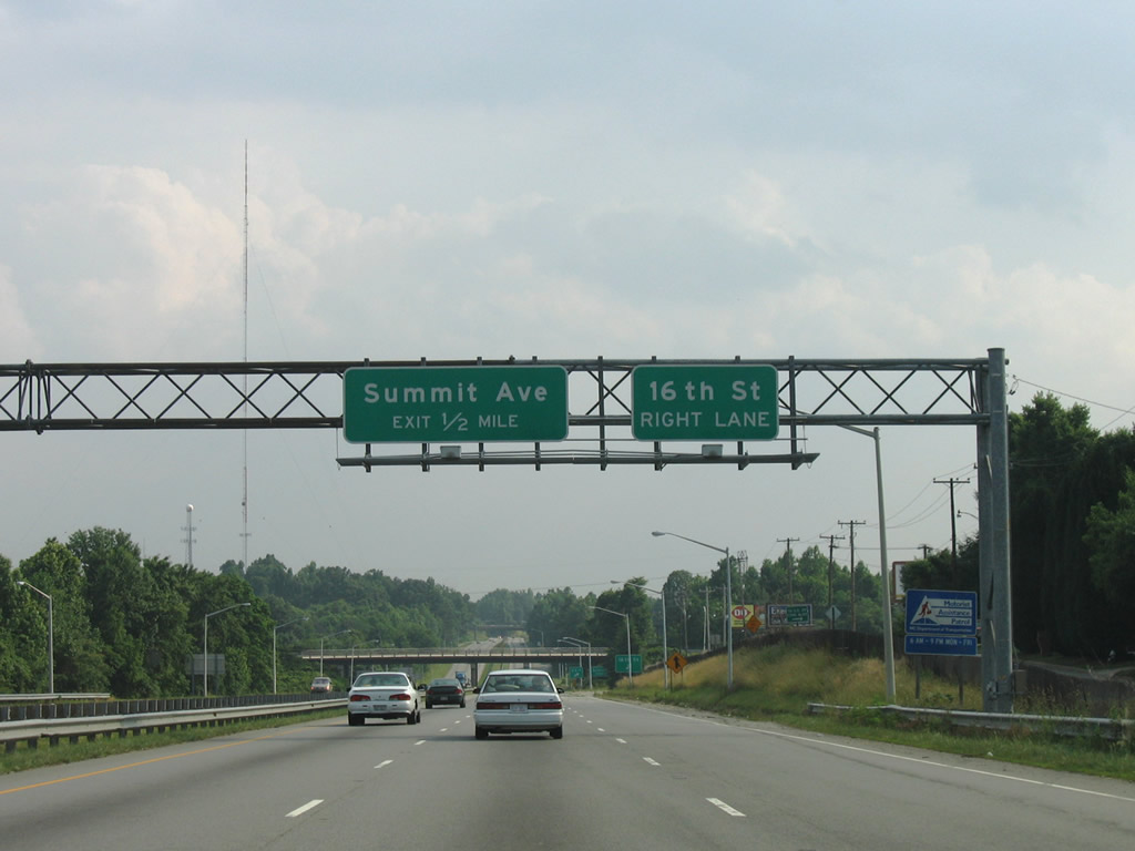
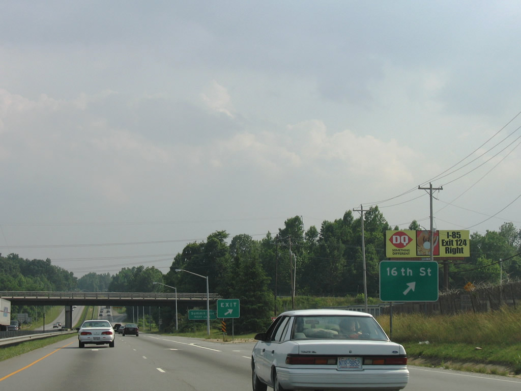
| 16th Street extends southwest from McKnight Mill Road (SR 2835) to Cone Boulevard and a parclo A2 interchange with U.S. 29 (O'Henry Boulevard). 06/05/05 |
|
| 16th Street arcs west from the site of Carolina Circle Mall to Summit Avenue near the exchange with U.S. 29. 06/05/05 |
|
| Southbound U.S. 29 meets 16th Street near the East White Oak section of the city. 16th Street ties into Church Street (SR 1001) south of Cone Boulevard and north of the Revolution neighborhood. 06/05/05 |
|
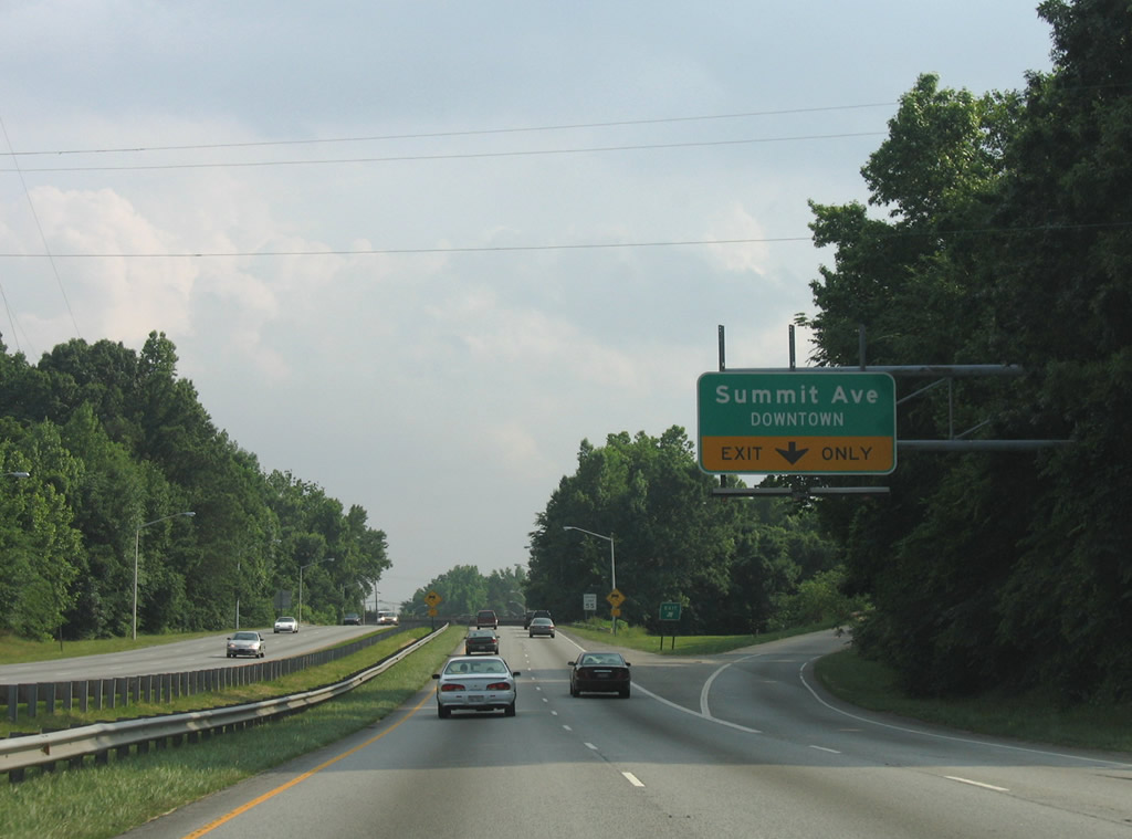
| A directional ramp leads onto Summit Avenue (former U.S. 29) from U.S. 29 south ahead of Phillips Avenue. Summit Avenue (SR 2526) diverges from the expressway into Downtown Greensboro. 06/05/05 |
|
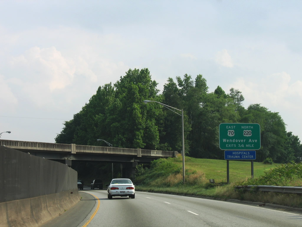
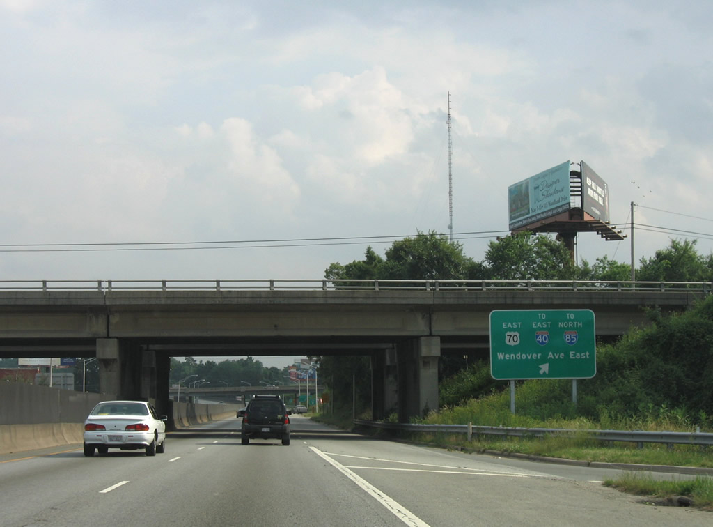
| U.S. 70 (Wendover Avenue) west and U.S. 220 south converge with U.S. 29 at a cloverleaf interchange 0.75 miles south of Phillips Avenue. U.S. 220 lines Wendover Avenue west from O'Henry Boulevard to Westover Terrace / Battleground Road. 06/05/05 |
|
| Residential service roads line both sides of the expressway along U.S. 29 (O'Henry Boulevard) south to RIRO intersections with Textile Drive. 06/05/05 |
|
| U.S. 70 (Wendover Avenue) runs east from U.S. 29/220 to the city line, where it becomes Burlington Road en route to I-785/840. 06/05/05 |
|
| The westbound exit for U.S. 220 to Moses H. Cone Memorial Hospital and the Lake Daniel community precedes the loop ramp to Arnold Street for U.S. 70 (Wendover Avenue) east and Bessemer Avenue. 06/05/05 |
|
| The RIRO intersection with Lutheran Street west at North Carolina A&T University was removed by 2007. 06/05/05 |
|
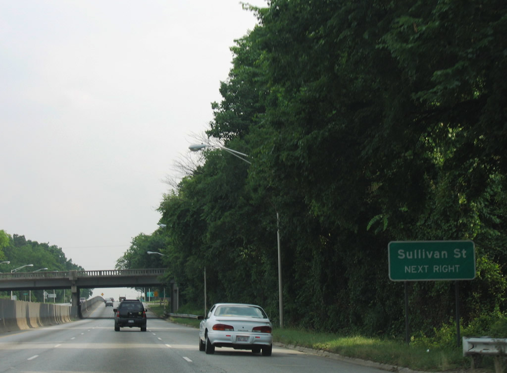
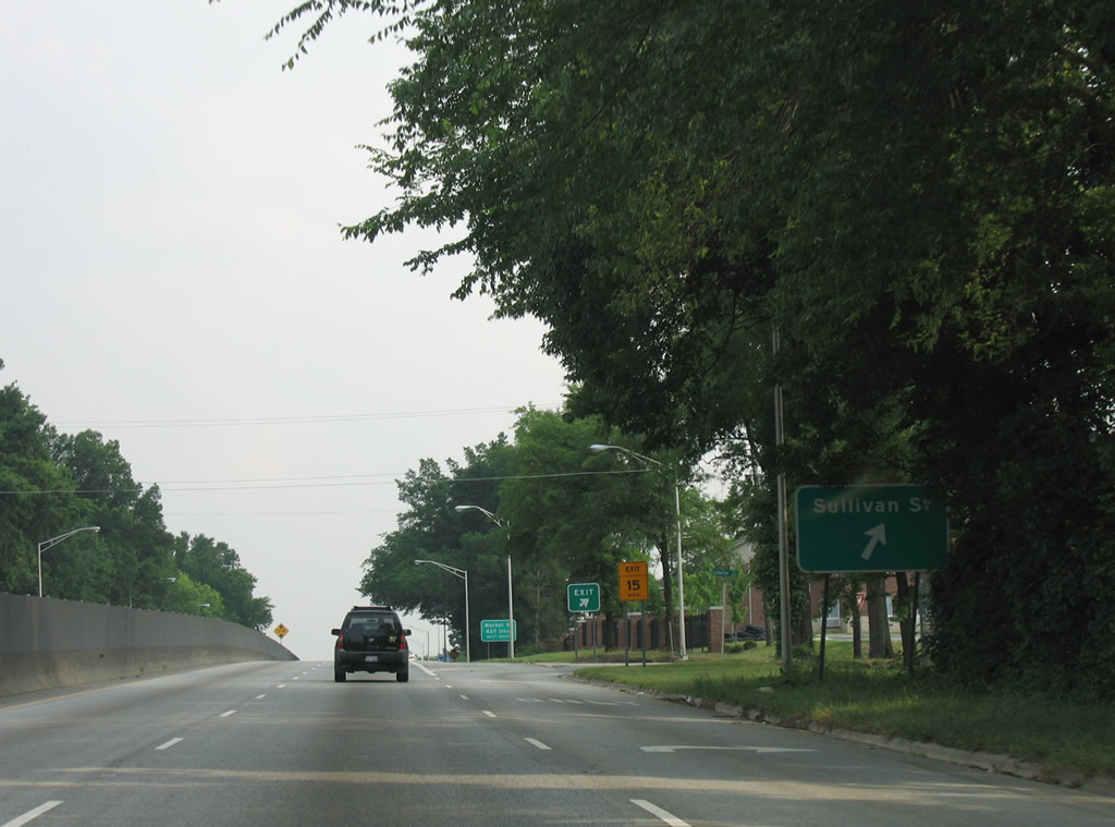
| Lutheran Street linked U.S. 29/70/220 south with Benbow Road north to Sullivan Street by Truist Stadium at NC A&T University. Sullivan Street heads west to Summit Avenue at Summit Shopping Center and east to warehouses at English Street. 06/05/05 |
|
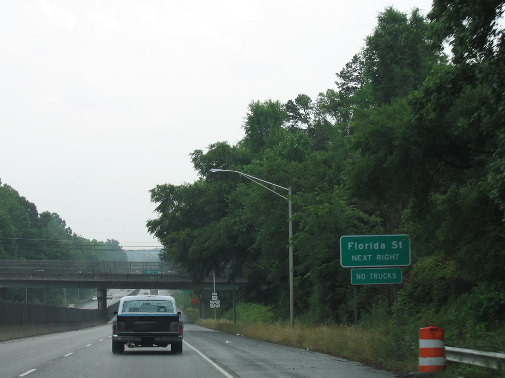
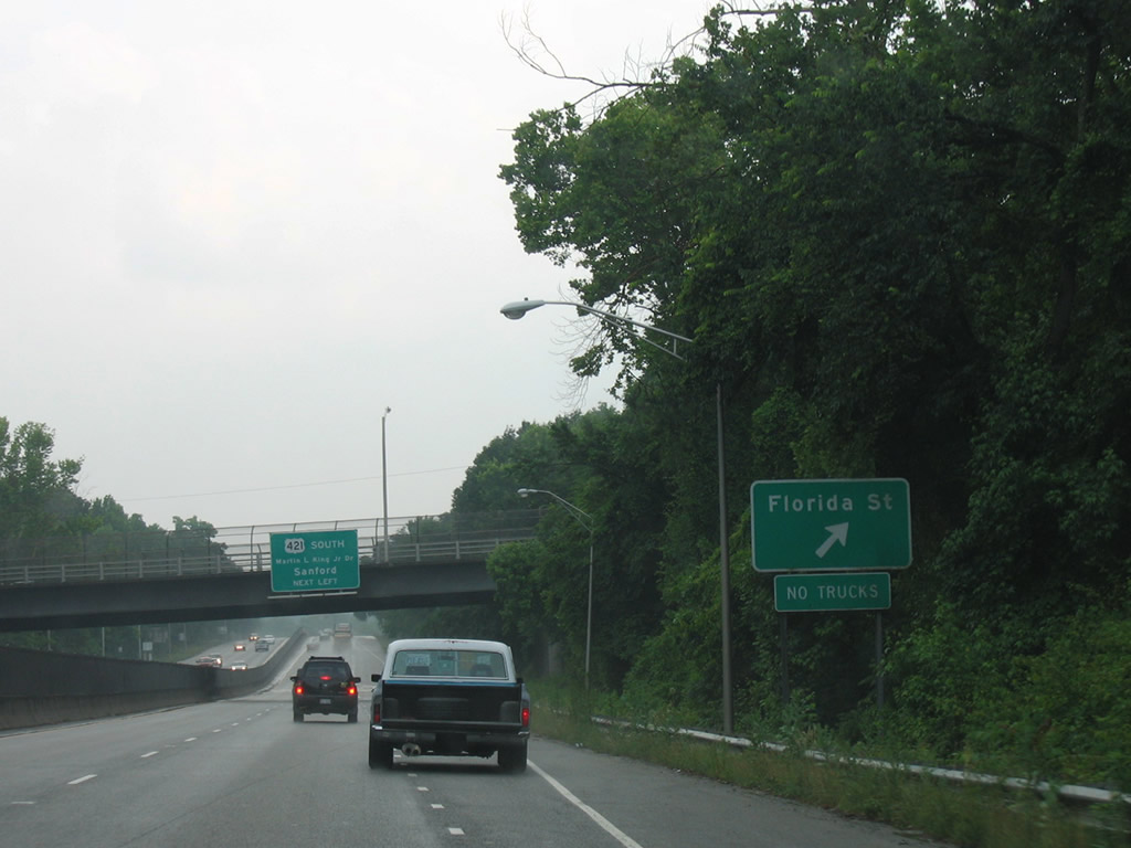
| Continuing south, U.S. 29-220 south / U.S. 70 west pass under Tuscaloosa Street ahead of the former RIRO ramps for Florida Street. 06/05/05 |
|
| The RIRO ramps with Eton Drive for Florida Street were removed by 2007 during reconstruction of O'Henry Boulevard. 06/05/05 |
Page Updated 11-29-2021.

 South
South