
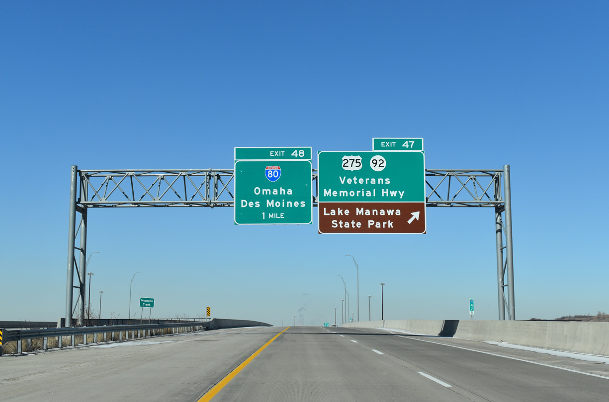
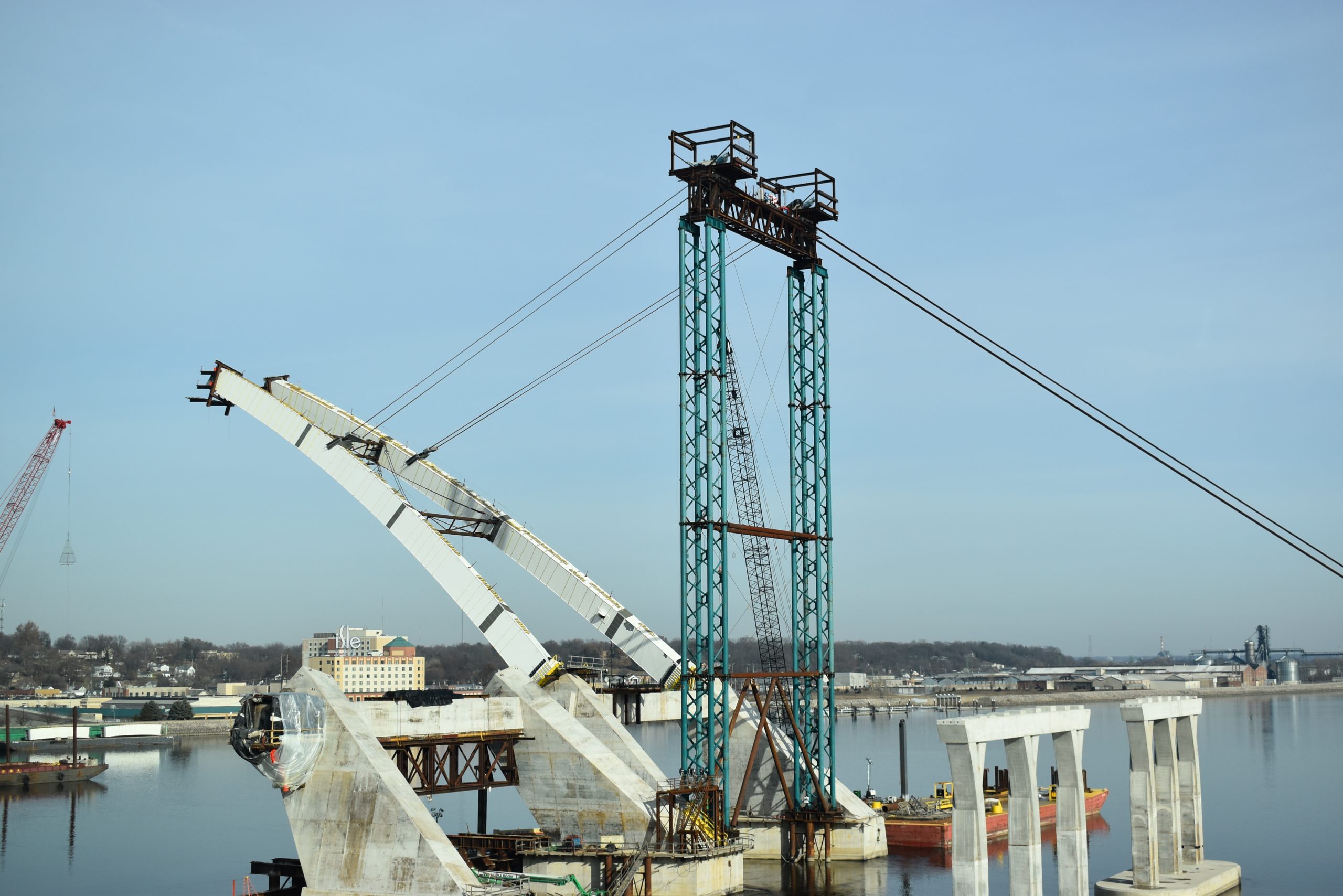
The last day of our eight day trek through the Upper Midwest took us from the Quad Cities area back to Chicago before heading southward to home. Leaving around lunchtime, we traveled I-74 through Bettendorf and Moline, catching a glimpse of the current utility work being performed in preparation of the I-74 rebuild across the Mississippi River. We then hooked up with I-80 east toward Lasalle and Joliet.
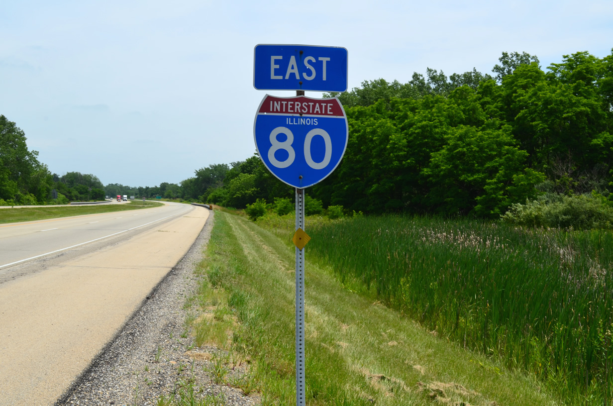
A rare state-named shield on the Interstate 80 mainline beyond the Atkinson interchange (Exit 27), though it was not originally a state-named marker per Jeff R…
Following the advice of Jeff, we poked down Interstate 180 to the first exit (U.S. 6) to see if his other “state-named” shield was in place, but unfortunately it had already been replaced.
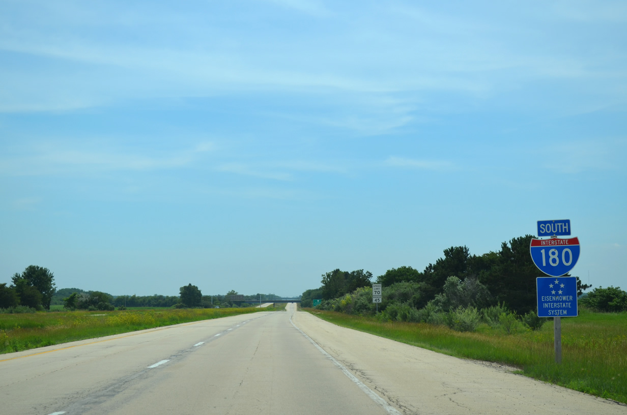
First shield for Interstate 180 south of its northern terminus at I-80. The 13-mile freeway connects Hennepin (Putnam County) to Interstate 80.
The American Association of State Highway Officials (AASHO), predecessor to AASHTO, established a road test site along this portion of Interstate 80 near Ottawa between 1958 and 1960 (62). Construction began on the seven-mile segment in August 1956 with the first road tests commencing October 1958. The test area included six loops and a tangent segment consisting of concrete and asphalt sections. 16 short-spanned bridges were also included within the road test area. Through a wide variety of subbase, base, and surface thickness, the AASHO Road Test provided the necessary foundation for the evaluation of stresses and deflections from moving vehicles.1 Ending November 1960, the Road Test area in Ottawa is a testament to some of the highway and bridge designs and specifications still in use today.

A sign marking the historic AASHO Road Test landmark stands along the south side of Interstate 80 between the East 12th and 14th Road overpasses near Ottawa.
Of the seven-mile test area, only this “Non-destructive weather loop” remains, consisting of two concrete carriageways looped on either end. The test site existed between the mid-to-late 1950s through the early 1960s according to this particular sign.
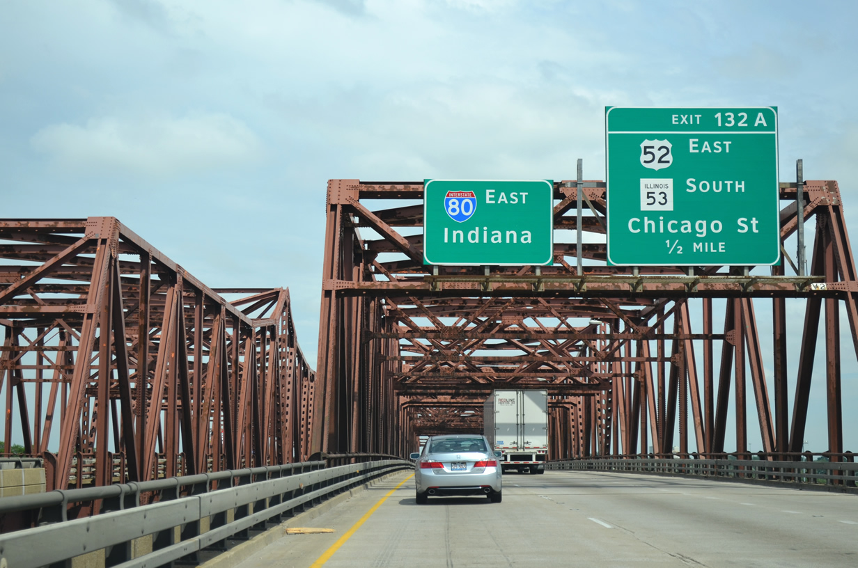
Continuing our drive east on Interstate 80 through La Salle and Grundy counties, we made it to Cook County and the outskirts of the greater Chicago metropolitan area, passing Joliet to the south.
Twin truss bridges carry Interstate 80 traffic across the Des Plaines River near Joliet.
Built in 1965, the pair of bridges has an average daily traffic (ADT) count of 148,200 vehicles (2012). The bridges were rehabilitated in 1998.2
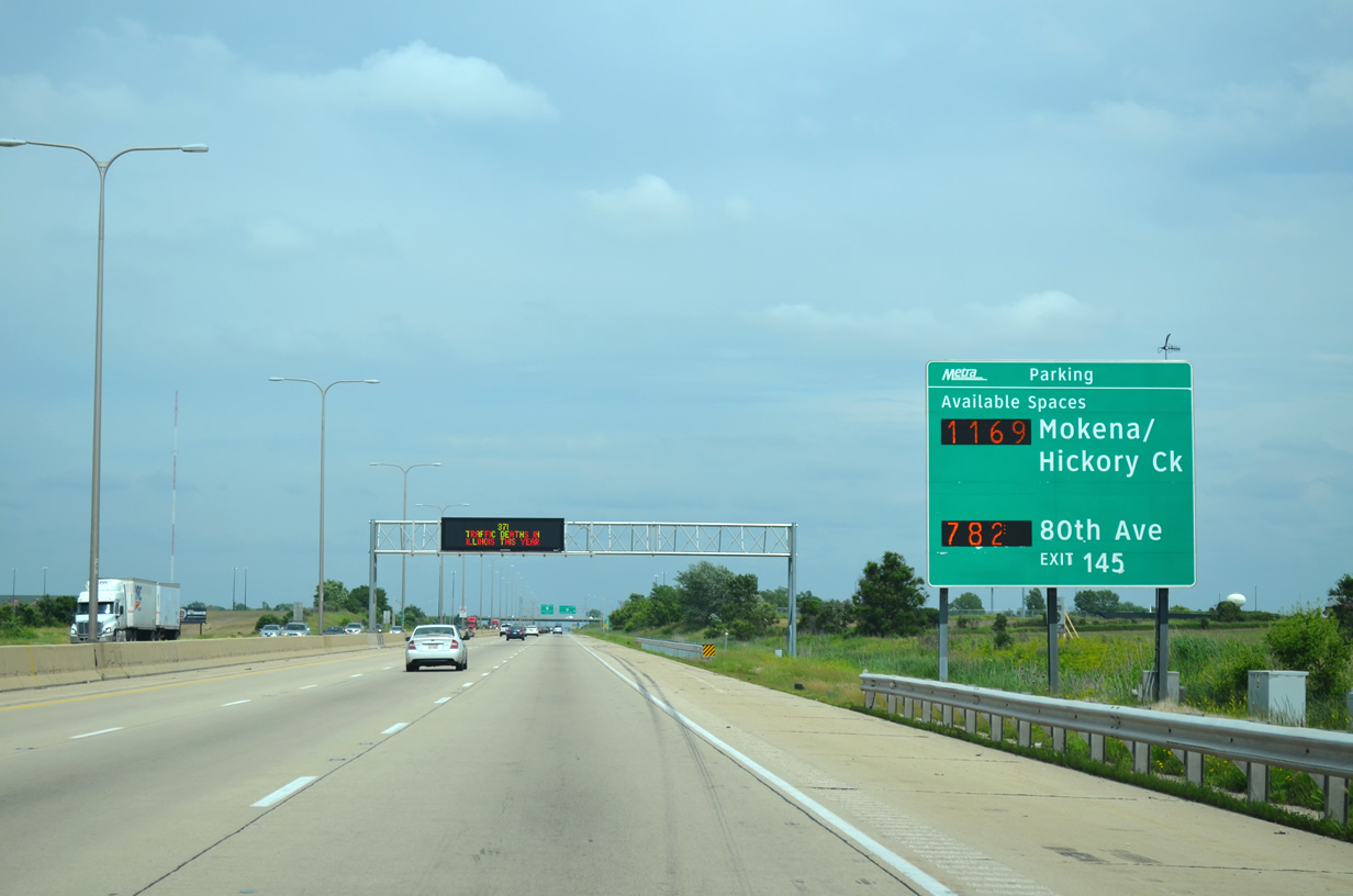
Digital guide sign in advance of U.S. 45 (Exit 145) displays the availability of parking spaces at two regional Metra commuter rail stations. U.S. 45 (La Grange Road) south links I-80 with the Mokena and Hickory Creek stations while the 80th Avenue station is reached via U.S. 45 north.
Hooking up with Interstate 57 in the vicinity of Country Club Hills, we headed north toward Blue Island and the merge with Interstate 94 (Dan Ryan Expressway).
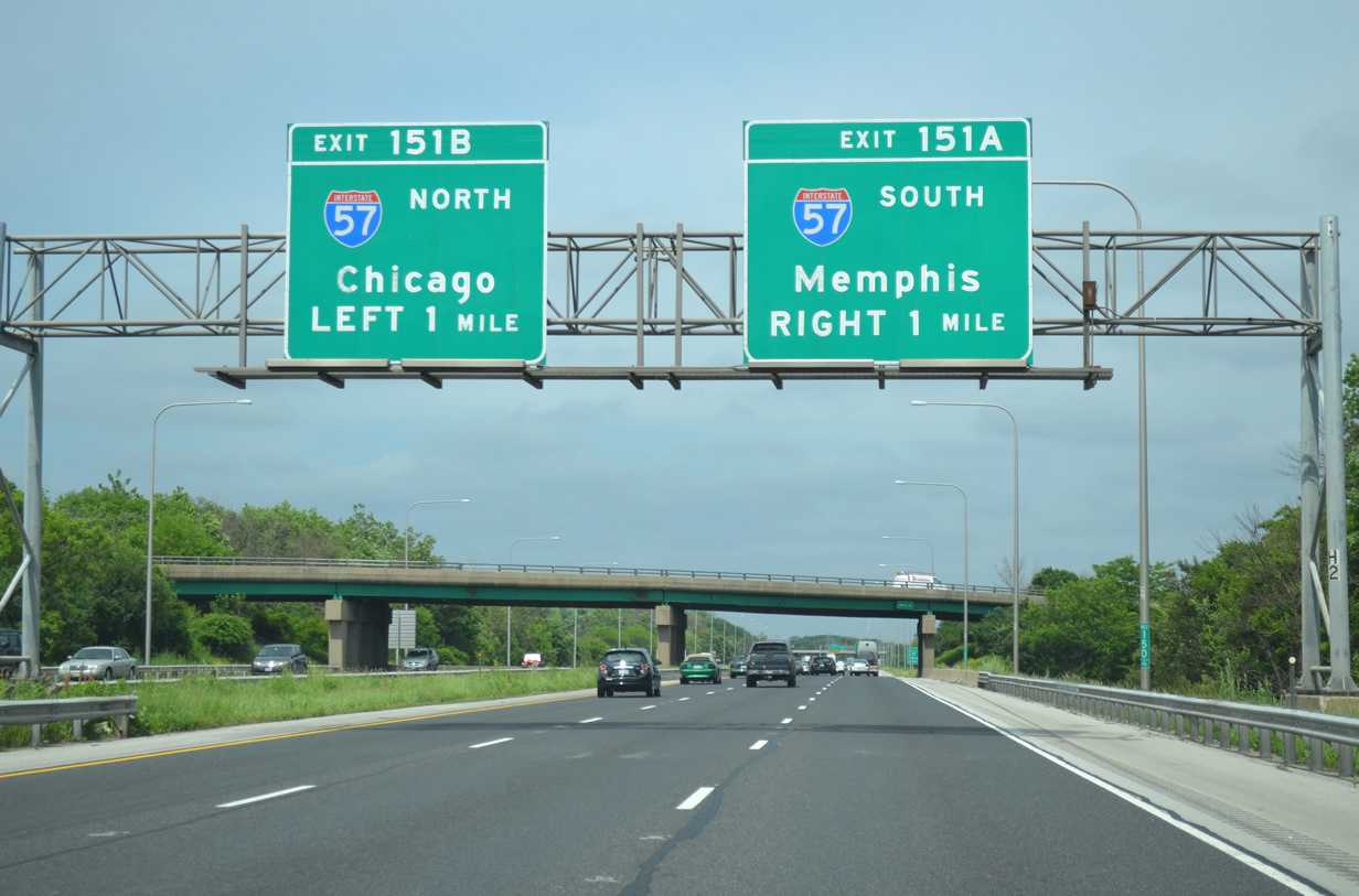
Some button copy signage is still hanging on along Interstate 80 east near the symmetrical exchange with I-57 (Exits 151AB).
Phase one of the connection between I-57 & I-294 (Tri-State Tollway) was completed in October 2014 with the opening of a ramp from I-57 north to I-294 north and from I-294 south to I-57 south. At a cost of over $600 million and spanning a decade, the linking of these two vital Interstates will reduce congestion and improve travel times. The second phase, expected to commence in 2023, will complete the freeway to freeway interchange.
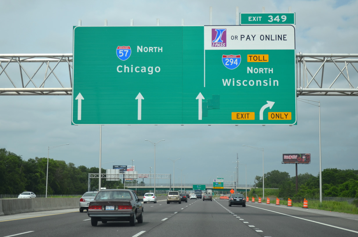
One arrow is temporarily masked on this Arrow Per Lane (APL) assembly on the final approach to Interstate 294 north (Tri-State Tollway) as crews perform some minor drainage work. The two-lane ramp from I-57 north to I-294 north opened to traffic October 2014.
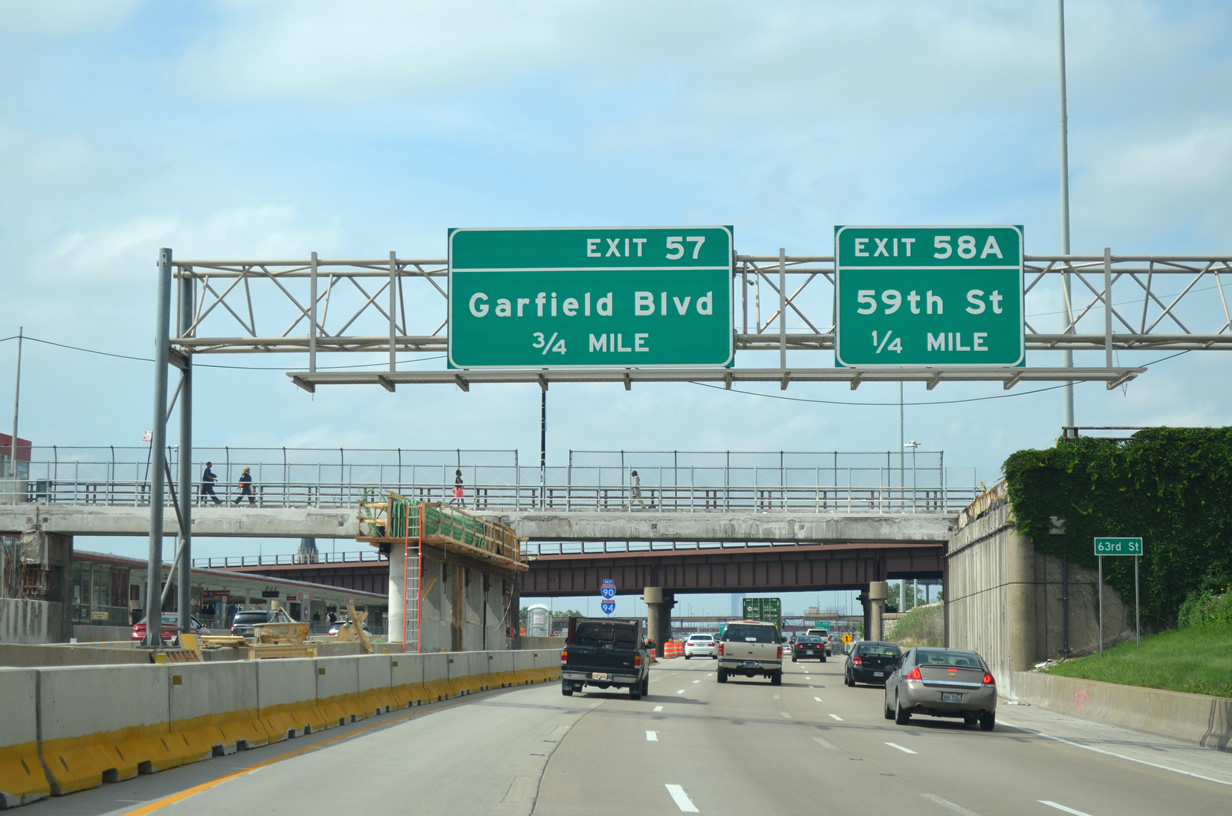
Beyond the merge of Interstates 90 & 94, the Dan Ryan Expressway passes under 63rd Street. The local arterial is closed between Yale and Wentworth Streets until November 2015 while construction of a new bridge spanning the Dan Ryan takes place.
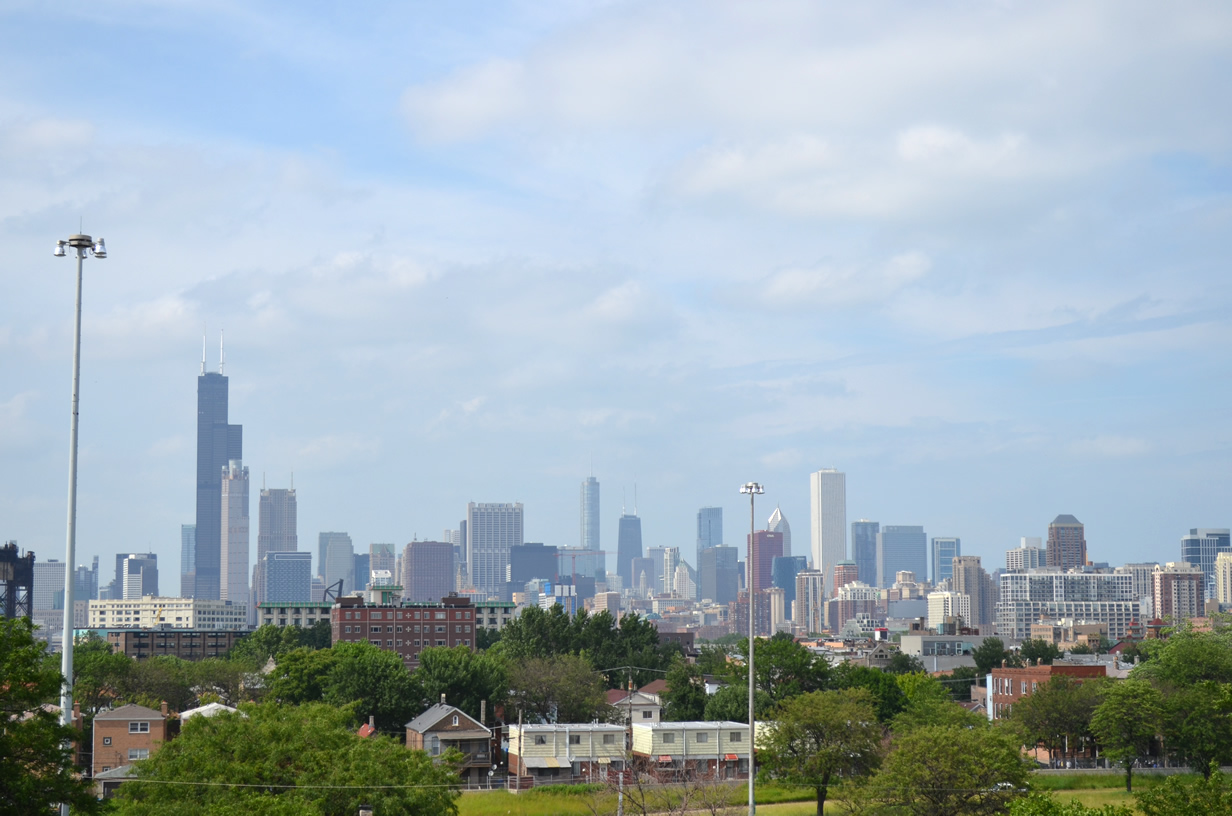
View of the the Willis Tower and the Downtown Chicago skyline as seen from the Dan Ryan Expressway near the exchange with Interstate 55 (Stevenson Expressway).
With some time left before needing to head toward O’Hare, we traveled south on Interstate 55 (Stevenson Expressway) with a brief return to Interstate 80 and Joliet.
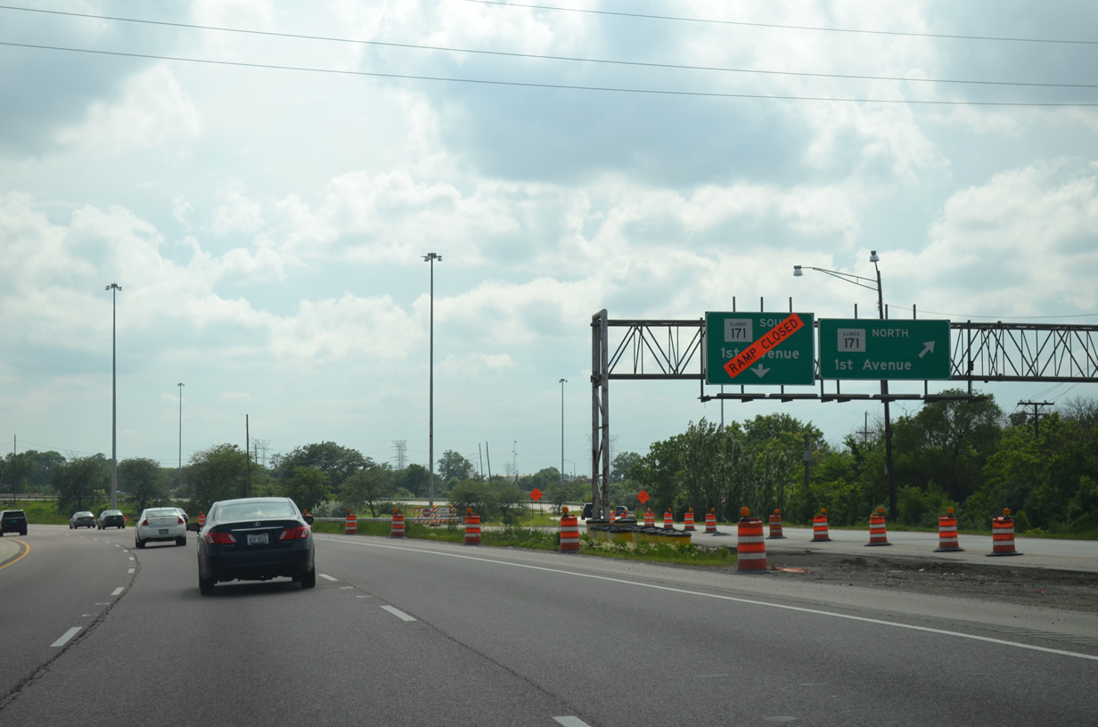
Another bridge replacement has the southbound span of Illinois 171 (1st Avenue) closed at its interchange with Interstate 55 (Stevenson Expressway). Work also includes construction of a new flyover ramp from IL 171 south to I-55 north. All work at the interchange is scheduled for a Fall 2015 completion.
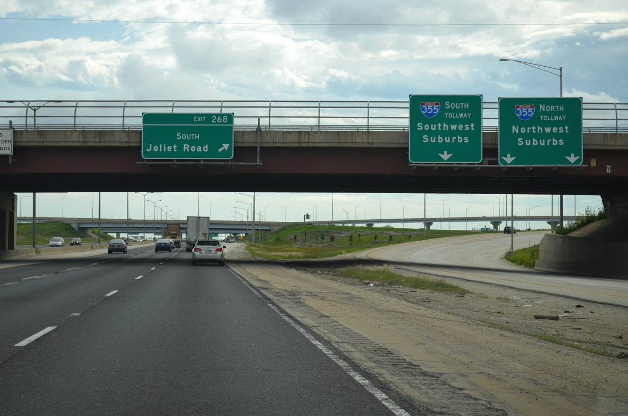
One older set of gantries remain along I-55 south at the departure to I-355 north and south near Bolingbrook.
After grabbing a quick bite to eat before the flight, we reversed course and headed back north on I-55 toward the Chicago area. Our final hour took us up to Interstate 294, with a revisit of the Tri-State Tollway northbound back to O’Hare.
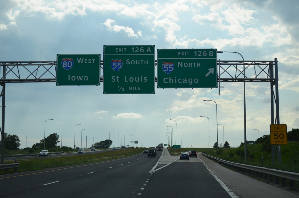
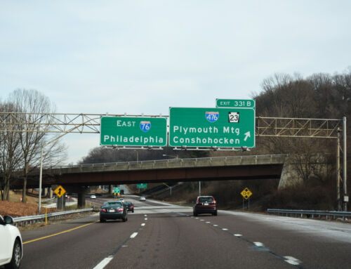
In lieu of a city destination, motorists see the state of Iowa as the next control point along I-80 west at the departure ramp to I-55 north (Exit 126B).
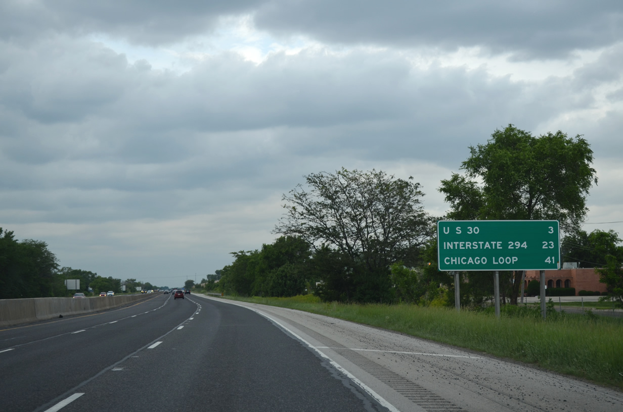
North of U.S. 52 (Exit 253) travelers pass by this mileage sign indicating that 41 miles remain to the Chicago Loop (I-90 & 94). The Tri-State Tollway will meet the Stevenson Expressway in 23 miles while U.S. 30 crosses the freeway next.
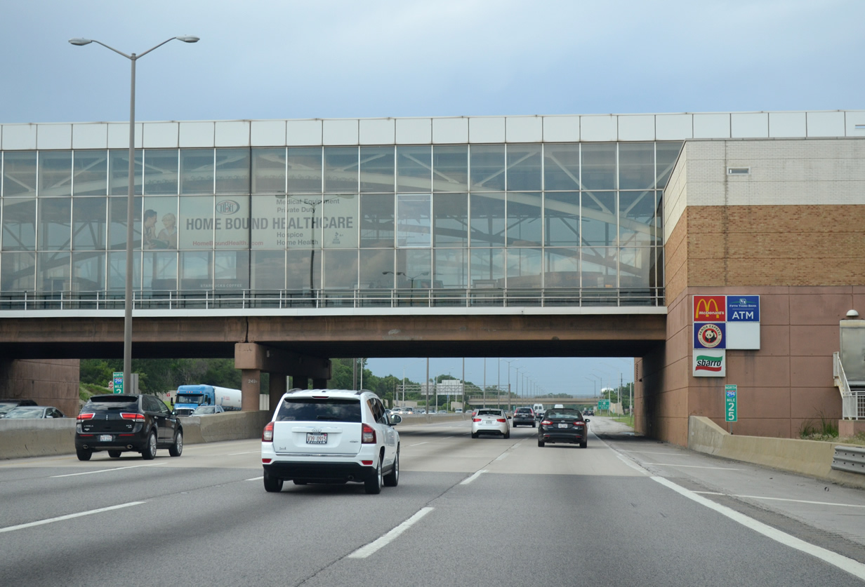
The Hinsdale Oasis spans across the I-294 (Tri-State Tollway) mainline north of its exchange with Interstate 55, featuring popular national food chains, restrooms, and traveler information.
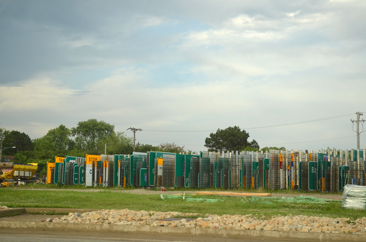
New signs line up awaiting placement along the Tollway at the Cermak Road Toll Plaza.
Button copy signage such as this trailblazer guide sign still adorn the service road at the O’Hare Oasis.
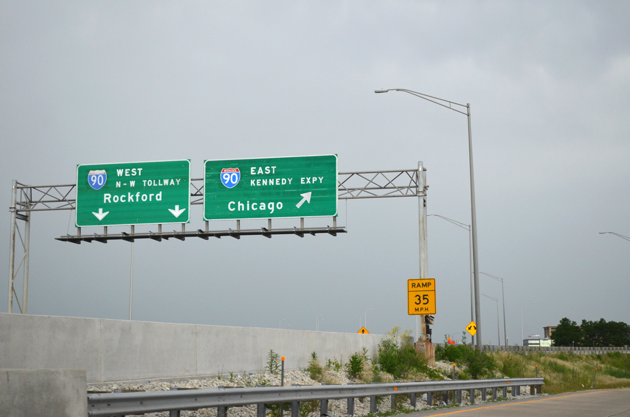
This sign gantry at the complex interchange system between I-294, I-90 and I-190 west still retains stain marks from when both the Kennedy Expressway and North-West Tollway carried the Illinois 194 designation.
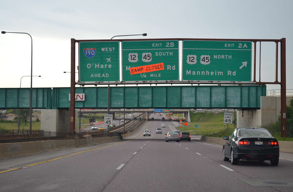
The ramp to U.S. 12 & 45 south (Mannheim Road) is closed due to a road project along the arterial.
Started in Spring 2013, the two-phase project includes road widening the portion of Mannheim Road between IL 19 (Irving Park Road) and IL 72 (Higgins Road) and the construction of an underpass from southbound U.S. 12 & 45 to eastbound Balmoral Avenue. Originally scheduled to be completed August 2014, the project is now slated to wrap up this fall.
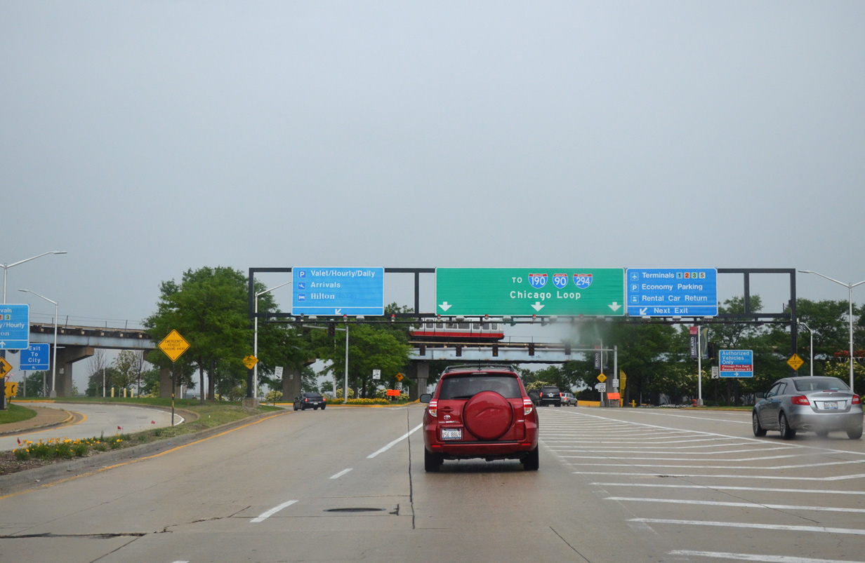
Leaving the departure access to O’Hare International Airport motorists are directed toward local interstates. Interstate leads 190 east to reach both I-90 to the Chicago Loop and I-294 to the north and south suburbs of the greater Chicago metro area.
With thunderstorms coming in from the west and the afternoon winding down, it was time to finally return the car, board our shuttle to the airport, and prepare to depart for Florida. We ended up traveling a total of 4676.8 miles through our eight-day trip into the Upper Midwest.
Sources:
- Federal Highway Administration (FHWA), www.fhwa.dot.gov/infrastructure/50aasho.cfm.
- bridgehunter.com, bridgehunter.com/il/will/99005721743
My take on the Fort Worth road system is that for seerval decades, Fort Worth was 2nd only to Austin in regards to being anti-freeway. The same if you don’t build it, they won’t come mentality that many people still somehow believe. Like Austin, Fort Worth is behind the curve now, and are madly trying to catch up, all of it with managed lanes/toll projects. Good luck.