|
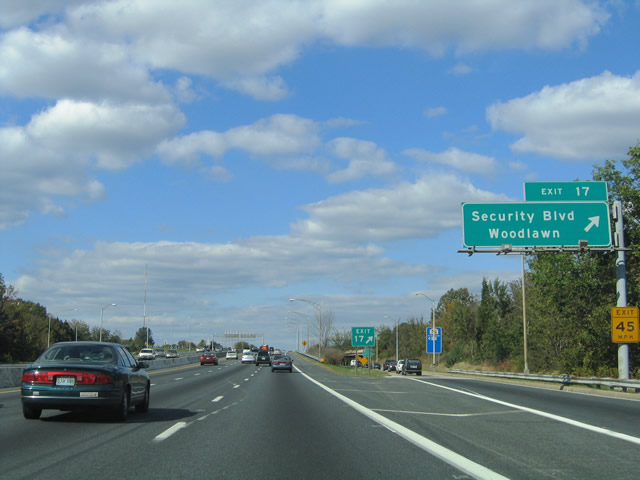
| Exit 17 departs from I-695 north MD 122 (Security Boulevard) within the systems interchange with Interstate 70. MD 122 is a 2.96 mile long arterial route between Rolling Road and the Baltimore city line along Cooks Lane. 08/27/05 |
|
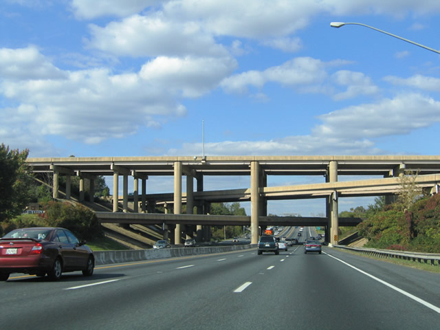
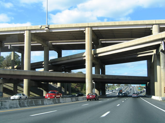
| The four level interchange with I-70 was built to accommodate the full length of the proposed route extending east to I-95 in Baltimore. 10/10/04 |
|
| I-70 and unsigned MD 570 meet on the top level with a single lane striped along each roadway. 10/10/04 |
|
| A six-ramp parclo interchange joins I-695 (Baltimore Beltway) and MD 122 (Security Boulevard) at Exit 17. Security Boulevard west leads to Security Square Mall. 10/10/04 |
|
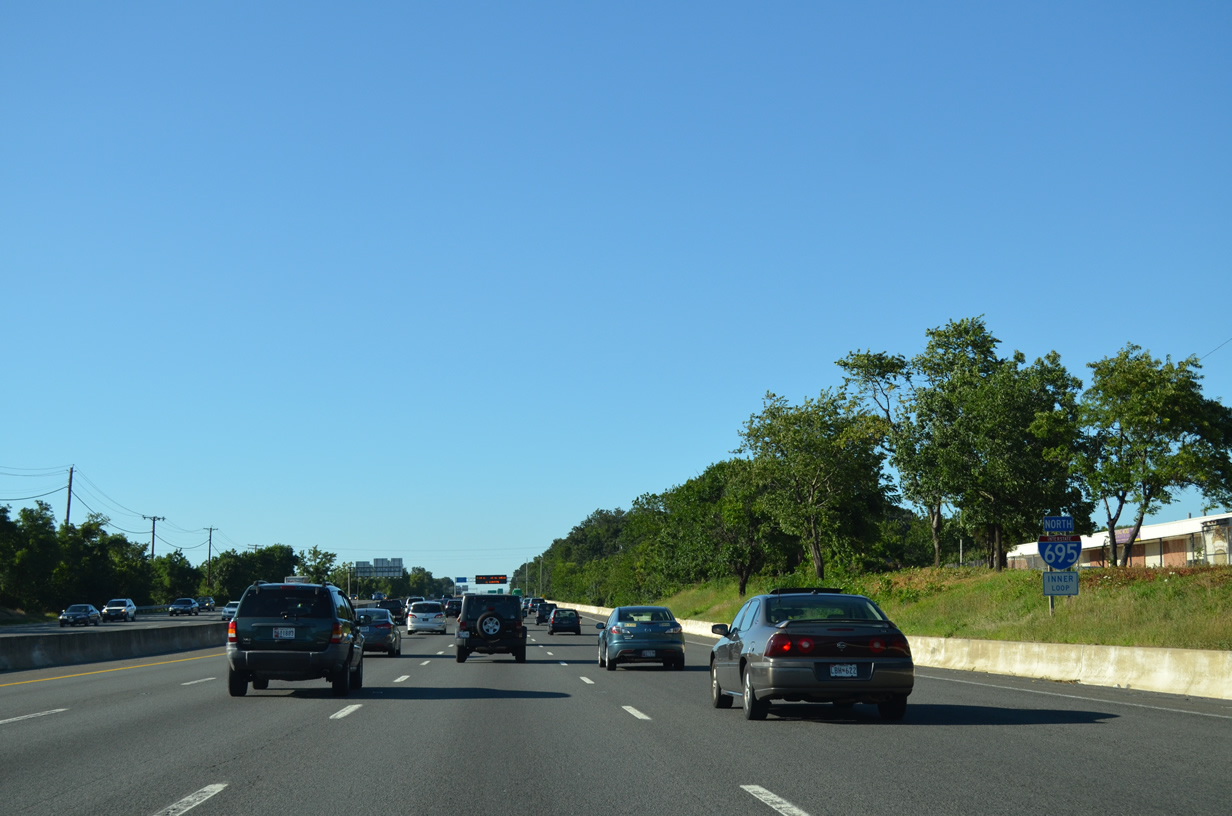
| Business and industrial parks spread both east and west of Interstate 695 from Woodlawn north to Windsor Mill Road. 08/04/13 |
|
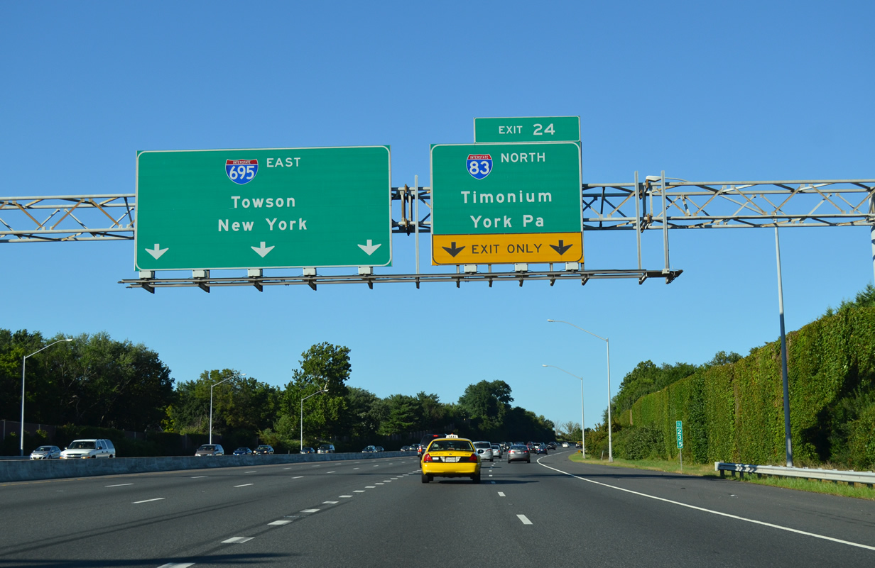
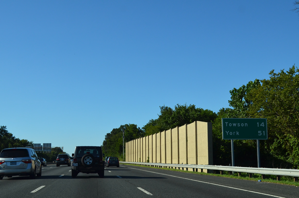
| Interstate 695 arcs northeast 14 miles to Towson. York, Pennsylvania is 45 miles away along Interstate 83. 08/04/13 |
|
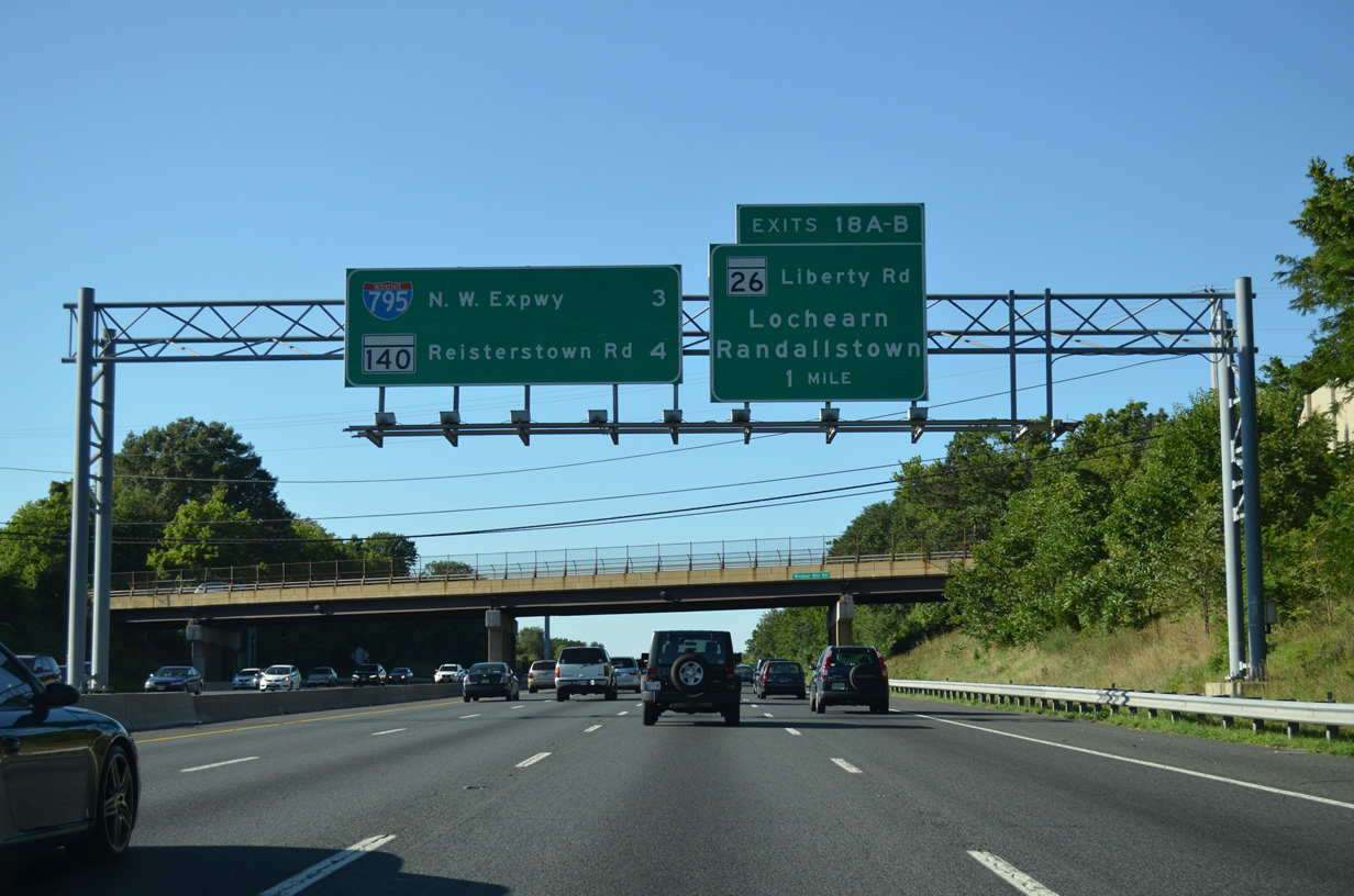
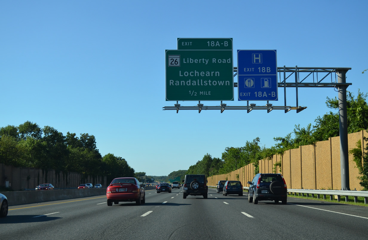
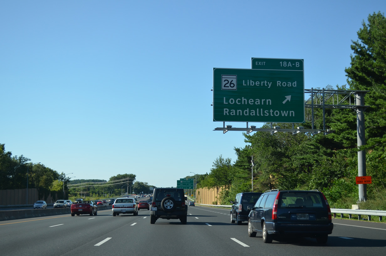
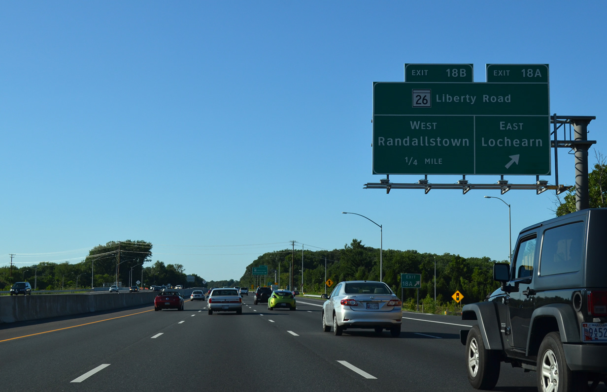
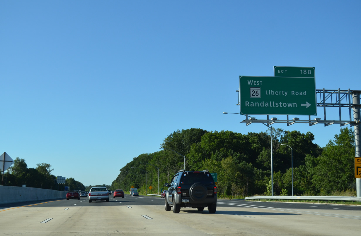
| The next beltway interchange serves MD 26 (Liberty Road) at Exits 18A/B. MD 26 spurs northwest from the city of Baltimore to Randallstown, Harrisonville, and Eldersburg. 08/04/13 |
|
| Construction during 2011-12 expanded the Beltway overpass above MD 26, adding a striped collector distributor roadway for Exits 18A/B. 08/04/13 |
|
| The c/d roadway for Exit 18 leaves Interstate 695 north for MD 26 (Liberty Road) eastbound to Woodmoor and Lochearn. 08/04/13 |
|
| MD 26 enters the city of Baltimore as Liberty Heights Avenue, proceeding east through the Howard Park and West Arlington neighborhoods within two miles. MD 26 serves interests to Pimlico Race Course and Baltimore City Community College. 08/04/13 |
|
| MD 26 (Liberty Road) serves the western suburbs between Rockdale and Wards Chapel near the Liberty Reservoir and Patapsco Valley State Park. 08/04/13 |
|
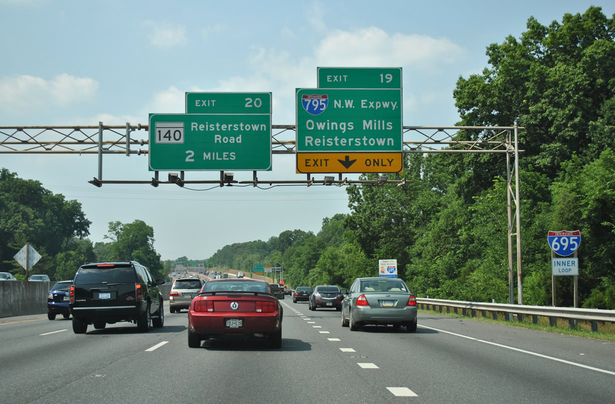
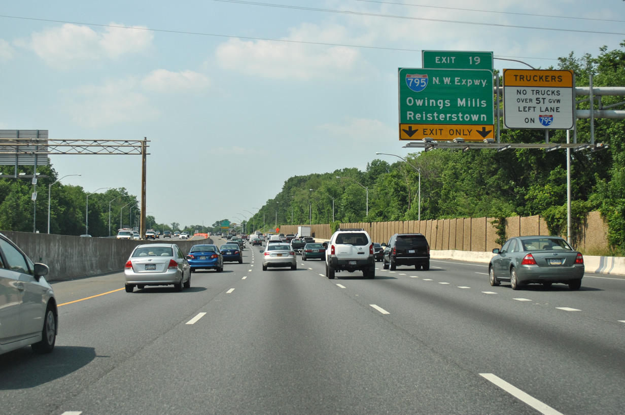
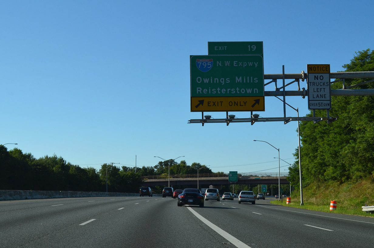
| I-795 (Northwest Expressway) spurs northwest from the Baltimore Beltway at Exit 19 to the suburbs of Owing Mills and Reisterstown in western Baltimore County. 06/20/12 |
|
| Paralleling MD 140 (Reisterstown Road) from Pikesville to Reisterstown, Interstate 795 provides part of the route northwest to Westminster. MD 140 follows the southernmost portion of historic U.S. 140, which connected Baltimore with Gettysburg, Pennsylvania. 06/20/12 |
|
| The Northwest Expressway was built in three stages between 1984 and 1987; it was designated as Interstate 795 in 1986. 08/04/13 |
|
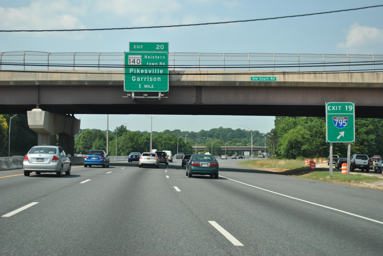
| I-695 enters the directional T interchange (Exit 19) with I-795 at the Old Court Road overpass. Cancelled in the late 1970s, the Northwest Expressway was proposed to continue southeast to Wasbash Avenue in Baltimore. MD 140 meets the Baltimore Beltway at the succeeding exit in one mile. 06/20/12 |
|
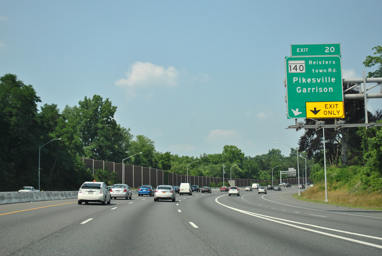
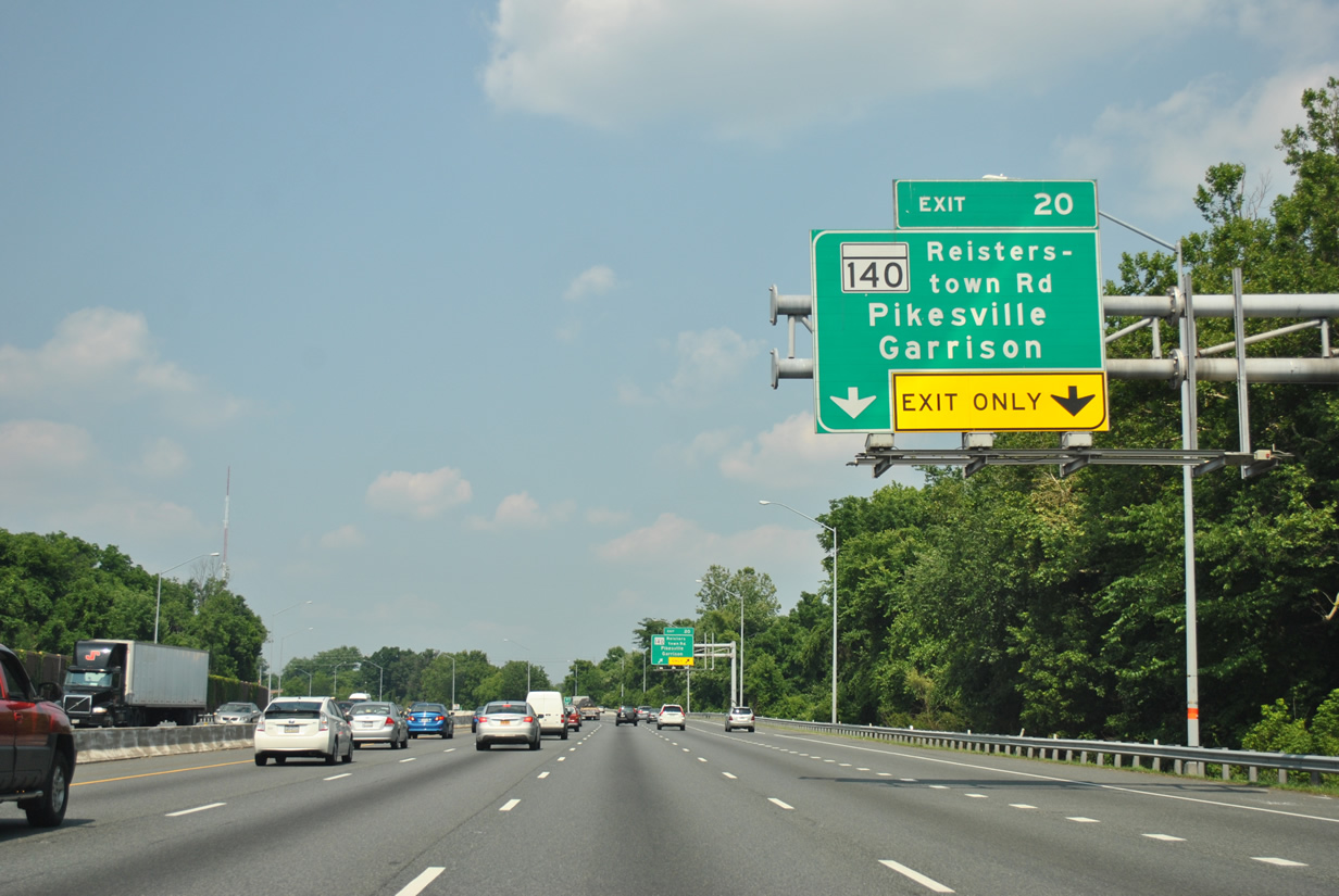
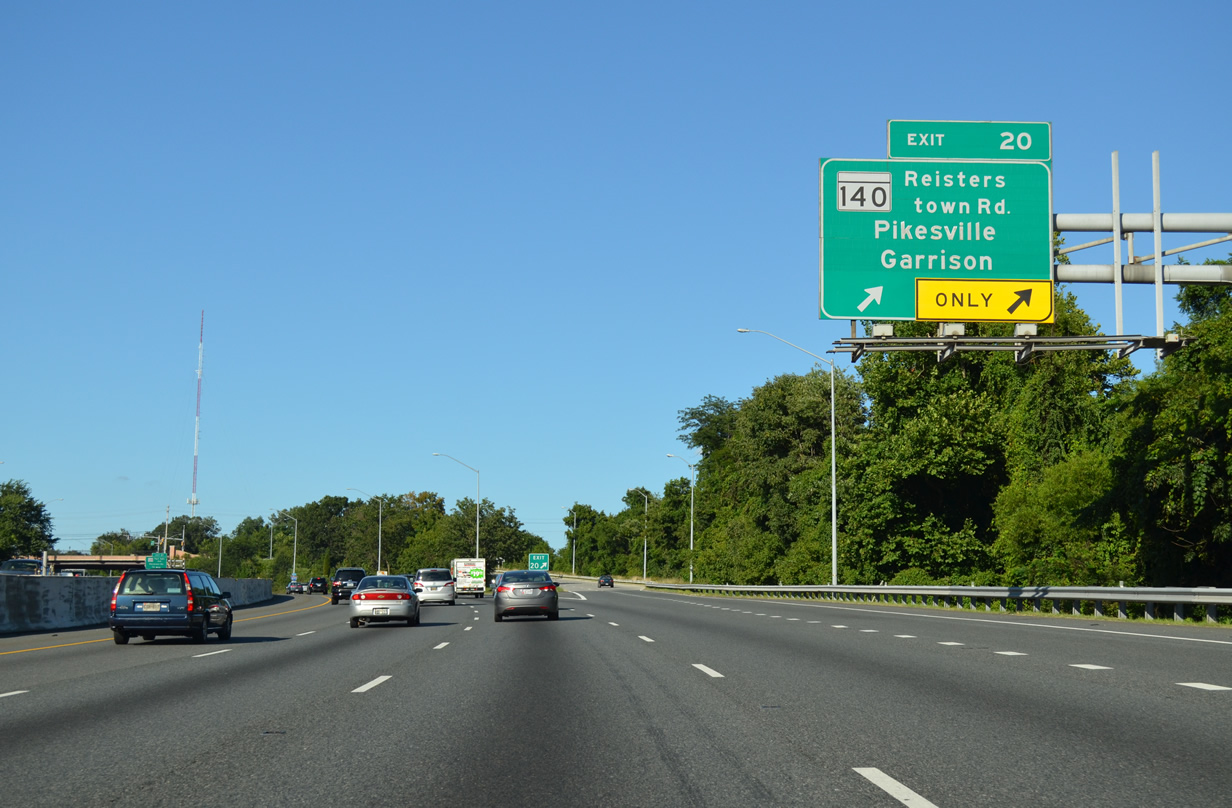
| A single point urban interchange (SPUI) links I-695 with MD 140 (Reisterstown Road) at Exit 20. The previous diamond interchange with Reisterstown Road was upgraded in the early 2000s. 06/20/12 |
|
| The Baltimore Beltway expands to eight overall lanes through the Pikesville and Towson areas north of the city. MD 140 (Reisterstown Road) serves the community of Pikesville south of Exit 20 and Garrison and Owing Mills to the northwest. 06/20/12 |
|
| MD 140 (Reisterstown Road) enters the city of Baltimore 1.9 miles to the southeast between the Fallstaff and Reisterstown Station neighborhoods en route to Druid Hill Park. 08/04/13 |
|
| Reassurance marker posted ahead of the MD 140 (Reisterstown Road) overpass at Exit 20. 08/04/13 |
|
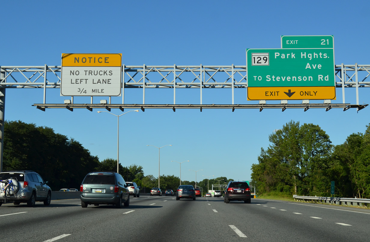
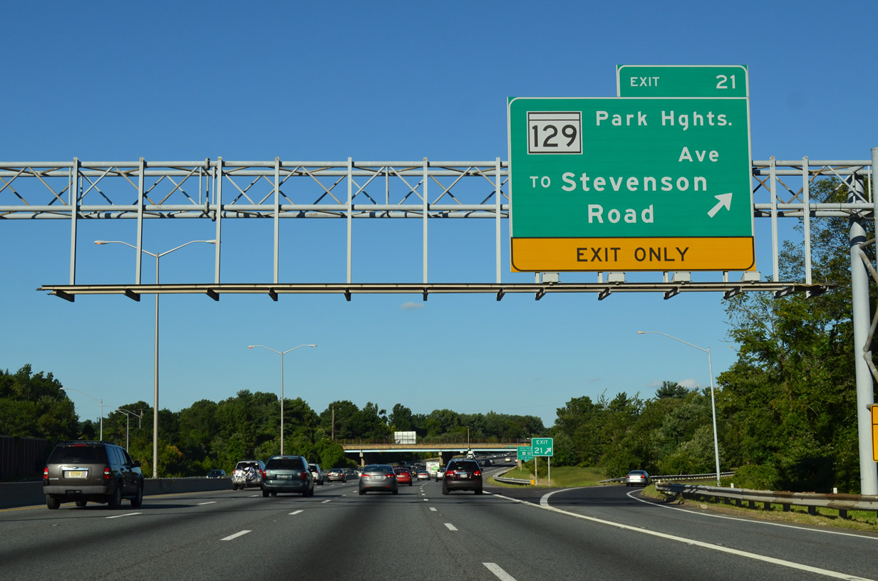
| MD 129 originates in central Baltimore at the Seton Hill neighborhood where U.S. 40 meets MD 295 (Paca Street). Angling northwest to Druid Hill Park, MD 129 shifts onto Park Heights Avenue from MD 140 at Liberty Square to leave the city at Pikesville. 08/04/13 |
|
| MD 129 (Park Heights Avenue) continues north from Interstate 695 to Worthington and Garrison Forest Road. 08/04/13 |
|
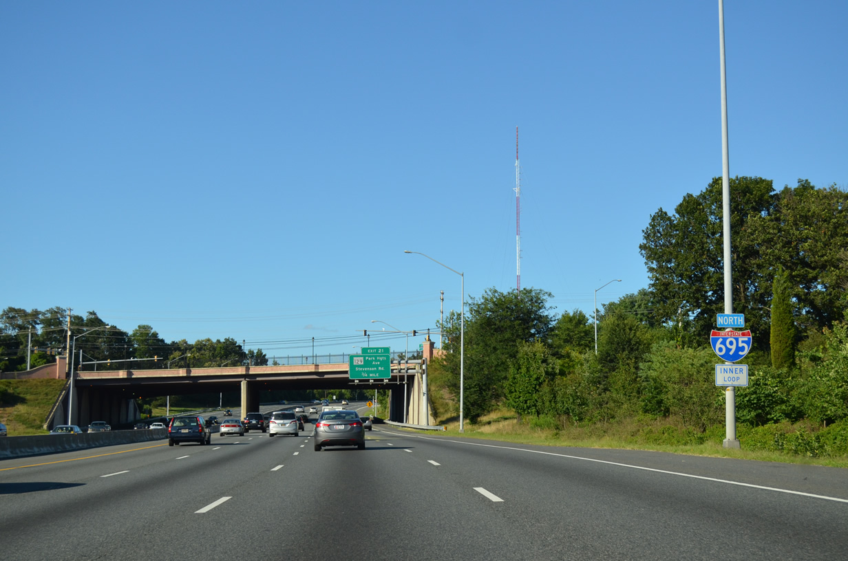
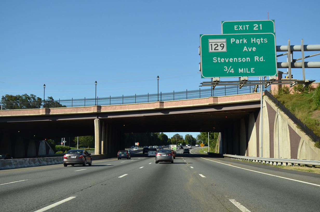
| The split diamond interchange at Exit 21 joins I-695 with Brooks Robinson Drive (MD 129A) east 0.48 miles to Stevenson Road. Stevenson Road extends 2.61 miles north from MD 133 (Old Court Road) to MD 130 (Greenspring Valley Road). 08/04/13 |
|
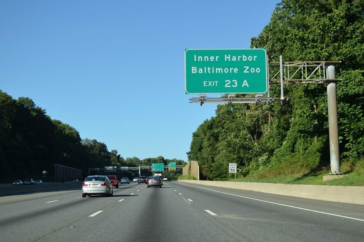
| Interstate 83 follows the Jones Falls Expressway southward from Exit 23 to The Maryland Zoo in Baltimore at Druid Hill Park, the Baltimore Inner Harbor and Fells Point. 08/04/13 |
|
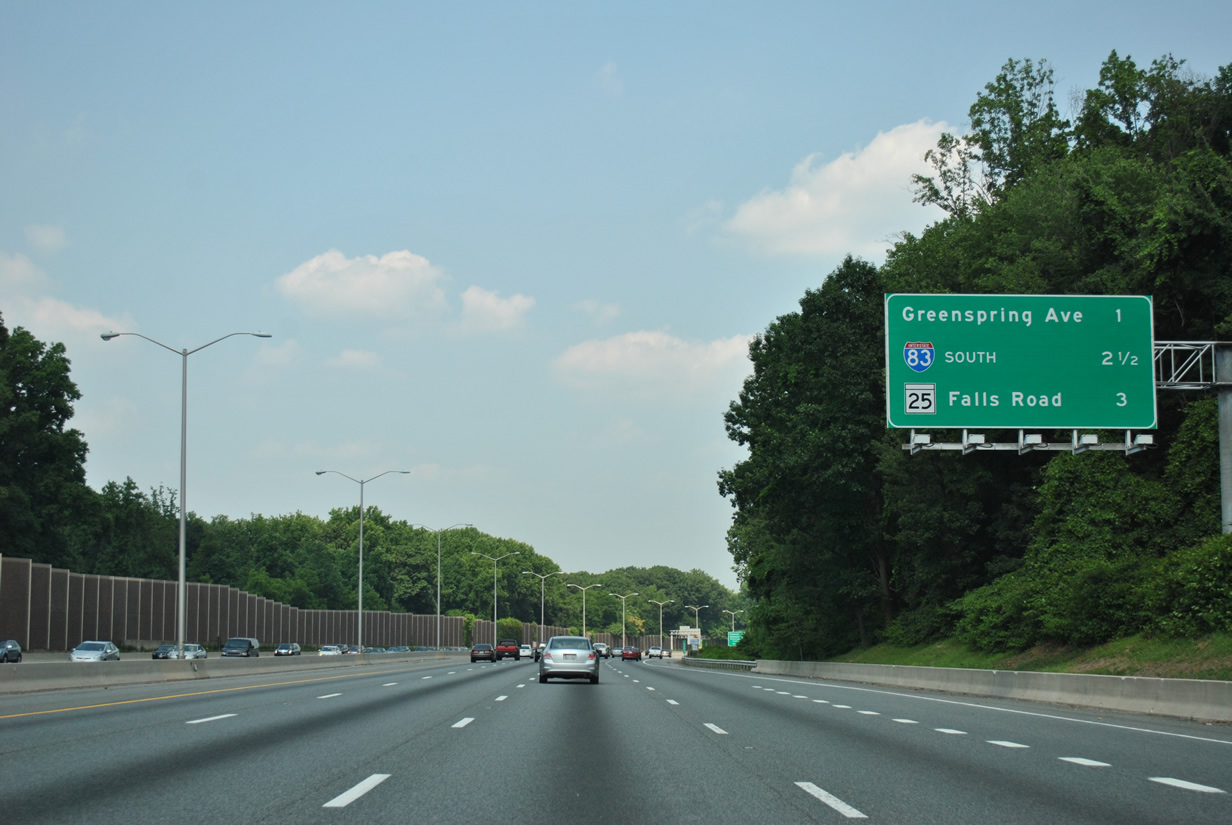
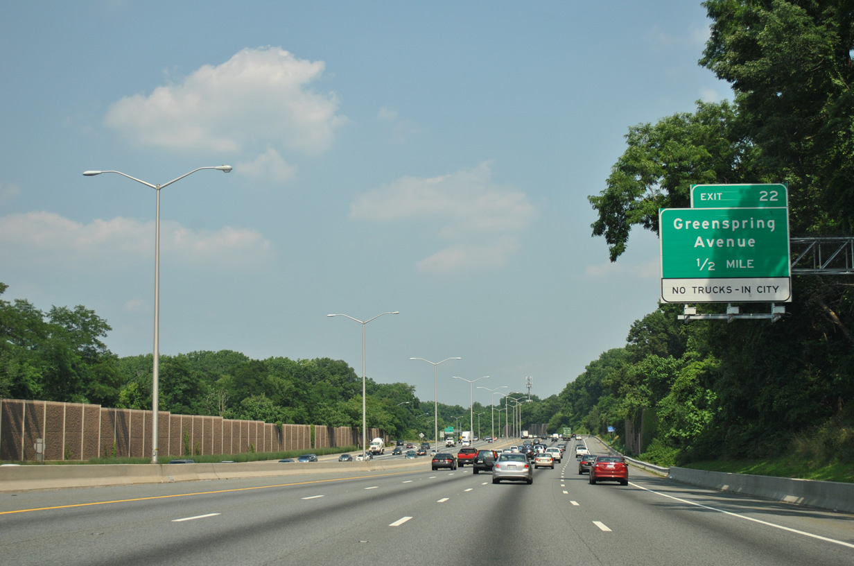
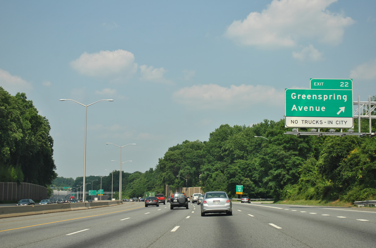
| A parclo B2 interchange links I-695 east with Greenspring Avenue at the ensuing exit. 06/20/12 |
|
| Interstate 695 parallels Slaughterhouse Branch east through a wooded stretch. 06/20/12 |
|
| Greenspring Avenue leads 1.72 miles south into Baltimore at the Cheswolde neighborhood. 06/20/12 |
|
| A major collector, Greenspring Avenue extends 7.80 miles north from I-695 to Cronhardt, Worthington and the roundabout joining Tufton and Worthington Avenues. 06/20/12 |
|
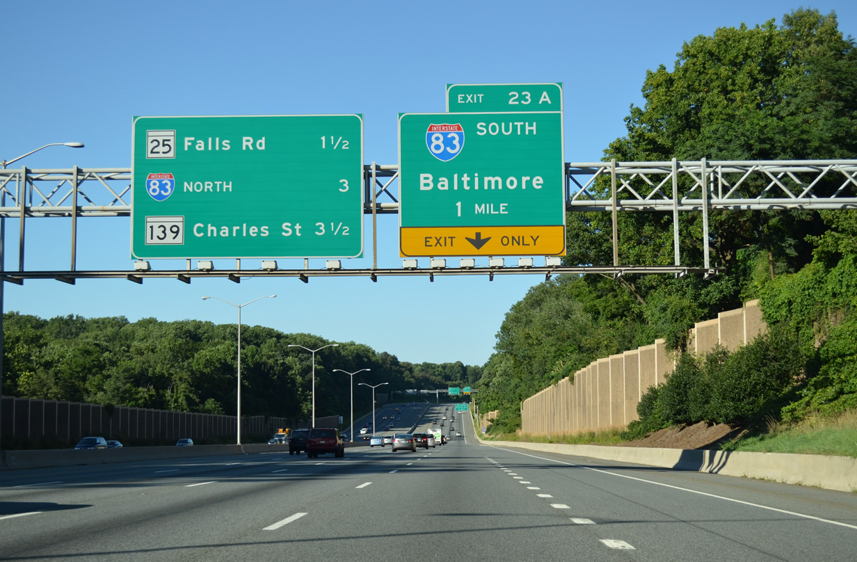
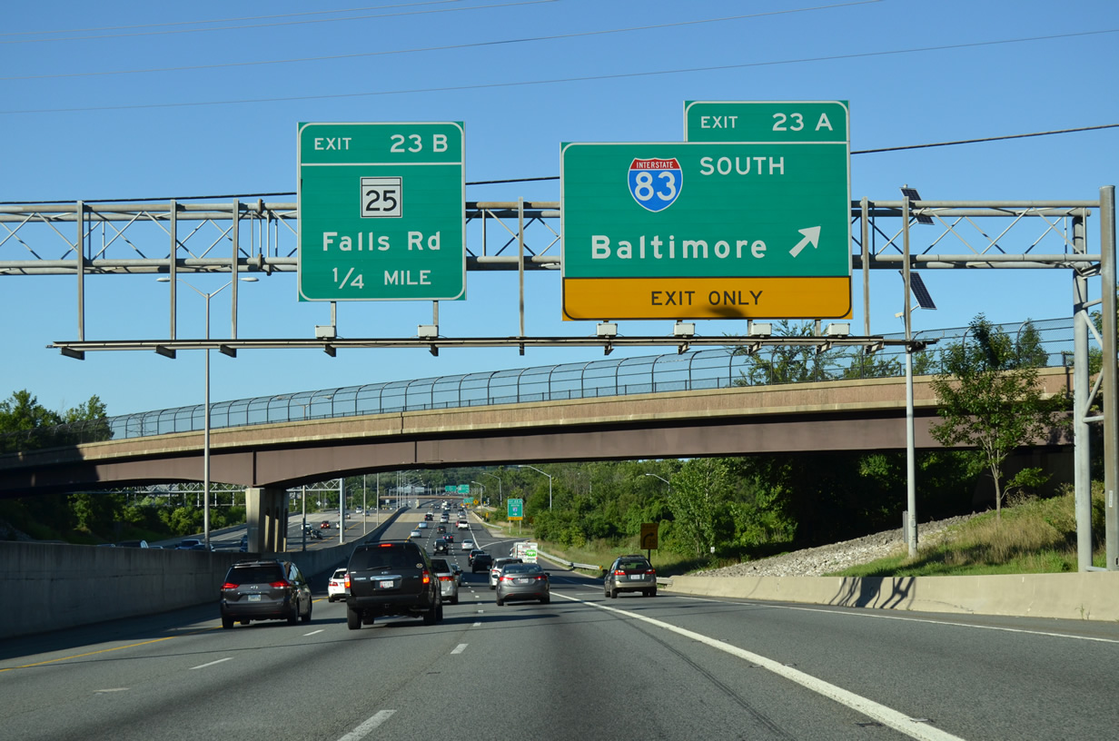
| I-695 advances east to a directional cloverleaf interchange with I-83 south and MD 25A north along the Jones Falls Expressway. 08/04/13 |
|
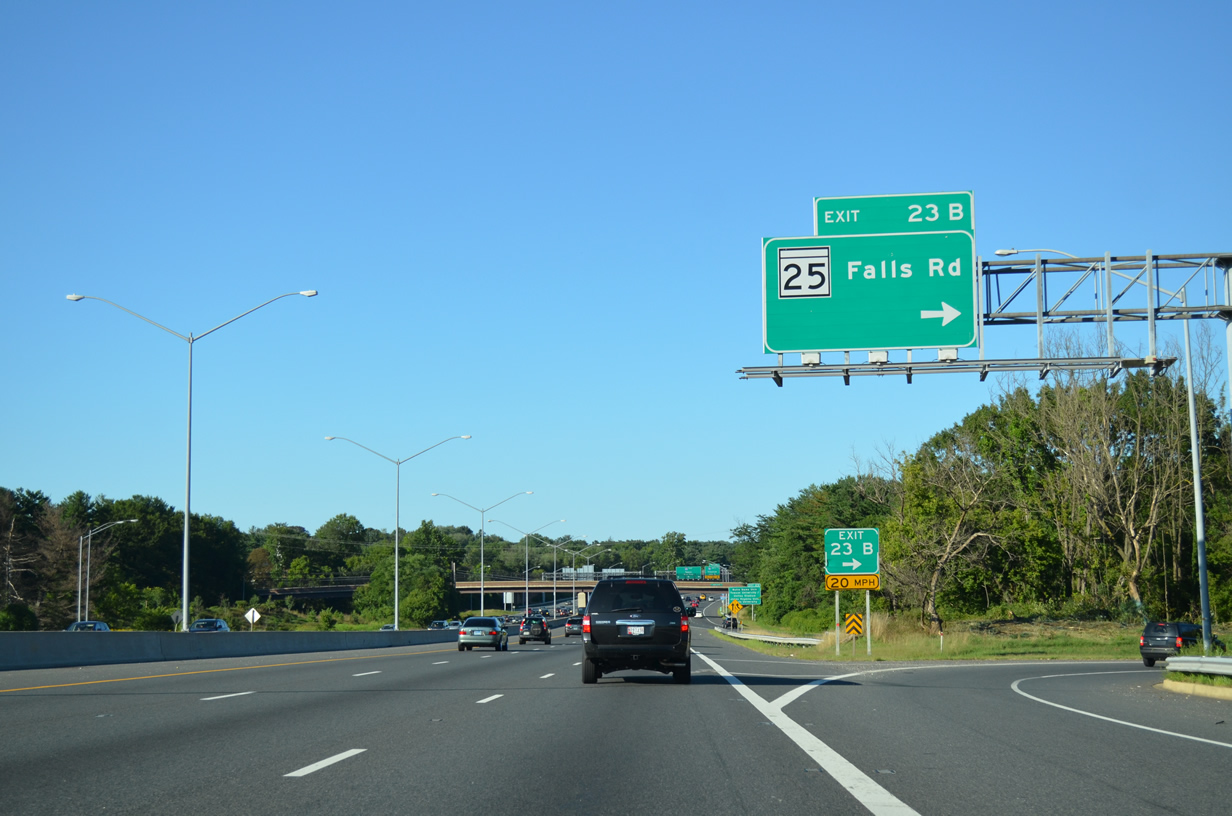
| Interstate 695 crosses Slaughterhouse Branch ahead of the MD 25 (Falls Road) overpass. 06/20/12 |
|
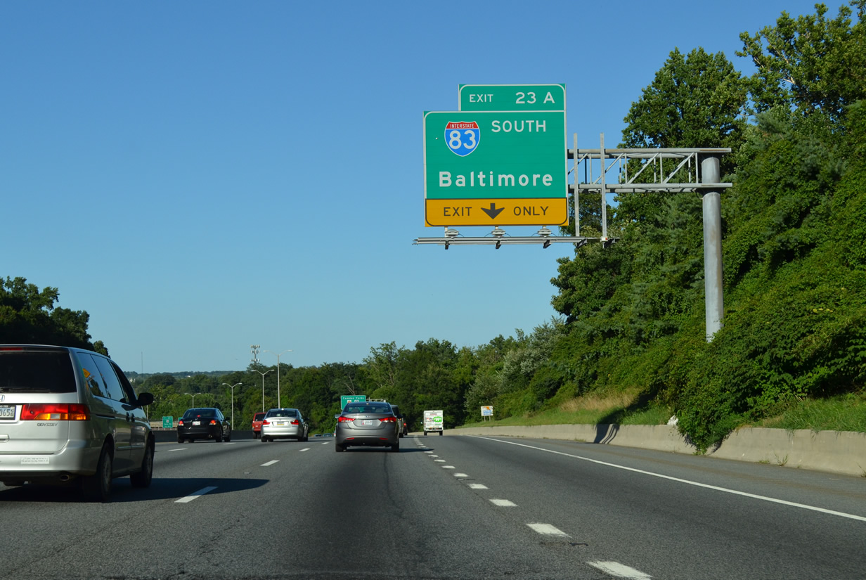
| I-83 south connects with Druid Park Lake Drive west to the Maryland Zoo in Baltimore and with the Baltimore Inner Harbor via Fayette and President Streets. 08/04/13 |
|
| Paralleling Jones Falls, I-83 (Jones Falls Expressway) enters Baltimore at Mount Washington and proceeds south by the Coldspring, Woodberry and Hampden neighborhoods toward Downtown. 08/04/13 |
|
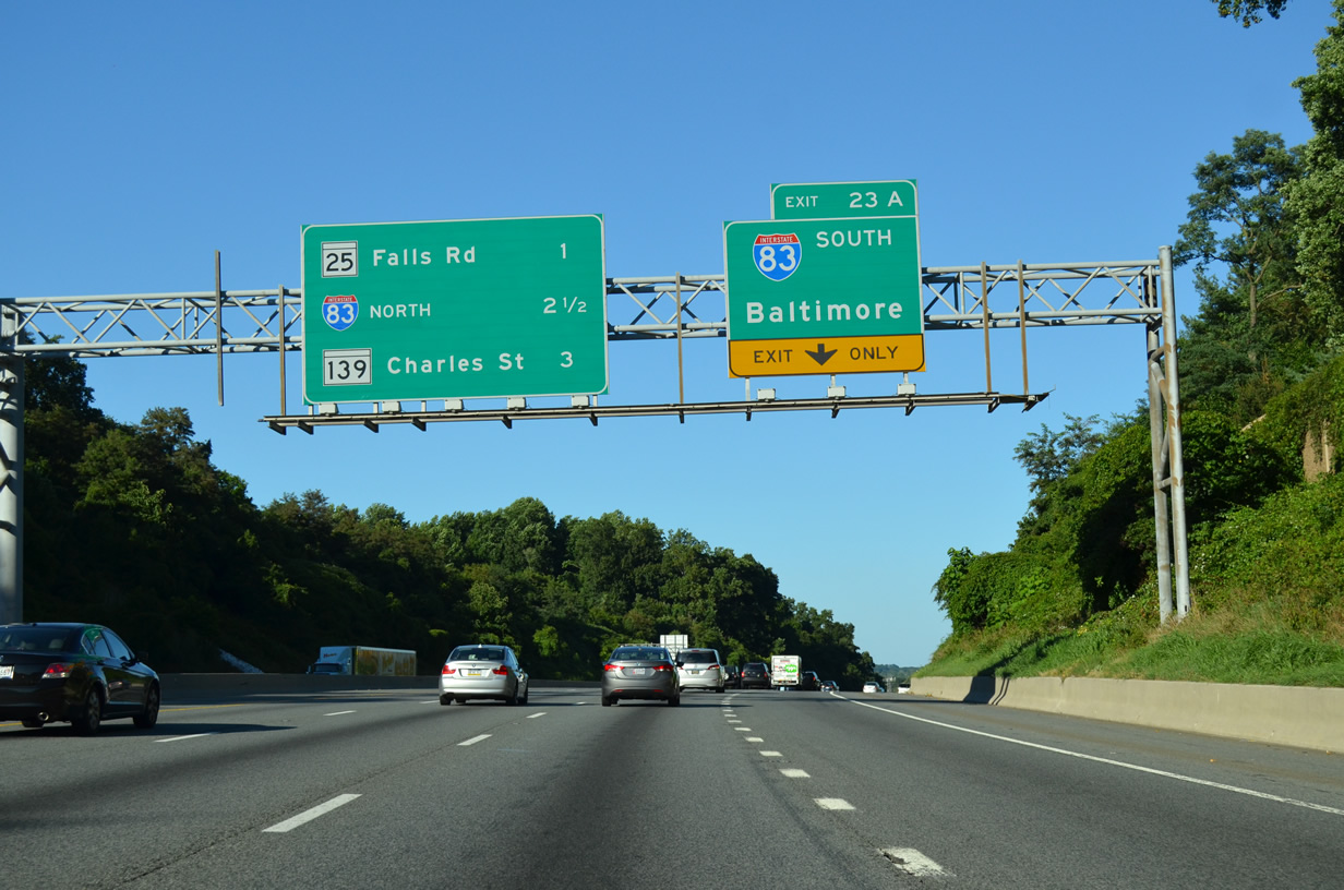
| MD 25 (Falls Road) follows I-83 just to the east through north Baltmore to MD 2 (Calvert Street) at Greenmount West. 08/04/13 |
|
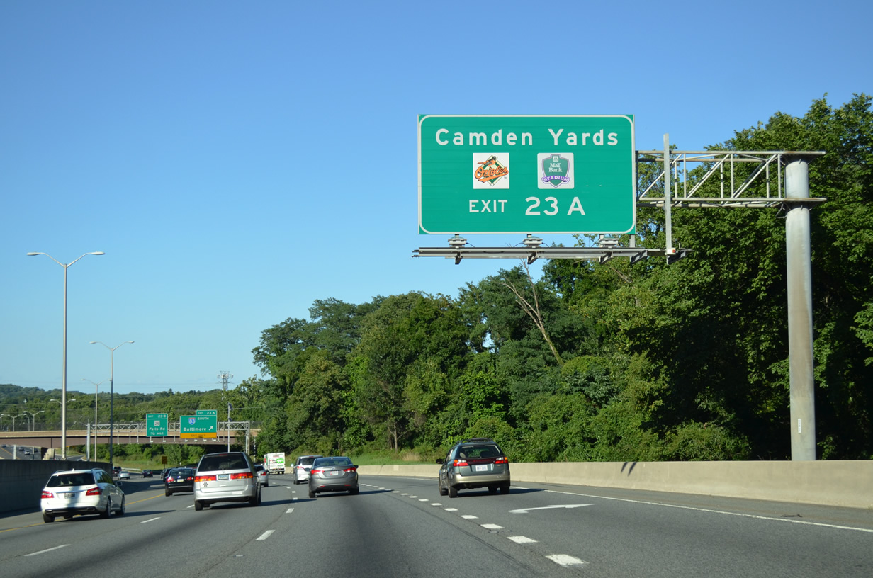
| Camden Yards, home of the Baltimore Orioles and M&T Bank Stadium for the Baltimore Ravens, lies beyond the south end of I-83. 08/04/13 |
|
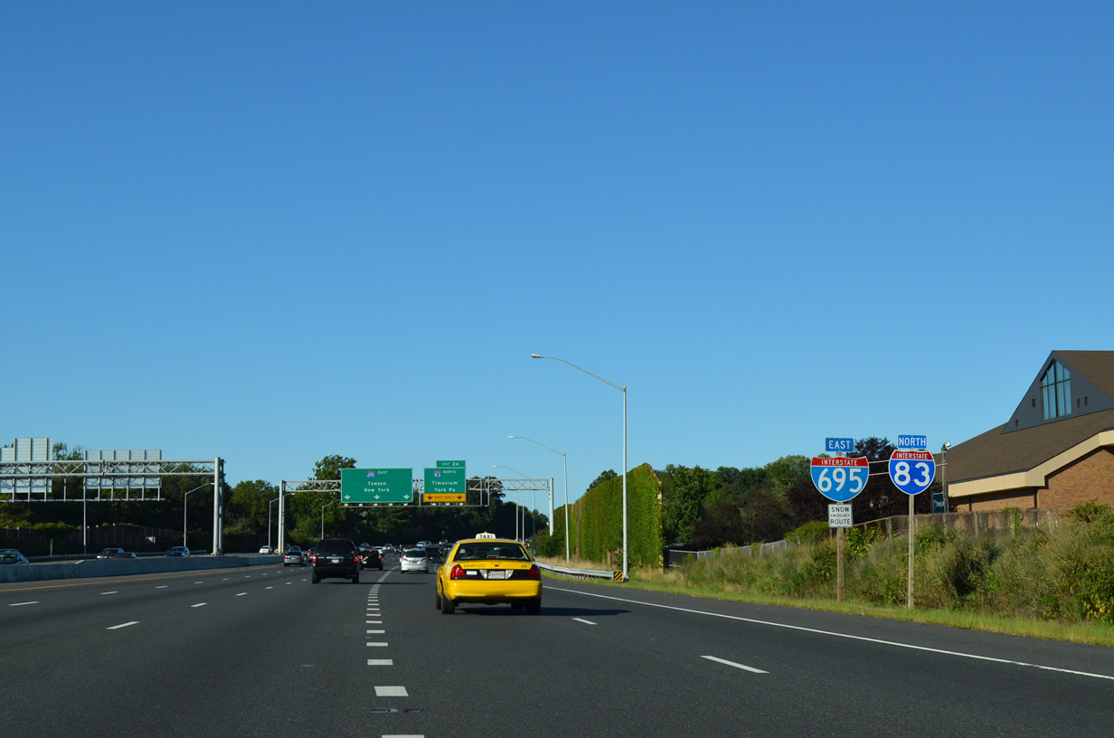
| Interstate 83 spurs 9.74 miles south from I-695 at Exit 23. The Jones Falls Expressway spurs 0.58 miles north as MD 25A to MD 25 (Falls Road) at Brooklandville. 08/04/13 |
|
| MD 25 (Falls Road) overtakes the north end of Jones Falls Expressway at Joppa Road to Butler, Coopersville and Whitehouse in northern Baltimore County. 08/04/13 |
|
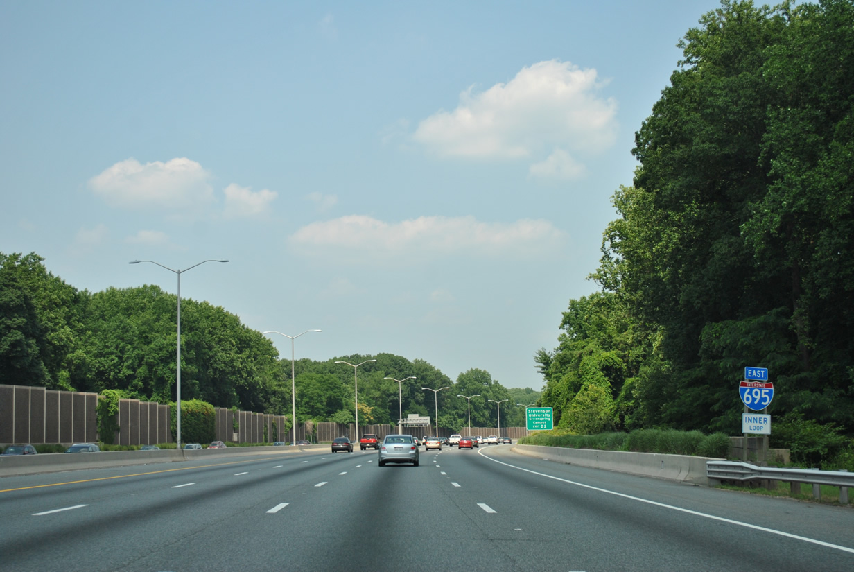
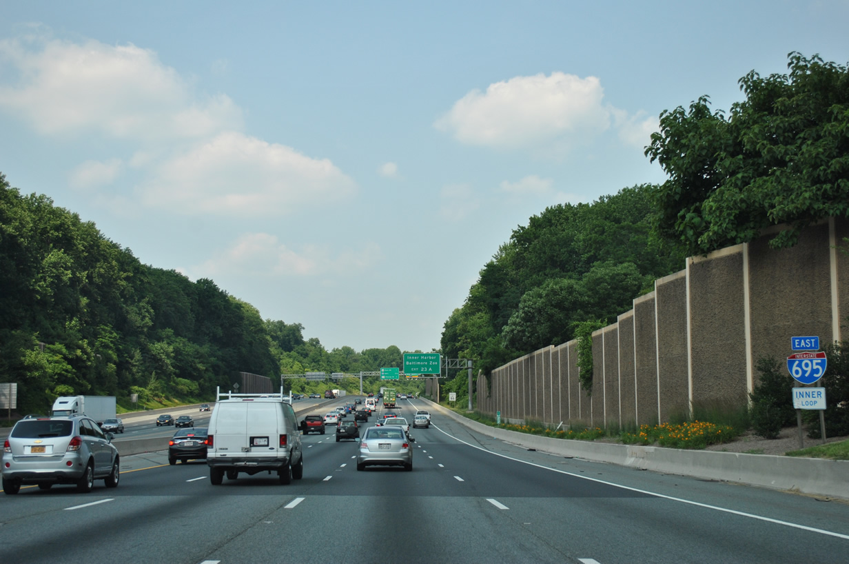
| I-83 north and I-695 east overlap for 1.52 miles between Exits 23 and 24. 08/04/13 |
|
| Two lanes partition from the Beltway eastbound at a directional T interchange (Exit 24) with Interstate 83 north to Timonium, Cockeysville and York, Pennsylvania. 08/04/13 |
|
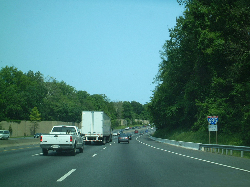
| Sound walls were added along northern reaches of the Baltimore Beltway during a widening project underway in the late 1990s. 06/20/12 |
|
| Interstate 83 weaves through Baltimore County suburbs northward 23.24 miles to the Pennsylvania state line. The Baltimore-Harrisburg Expressway was built in the 1950s as part of U.S. 111. 06/20/12 |
|
| Interstate 83 north connects with MD 45 (York Road) at Cockeysville en route to York in 37 miles and Harrisburg, Pennsylvania in 65 miles. 08/04/13 |
|
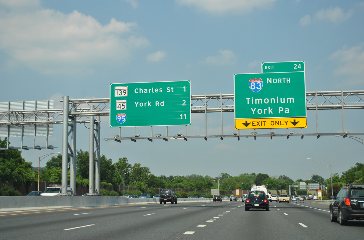
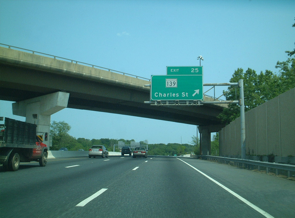
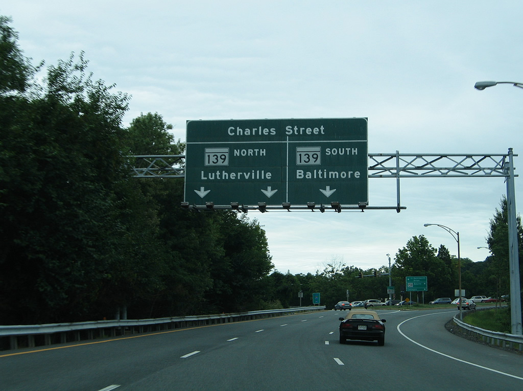
| A parclo interchange joins I-695 to the immediate east of I-83 with MD 139 (Charles Street) at Exit 25. 06/01/03 |
|
| A 7.89 mile long route, MD 139 concludes at Bellona Avenue on the north side of I-695 at Exit 25 and at U.S. 1 (North Avenue) between the Barclay and Greenmount West neighborhoods. 06/01/03 |
|
| Ramps from I-83 south and I-695 east combine ahead of MD 139 (Charles Street). 08/27/05 |
|
| MD 139 (Charles Street) heads south from near Towson University into the city of Baltmore to Notre Dame of Maryland University, Loyola University Maryland and John Hopkins University. 08/27/05 |
|
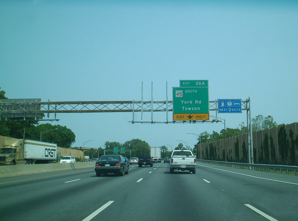
| The succeeding exit from I-695 east is for MD 45 (York Road) at Towson. 06/01/03 |
|
| MD 45 (York Road) follows the original of U.S. 111. Decommissioned in 1963, U.S. 111 was replaced by Interstate 83 as the main route from Baltimore north to York and Harrisburg, Pennsylvania. 06/01/03 |
|
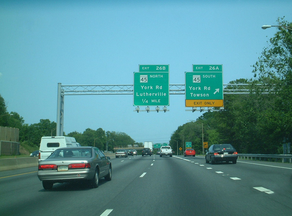
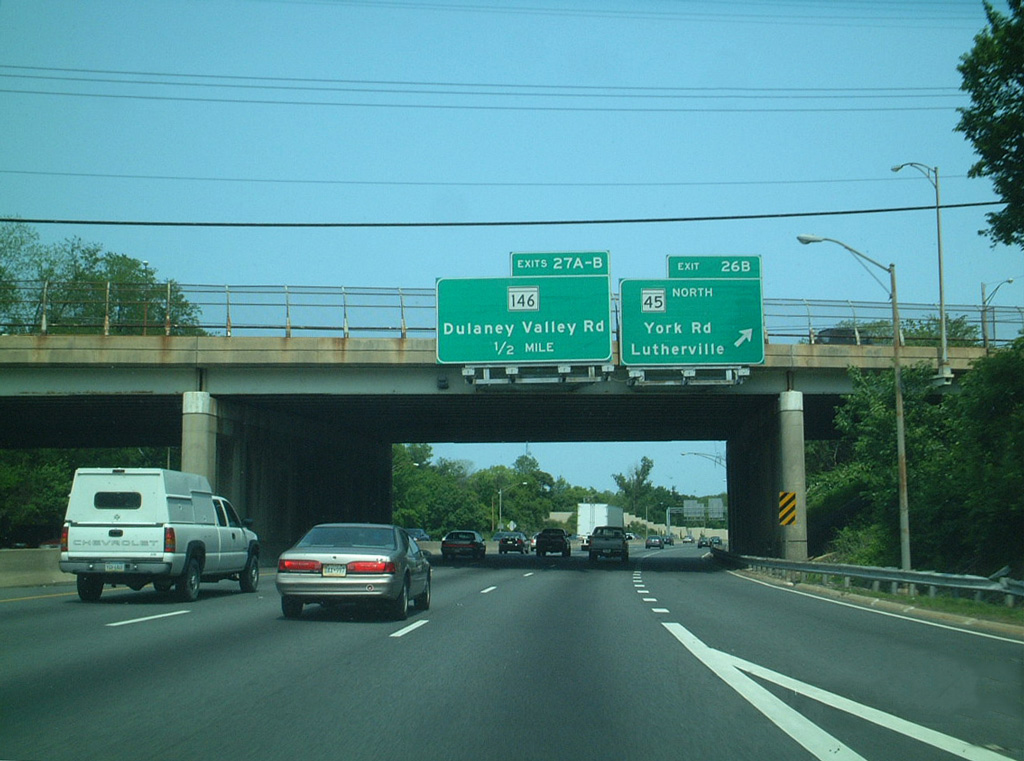
| MD 146 (Dulaney Valley Road) branches 0.82 miles north from MD 45 (York Road) in Towson to meet I-695 at Exit 27. 06/01/03 |
|
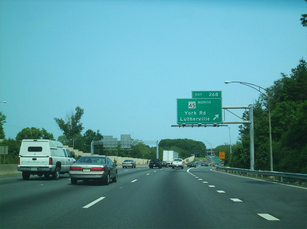
| Exit 26B loops onto MD 45 (York Road) north to Lutherville and Timonium. 06/01/03 |
|
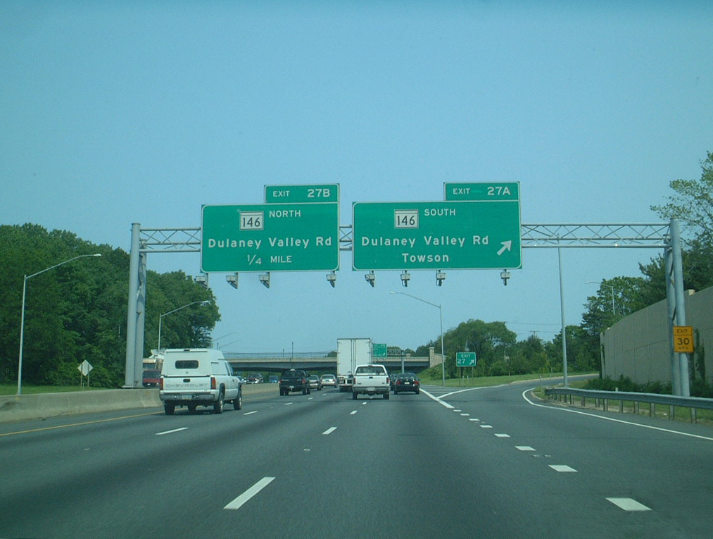
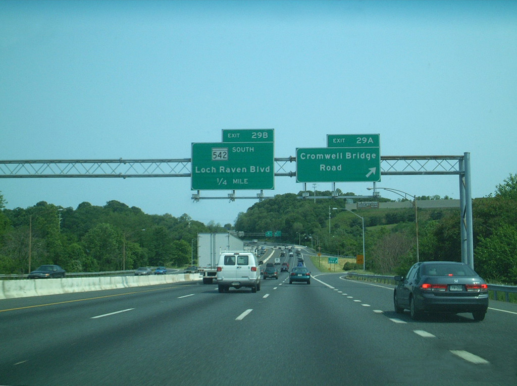
| Exit 27A leaves I-695 east for MD 146 south to Townson Town Center. The loop ramps from MD 146 (Dulaney Valley Road) to I-695 were removed from the cloverleaf interchange at Exit 27. 06/01/03 |
|
| Exit 27B loops onto MD 146 (Dulaney Valley Road) north to Loch Raven Reservoir and Jacksonville. 16.81 miles in length, MD 146 extends to MD 23 at Madonna in Harford County. 06/01/03 |
|
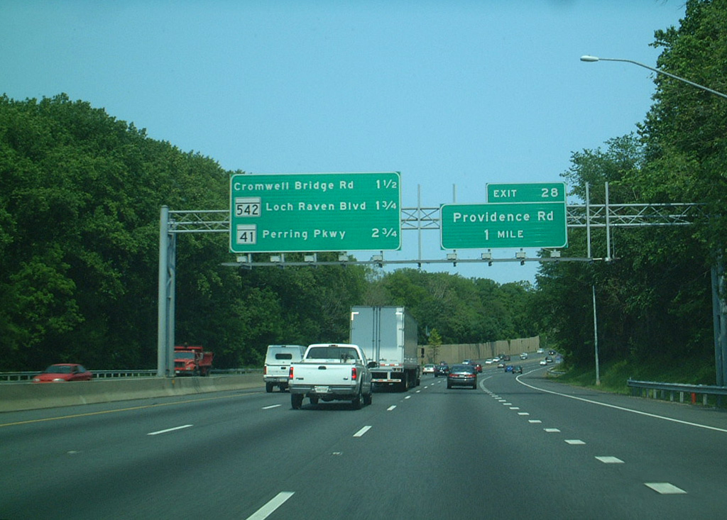
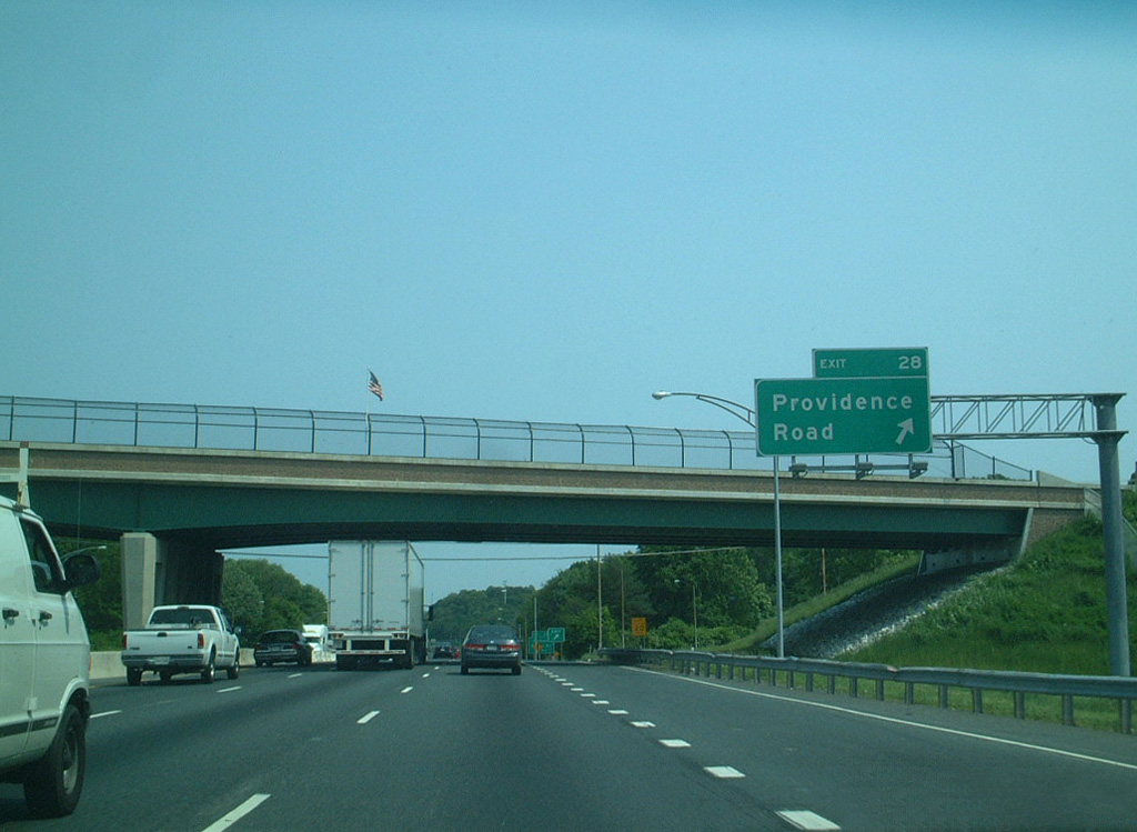
| Providence Road angles northeast from Towson to a parclo B2 interchange with Interstate 695 at Exit 28. 06/01/03 |
|
| Interstate 695 arcs east between the campus of Goucher College and the Hampton National Historic Site. 06/01/03 |
|
| Providence Road constitutes a major collector leading northeast 2.56 miles to Hampton and Loch Raven by Loch Raven Reservoir. 06/01/03 |
|
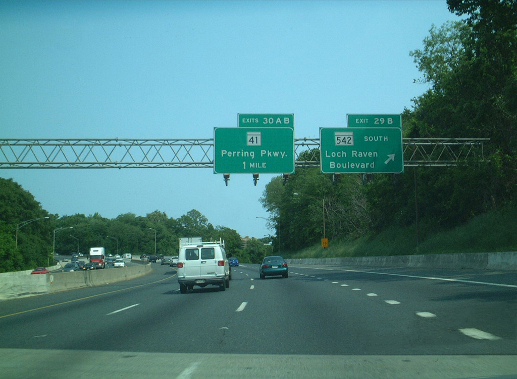
| MD 542 (Loch Raven Boulevard) ties into Cromwell Bridge Road at a folded diamond interchange with I-695 at Exit 29A. Cromwell Bridge Road runs northeast to Gunpowder Falls State Park. A portion of the minor arterial was designated as MD 567. 06/01/03 |
|
| MD 542 (Loch Raven Boulevard) is an urban boulevard heading 6.33 miles south to MD 147 (Harford Road) at Clifton Park in Baltimore. 06/01/03 |
|
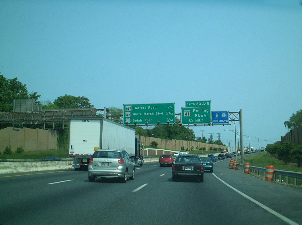
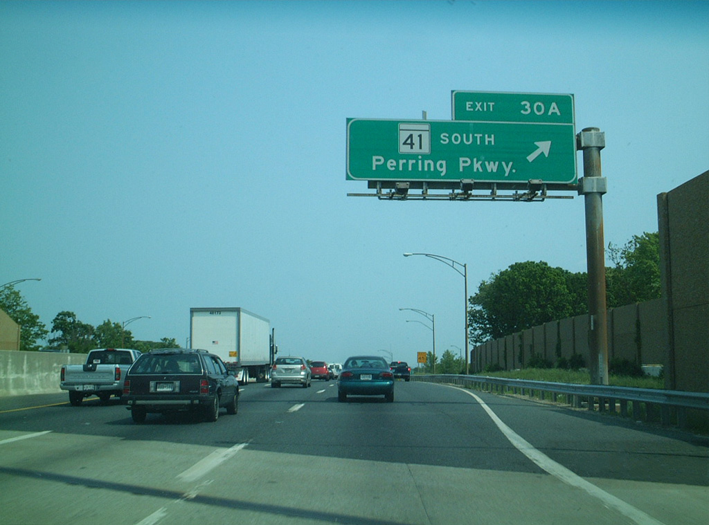
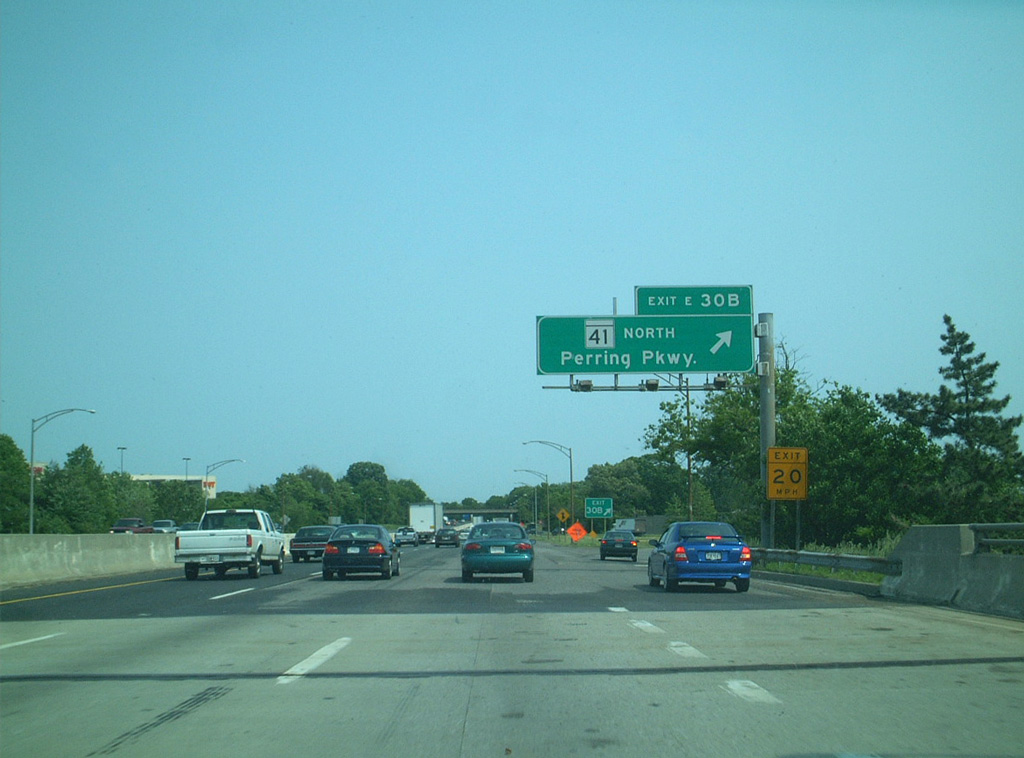
| A cloverleaf interchange joins Interstate 695 with MD 41 (Perring Parkway) at Exits 30A/B. A 6.73 mile long route, MD 41 is a controlled access arterial southwest to the Loch Raven neighborhood in Baltimore. 06/01/03 |
|
| Perring Parkway leads MD 41 south to Hillen Road. The state route concludes at MD 147 (Harford Road) at the Clifton Park neighborhood in Baltimore. 06/01/03 |
|
| MD 41 (Perring Parkway) spurs 0.6 miles northeast from Exit 30B to Waltham Woods Road beyond North Plaza Shopping Center. 06/01/03 |
|
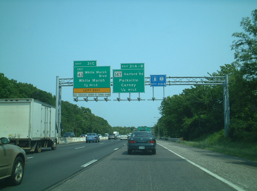
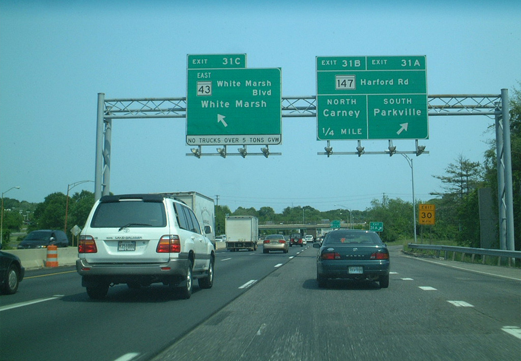
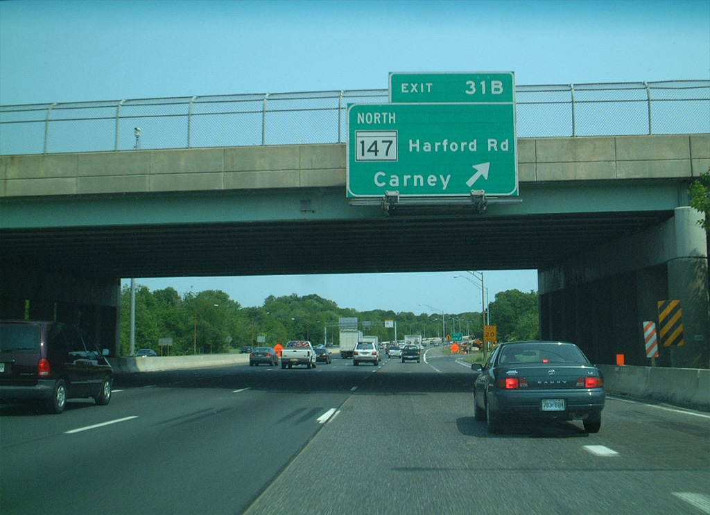
| MD 147 (Harford Road) angles northeast from Baltimore through Parkville to Interstate 695 at Exit 31. 06/01/03 |
|
| The 18.82 mile long route of MD 147 (Harford Road) originates from U.S. 1 (North Avenue) at the Oliver neighborhood in Baltimore. The state route runs northeast from Carney to U.S. 1/1 Business at Bel Air. 06/01/03 |
|
| The loop ramp (Exit 31B) at the cloverleaf interchange for MD 147 (Harford Road) north to Carney permanently closed in 2016. 06/01/03 |
|
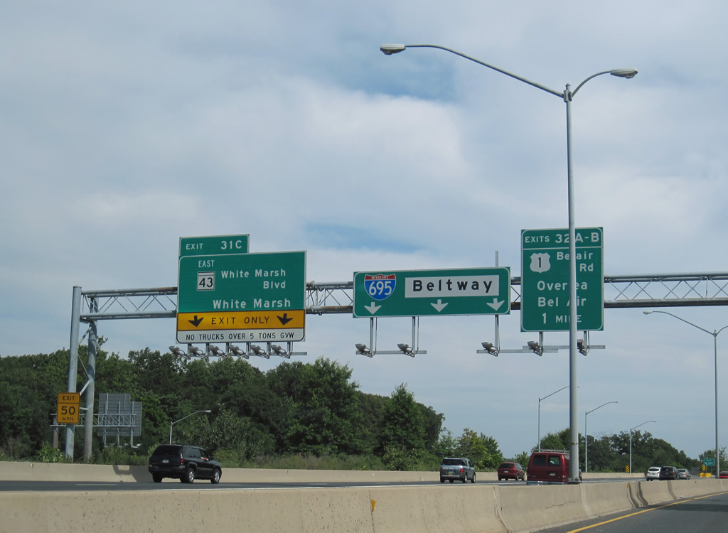
| Left Exit 31C separates from I-695 eastbound at the Avondale Road underpass for MD 43 (White Marsh Boulevard) south. MD 43 constitutes a controlled access arterial east to White Marsh Mall, I-95 (John F. Kennedy Memorial Highway) and MD 150 at Middle River. MD 43 was originally planned as a freeway between the beltway and I-95. 06/30/10 |
|
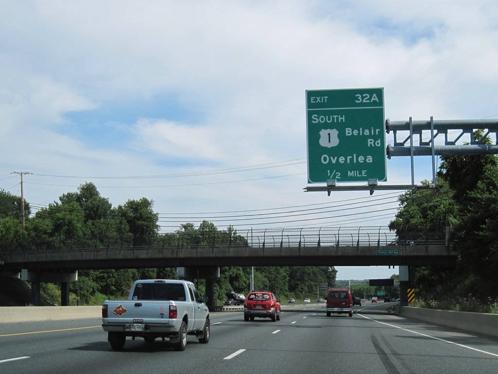
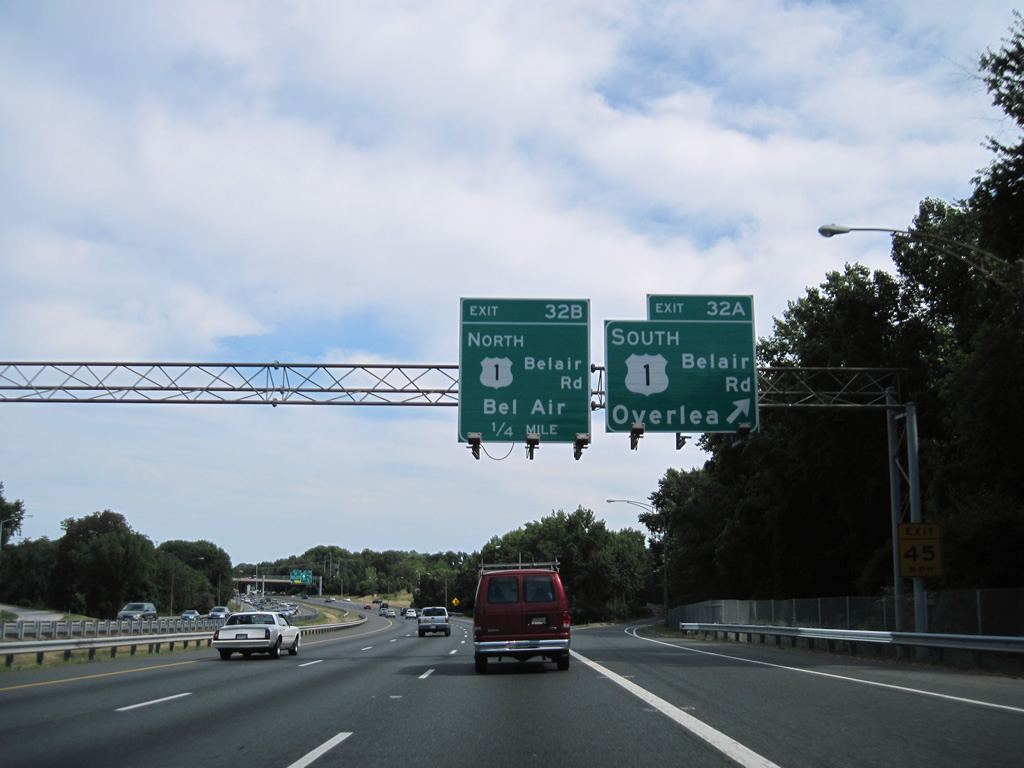
| A cloverleaf interchange joins I-695 with U.S. 1 (Bel Air Road) between the Overlea and Perry Hall communities. 06/30/10 |
|
| U.S. 1 (Bel Air Road) runs southwest to North Avenue at the Berea neighborhood in Baltimore. 06/30/10 |
|
| U.S. 1 heads northeast from Perry Hall to Kingsville, Bel Air and Hickory. Crossing Conowingo Dam, U.S. 1 continues past Rising Sun to Chester County, Pennsylvania. 06/30/10 |
Page Updated 06-03-2014.


 North
North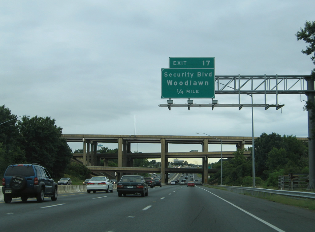

 North
North