|
| Confirming marker posted along the Turnpike north of Yeehaw Junction. 04/15/16 |
|
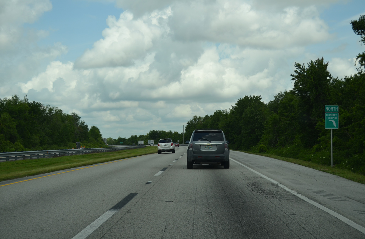
| Distance sign posted along Florida's Turnpike northbound after Yeehaw Junction. The four lane toll road continues 49 miles to the succeeding exit at St. Cloud and 54 miles to Kissimmee. 04/15/16 |
|
| Angling northwest, U.S. 441 crosses over the Turnpike and travels two miles or so to the east as both plie across wetland areas and open ranch land. 04/15/16 |
|
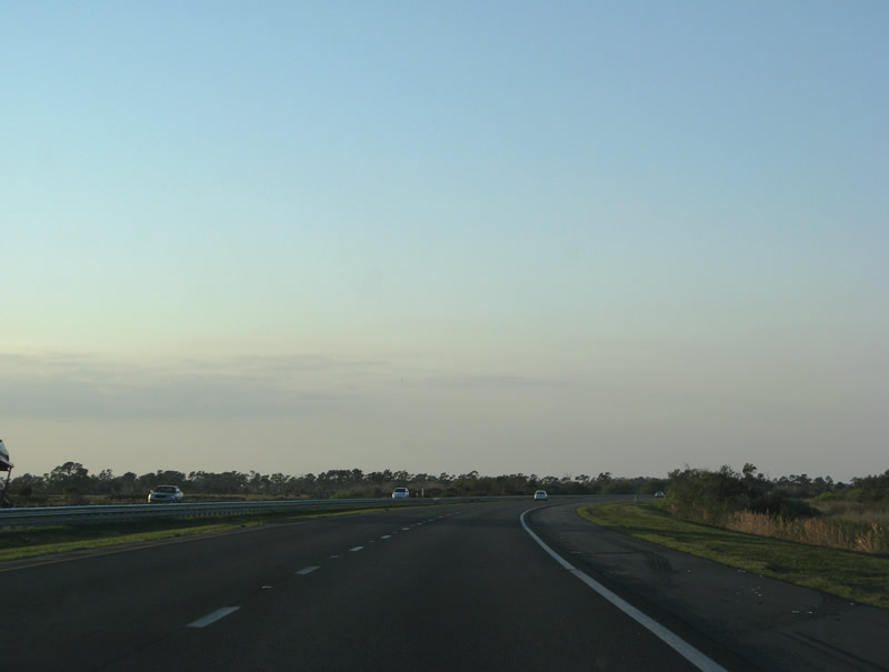
| Florida's Turnpike bends northward in the vicinity of Lake Marian and Kenansville. Areas to the southwest along SR 60 were once the proposed location for Destiny, town of 50,000. 02/16/08, 04/15/16 |
|
| The north and south roadways separate around a wide forested median just north of the Williams Road under crossing. This configuration is similar to those at the eight service areas along the Turnpike. 02/16/08 |
|
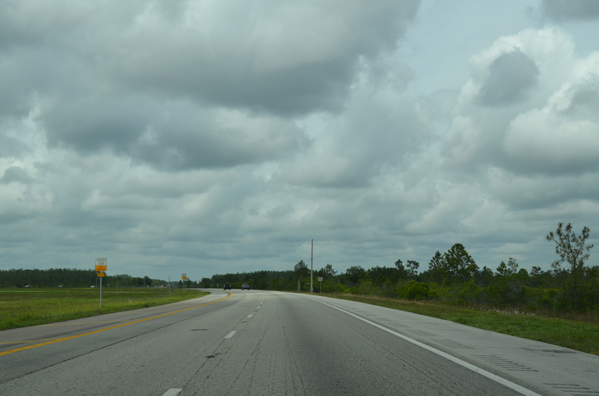
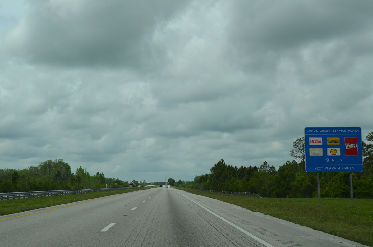
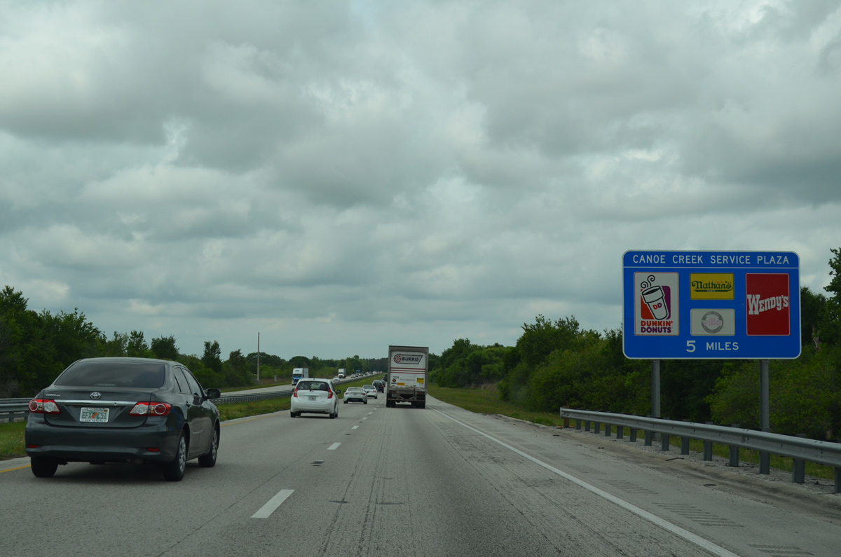
| Advancing northwest through Three Lakes Wildlife Management Area, the toll road shifts westward parallel to CR 523 (Canoe Creek Road). The Canoe Creek Service area lies nine miles ahead. 04/15/16 |
|
| Crossing over an unnamed ranch road along the Turnpike northbound, east of Coon Hammock. 04/15/16 |
|
| The Turnpike roadways again separate around a forested median four miles south of the Canoe Creek Service area at mile post 229. 04/15/16 |
|
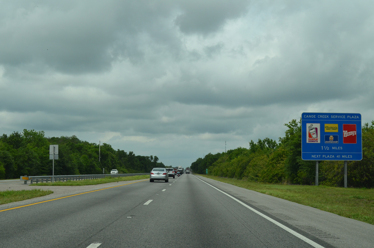
| Canoe Creek Road (Osceola County Road 523) spans Florida's Turnpike one mile south of the Canoe Creek Service area. Like other service plazas on the turnpike mainline, the facilities are located within the freeway median. 04/15/16 |
|
| Florida's Turnpike northbound at the left side ramp for the Canoe Creek Service plaza. Amenities here include fast food, a gas station and a gift shop. 04/15/16 |
|
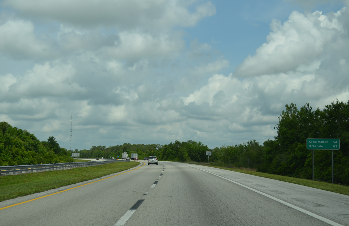
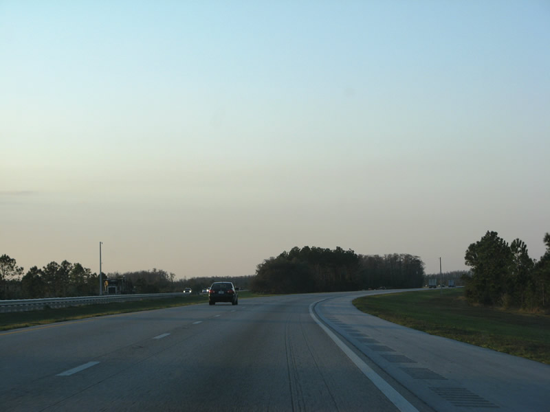
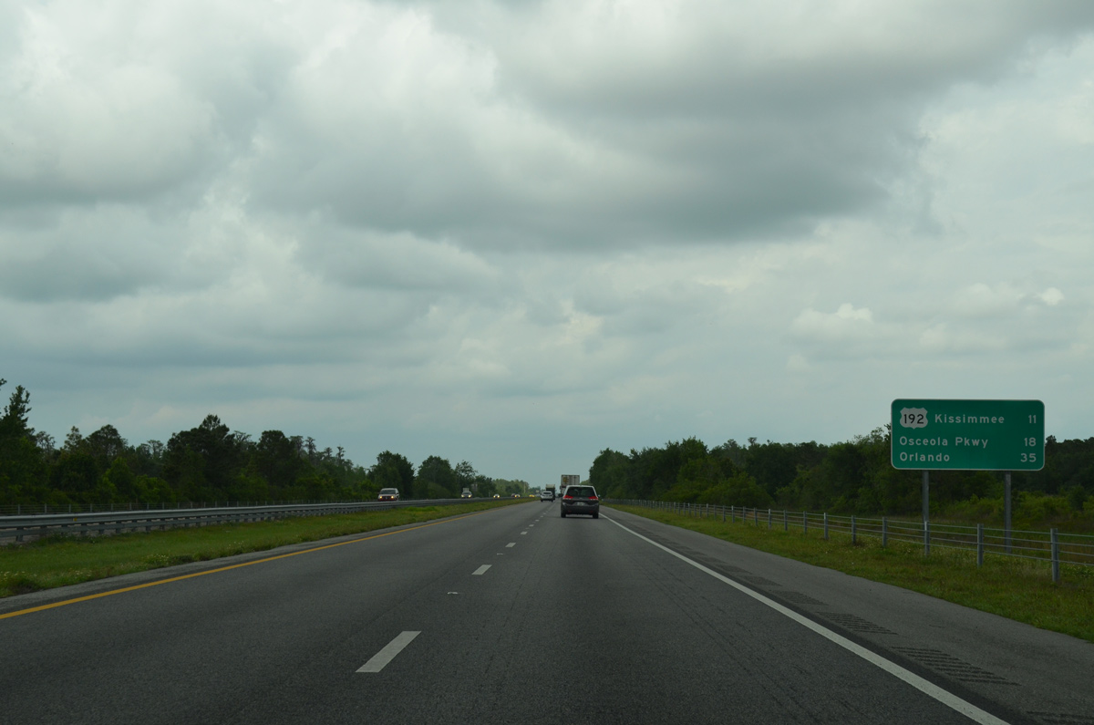
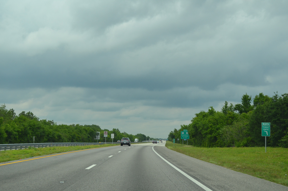
| Advancing north from the Canoe Creek Service Area, Florida's Turnpike initially remains rural between Lake Tophopekaliga and Lake Gentry. The last two Osceola County exits depart in 11 miles for U.S. 192/441 at St. Cloud and in 18 miles for Osceola Parkway. 04/15/16 |
|
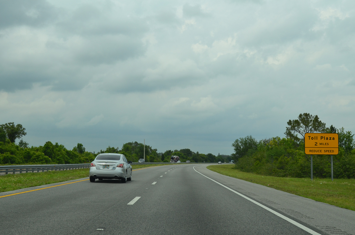
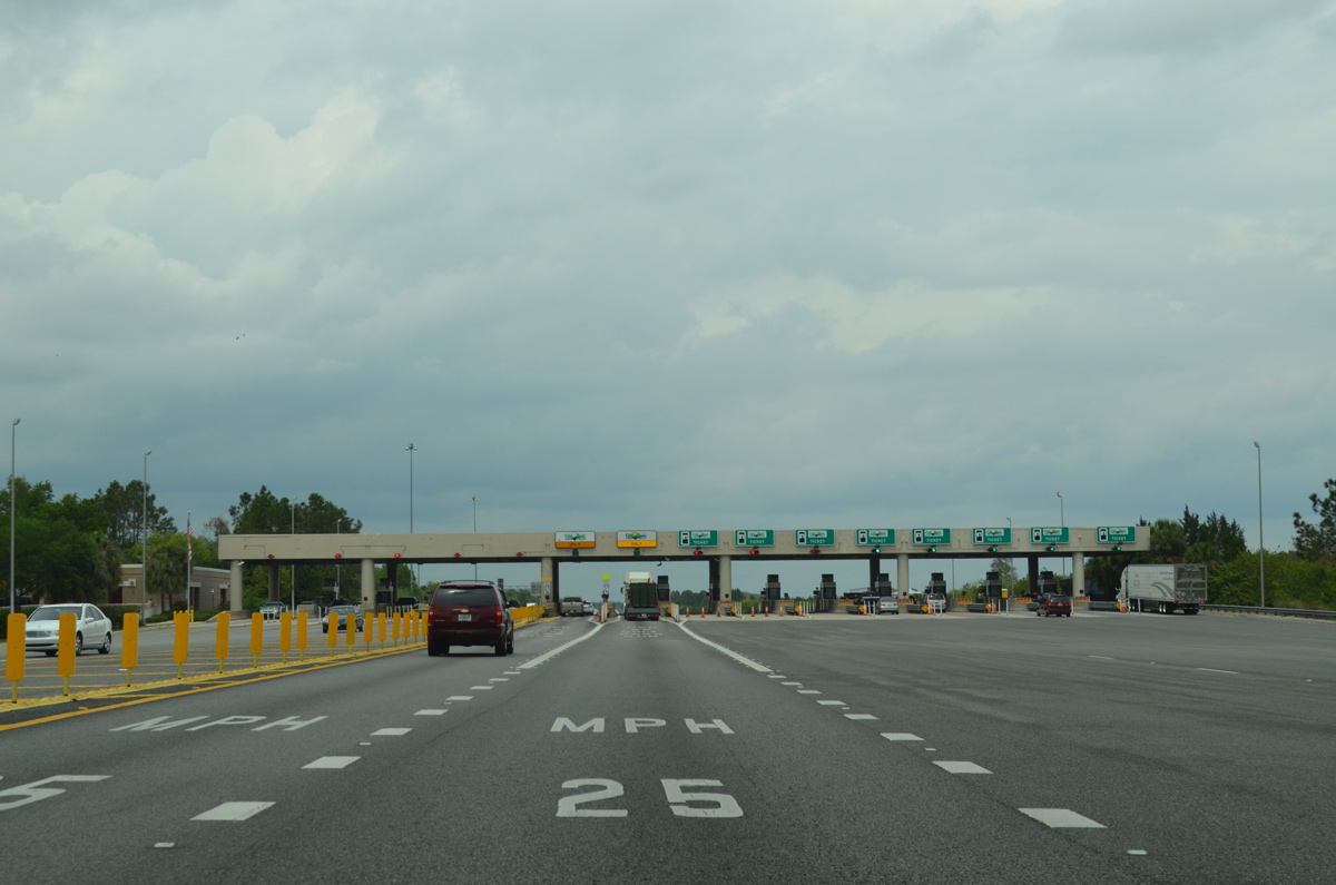
| Approaching the Three Lakes Toll Plaza on Florida's Turnpike northbound near Fanny Bass Pond. 04/15/16 |
|
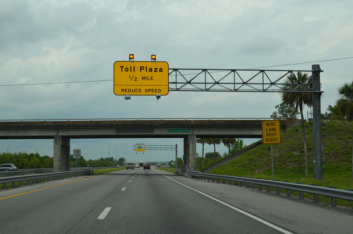
| Passing under Friars Cove Road, one half mile ahead of the Three Lakes Toll Plaza. The previously rural area along the north side of Friars Cove Road was annexed by the city of St. Cloud and developed with the Esprit subdivision. 04/15/16 |
|
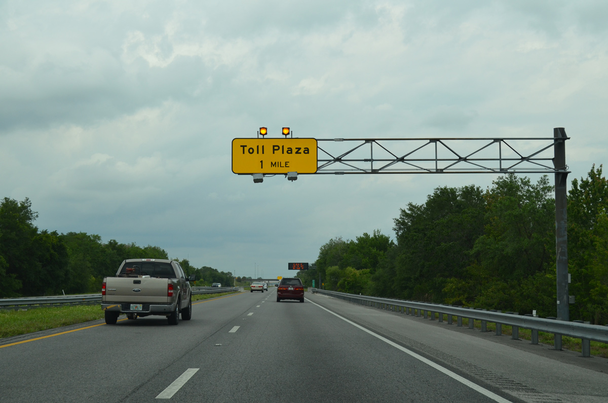
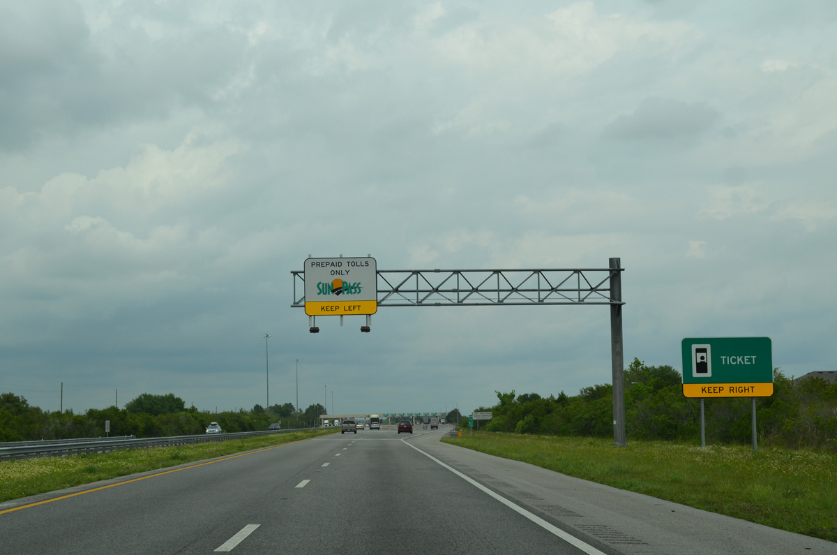
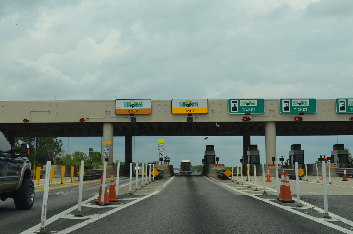
| The main line Three Lakes Plaza represents the end of the ticketed system for Florida's Turnpike northbound. 04/15/16 |
|
| Open road tolling for SunPass account holders is not yet available at the Three Lakes Toll Plaza. Instead SunPass drivers must slow to 25 mph through one of two dedicated SunPass toll booth lanes. 04/15/16 |
|
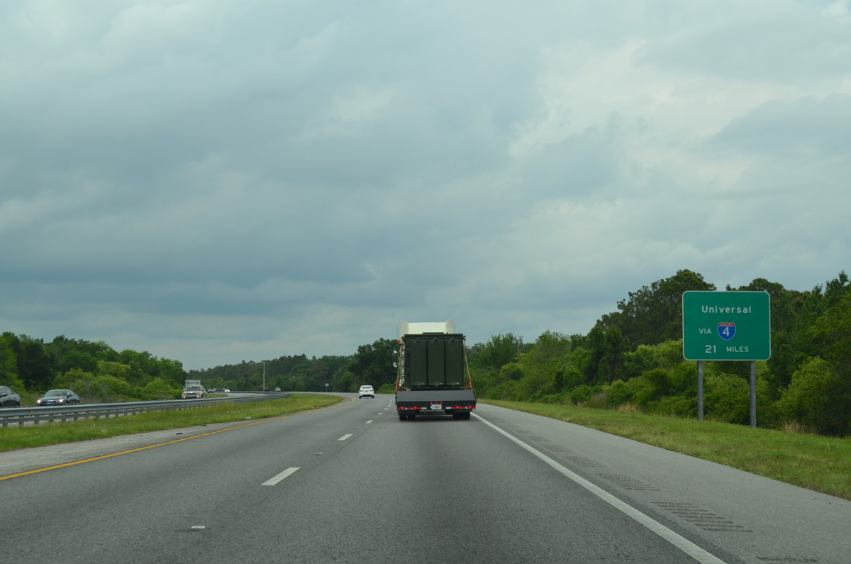
| Leading away from the Three Lakes Toll Plaza, supplemental signs reference Orlando area attractions, including Universal Studios and Walt Disney World. 04/15/16 |
|
| With SunPass only ramps, a half diamond interchange opened in December 2006 joining Osceola County Road 525 (Kissimmee Park Road) with the Turnpike northbound. Costing $12 million and signed as Exit 240 along southbound, the ramps serve commuters in annexed areas of south St. Cloud. Plans for the exchange dated back to 2000.1 04/15/16 |
|
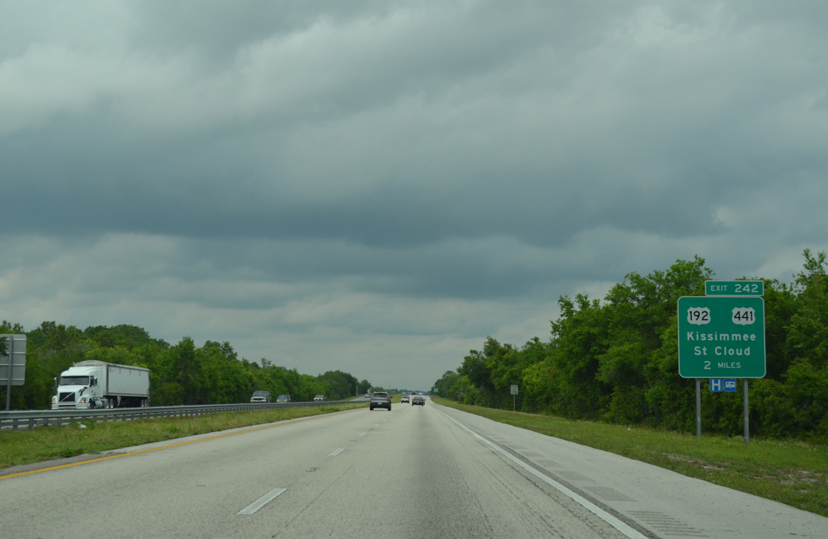
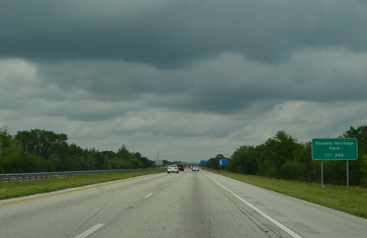
| Interchange modifications in 2002 relocated the northbound off-ramp for U.S. 192/441 to St. Cloud and Kissimmee to a new ramp (Exit 242).2 The change removed the original off-ramp at the trumpet interchange (Exit 244) further north. 04/15/16 |
|
| U.S. 192/441 overlap from Holopaw in rural east Osceola County across St. Cloud to U.S. 17-92 (Main Street) outside Downtown Kissimmee. The pair follow a busy arterial route, which was widened from Michigan Avenue to Aeronautical Boulevard from October 8, 2001 to June 2003.3. U.S. 441 meets Florida's Turnpike again near Taft. 04/15/16 |
|
| Osceola Heritage Park, home of Osceola County Stadium (Spring Training site for the Houston Astros), the Osceola County Fairgrounds and Silver Spurs Arena, lies along U.S. 192/441 (Irlo Bronson Memorial Highway) just northwest of the Turnpike access road from Exit 244 (southbound). 04/15/16 |
|
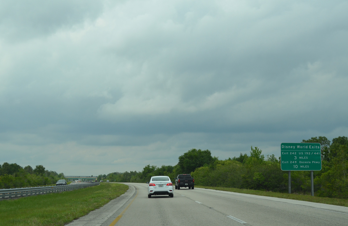
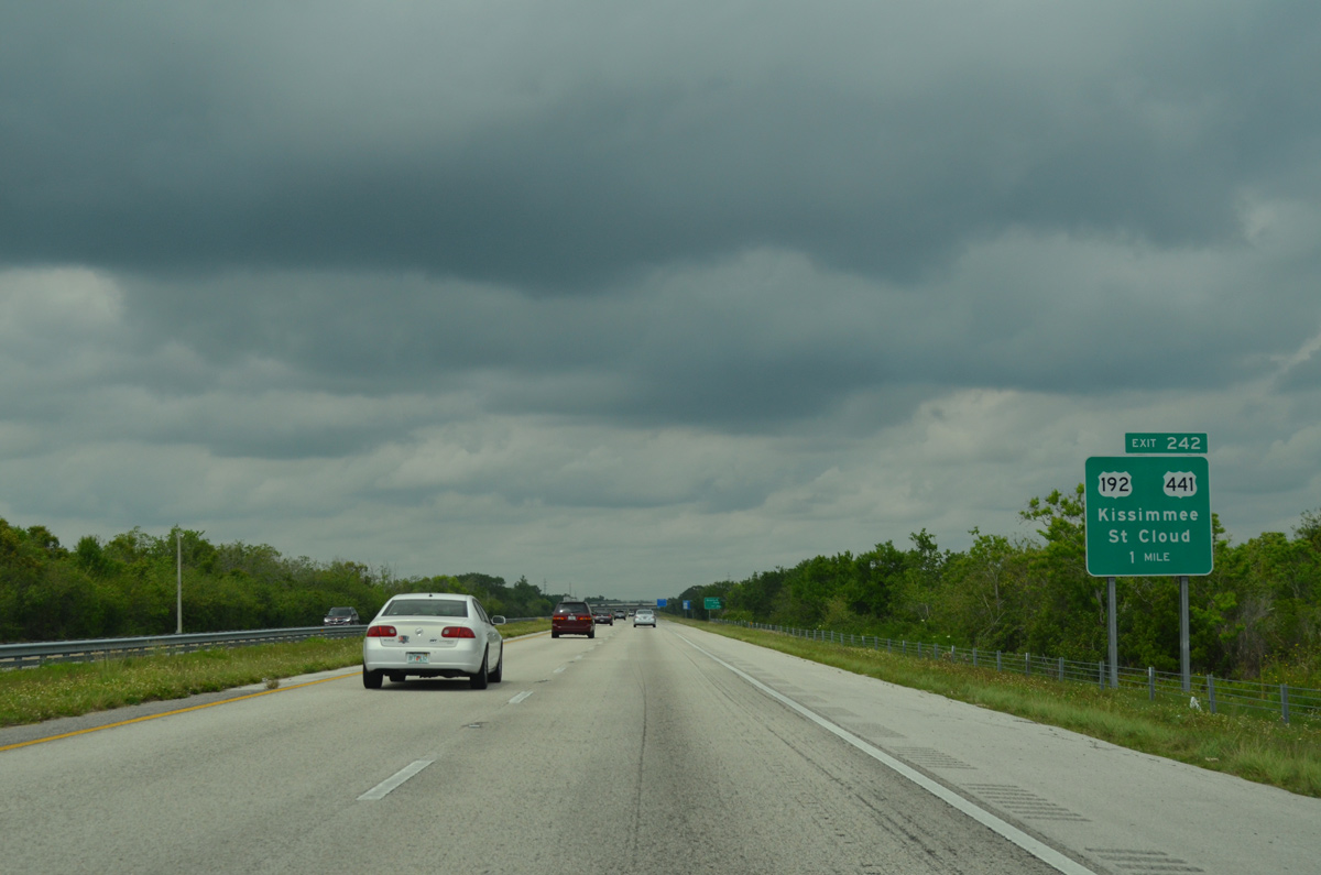
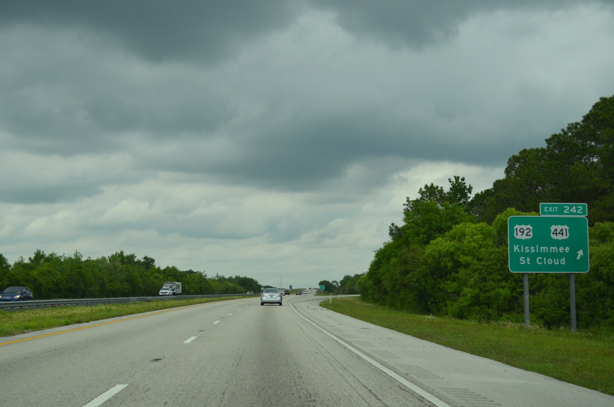
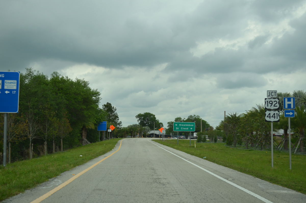
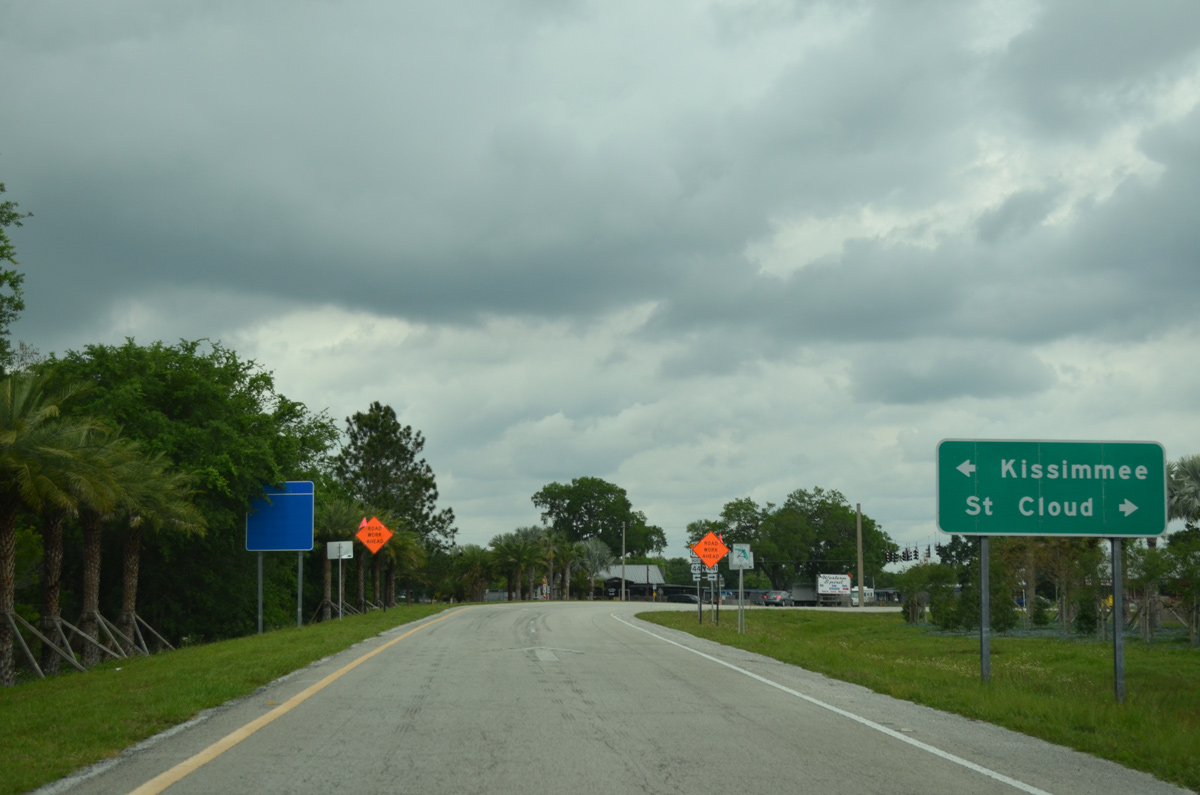
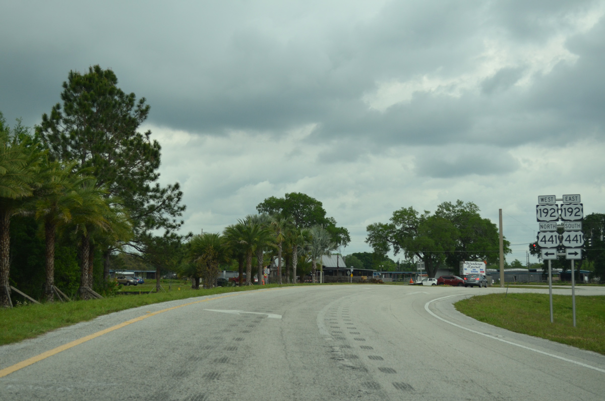
| Exit 242 departs Florida's Turnpike northbound for U.S. 192/441. U.S. 192 east / U.S. 441 south travel along 13th Street from the St. Cloud Canal toward Downtown St. Cloud. The pair continue northwest through unincorporated areas and enter the Kissimmee city limits beyond Boggy Creek Road (CR 530). 04/15/16 |
|
| Beyond Kissimmee, U.S. 192 turns northward toward Walt Disney World. The intrastate route ends at U.S. 27 in Four Corners. 04/15/16 |
|
| U.S. 192 connects St. Cloud with Melbourne and the Space Coast to the east. U.S. 441 combines with U.S. 17/92 along Orange Blossom Trail (OBT) north from Kissimmee through south Orange County. 04/15/16 |
|
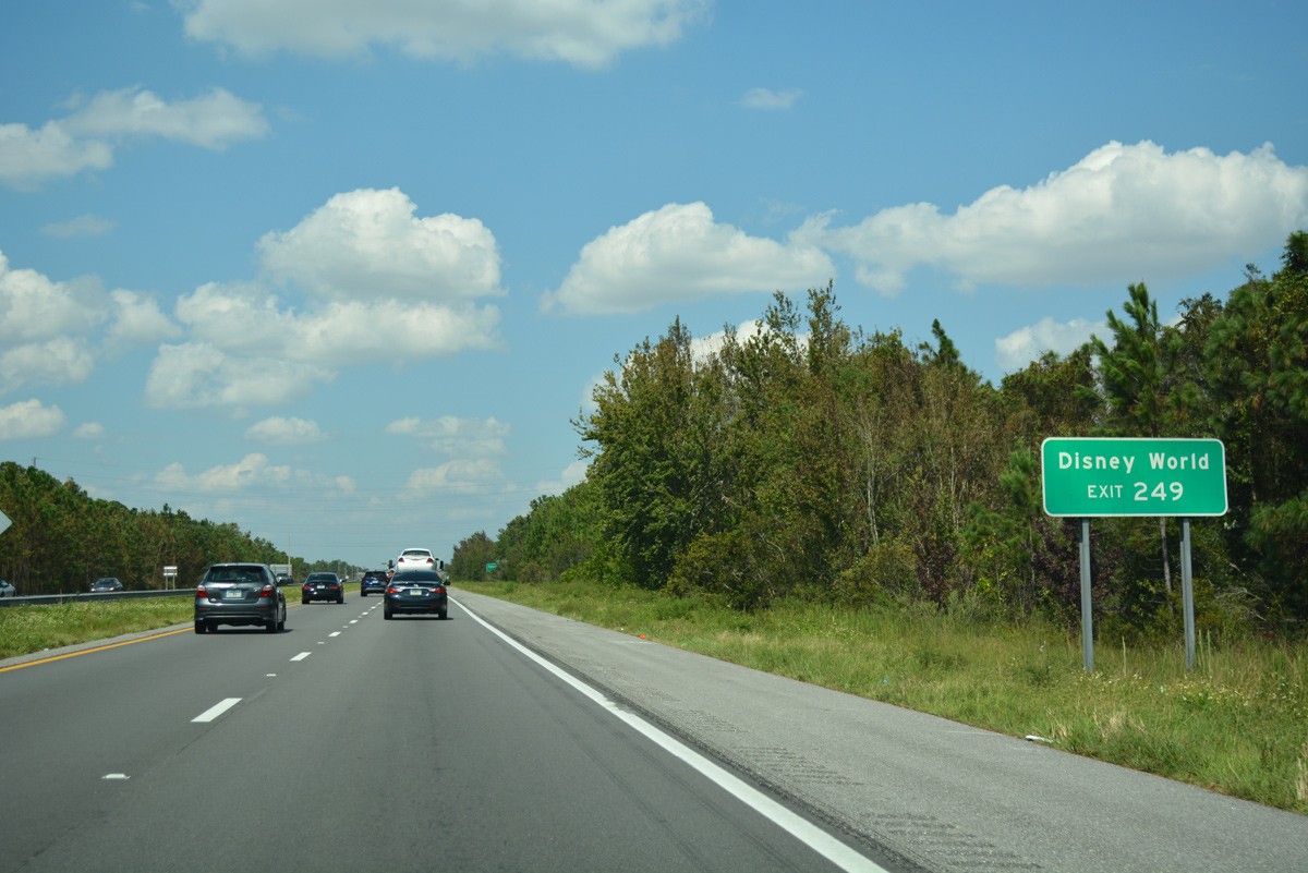
| Just beyond Exit 249, Simpson Road leads north across Florida's Turnpike from U.S. 192/441 to CR 530 (Fortunate Road). 09/20/17 |
|
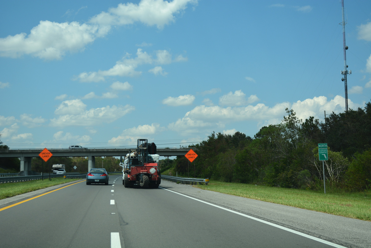
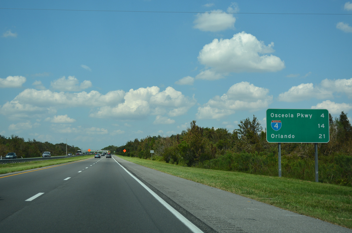
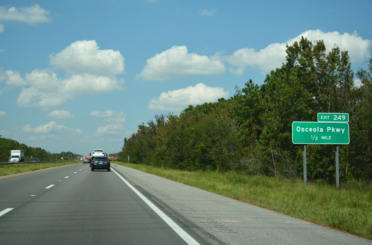
| The third Osceola County interchange joins Florida's Turnpike with Osceola Parkway (CR 522) in north Kissimmee. Travelers reach Interstate 4 and Orlando within 25 miles. 09/20/17 |
|
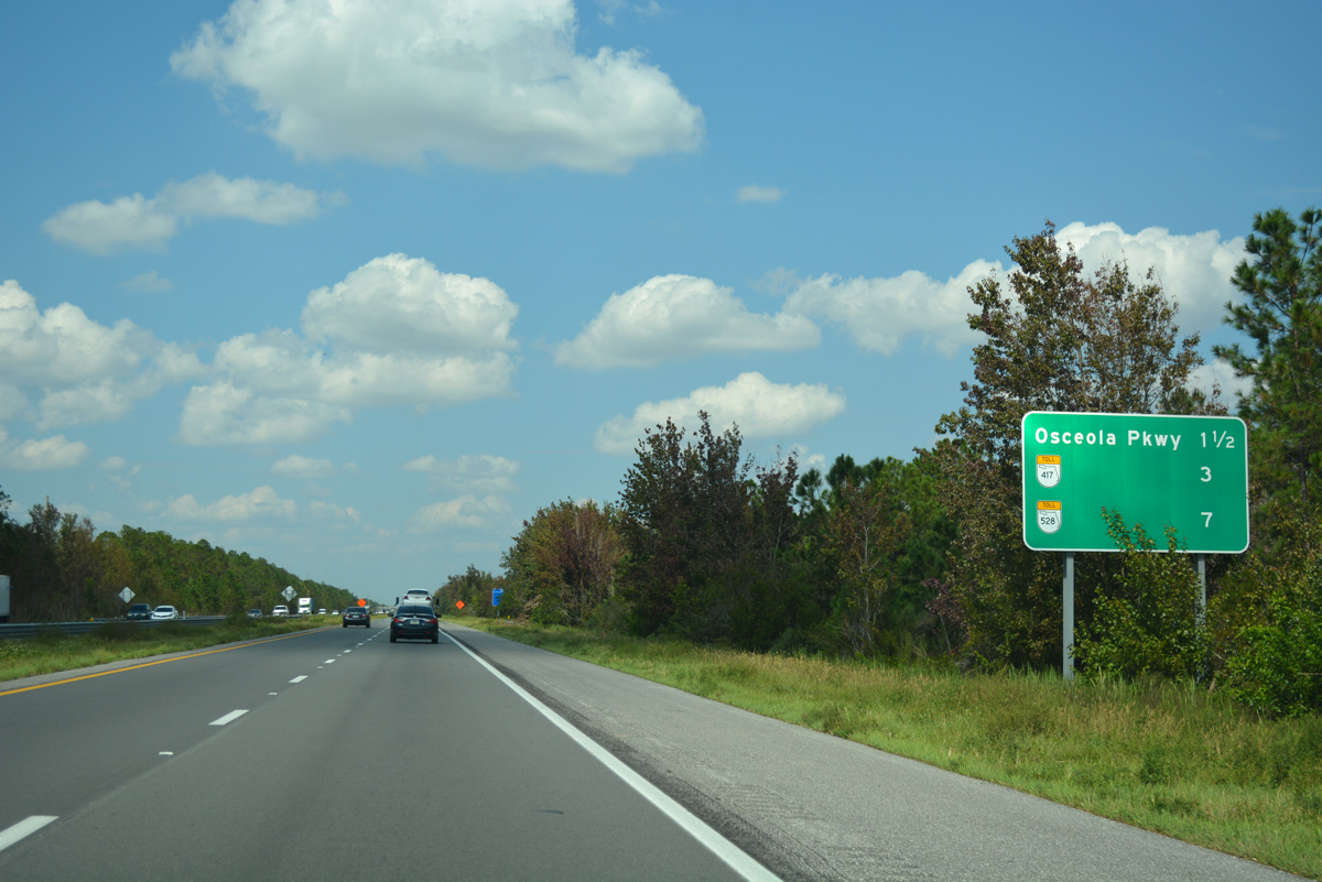
| A second distance sign references the upcoming systems interchange with SR 417 (Central Florida GreeneWay). The initial ramps opened with the Orlando beltway on January 26, 2015. 09/20/17 |
|
| Approaching Osceola Parkway (Exit 249) Florida's Turnpike lines the Kissimmee city limits between the Oak Run subdivision and the Bueneaventura Lakes community. 09/20/17 |
|
| West of Flora Boulevard, Osceola Parkway upgrades to a tolled expressway en route to Walt Disney World. The controlled access parkway ends at Disney's Animal Kingdom. 09/20/17 |
|
| Osceola Parkway constitutes an arterial route east through Bueneaventura Lakes to Boggy Creek Road (Osceola County Road 530) and west along a retail corridor through north Kissimmee. 09/20/17 |
|
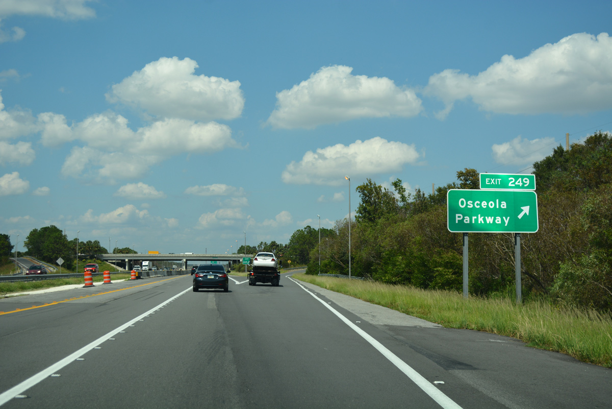
| A diamond interchange joins the Turnpike with Osceola Parkway (CR 522) at Exit 249. Ramps here were widened / reconstructed as part of the 2017-21 widening project along SR 91 north to SR 528. 09/20/17 |
|
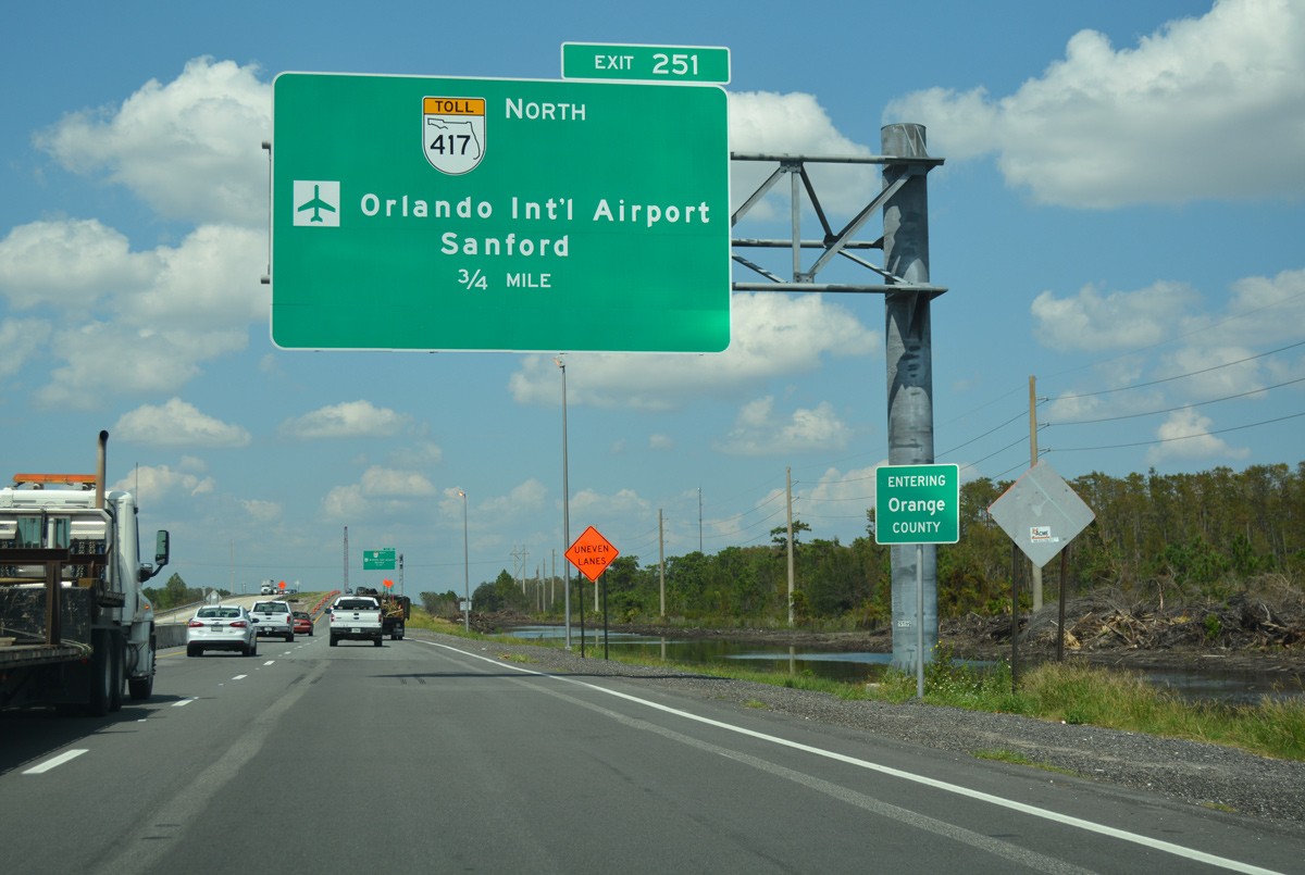
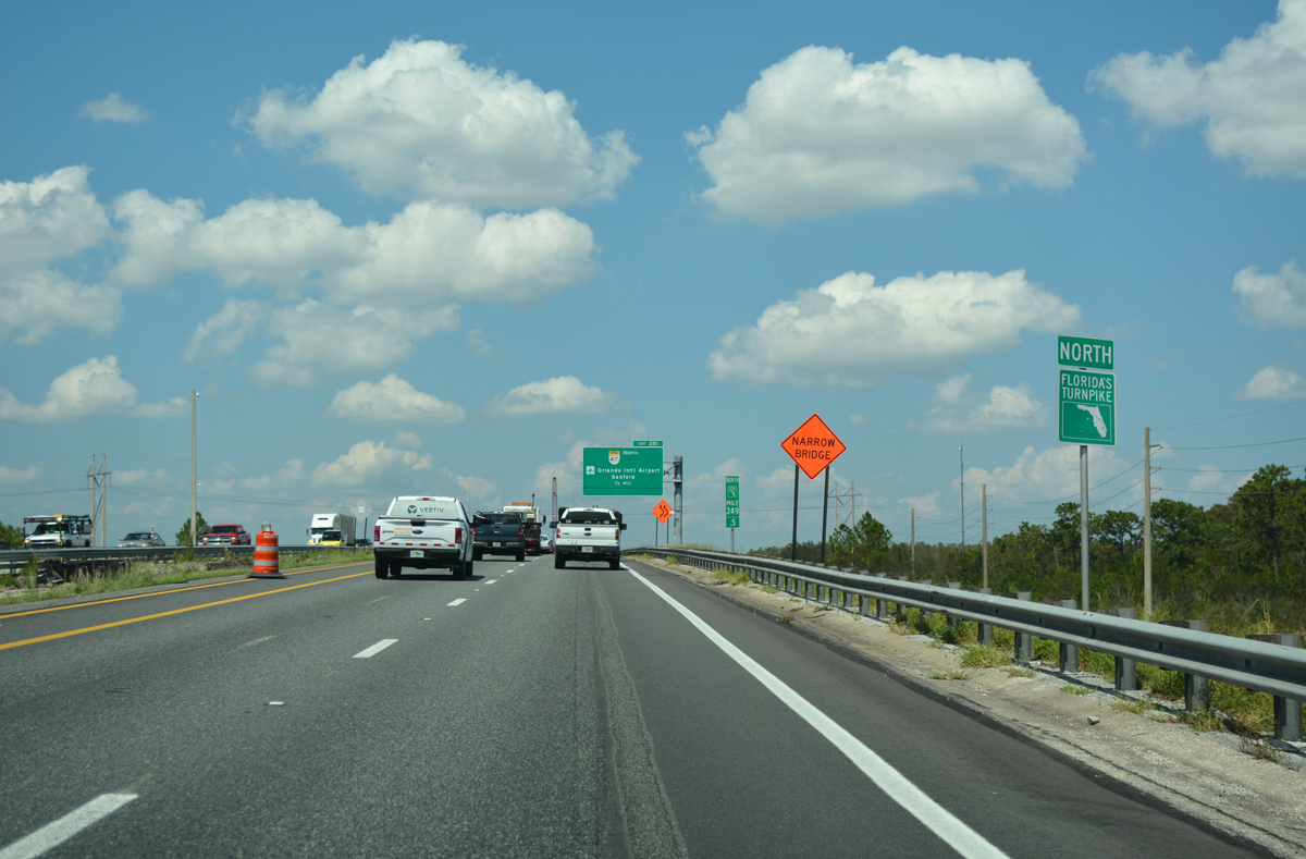
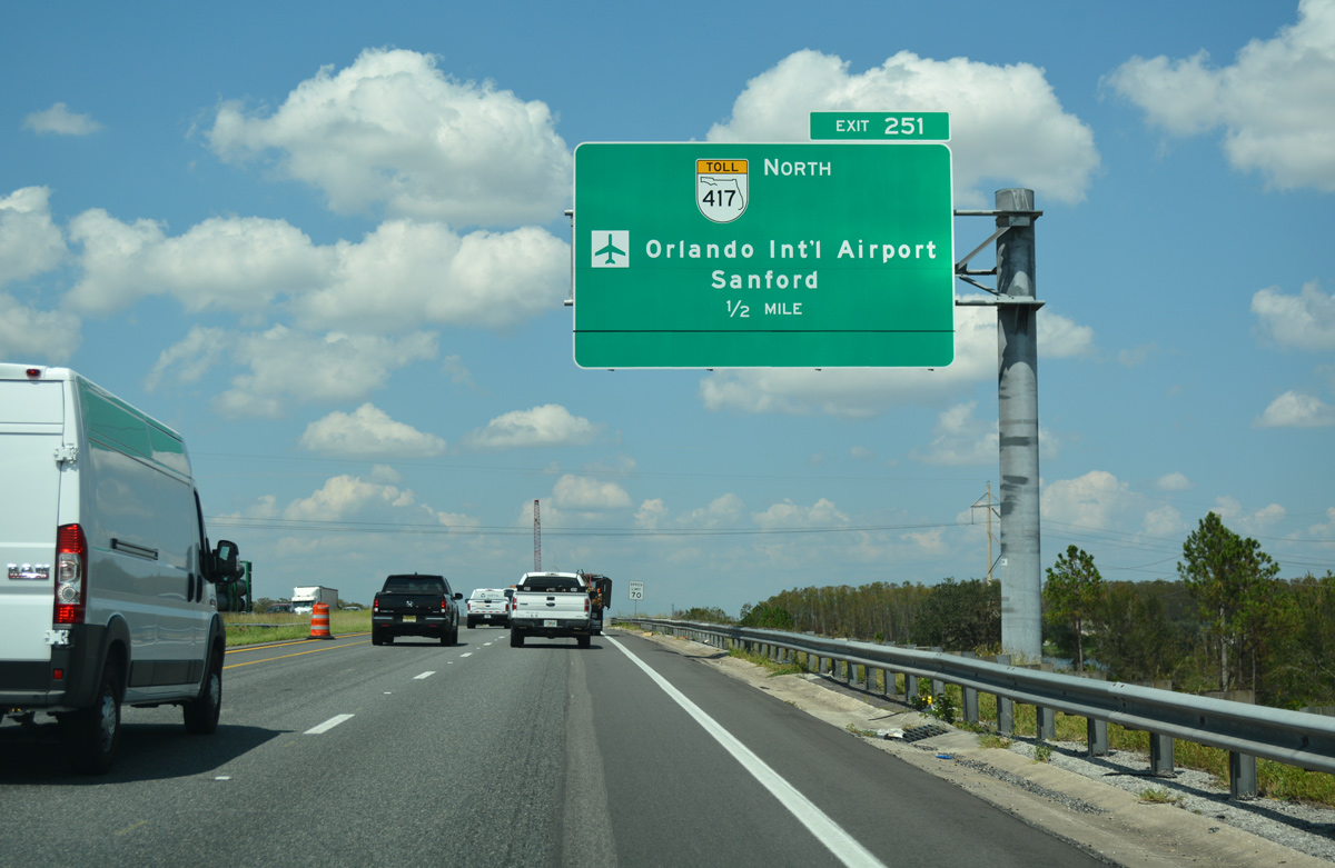
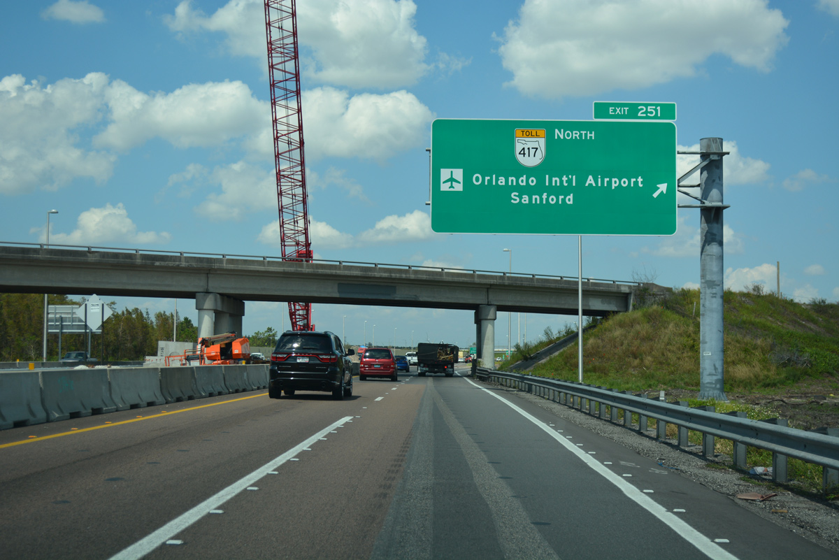
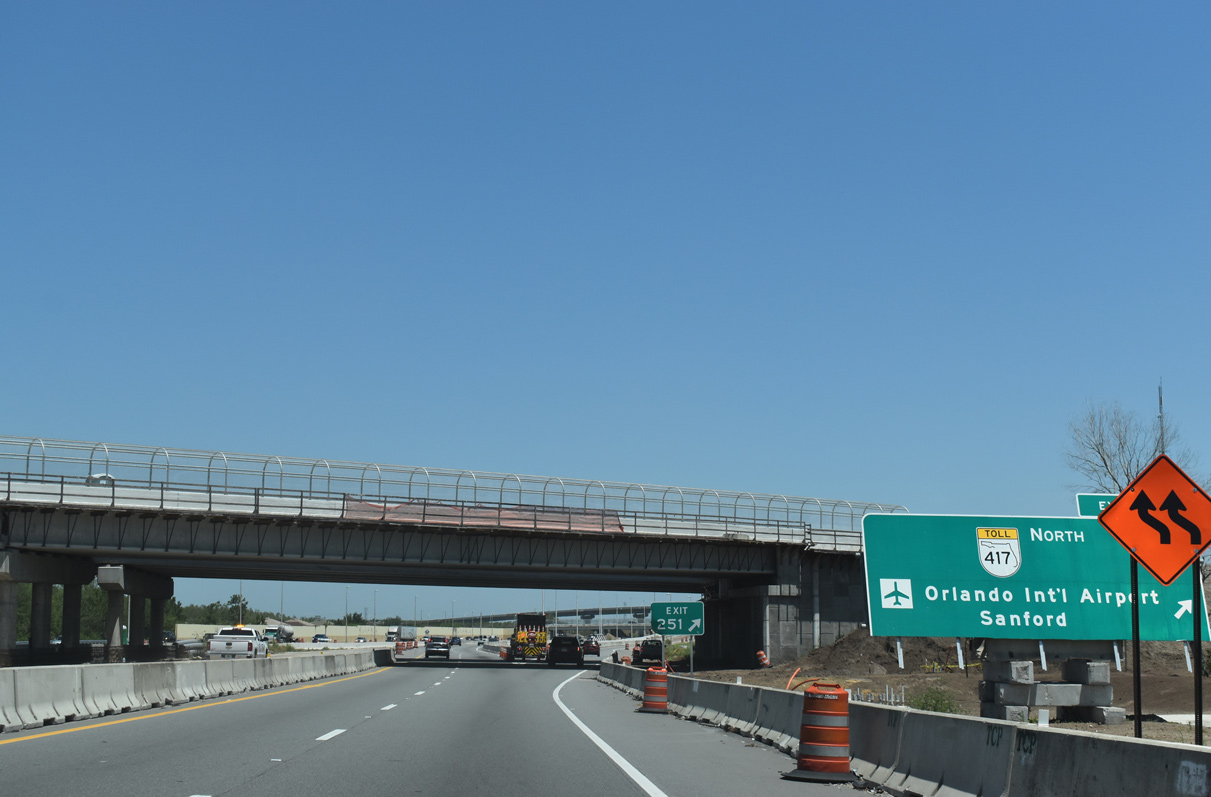
| Florida's Turnpike crosses the Orange County line to the immediate north of Osceola Parkway. Exit 251 departs next in 0.75 miles for SR 417 (Central Florida Greeneway) east to Orlando International Airport (MCO) and the Lake Nona area of southeast Orlando. 09/20/17 |
|
| This confirming marker precedes an underpass for the CSX Railroad line. Started in April 2017, a $176 million construction project expanded the toll road from four to eight lanes, with two express lanes in each direction, from Osceola Parkway north to the Beachline Expressway.4 09/20/17 |
|
| Included in Turnpike widening project was the addition of three ramps at the systems interchange with SR 417 (Central Florida GreeneWay).4 The first two ramps at Exit 251 were constructed from Fall 2013 to January 2015. 09/20/17 |
|
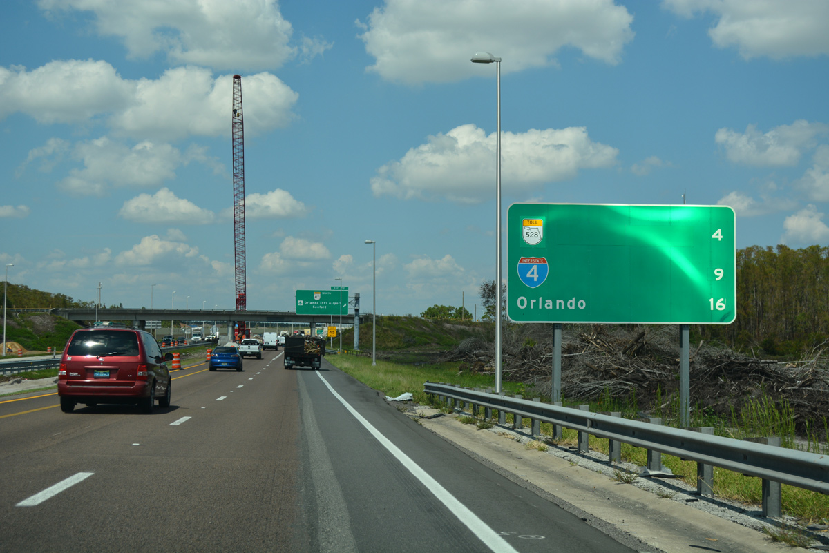
| The subsequent interchanges beyond the Central Florida GreeneWay join the Turnpike with the Orlando area expressway network: SR 528 (Beachline Expressway), Interstate 4 and SR 408 (East-West Expressway). 09/20/17 |
|
| SR 417 encircles south and eastern areas of Orlando from Celebration to Union Park. The toll road stretches 55 miles north to I-4 at Sanford. 09/20/17 |
|
| The Orange Avenue (CR 527) overpasses at Exit 251 were replaced during the 2017-21 Turnpike widening project. 05/22/20 |
|
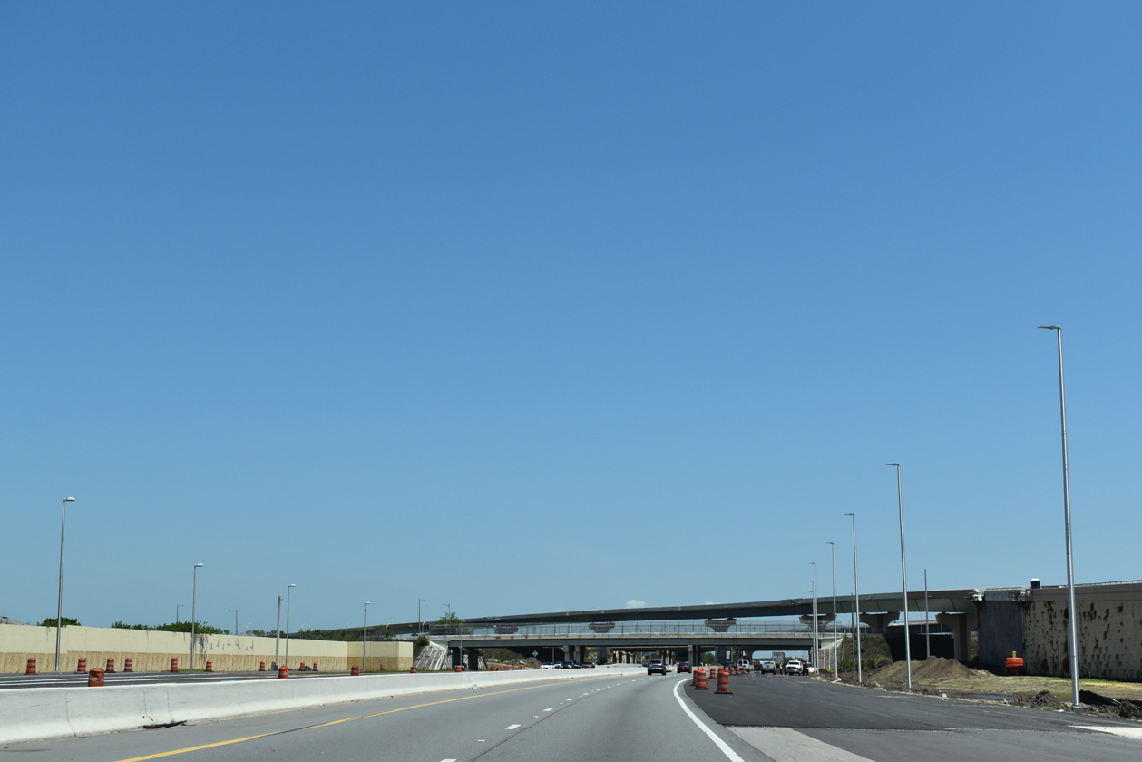
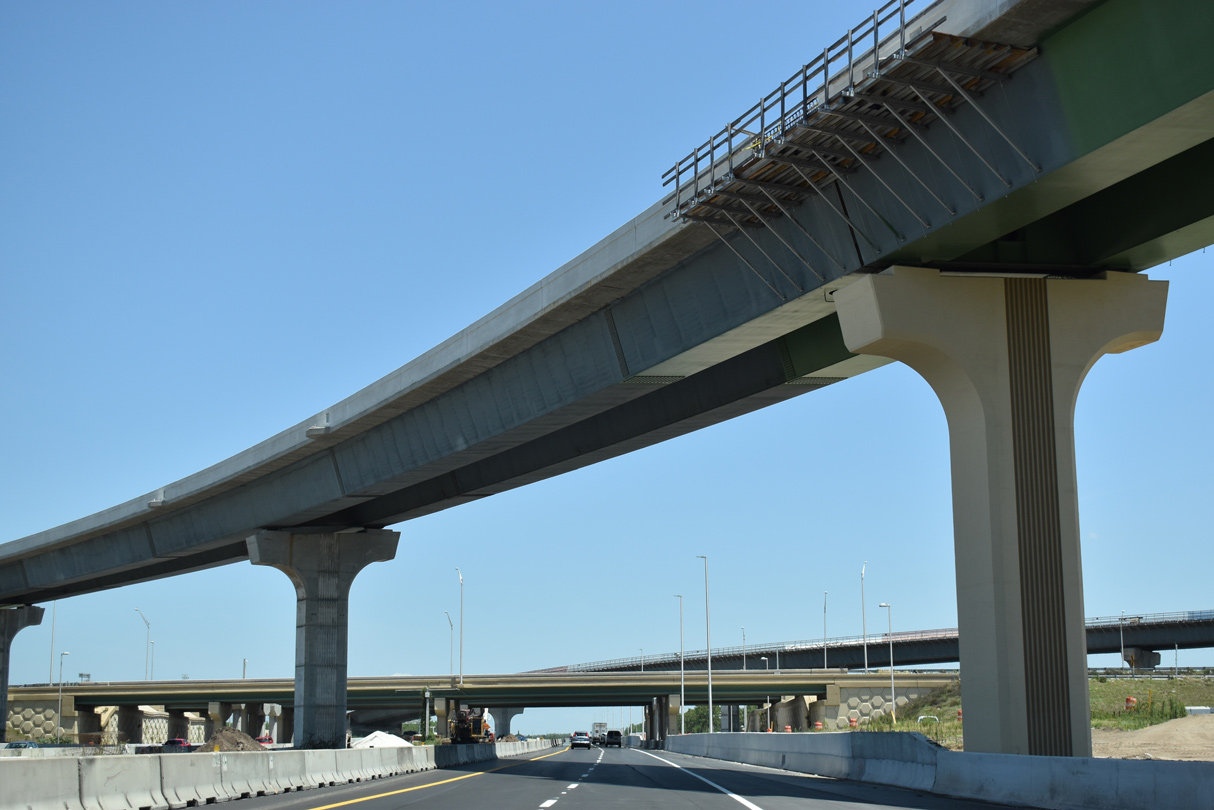
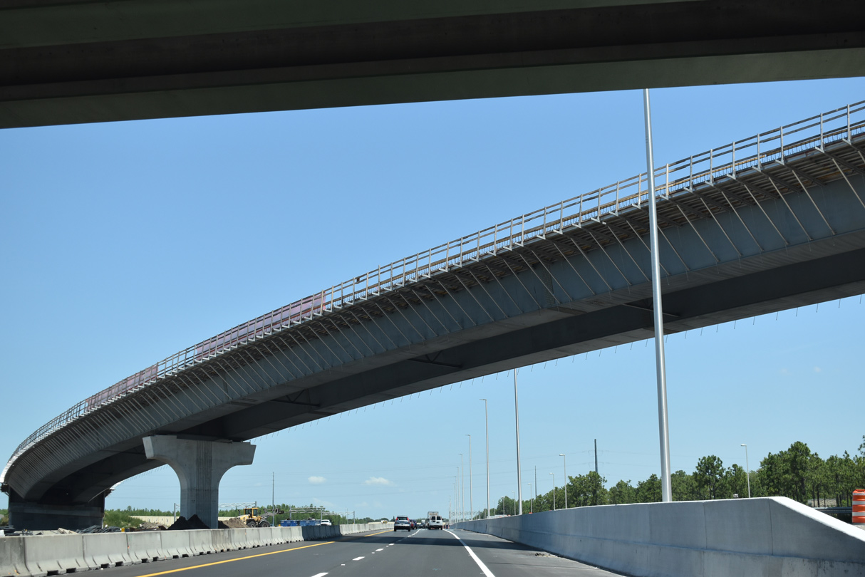
| A pair of high flyovers take shape at the systems interchange between Florida's Turnpike and SR 417 (Central Florida GreeneWay). 05/22/20 |
|
| Subdivisions in the Southchase development line both sides of Florida's Turnpike north to the Wetherbee Road overpass. 09/20/17 |
|
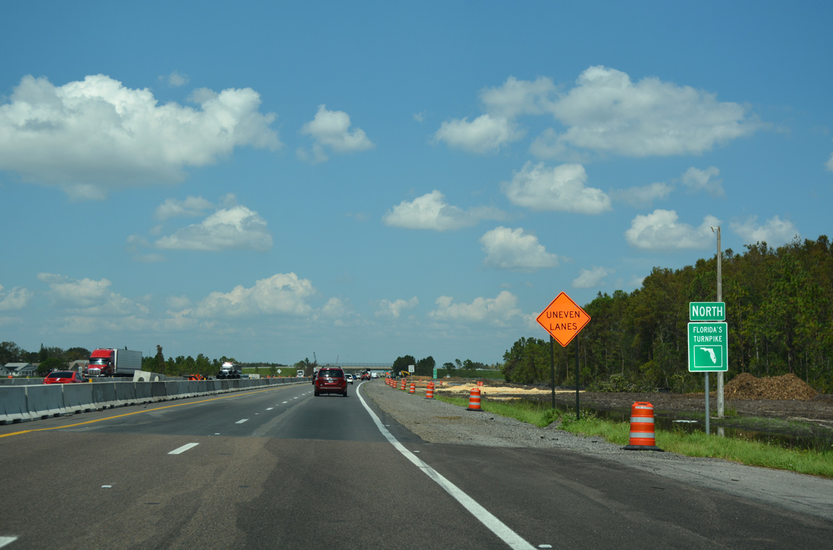
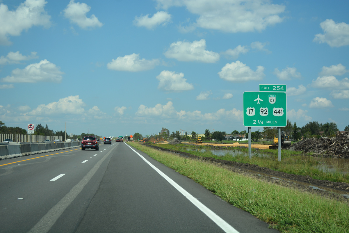
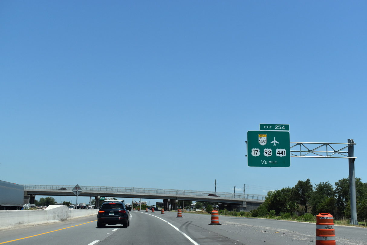
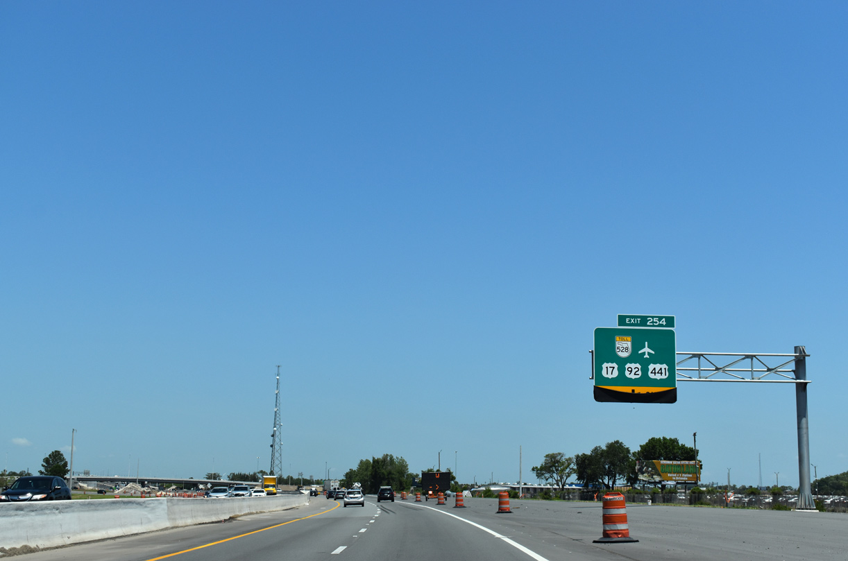
| Forthcoming Exit 254 serves both the Beachline Expressway (SR 528) a toll road between I-4 and Cocoa, and U.S. 17-92-441 (Orange Blossom Trail). Orange Blossom Trail (OBT) constitutes a busy commercial arterial northward into Orlando and south to Kissimmee. 09/20/17 |
|
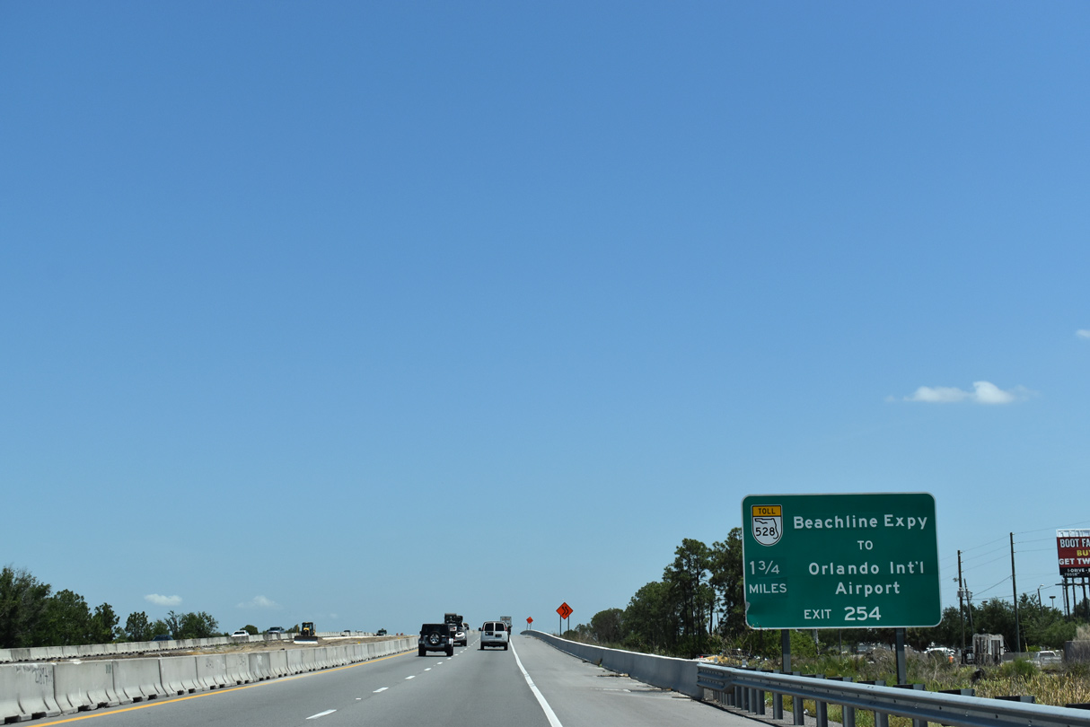
| The Beachline Expressway heads six miles east from Exit 254 to Orlando International Airport (MCO) at SR 436 (Semoran Boulevard). 05/22/20 |
|
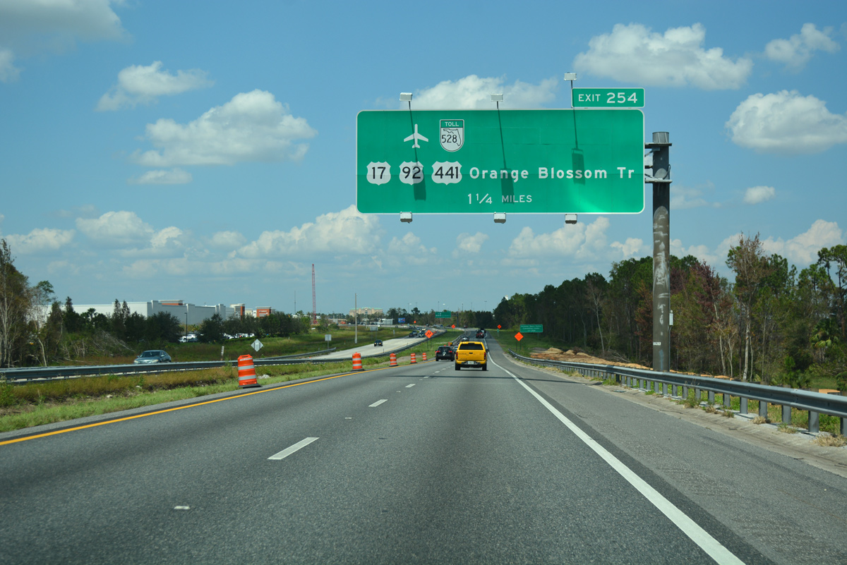
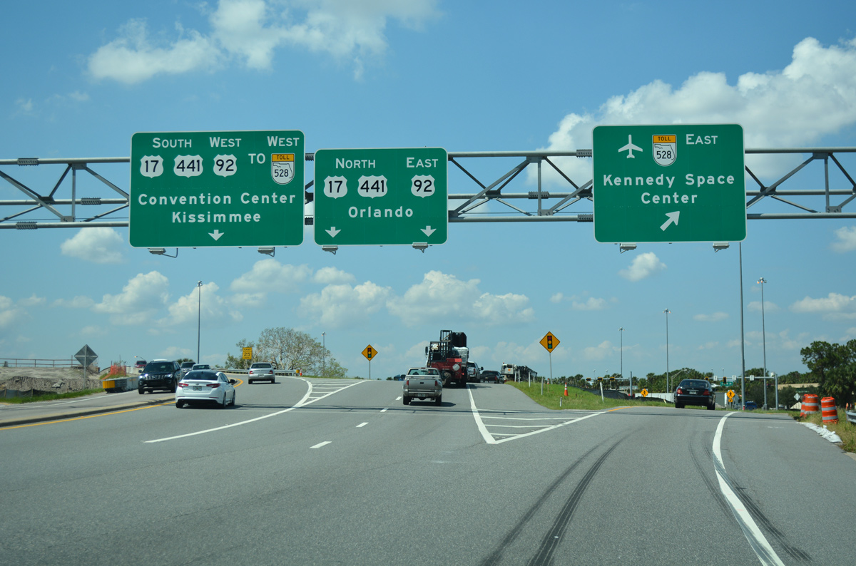
| Crossing over Central Florida Parkway by Florida Consolidated Industrial Park, Florida's Turnpike continues north 1.25 miles to the trumpet interchange (Exit 254) and access road for SR 528 and U.S. 17-92-441 (OBT). 09/20/17 |
|
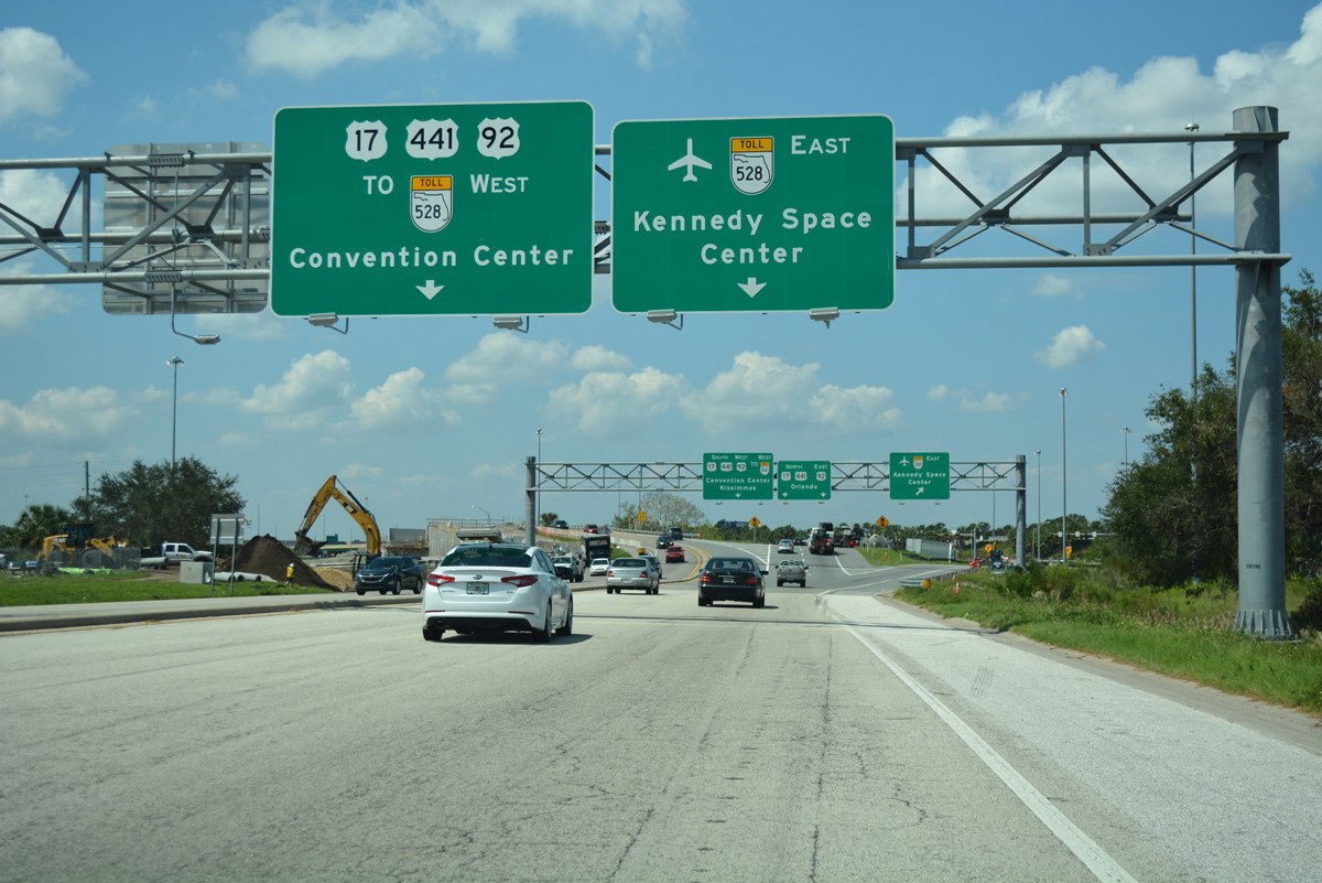
| SR 528 (Beachline Expressway) extends four miles west to International Drive, the Orange County Convention Center and Sea World. Eastward SR 528 heads to Belle Isle, Wedgefield and Brevard County. The toll road joins the Orlando area with Kennedy Space Center, Merritt Island and Cocoa Beach. 05/22/20 |
|
| Florida's Turnpike commences its northwestern trajectory toward Wildwood and Sumter County ahead of the Taft Vineland Road overpass. The second to last service area lies nine miles ahead at mile post 263. 09/20/17 |
|
| Exit 254 leaves Florida's Turnpike northbound and enters a toll plaza before partitioning into ramps for U.S. 17-92-441 (OBT) north / south and SR 528 east. 05/22/20 |
|
| A Breezewood connection links the Turnpike north with the Beachline Expressway west via OBT south and Consulate Drive west. The SunPass-only ramp from Consulate Drive to SR 528 west opened to traffic on July 27, 2004.5 09/20/17 |
|
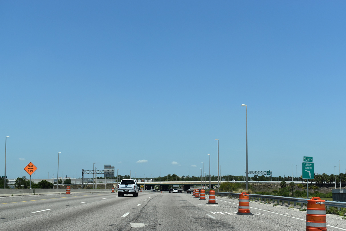
| Construction through April 2008 expanded Florida's Turnpike into eight overall lanes from SR 528 to Interstate 4. Subsequent construction underway to 2021 further widened this stretch to ten general use lanes. 05/22/20 |
|
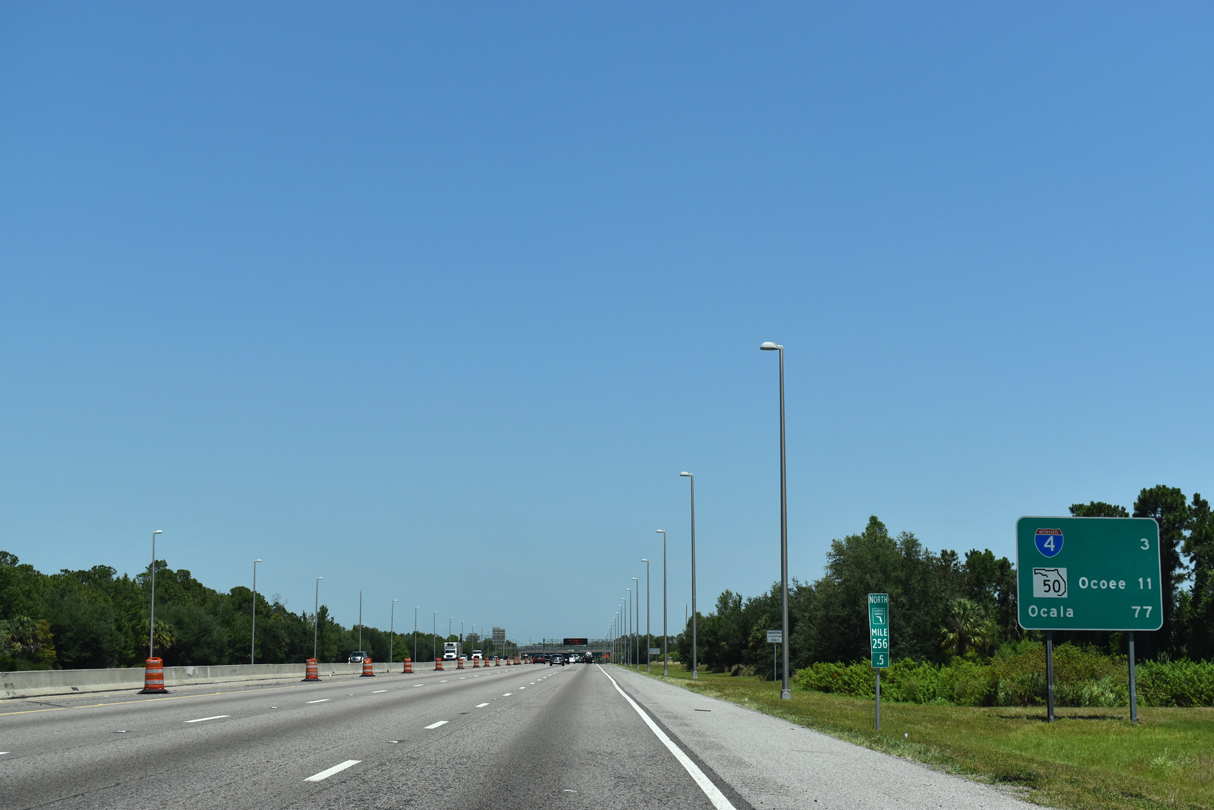
| Florida's Turnpike progresses northwest three miles to Interstate 4 in unincorporated Orange County. The succeeding exit is SR 408, with Ocala debuting at 77 miles to the northwest. 05/22/20 |
|
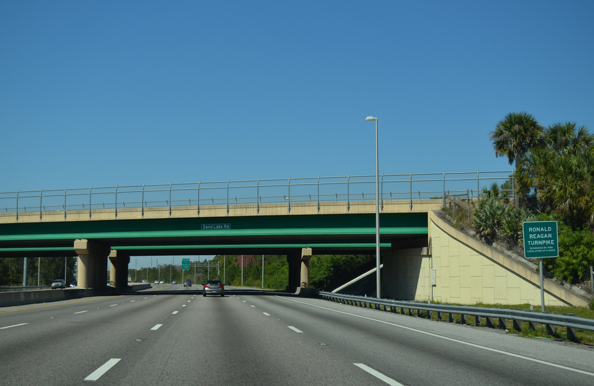
| SR 482 (Sand Lake Road) crosses over Florida's Turnpike by this sign dedicated the toll road as the Ronald Reagan Turnpike. Signs for the Reagan Turnpike appear sporadically throughout the 309 mile mainline. 02/27/16 |
|
| Interstate 4 represents the main travel corridor throughout the Orlando metropolitan area, and across central Florida in general. 05/22/20 |
|
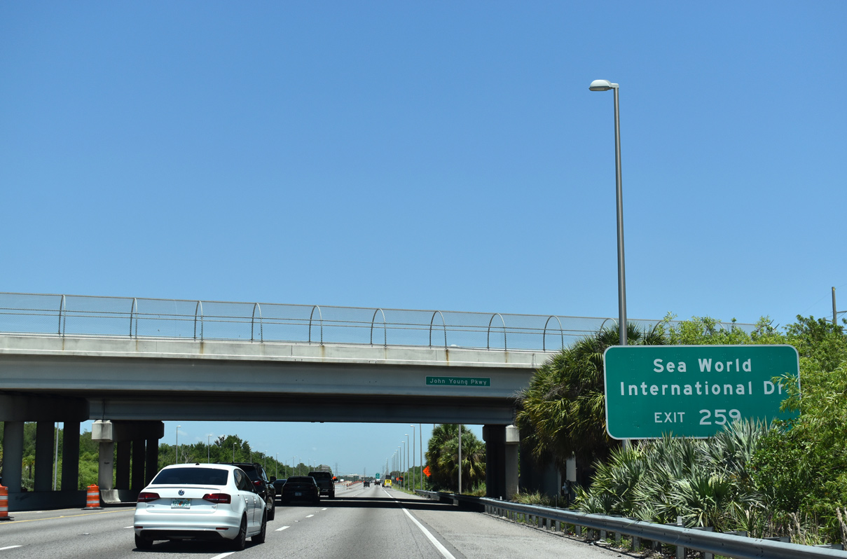
| Locally known as I-Drive, International Drive parallels Interstate 4 south from Oak Ridge Road and Artegon Marketplace Mall to Sea World and World Center Drive. SR 435 (Kirkman Road) links I-4 with I-Drive from just west of the Turnpike. 05/22/20 |
|
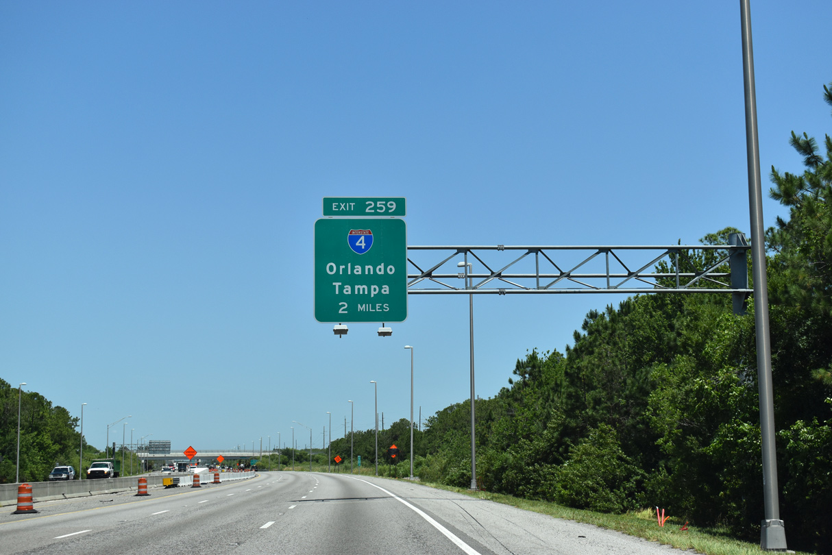
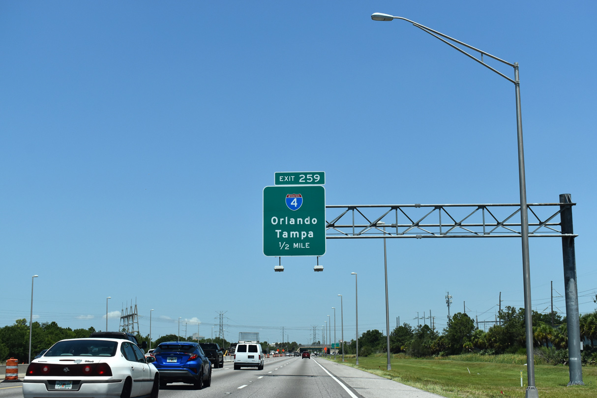
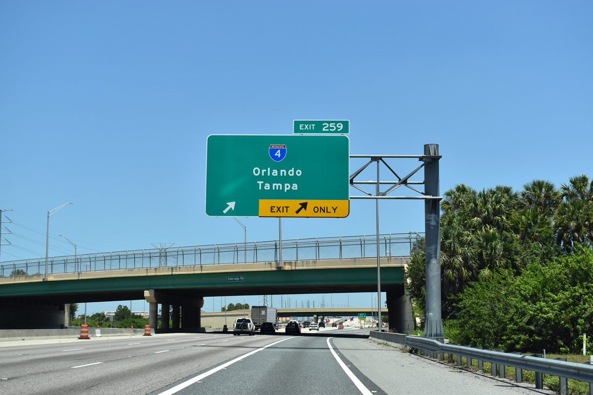
| One mile ahead of the trumpet interchange (Exit 259) and access road to Interstate 4 on Florida's Turnpike north. The $85 million, I-4 Direct Connect Ramps project builds a flyover for I-4 eastbound. 05/22/20 |
|
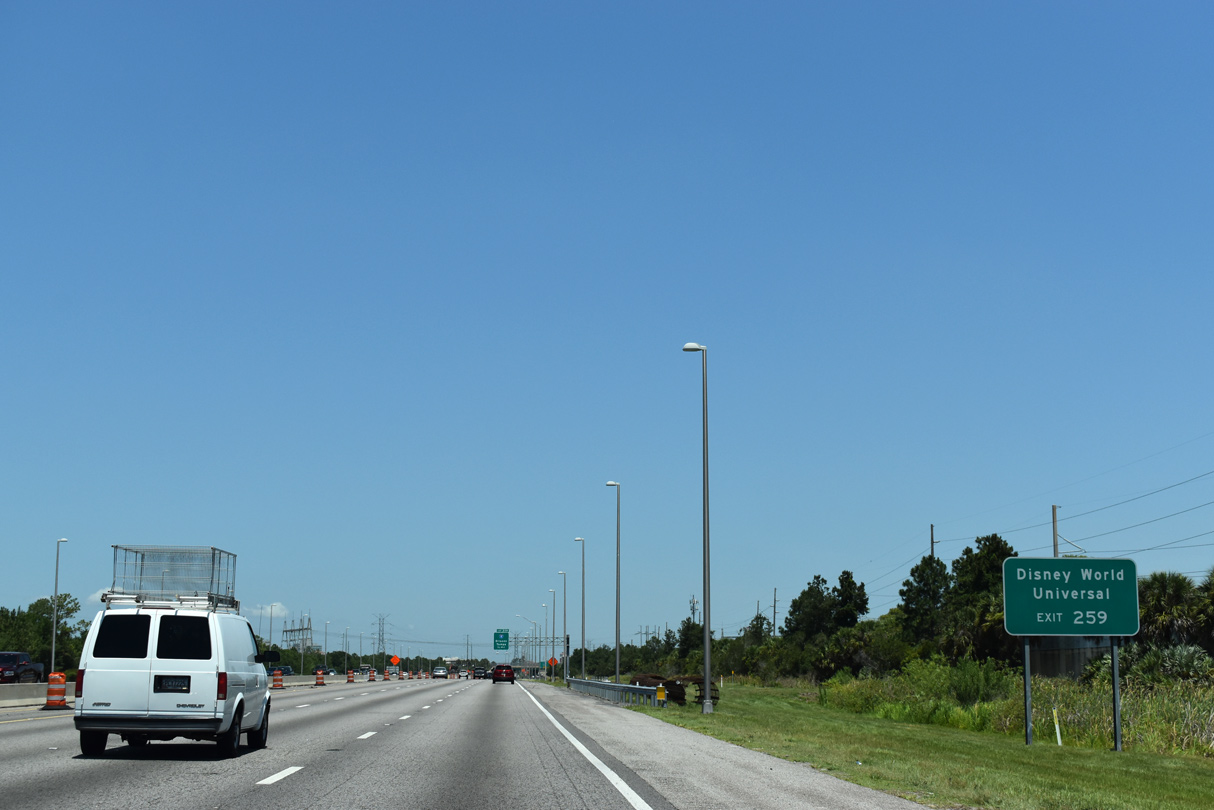
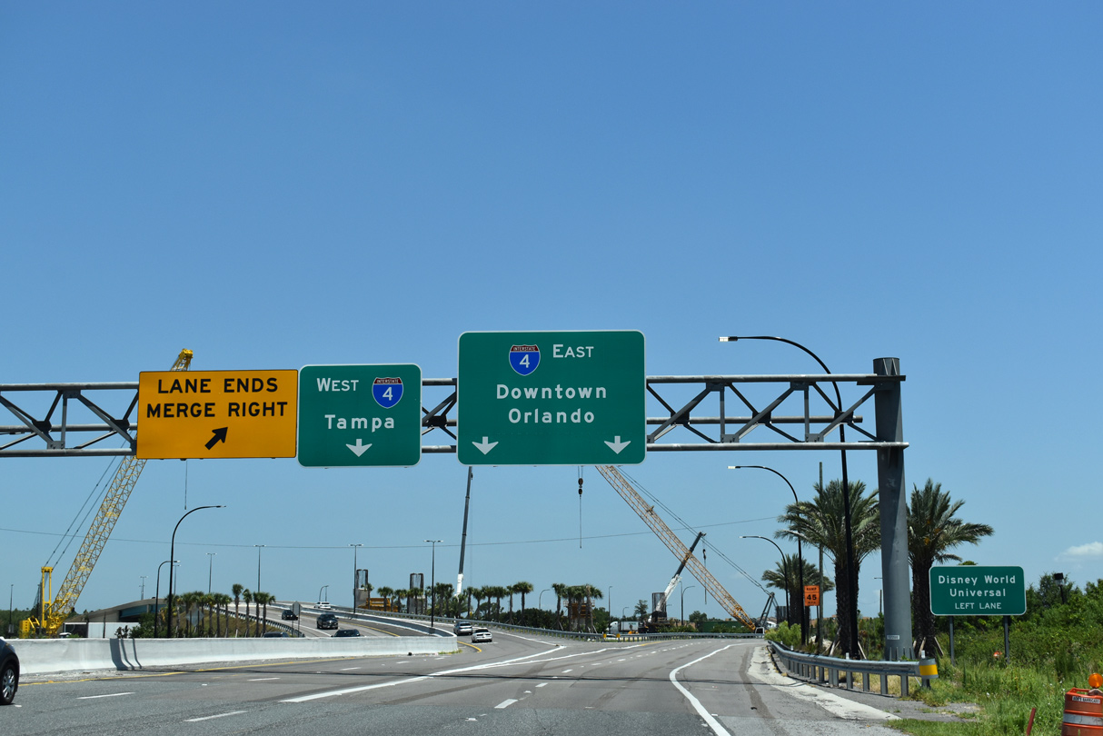
| Interstate 4 travels southwest to Universal Studios, the International Drive corridor, and Walt Disney World. 05/22/20 |
|
| The Ultimate I-4 project through 2021 rebuilds Interstate 4 from Kirkman Road north to the Seminole County line. Construction adds express toll lanes along the freeway and upgrades interchanges along the corridor. 05/22/20 |
|
| Exit 259 departs from the Turnpike north with two lanes at the Oak Ridge Road overpass. 05/22/20 |
|
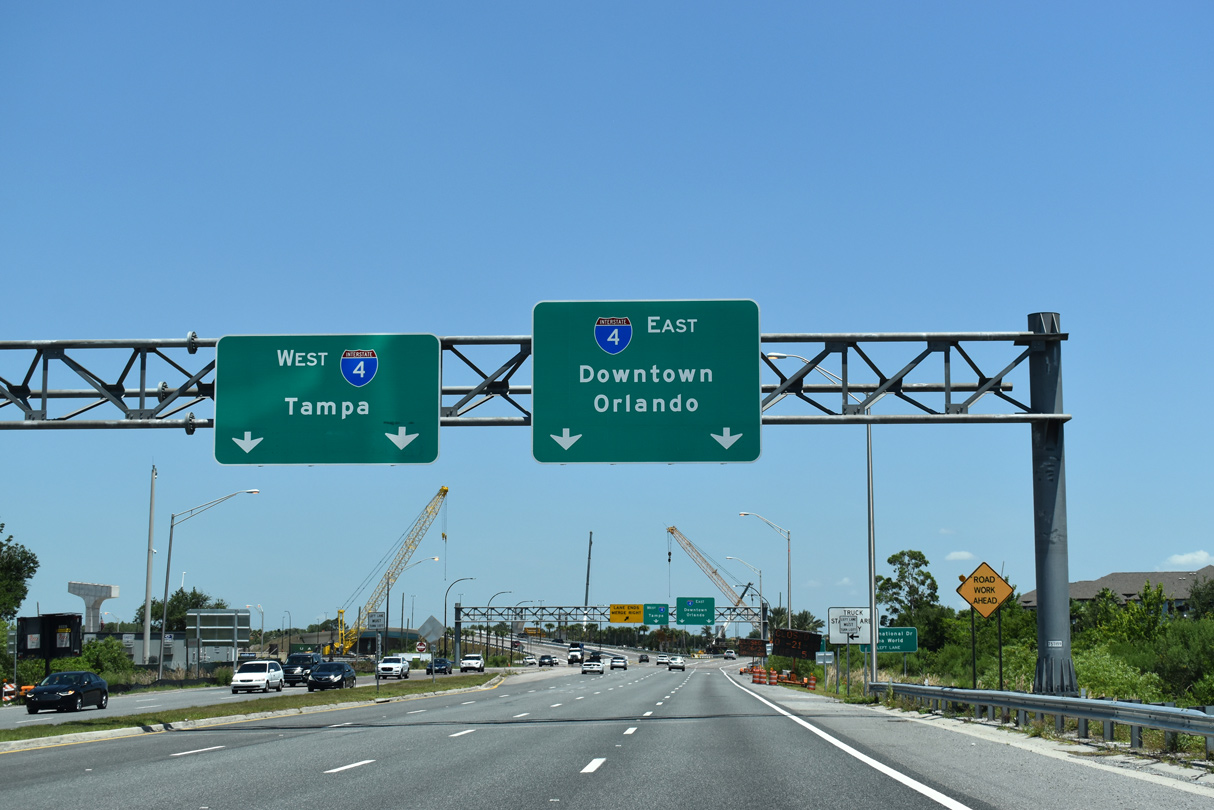
| Overall I-4 joins Orlando with Lakeland and Tampa to the west and Sanford, Deltona and Daytona Beach to the north. 05/22/20 |
|
| Interstate 4 heads northeast seven miles to Downtown Orlando and ten miles southwest to Lake Buena Vista / Walt Disney World. 05/22/20 |
Page Updated 05-29-2020.


