

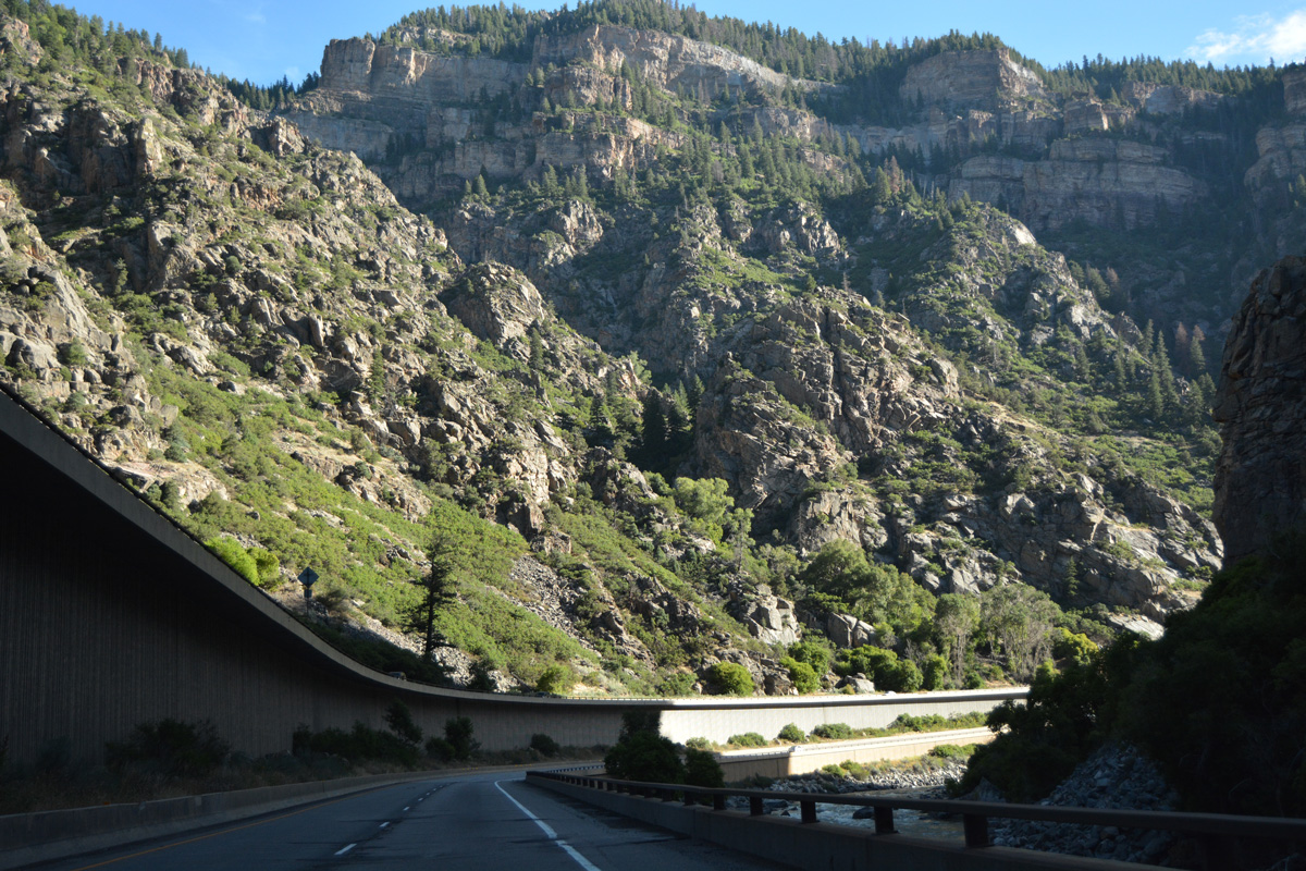
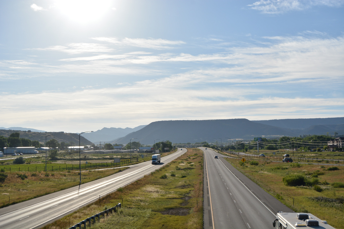
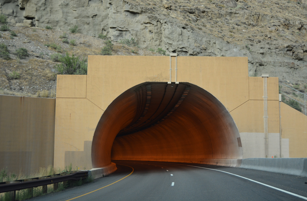
Spanning the Centennial State, Interstate 70 travels 450 miles from the desert in Grand Valley to Burlington on the High Plains. Entering the state from Utah near Grand Junction, Interstate 70 follows the U.S. 6-50 corridor along the Colorado River. East from Grand Junction, I-70 leads to Rifle, Silt and Glenwood Springs. I-70 then travels through Glenwood Canyon, one of the last sections of Interstate highway completed in the state of Colorado. Considered to be a marvel of engineering, the four lane freeway was constructed through the tight canyon on a series of viaducts and through three tunnels.
Interstate 70 then enters the Rocky Mountains, connecting to several major ski resorts along the way: Aspen, Beaver Creek, Vail, Copper Mountain, Breckenridge, Arapahoe and Keystone. Many of these resorts are very close to the freeway, while others are located some distance from the freeway. Aspen, for instance, requires a trip along SH 82. However, one can ski Vail and look down on Interstate 70.
But Interstate 70 is not just for skiers. It is also for those who want to see the Rocky Mountains at their best. With the combination of National Forest, 14,000 foot high peaks, snow, highway tunnels and spectacular views, I-70 is easier to describe with pictures than with words.
Interstate 70 Colorado Guides
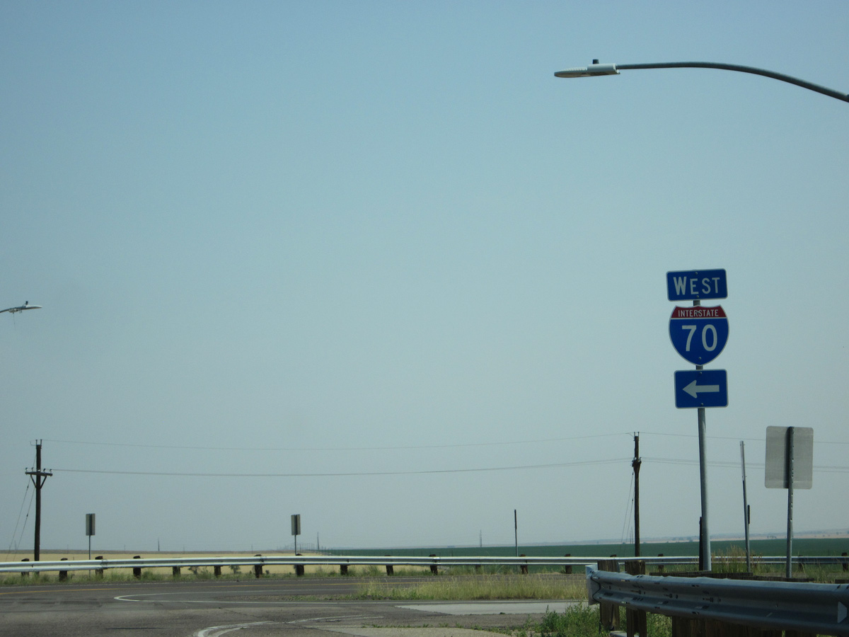
East
Business Routes
Central 70 Project
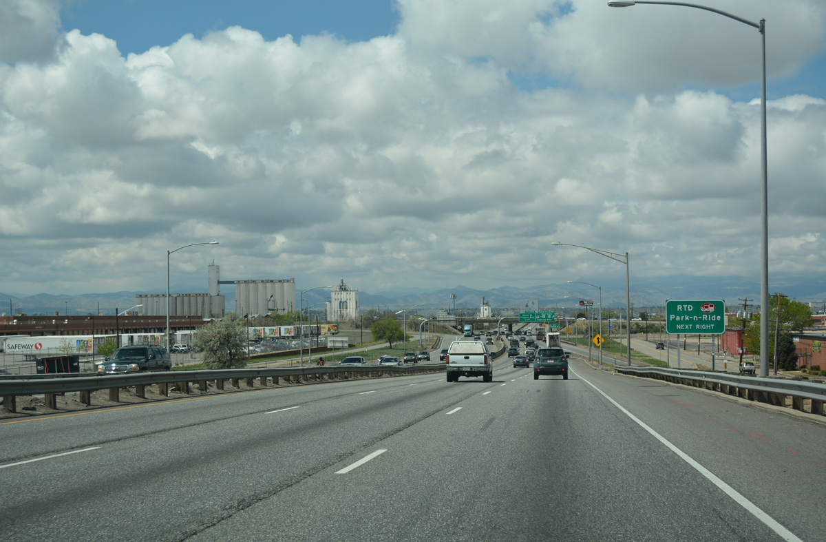
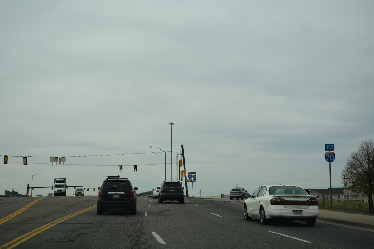
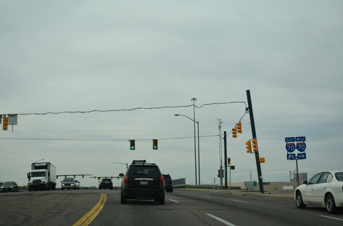
The six lane freeway alomg Interstate 70 through northern Denver is part of what used to be the SH 72 expressway. The expressway was built in the mid-1960s between Sheridan Boulevard (SH 95) to the west, and Colfax Avenue (Business Loop I-70 and U.S. 40-287) to the east. While several portions of old construction for SH 72 were superseded by a variety of reconstruction projects, parts of the original freeway remained, including the 46th Avenue Viaduct, and portions near the east end of Interstate 270. The Central 70 Project rebuilt ten miles of the freeway leading east from I-25 (Mousetrap Interchange) to Tower Road in the Gateway area. The $1.2 billion project ran from 2018 to late 2022, with final punch list items completed in 2023.
Originally, Interstate 70 in Colorado was planned to end in Denver from the east. This was due to the lack of interest in neighboring Utah for a connecting route along what was then U.S. 6-50. Officials from Colorado and Utah negotiated the concept of creating such a route, despite the enormous costs to construct the route through the mountains in both states. In October 1956, the federal government approved such a route, which would connect I-25 with Interstate 15 near Cove Fort, Utah. Plans never called for any further extension of I-70 west, although some have offered fanciful proposals.
Between 1956 and 1992, Interstate 70 in Colorado was under construction. The very first segment was constructed in Denver, along the route of 46th Avenue in the northeastern part of the city. Construction started in 1961 and this section opened on September 12, 1964. The first segment of I-70 to be completed west of the Continental Divide was between Clifton and the interchange with SH 65 in 1963. The final section to be completed and opened to traffic was in Glenwood Canyon. Officials descended on the canyon to dedicate this link in October 1992.
While construction continued on Interstate 70, incomplete segments used portions of old U.S. 6 in. The freeway was initially constructed with two-way traffic on just two lanes with interchanges in some cases. Examples of this included the section between Agate and the West Limon Bypass (completed with two lanes in 1963, and widened to four lanes in 1968) and the section between Seibert and Bethune (two lanes opened in 1966, four lane freeway completed in 1971).
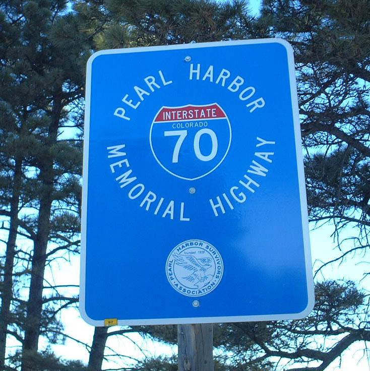
Many superlative achievements occurred on Interstate 70 in Colorado. The freeway was an engineering marvel as it weaved through and around mountains, and it was perhaps the most famous for its Continental Divide tunnel. Originally planned as the Straight Creek Tunnel, the Eisenhower - Johnson Memorial Tunnel is the formal name for the two tunnels that burrow under Loveland Pass. The original tunnel was the Eisenhower Tunnel, which is the westbound lanes of Interstate 70. Construction of this tunnel began in 1968; it was completed and opened to traffic on March 8, 1973. The second tunnel bore is the Edwin C. Johnson Tunnel. It was constructed between 1972 and 1980. Tunnels were constructed in several other locations along Interstate 70, including Beavertail (near De Beque), Glenwood Canyon and Idaho Springs. Also a three mile section of Tenmile Creek west of Frisco had to be channeled onto a new stream bed.
According to Colorado Department of Transportation 50th Anniversary of the Interstate Highway System web page, the completion of the Glenwood Canyon segment marked the final link in the mainline Interstate Highway System (excluding spur, bypass, and other three-digit Interstates). The Glenwood Canyon section of Interstate 70 provides plenty of recreation opportunities, including a bikepath for the entire length and four CDOT rest areas. The section of I-70 over Vail Pass also features a bike path.
Dates on which each section of Interstate 70 was opened, from the Utah State Line to the Kansas State Line:
| Section | Distance | Completion Date |
|---|---|---|
| From Utah State Line east to Mack | 11 miles | 1973 |
| From Mack east to Fruita | 8 miles | 1972 |
| From Fruita east to 22 Road | 6 miles | 1969 |
| From 22 Road east to Horizon Drive | 5 miles | 1967 |
| From Horizon Drive east to Clifton | 6 miles | 1965 |
| From Clifton east to SH 65 | 12 miles | 1963 |
| From SH 65 east to De Beque | 13 miles | 1989 |
| From De Beque east to Parachute | 13 miles | 1984 |
| From Parachute east to Rulison | 6 miles | 1983 |
| From Rulison east to the West Rifle Interchange | 6 miles | 1980 |
| From the West Rifle Interchange east to Silt | 11 miles | 1976 |
| From Silt east to New Castle | 8 miles | 1973 |
| From New Castle east to Chacra | 4 miles | 1971 |
| From Chacra east to Glenwood Springs | 7 miles | 1971 |
| From Glenwood Springs east to No Name | 3 miles | 1966 |
| From No Name east to the East End of Glenwood Canyon | 12 miles | 1992 |
| From East End of Glenwood Canyon to Gypsum | 7.8 miles | 1980 |
| From Gypsum east to Eagle | 8 miles | 1979 |
| From Eagle east to Wolcott | 10 miles | 1973 |
| From Wolcott east to Avon | 10 miles | 1971 |
| From Avon east to Dowd Junction (U.S. 24) | 4 miles | 1970 |
| From Dowd Junction east to East Vail | 6 miles | 1968 |
| From East Vail east to Wheeler Junction via Vail Pass | 15 miles | 1969 |
| From Wheeler Junction east to Frisco via Tenmile Canyon , including SH 91 interchange | 6 miles | 1979 |
| From Frisco to Silverthorne | 5 miles | 1972 |
| From Silverthorne to the west portal of the Eisenhower-Johnson Memorial Tunnels | 7 miles | 1973 |
| Eisenhower-Johnson Memorial Tunnels | 1.7 miles | 1973, 1980 |
| From east portal of the Eisenhower-Johnson Memorial Tunnels to Silver Plume | 10 miles | 1972 |
| From Silver Plume east to Exit 232, U.S. 40 near Empire | 6 miles | 1968 |
| From Exit 232, U.S. 40 east to Idaho Springs (west entrance, Business Loop I-70) | 7 miles | 1966 |
| Idaho Springs Bypass, from west entrance to east entrance | 2 miles | 1961 |
| From Idaho Springs (west entrance) east to Exit 244, U.S. 6 | 3 miles | 1961 |
| From Exit 244, U.S. 6 east to Beaver Brook | 4 miles | 1975 |
| From Beaver Brook east to SH 74, Evergreen Parkway/El Rancho | 4 miles | 1972 |
| From SH 74 east to Genesee Mountain Interchange | 2 miles | 1972 |
| From Genesee Mountain Interchange east to Lookout Mountain Interchange | 2.4 miles | 1970 |
| From Lookout Mountain Interchange to SH 26 and Business Loop I-70 ( Mount Vernon Canyon ) | 2.8 miles | 1970 |
| From SH 26 and Business Loop I-70 ( Mount Vernon Canyon ) east to Business Loop I-70 / U.S. 40, West Colfax Avenue | 2.9 miles | 1969 |
| From Business Loop I-70 / U.S. 40, West Colfax Avenue east to Exit 266, SH 72, Ward Road | 4 miles | 1970 |
| From Exit 266, SH 72, Ward Road east to Exit 267, SH 391, Kipling Street | 1.7 miles | 1968 |
| From Exit 267, SH 391, Kipling Street east to Exit 269, SH 121, Wadsworth Boulevard | 2 miles | 1968 |
| From Exit 269, SH 121, Wadsworth Boulevard east to Exit 271, SH 95, Sheridan Boulevard | 2 miles | 1967 |
| From Exit 271, SH 95, Sheridan Boulevard east to Exit 272, U.S. 287, Federal Boulevard | 1 mile | July 9, 1966 |
| From Exit 272, U.S. 287, Federal Boulevard east to Exit 274, Interstate 25/U.S. 6-85-87 | 2 miles | December 10, 1965 |
| From Exit 274, Interstate 25 / U.S. 6-85-87 east to Exit 276, SH 2 ( Colorado Boulevard ) | 2.6 miles | September 12, 1964 |
| From Exit 276, SH 2 ( Colorado Boulevard ) east to Exit 281, Peoria Street | 5 miles | 1965 |
| From Exit 281, Peoria Street east to Exit 288, Business Loop I-70 and U.S. 40-287, East Colfax Avenue | 7 miles | 1966 |
| From Exit 288, Business Loop I-70 and U.S. 40-287, East Colfax Avenue east to Watkins | 7 miles | 1977 |
| From Watkins to Bennett | 9 miles | 1963 |
| From Bennett east to Byers | 12 miles | 1964 |
| From Byers east to Deer Trail | 12 miles | 1967 |
| From Deer Trail east to Agate | 12 miles | 1968 |
| From Agate east to West Limon Bypass | 19 miles | 1963, 1968 |
| West Limon Bypass | 3.5 miles | 1975 |
| East Limon Bypass | 3.8 miles | 1975 |
| From East Limon Bypass east to a point west of Genoa | 4.2 miles | 1975 |
| From a point west of Genoa to a point east of Genoa | 4 miles | 1975 |
| From a point east of Genoa east to Flagler | 24 miles | 1975 |
| From Flagler east to Seibert | 10 miles | 1974 |
| From Seibert east to Bethune | 25 miles | 1966, 1971 |
| From Bethune to Burlington | 8 miles | 1967 |
| From Burlington to Kansas State Line | 14 miles | 1969 |
 scenes scenes |
 | The Grizzly Creek rest area resides between the elevated lanes of Interstate 70 at milepost 121, and the north banks of the Colorado River. A frontage road connects with the I-70 ramps west to Glenwood Springs and east to Gypsum. 08/11/16 |
 | A second set of shields for I-70 direct motorists from the east side of the Grizzly Creek rest area and nearby trail head parking lot. 08/11/16 |
 | I-70 trailblazer posted ahead of the eastbound on-ramp from Grizzly Creek. 08/11/16 |
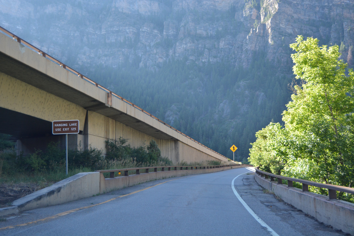 | Partial interchanges lie east of Grizzly Creek at both Shoshone and Hanging Lake. A small guide sign references Exit 125 along the eastbound on-ramp. 08/11/16 |
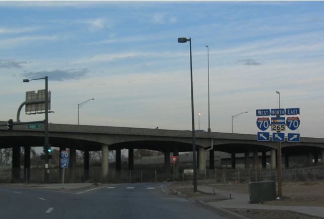 | SH 265 (Brighton Boulevard) north begins at the diamond interchange with Interstate 70 (Exit 265) in the Elyria Swansea neighborhood of Denver. 11/10/03 |
 | Chambers Road north at the diamond interchange (Exit 283) with Interstate 70 in northeast Aurora. 04/23/17 |
 | Heading south from Montbello in northeast Denver, Chambers Road enters the city of Aurora along a commercialized stretch preceding Interstate 70. 04/23/17 |
   | Interstate 70 enters the city of Denver just west of Chambers Road at Interstate 225. The freeway east continues through Aurora to milepost 300. 04/23/17 |
 | Tower Road south at the diamond interchange (Exit 286) with Interstate 70 in east Aurora. Tower Road was formerly SH 32 south from I-70 to Business Loop I-70 (Colfax Avenue). 04/23/17 |
 | SH 36 separates from I-70/U.S. 36-40-287 at Exit 292 in northeast Aurora. The state highway initially runs along the north side of I-70 to Watkins. 07/04/12 |
Photo Credits:
11/10/03, 07/04/12, 08/11/16, 04/23/17 by AARoads
Connect with:
Interstate 25
Interstate 76
Interstate 225
Interstate 270
U.S. 6
U.S. 36
U.S. 40
U.S. 50
U.S. 85
State Highway 121 - Wadsworth Boulevard
Page Updated 02-01-2022.