
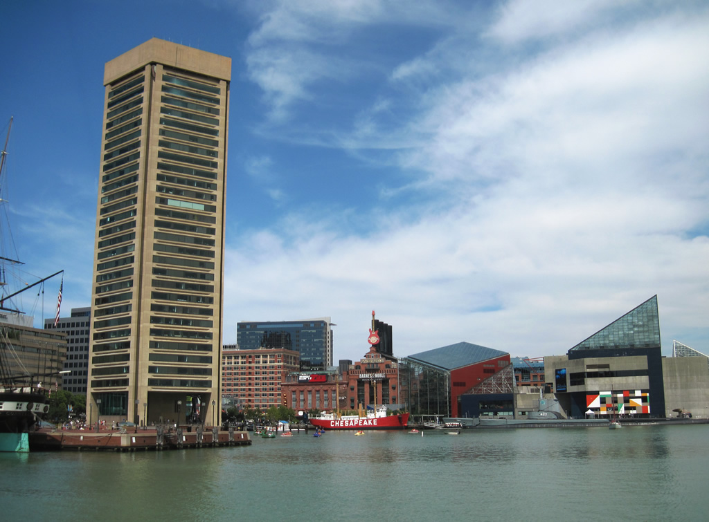
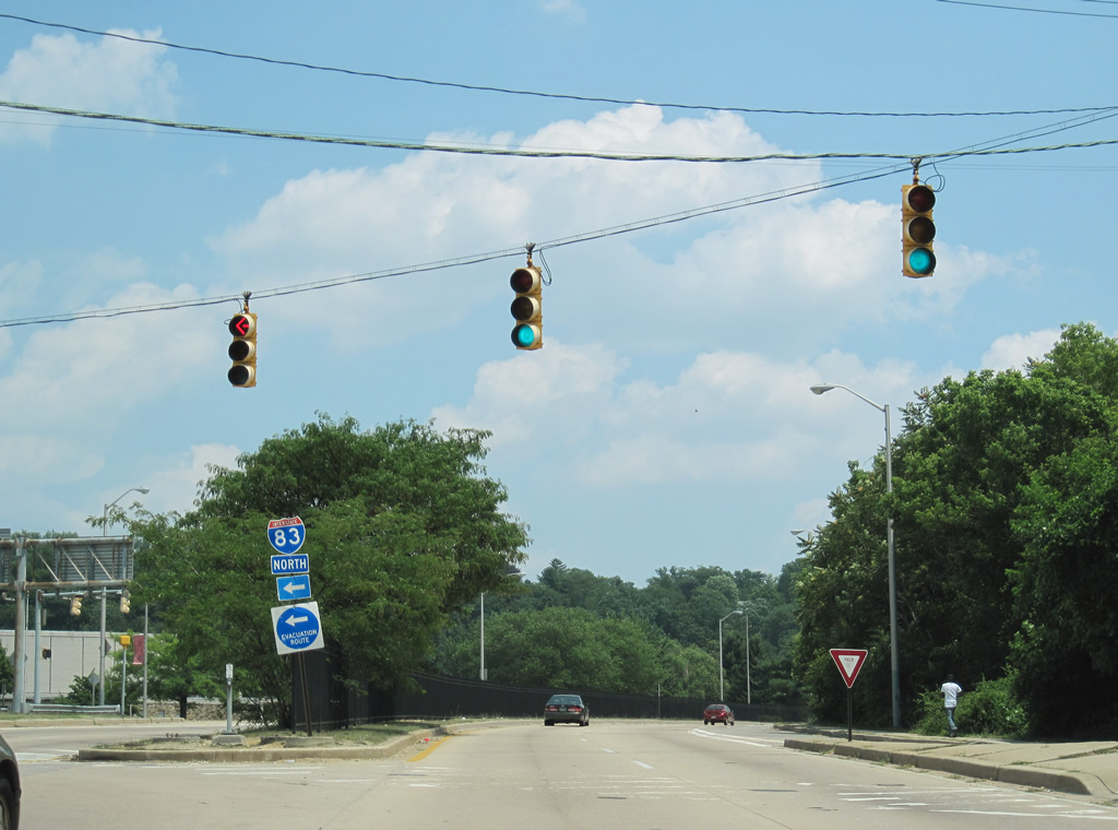
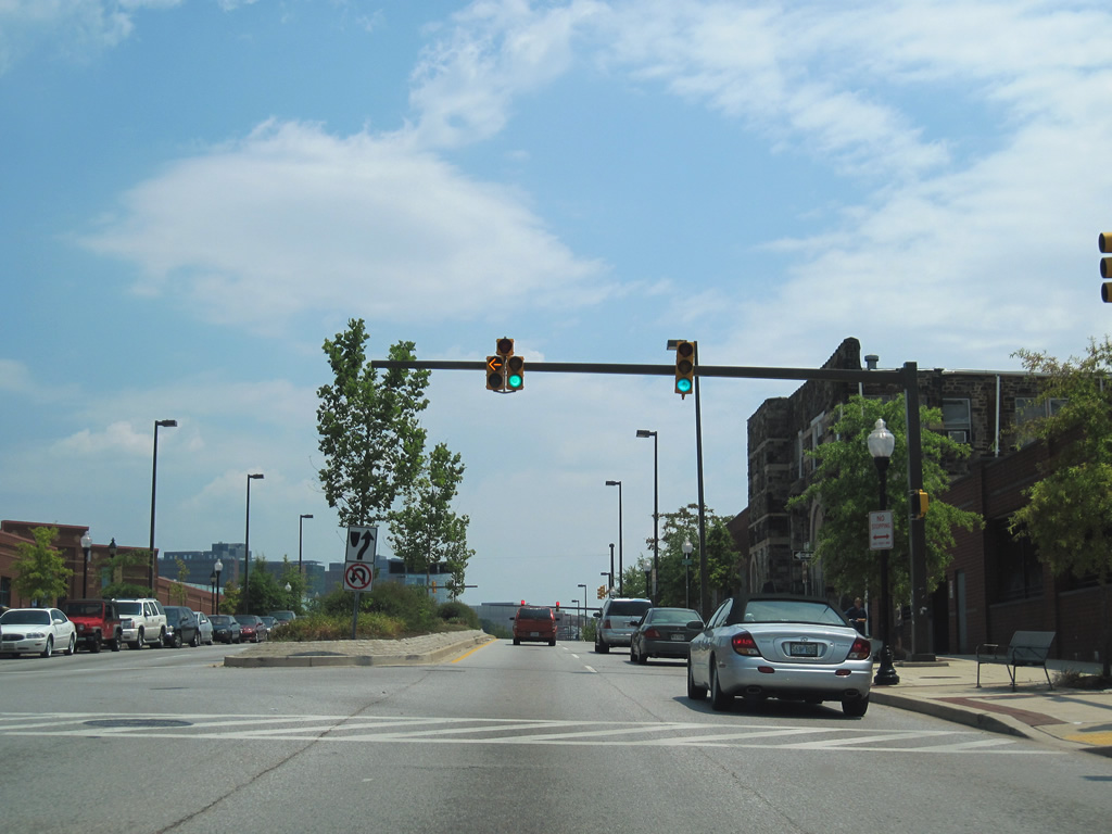
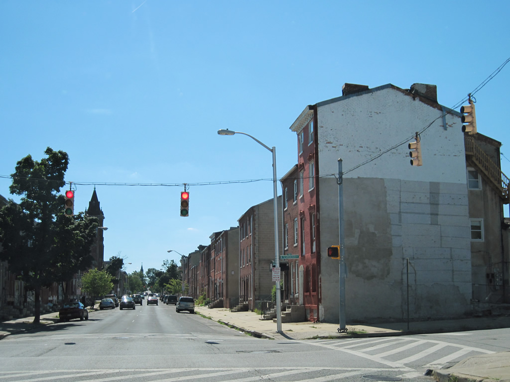
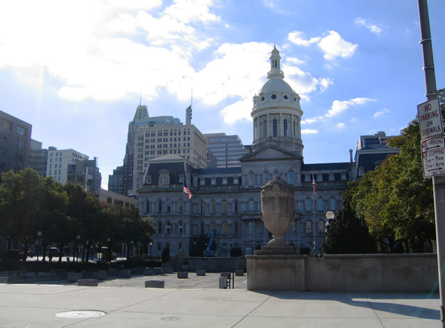
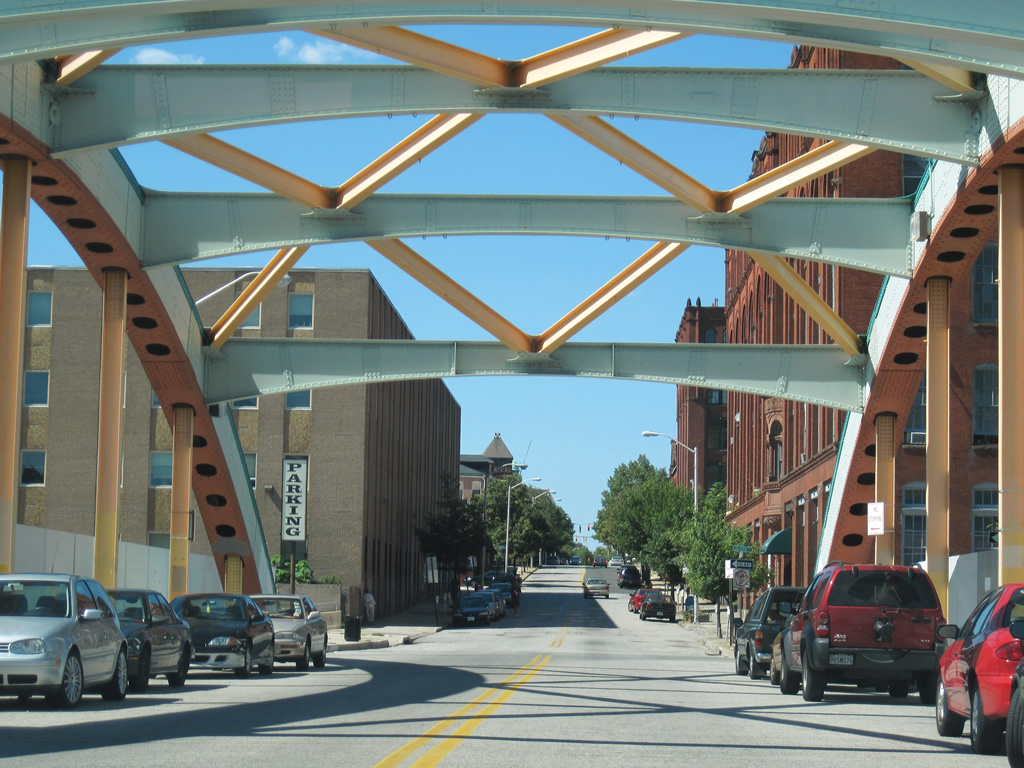
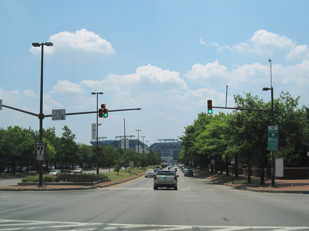
The Inner Harbor represents the core tourist destination for the city of Baltimore. Downtown area attractions include the National Aquarium, the USS Constellation, the USS Torsk, Harborplace mall, and the World Trade Center. 06/30/10
Interstates

Guides:
Interstate 70
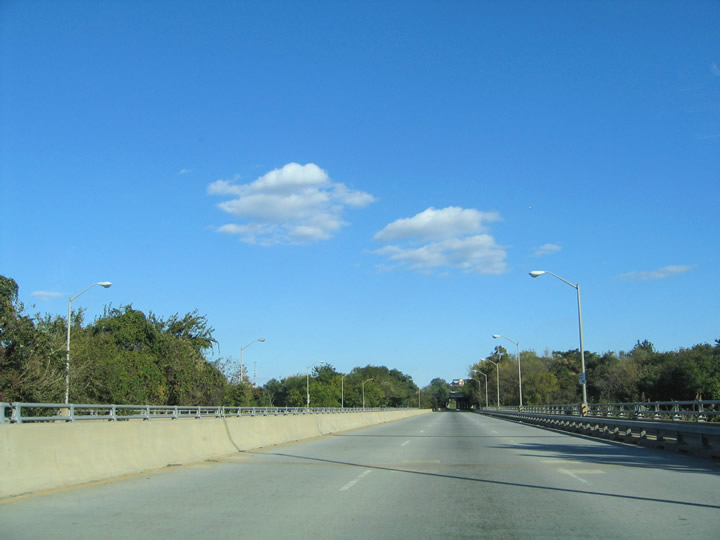
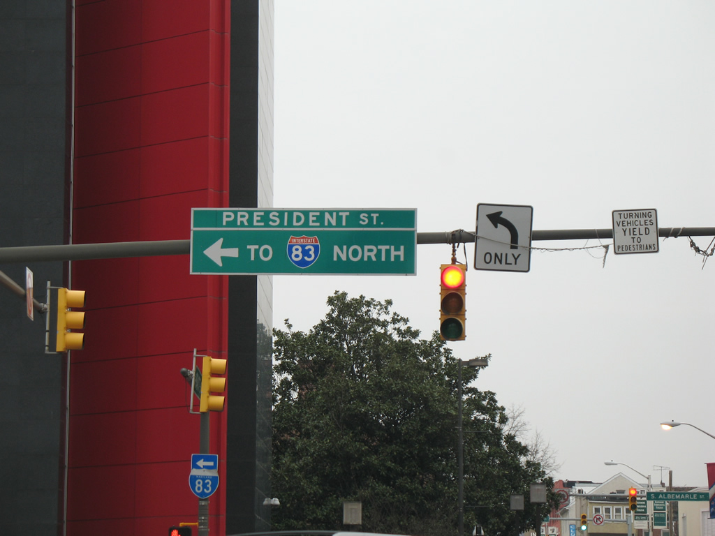
Designated as Interstate 70N (I-70S was assigned to I-270 leading southeast from Frederick to I-495) until 1973, I-70 joins Baltimore with Frederick, Hagerstown and Pittsburgh, Pennsylvania to the west. The freeway was proposed to continue east through western reaches of Baltimore to end at Interstate 95 east of Caton Avenue.
The initial plan for Interstate 70N east into Baltimore outlined an easterly route utilizing a portion of the U.S. 40 (old I-170 freeway) east to Arlington Avenue. This alignment concluded Interstate 70 just west of an interchange with MD 295 (Baltimore-Washington Expressway). A subsequent plan shifted the freeway onto a more southeasterly track to end at Interstate 95 between Caton Avenue and Washington Boulevard, with a freeway spur (Interstate 170) extending east along U.S. 40. Beyond provisions made for the proposed interchange with I-95, only a short section of the I-170 freeway was ever built for Interstate 70 within the city of Baltimore.

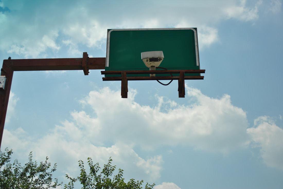
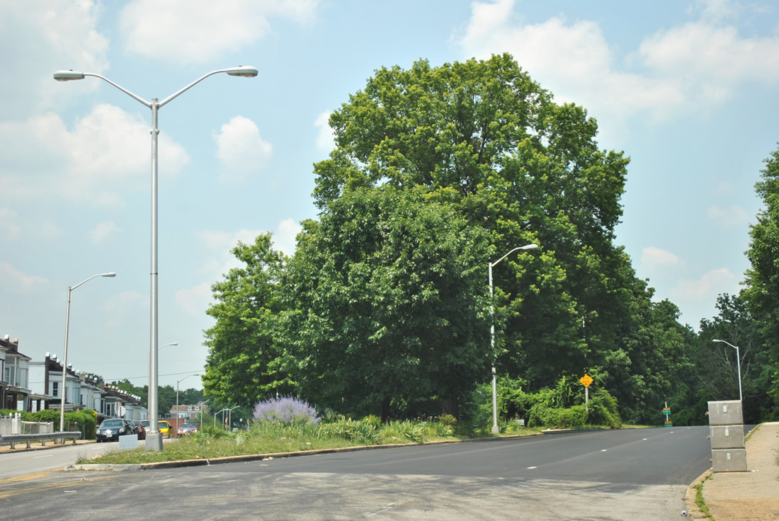
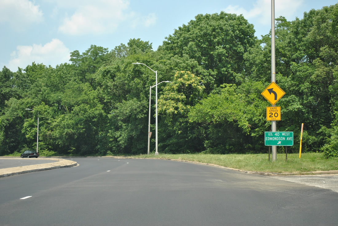
This span wire sign found along U.S. 40 (Edmondson Avenue) in 1994 referenced Interstate 70N, the former designation for I-70 between Frederick and Baltimore. This sign, and a similar assembly posted elsewhere along Edmondson Avenue westbound, was replaced by the mid 2000s.
Interstate 70N opened 12 miles west from the Baltimore city line in 1968. The six lane freeway directly replaced portions of U.S. 40 west to Frederick. Cancellation of the route east to Interstate 170 occurred in 1981, though a small section south from I-170 to I-95. remained planned until 1983
East of the Baltimore Beltway, I-70 spurs to a park and ride lot located east of MD 122 (Security Boulevard) and west of Gwynns Falls Park. As approved by AASHTO on May 29, 2014, this section of freeway was officially dropped from the Interstate system.

Guides:
Former Interstate 170
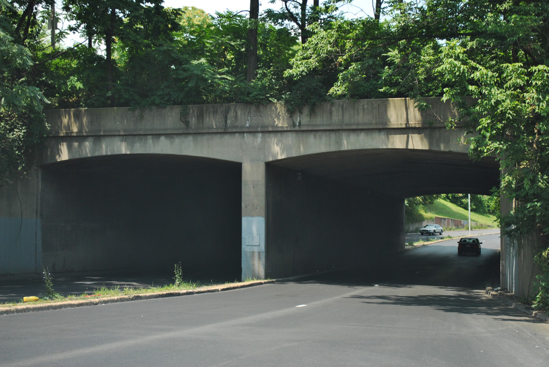
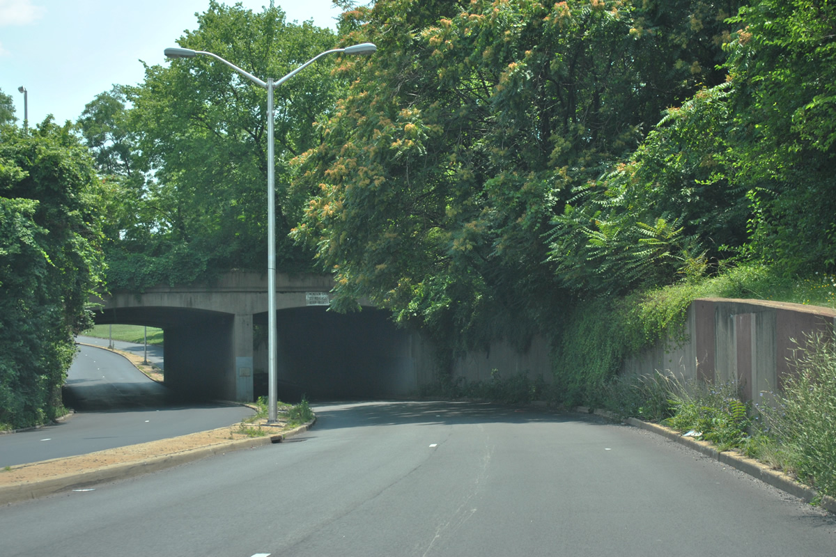
Interstate 170 was to link the second proposal of I-70 from the west with northern reaches of the Baltimore central business district via Martin Luther King, Jr. Boulevard and U.S. 40 to the east. 1.4 miles of the freeway, from Smallwood Street to Greene Street (MD 295), opened to traffic in 1979. The remaining 0.9 miles of freeway west to unconstructed Interstate 70 were never built.
When plans for I-70 east from the city line were canceled in 1981, it left I-170 without a connection to the Interstate system. A separate proposal remained in consideration for two years, outlining a freeway link south from the I-170 west end to Interstate 95. The 1.8 mile alignment of proposed freeway, and the existing Interstate 170 were to be redesignated as Interstate 595. Community opposition remained strong though, and that proposal was ultimately dropped.
Despite not connecting to its parent, Interstate 170 remained signed until 1989. During that time, the route was decommissioned, with U.S. 40 shifted from parallel frontage streets to overtake the below grade freeway.3 Despite community efforts calling for the removal of the freeway in the late 1970s, the highway remains in place with traffic counts topping out at 40,000 vehicles per day.
The I-170 right of way included provisions for a light rail lane between the east and westbound carriageways. The metro line remains unbuilt, though construction at the west end leveled a portion of the unbuilt roadway to accommodate new commuter parking lots.

Guides:
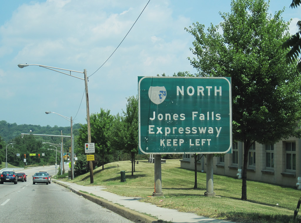
Jones Falls Expressway
Traveling 85 miles overall, Interstate 85 runs north from Baltimore to York and Harrisburg, Pennsylvania. The 34.5 mile portion in Maryland utilizes the Jones Falls Expressway within the Baltimore Beltway (I-695) and the Baltimore-Harrisburg Expressway between Interstate 695 and the state line. The Baltimore-Harrisburg Expressway predates the Interstate system as the alignment for U.S. 111 north to Pennsylvania. The first section opened to traffic by 1955 from the beltway north to Shawan Road (Exit 20).1
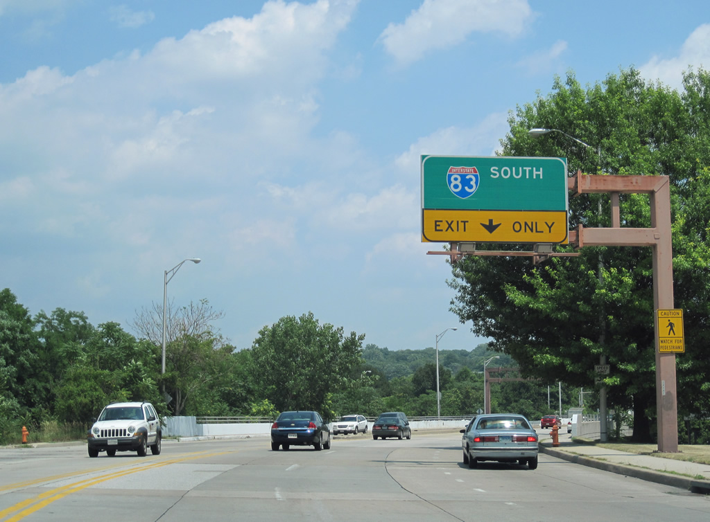
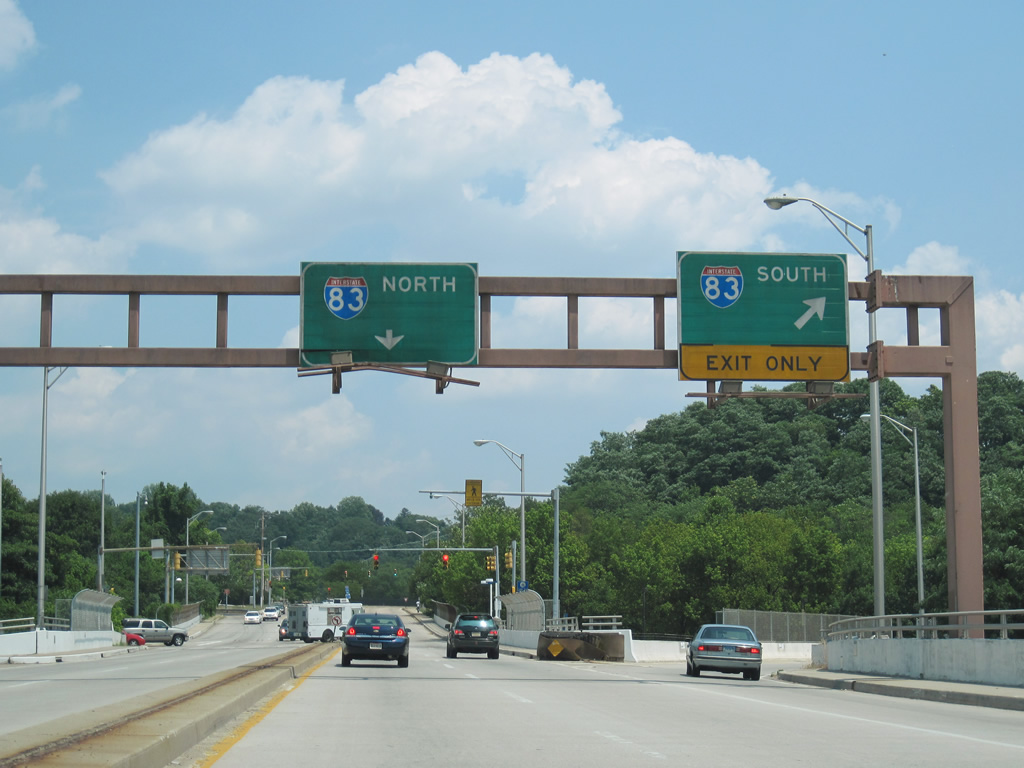
Although two plans called for directly linking the Baltimore-Harrisburg Expressway with the Jones Falls Expressway independent of the Baltimore Beltway, those never came to fruition. Instead I-83 briefly dog legs west along side I-695 between Exits 23 and 24 to continue south into Baltimore.
Southward, Interstate 83 overtakes the Jones Falls Expressway from a spur originating at MD 25, to Druid Hill Park, Bolton Hill and an alignment east of the central business district. Original plans called for the freeway to swing east through historic Fells Point to directly link with Interstate 95 near Canton. This alignment was dropped due to community opposition and difficulties with right-of-way acquisition. Remnants of the plan remain at the interchange joining I-95 with Boston and O’Donnell Streets.
The Jones Falls Expressway was completed from I-695 south to Guilford Avenue by 1963 and to Monument Street by 1983.1 After lengthy delays, the elevated portion south to Fayette Street was finished in 1990.1

Guides:
JFK Memorial Highway / Fort McHenry Tunnel
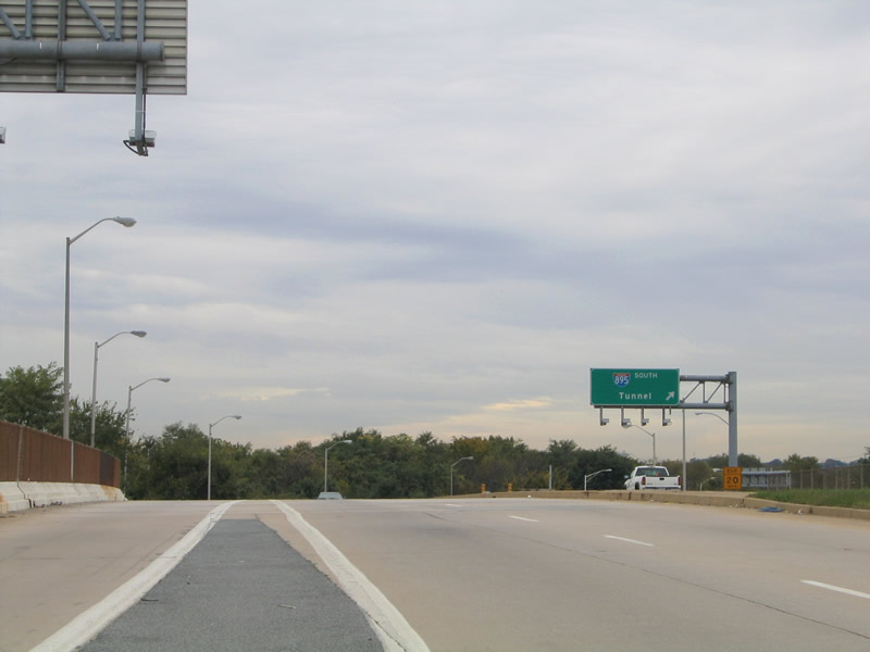
Interstate 95, “East Coast’s Main Street,” joins Baltimore with Washington, DC to the south and Wilmington, Philadelphia and New York to the north. Traveling with a minimum of six overall lanes, I-95 serves both commuter and through traffic throughout the Baltimore-Washington area.
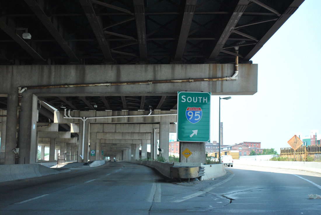
Construction of Interstate 95 was completed from the Capital Beltway outside Washington to Interstate 695 (Baltimore Beltway) by 1971. Early 1960s plans for the route across Baltimore followed a more northerly course through Fells Point. Reducing impacts to area neighborhoods, the alignment was eventually shifted southward to cross the Northwest Harbor of the Patapsco River at Fort McHenry. Until completion of the tolled Fort McHenry Tunnel in 1985, through-traffic across Baltimore defaulted onto the 1957-completed Baltimore Harbor Tunnel Thruway.
Heading northeast toward Elkton, Interstate 95 opened as the Northeast Expressway on November 14, 1963. Completion of the toll road coincided with opening of the Delaware Turnpike east to the Delaware Memorial Bridge (via Interstate 295). Renamed the John F. Kennedy Memorial Highway, ramp tolls were collected along I-95 at interchanges between MD 43 and Delaware State Route 141 until the 1980s. Tolls are still collected at main line plazas located northbound after the Millard Tydings Bridge over the Susquehanna River and in both directions east of the state line near Newark.
Major reconstruction along Interstate 95 took place between 2007 and 2014 as part of the I-95 Express Toll Lanes project. Work reconfigured the wye interchange with Interstate 895 (Baltimore Harbor Tunnel Thruway) near Moravia Road to move the split from the left-hand side of I-95 southbound to the right. This coincided with expansion of I-95 from Baltimore east to MD 43 with the addition of four toll lanes running between the eight general travel lanes.
The exchange joining Interstates 95 and 695 was also redesigned into a multi-level interchange with high speed flyovers. The work eliminated left-hand ramps between the two freeways and realigned the carriageways of I-95 so that they no longer switched places above I-695. The Express Toll Lanes use all electronic toll collection requiring motorists to have E-ZPass transponders. The lanes opened to traffic on December 6, 2014.

Guides:
Interstate 195 – Metropolitan Boulevard
A 4.71 mile long freeway linking Thurgood Marshall Baltimore-Washington International Airport (BWI) with Interstate 95 and MD 166 near Catonsville, I-195 was fully completed on June 20, 1990. This freeway varies between four and six lanes and carries a 60 mile per hour speed limit.
Interstate 195 was approved by AASHTO in 1975, to link the separate freeway for MD 46 and MD 166. The southern spur connected then-Friendship International Airport with MD 295 (Baltimore-Washington Parkway), while MD 166 traveled along Metropolitan Boulevard north from U.S. 1 to I-95 and the campus of the University of Maryland – Baltimore County. Patapsco Valley State Park fell within the 1.5 mile gap between the two routes, resulting in extended environmental study and the lengthy time frame for completion of the freeway link.

Guides:
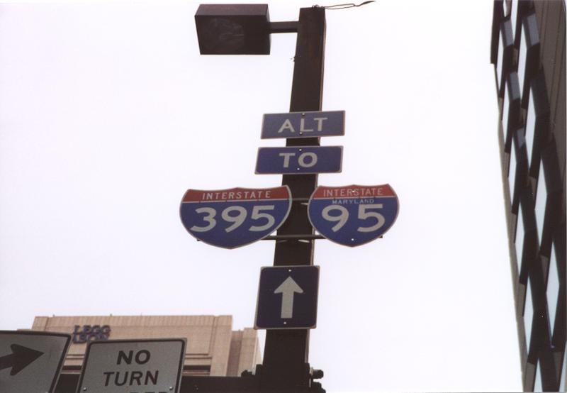
Interstate 395
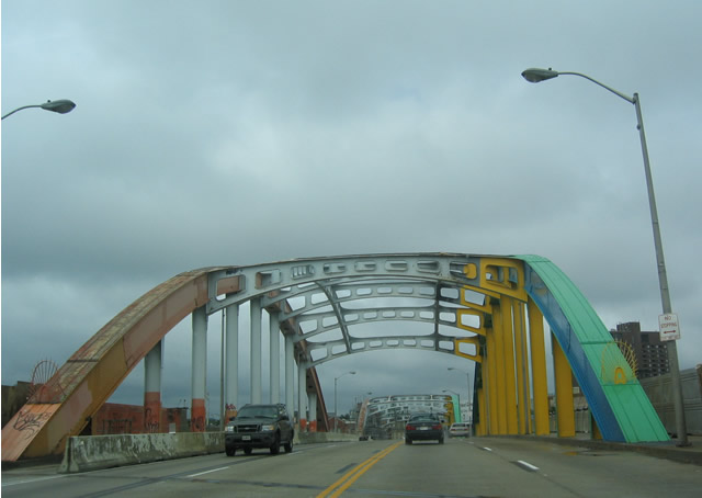
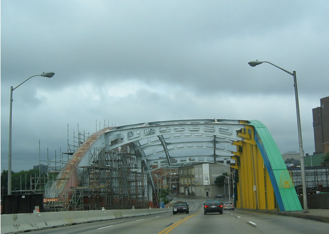
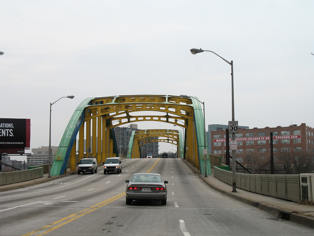
Interstate 395 constitutes a two pronged freeway connecting the Inner Harbor and Martin Luther King Jr., Boulevard with I-95 west of the Fort McHenry Tunnel. The split branches come together just east of M&T Bank Stadium (home of the Baltimore Ravens NFL franchise), funneling stadium and tourist based traffic to Interstate 95 for an exit of the city. The route opened to traffic on December 9, 1982.

Interstate 395 begins above the waters of the Patapsco River Middle Branch at a semi-directional T interchange with I-95. The freeway proceeds northward a short distance before separating into two branches. The western branch merges directly with Martin Luther King, Jr. Boulevard, a six-lane urban arterial arcing north to U.S. 40 (former Interstate 170) and Central Baltimore. The eastern branch serves the Inner Harbor area via Howard Street north and Conway Street east to Calvert Street (MD 2).

Guides:
Baltimore Beltway
Interstate 695 encircles the city of Baltimore from Towson to the north to Dundalk and Glen Burnie to the south. The 51.5-mile loop constitutes a suburban route for most of its course north of I-95 and an industrial route to the south of I-95. 30.57 miles of the beltway are included within the Interstate system, while a 19.37 mile section, from Exit 33 south and west to Exit 4, are officially MD 695, but signed as I-695.3
Initial work on the Beltway commenced in 1951 on the stretch between MD 295 and MD 168 (Nursery Road). State officials took over the county-based project by 1953,3 and the beltway opened between Exits 4 and 7 and Exits 23 and 27 by 1958. During that same year, the beltway was designated Interstate 695.
Work on the beltway north of Interstate 95 was completed by July 1962. Construction on the route south of Interstate 95 would follow slowly under the designation of MD 695. The state route-based freeway opened between Exits 2 and 3 and Exits 35 and 39 by 1973. Completion of the route coincided with the opening of the Francis Scott Key Bridge on March 23, 1977.
Late 1990s and early 2000s projects focused on the expansion and modernization of the Baltimore Beltway. These projects involved widening the highway from six to eight lanes on the northern portion of the highway, expanding the two-lane section near Sparrows Point, and installing sound barriers throughout the route.
The Francis Scott Key Bridge, a continuous through truss bridge shaped with a steel arch, crosses the Patapsco River as it empties into Chesapeake Bay. Representing milepost zero for the beltway exit numbering system, the Key Bridge is tolled in both directions.

Guides:
Northwest Expressway
Known as the Northwest Expressway, Interstate 795 links the Baltimore Beltway (Interstate 695) with the northwestern suburbs of Reisterstown, Owings Mills and Westminster via MD 140. Southernmost reaches of the freeway, from Exit 4 (Owings Mill Station) to I-695, parallel the Baltimore Metro Line, including a section where the transit corridor occupies the freeway median. I-795 varies with six lanes to the south and four lanes along the northernmost portion.
Interstate 795 opened initially from Interstate 695 to Owings Mill Boulevard in November 1985. Completion of the entire route followed in October 1986.
Planning for the Northwest Expressway included an extension of the route southeast from I-695 and over Wabash Avenue from Northern Parkway to MD 140 (Reisterstown Road), near the Cold Spring Metro Station. Due to community opposition, the project was canceled in 1973.

Guides:
Baltimore Harbor Tunnel Thruway
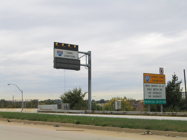
The Baltimore Harbor Tunnel Thruway opened on November 30, 1957. The 15-mile long toll road provides an alternate route to Interstate 95 and the Fort McHenry Tunnel through central Baltimore. Carrying just four overall lanes, the limited access highway includes a rural type stretch signed with 65 mile per hour speed limits along the southernmost portion of I-895. The K-Truss Bridge spans a CSX Railroad yard east to the Harbor Tunnel toll plaza.
The Harbor Tunnel descends to a maximum depth of 101 feet above the Patapsco River. The four-lane tunnel emerges ahead of the Canton Viaduct, which leads I-895 north back to Interstate 95 through eastern Baltimore.
The Harbor Tunnel was the first of three Interstate-grade crossings over or under the Patapsco River. Tolled in both directions of travel, the Harbor Tunnel totals 7,392 feet in length. Tolls increased to $4.00 per passenger vehicle on July 1, 2013.
Two Spurs of Interstate 895 (Baltimore Harbor Tunnel Thruway) connect the Patapsco River crossing with Interstate 97 (Glen Burnie Bypass) and MD 2 (Governor Richie Highway) to the south. These are generally unsigned, though a reassurance shield was once posted on the southbound off-ramp for Interstate 895 Spur. The spurs shuttle traffic southward to Anne Arundel County and northward from the connecting routes. There are no exits on the I-895 Spurs, nor in the northbound direction of the I-895 mainline until after the tunnel.

Guides:
Interstate 97
Measuring just 17.53 miles in length, Interstate 97 was first approved by AASHTO in 1975 from proposed Interstate 68 north to Interstate 695 (Baltimore Beltway). The route included the Glen Burnie Bypass (MD 3), an older freeway built between 1954 and 1957, and upgraded between 1994 and 1996. The route south from there to MD 3 and 32 was completed in 1989, and the new alignment southeast to U.S. 50/301, outside Annapolis, opened to traffic in 1991. The highway links southern Baltimore with Annapolis and the Bay Bridge/Eastern Shore area.
Designation of Interstate 97 resulted in the truncation of MD 3 south to Millersville. Business MD 3 runs north of that location, serving Glen Burnie to the east of I-97.
U.S. Highways

Guides:
Washington Blvd / North Av / Bel Air Rd
Through the Baltimore metro area, U.S. 1 follows its original alignment. Traveling Washington Boulevard northeast from Waterloo, the US route meets Interstate 195 just east of the Patapso River and Howard County line. U.S. 1 then splits with Washington Boulevard (U.S. 1 Alternate) and joins Southwestern Boulevard north to Arbutus and an entrance into Baltimore city.
Once in Baltimore, U.S. 1 quickly overtakes Wilkens Avenue from MD 372 and turns eastward to the one-way couplet of Fulton Avenue and Monroe Street. Scores of row homes line much of the alignment through to its turn onto North Avenue.
Doubling as a truck route for U.S. 40, North Avenue takes U.S. 1 east with up to six lanes along a commercial boulevard from Monroe Street (former U.S. 140). Gay Street angles northeast from Biddle Street to become Bel Air Road, where U.S. 1 turns northeast from North Avenue. Bel Air Road derives its name from the Harford County seat and the destination of U.S. 1 leading northeast from the city.
U.S. 1 Alternate constitutes a 3.92 mile long loop from U.S. 1 along Washington Boulevard northeast to the five point intersection with Caton Avenue north, Patapsco Avenue east and Hammonds Ferry Road south, located just inside Baltimore. Although not signed within Baltimore, U.S. 1 Alternate lines Caton Avenue back to U.S. 1 (Wilkens Avenue) near Violetville.


Guides:
Columbia Pike
U.S. 29 ends at the intersection with MD 99 (Old Frederick Road) just north of Interstate 70 at Exit 87 in Howard County. The US highway comprises a full freeway southward from I-70 to Columbia and Burtonsville in Montgomery County. Several upgrades were made to bring U.S. 29 to limited access standards during the 1990ss.
Prior to 1955, U.S. 29 extended east from Ellicott City to Baltimore. U.S. 29 followed a shared alignment with U.S. 40 east from Old Columbia Pike along Frederick Road through Catonsville to Frederick Avenue in the city. This alignment was redesignated as MD 144.

Guides:
National Pk / Edmondson Av / Orleans St / Pulaski Hwy
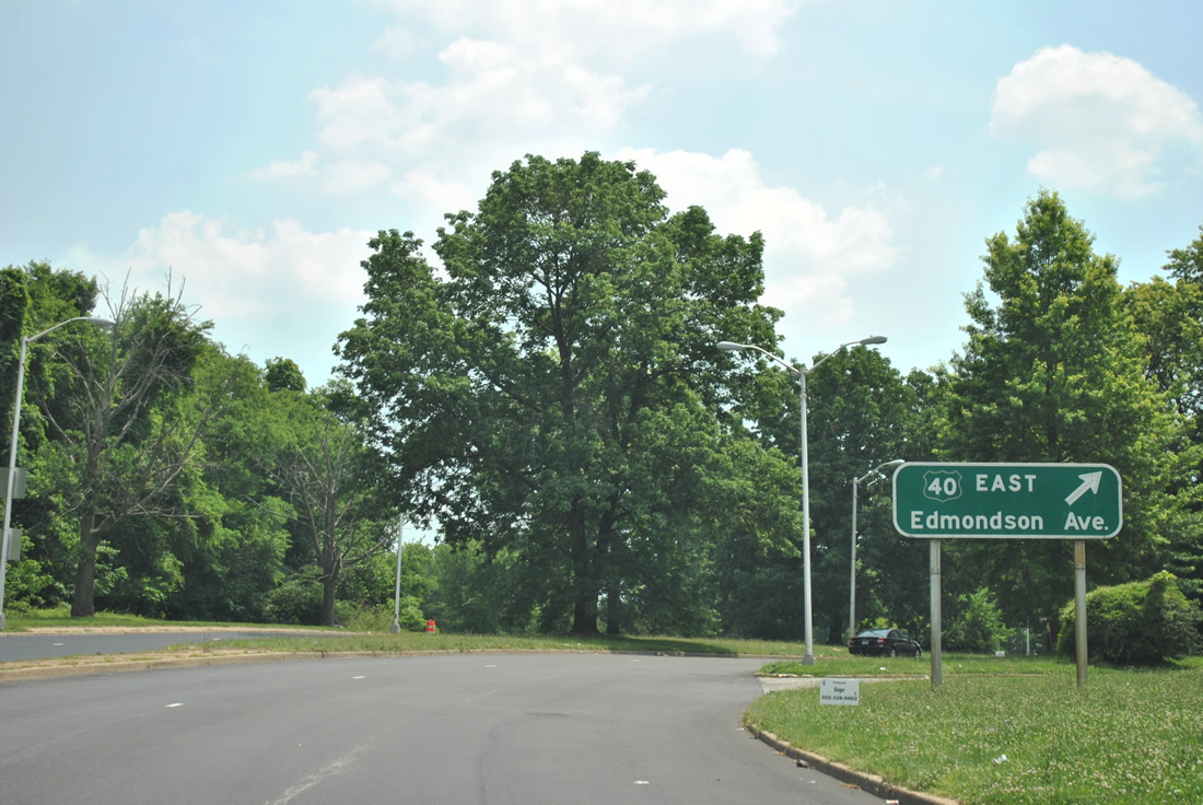
U.S. 40 overlaps with I-70 east from Frederick into Howard County. The US highway separates from the freeway at Exit 82 to follow Baltimore National Pike east to Ellicott City. MD 144 (Frederick Road) west from there represents the pre-freeway alignment.
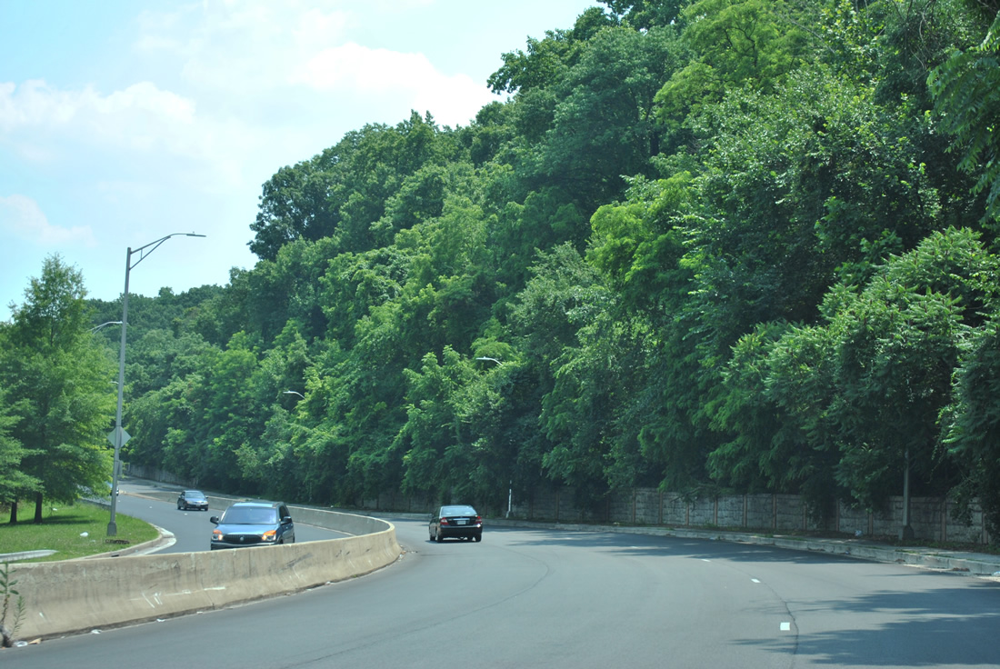
Crossing the Patapso River, U.S. 40 enters Baltimore County and continues along Baltimore National Pike onto Edmondson Avenue through west Baltimore. Frederick Road (MD 144) parallels to the south as the previous alignment.
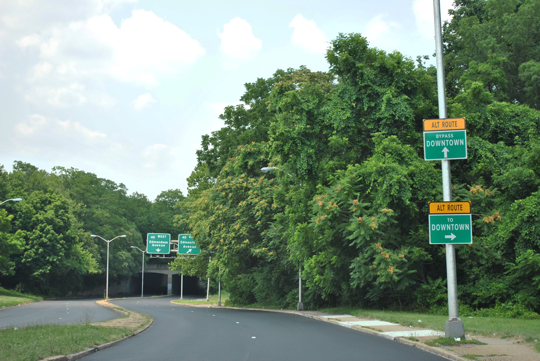
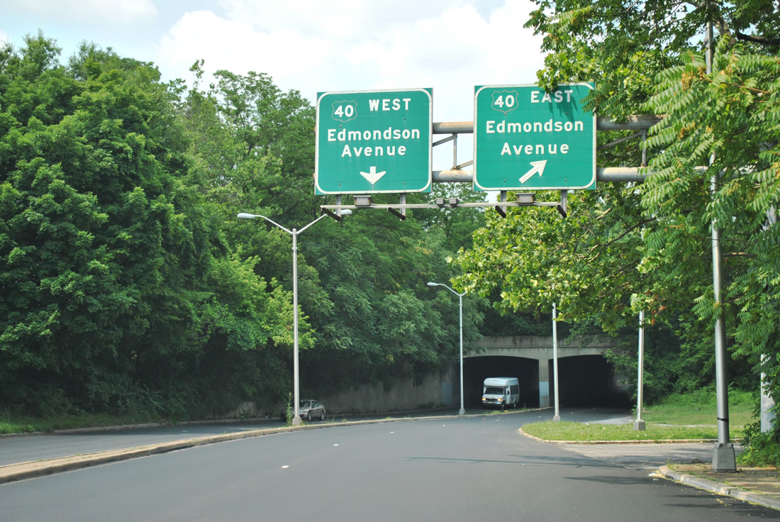
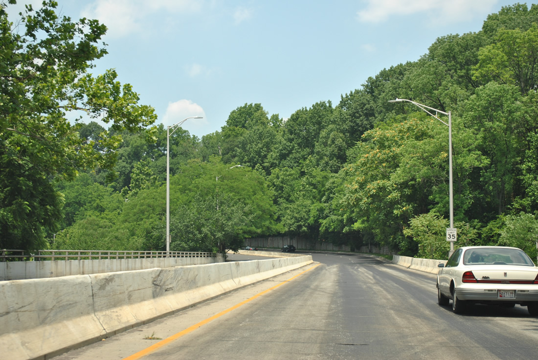
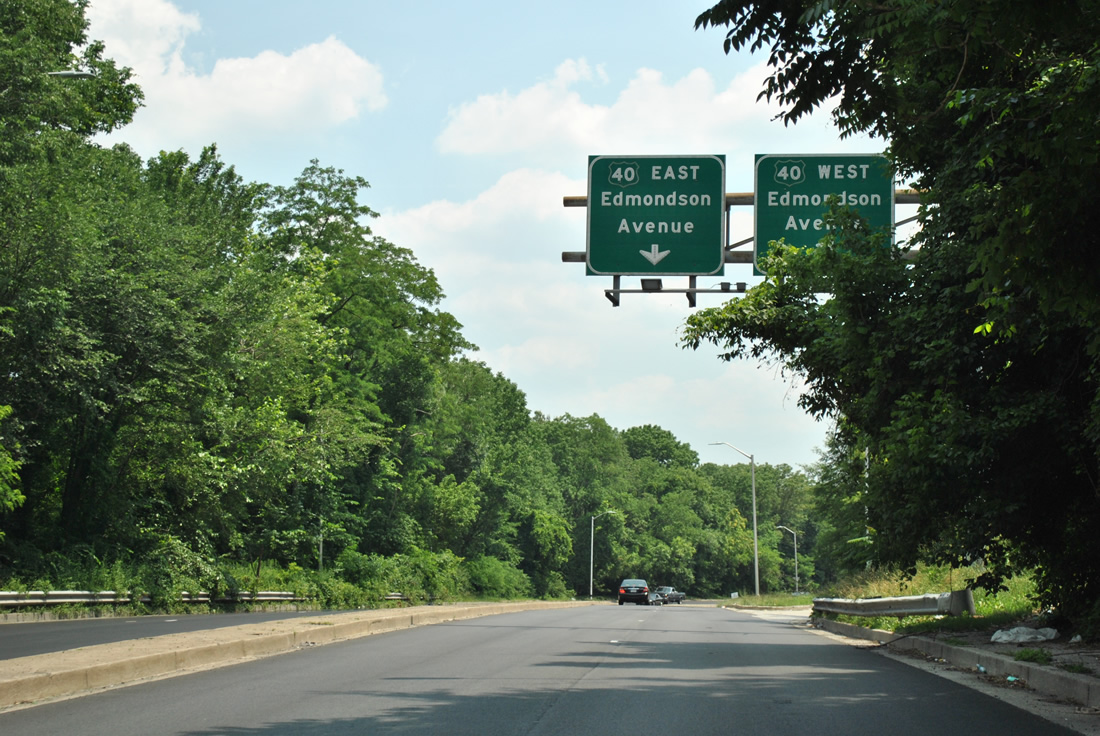
Edmondson Avenue leads U.S. 40 east over Gwynns Falls to Franklin Street. The US route partitions into a one-way couplet of Franklin Street (west) and Mulberry Street (east). This alignment connects U.S. 40 with the former Interstate 170 freeway, which travels between Franklin and Mulberry Streets, at Pulaski Street. U.S. 40 emerges from the below grade freeway at Greene Street (MD 295).
Rejoining Franklin and Mulberry Streets, U.S. 40 passes north of Downtown Baltimore en route to St. Paul Place and the Orleans Street viaduct over Intestate 83 (Jones Falls Expressway). Orleans Street carries the route east to the Pulaski Highway, which U.S. 40 follows to Elkton and State Road, Delaware.
Coinciding with the cancellation of Interstate 70 east from Gwynns Falls Park, U.S. 40 was realigned to overlap with I-170 along the Franklin and Mulberry Street freeway alignment in 1981.4
A partially signed truck route for U.S. 40 across Baltimore utilizes MD 151 (Erdman Avenue) northwest from Pulaski Highway to U.S. 1 (North Avenue), and North Avenue west from Monroe Street. Hilton Parkway leads the truck route south back to U.S. 40 (Edmondson Avenue).

Guides:
Old U.S. 111 – Greenmount Av / York Rd
An original U.S. highway, U.S. 111 ran north from Baltimore to York, Harrisburg and Lawrenceville, Pennsylvania. Within Baltimore, U.S. 111 began at U.S. 1 (North Avenue) and followed Greenmount Avenue north. Greenmount Avenue becomes York Road at 42nd Street, which U.S. 111 lined northward to Towson and the Pennsylvania state line.
As sections of the Baltimore-Harrisburg Expressway (I-83) opened, starting in 1955, U.S. 111 shifted from York Road westward onto the freeway. Interstate 83 and U.S. 111 were cosigned through to 1963, when U.S. 111 was eliminated. York Road was subsequently renumbered as MD 45.

Guides:
Old U.S. 140 – Reisterstown Rd / Park Heights Av
U.S. 140 traveled just 48 miles from Baltimore northwest to Gettysburg, Pennsylvania. The route was decommissioned in 1977, partially due to the close proximity of the planned Northwest Expressway (Interstate 795) from Pikesville to Reisterstown.
MD 140 replaced U.S. 140 from Baltimore northwest to Westminster. The alignment north from Westminster to the Pennsylvania state line near Littlestown was renumbered as MD 97. Prior to 1977, MD 97 followed what is now MD 140 west from Westminster to Emmitsburg.
The south end of U.S. 140 in Baltimore changed by the 1950s when the US route shifted onto the one-way couplet of Fulton Avenue and Monroe Street to end at U.S. 1 (North Avenue). The route previously followed Reisterstown Road southeast onto Pennsylvania Avenue to end a short distance east of Fulton Avenue at U.S. 1 (North Avenue).

Guides:
Old U.S. 301 – Russell St / Monroe St / Paca St
When it was extended north from Petersburg, Virginia in 1941, U.S. 301 traveled along Baltimore-Annapolis Boulevard / Annapolis Road (MD 648) north to Russell Street in southwest Baltimore. The route ran north along Paca Street to U.S. 40 (Franklin Street). U.S. 301 was later relocated east along side MD 2 on St. Paul / Calvert Streets to end at U.S. 1 (North Avenue).
By 1959, U.S. 301 was relocated again, angling northwest along Monroe Street from Russell Street to U.S. 1 at Wilkens Avenue. The route south into Anne Arundel County utilized portions of the Baltimore-Washington Expressway (MD 295), the Baltimore Beltway (Interstate 695) and the the Glen Burnie Bypass (Interstate 97). A major change followed in 1960, with U.S. 301 replacing MD 71 along the Eastern Shore to Middletown, Delaware.
State Routes
| Route | Names | West/ South End | East/ North End | Mileage | Signed? |
|---|---|---|---|---|---|
| 2 | Charles St, Calvert St, Hanover St, Potee St, St. Paul St, Gov. Richie Hwy | MD 4 at Solomons Island Road | U.S. 1 (North Avenue) | 86.47 | Yes |
| 3 | Robert Crain Hwy | U.S. 50/301 (Exit 13) | Interstate 97 and MD 32 | 7.11 | Yes |
| 3BR | New Cut Rd | near Upton Rd | MD 2 (Gov. Ritche Hwy) | 5.08 | Yes |
| 7 | Philadelphia Rd | U.S. 40 (Pulaski Hwy) | U.S. 40 in Elkton | 83.00 | Yes |
| 10 | Arundel Fwy | MD 2 (Gov. Riche Hwy) | Interstate 695 | 7.17 | Yes |
| 25 | Falls Rd | MD 2 (Calvert Rd) | Beckleysville Rd | 26.89 | Yes |
| 25A | Jones Falls Expressway | I-83/695 | MD 25 (Falls Rd) at Joppa Rd | 0.58 | No |
| 26 | Liberty Heights Av, Liberty Rd | U.S. 15 Frederick | MD 140 (Reisterstown Rd) | 44.13 | Yes |
| 41 | Hillen Av, Perring Parkway | MD 147 (Harford Rd) | Waltham Woods Rd | 6.75 | Yes |
| 43 | White Marsh Bl | Interstate 695 | MD 150 (Eastern Av) | 8.65 | Yes |
| 45 | York Rd, Greenmount Av | U.S. 1 (North Avenue) | Pennsylvania state line | 30.06 | Yes |
| 122 | Security Bl | Rolling Rd | Baltimore city line | 2.96 | Yes |
| 126 | Gwynn Oak Av | Baltimore city line | MD 26 (Liberty Heights Av) | 0.92 | No |
| 129 | Druid Hill Av, McCulloh St, Park Heights Av | U.S. 40 (Franklin St) and MD 295 (Paca St) | Garrison Forest Rd | 15.45 | Yes |
| 129A | Brooks Robinson Dr | MD 129 (Park Heights Av) | Stevenson Rd at I-695 | 0.48 | No |
| 130 | Greenspring Valley Rd | MD 140 (Reisterstown Rd) | MD 25 (Falls Rd) | 5.57 | Yes |
| 131 | Seminary Av | MD 25 (Falls Rd) | MD 45 (York Rd) | 3.06 | Yes |
| 133 | Old Court Rd | MD 129 (Park Heights Av) | MD 25 (Falls Rd) | 3.31 | Yes |
| 134 | Bellona Av | MD 139 (Charles St) | La Belle Av, Ruxton Rd | 1.63 | Yes |
| 139 | Charles St, St. Paul St | U.S. 1 (North Av) | Interstate 695 | 7.89 | Yes |
| 140 | Monroe St, Fulton Av, Reisterstown Rd | U.S. 1 (North Av) | Pennsylvania state line | 17.80 | Yes |
| 144 | Frederick Av, Frederick Rd | Howard County line | U.S. 1 (Fulton Av) | 8.62 | Yes |
| 146 | Dulane Valley Rd | MD 45 (York Rd) | MD 23 | 16.81 | Yes |
| 147 | Harford Rd | U.S. 1 (North Avenue) | U.S. 1/U.S. 1 Business | 18.81 | Yes |
| 150 | Eastern Av, Eastern Bl, Haven St, Lombard St, Ponca St | U.S. 40 (Pulaski Hwy) | Grace Quarters Rd | 13.01 | Yes |
| 151 | Erdman Av, North Point Bl, Sparrows Point Rd | 7th Street at Sparrows Point Rd | U.S. 1 (Bel Air Rd) | 10.80 | Yes |
| 151B | Wharf Rd | MD 151 (Sparrows Point Rd) | Interstate 695 | 0.60 | No |
| 157 | Merritt Bl, Peninsula Expwy | Interstate 695 at MD 158 | North Point Rd near I-695/MD 151 | 4.79 | Yes |
| 158 | Bethlehem Bl | Riverside Dr | North Point Rd | 2.35 | Yes |
| 162 | Aviation Bl | MD 170 | MD 176 (Dorsey Rd) | 2.31 | Yes |
| 166 | Rolling Rd | Interstate 195 / Metropolitan Bl | MD 144 (Frederick Rd) | 2.71 | Yes |
| 168 | Nursery Rd | Hammonds Ferry Rd | MD 648 (Baltimore Annapolis Rd) | 1.28 | Yes |
| 169 | Maple Rd | Hammonds Ferry Rd | MD 648 (Baltimore Annapolis Rd) | 0.97 | Yes |
| 170 | Aviation Bl, Belle Grove Rd, Campe Meade Rd, Telegraph Rd | MD 175 (Annapolis Rd) | MD 2 (Potee St) | 12.98 | Yes |
| 171 | Church St | MD 2 (Gov. Richie Hwy) | MD 173 (Curtis Av) | 1.54 | Yes |
| 173 | Curtis Av, Fort Smallwood Rd, Hawkins Point Rd, Patapsco Rd, Pennington Av | East Dr | MD 2 (Potee St) | 13.78 | Yes |
| 270 | Furnace Branch Rd | MD 648 (Baltimore Annapolis Bl) | MD 2 (Gov. Richie Hwy) | 2.16 | Yes |
| 295 | Baltimore-Washington Expwy, Greene St, Paca St | U.S. 50 (John Hanson Hwy) and MD 201 (Kenilworth Av) | U.S. 40 (Franklin St) | 32.52 | Yes |
| 372 | Wilkens Av | MD 166 (Rolling Rd) | U.S. 1 (Southwestern Bl) | 2.86 | Yes |
| 542 | Lock Raven Bl | MD 147 (Harford Rd) | Interstate 695 | 6.33 | Yes |
| 587 | Wilson Point Rd | Dogwood Dr and Strawberry Point Rd | MD 150 (Eastern Av) | 1.14 | Yes |
| 588 | Golden Ring Rd, Kenwood Av | MD 7 (Philadelphia Rd) | Kenwood Av near Brookwood Av | 1.94 | Yes |
| 648E | Annapolis Rd, Baltimore Annapolis Bl, Old Annapolis Rd | MD 177 (Mountain Rd) | MD 2 (Russell St) | 11.15 | Yes |
| 686 | 2nd St | Baltimore city line | MD 173 (Patapsco Av) | 0.34 | No |
| 695 | Baltimore Beltway | Interstate 95 (Exit 53) | Exit 4 | 19.37 | No |
| 695A | Broening Hwy | Interstate 695 (Exit 44) | Baltimore city line | 1.93 | No |
| 695C | Authority Dr | Toll Maintenance | MD 695 (Broening Hwy) | 1.23 | No |
| 700 | Martin Bl | U.S. 40 (Pulaski Hwy) | MD 150 (Eastern Av) | 1.97 | Yes |
| 702 | Southeast Expwy, Southeast Bl | Back River Neck Rd | Interstate 695 | 4.17 | Yes |
| 710 | East Ordnance Rd | MD 2 (Gov. Riche Hwy) | MD 173 (Camp Meade Rd) | 2.16 | Yes |
| 711 | Arundel Corporation Road | MD 2 (Gov. Richie Hwy) | near Cherry Ln | 0.51 | No |
| 762 | Andover Rd | MD 162 (Aviation Bl) | MD 170 | 0.53 | No |
| 940 | Owings Mill Bl | Red Run Bl | MD 140 (Reisterstown Rd) | 1.48 | Yes |
| 943 | Warren Rd | Interstate 83 | Beaver Dam Rd | 0.59 | No |
| 995 | Amtrak Wy | MD 170 (Aviation Bl) | end of road | 0.50 | No |
Sources: State Highway Administration of Maryland Highway Information Services Dvision Data Support Group, State Highway Location Reference – Baltimore City – 2005.
State Highway Administration of Maryland Highway Information Services Division Data Support Group, State Highway Location References – 2009.

Guides:
Robert S. Crain Highway
MD 3 follows Robert S. Crain Highway north from Bowie (U.S. 50/301) to Interstate 97 at Millersville. The state route used to extend north to Baltimore utilizing the Glen Burnie Bypass (I-97), Baltimore Beltway (I-695), MD 295 (Baltimore-Washington Parkway) and Monroe Street (former U.S. 301) to end at U.S. 1 and Wilkens Avenue.

Guides:
Patuxent Freeway
MD 32 forms a nearly 52 mile arc from MD 178, east of Waterbury, north to the city of Westminster. The state route overlays the Patuxent Freeway between Clarksville (MD 108) and Interstate 97 near Odenton. Construction to build the Patuxent Freeway ran from the early 1990s to 1996. Signalized intersections at Fort Meade however remained in operation until 2004.5

Guides:
MD 100
MD 100 is a limited-access highway linking U.S. 29 near Columbia with Lake Shore and MD 177 east to Gibson Island. The freeway was built in stages, with the portion from MD 10 to MD 177 (Mountain Road) completed by the early 1980s. Ensuing construction in through the 1990s completed the route, with the final stretch opened between MD 103 and MD 295 (Baltimore-Washington Parkway). Portions of the original freeway were also rebuilt at that time.

Guides:
Baltimore-Washington Expressway / Parkway
Opened to traffic in 1952, Baltimore-Washington Parkway was the first limited access highway built in the metropolitan area. The state maintained portion runs north from MD 175 at Jessup to the city of Baltimore. The parkway south from MD 175 to Kenilworth Avenue outside D.C. is maintained by the National Park Service (NPS). This stretch was completed in 1954.
Baltimore-Washington Parkway doubled as the temporary alignment for Interstate 95 during the early 1960s as the freeway remained unbuilt between the Capital and Baltimore Beltways. The I-295 designation was applied to the route in 1969, but necessary upgrades to the parkway to bring it up to Interstate standards were never made. Instead the state maintained portion was signed as MD 295 and the NPS section left unnumbered.
Despite carrying just four lanes of traffic, Baltimore-Washington Parkway remains both a busy commuter and through route. Trucks are prohibited along the parkway due to NPS restrictions and low clearance arch bridges.
The Baltimore-Washington Expressway portion of MD 295 extends north through Westport and Interstate 95 in Baltimore. The freeway transitions into Russell Street north ahead of M&T Bank Stadium and Oriole Park at Camden Yards. Although poorly marked as MD 295, the state route separates into a couplet of Paca Street (north) and Greene Street (south) through to its terminus at U.S. 40 (Franklin / Mulberry Streets).

Guides:
Southeast Boulevard / Expressway
MD 702 spurs 4.13 miles southeast from Interstate 695 at Exit 36 to Back River Neck Road in southeastern Baltimore County. The state route follows the Southeast Freeway from the Baltimore Beltway to MD 150 (Eastern Boulevard) and an arterial route (Southeast Boulevard) through Middleborough.
A cancelled proposal extended the Southeast Freeway beyond Eastern Avenue to Rocky Point along the Back River and Hawk Cove. Early plans for the Baltimore Beltway incorporated a portion of the Southeast Freeway, joining it with a proposed freeway west of Cedar Beach and east of Stansbury Point.
Baltimore City Streets
| Central Avenue |
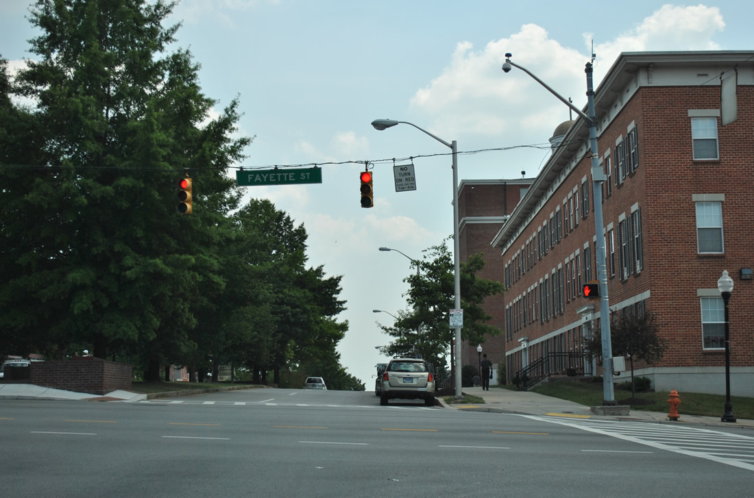
 | Central Avenue leads north from the Inner Harbor East and Fells Point to Harford Road. The route doubles as an alternate route to Interstate 83 via Fayette Street west. White guide signs for I-83 were replaced with conventional green ones by 2008. 12/28/07 |
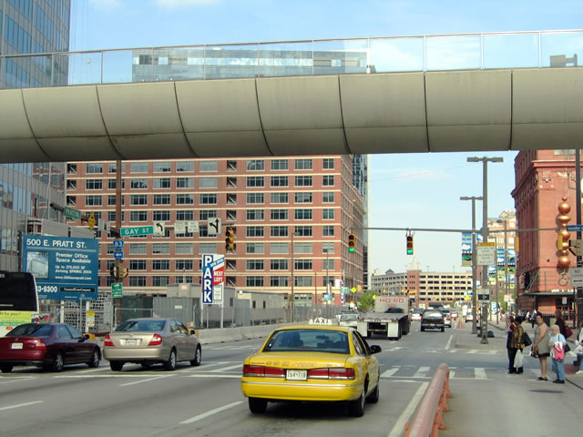
 | Fayette Street (former U.S. 40 Alternate) connects Central Avenue with Fallsway and Interstate 83 (Jones Falls Expressway) to the west and Washington Hill and Pulaski Highway (U.S. 40) to the east. 12/28/07 |
| Charles Street |
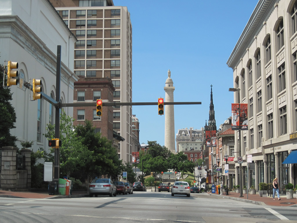
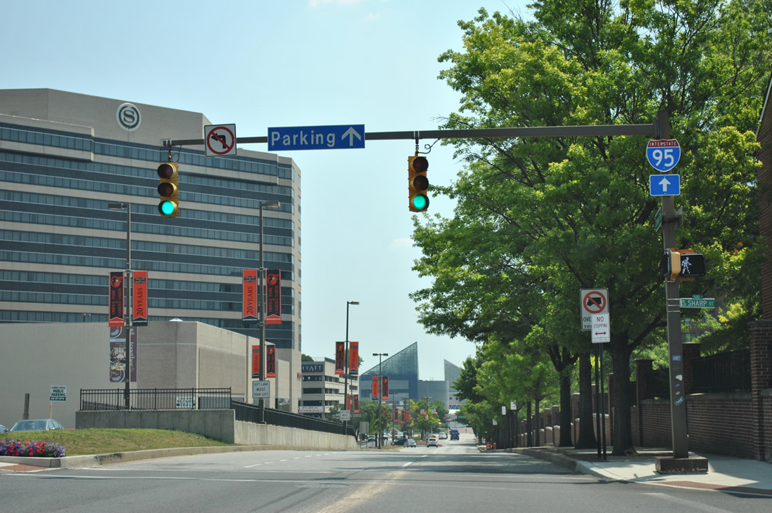
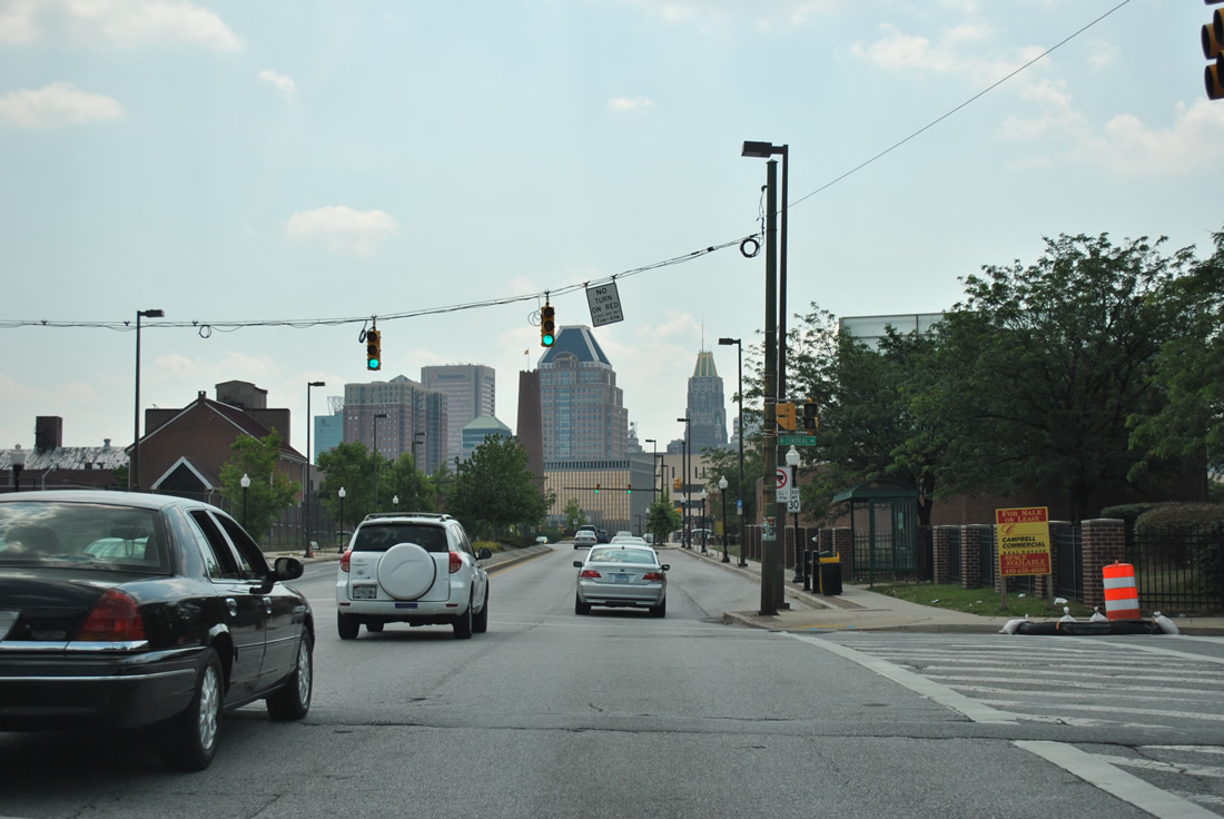
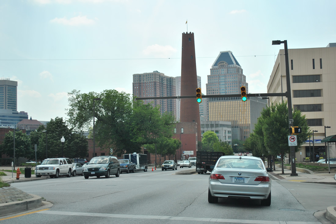
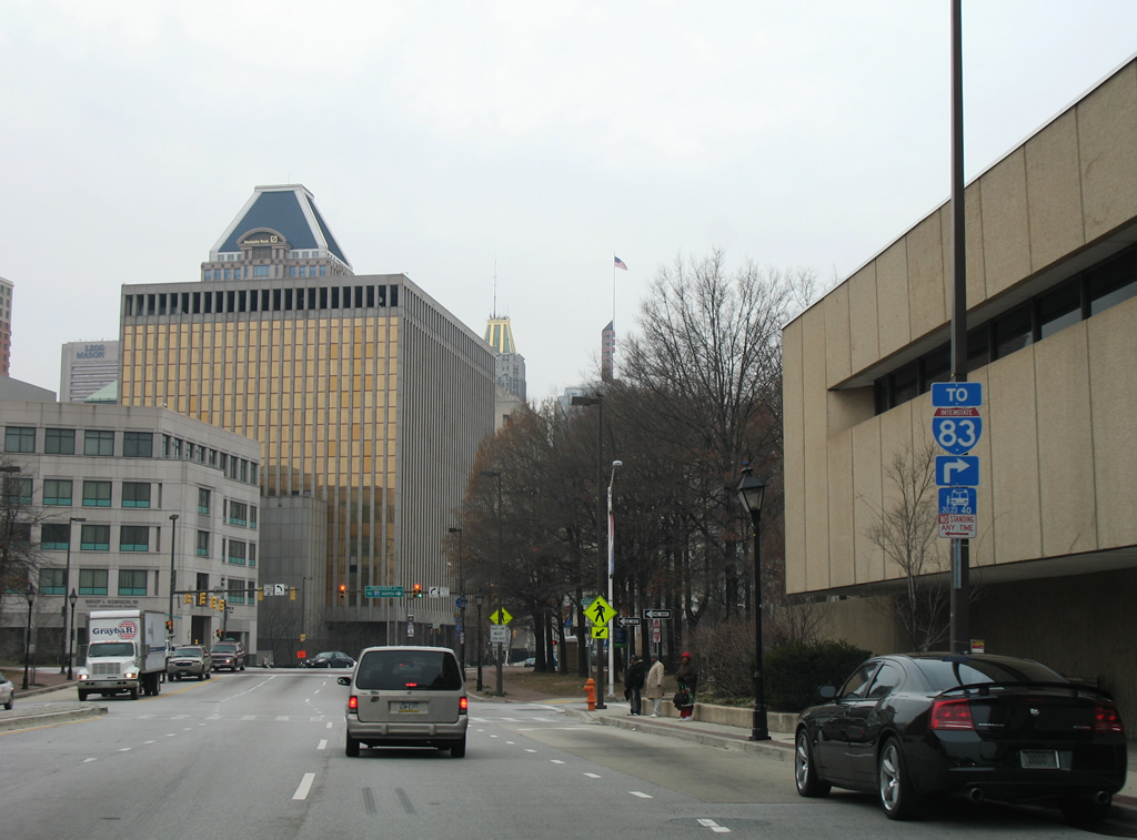
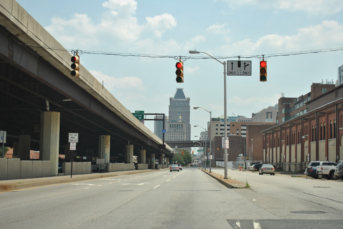
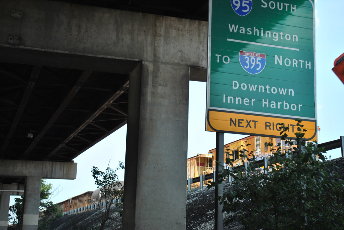
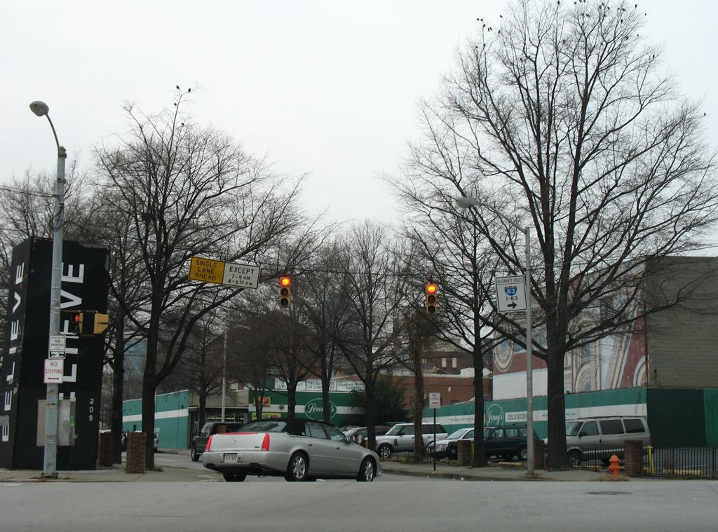
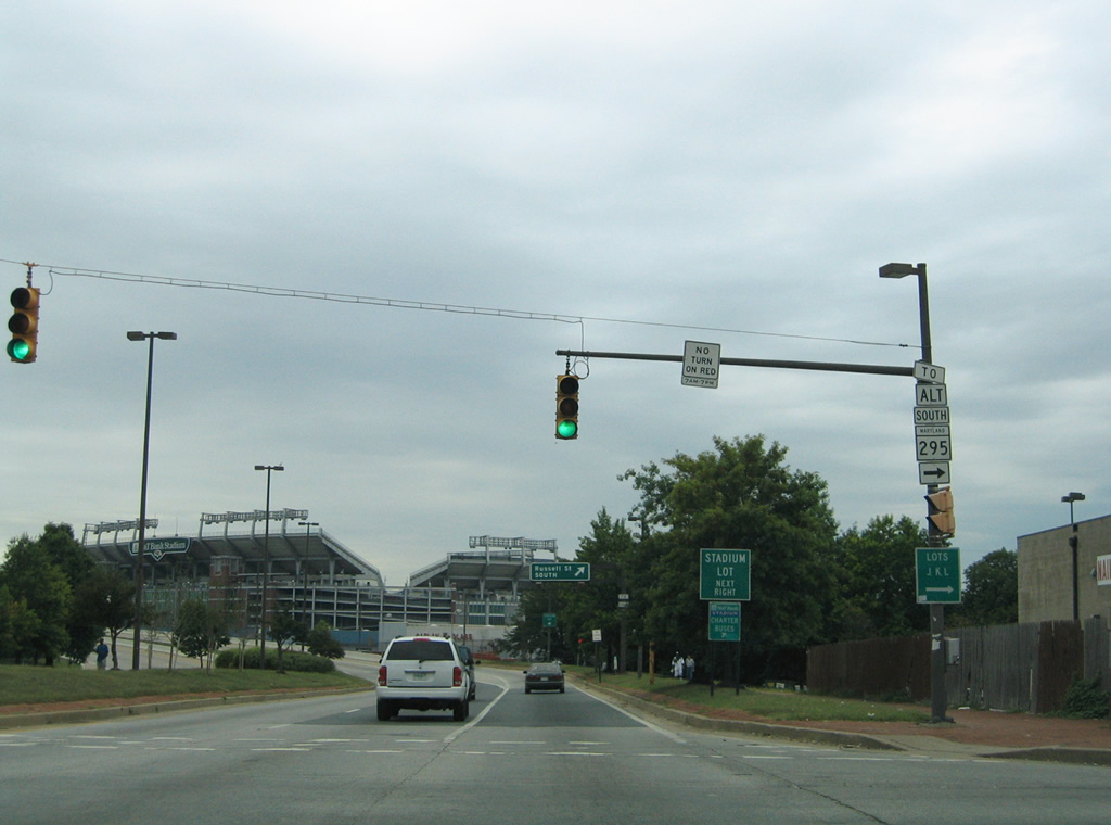
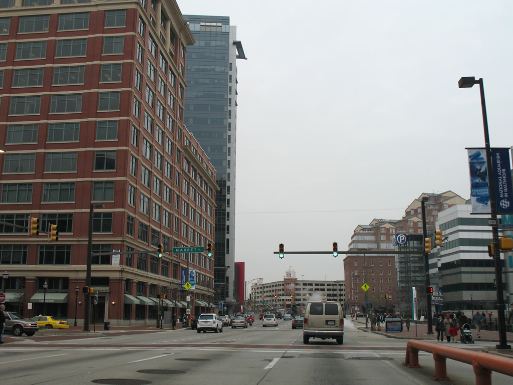
 | Charles Street provides a northbound through route between Otterbein and Mount Vernon through the Baltimore central business district. Several parking facilities lie near the route for the Inner Harbor area. Trailblazers for Interstates 95 & 395 direct departing motorists onto Conway Street west to the southbound beginning of Interstate 395 at Camden Yards in this scene. 06/30/10 |
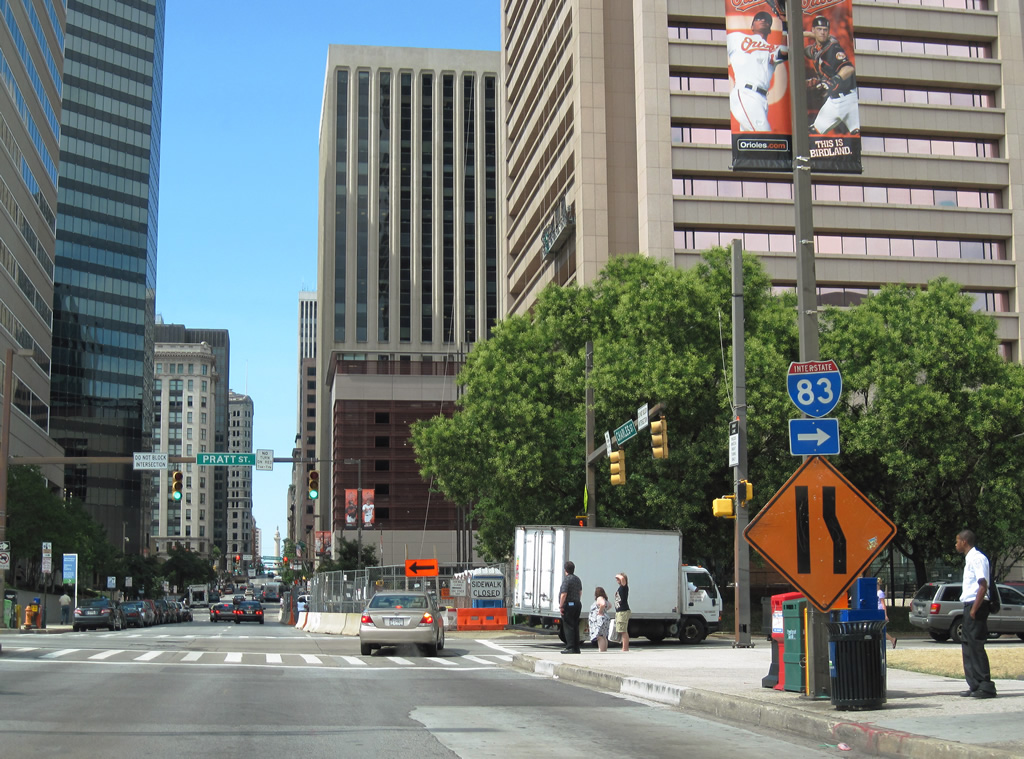 | Motorists exiting the city via Interstate 83 are pointed onto Pratt Street eastbound from Charles Street to either Gay Street north or President Street north for the Jones Falls Expressway. 06/30/10 |
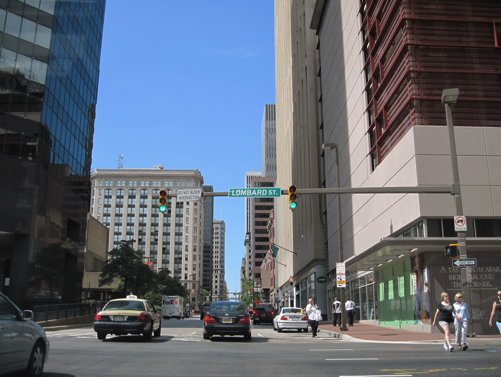 | Lombard Street flows west from Charles Street to 1st Mariner Arena and the University of Maryland at Baltimore. Connections with Martin Luther King, Jr. Boulevard lead motorists south to Interstate 395 and north to Bolton Hill. 06/30/10 |
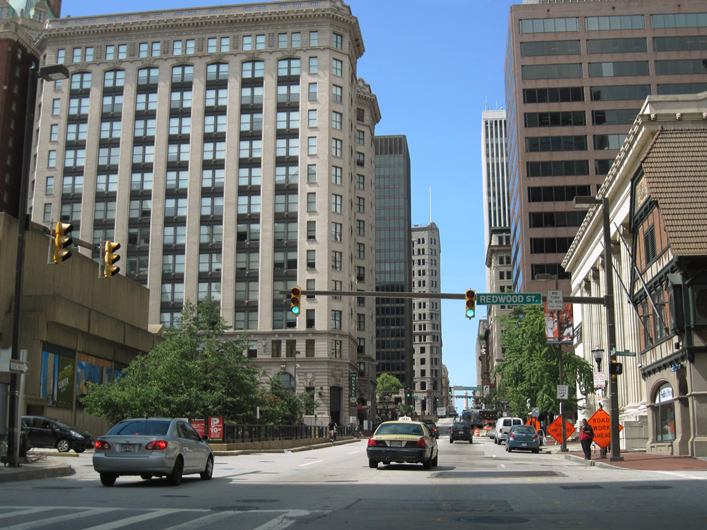 | A section of Redwood Street travels three blocks from South Street west to Charles Street within the business district. 06/30/10 |
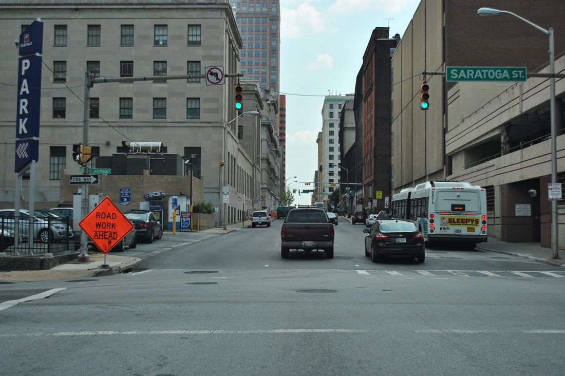
 | Saratoga Street heads west from Frederick Street and bumps northwest at Charles Street to Lexington Market and MD 295 (Greene / Paca Streets). 06/30/10 |
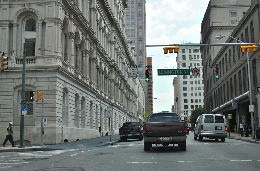
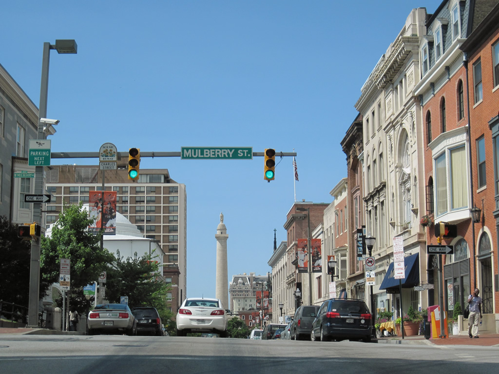 | Charles Street meets the eastbound direction of U.S. 40 (Mulberry Street) in this northbound scene. U.S. 40 partitions between Franklin (west) and Mulberry Streets from the Orleans Street Viaduct to Wheeler Avenue west of U.S. 1. 06/30/10 |
 | U.S. 40 (Franklin Street) westbound continues from Charles Street to Seton Hill and the former Interstate 170 freeway between Harlem Park and Franklin Square. U.S. 40 meets the north end of MD 295 (Paca Street) and north beginning of MD 129 in six blocks. 06/30/10 |
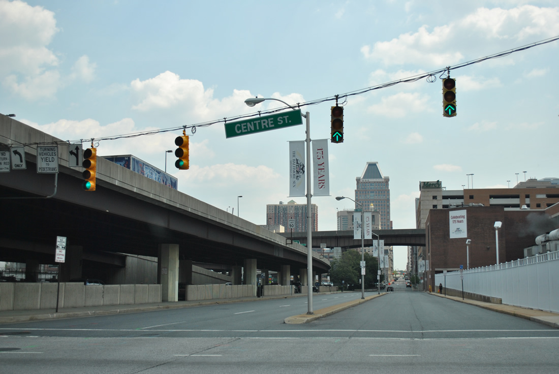
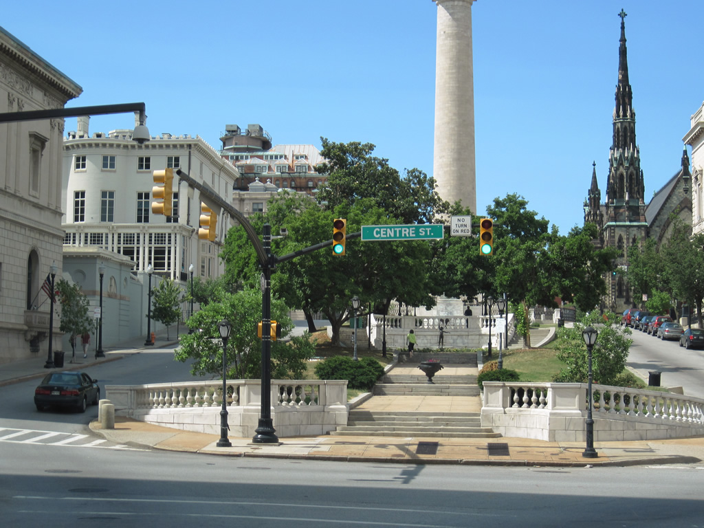 | Charles Street partitions into Washington Place around Washington Monument between Centre and Madison Streets. 06/30/10 |
| Cold Spring Lane - East |
 | Cold Spring Lane leaves MD 129 (Park Heights Avenue) and intersects Pimlico Road. Pimlico Road leads north to Pimlico race course and Mount Washington. 06/27/10 |
 | Cold Spring Lane lowers from the Parks Heights community to intersect Greenspring Road near Cylburn Park. Greenspring Avenue meanders south to Druid Hill Park and north to Cylburn Arboretum. 06/27/10 |
 | Continuing the descent along Cold Spring Lane to Tamarind Road and Interstate 83. 06/27/10 |
 | Original button copy signage for Interstate 83 and Jones Falls Expressway posted on the Cold Spring Lane east. 06/27/10 |
 | Eastbound motorists span Glens Falls and a MARC line ahead of the six-ramp parclo interchange with Interstate 83 (Jones Falls Expressway). 06/27/10 |
 | The southbound on-ramp to Interstate 83 to Druid Hill Park and Downtown Baltimore departs Cold Spring Lane east. 06/27/10 |
 | A signalized ramp connects the Jones Falls Expressway southbound with Cold Spring Lane opposite the walkway down to MARC's Cold Spring Lane light rail station below. 06/27/10 |
 | Interstate 83 winds northward from Cold Spring Lane to Northern Parkway (Exit 10) and the Baltimore Beltway near Brooklandville. 06/27/10 |
 | Leaving the Jones Falls Expressway behind, Cold Spring Lane next intersects Grand View Avenue. 06/27/10 |
 | Falls Road (MD 25) crosses Cold Spring Lane west of Roland Park and north of Hampden. MD 25 follows Falls Road north from Lafayette and Lanvale Streets near Bolton Hill and Mount Vernon. 06/27/10 |
| Cold Spring Lane - West |
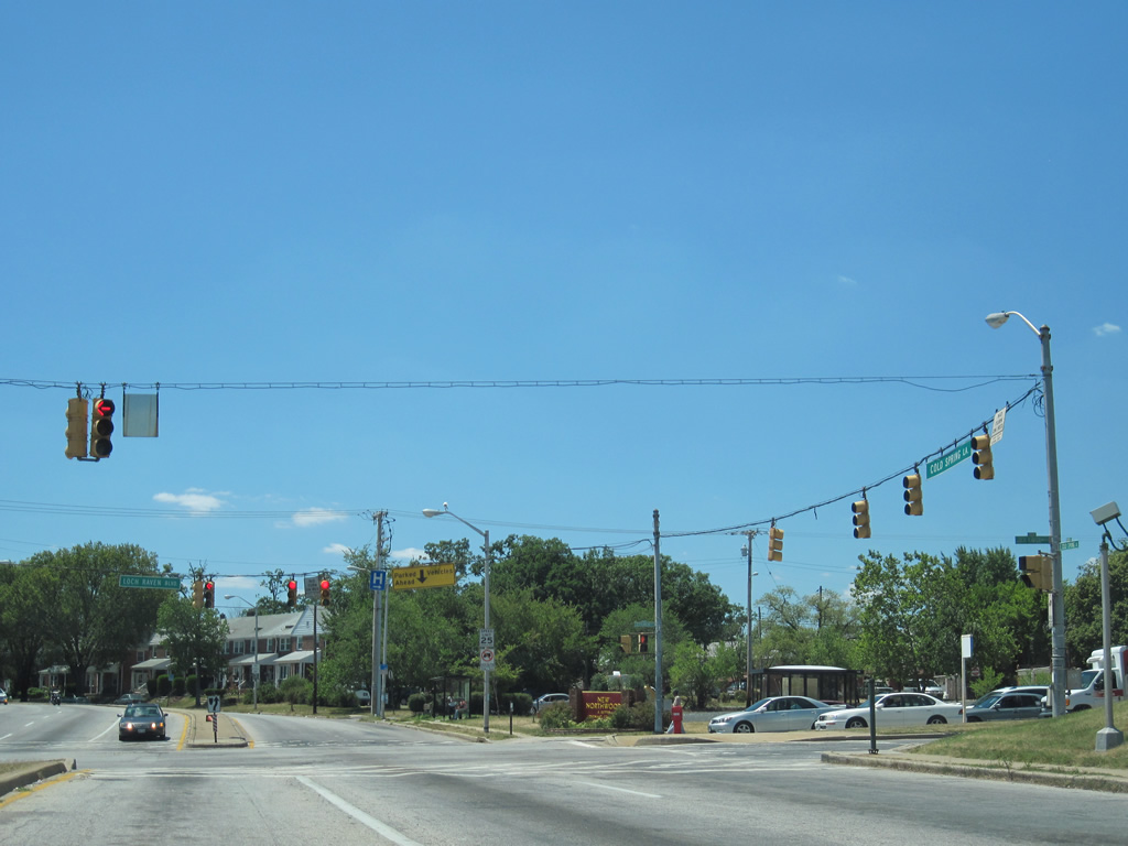 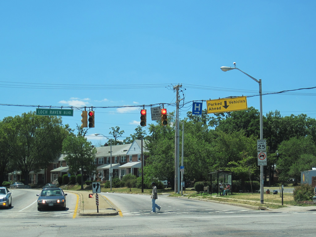 | Cold Spring Lane westbound at Loch Raven Boulevard (MD 542) near Morgan Station University. The four lane divided parkway reduces to a four lane roadway, where the right lane doubles as on-street parking. An uncommon "Parked Vehicles Ahead" sign hangs from the traffic signal span wire advises westbound motorists of the right-lane change. 07/02/10 |
| Conway Street |
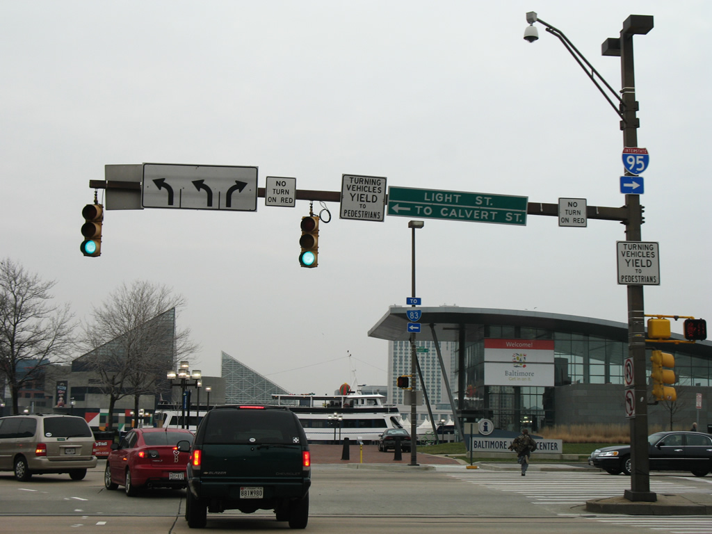
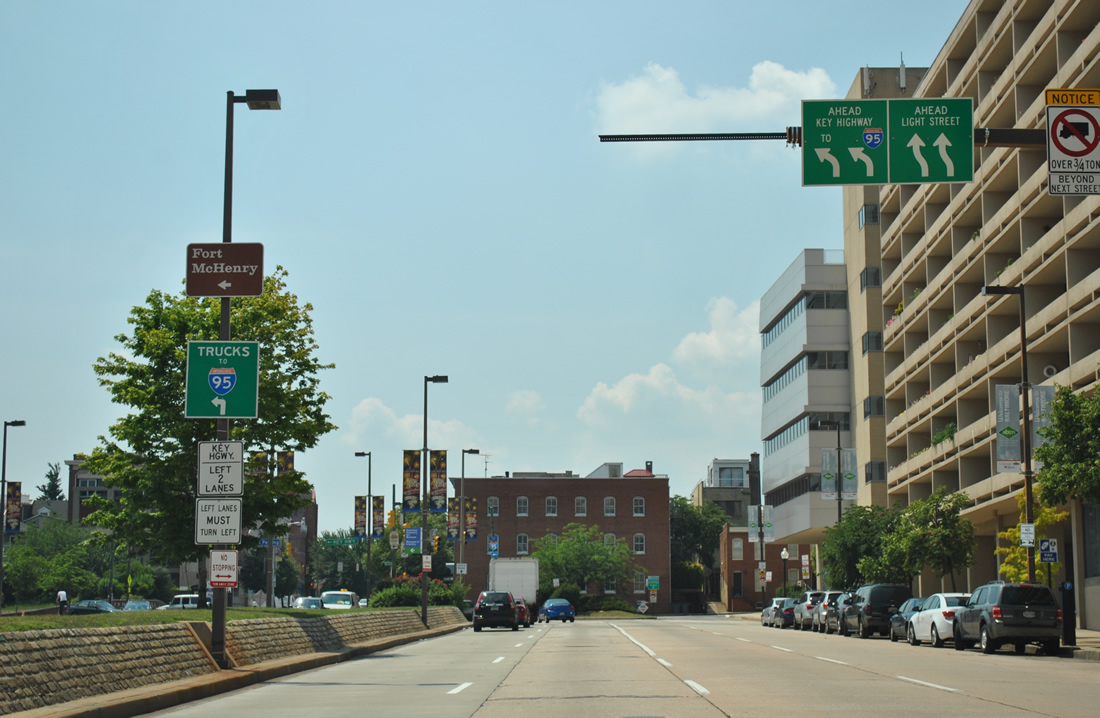
 | Conway Street connects Howard Street and the north end of Interstate 395 with MD 2 (Light Street). This picture shows the intersection between eastbound Conway Street and Sharp Street. Note the trailblazer for Interstate 95, which directs motorists east on Conway to Light Street south for the Key Highway. 06/20/12 |
 | Charles Street carries MD 2 southbound in hidden fashion from Lee Street south to Hughes Street nearby. MD 2 north follows Light Street from Montgomery Street over two blocks to the south. 06/30/10 |
 | Conway Street ends at Light Street (MD 2 northbound) opposite the Baltimore Visitor Center. Drivers bound for Interstate 95 are pointed onto Light Street south for Key Highway and its ramps to the freeway. 12/28/07 |
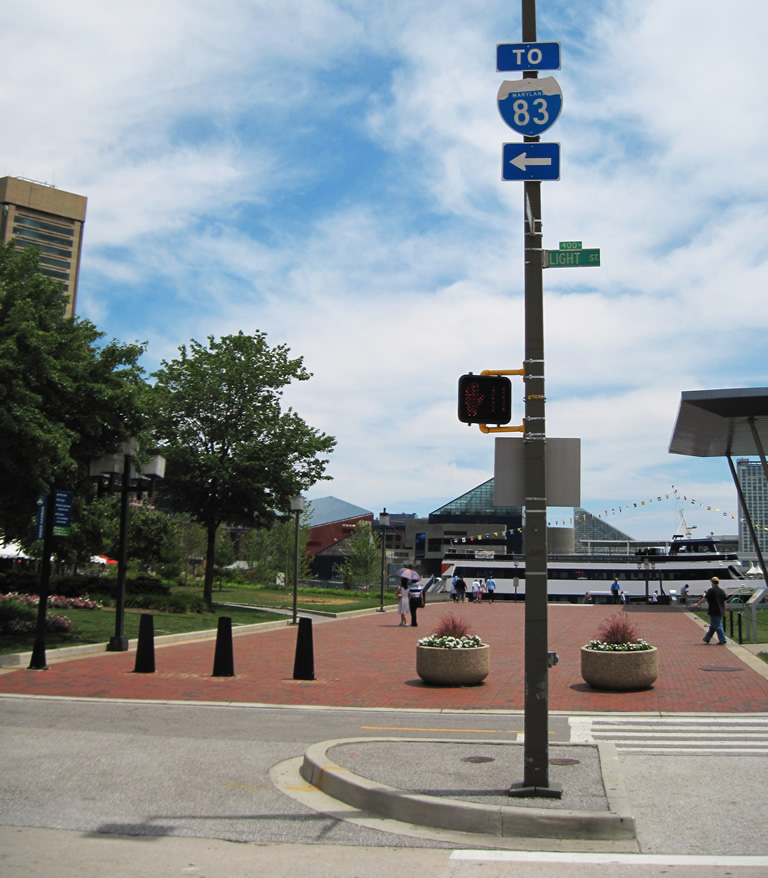 | A trailblazer for Interstate 83 advises motorists to the Jones Falls Expressway to follow Light Street north. Light Street ends at the split of Calvert Street north and Pratt Street east. Pratt Street leads to Gay Street north to Interstate 83 or President Street south of its transition to the Jones Falls Expressway. 06/30/10 |
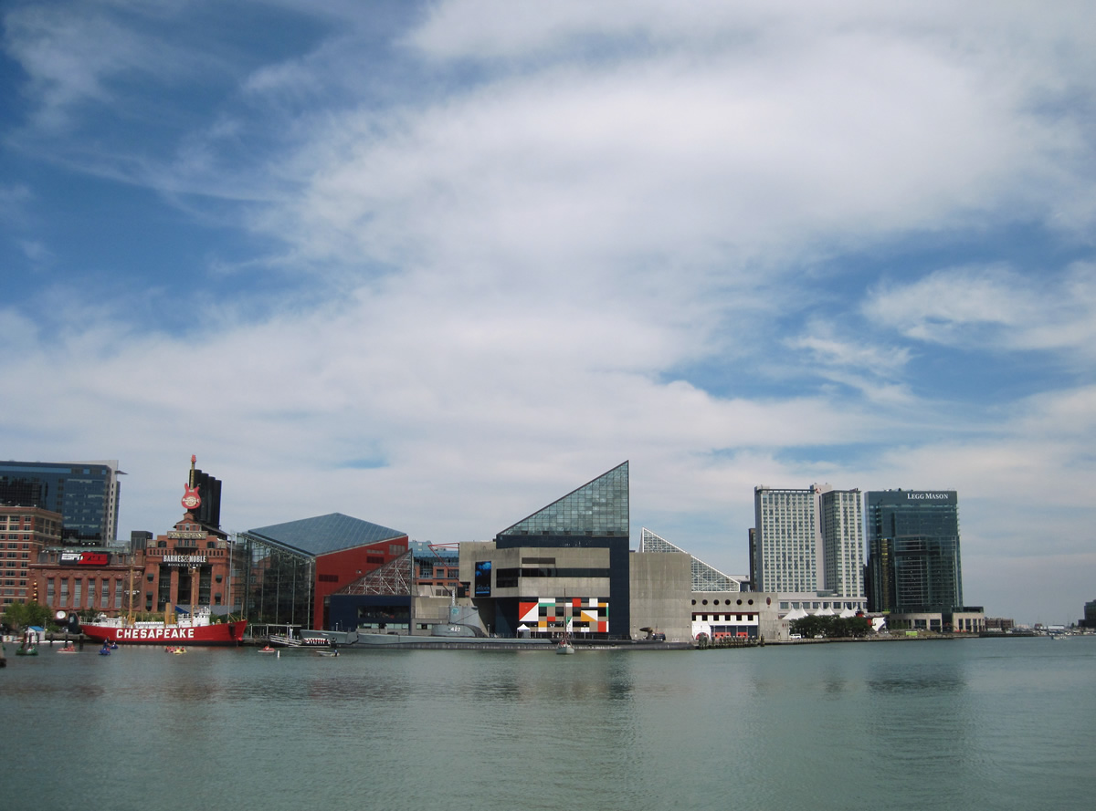 | A look at the Inner Harbor including the National Aquarium, the Power Plant, and the Pier 6 Convert Pavilion from the Light Street Pavilion opposite Conway and Light Streets. 06/30/10 |
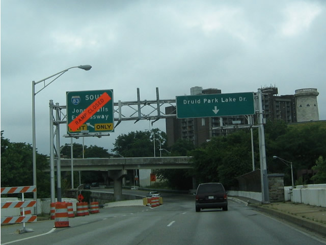
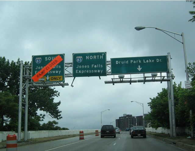
| Druid Park Lake Drive |
 | Druid Park Lake Drive follows the southern periphery of Druid Hill Park between MD 129 (Druid Hill Avenue / McCulloh Street) to Interstate 83 at 28th / 29th Streets. Pictured here is the parkway eastbound beginning at McCulloh Street north. 06/27/10 |
 | Swann Drive travels north from Druid Park Lake Drive at Madison Avenue south to the Maryland Zoo in Baltimore. A decorative arch lies south of Swann Drive touting the inauguration of Druid Hill Park by Mayor Thomas Swann on October 19, 1860. 06/27/10 |
| Fayette Street - East |
 | Fayette Street passes by the Baltimore main post office and intersects Colvin Street. Colvin Street angles northwest to Lafayette Courts and Hillen Street. 06/27/10 |
 | Aisquith Street travels north from Baltimore Street across Fayette Street at this light to U.S. 40 (Orleans Street) and Old Town Mall. Johns Hopkins Hospital is visible along the eastern horizon. 06/27/10 |
| Fayette Street - West |
 | Broadway exits the campus of Johns Hopkins Hospital and enters the Washington Hill community at the intersection with Fayette Street. 06/20/12 |
 | Two blocks west of Broadway along Fayette Street at Caroline Street. Caroline Street leads north to Johns Hopkins Hospital. 06/20/12 |
 | Fayette Street westbound at Central Avenue. 06/20/12 |
 | Colvin Street angles northwest from Fayette Street to Low Street and Lafayette Courts. 06/20/12 |
 | Westbound on Fayette Street at the signalized intersection with Aisquith Street. 12/28/07 |
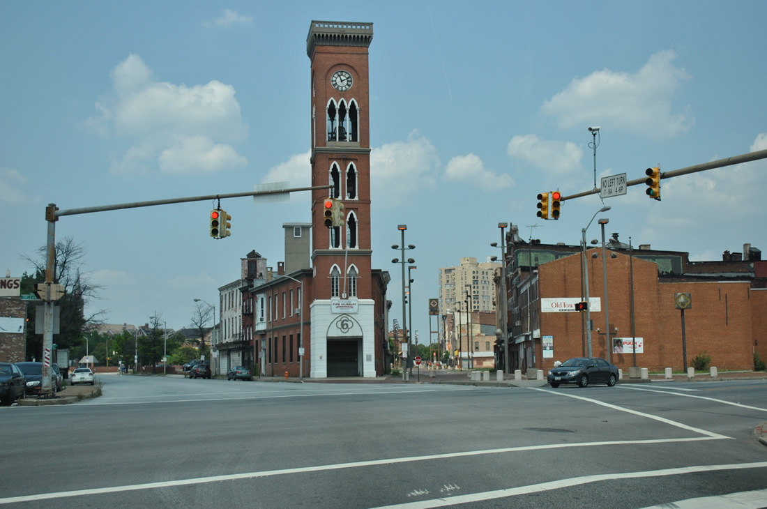
  | Approaching the Shot Tower on Fayette Street west by the Baltimore main post office. The Shot Tower, a National Historic Landmark, was used to create lead shot from 1828 to 1892. 12/28/07, 06/20/12 |
 | Nearing President Street, the multi-lane boulevard southeast to Fells Point and north to Interstate 83 (Jones Falls Expressway) on Fayette Street west. 12/28/07 |
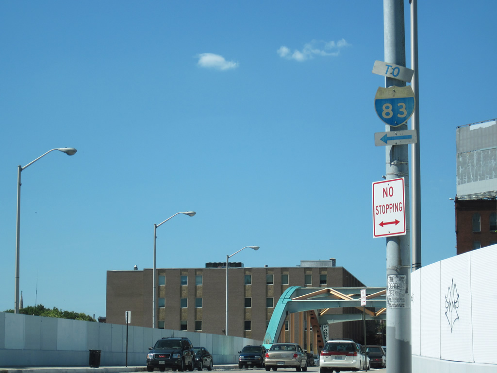
 | Interstate 83 begins from Fayette and President Streets and leads north through Baltimore to Interstate 695 near Brooklandville. The freeway stretches 85.30 miles north to Harrisburg, Pennsylvania. 12/28/07 |
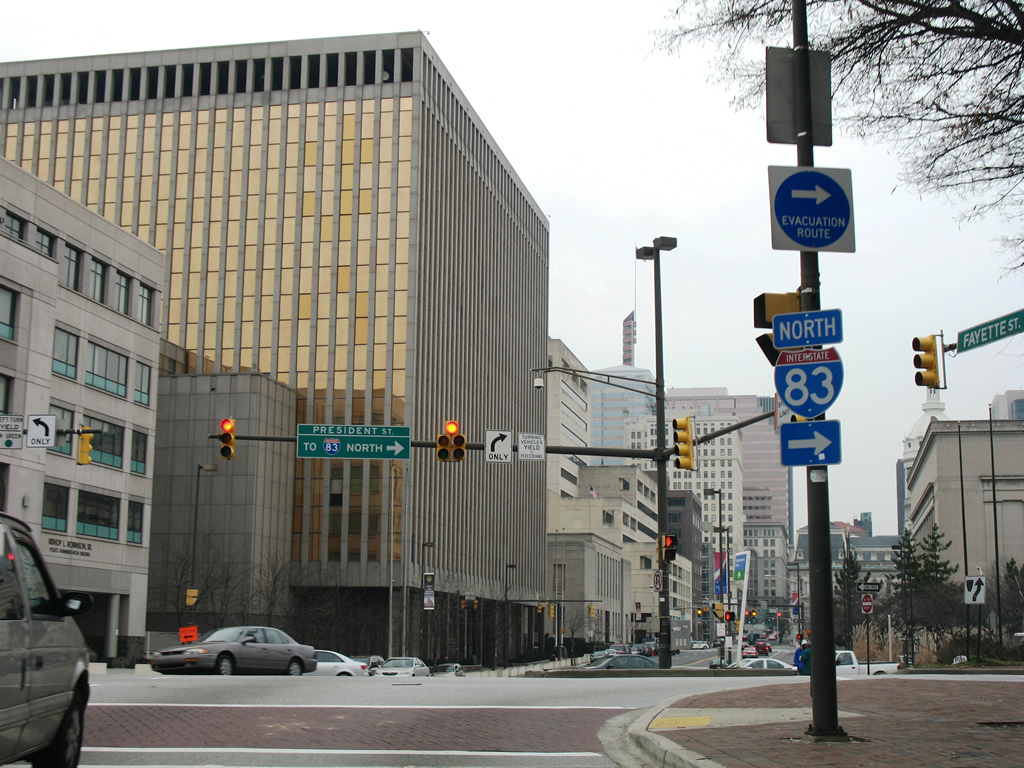
 | Fayette Street westbound at the split intersection with Frederick Street, just west of the Interstate 83 southern terminus at President Street. Fayette Street skims the northern reaches of the central business district between President Street and Martin Luther King, Jr. Boulevard. 06/20/12 |
  | An older Interstate 83 trailblazer, since replaced, directs Fayette Street westbound drivers onto Gay Street northbound for the Jones Falls Expressway northbound on-ramp at the Fallsway. The rotunda of Baltimore City Hall lies to adjacent to the Fayette and Gay Street intersection. 10/10/04, 06/20/12 |
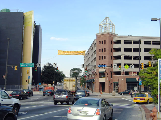
 | Fayette Street continues west to the joint intersection with Liberty Street south and Park Avenue north. 1st Mariner Arena lies one block to the south. Small guide signs, such as the one posted at ground level here, direct motorists to either Interstate 83, Interstate 95, of the Baltimore-Washington Parkway (B-W Pkwy in a green square). 07/02/10 |
 | Paca Street doubles as MD 295 northbound from Oriole Park at Camden Yards to U.S. 40 (Franklin / Mulberry Streets). Fayette Street intersects the northbound-only street in this scene. 07/02/10 |
 | One block west at the southbound street of MD 295 (Greene Street). Greene Street becomes Russell Street ahead of Martin Luther King, Jr. Boulevard and Interstate 95. 07/02/10 |
 | Fayette Street crosses Martin Luther King, Jr. Boulevard and enters Lexington Terrace, intersecting Fremont Avenue. Fremont Avenue's role has depreciated over the years due to construction of the six lane MLK Boulevard and the U.S. 40 (former Interstate 170) freeway. 07/02/10 |
 | Schroeder Street intersects Fayette Street at the Poppleton community a few blocks west of Fremont Avenue. 07/02/10 |
 | Westbound Fayette Street at Carey Street and Franklin Square park. 07/02/10 |
 | Gilmor Street leads south two blocks from Fayette Street to Frederick Avenue. Frederick Avenue eventually becomes MD 144, an old alignment of U.S. 29. 07/02/10 |
| Fleet Street |
 | Westbound Fleet Street meets President Street, which links with Interstate 83. 05/31/04 |
| Frederick Avenue |
 | Frederick Avenue flows west to U.S. 1 (Fulton Avenue) north at Hollins Street. Between Fulton and Payson Street, Frederick Avenue flows east. The road becomes a part of MD 144 at Lombard and Payson Streets. 07/02/10 |
 | A southwesterly look at Frederick Avenue from Hollins Street across from Addison Street. Frederick Avenue carried U.S. 29 until 1949 and the intersections with U.S. 1 represented the northern terminus. 07/02/10 |
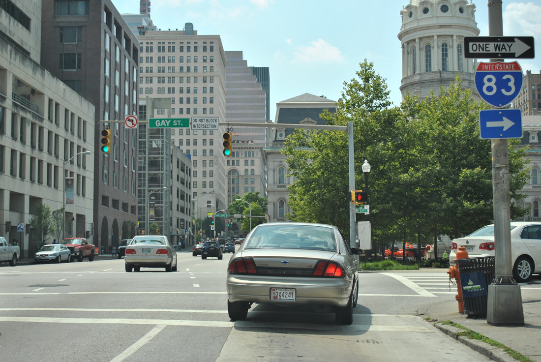
| Gay Street |
 | Northbound Gay Street passes through the heart of Downtown Baltimore and approaches Lombard Street. Lombard Street forms a one way couplet with Pratt Street heads east. 05/01/04 |
 | Gay Street northbound on the block between Fayette and Lexington Streets adjacent to Baltimore City Hall. Lexington Street flows east one more block to Frederick Street before ending adjacent to the Jones Falls Expressway. 06/20/12 |
 | Fans of the HBO series The Wire will recognize the rotunda and building of Baltimore City Hall. The city government complex lies between Fayette and Lexington Streets on Gay Street north of Downtown. 10/10/04 |
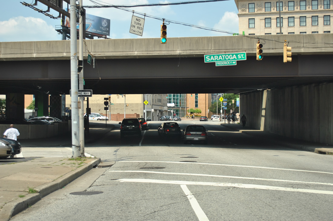 | Gay Street continues north one block to Saratoga Street adjacent to the Jones Falls Expressway. Saratoga Street curves alongside Interstate 83 southbound from Lexington Street to Gay Street before turning west to Mercy Medical Center. 06/20/12 |
  | Gay Street passes under the JFX mainline and ahead of The Fallsway. 06/20/12 |
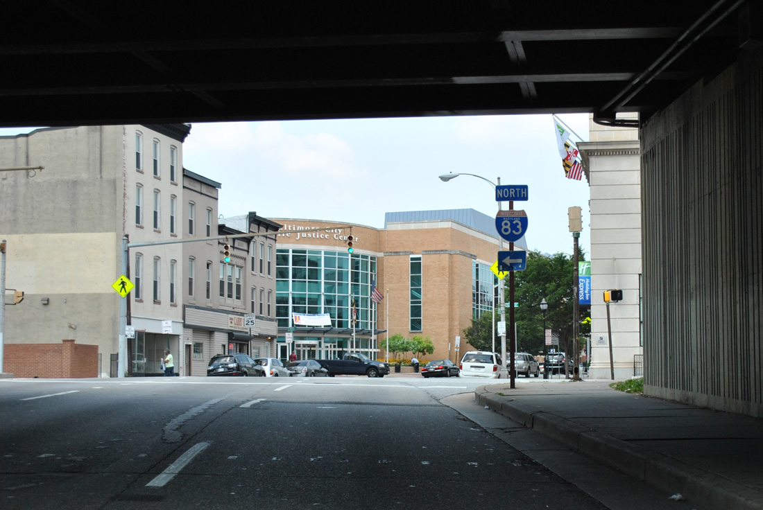
 | Gay Street continues northeast from The Fallsway to meet U.S. 40 (Orleans Street) at the south end of Old Town Mall. Old Town Mall was a pedestrian mall created from the former path of Gay Street in the 1970s. Motorists along Gay Street default onto Ensor Street beyond Orleans Street. 06/20/12 |
 | An on-ramp joins Interstate 83 northbound from the Fallsway just north of Gay Street. 06/20/12 |
 | Ensor Street winds northward from Gay Street and U.S. 40 (Orleans Street) to Forrest Street at the next traffic light. Forrest Street ventures northward to become Greenmount Avenue nearby while Ensor continues to become Harford Avenue. Both Greenmount and Harford Avenues lead out of the city as MD 45 and 147 respectively. 06/20/12 |
| Gilmor Street |
 | Gilmor Street connects Fayette Street (former U.S. 40 Alternate) with Frederick Avenue two blocks east of U.S. 1 (Fulton Avenue) north. 07/02/10 |
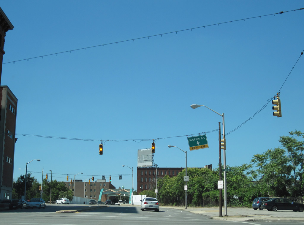
| Guilford Avenue |
 | Interstate 83 trailblazer posted along Guilford Avenue northbound after the merge with Fallsway. 07/02/10 |
 | Preston Street flows west over Interstate 83 to Mount Vernon from Guilford Avenue as the north-south street prepares to split with Mount Royal Avenue west. 07/02/10 |
 | Mount Royal Avenue bends west from Guilford Avenue to Bolton Hill and U.S. 1 (North Avenue). Guilford Avenue passes over the Jones Falls Expressway and ends five blocks north at North Avenue. 07/02/10 |
 | An original Interstate 83 trailblazer directs motorists from Guilford Avenue north onto Mount Royal Avenue. Mount Royal Avenue ends opposite the northbound on-ramp to Interstate 83. 07/02/10 |
  | A colorful arch bridge carries Guilford Avenue northbound above both Interstate 83 and an AMTRAK line. 07/02/10 |
 | Lanvale Street flows east and intersects Guilford Avenue north. Lanvale Street carries the final three blocks of MD 25 from Maryland Avenue to MD 2 (Calvert Street) north nearby. 07/02/10 |
 | Lafayette Street forms the northbound beginning of MD 25 one block west of Guilford Avenue at Calvert Street. MD 25 turns onto Falls Road and parallels Interstate 83 north to Brooklandville outside the city. 07/02/10 |
 | Guilford Avenue drops below the adjacent Jones Falls Expressway viaduct and intersects Madison Street just south of the final Interstate 83 southbound on-ramp. 06/20/12 |
 | One block south of Madison Street is the intersection with Monument Street west. Monument Street was severed due to construction of Interstate 83, with the Centre Street making the direct link with Monument leading east. Guilford Avenue here partitions into a through street and service road configuration. 06/20/12 |
 | Centre Street curves northeast from Guilford Avenue to intersect The Fallsway along the opposite side of Interstate 83. 06/20/12 |
 | Southbound Guilford Avenue at Saratoga Street. 06/20/12 |
 | Traffic signal upgrades from span wire to mast arm assemblies underway in this scene along Guilford Avenue at Lexington Street. 06/20/12 |
| Hilton Parkway - North |
 | Hilton Street northbound at the beginning of Hilton Parkway. Hilton Parkway winds northward through Gwynns Falls Park to North Avenue and the Walbrook neighborhood of the city. 06/20/12 |
 | Hilton Parkway doubles as U.S. 40 Truck northward to North Avenue from forthcoming Edmondson Avenue. U.S. 1 Truck follows Caton Avenue north to Hilton Street and the parkway here as the north-south leg of an overall bypass of U.S. 1 along Monroe Street and Fulton Avenue. 06/20/12 |
 | Hilton Parkway sees a three quarter cloverleaf interchange with U.S. 40 (Edmondson Avenue) just west of its crossing over Gwynns Falls. U.S. 40 eastbound follows Edmondson Avenue to the one way street couplet of Franklin and Mulberry Streets toward downtown. 06/20/12 |
 | A 1952 constructed overpass carries four lanes of U.S. 40 above Hilton Parkway as the roadway becomes a controlled access facility northward through Gwynns Falls Park. 06/20/12 |
 | A tight loop ramp follows this text based sign for U.S. 40 west. U.S. 40 continues along Edmondson Avenue to Rognel Heights, Uplands, and an exit of the city onto Baltimore National Pike. 06/20/12 |
  | Winding through Gwynns Falls Park along Hilton Parkway northbound. The parkway passes over Gwynns Falls and adjacent Franklintown Road along an uninterrupted stretch. 06/20/12 |
 | Hilton Parkway rejoins Hilton Street at the signalized intersection with North Avenue. A small sign references the truck route as "Alt Route - Bypass Downtown ". U.S. 1 Truck & 40 Truck turn east onto North Avenue to U.S. 1 at Monroe Street and Fulton Avenues. 06/20/12 |
| Hilton Parkway - South |
  | Hilton Parkway veers southwest from Hilton Street at the intersection with North Avenue at the Walbrook neighborhood. The four lane parkway consists of a controlled access route through Gwynns Falls Park south to U.S. 40 (Edmondson Avenue). 06/20/12 |
 | Button copy signs direct motorists from Hilton Parkway southbound to U.S. 40 (Edmondson Avenue) west toward Rognel Heights and Catonsville and U.S. 40 east toward downtown. A three quarter cloverleaf interchange joins the two roadways. 06/20/12 |
 | Lowering to pass under U.S. 40, Hilton Parkway nears its end where it merges with Hilton Street south. A small white guide sign affixed to the 1952-built span comes into view ahead of the loop ramp onto Edmondson Avenue east. 06/20/12 |
 | The eastbound ramp to U.S. 40 utilizes a stretch of Hilton Street north to its intersection with Edmondson Avenue. U.S. 40 spans Gwynns Falls nearby en route to the former Interstate 170 freeway south of Rosemont. 06/20/12 |
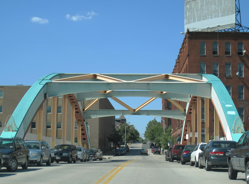
| Howard Street Bridge |
  | These photos show the painting project that is transforming the Howard Street bridge in a rainbow spectacle over Interstate 83 along eastbound. Howard Street begins as a spur Interstate 395, passing through downtown until reaching Martin Luther King Jr. Boulevard. The street runs parallel to the light rail tracks, then angles northeast across Interstate 83 before reaching MD 25/Falls Road north to Interstate 83 and U.S. 1/West North Avenue. From there, Howard Street continues north to John Hopkins University. 05/31/04 |
 | Looking south at the Howard Street Bridge over Interstate 83 and AMTRAK from U.S. 1 (North Avenue). The arch bridge opened to traffic in 1928 and was reconstructed in 1981. 0000 |
| Key Highway |
 | Light Street travels one block from Lee Street (unsigned MD 2 south) to the intersection of Key Highway south and Montgomery Street (unsigned MD 2 north). Key Highway lines the Inner Harbor east toward Interstate 95 while Light Street continues south into Federal Hill. 06/20/12 |
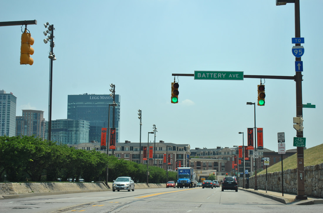 | Key Highway travels two blocks from Light Street to intersect Battery Avenue at Federal Hill Park. 06/20/12 |
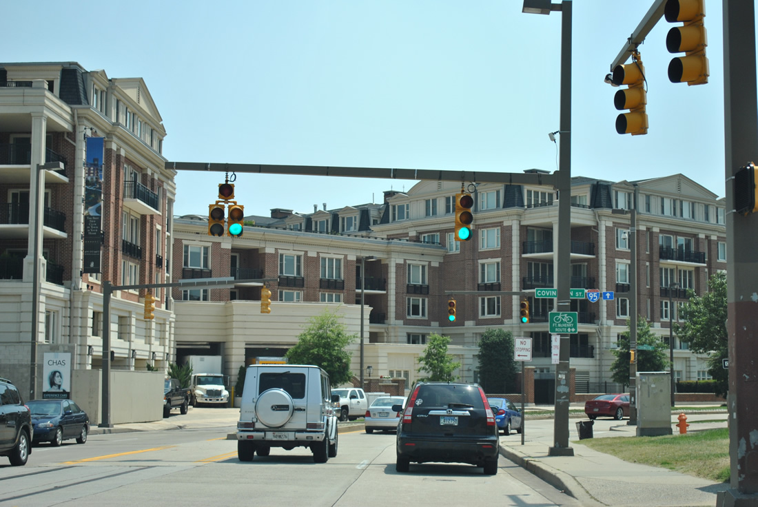 | Curving southward, Key Highway intersects Covington Street south. 06/20/12 |
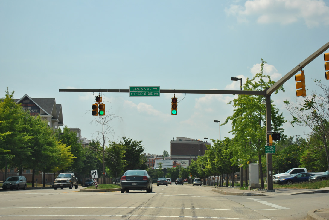 | Cross Street east and Pier Side Drive come together by the Harborview community at this traffic light along Key Highway south. 06/20/12 |
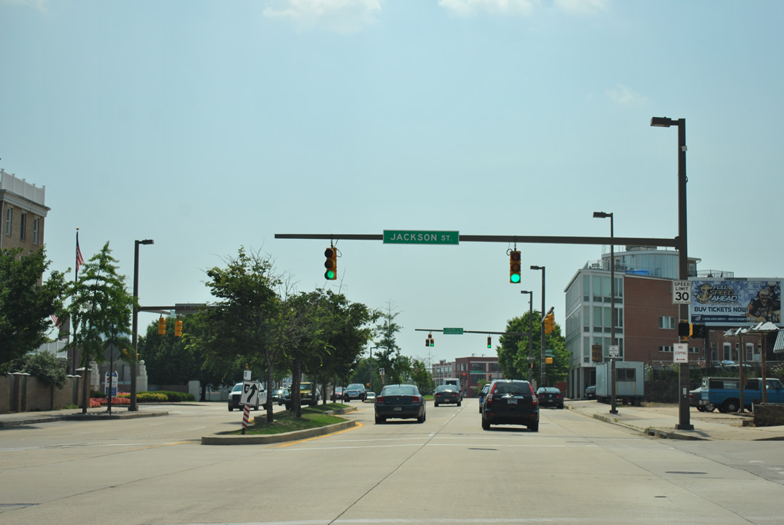 | Back to back traffic lights follow at Jackson Street south and Anchor Street / Harborview Drive as Key Highway kinks southeastward. 06/20/12 |
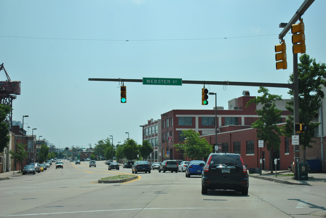 | Signs of industry appear along Key Highway south from Webster Street onward toward Locust Point. 06/20/12 |
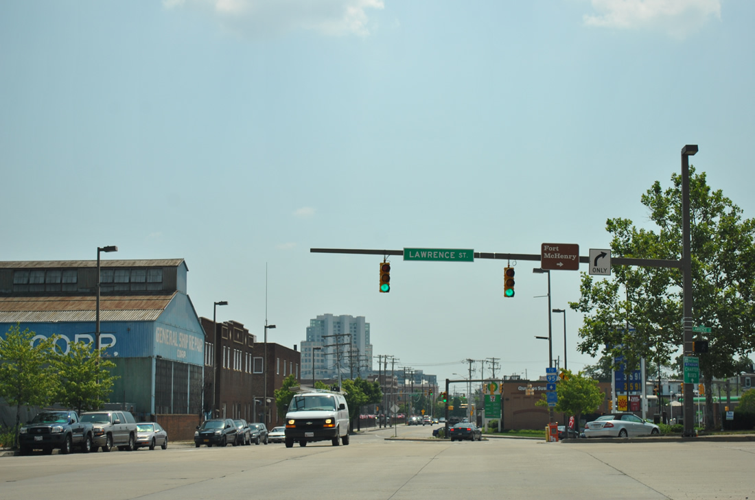 | Lawrence Street provides access between Key Highway and Fort Avenue as the two routes are grade separated. Fort Avenue stems southeast from Federal Hill to the North Locust Point Marine Terminal and Fort McHenry. 06/20/12 |
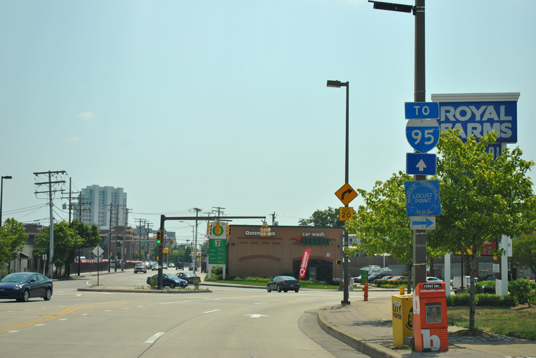 | An Interstate 95 trailblazer continues directing motorists southward along Key Highway as the boulevard intersects Key Highway East to Locust Point. 06/20/12 |
 | Passing under Fort Avenue along Key Highway south. Brackets remain from previously installed button copy signs for Interstate 95 north to New York and south to Washington. These were removed sometime after 2009. 06/20/12 |
 | New ground level signs direct drivers to the forthcoming diamond interchange with Interstate 95. 06/20/12 |
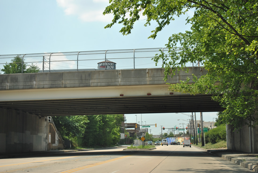
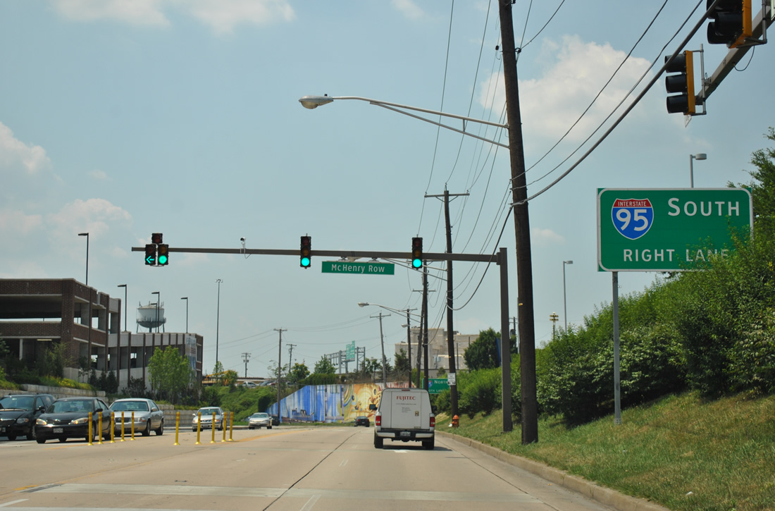
 | Key Highway curves between industry to the west and the new McHenry Row development to intersect McComas Street underneath the Interstate 95 viaduct. 06/20/12 |
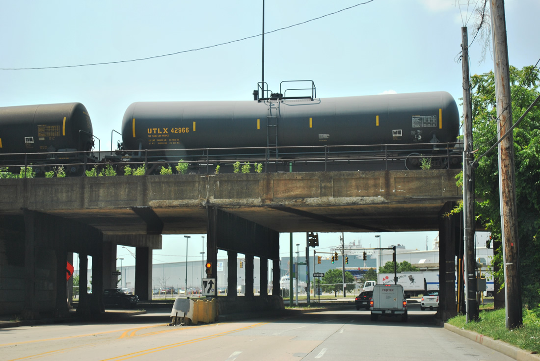 | Originally attached to this CSX Railroad bridge were a set of button copy signs for Interstate 95. Key Highway ends at a traffic light with McComas Street below I-95. 06/20/12 |
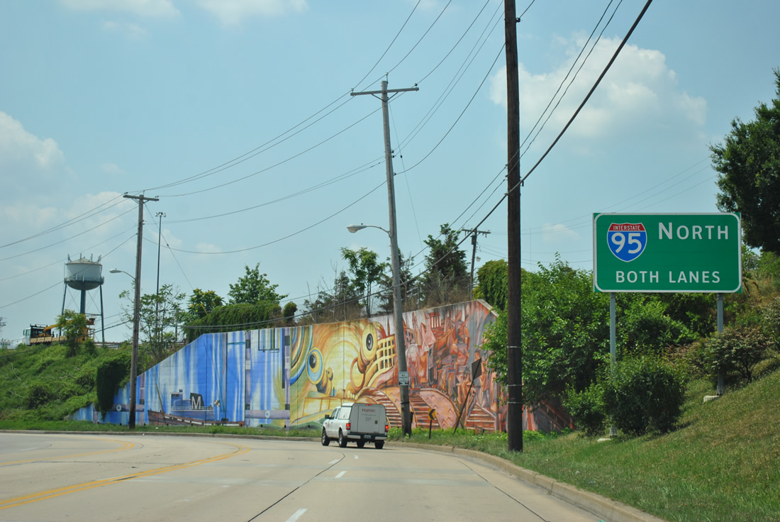
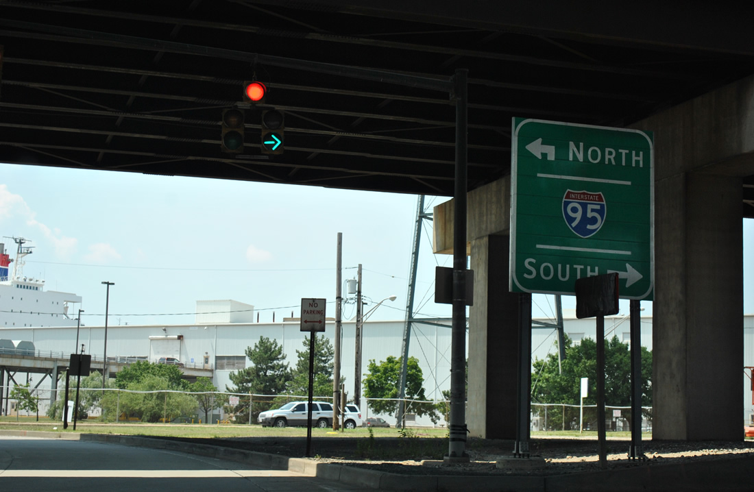 | Traffic bound for Interstate 95 north through the Fort McHenry Tunnel follows the McComas Street eastbound on-ramp. 06/20/12 |
  | McComas Street west continues below I-95 briefly before splitting with the southbound ramp to Interstate 395 north and Washington. 06/20/12 |
| Lexington Street |
  | Lexington Street east at Holliday Street north and Baltimore City Hall during a traffic light replacement project. 06/20/12 |
 | Lexington Street passes by War Memorial Plaza and then intersects Gay Street. Gay Street leads one block north to Saratoga Street and a northbound on-ramp to Interstate 83 (Jones Falls Expressway). Lexington Street otherwise ends one block east at Frederick Street. 06/20/12 |
| Lombard Street |
 | Lombard Street westbound at Central Avenue near Little Italy. The Alternate Route sign for Interstate 83 was removed by 2008. 12/28/07 |
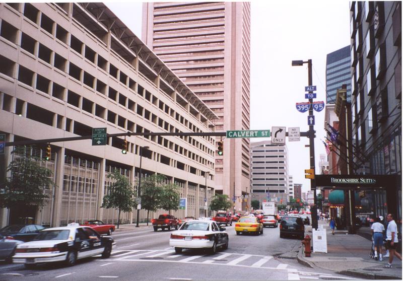  | Lombard Street, which forms one-half of a one way couplet shared with Pratt Street, passes through downtown Baltimore in a westbound fashion. This photo shows Lombard Street westbound at Calvert Street (MD 2 north); use Lombard Street west to reach Interstate 95 and Interstate 395. 07/01/00 |
 | Nearing MD 2 (St. Paul Avenue) along Lombard Street west. While MD 2 south may be used to reach Interstate 95 south via Hanover Street and north via McComas Street, access to MD 295 is best provided by continuing west on Lombard Street and then south on Greene Street. 05/01/04 |
 | Westbound Lombard Street approaches Junction Southbound MD 2, Saint Paul Avenue, immediately after the intersection with MD 2 northbound (Calvert Street). While MD 2 south may be used to reach Interstate 95 south via Hanover Street and north via McComas Street, access to MD 295 is best provided by continuing west on Lombard Street and then south on Greene Street, as indicated by the MD 295 trailblazer shield. 05/01/04 |
 | This picture shows Lombard Street westbound at Gay Street, which heads south to Pratt Street and the National Aquarium at Baltimore. To reach Interstate 95 and Interstate 395, the most direct route is to continue straight ahead on Lombard Street through downtown to Greene Street. In case of congestion on Lombard Street, other options include turning right on Gay Street and then west on Fayette Street until reaching Greene Street or Martin Luther King, Jr. Boulevard southbound. 05/01/04 |
| Martin Luther King, Jr. Boulevard |
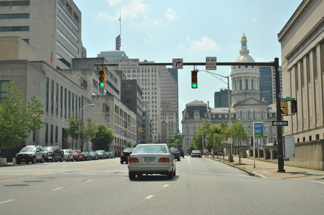
 | Martin Luther King, Jr. Boulevard comprises a six lane arterial from the western spur of I-395 northward to Howard Street around downtown Baltimore. The six lane highway serves Oriole Park at Camden Yards, M&T Bank Stadium, and the University of Maryland Medical Center. Pictured here is MLK Boulevard southbound at Saratoga Street, one block south of the Mulberry / Franklin Street intersections at the U.S. 40 freeway. 10/10/04 |
 | Martin Luther King, Jr. Boulevard southbound at the signalized intersection with Baltimore Street. Baltimore Street flows east to the University of Maryland at Baltimore from the Hollins Market area to the west. 06/27/10 |
 | M&T Bank Stadium (home of the NFL Baltimore Ravens) comes into view as Martin Luther King Jr. Boulevard southbound intersects Lombard Street. To the left is the University of Maryland Medical Center. Lombard Street flows through the Inner Harbor from Fells Point westward. 10/10/04 |
 | Pratt Street follows as the eastbound arterial between Martin Luther King Jr. Boulevard, the Inner Harbor, and Fells Point. 06/27/10 |
 | Continuing south of Pratt Street toward the intersection with Washington Boulevard. The right lane forms a turn lane for Washington Boulevard south and MD 295 (Russell Street) southbound. The guide sign for MD 295 was removed by 2010. 10/10/04 |
 | MD 295 continues south from Martin Luther King, Jr. Boulevard at Camden Yards via Russell Street onto Baltimore-Washington Expressway. The state route is unsigned north of MLK Boulevard along Russell Street and the couplet of Green Street (south) and Paca Street (north). 06/27/10 |
 | Approaching the intersection with Washington Boulevard on Martin Luther King, Jr. Boulevard south. Washington Boulevard stems southwest from MD 295 (Greene / Paca Streets) to Carroll Park and Violetville in southwest Baltimore. The roadway eventually becomes part of U.S. 1 Alternate and U.S. 1 in Baltimore County. 10/10/04 |
 | Southbound at the intersection with Washington Avenue near M&T Bank Stadium. A shield assembly advises of an alternate route to MD 295 (Russell Street) southbound in lieu of the ramp ahead. The alternate alignment bypasses the Camden Yards stadium area via Washington Boulevard west, Scott Street south, and Ostend Street east. 08/27/05 |
 | Martin Luther King Jr. Boulevard transitions into the western spur of Interstate 395 southbound. The freeway ascends over MD 295 (Russell Street) and a spur of the CSX Railroad line between M&T Bank Stadium and Oriole Park at Camden Yards. The first Interstate 395 shield appears just beyond the Russell Street southbound off-ramp. 06/27/10 |
| Moravia Road |
 | Moravia Road provides the connections between Interstate 895 (Harbor Tunnel Thruway), U.S. 40 (Pulaski Highway), and Interstate 95 in east Baltimore. The four lane divided highway is limited access between Interstate 95 and Interstate 895 at Herring Run Park. The roadway provides connections between U.S. 40 and the respective freeways in lieu of missing direct connections. Pictured here is the northbound loop ramp onto Interstate 895 from Moravia Road southbound from the Gardenville neighborhood. 10/13/04 |
 | A rare state named shield, since replaced, was posted at the northbound loop ramp to I-95 from Moravia Road south. I-895 and the Harbor Tunnel Thruway end in a half mile at a wye interchange with I-95 near the Baltimore city line. 10/13/04 |
 | Moravia Road continues south from Interstate 895 to a partial junction with U.S. 40 (Pulaski Highway). Southbound drivers are permitted access onto U.S. 40 westbound but not eastbound. U.S. 40 meets MD 151 (Erdman Avenue) at the Orangeville neighborhood just west of Moravia Road. 10/13/04 |
 | Looking back to the north, Moravia Road sees a loop ramp onto Interstate 895 (Harbor Tunnel Thruway) southbound for downtown Baltimore and Washington. A variable message sign and hazardous materials restrictions sign lie ahead of the freeway on-ramp. 10/13/04 |
 | Interstate 895 southbound tunnel overhead placed at the Moravia Road northbound on-ramp to the Harbor Tunnel Thruway southbound. 10/13/04 |
| Mount Royal Avenue |
 | Mount Royal Avenue constitutes a multi-lane boulevard east from U.S. 1 (North Avenue) and Bolton Hill to Guilford Avenue north and the Fallsway south above the Jones Falls Expressway. 07/02/10 |
| Patapsco Avenue |
 | Patapsco Avenue skims the southern boundaries of Baltimore city between Caton Avenue (U.S. 1 Alternate) and East Brooklyn along Curtis Bay. The street comprises a divided surface arterial from U.S. 1 Alternate (Washington Boulevard) and MD 2 (Potee Street). Pictured here is the Patapsco Avenue eastbound intersection with MD 648 (Annapolis Road). 10/10/04 |
 | Patapsco Avenue travels a six lane viaduct over the Patapsco River between Cherry Hill and Southwest Area Parks. The divided highway enters the Brooklyn community of South Baltimore and intersects MD 2 (Potee Street). Although vastly unsigned, Patapsco Avenue becomes MD 173 east of MD 2 to Curtis & Pennington Avenues. 10/10/04 |
| Pratt Street |
 | Pratt Street east at South Street. Pratt Street east begins at MD 144 (Frederick Avenue) and passes through Downtown before ending at South Patterson Park Avenue at Patterson Park. Other segments of Pratt Street lie east of the park. 05/01/04 |
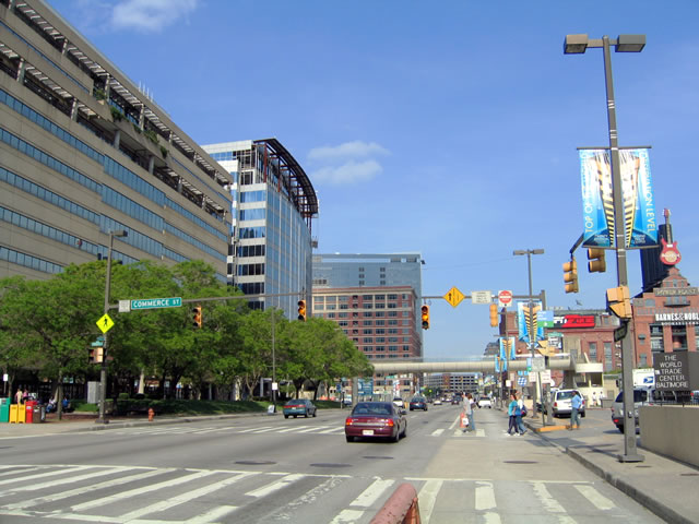 | One block east of South Street, Pratt Street reaches Commerce Street. Pratt Street Pavilion and Baltimore World Trade Center are located along the water nearby. Commerce Street is fairly short and only goes north as far as Baltimore Street and Fayette Street. 05/01/04 |
 | Two blocks east of South Street, Pratt Street reaches Gay Street. Gay Street is a fairly major surface street that angles northeast via Ensor Street to become MD 147 (Harford Avenue). Gay Street south leads toward the National Aquarium. 05/01/04 |
  | Between Gay Street and President Street, Pratt Street passes by Market Place. An I-83 trailblazer sign references forthcoming President Street. Columbus Center and the Pier Six Concert Pavilion are harbor side to the south. 05/01/04, 12/28/07 |
   | President Street heads north from Pratt Street to become the Jones Falls Expressway (I-83). President Street continues south to Fleet Street, which leads east to Boston Street for Fells Point and Interstate 95. 05/01/04, 12/28/07 |
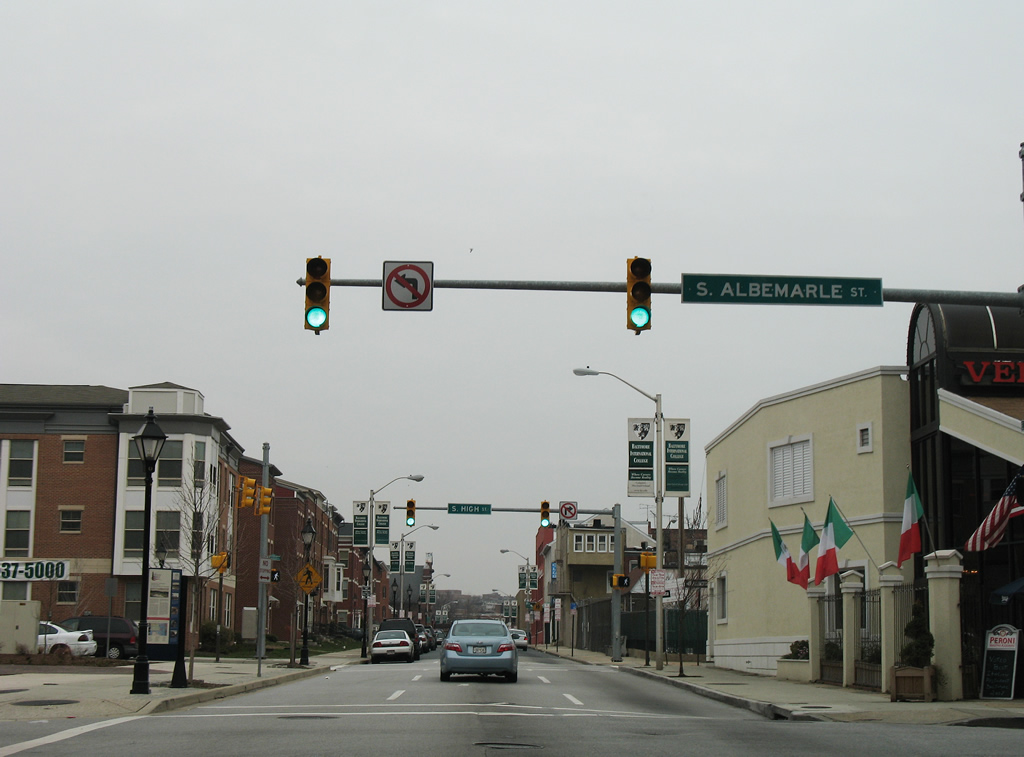 | Pratt Street enters Little Italy and meets the one way street couplet of Albemarle and High Streets. 12/28/07 |
| Washington Boulevard |
 | An old button copy Interstate 95 sign along northbound Washington Boulevard as it angles toward the freeway. 05/31/04 |
| West 28th Street |
  | Westbound West 28th Street at Interstate 83 (Jones Falls Expressway) and Druid Hill Park. 05/31/04 |
Sources:
Additional background and historical information found on this guide was derived from the well researched pages of DCRoads.net by Steve Anderson, MDRoads.com by Mike Pruett, and Roads to the Future by Scott Kozel.
Page updated June 20, 2017.